
| 
| |
|
|
This page contains present day photos (Year 2000 to date) of Ontario's King's Highway 17, arranged by location from the King's
Highway 11 Interchange in North Bay westerly to the King's Highway 17B Junction west of North Bay. All photographs displayed on this page were taken by the Webmaster
(Cameron Bevers), unless specifically noted otherwise. Click on any thumbnail to see a larger image!
Please note that all photographs displayed on this
website are protected by copyright. These photographs must not be reproduced, published,
electronically stored or copied, distributed, or posted onto other websites without
my written permission. If you want to use photos from this website, please
email me first for permission. Thank-you!
|
|---|
|
Page 15: Present Day King's Highway 17 Photographs (North Bay to Hwy 17B)


Left - Eastern approach to the Hwy 11 Interchange in North Bay, facing west along Hwy 17. For 4 km, Hwy 11 & Hwy 17 run concurrently along the
North Bay Bypass. See an Enlarged Photo Here. (Photograph taken on June 4, 2006 - © Cameron Bevers) Right - Facing west along Hwy 11 & Hwy 17 (North Bay Bypass) at the Ontario Northland Railway Crossing. See an Enlarged Photo Here. (Photograph taken on June 4, 2006 - © Cameron Bevers) 

Left - Facing east along Hwy 11 & Hwy 17 (North Bay Bypass) at the Ontario Northland Railway Crossing. See an
Enlarged Photo Here. (Photograph taken on June 4, 2006 - © Cameron Bevers) Right - Facing west along Hwy 11 & Hwy 17 towards the Hwy 17B Junction (Fisher Street) in North Bay. See an Enlarged Photo Here. (Photograph taken on June 4, 2006 - © Cameron Bevers) 

Left - Advance direction sign for the Hwy 17B (Fisher Street) Junction on the North Bay Bypass. See an
Enlarged Photo Here. (Photograph taken on June 4, 2006 - © Cameron Bevers) Right - Facing west along Hwy 11 & Hwy 17 towards the Hwy 63 Junction (Cassels Street) in North Bay. See an Enlarged Photo Here. (Photograph taken on June 4, 2006 - © Cameron Bevers) 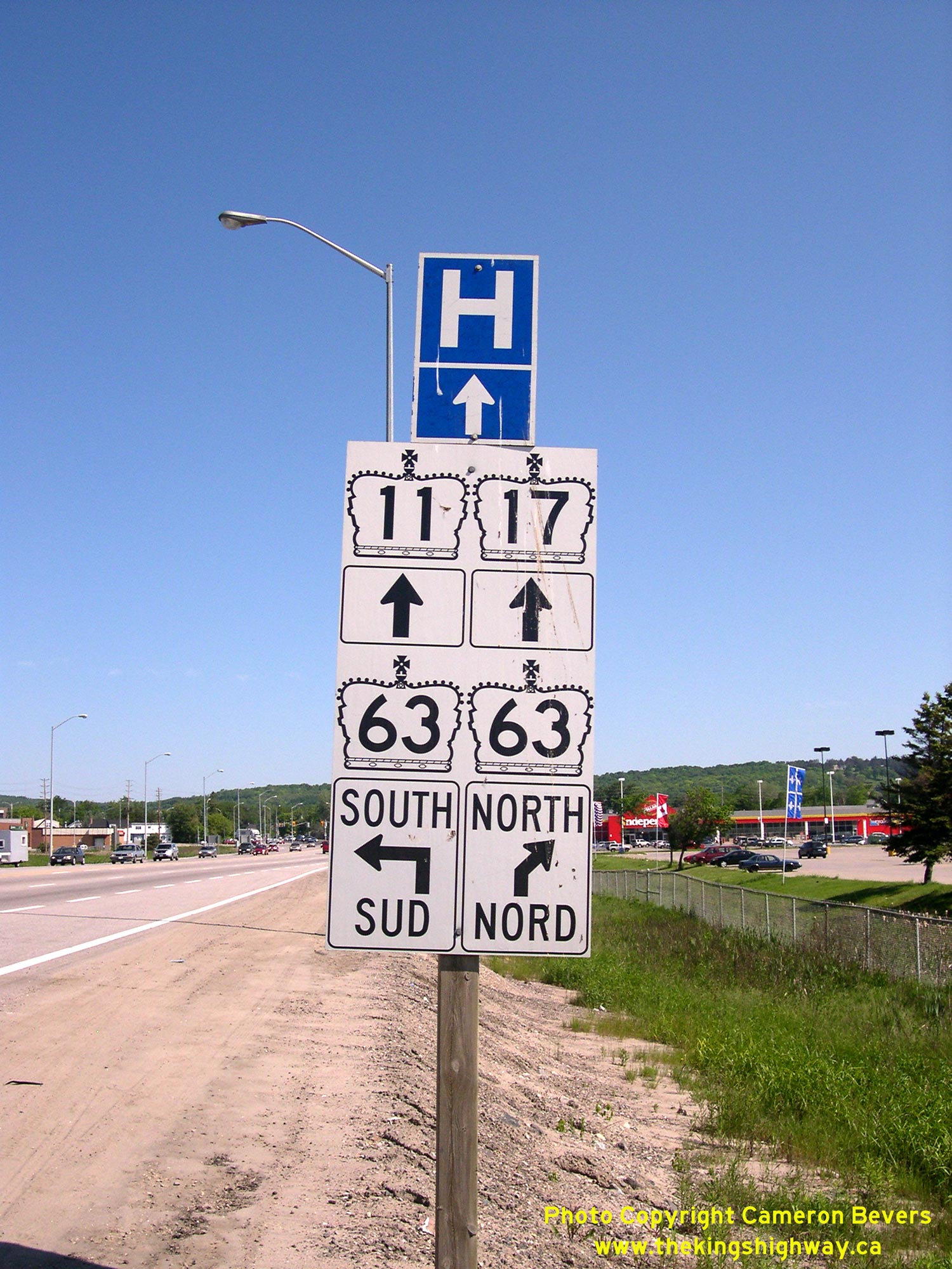
Above - Advance junction sign assembly at Hwy 11 & Hwy 17 and Hwy 63 in North Bay. See an
Enlarged Photo Here. (Photograph taken on June 4, 2006 - © Cameron Bevers)
Continue on to King's Highway 17 Photos: Hwy 17B to Verner
|
|---|
Links to Adjacent King's Highway Photograph Pages:
Back to King's Highway 16 Photos /
King's Highway 17 History /
On to King's Highway 18 Photos
Ontario Highway History - Main Menu / Back to List of Highways Website contents, photos & text © 2002-2026, Cameron
Bevers (Webmaster) - All Rights Reserved / Contact Me
|
|---|