
| 
| |
|
|
This page contains historical photos of Ontario's King's Highway 17 dating from 1970 to 1999. All photographs displayed on
this page were taken by the Ontario Ministry of Transportation, unless specifically noted otherwise. Historical photographs are arranged in approximate chronological
order. Click on any thumbnail to see a larger image!
Please note that all photographs displayed on this
website are protected by copyright. These photographs must not be reproduced, published,
electronically stored or copied, distributed, or posted onto other websites without
my written permission. If you want to use photos from this website, please
email me first for permission. Thank-you!
|
|---|
|
Page 8: Historical King's Highway 17 Photographs (1970 to 1999)
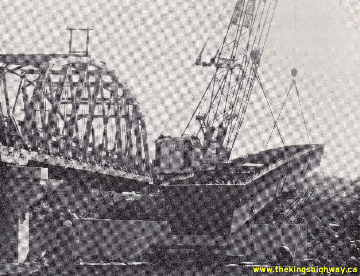
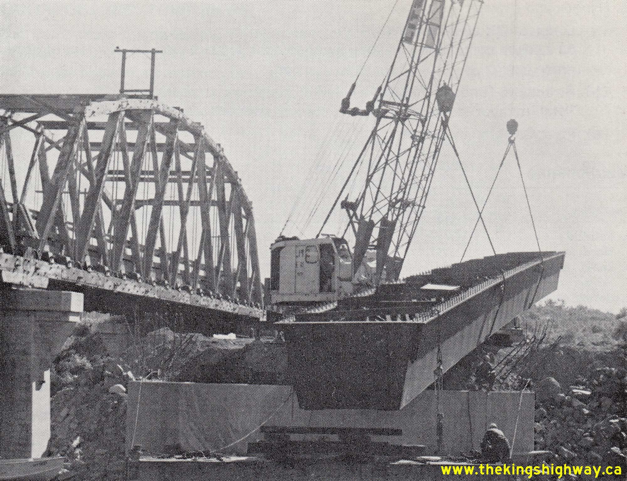
Above - Crane hoisting a steel girder into place for the new Cameron Bay Bridge on Hwy 17 between Kenora and Keewatin in 1970. The old timber through truss
bridge at left was constructed under Contract #1937-125 and was completed in 1938. The old wooden structure was demolished in 1971, shortly after the new bridge was
completed across the narrows in the Fall of 1970. The replacement of the Cameron Bay Bridge was carried out under Contract #1969-191. See an
Enlarged Photo Here. Photo taken in 1970. (Photo courtesy of Ontario Ministry of Transportation - © King's Printer for Ontario, 1970) 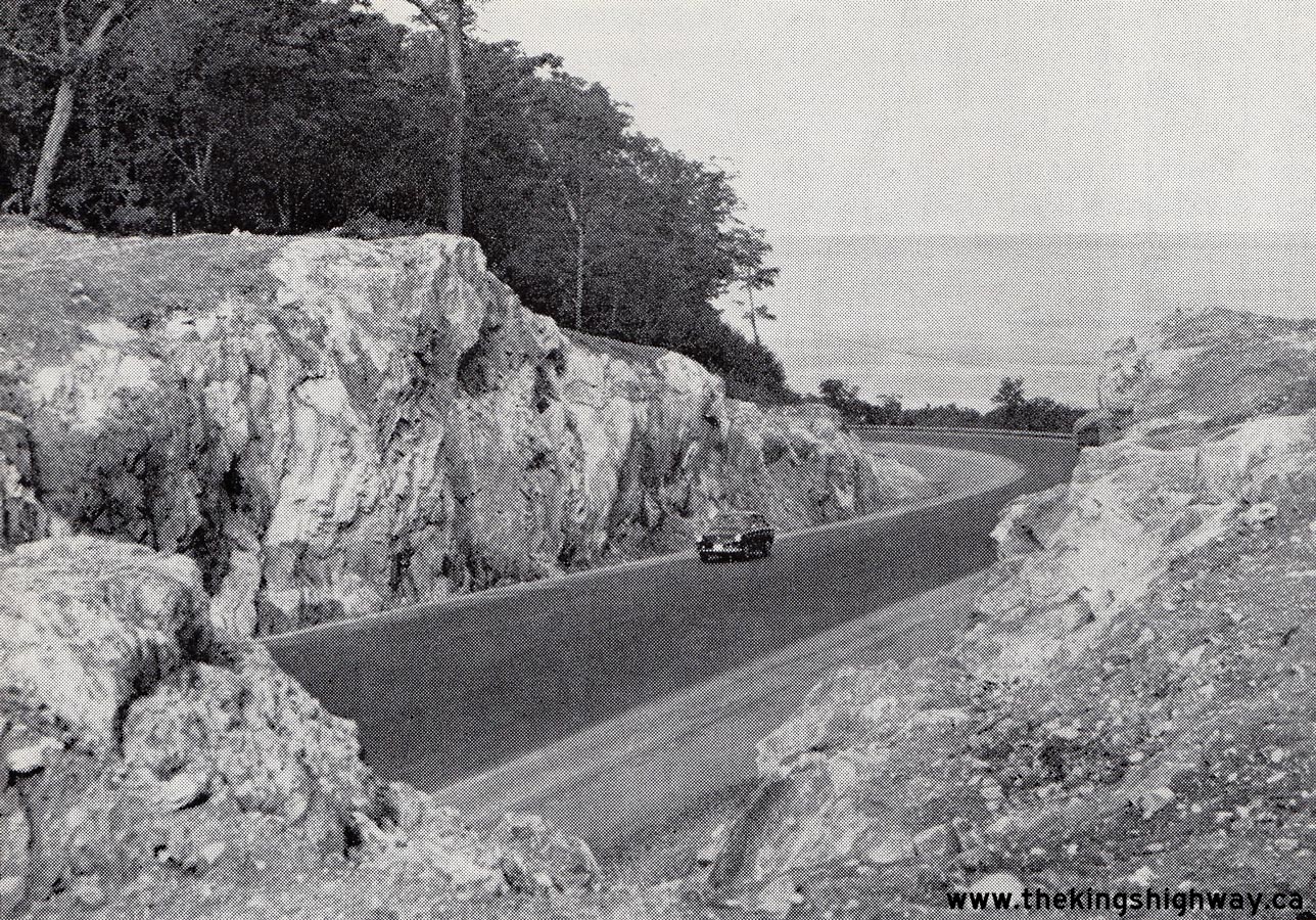  Above - Reconstructed section of Hwy 17 at Montreal River Hill near Lake Superior Provincial Park, Contract #1969-53. See an
Enlarged Photo Here. Photo taken in 1970. Above - Reconstructed section of Hwy 17 at Montreal River Hill near Lake Superior Provincial Park, Contract #1969-53. See an
Enlarged Photo Here. Photo taken in 1970.(Photo courtesy of Ontario Ministry of Transportation - © King's Printer for Ontario, 1970) 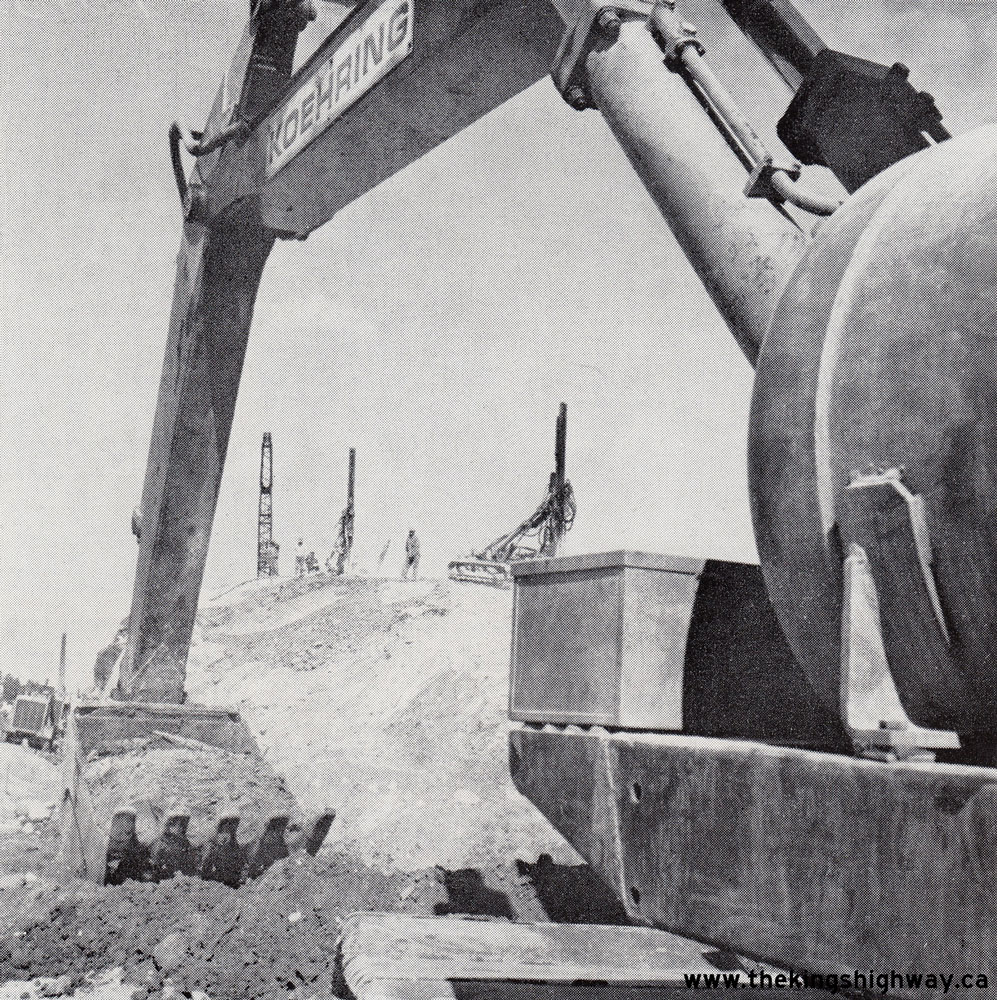 Above - Heavy equipment preparing for rock excavation along Hwy 17 west of Sudbury. A 5-mile section of Hwy 17 was expanded to a four-lane divided highway under
Contract #1969-207, through the construction of a new eastbound carriageway between Copper Cliff and the Hwy 536 Junction near Lively. See an
Enlarged Photo Here. Photo taken in 1970. Above - Heavy equipment preparing for rock excavation along Hwy 17 west of Sudbury. A 5-mile section of Hwy 17 was expanded to a four-lane divided highway under
Contract #1969-207, through the construction of a new eastbound carriageway between Copper Cliff and the Hwy 536 Junction near Lively. See an
Enlarged Photo Here. Photo taken in 1970.(Photo courtesy of Ontario Ministry of Transportation - © King's Printer for Ontario, 1970) 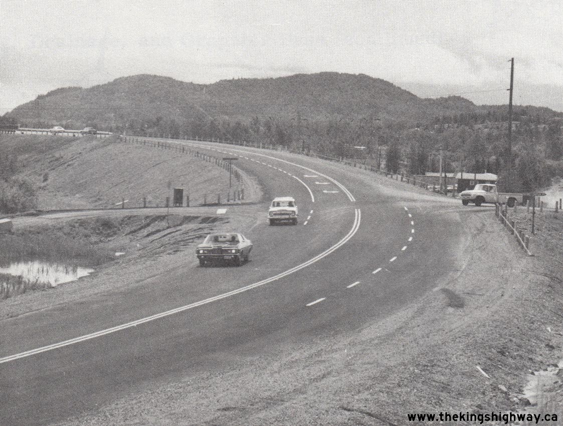
Left - Intersection improvements at Hwy 11 & Hwy 17 and Ouimet Canyon Road between Thunder Bay and Nipigon, Contract #1971-123. See an
Enlarged Photo Here. Photo taken in 1972. (Photo courtesy of Ontario Ministry of Transportation - © King's Printer for Ontario, 1972) Right - Pier construction for the new Nipigon River Bridge on Hwy 11 & Hwy 17 near Nipigon, Contract #1972-205. See an Enlarged Photo Here. Photo taken in 1973. (Photo courtesy of Ontario Ministry of Transportation - © King's Printer for Ontario, 1973)  Above - Circa 1973 postcard view of the Arctic Watershed Sign on Hwy 17 at Raith, located about 55 miles northwest of Thunder Bay. See an
Enlarged Photo Here. Above - Circa 1973 postcard view of the Arctic Watershed Sign on Hwy 17 at Raith, located about 55 miles northwest of Thunder Bay. See an
Enlarged Photo Here.(Photo courtesy of R.E. Ettinger) 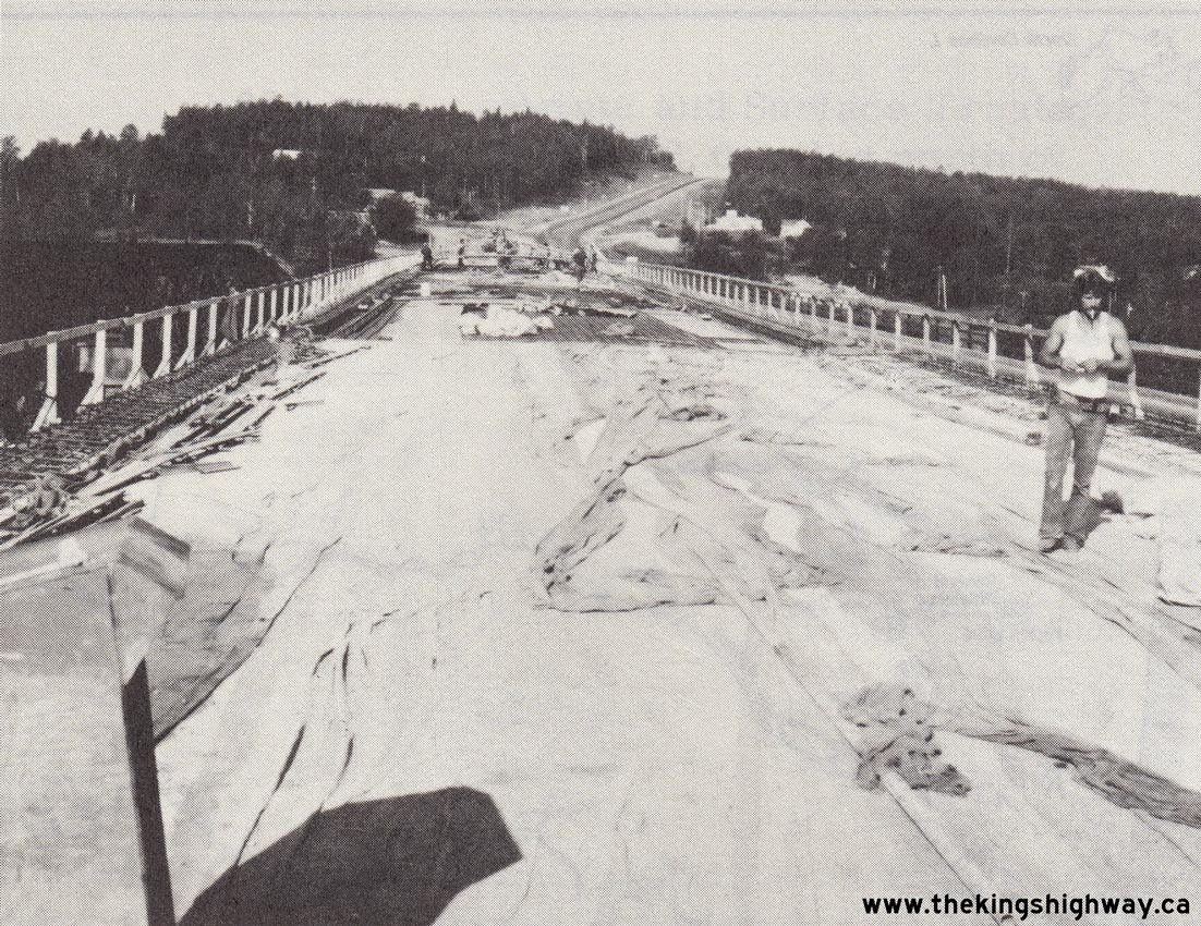
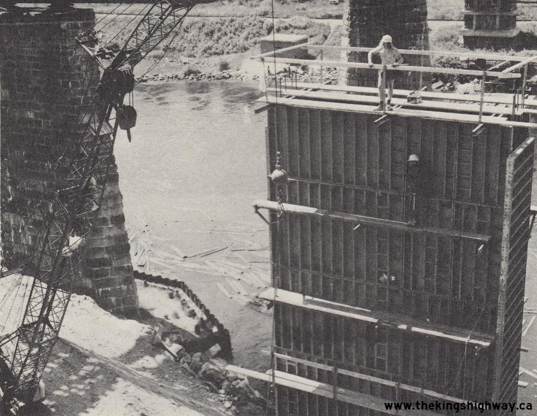
Left - Deck construction on the new Nipigon River Bridge on Hwy 11 & Hwy 17 near Nipigon, Contract #1972-205. See an
Enlarged Photo Here. Photo taken in 1974. (Photo courtesy of Ontario Ministry of Transportation - © King's Printer for Ontario, 1974) Right - Heavy grading for a new section of the Thunder Bay Expressway (Hwy 11 & Hwy 17) near Oliver Road, Contract #1972-202. See an Enlarged Photo Here. Photo taken in 1974. (Photo courtesy of Ontario Ministry of Transportation - © King's Printer for Ontario, 1974) 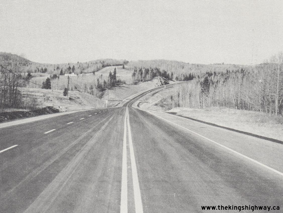
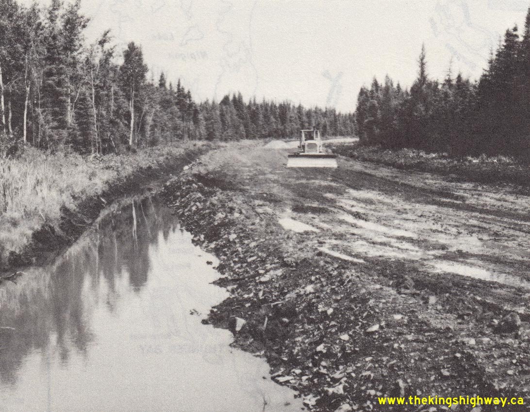
Left - New passing lane on Hwy 11 & Hwy 17, about 22 1/2 miles west of Thunder Bay, Contract #1975-26. See an
Enlarged Photo Here. Photo taken in 1976. (Photo courtesy of Ontario Ministry of Transportation - © King's Printer for Ontario, 1976) Right - New vertical grade revision and rock cut on Hwy 11 & Hwy 17 east of Shabaqua Corners, Contract #1976-17. See an Enlarged Photo Here. Photo taken in 1977. (Photo courtesy of Ontario Ministry of Transportation - © King's Printer for Ontario, 1977) 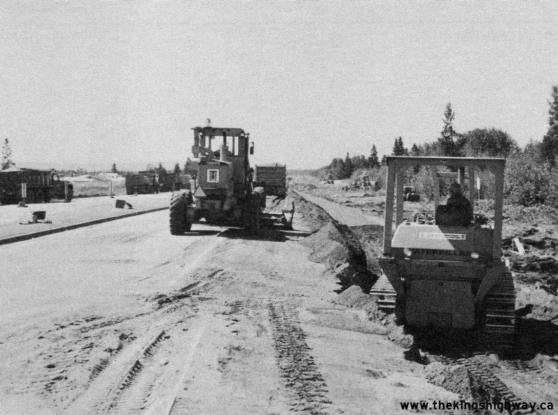
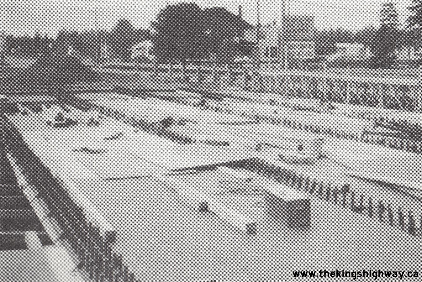
Above - Widening of the Thunder Bay Expressway (Hwy 11 & Hwy 17) approaching John Street, Contract #1977-41. See an
Enlarged Photo Here. Photo taken in 1977. (Photo courtesy of Ontario Ministry of Transportation - © King's Printer for Ontario, 1977) 
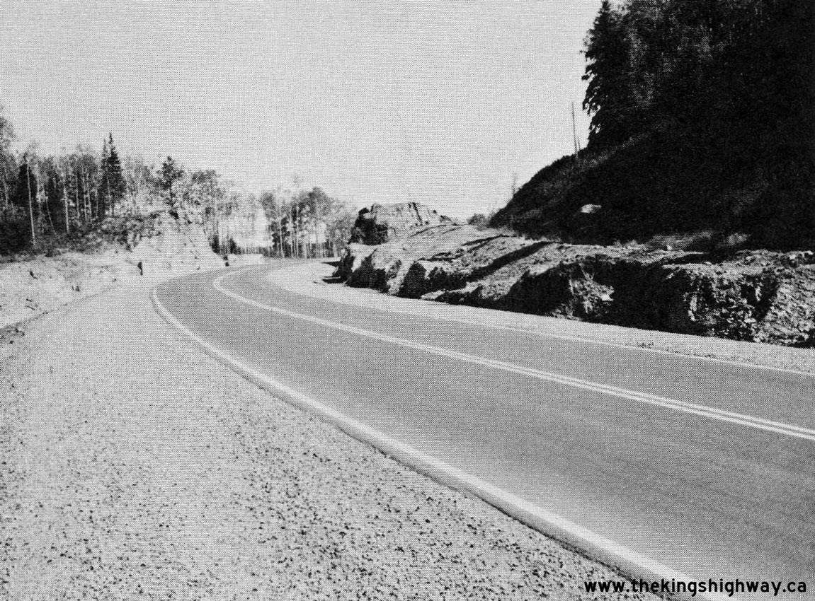
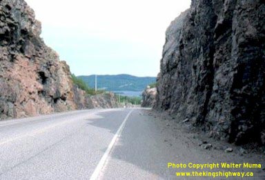
Above - Rock cut on Hwy 17 at Cavers Hill along Lake Superior's North Shore, facing east towards Pays Plat Bay. See an
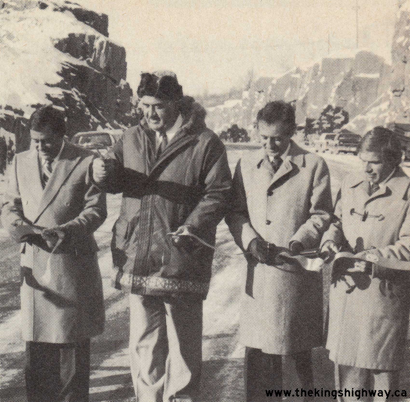
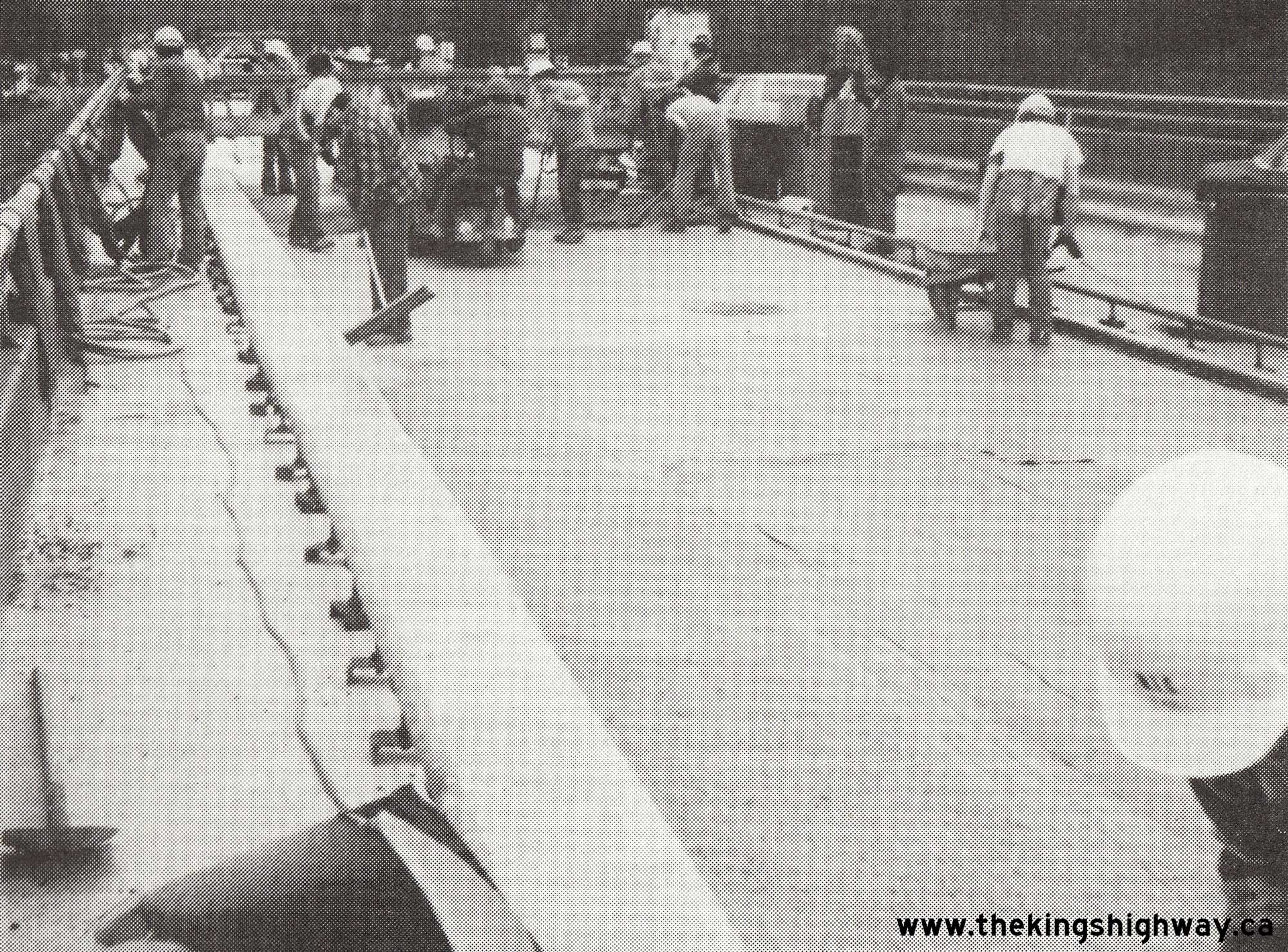
Enlarged Photo Here. Photo taken in 1978. (Photo Courtesy of Walter Muma - © 1978)  Above - Transportation Minister James Snow cuts a ribbon, officially opening Hwy 17 New to traffic between Sudbury and Whitefish on December 4, 1980. This new
20 km section of four-lane Hwy 17 took four full construction seasons to complete, at a total cost of $25.5 million in 1980 Dollars, roughly the equivalent of $100
million in 2025 Dollars - a reflection of just how expensive freeway facilities cost to build in Northern Ontario. See an
Enlarged Photo Here. Photo taken on December 4, 1980. Above - Transportation Minister James Snow cuts a ribbon, officially opening Hwy 17 New to traffic between Sudbury and Whitefish on December 4, 1980. This new
20 km section of four-lane Hwy 17 took four full construction seasons to complete, at a total cost of $25.5 million in 1980 Dollars, roughly the equivalent of $100
million in 2025 Dollars - a reflection of just how expensive freeway facilities cost to build in Northern Ontario. See an
Enlarged Photo Here. Photo taken on December 4, 1980.(Photo courtesy of Ontario Ministry of Transportation - © King's Printer for Ontario, 1980) 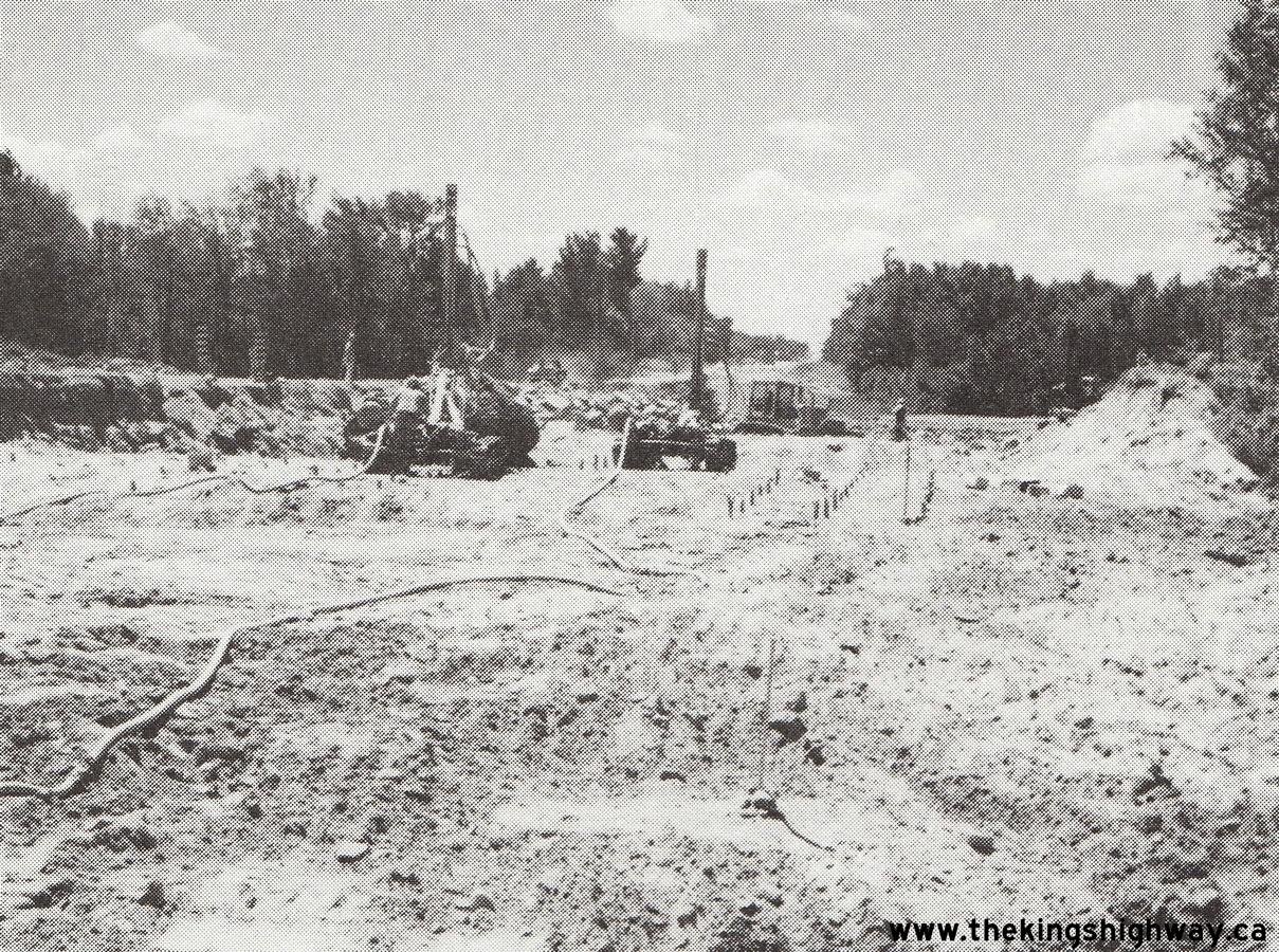 Above - Rock drilling underway on the Pembroke Bypass (Hwy 17 New) at the Hwy 62 Junction, Contract #1980-12. See an
Enlarged Photo Here. Photo taken in 1981. Above - Rock drilling underway on the Pembroke Bypass (Hwy 17 New) at the Hwy 62 Junction, Contract #1980-12. See an
Enlarged Photo Here. Photo taken in 1981.(Photo courtesy of Ontario Ministry of Transportation - © King's Printer for Ontario, 1981) 
 Left - Construction crew doing bridge rehabilitation work on the Deux Rivieres Canadian Pacific Railway (CPR) Overhead on Hwy 17 east of Mattawa, Contract
#1981-309. See an Enlarged Photo Here. Photo taken in 1981. Left - Construction crew doing bridge rehabilitation work on the Deux Rivieres Canadian Pacific Railway (CPR) Overhead on Hwy 17 east of Mattawa, Contract
#1981-309. See an Enlarged Photo Here. Photo taken in 1981.(Photo courtesy of Ontario Ministry of Transportation - © King's Printer for Ontario, 1981) Right - Rehabilitation of the Aumond Creek Bridge on Hwy 17 between North Bay and Mattawa, Contract #1981-309. See an
Enlarged Photo Here. Photo taken in 1981.(Photo courtesy of Ontario Ministry of Transportation - © King's Printer for Ontario, 1981) 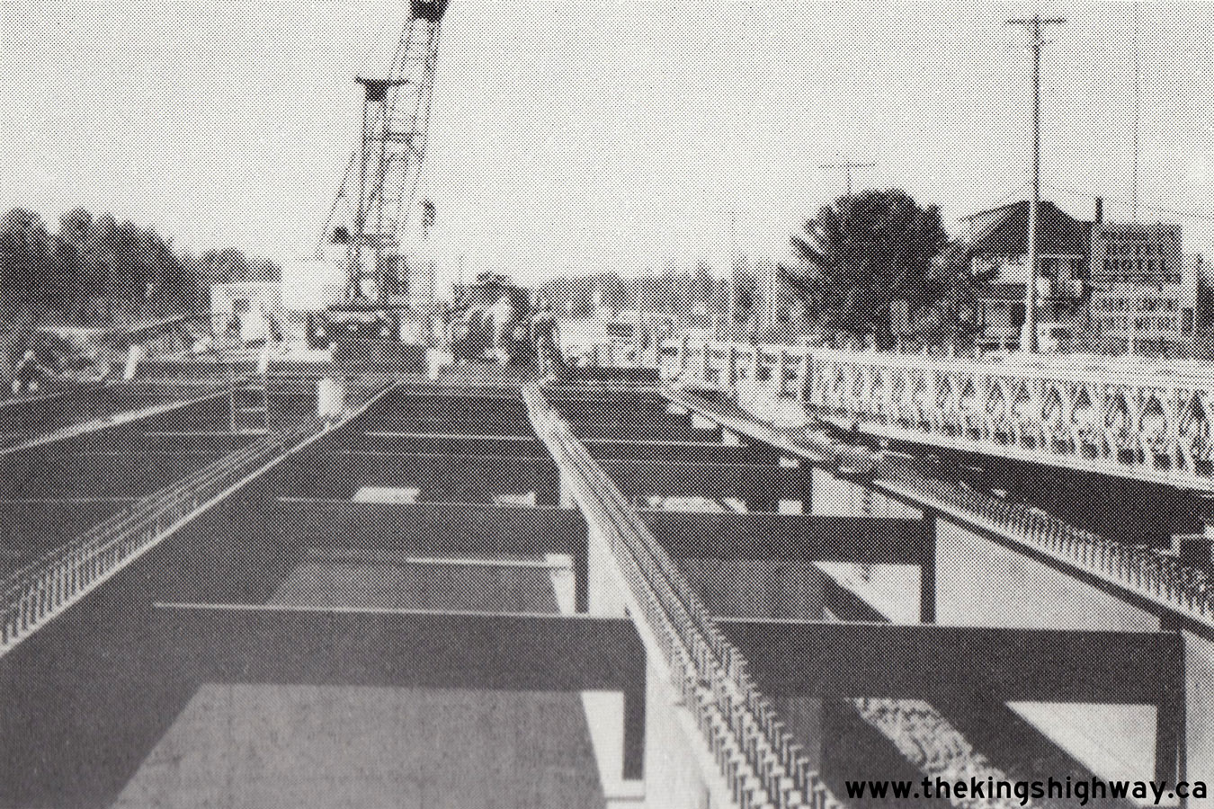
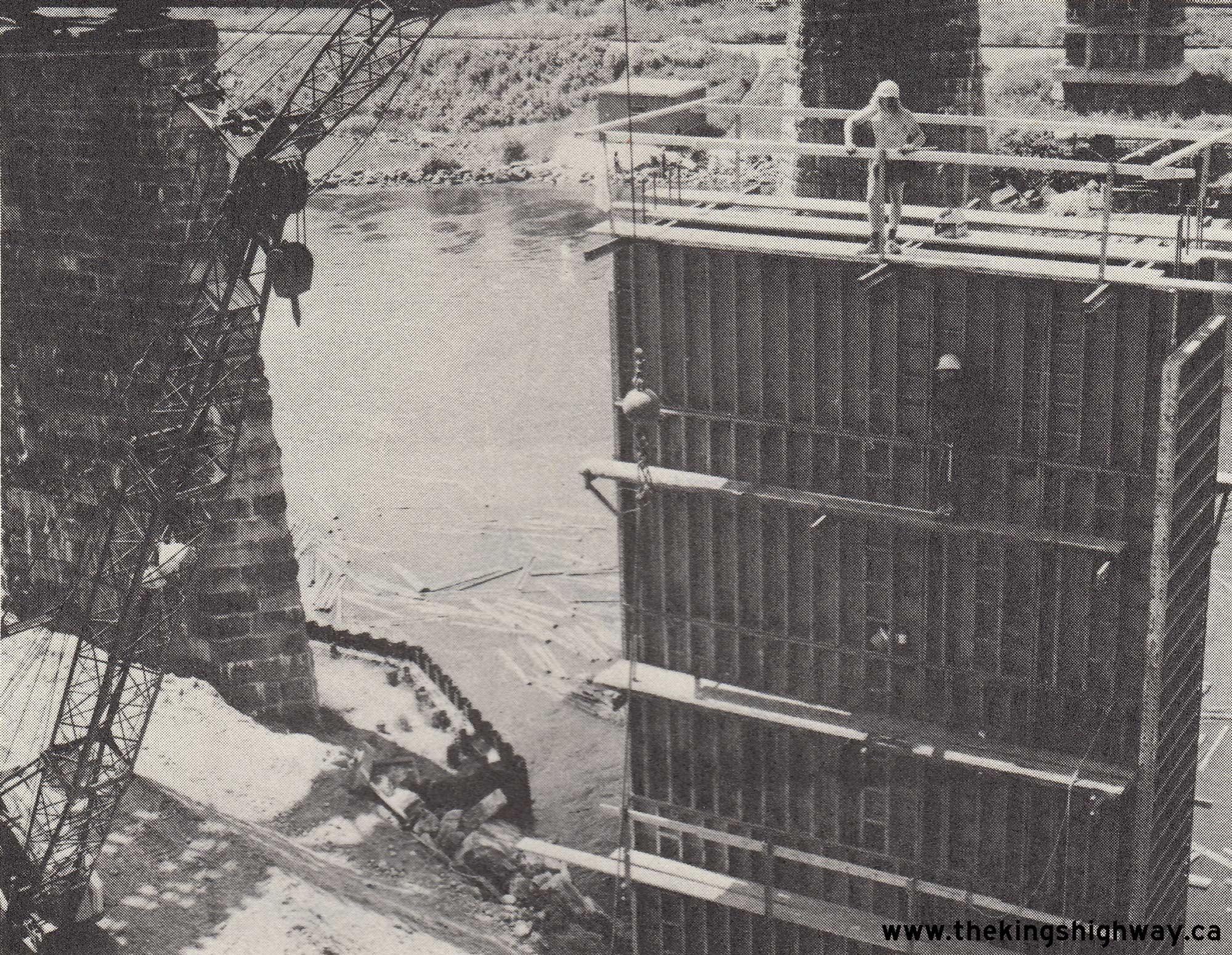
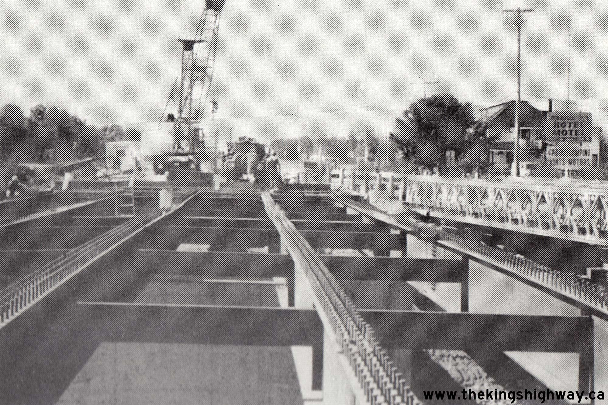
 Left - Placing steel girders for the replacement Little Sturgeon River Bridge on Hwy 17 east of Sturgeon Falls, Contract #1982-216. See an
Enlarged Photo Here. Photo taken in 1982. Left - Placing steel girders for the replacement Little Sturgeon River Bridge on Hwy 17 east of Sturgeon Falls, Contract #1982-216. See an
Enlarged Photo Here. Photo taken in 1982.(Photo courtesy of Ontario Ministry of Transportation - © King's Printer for Ontario, 1982) Right - Placing formwork for the concrete deck on the Little Sturgeon River Bridge on Hwy 17 near Sturgeon Falls, Contract #1982-216. See an
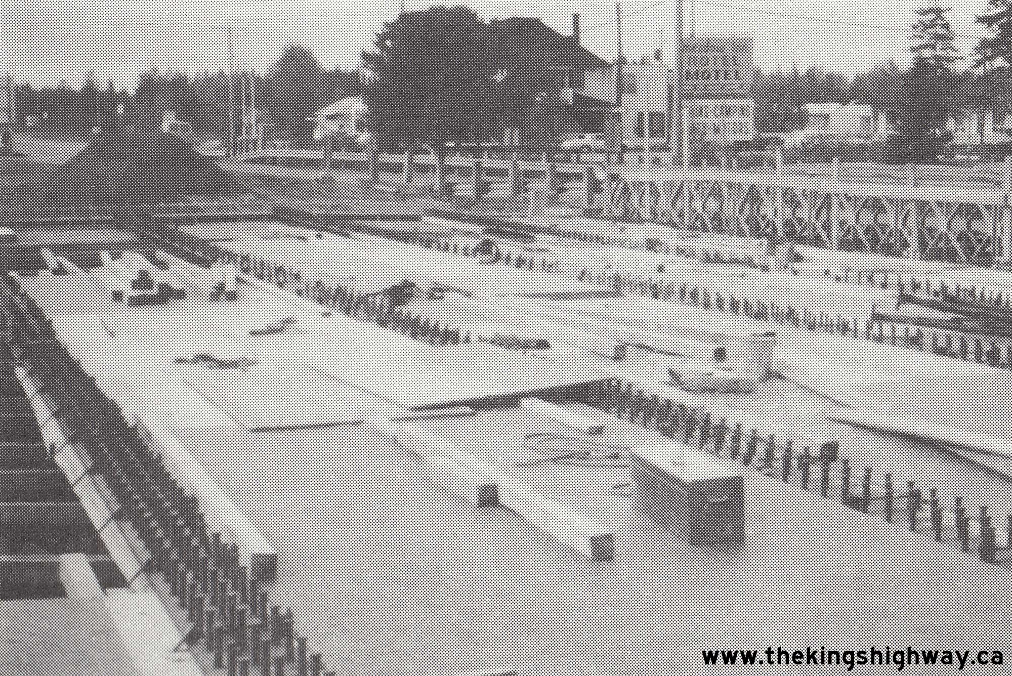
Enlarged Photo Here. Photo taken in 1982.(Photo courtesy of Ontario Ministry of Transportation - © King's Printer for Ontario, 1982) 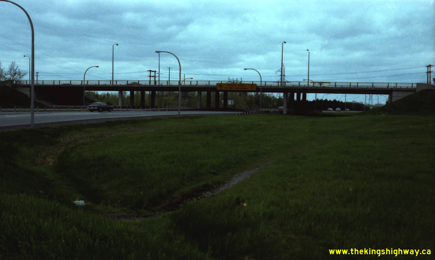 Above - Facing west along the Ottawa Queensway (Hwy 17) at the Blair Road Interchange in Ottawa. Note the interesting overhead sign advising drivers to "Reduce
Speed on Wet Pavement" with an 80 km/h advisory speed. Similar bridge-mounted advisory signs existed along highways in the Toronto area as well. See an
Enlarged Photo Here. Photo taken on May 26, 1983. Above - Facing west along the Ottawa Queensway (Hwy 17) at the Blair Road Interchange in Ottawa. Note the interesting overhead sign advising drivers to "Reduce
Speed on Wet Pavement" with an 80 km/h advisory speed. Similar bridge-mounted advisory signs existed along highways in the Toronto area as well. See an
Enlarged Photo Here. Photo taken on May 26, 1983.(Photo courtesy of Ontario Ministry of Transportation - © King's Printer for Ontario, 2026) 
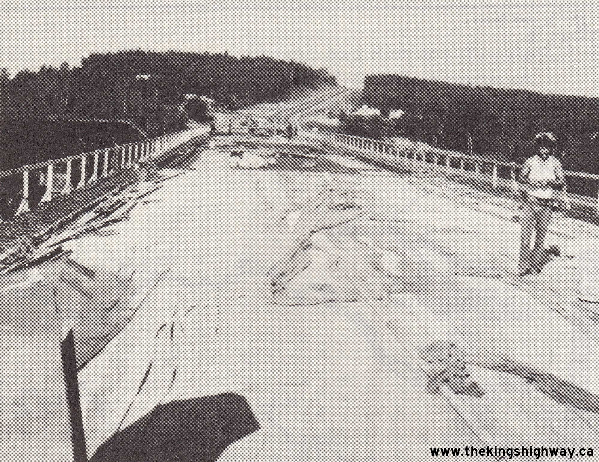
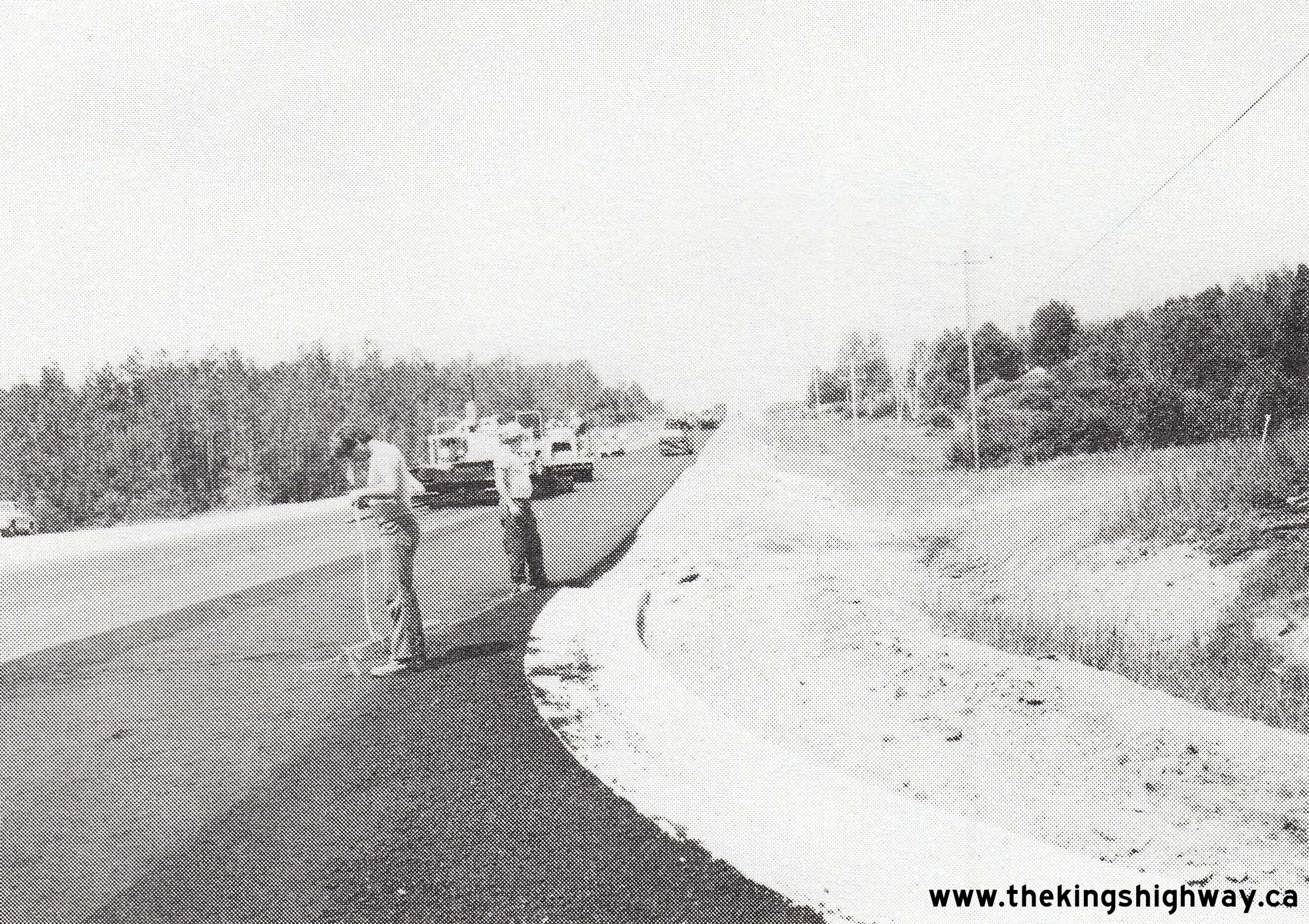
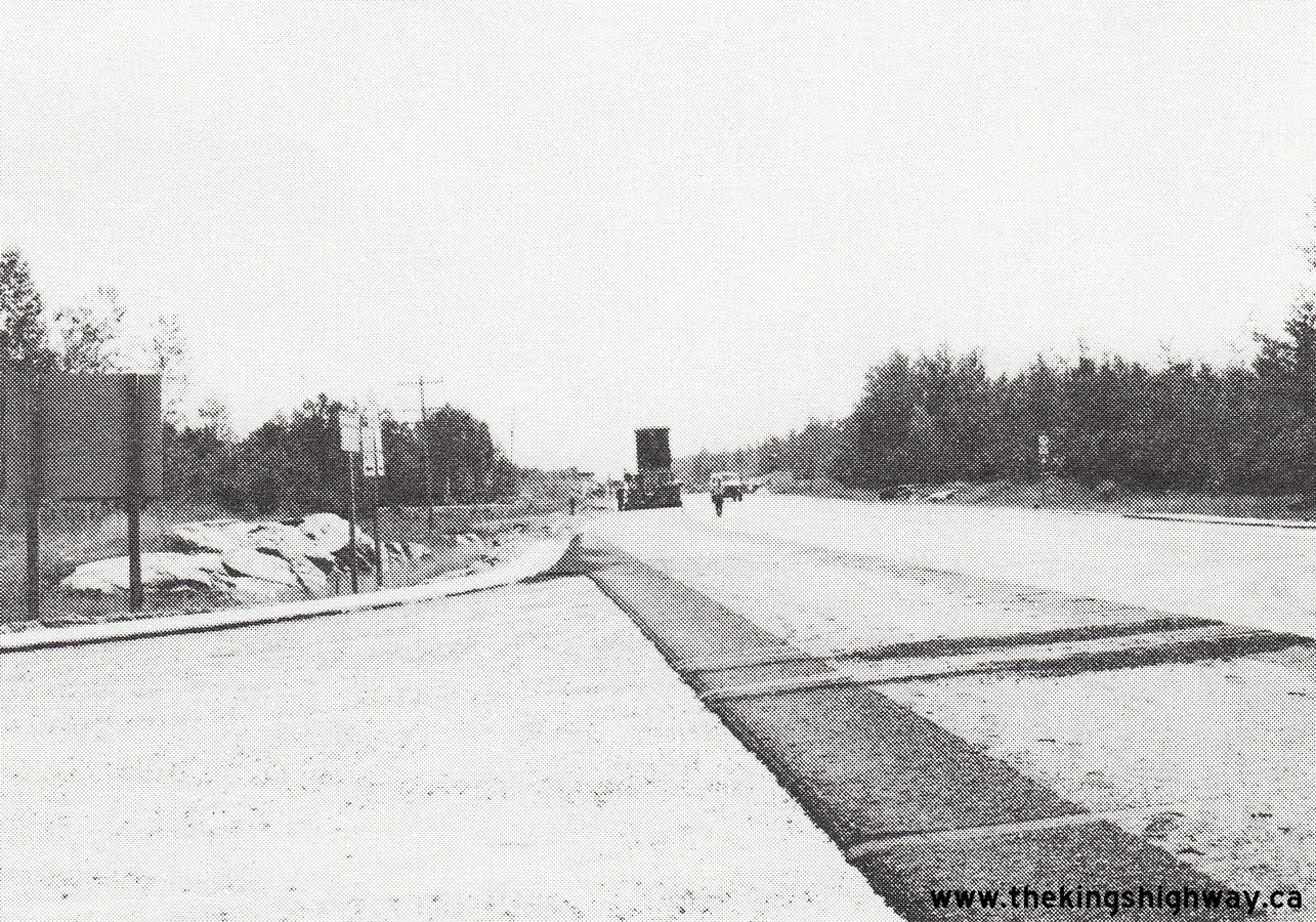 Left - Hot-mix asphalt paving operations along Hwy 17 east of North Bay, Contract #1983-210. See an
Enlarged Photo Here. Photo taken in 1983. Left - Hot-mix asphalt paving operations along Hwy 17 east of North Bay, Contract #1983-210. See an
Enlarged Photo Here. Photo taken in 1983.(Photo courtesy of Ontario Ministry of Transportation - © King's Printer for Ontario, 1983) Right - Facing east along Hwy 17 from the Hwy 94 Junction during highway resurfacing, Contract #1983-210. See an
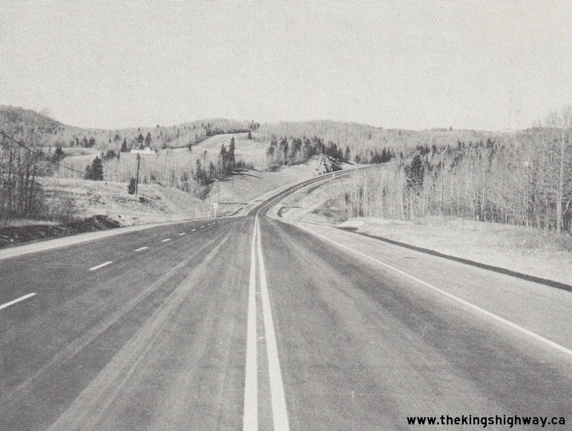
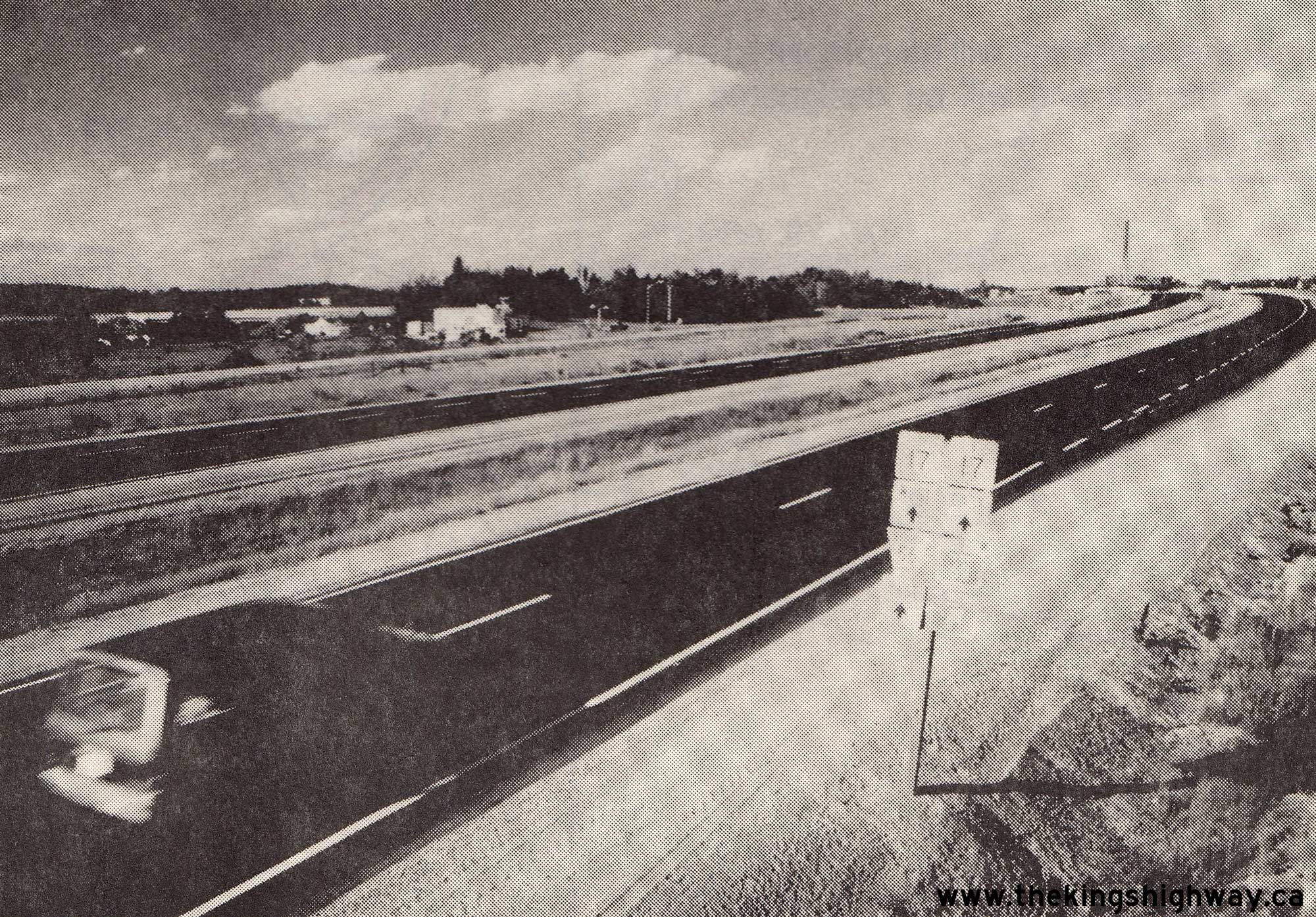
Enlarged Photo Here. Photo taken in 1983.(Photo courtesy of Ontario Ministry of Transportation - © King's Printer for Ontario, 1983) 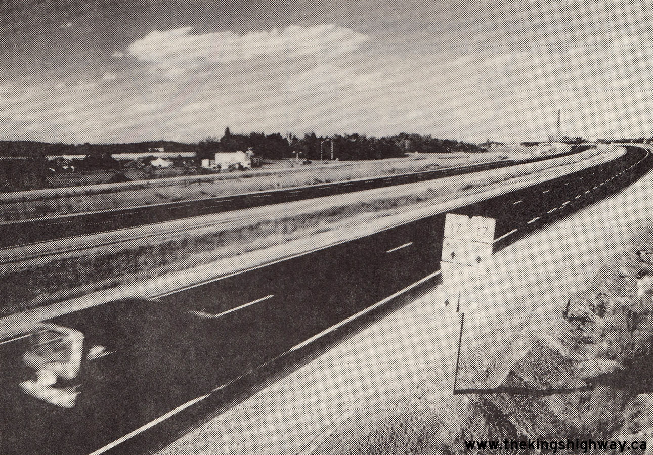 Above - Completed rehabilitation of Old Hwy 17, facing east from Lively towards Sudbury in 1988. The entire bypassed section of Hwy 17 from Whitefish to Lively
was rehabilitated under Contract #1987-226, in preparation for the transfer of the old highway to the Regional Municipality of Sudbury. Note the junction sign
assembly in the foreground, which marks the Southwest Sudbury Bypass as "TO/VERS 69". Up until the completion of the Southeast Sudbury Bypass in the 1990s, Hwy 17
passed directly through Sudbury's City Centre. See an Enlarged Photo Here. Photo taken in 1988. Above - Completed rehabilitation of Old Hwy 17, facing east from Lively towards Sudbury in 1988. The entire bypassed section of Hwy 17 from Whitefish to Lively
was rehabilitated under Contract #1987-226, in preparation for the transfer of the old highway to the Regional Municipality of Sudbury. Note the junction sign
assembly in the foreground, which marks the Southwest Sudbury Bypass as "TO/VERS 69". Up until the completion of the Southeast Sudbury Bypass in the 1990s, Hwy 17
passed directly through Sudbury's City Centre. See an Enlarged Photo Here. Photo taken in 1988.(Photo courtesy of Ontario Ministry of Transportation - © King's Printer for Ontario, 1988)
Continue on to King's Highway 17 Present Day Photos: Quebec Boundary to Ottawa
|
|---|
Links to Adjacent King's Highway Photograph Pages:
Back to Hwy 17 - Historical Photos (1965-1969)
Hwy 17 Photo Index
On to Hwy 17 - Quebec Boundary to Ottawa
Back to King's Highway 16 Photos /
King's Highway 17 History /
On to King's Highway 18 Photos
Ontario Highway History - Main Menu / Back to List of Highways Website contents, photos & text © 2002-2026, Cameron
Bevers (Webmaster) - All Rights Reserved / Contact Me
|
|---|