
| 
|  |
|
|
This page contains historical photos of Ontario's King's Highway 21 dating from 1927 to 1999. All photographs displayed on
this page were taken by the Ontario Ministry of Transportation, unless specifically noted otherwise. Historical photographs are arranged in approximate chronological
order. Click on any thumbnail to see a larger image!
Please note that all photographs displayed on this
website are protected by copyright. These photographs must not be reproduced, published,
electronically stored or copied, distributed, or posted onto other websites without
my written permission. If you want to use photos from this website, please
email me first for permission. Thank-you!
|
|---|
|
Page 1: Historical King's Highway 21 Photographs
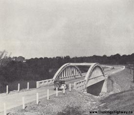
Above - New concrete bowstring arch bridge over Bear Creek on Hwy 21 north of Petrolia in 1929. See an
Enlarged Photo here. (Photo courtesy of Ontario Ministry of Transportation - © King's Printer for Ontario, 1929) 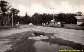
Above - Circa 1940 postcard view of the Junction of Hwy 21 & Hwy 82 at Pork Franks. See an
Enlarged Photo here. (Photo courtesy of The Photogelatine Engraving Company Ltd.) 
Above - Postcard view of the Hwy 2 & Hwy 21 Junction in Thamesville in 1946, facing east. This great photo of the highway junction shows an old DHO "Totem
Pole" fingerboard guide sign post. These Totem Pole signposts were installed at most King's Highway junctions up until the 1940s, where fingerboard signs pointed
motorists towards their intended destination. The DHO adopted larger destination guide signs for use at King's Highway junctions beginning in 1948. Interestingly, the
Hwy 2 & Hwy 21 Junction was already controlled by traffic signals when this photo was taken in 1946. At that time, traffic signals were still faily uncommon
along the King's Highways outside of major cities, which makes this installation in Thamesville rather noteworthy. See an
Enlarged Photo Here. Photo taken in 1946. (Photo from Cameron Bevers' historical photograph collection - Original photographer unknown) 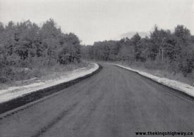

Left - New mulch asphalt pavement on Hwy 21 south of Grand Bend (1944) (Photo courtesy of Ontario Ministry of Transportation - © King's Printer for Ontario, 1944) Right - Zone striping on Hwy 21, 6 miles north of Forest. Photo taken on September 21, 1948. (Photo courtesy of Ontario Ministry of Transportation - © King's Printer for Ontario, 1948) 
Above - View of Hwy 21 passing through a rural area, 2 1/2 miles south of Kincardine. Photo taken on August 25, 1949. See an
Enlarged Photo here. (Photo courtesy of Ontario Ministry of Transportation - © King's Printer for Ontario, 1949) 
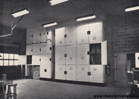
Left - Owen Sound District Garage and Paint Shop. Photo taken on October 29, 1952. (Photo courtesy of Ontario Ministry of Transportation - © King's Printer for Ontario, 1952) Right - Highway sign storage room at the Owen Sound District Garage in 1952. Note the "Junction" sign for Hwy 6 & Hwy 21 leaning against the wall. Despite the widespread downloading of Ontario's King's Highways in the 1990s, the overlapped route of Hwy 6 & Hwy 21 still remains intact today between Springmount and Owen Sound. Photo taken on October 29, 1952. (Photo courtesy of Ontario Ministry of Transportation - © King's Printer for Ontario, 1952) 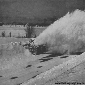
Above - "Sno-Go" rotary snow plow performing winter snow-clearing operations on Hwy 21, 2 miles north of Tiverton. Photo taken on March 6, 1954. See an
Enlarged Photo here. (Photo courtesy of Ontario Ministry of Transportation - © King's Printer for Ontario, 1954) 
Above - New Port Albert Bridge on Hwy 21 north of Goderich. Photo taken on August 19, 1954. (Photo courtesy of Ontario Ministry of Transportation - © King's Printer for Ontario, 1954) 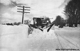
Above - Snowplowing operations on Hwy 21, 1 mile south of Port Elgin. Photo taken on November 6, 1954. See an
Enlarged Photo Here. (Photo courtesy of Ontario Ministry of Transportation - © King's Printer for Ontario, 1954) 

Left - Grading on Hwy 21, 2 miles south of Port Elgin (1955) (Photo courtesy of Ontario Ministry of Transportation - © King's Printer for Ontario, 1955) Right - Grading for a new earth cut on Hwy 21, 5 miles north of Underwood (1955) (Photo courtesy of Ontario Ministry of Transportation - © King's Printer for Ontario, 1955) 
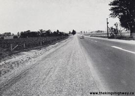
Left - Zone striping on Hwy 21, 3 1/2 miles south of Port Elgin. Photo taken on August 30, 1956. (Photo courtesy of Ontario Ministry of Transportation - © King's Printer for Ontario, 1956) Right - View of Hwy 21, 1 1/2 miles south of Forest (1957) (Photo courtesy of Ontario Ministry of Transportation - © King's Printer for Ontario, 1957) 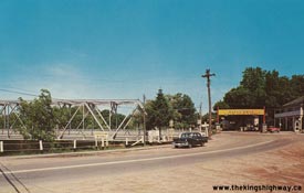
Left - Postcard view of the Hwy 21 & Hwy 81 Junction in Grand Bend in 1957. Note the steel truss bridge across the Ausable River on Hwy 21 immediately
south of the Hwy 81 Junction. This steel truss bridge existed up until 1964, when it was demolished and replaced with the current Hwy 21 structure. See an
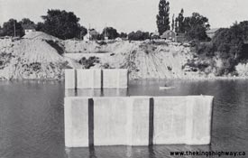
Enlarged Photo here. (Photo courtesy of Canadian Post Card Company Ltd.) Right - Piers for the new Saugeen River Bridge on Hwy 21 at Southampton (1958) (Photo courtesy of Ontario Ministry of Transportation - © King's Printer for Ontario, 1958) 
Above - Rotary snowplow in operation on Hwy 21, Stratford District (1959) (Photo courtesy of Ontario Ministry of Transportation - © King's Printer for Ontario, 1959) 

Left - Construction progress on the new Saugeen River Bridge on Hwy 21 in Southampton (1959) (Photo courtesy of Ontario Ministry of Transportation - © King's Printer for Ontario, 1959) Right - New culvert extension under construction on Hwy 21 south of the Hwy 84 Junction at St. Joseph (1959) (Photo courtesy of Ontario Ministry of Transportation - © King's Printer for Ontario, 1959) 
Above - Completed Saugeen River Bridge on Hwy 21 in Southampton in 1959. The new bridge was constructed in just under 2 years at an approximate cost of
$735,400, in 1959 Dollars (the equivalent of approximately $6.2 million today). The new bridge was 442 feet in length and was officially opened to traffic on
September 9, 1959. (Photo courtesy of Ontario Ministry of Transportation - © King's Printer for Ontario, 1959) 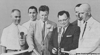
Left - Southampton Mayor W.H. Rogers cuts the ribbon and officially opens the new Saugeen River Bridge on Hwy 21 to traffic on September 9, 1959. The ceremony
attendees were, from left to right: Fred Cass, Minister of Highways; Lloyd Johnston, local businessman; Ross Whitcher, M.P.P. for Bruce; W.H. Rogers, Mayor of
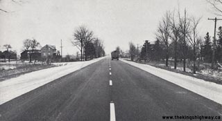
Southampton; George Joynt, Warden for Bruce County; and John Hanna, M.P.P for Huron-Bruce. (Photo courtesy of Ontario Ministry of Transportation - © King's Printer for Ontario, 1959) Right - Resurfaced section of Hwy 21 near Drysdale, between St. Joseph and Bayfield (1959) (Photo courtesy of Ontario Ministry of Transportation - © King's Printer for Ontario, 1959) 
Above - New spillway with energy dissipation weirs at a culvert on Hwy 21, 1 1/4 miles south of St. Joseph (1960) (Photo courtesy of Ontario Ministry of Transportation - © King's Printer for Ontario, 1960) 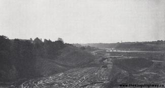

Left - Relocation of Hwy 21 north of Goderich approaching the Maitland River (1961) (Photo courtesy of Ontario Ministry of Transportation - © King's Printer for Ontario, 1961) Right - Aerial view of the relocated Hwy 21 approaching Goderich, showing the new Maitland River Bridge (1962) (Photo courtesy of Ontario Ministry of Transportation - © King's Printer for Ontario, 1962) 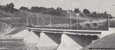
Above - New Maitland River Bridge on Hwy 21 in Goderich (1962) (Photo courtesy of Ontario Ministry of Transportation - © King's Printer for Ontario, 1962) 

Left - Railway crossing gates and flashing warning lights on Hwy 21 in Thamesville (1963) (Photo courtesy of Ontario Ministry of Transportation - © King's Printer for Ontario, 1963) Right - Paving operations on Hwy 21 near Kincardine (1963) (Photo courtesy of Ontario Ministry of Transportation - © King's Printer for Ontario, 1963) 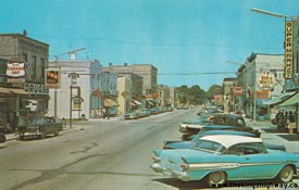
Above - Postcard view of Goderich Street (Hwy 21) in Downtown Port Elgin in 1964. See an
Enlarged Photo here. (Photo courtesy of Canadian Post Card Company Ltd.) 
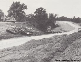
Left - Excavator cutting a new drainage ditch on Hwy 21 north of Southampton (1964) (Photo courtesy of Ontario Ministry of Transportation - © King's Printer for Ontario, 1964) Right - Reconstruction of Hwy 21 approaching the Little Bear Creek Bridge, north of the Hwy 80 Junction at Oil City (1974) (Photo courtesy of Ontario Ministry of Transportation - © King's Printer for Ontario, 1974)
Continue on to King's Highway 21 Present Day Photos: Morpeth to Hwy 402
|
|---|
Links to Adjacent King's Highway Photograph Pages:
Back to King's Highway 20 Photos /
King's Highway 21 History /
On to King's Highway 22 Photos
Ontario Highway History - Main Menu / Back to List of Highways Website contents, photos & text © 2002-2025, Cameron
Bevers (Webmaster) - All Rights Reserved / Contact Me |
|---|