
| 
| |
|
|
This page contains present day photos (Year 2000 to date) of Ontario's King's Highway 21, arranged by location from
Allenford northerly to Owen Sound. All photographs displayed on this page were taken by the Webmaster (Cameron Bevers), unless specifically noted
otherwise. Click on any thumbnail to see a larger image!
Please note that all photographs displayed on this
website are protected by copyright. These photographs must not be reproduced, published,
electronically stored or copied, distributed, or posted onto other websites without
my written permission. If you want to use photos from this website, please
email me first for permission. Thank-you!
|
|---|
|
Page 7: Present Day King's Highway 21 Photographs (Allenford to Owen Sound)


Left - Facing south along Hwy 21 towards Southampton from the Hwy 6 (Former Hwy 70) Junction at Springmount. (Photograph taken on October 3, 2010 - © Cameron Bevers) Right - Facing north along Hwy 21 approaching the Hwy 6 (Former Hwy 70) Junction at Springmount. (Photograph taken on October 3, 2010 - © Cameron Bevers) 

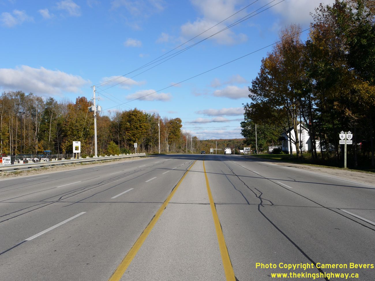
Left - Facing north along Hwy 21 towards the Hwy 6 (Former Hwy 70) Junction at Springmount. At this intersection, Hwy 6 & Hwy 21 join together
to form a single highway route through Owen Sound. Motorists who turn left here can follow Hwy 6 north to Wiarton and Tobermory. At right, Grey County Road
18 forms a bypass route around Owen Sound, which connects to Hwy 6 & Hwy 10 at Rockford just south of Owen Sound. See an
Enlarged Photo here. (Photograph taken on October 3, 2010 - © Cameron Bevers) Right - Junction assembly on Hwy 21 approaching the Hwy 6 Junction at Springmount. (Photograph taken on October 3, 2010 - © Cameron Bevers) 

Left - Approaching the Hwy 6 & Hwy 21 Junction at Springmount, facing west. The present-day route of Hwy 6 via Shallow Lake was known as Hwy 70
up until 1998. At this intersection, Hwy 6 turns right and continues north towards Shallow Lake and Wiarton, while Hwy 21 proceeds straight through towards
Southampton and Port Elgin. (Photograph taken on October 3, 2010 - © Cameron Bevers) Right - Facing south along Hwy 6 (Former Hwy 70) towards the Hwy 21 Junction at Springmount. Traffic proceeding straight through this intersection can follow a signed bypass route around Owen Sound via Grey County Road 18. Traffic turning left follows Hwy 6 & Hwy 21 into Owen Sound. (Photograph taken on October 3, 2010 - © Cameron Bevers) 

Left - Facing north along Hwy 6 (Former Hwy 70) towards Wiarton from the Hwy 21 Junction at Springmount. (Photograph taken on October 3, 2010 - © Cameron Bevers) Right - Junction assembly at the Hwy 6 & Hwy 21 Junction at Springmount, west of Owen Sound. (Photograph taken on October 3, 2010 - © Cameron Bevers) 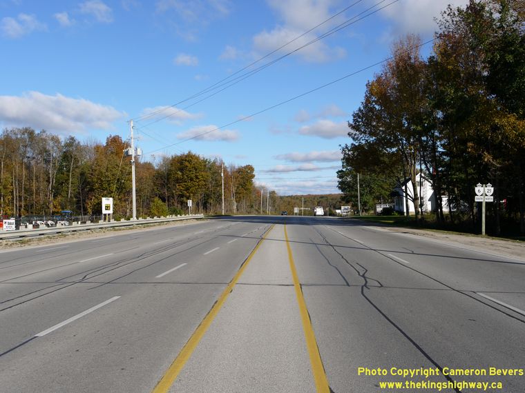

Left - Facing east along Hwy 6 & Hwy 21 from Springmount. See an
Enlarged Photo here. (Photograph taken on October 3, 2010 - © Cameron Bevers) Right - Owen Sound Bypass sign on Hwy 21 approaching Springmount. Grey County Road 18 forms a bypass around Owen Sound, which connects to Hwy 6 & Hwy 10 at Rockford. It is very unusual to see a sign such as this one on a King's Highway, which encourages highway traffic to utilize a municipal road to bypass a city. The bypass via Grey County Road 18 is significantly faster than following the route of Hwy 6 through Owen Sound. (Photograph taken on October 3, 2010 - © Cameron Bevers) 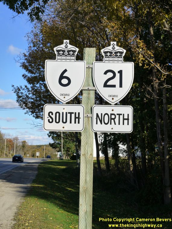
Above - Hwy 6 South & Hwy 21 North King's Highway route markers at Springmount. The concurrent route of Hwy 6 & Hwy 21 between Springmount
and Owen Sound is signed with opposing cardinal directions. Although this sign assembly may seem very odd, it is actually correct. Motorists who pass this
sign are indeed travelling northbound on Hwy 21 and southbound on Hwy 6. This is the only instance in Ontario where two King's Highways are signed
concurrently with opposing cardinal directions. (Photograph taken on October 3, 2010 - © Cameron Bevers) 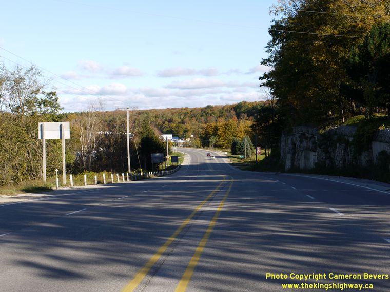
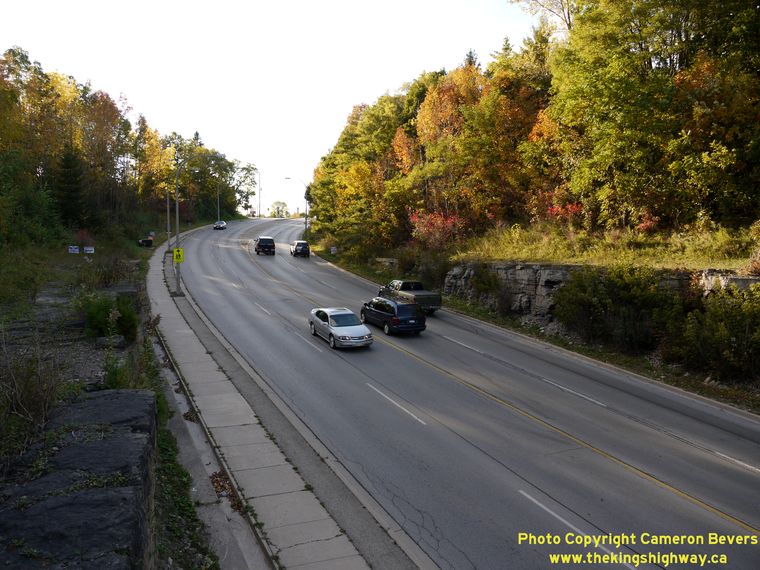
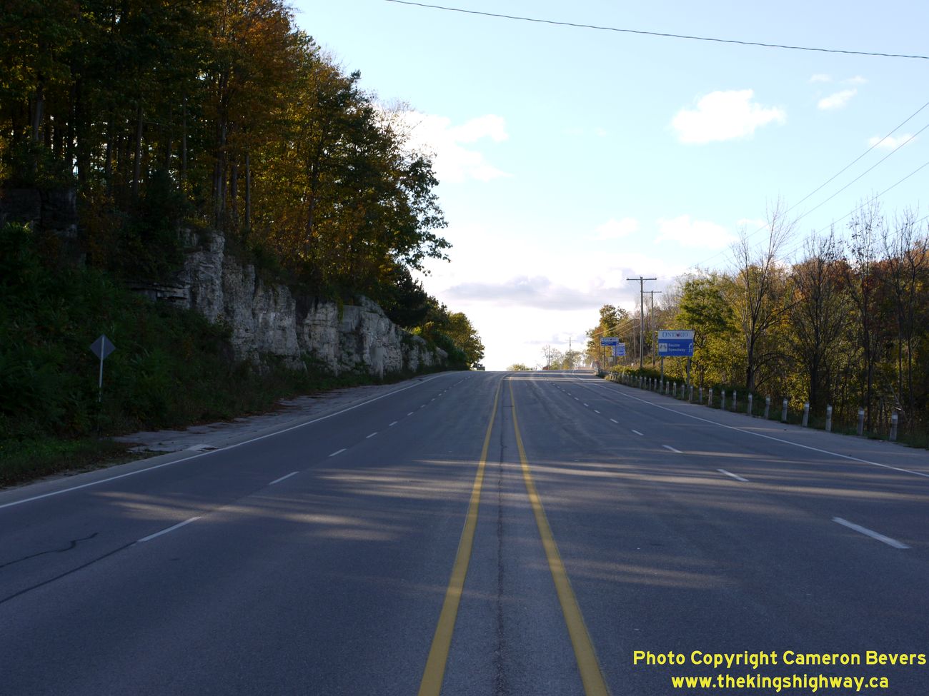
Left - Facing east along Hwy 6 & Hwy 21 towards Owen Sound, east of Springmount. (Photograph taken on October 3, 2010 - © Cameron Bevers) Right - Facing west along Hwy 6 & Hwy 21 towards Springmount from Maxwell Creek. The highway ascends another section of the Niagara Escarpment between Maxwell Creek and Springmount. See an Enlarged Photo here. (Photograph taken on October 3, 2010 - © Cameron Bevers) 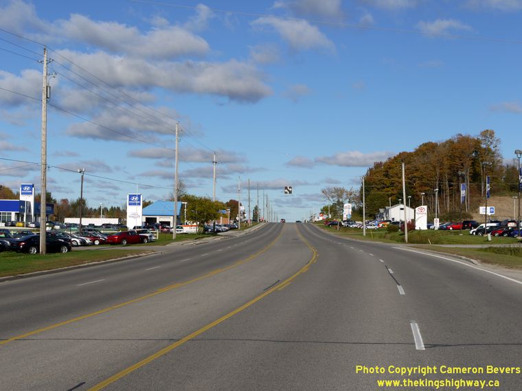
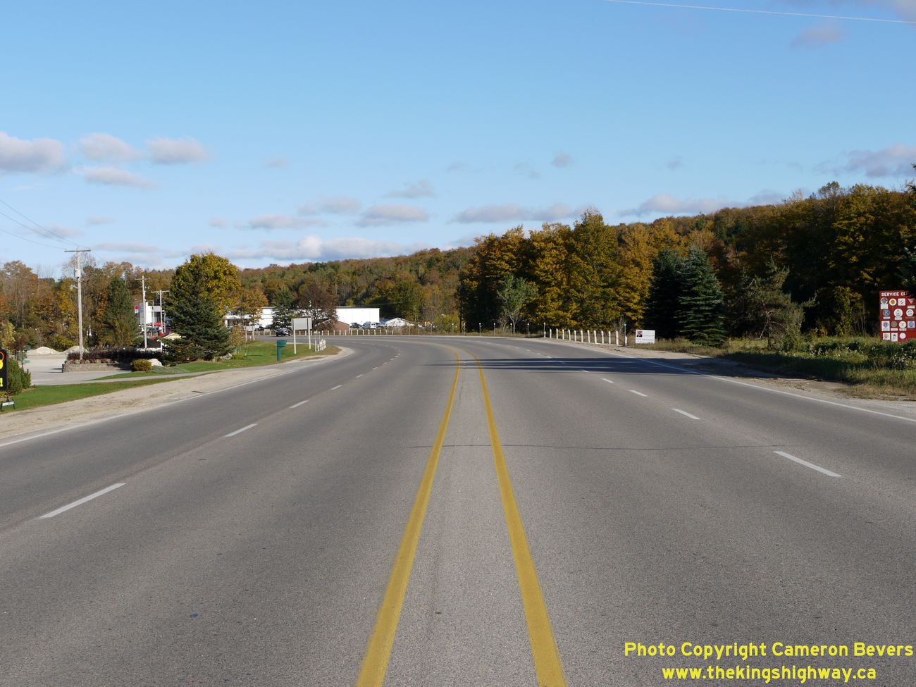
Left - Facing east along Hwy 6 & Hwy 21 approaching Owen Sound. The highway widens to a 5-lane cross section with two-way centre left turn lane
as it passes through the commercial area just west of Owen Sound. (Photograph taken on October 3, 2010 - © Cameron Bevers) Right - Facing east along Hwy 6 & Hwy 21 towards Owen Sound from Maxwell Creek. The two-way centre left turn lane terminates at this point. See an Enlarged Photo here. (Photograph taken on October 3, 2010 - © Cameron Bevers) 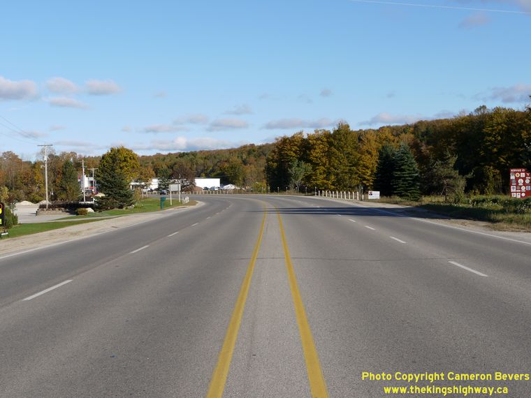
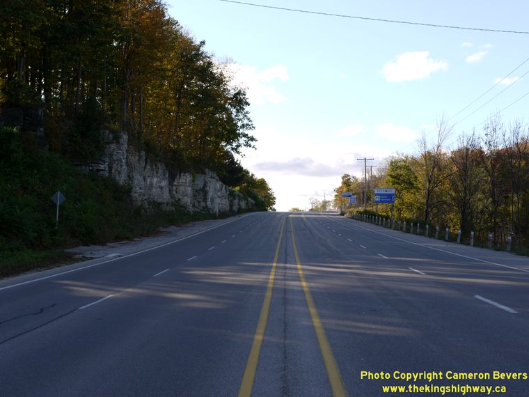
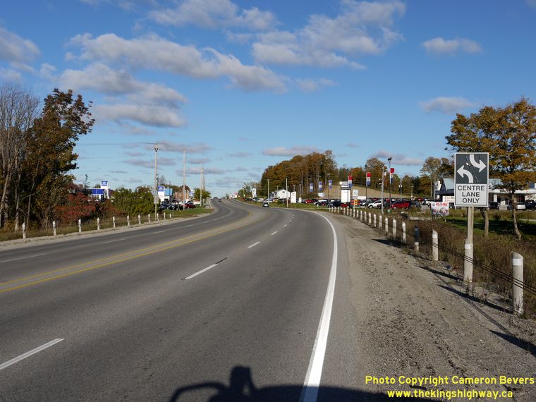
Left - Facing east along Hwy 6 & Hwy 21 approaching Owen Sound. The remainder of the highway from Maxwell Creek to Springmount has an undivided
four-lane cross section with a narrow flush median. See an Enlarged Photo here. (Photograph taken on October 3, 2010 - © Cameron Bevers) Right - Facing east along Hwy 6 & Hwy 21 towards Downtown Owen Sound from the top of the Niagara Escarpment. (Photograph taken on October 3, 2010 - © Cameron Bevers) 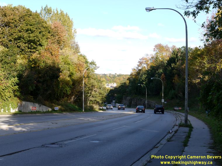
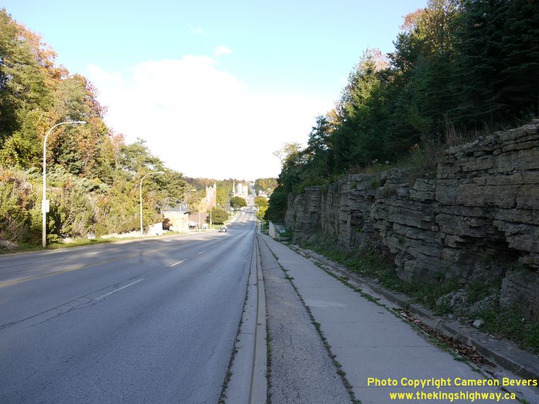
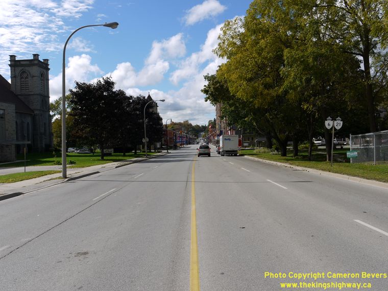
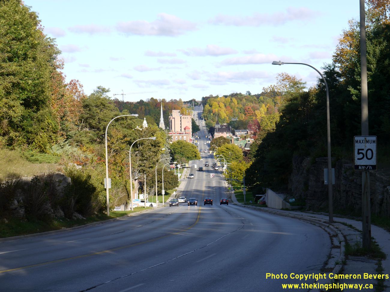
Left - Descending the Niagara Escarpment on Hwy 6 & Hwy 21 heading into Downtown Owen Sound, facing east. (Photograph taken on October 3, 2010 - © Cameron Bevers) Right - The western approach to Downtown Owen Sound on Hwy 6 & Hwy 21 passes through a large rock cut as it climbs the Niagara Escarpment. (Photograph taken on October 3, 2010 - © Cameron Bevers) 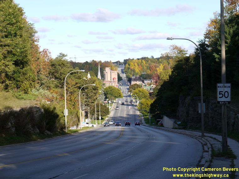
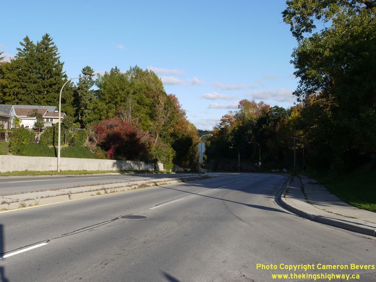
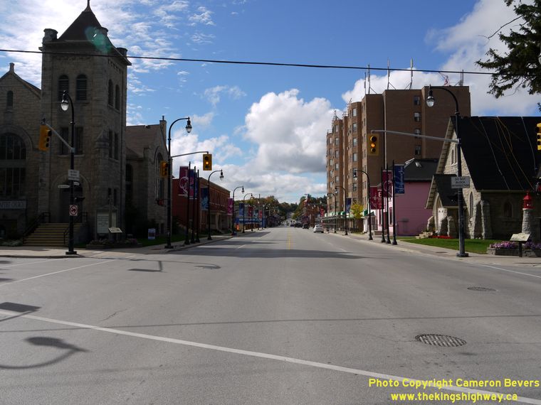
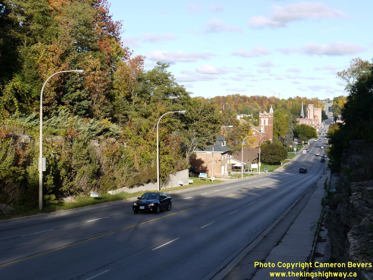
Left - Facing east along Hwy 6 & Hwy 21 approaching Downtown Owen Sound. The entire central business district of Owen Sound is located down in
the valley. The Hwy 10 & Hwy 26 Junction is located at the top of the next hill. See an
Enlarged Photo here. (Photograph taken on October 3, 2010 - © Cameron Bevers) Right - Ascending the Niagara Escarpment on Hwy 6 & Hwy 21 leaving Downtown Owen Sound, facing west. (Photograph taken on October 3, 2010 - © Cameron Bevers) 
Left - Approaching Downtown Owen Sound on Hwy 6 & Hwy 21, facing east. See an
Enlarged Photo here. (Photograph taken on October 3, 2010 - © Cameron Bevers) Right - Southern side of the Sydenham River Bridge on Hwy 6 & Hwy 21 in Downtown Owen Sound. (Photograph taken on October 3, 2010 - © Cameron Bevers) 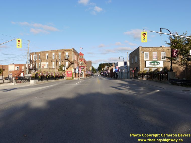
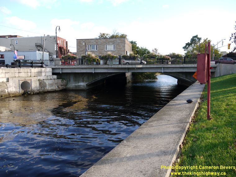
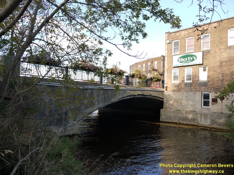
Left - Facing east along Hwy 6 & Hwy 21 at the Sydenham River Bridge in Downtown Owen Sound. See an
Enlarged Photo here. (Photograph taken on October 3, 2010 - © Cameron Bevers) Right - Northern side of the Sydenham River Bridge on Hwy 6 & Hwy 21 in Downtown Owen Sound. Note the separate span carrying the north sidewalk, which was added to the bridge long after it was originally constructed. See an Enlarged Photo here. (Photograph taken on October 3, 2010 - © Cameron Bevers) 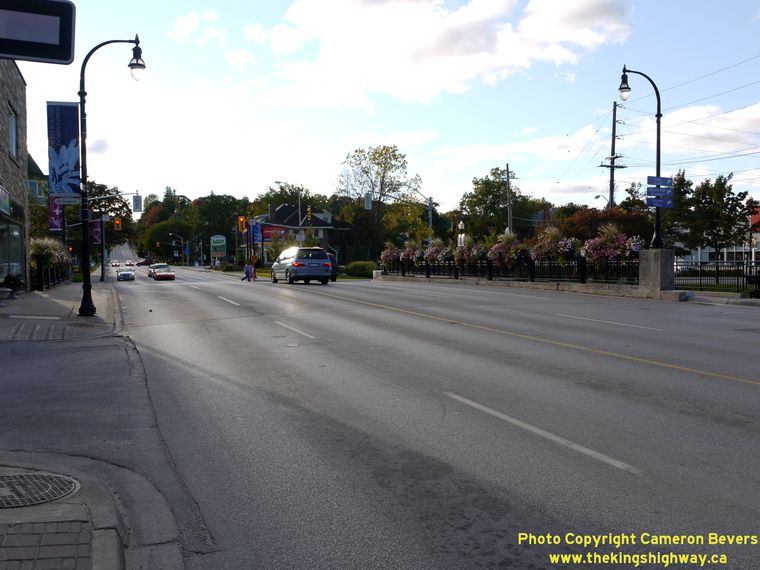
Left - Facing west along Hwy 6 & Hwy 21 at the Sydenham River Bridge in Downtown Owen Sound. (Photograph taken on October 3, 2010 - © Cameron Bevers) Right - Facing west along Hwy 6 & Hwy 21 from 4th Avenue East in Downtown Owen Sound. (Photograph taken on October 3, 2010 - © Cameron Bevers) 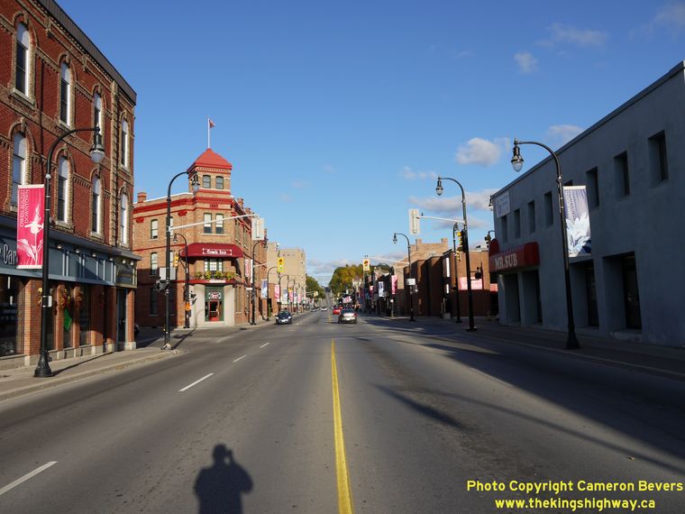
Left - View of Hwy 6 & Hwy 21 in Downtown Owen Sound, facing east near 2nd Avenue East. See an
Enlarged Photo here. (Photograph taken on October 3, 2010 - © Cameron Bevers) Right - Facing west along Hwy 6 & Hwy 21 approaching Downtown Owen Sound. Currently, the routes of Hwy 6 & Hwy 21 share an overlapped route for about 5 km through Owen Sound. This concurrent routing of Hwy 6 & Hwy 21 through Owen Sound has existed since 1937, when Hwy 6 was extended beyond its original terminus in Downtown Owen Sound up the Bruce Peninsula to Tobermory. (Photograph taken on October 3, 2010 - © Cameron Bevers) 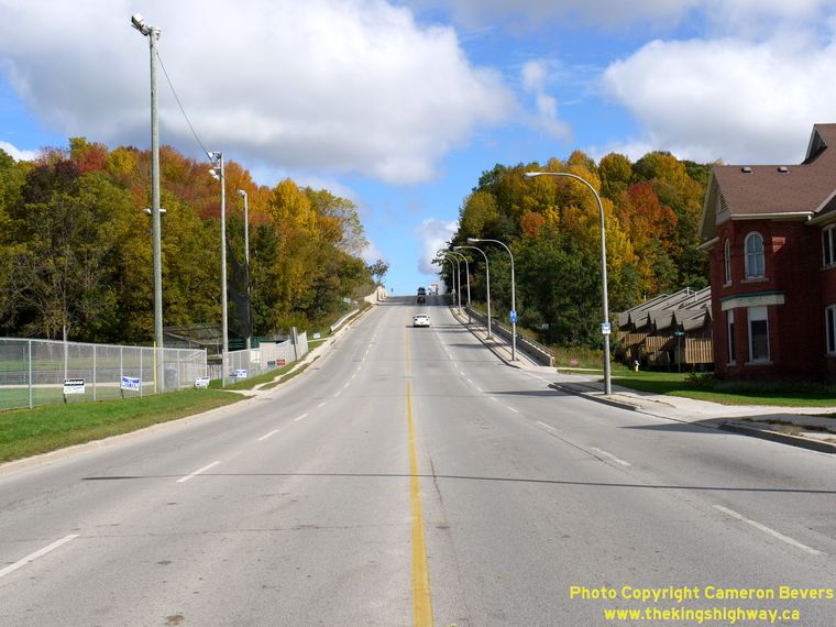

Left - Facing east along Hwy 6 & Hwy 21 from Downtown Owen Sound. The highway climbs this steep grade before reaching the Hwy 10 & Hwy 26
Junction at the top of the hill. (Photograph taken on October 3, 2010 - © Cameron Bevers) Right - Facing north along Hwy 6 & Hwy 10 towards the Hwy 21 and Hwy 26 Junction in Owen Sound. (Photograph taken on October 3, 2010 - © Cameron Bevers) 

Left - Junction assembly at the northern terminus of Hwy 10 at the Hwy 21 & Hwy 26 Junction in Owen Sound. This highway junction is rather
unique, as it marks the common terminus of three different King's Highways; Hwy 10, Hwy 21 & Hwy 26 all end here. Note the "Hwy 10 Ends" sign on the
junction assembly. Traffic continuing straight through at the traffic signals follows Hwy 26 east towards Meaford, while left-turning traffic follows
Hwy 6 & Hwy 21 into Downtown Owen Sound. See an Enlarged Photo here. (Photograph taken on October 3, 2010 - © Cameron Bevers) Right - Facing west along Hwy 26 towards the Hwy 6, Hwy 10 & Hwy 21 Junction in Owen Sound. After travelling nearly 120 km from Barrie, Hwy 26 comes to an end at the signalized intersection. Traffic continuing straight through at the traffic signals follows Hwy 6 & Hwy 10 south towards Chatsworth, while right-turning traffic follows Hwy 6 & Hwy 21 into Downtown Owen Sound. See an Enlarged Photo here. (Photograph taken on October 3, 2010 - © Cameron Bevers) 

Left - Western terminus of Hwy 26 at the Hwy 6, Hwy 10 & Hwy 21 Junction in Owen Sound. Unfortunately, there is no sign indicating that Hwy 26
ends at this junction. (Photograph taken on October 3, 2010 - © Cameron Bevers) Right - Facing east along Hwy 26 towards Meaford from the Hwy 6, Hwy 10 & Hwy 21 Junction in Owen Sound. See an Enlarged Photo here. (Photograph taken on October 3, 2010 - © Cameron Bevers) 

Left - Northern terminus of Hwy 21 at the Hwy 6, Hwy 10 & Hwy 26 Junction in Owen Sound. Like Hwy 10 and Hwy 26, Hwy 21 also reaches its
terminus at this intersection. Of the four highways which intersect here, only Hwy 6 continues beyond the intersection. Unfortunately, there is no sign
indicating that Hwy 21 ends at this junction. (Photograph taken on October 3, 2010 - © Cameron Bevers) Right - Junction assembly approaching the northern terminus of Hwy 21 at the Hwy 6, Hwy 10 & Hwy 26 Junction in Owen Sound. (Photograph taken on October 3, 2010 - © Cameron Bevers) 
Above - Facing south along Hwy 6 & Hwy 10 towards Chatsworth from the Hwy 21 and Hwy 26 Junction in Owen Sound. The routes of Hwy 6 & Hwy 10
run concurrently for about 13 km from Chatsworth to Owen Sound. This overlapped routing between Hwy 6 & Hwy 10 has existed since route numbers were
first introduced on Ontario Provincial Highways in 1925. (Photograph taken on October 3, 2010 - © Cameron Bevers)
More King's Highway 21 Photographs Coming Soon!
|
|---|
Links to Adjacent King's Highway Photograph Pages:
Back to King's Highway 20 Photos /
King's Highway 21 History /
On to King's Highway 22 Photos
Ontario Highway History - Main Menu / Back to List of Highways Website contents, photos & text © 2002-2026, Cameron
Bevers (Webmaster) - All Rights Reserved / Contact Me
|
|---|