
| 
| |
|
|
This page contains present day photos (Year 2000 to date) of Ontario's King's Highway 24, arranged by location from Long Point
northerly to Paris. All photographs displayed on this page were taken by the Webmaster (Cameron Bevers), unless specifically noted otherwise. Click on any
thumbnail to see a larger image!
Please note that all photographs displayed on this
website are protected by copyright. These photographs must not be reproduced, published,
electronically stored or copied, distributed, or posted onto other websites without
my written permission. If you want to use photos from this website, please
email me first for permission. Thank-you!
|
|---|
|
Page 2: Present Day King's Highway 24 Photographs (Long Point to Paris)

Above - An old stone arch culvert on Old Hwy 24 at Bloomsburg, north of Simcoe. This historic arch culvert was constructed approximately 1853. A historical
view of the Bloomsburg Culvert can be seen in this Circa 1900 postcard view of Bloomsburg. See an
Enlarged Photo here. (Photograph taken on June 22, 2003 - © Cameron Bevers) 

Left - Facing south along Old Hwy 24 in Downtown Waterford. See an
Enlarged Photo here. (Photograph taken on May 11, 2012 - © Cameron Bevers) Right - Approaching Waterford on Old Hwy 24, facing south. Waterford was one of several villages bypassed in the late 1960s, when Hwy 24 was relocated onto a new and much-improved route between Simcoe and Brantford. The original 1927 route of Hwy 24, seen here, was rather winding and indirect. The highway passed through several sizeable communities along the way between Simcoe and Brantford. Old Hwy 24 is now known as Norfolk County Road 24 and Brant County Road 24 in Norfolk and Brant Counties, respectively. See an Enlarged Photo here. (Photograph taken on May 11, 2012 - © Cameron Bevers) 

Left - Facing north along Old Hwy 24 at Townsend Concession 6, north of Waterford. See an
Enlarged Photo here. (Photograph taken on May 11, 2012 - © Cameron Bevers) Right - Old Hwy 24 near Townsend Concession 5, facing south towards Waterford. By the 1960s, the old route of Hwy 24 had become quite developed, with frequent private entrances along the highway. The highway had a narrow right-of-way and minimal roadside shoulders. As a result, utility poles along the highway encroached very close to the edge of the pavement. Rather than trying to improve the existing route of Hwy 24 any further, the Department of Highways of Ontario (DHO) instead elected to build an entirely new route for Hwy 24 just a short distance to the west during the 1960s. See an Enlarged Photo here. (Photograph taken on May 11, 2012 - © Cameron Bevers) 

Left - This abandoned section of Old Hwy 24 at Norfolk County Road 19 south of Wilsonville was closed to traffic decades ago. See an
Enlarged Photo here. (Photograph taken on May 11, 2012 - © Cameron Bevers) Right - Facing south along Old Hwy 24 in Wilsonville. See an Enlarged Photo here. (Photograph taken on May 11, 2012 - © Cameron Bevers) 

Left - Facing north along Old Hwy 24 at the Brant-Norfolk County Boundary. See an
Enlarged Photo here. (Photograph taken on May 11, 2012 - © Cameron Bevers) Right - Approaching Oakland on Old Hwy 24, facing north. See an Enlarged Photo here. (Photograph taken on May 11, 2012 - © Cameron Bevers) 

Left - Facing south along Old Hwy 24 in Oakland. See an
Enlarged Photo here. (Photograph taken on May 11, 2012 - © Cameron Bevers) Right - Facing north along Old Hwy 24 towards Brantford near Elliott Road. See an Enlarged Photo here. (Photograph taken on May 11, 2012 - © Cameron Bevers) 

Left - Approaching the Mount Pleasant turn-off on Old Hwy 24, facing north. A channelized right-turn ramp carries northbound traffic towards Brantford.
As originally established in 1927, Hwy 24 turned right at the next intersection and continued in a northeasterly direction into Brantford, via Mount Pleasant. See an
Enlarged Photo here. (Photograph taken on May 11, 2012 - © Cameron Bevers) Right - This channelized right-turn ramp near Mount Pleasant once carried Hwy 24 traffic in both directions. The ramp was converted to one-way traffic during the 1960s. See an Enlarged Photo here. (Photograph taken on May 11, 2012 - © Cameron Bevers) 

Left - Note the width of the pavement on the channelized right-turn ramp. At one point, both lanes of Hwy 24 followed this corner diversion. See an
Enlarged Photo here. (Photograph taken on May 11, 2012 - © Cameron Bevers) Right - Facing south along Old Hwy 24 approaching the Mount Pleasant turn-off. The end of the channelized right turn ramp can be seen joining Old Hwy 24 at right. Southbound traffic on Old Hwy 24 heading for Waterford must turn left at the stop sign in the distance. See an Enlarged Photo here. (Photograph taken on May 11, 2012 - © Cameron Bevers) 

Left - This sharp curve on Old Hwy 24 approaching Mount Pleasant likely caught many motorists off-guard. The construction of the new Hwy 24 corridor in the
1960s bypassed several hazardous curves on the original 1927 highway route, including this example. See an
Enlarged Photo here. (Photograph taken on May 11, 2012 - © Cameron Bevers) Right - Facing north along Old Hwy 24 in Mount Pleasant. See an Enlarged Photo here. (Photograph taken on May 11, 2012 - © Cameron Bevers) 

Left - Facing north along Old Hwy 24 towards Brantford from Mount Pleasant. Downtown Brantford lies about 8 km ahead. See an
Enlarged Photo here. (Photograph taken on May 11, 2012 - © Cameron Bevers) Right - Waterford Railway Overhead on the Hwy 24 Bypass. Once the railway below the structure was abandoned, the structure became redundant and was ultimately removed. See an Enlarged Photo here. (Photograph taken on May 11, 2012 - © Cameron Bevers) 

Left - Facing north along the Hwy 24 Bypass across the Waterford Railway Overhead. See an
Enlarged Photo here. (Photograph taken on May 11, 2012 - © Cameron Bevers) Right - Western side of the Waterford Railway Overhead on the Hwy 24 Bypass. This three-span concrete girder structure was completed in 1966. See an Enlarged Photo here. (Photograph taken on May 11, 2012 - © Cameron Bevers) 

Left - Structure identification number and date stamp (1966) on the Waterford Railway Overhead. See an
Enlarged Photo here. (Photograph taken on May 11, 2012 - © Cameron Bevers) Right - Facing south along the Hwy 24 Bypass across the Waterford Railway Overhead. See an Enlarged Photo here. (Photograph taken on May 11, 2012 - © Cameron Bevers) 

Left - Eastern side of the Waterford Railway Overhead on the Hwy 24 Bypass. This structure was demolished in 2013, shortly after these photos were taken. See
an Enlarged Photo here. (Photograph taken on May 11, 2012 - © Cameron Bevers) Right - Steel handrail design on the Waterford Railway Overhead. Several DHO-built bridges were constructed with this type of handrail between 1965 and 1969. See an Enlarged Photo here. (Photograph taken on May 11, 2012 - © Cameron Bevers) 

Left - Facing north along the Hwy 24 Bypass towards Scotland from the Waterford Railway Overhead. See an
Enlarged Photo here. (Photograph taken on May 11, 2012 - © Cameron Bevers) Right - Start of the twin-slab concrete section of the Hwy 24 Bypass south of Scotland, facing north. Approximately 13 km of the new Hwy 24 Bypass between the Scotland area and the Hwy 53 Junction was surfaced with concrete in 1966-1967. See an Enlarged Photo here. (Photograph taken on April 15, 2006 - © Cameron Bevers) 

Left - Facing north along the Hwy 24 Bypass approaching Scotland. From this point north to the Hwy 53 Junction, the Hwy 24 Bypass was constructed on a brand
new alignment. Although it not a fully controlled-access highway or staged freeway, access points onto the Hwy 24 Bypass north of Scotland are limited to a handful of
at-grade intersections and private driveways. See an Enlarged Photo here. (Photograph taken on April 15, 2006 - © Cameron Bevers) Right - Facing north along the Hwy 24 Bypass at the Brant Road 4 (Vanessa Road) turn-off to Scotland and Delhi. See an Enlarged Photo here. (Photograph taken on April 15, 2006 - © Cameron Bevers) 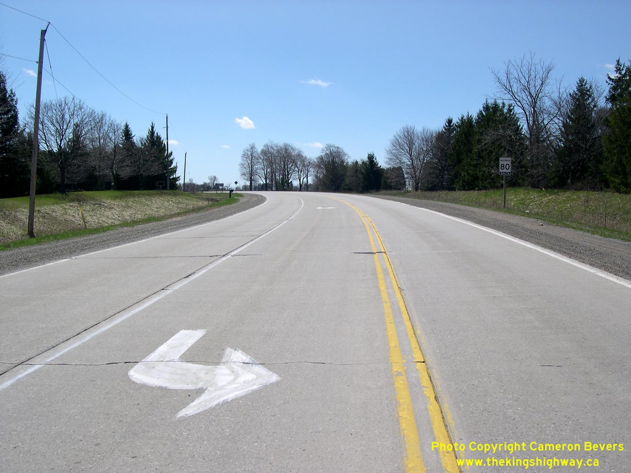

Left - Facing south along the Hwy 24 Bypass from the Brant Road 4 (Vanessa Road) turn-off near Scotland. See an
Enlarged Photo here. (Photograph taken on April 15, 2006 - © Cameron Bevers) Right - Facing north along the Hwy 24 Bypass towards Paris from Scotland. See an Enlarged Photo here. (Photograph taken on April 15, 2006 - © Cameron Bevers) 

Left - Facing north along the Hwy 24 Bypass, about 3 km north of Scotland. The new Hwy 24 Bypass was officially completed and opened to traffic on August 18,
1967. See an Enlarged Photo here. (Photograph taken on April 15, 2006 - © Cameron Bevers) Right - Facing south along the Hwy 24 Bypass towards Scotland. The concrete pavement on the Hwy 24 Bypass had generally fared quite well, considering it was 40 years old. See an Enlarged Photo here. (Photograph taken on April 15, 2006 - © Cameron Bevers) 

Left - An abandoned railway prominently crosses the Hwy 24 Bypass about 2 km south of the Hwy 53 Junction. See an
Enlarged Photo here. (Photograph taken on April 15, 2006 - © Cameron Bevers) Right - Facing south along the Hwy 24 Bypass towards Scotland, about 2 km south of the Hwy 53 Junction. The concrete pavement along the Hwy 24 Bypass was replaced with an asphalt surface in 2006. See an Enlarged Photo here. (Photograph taken on April 15, 2006 - © Cameron Bevers) 

Left - Facing north along the Hwy 24 Bypass towards Paris from Brant Road 12 (Arthur Road). See an
Enlarged Photo here. (Photograph taken on April 15, 2006 - © Cameron Bevers) Right - Construction joint between the rigid and flexible pavement types on the Hwy 24 Bypass at Brant Road 12 (Arthur Road). See an Enlarged Photo here. (Photograph taken on April 15, 2006 - © Cameron Bevers) 

Left - Transverse expansion joint in the concrete pavement on the Hwy 24 Bypass south of the Hwy 53 Junction. See an
Enlarged Photo here. (Photograph taken on April 15, 2006 - © Cameron Bevers) Right - End of the concrete pavement section on the Hwy 24 Bypass, just south of the Hwy 53 Junction. See an Enlarged Photo here. (Photograph taken on April 15, 2006 - © Cameron Bevers) 
Above - Approaching the Hwy 53 Junction on the Hwy 24 Bypass, facing north towards Paris. See an
Enlarged Photo here. (Photograph taken on April 15, 2006 - © Cameron Bevers)
Continue on to King's Highway 24 Photos: Paris to Cambridge
|
|---|
Links to Adjacent King's Highway Photograph Pages:
Back to King's Highway 23 Photos /
King's Highway 24 History /
On to King's Highway 25 Photos
Ontario Highway History - Main Menu / Back to List of Highways Website contents, photos & text © 2002-2026, Cameron
Bevers (Webmaster) - All Rights Reserved / Contact Me
|
|---|