
| 
|  |
|
|
This page contains present day photos (Year 2000 to date) of Ontario's King's Highway 24, arranged by location from Singhampton
northerly to Collingwood. Please note that this historical section of King's Highway 24 is now officially known as Simcoe County Road 124. All photographs displayed
on this page were taken by the Webmaster (Cameron Bevers), unless specifically noted otherwise. Click on any thumbnail to see a larger image!
Please note that all photographs displayed on this
website are protected by copyright. These photographs must not be reproduced, published,
electronically stored or copied, distributed, or posted onto other websites without
my written permission. If you want to use photos from this website, please
email me first for permission. Thank-you!
|
|---|
|
Page 7: Present Day King's Highway 24 Photographs (Singhampton to Collingwood)


Left - Facing south along Hwy 24 towards the Hwy 4 Junction from the southern entrance to Singhampton. Hwy 24 intersects with Hwy 4 just ahead at the top of
this hill. See an Enlarged Photo Here. (Photograph taken on May 22, 2023 - © Cameron Bevers) Right - Approaching Singhampton on Hwy 24, facing north towards Collingwood. See an Enlarged Photo Here. (Photograph taken on May 22, 2023 - © Cameron Bevers) 
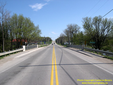
Left - Eastern side of the Mad River Bridge on Hwy 24 in Singhampton. This single-span concrete rigid frame structure was completed in 1957. See an
Enlarged Photo Here. (Photograph taken on May 13, 2007 - © Cameron Bevers) Right - Facing south along Hwy 24 at the Mad River Bridge in Singhampton. See an Enlarged Photo Here. (Photograph taken on May 13, 2007 - © Cameron Bevers) 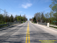
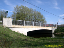
Left - Facing north along Hwy 24 at the Mad River Bridge in Singhampton. See an
Enlarged Photo Here. (Photograph taken on May 13, 2007 - © Cameron Bevers) Right - Western side of the Mad River Bridge on Hwy 24 in Singhampton. This bridge was constructed under Department of Highways' Contract #1956-165. See an Enlarged Photo Here. (Photograph taken on May 13, 2007 - © Cameron Bevers) 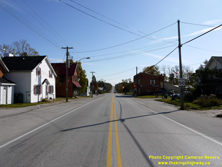
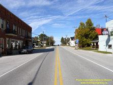
Left - View of Hwy 24 through Singhampton, facing south towards the Mad River Bridge. See an
Enlarged Photo Here. (Photograph taken on October 16, 2009 - © Cameron Bevers) Right - Facing north along Hwy 24 towards the turn-off in Singhampton. At this intersection, Hwy 24 turns right towards Collingwood. See an Enlarged Photo Here. (Photograph taken on October 16, 2009 - © Cameron Bevers) 

Left - Facing north along Hwy 24 at the turn-off in Singhampton. Up until the 1940s, Hwy 24 continued straight through at this intersection. In 1944, a new
improved route was established for Hwy 24 between Singhampton and Duntroon. Since 1944, Hwy 24 has turned right towards Collingwood at this intersection. See an
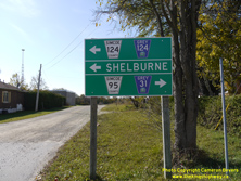
Enlarged Photo Here. (Photograph taken on October 16, 2009 - © Cameron Bevers) Right - Green guide signs on Hwy 24 at the turn-off in Singhampton. Heading northbound, traffic must turn right in order to continue on Hwy 24 (now known as Simcoe County Road 124) towards Collingwood. As an alternate route, motorists can continue north from Singhampton along the original pre-1944 route of Hwy 24 (today's Grey County Road 31 & Simcoe County Road 95) and return to Hwy 24 in Duntroon via Simcoe County Road 91. See an Enlarged Photo Here. (Photograph taken on October 16, 2009 - © Cameron Bevers) 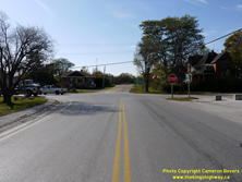
Left - Facing south along Hwy 24 at the turn-off in Singhampton. At this intersection, Hwy 24 turns left towards Shelburne. See an
Enlarged Photo Here. (Photograph taken on October 16, 2009 - © Cameron Bevers) Right - Green guide signs on Hwy 24 at Singhampton. Heading southbound, traffic must turn left in order to continue on Hwy 24 (now County Road 124) towards Shelburne. Since this is a boundary road between two counties, County Road 124 is jointly-owned by Simcoe and Grey Counties from Singhampton southerly. See an Enlarged Photo Here. (Photograph taken on October 16, 2009 - © Cameron Bevers) 
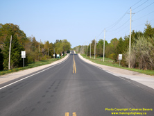
Left - Facing north along Hwy 24 towards Collingwood from the turn-off in Singhampton. See an
Enlarged Photo Here. (Photograph taken on October 16, 2009 - © Cameron Bevers) Right - Facing north along Hwy 24 from the northeastern entrance to Singhampton. For a few kilometres near Singhampton, Hwy 24 briefly turns east before resuming its route north again near Devil's Glen Provincial Park. Collingwood lies along the shores of Georgian Bay about 20 km ahead. See an Enlarged Photo Here. (Photograph taken on May 22, 2023 - © Cameron Bevers) 
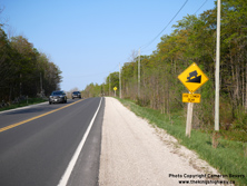
Left - Approaching Singhampton on Hwy 24, facing south towards Shelburne. See an
Enlarged Photo Here. (Photograph taken on May 22, 2023 - © Cameron Bevers) Right - Warning sign on northbound Hwy 24 advising motorists of the steep grade ahead. For the next 8 km, Hwy 24 descends the Niagara Escarpment, with several long and consistent downhill grades. With the escarpment being enshrouded by forests, it isn't apparent to motorists how steep the grade is just ahead. See an Enlarged Photo Here. (Photograph taken on May 22, 2023 - © Cameron Bevers) 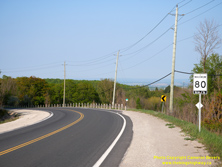

Left - As Hwy 24 rounds this curve about 2 km north of Singhampton, motorists catch their first glimpse of the Nottawasaga Valley which lies below. See an
Enlarged Photo Here. (Photograph taken on May 22, 2023 - © Cameron Bevers) Right - View of Hwy 24 at the entrance to Devil's Glen Provincial Park, located about 3 km north of Singhampton. This small Provincial Park actually began as a Department of Highways of Ontario (DHO) Roadside Park, where a scenic lookout point was established beside Hwy 24 at the edge of the Niagara Escarpment. The present day route of Hwy 24 at left is actually a diversion of the original 1944 route of the highway. Previously, Hwy 24 passed through Devil's Glen Park. See an Enlarged Photo Here. (Photograph taken on May 22, 2023 - © Cameron Bevers) 

Left - View of the old route of Hwy 24 through Devil's Glen Park. The former highway alignment is rather overgrown, but it is easily discernible today. This
section of the highway was bypassed by the current route of Hwy 24 during the 1940s under Contract #1947-20. Once Hwy 24 had been relocated, the old highway alignment
was repurposed as a park access road after Devil's Glen was established as a DHO Roadside Park in 1950. The park access road looped over to the now-abandoned eastern
lookout point as well as picnic tables and cooking stoves placed for the convenience of motorists. Although prohibited today, camping was also permitted in Devil's
Glen Park at one time. See an Enlarged Photo Here. (Photograph taken on May 22, 2023 - © Cameron Bevers) Right - Until the new highway alignment was completed in 1948, Hwy 24 rounded a very sharp curve to the left at this point, followed by a steep downhill grade. The highway curve was removed as part of highway improvements between Nottawa and Singhampton carried out in 1947 and 1948. Despite the long grade up the Niagara Escarpment, this was one of only three very minor highway realignments along the route of Hwy 24 between Singhampton and Duntroon. See an Enlarged Photo Here. (Photograph taken on May 22, 2023 - © Cameron Bevers) 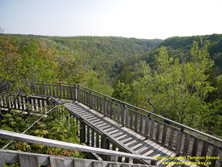

Left - View of Devil's Glen spectacular western lookout, which oversees the roughly 400-foot deep Mad River Canyon. This lookout is located a short walk from
the parking lot on Hwy 24. Motorists bound for Collingwood are certainly advised to stop at this roadside lookout, as the views here are among the best in the area. A
second lookout point once existed facing east towards the Nottawasaga Valley, but it is no longer in use today. Given the multiple vantage points from this
mountaintop site, it is no surprise that the DHO established a roadside park at this location. See an
Enlarged Photo Here. (Photograph taken on May 22, 2023 - © Cameron Bevers) Right - These overgrown concrete steps and cedar roadside guide posts are all that remain of the abandoned eastern lookout in Devil's Glen Park. This portion of the park is now so thickly-forested that any view that motorists once had from this vantage point is now obscured. When the Devil's Glen Roadside Park first opened in 1950, there were very few trees on this mountain, as seen in this Historical 1951 Photo of the DHO Devil's Glen Park taken shortly after it was built. See an Enlarged Photo Here. (Photograph taken on May 22, 2023 - © Cameron Bevers) 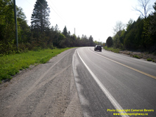

Left - Facing south along Hwy 24 approaching Devil's Glen Park. Prior to 1948, Hwy 24 continued straight ahead rather than curve to the right. See an
Enlarged Photo Here. (Photograph taken on May 22, 2023 - © Cameron Bevers) Right - The revised highway grade that was constructed in 1948 ties back into the original highway's alignment on this curve. A spectacular view of the Nottawasaga Valley becomes visible off in the distance. While the scenery along most sections of Hwy 24 across Southern Ontario is generally fairly subdued, the final 20 km of the highway's route from Singhampton to Collingwood is rather noteworthy. See an Enlarged Photo Here. (Photograph taken on May 22, 2023 - © Cameron Bevers) 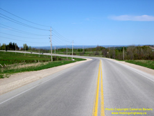
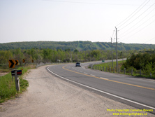
Left - Facing north along Hwy 24 towards Collingwood about 4 km northeast of Singhampton. This section of Hwy 24 between Singhampton and Duntroon is
particularly interesting, because it follows along the rim of the Niagara Escarpment for several kilometres. There are many beautiful vistas of the Nottawasaga Valley
and Georgian Bay from Hwy 24 in this area. See an Enlarged Photo Here. (Photograph taken on May 13, 2007 - © Cameron Bevers) Right - View of Hwy 24 approaching Glen Huron Road, facing southwest towards Singhampton. The Devil's Glen Ski Resort can be seen on the far side of the valley. See an Enlarged Photo Here. (Photograph taken on May 22, 2023 - © Cameron Bevers) 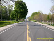
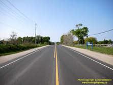
Left - View of Hwy 24 about 1 km south of the Hwy 91 Junction in Duntroon. As Hwy 24 heads north into Duntroon, the highway continues its steady descent from
the Niagara Escarpment. Although there are some steep sections, the descent is nowhere near as pronounced as the grade on the original 1937 route of Hwy 24 which
approached Duntroon from the west. See an Enlarged Photo Here. (Photograph taken on May 22, 2023 - © Cameron Bevers) Right - Approaching Duntroon on Hwy 24, facing north. Although they are located over 12 km away, Collingwood Harbour's grain elevators are a prominent landmark. See an Enlarged Photo Here. (Photograph taken on May 22, 2023 - © Cameron Bevers) 

Left - Nottawasaga Bay and Wasaga Beach can be seen in the distance from Hwy 24 at the southern entrance to Duntroon. See an
Enlarged Photo Here. (Photograph taken on May 22, 2023 - © Cameron Bevers) Right - Distance guide sign facing southbound Hwy 24 traffic at the Hwy 91 Junction in Duntroon. See an Enlarged Photo Here. (Photograph taken on May 22, 2023 - © Cameron Bevers) 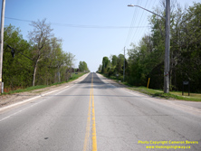
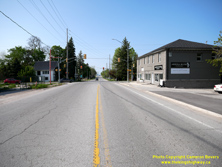
Left - Facing south along Hwy 24 from the Hwy 91 Junction in Duntroon. Note that the concrete curb and gutter alongside Hwy 24 was extended well beyond the
built-up area in order to manage stormwater runoff. Southbound motorists on Hwy 24 should always be on the lookout for slow-moving trucks on this long grade. Although
the revised 1944 route of Hwy 24 has a less severe grade than the original route of Hwy 24 assumed previously in 1937, it is still a long and arduous ascent for a
transport truck - even today! See an Enlarged Photo Here. (Photograph taken on May 22, 2023 - © Cameron Bevers) Right - Approaching the Hwy 91 Junction on Hwy 24 in Duntroon, facing north. At this intersection, the revised 1944 route of Hwy 24 connects back to the original 1937 route of Hwy 24, which approaches from the west at this traffic signal. It is rather noteworthy that all four legs of this intersection were at one time King's Highways. The diminutive route of Hwy 91 approaches from Stayner at right. See an Enlarged Photo Here. (Photograph taken on May 22, 2023 - © Cameron Bevers) 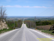

Left - Former route of Hwy 24 west of Duntroon. This road served as the route of Hwy 24 for a few years in the late 1930s and early 1940s. The steep hill
proved to be too much for many early transport trucks, so the highway was relocated in 1944. The new highway had a less severe grade that could be negotiated by
trucks more easily. See an Enlarged Photo Here. (Photograph taken on May 13, 2007 - © Cameron Bevers) Right - This stunning view of Georgian Bay and the Nottawasaga Valley once greeted all motorists arriving in the Collingwood area on the original alignment of Hwy 24. Today, this view is a little-known visual gem, hidden on one of the many scenic back roads of northern Simcoe County. See an Enlarged Photo Here. (Photograph taken on May 13, 2007 - © Cameron Bevers) 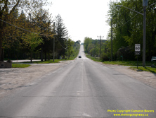
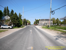
Left - View of Old Hwy 24 approaching Duntroon from the west. This bypassed section of Hwy 24 was the main highway south to Shelburne from 1937 up until 1944,
when it was bypassed by a new Hwy 24 route which had gentler grades. Old Hwy 24 is now part of today's Simcoe County Road 91. After serving in the highway system for
about 7 years, jurisdiction over Old Hwy 24 was transferred from the DHO to the County of Simcoe in July 1944. See an
Enlarged Photo Here. (Photograph taken on May 22, 2023 - © Cameron Bevers) Right - Approaching the Hwy 24 & Hwy 91 Junction on Old Hwy 24 in Duntroon, facing east. When Hwy 24 was first assumed through Simcoe County in 1937, northbound Hwy 24 motorists heading to Collingwood would have to turn left at this intersection. Motorists could also proceed straight ahead to Stayner via Hwy 91, which began at this intersection. Both the Singhampton-Collingwood Highway (Hwy 24) and the Duntroon-Stayner Highway (Hwy 91) were both assumed as King's Highways by the DHO on the same day - August 11, 1937. See an Enlarged Photo Here. (Photograph taken on May 22, 2023 - © Cameron Bevers) 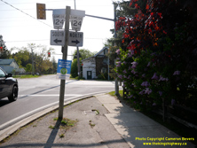
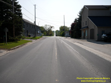
Left - Older Simcoe County Road 124 junction sign assembly in Duntroon. Simcoe County has been replacing its older county road route markers with a newer
graphical version in recent years. Prior to the highway's transfer or "downloading" in 1998, there would have been two Hwy 24 crown signs in this assembly. See an
Enlarged Photo Here. (Photograph taken on May 22, 2023 - © Cameron Bevers) Right - Approaching the historical western terminus of King's Highway 91 in Duntroon. The highway ended at the King's Highway 24 Junction in Duntroon between 1937 and 1998. After jurisdiction over Hwy 91 was transferred from the province to the County of Simcoe in the 1990s, the county decided to renumber one of its existing county roads west of Duntroon (Simcoe County Road 63) as an extension of Simcoe County Road 91. Accordingly, the present day route of Simcoe County Road 91 is actually much longer than King's Highway 91 was prior to downloading. See an Enlarged Photo Here. (Photograph taken on May 22, 2023 - © Cameron Bevers) 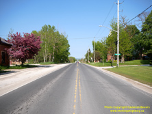

Left - Facing east along Hwy 91 towards Stayner from the Hwy 24 Junction in Duntroon. With a total length of only 7.9 km (4.9 miles), Hwy 91 was among
Ontario's shortest King's Highways. This highway formed a short cut-off route between Hwy 24 and Hwy 26, which intersects with Hwy 91 in nearby Stayner. See an
Enlarged Photo Here. (Photograph taken on May 22, 2023 - © Cameron Bevers) Right - A newer Simcoe County Road 91 route marker in Duntroon. The newer route markers feature the graphical county logo. See an Enlarged Photo Here. (Photograph taken on May 22, 2023 - © Cameron Bevers) 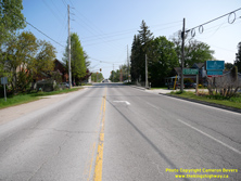

Left - Facing south along Hwy 24 approaching the Hwy 91 Junction in Duntroon. Early motorists arriving at this junction would have had to turn right in order
to stay on Hwy 24 to Shelburne. The DHO assumed a revised route for Hwy 24 in 1944, which resulted in the highway continuing straight ahead at the main intersection
in Duntroon. See an Enlarged Photo Here. (Photograph taken on May 22, 2023 - © Cameron Bevers) Right - View of Hwy 24 in Duntroon, facing north from the Hwy 91 Junction. See an Enlarged Photo Here. (Photograph taken on May 22, 2023 - © Cameron Bevers) 
Left - Approaching Duntroon on Hwy 24, facing south from Sydenham Trail. The Hwy 91 Junction can be seen in the background. See an
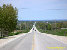
Enlarged Photo Here. (Photograph taken on May 22, 2023 - © Cameron Bevers) Right - This magnificent view of Georgian Bay opens up in front of northbound Hwy 24 traffic between Duntroon and Collingwood. See an Enlarged Photo Here. (Photograph taken on May 13, 2007 - © Cameron Bevers) 
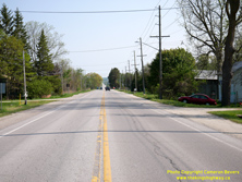
Left - Facing south along Hwy 24 towards Duntroon from the base of the Niagara Escarpment. The highway generally climbs in elevation from this point to
Singhampton. See an Enlarged Photo Here. (Photograph taken on May 22, 2023 - © Cameron Bevers) Right - View of Hwy 24 facing south from the southern entrance to Nottawa. This small community lies about 2 km south of Collingwood. See an Enlarged Photo Here. (Photograph taken on May 22, 2023 - © Cameron Bevers) 

Left - Facing north along Hwy 24 towards Collingwood from the southern entrance to Nottawa. See an
Enlarged Photo Here. (Photograph taken on May 22, 2023 - © Cameron Bevers) Right - View of Hwy 24 through Nottawa, facing north between Queen Street and Batteaux Road. See an Enlarged Photo Here. (Photograph taken on May 22, 2023 - © Cameron Bevers) 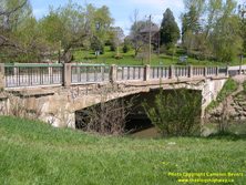

Left - Pretty River Bridge on Hwy 24 in Nottawa. This single-span concrete rigid frame structure was completed in 1949. See an
Enlarged Photo Here. (Photograph taken on May 13, 2007 - © Cameron Bevers) Right - Facing north along Hwy 24 towards Collingwood at the Pretty River Bridge in Nottawa. See an Enlarged Photo Here. (Photograph taken on May 13, 2007 - © Cameron Bevers) 

Left - Facing south along Hwy 24 towards Duntroon at the Pretty River Bridge in Nottawa. See an
Enlarged Photo Here. (Photograph taken on May 13, 2007 - © Cameron Bevers) Right - An old green "fingerboard" sign marks the Pretty River Bridge on Hwy 24. During the 1990s, the green fingerboard signs along provincial highways were doubled in size to increase their visibility. There are still many examples of the old size fingerboard signs left throughout the province, but most of these surviving signs are located on downloaded provincial highways. See an Enlarged Photo Here. (Photograph taken on May 13, 2007 - © Cameron Bevers) 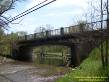
Left - Eastern side of the Pretty River Bridge on Hwy 24 in Nottawa. This structure was built under Contract #1948-73 by the Gaffney Construction Company. It
replaced a narrow concrete bowstring arch bridge. In order to maintain the existing alignment of Hwy 24 through Nottawa, a Bailey Bridge was installed on a roadside
diversion to carry Hwy 24 traffic while the new permanent bridge seen here was being constructed. See an
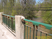
Enlarged Photo Here. (Photograph taken on May 13, 2007 - © Cameron Bevers) Right - Deteriorated handrail on the Pretty River Bridge. This photo exemplifies the importance of periodic painting of steel handrails. Note that the handrails are only rusted right through in places where the paint has peeled off. See an Enlarged Photo Here. (Photograph taken on May 13, 2007 - © Cameron Bevers) 
Left - Many highway bridges built in Ontario during the 1930s were constructed with a trio of embossed ornamental stripes on the balusters. Surprisingly, the
Pretty River Bridge also bears these features, despite the fact that the bridge was built in 1949. It is quite possible that this bridge was designed many years
earlier, but wasn't built due to the severe shortages of construction materials precipitated by World War II. See an
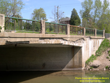
Enlarged Photo Here. (Photograph taken on May 13, 2007 - © Cameron Bevers) Right - Deteriorated concrete deck on the Pretty River Bridge. The Pretty River Bridge underwent a major rehabilitation by Simcoe County in 2007-2008. See an Enlarged Photo Here. (Photograph taken on May 13, 2007 - © Cameron Bevers) 
Left - Facing north along Hwy 24 towards Collingwood from the northern entrance to Nottawa. See an
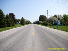
Enlarged Photo Here. (Photograph taken on May 22, 2023 - © Cameron Bevers) Right - Approaching Nottawa on Hwy 24, facing south towards Singhampton. See an Enlarged Photo Here. (Photograph taken on May 22, 2023 - © Cameron Bevers) 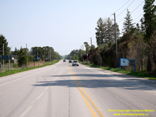

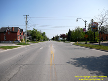
Left - Entering Clearview Township on southbound Hwy 24, facing south from the Simcoe County Road 32 Junction. See an
Enlarged Photo Here. (Photograph taken on May 22, 2023 - © Cameron Bevers) Right - Facing north along Hwy 24 approaching the Simcoe County Road 32 Junction at the southern entrance to Collingwood. The municipal boundary line crosses Hwy 24 at this point. Simcoe County Road 32 has become the de facto bypass route for Hwy 26 around Collingwood. Traffic wishing to reach Hwy 26 either east or west of town from Hwy 24 will likely find that the route offered by Simcoe County Road 32 is shorter than driving through the town centre. See an Enlarged Photo Here. (Photograph taken on May 22, 2023 - © Cameron Bevers) 
Left - Blue municipal boundary sign on northbound Hwy 24 entering Collingwood. With a current population of about 25,000, Collingwood is the largest town on
Hwy 24 north of Orangeville. It is also among Ontario's fastest-growing municipalities. See an
Enlarged Photo Here. (Photograph taken on May 22, 2023 - © Cameron Bevers) Right - Facing south along Hurontario Street (Hwy 24) from Hume Street in Collingwood. See an Enlarged Photo Here. (Photograph taken on May 22, 2023 - © Cameron Bevers) 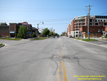

Left - Approaching Hume Street on Hwy 24 (Hurontario Street), facing north towards Downtown Collingwood. This signalized intersection once marked the northern
terminus of Hwy 24, where it intersected with Hwy 26 coming from Barrie. The route of Hwy 26 was subsequently changed through Collingwood during the 1970s, which
resulted in the route of Hwy 24 being extended northerly for several blocks through Collingwood's town centre. See an
Enlarged Photo Here. (Photograph taken on May 22, 2023 - © Cameron Bevers) Right - This municipally-installed sign assembly at the intersection of Hurontario Street and Hume Street in Collingwood is intended to serve as a trailblazed route to guide traffic to Hwy 26. Coincidentally, the sign assembly accurately depicts the historical pre-1971 route of Hwy 26 through this intersection. Before 1971, this sign assembly would have been similar to the one seen here, but would have had a "24 ENDS" tab lying above it. See an Enlarged Photo Here. (Photograph taken on May 22, 2023 - © Cameron Bevers) 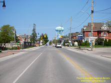

Left - Facing east along Hume Street (Old Hwy 26) from Hurontario Street (Hwy 24) in Collingwood. When Hwy 26 was first established in the 1920s, the highway
entered Collingwood from Barrie along Hume Street. A new route for Hwy 26 was established through Collingwood in 1971 via Huron Street and Pretty River Parkway, which
allowed through traffic on Hwy 26 to bypass Collingwood's busy main street. See an
Enlarged Photo Here. (Photograph taken on May 22, 2023 - © Cameron Bevers) Right - Approaching Hurontario Street (Hwy 24) on Hume Street. Up until 1971, Hwy 26 turned right onto Hurontario Street while Hwy 24 came to an end at left. See an Enlarged Photo Here. (Photograph taken on May 22, 2023 - © Cameron Bevers) 

Left - Facing south at the historical junction of Hwy 24 & Hwy 26 at Hume Street in Collingwood. Prior to 1971, Hwy 26 turned left onto Hume Street and
continued east to Barrie, while Hwy 24 began and continued straight ahead to Duntroon. A municipally-installed Hwy 124 crown sign points the way ahead to Simcoe
County Road 124, While this technically should be a flowerpot marker, it is nevertheless a commendable effort put forth by the municipality to aid in way-finding to
the major highways leaving town. See an Enlarged Photo Here. (Photograph taken on May 22, 2023 - © Cameron Bevers) Right - View of Hurontario Street (Hwy 24) facing north from Hume Street (Old Hwy 26). Following the 1971 rerouting of Hwy 26 through Collingwood, Hwy 24 was extended northerly along Hurontario Street from Hume Street for four blocks to Hwy 26's new route via First Street & Huron Street. See an Enlarged Photo Here. (Photograph taken on May 22, 2023 - © Cameron Bevers) 
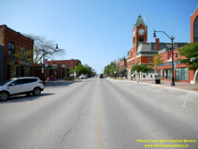
Left - Facing south along Hurontario Street (Hwy 24) approaching Third Street & Ontario Street. Under a thoughtful Heritage Conservation District Plan,
Collingwood features many well-preserved historical buildings along its main street. Even newer buildings, such as the one at right, have been designed to complement
and blend in with the overall street facade. Accordingly, Collingwood's town centre is very well-kept and far more vibrant than many other small town centres in
Southern Ontario. Some municipalities have really struggled in recent decades to maintain their town centres as desirable destinations for residents and tourists
alike. See an Enlarged Photo Here. (Photograph taken on May 22, 2023 - © Cameron Bevers) Right - View of Hurontario Street (Hwy 24) approaching Second Street & Simcoe Street. Collingwood's beautiful Town Hall is housed in the red brick building with the clock tower at right. Completed in 1891, Collingwood's Town Hall is the dominant landmark in the town centre, with the clock tower visible from a considerable distance up and down the street. See an Enlarged Photo Here. (Photograph taken on May 22, 2023 - © Cameron Bevers) 

Left - Facing south along Hurontario Street (Hwy 24) from First Street & Huron Street (Hwy 26). See an
Enlarged Photo Here. (Photograph taken on May 22, 2023 - © Cameron Bevers) Right - Northern terminus of Hwy 24 at the Hwy 26 Junction in Collingwood. The intersection of Hurontario Street and First Street & Huron Street has changed rather dramatically in recent decades, as Collingwood's waterfront has been transformed from an area of heavy industry into an upscale urban area. Compare this present day view to this Historical 1960 Photo when Collingwood's shipyards were still in operation. See an Enlarged Photo Here. (Photograph taken on May 22, 2023 - © Cameron Bevers) 

Left - Facing east along Hwy 26 (Huron Street) from Hwy 24 (Hurontario Street) in Downtown Collingwood. See an
Enlarged Photo Here. (Photograph taken on May 22, 2023 - © Cameron Bevers) Right - Junction of Hwy 24 & Hwy 26 in Downtown Collingwood, facing west along Huron Street. Although it is located about 7 km to the west, the Blue Mountain Ski Resort is clearly visible on the horizon. Huron Street becomes First Street at the traffic signals, as Hwy 26 continues west from the Hwy 24 Junction towards Meaford and Owen Sound. See an Enlarged Photo Here. (Photograph taken on May 22, 2023 - © Cameron Bevers) 

Left - Junction of Hwy 24 & Hwy 26 in Downtown Collingwood, facing east along First Street. The revised 1970s route of Hwy 26 continues straight ahead
towards Stayner and Barrie via Huron Street. From 1927 up until 1971, Hwy 26 turned right at these traffic signals and followed Collingwood's Main Street (today's
Hurontario Street) through the town centre. See an Enlarged Photo Here. (Photograph taken on May 22, 2023 - © Cameron Bevers) Right - Facing west along Hwy 26 (First Street) from Hwy 24 (Hurontario Street). Most urban sections of Hwy 26 through Collingwood has been designated as a Municipal Connecting Link. Almost 10 km of Hwy 26's route through Collingwood is now maintained by the municipality and not the province. See an Enlarged Photo Here. (Photograph taken on May 22, 2023 - © Cameron Bevers)
More King's Highway 24 Photographs Coming Soon!
|
|---|
Links to Adjacent King's Highway Photograph Pages:
Back to King's Highway 23 Photos /
King's Highway 24 History /
On to King's Highway 25 Photos
Ontario Highway History - Main Menu / Back to List of Highways Website contents, photos & text © 2002-2025, Cameron
Bevers (Webmaster) - All Rights Reserved / Contact Me |
|---|