
| 
| |
|
|
This page contains present day photos (Year 2000 to date) of Ontario's King's Highway 25, arranged by location from Milton
northerly to the Highway 89 Junction. All photographs displayed on this page were taken by the Webmaster (Cameron Bevers), unless specifically noted otherwise. Click
on any thumbnail to see a larger image!
Please note that all photographs displayed on this
website are protected by copyright. These photographs must not be reproduced, published,
electronically stored or copied, distributed, or posted onto other websites without
my written permission. If you want to use photos from this website, please
email me first for permission. Thank-you!
|
|---|
|
Page 3: Present Day King's Highway 25 Photographs (Milton to Hwy 89)
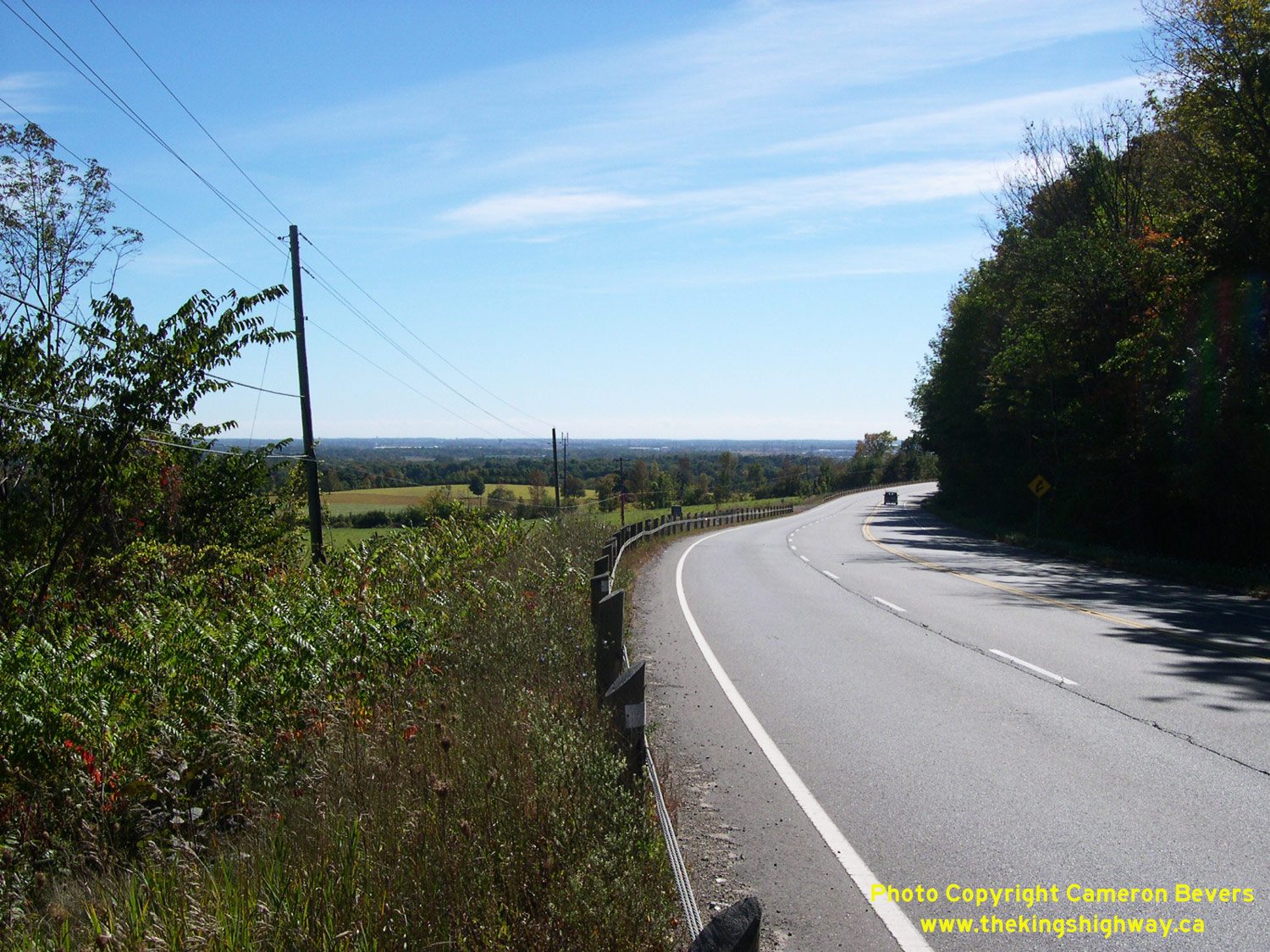
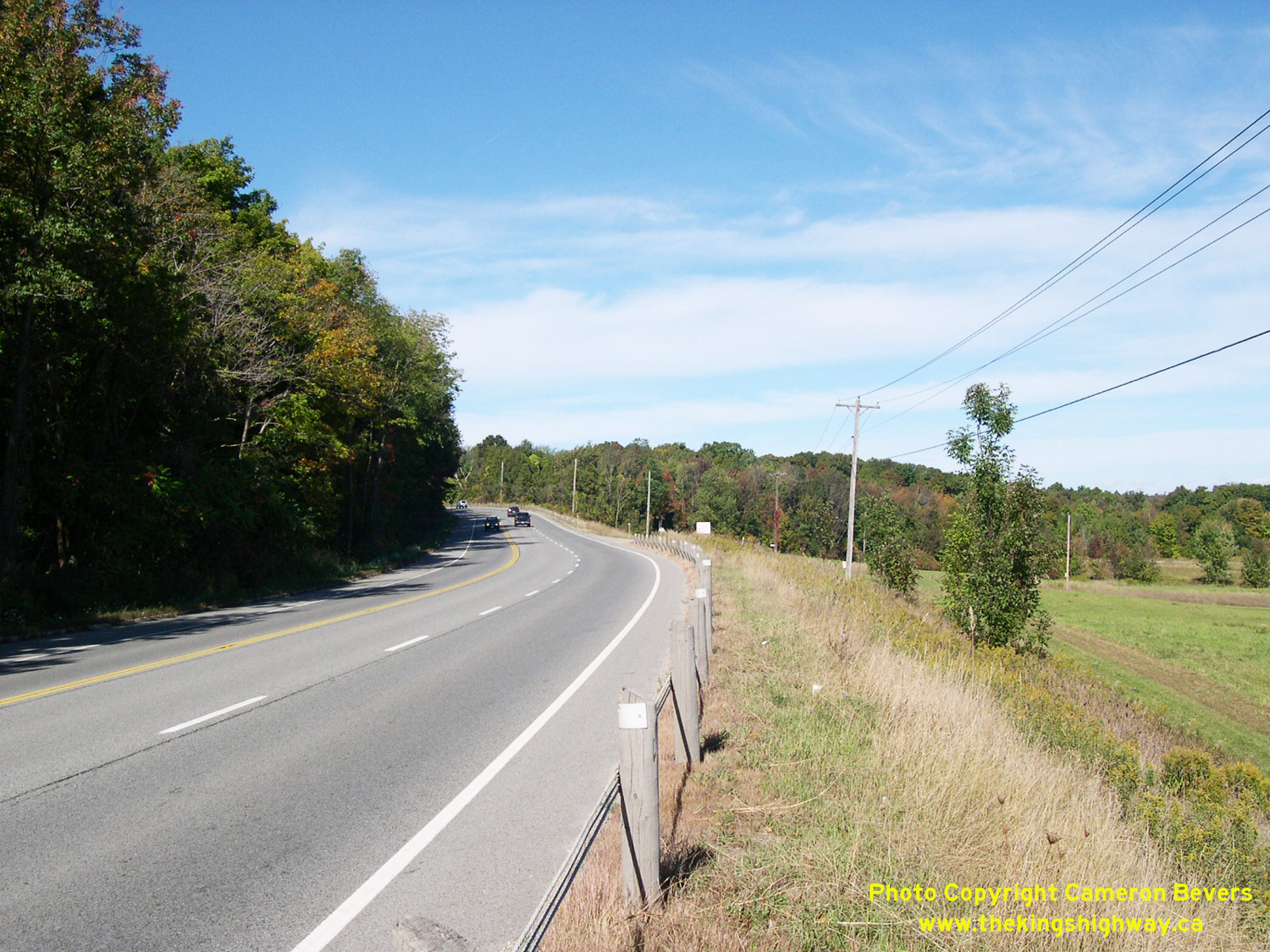
Left - Facing south along Hwy 25 at the Niagara Escarpment, about 7 km north of Milton. See an
Enlarged Photo Here. (Photograph taken on October 3, 2004 - © Cameron Bevers) Right - View of Hwy 25 ascending the Niagara Escarpment north of Milton, facing north towards Acton. See an Enlarged Photo Here. (Photograph taken on October 3, 2004 - © Cameron Bevers) 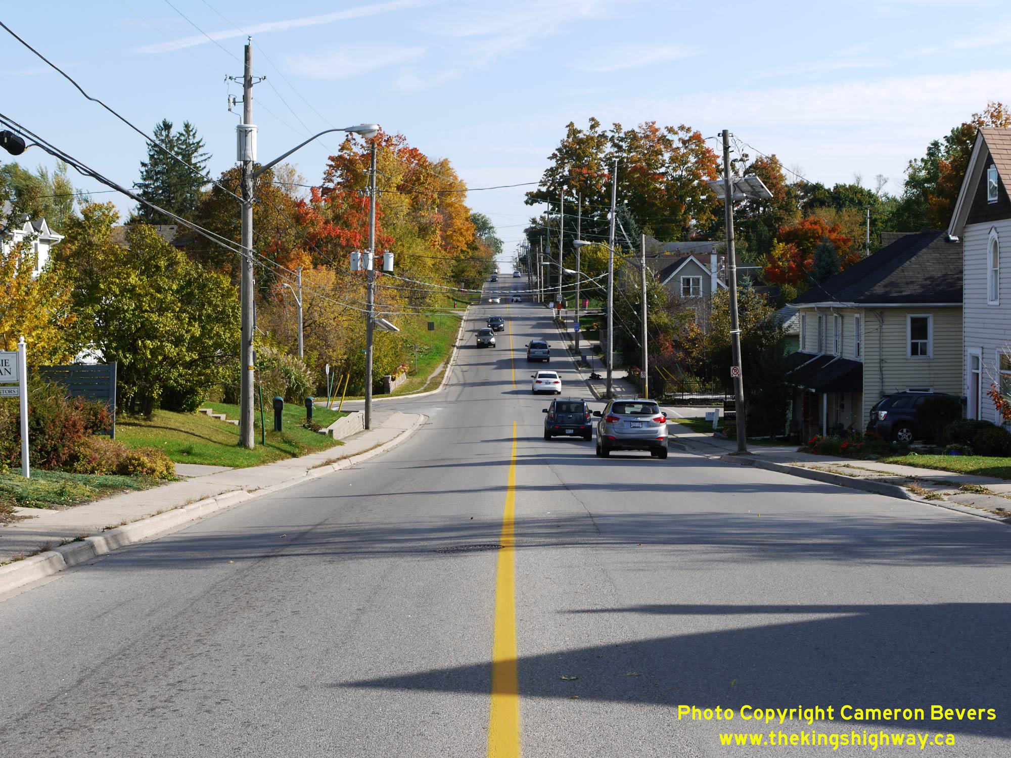
Left - Facing south along Hwy 25 towards Milton from the Hwy 7 East Junction in Acton. The section of Hwy 25 between Milton and Acton was first assumed as a
King's Highway by the Department of Highways of Ontario (DHO) in August 1937. Prior to 1937, the Milton-Acton Road was a Halton County Road. See an
Enlarged Photo Here. (Photograph taken on October 12, 2015 - © Cameron Bevers) Right - View of Hwy 25 approaching the Hwy 7 East Junction at Mill Street in Acton. Between 1937 and 1963, Hwy 25 reached its northern terminus at this intersection. The route of Hwy 25 was extended northerly from Acton to the Hwy 24 Junction at Ospringe in 1963, which resulted in a short concurrent route between Hwy 7 & Hwy 25 through Acton. See an Enlarged Photo Here. (Photograph taken on October 12, 2015 - © Cameron Bevers) 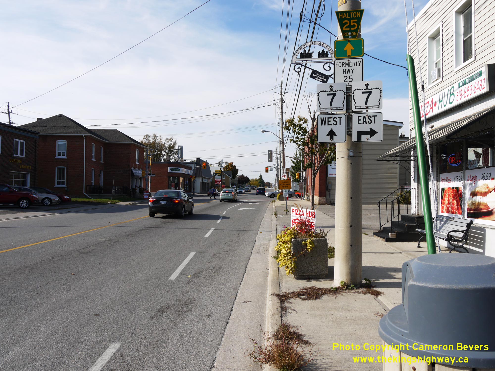
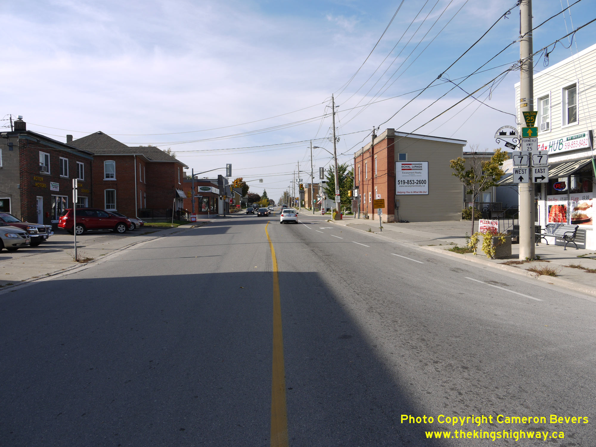
Left - Junction sign assembly on northbound Hwy 25 at the Hwy 7 East Junction at Mill Street in Acton. Jurisdiction over Hwy 25 in the Acton area was
transferred from the province to the Regional Municipality of Halton in 1998. The route is now officially known as Halton Regional Road 25. Through Acton,
black-and-white "Formerly Hwy 25" sign tabs are in place adjacent to the newer Halton Road 25 route markers, to indicate the former King's Highway designation. Hwy 7
& Hwy 25 share a concurrent, overlapped route for a distance of about 600 metres along Main Street through Acton. See an
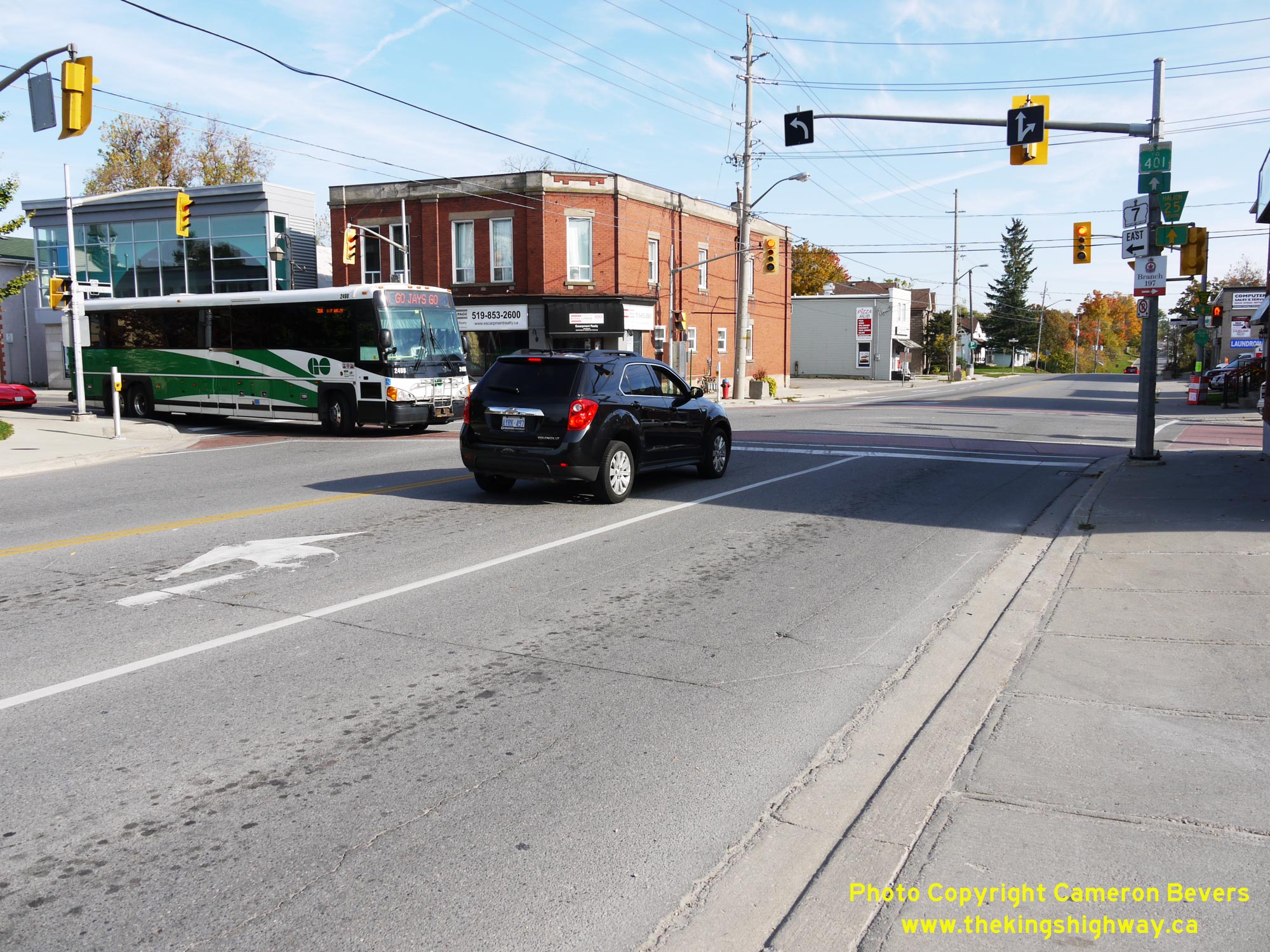
Enlarged Photo Here. (Photograph taken on October 12, 2015 - © Cameron Bevers) Right - View of the Hwy 25 and Hwy 7 East Junction at the intersection of Main Street and Mill Street in Downtown Acton, facing south. At this junction, Hwy 7 turns left onto Mill Street and continues east towards Brampton via Georgetown, while Hwy 25 continues straight through at this intersection and heads south via Main Street to Milton. Note the GO Transit bus turning northbound onto Hwy 7 & Hwy 25 (Main Street). Traffic bound for Hwy 401 is directed to follow Hwy 25 southerly to Milton from this highway junction. See an Enlarged Photo Here. (Photograph taken on October 12, 2015 - © Cameron Bevers) 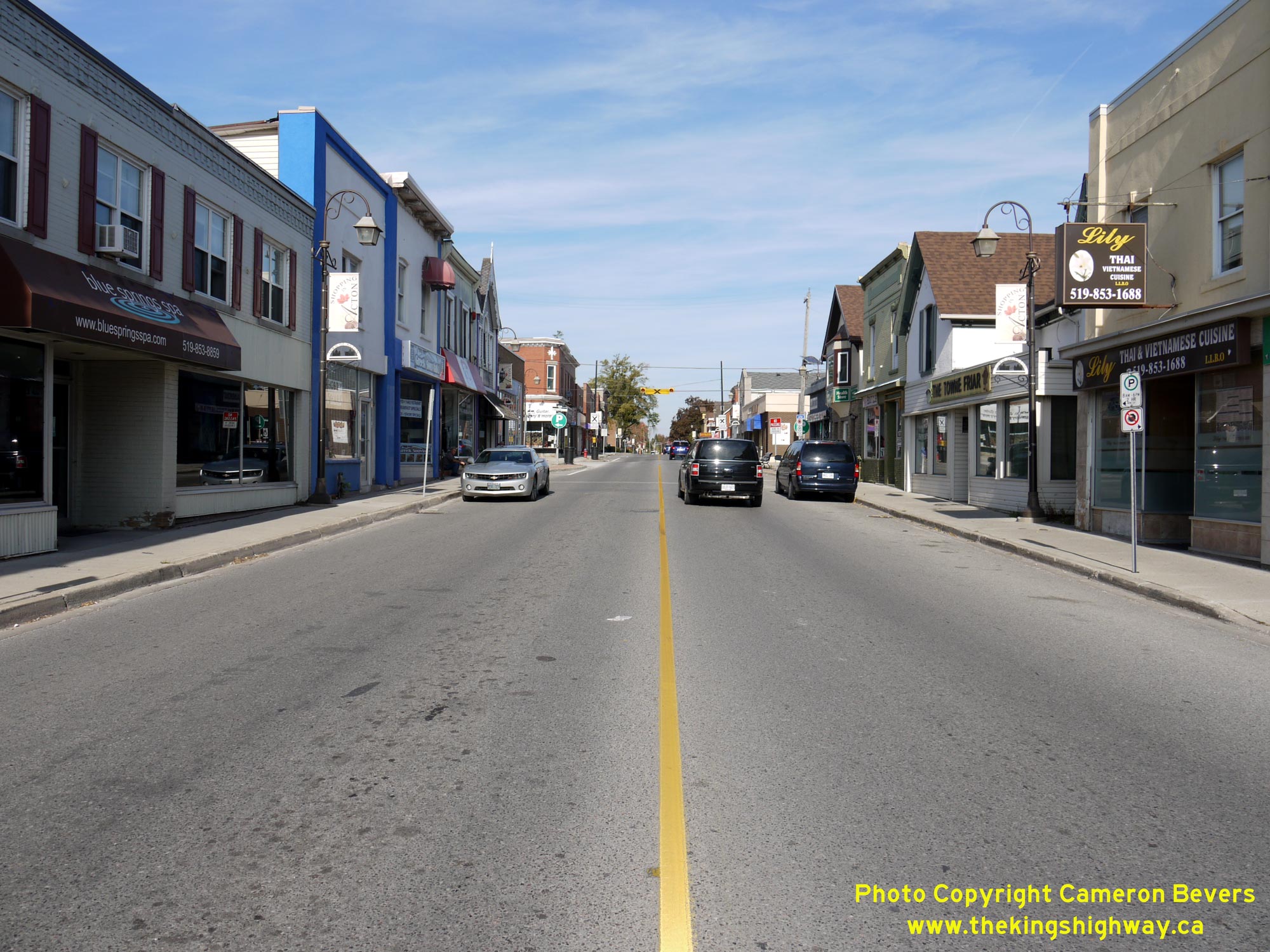
Left - Facing east along Hwy 7 (Mill Street) towards Brampton from the Hwy 25 Junction in Downtown Acton. See an
Enlarged Photo Here. (Photograph taken on October 12, 2015 - © Cameron Bevers) Right - Approaching the Hwy 25 Junction on Hwy 7 (Mill Street) in Downtown Acton, facing west. At this intersection, Hwy 7 turns right and briefly heads north via Main Street concurrently with Hwy 25. At the northern entrance to Acton, these two highways part ways where Hwy 7 curves west again towards Guelph. See an Enlarged Photo Here. (Photograph taken on October 12, 2015 - © Cameron Bevers) 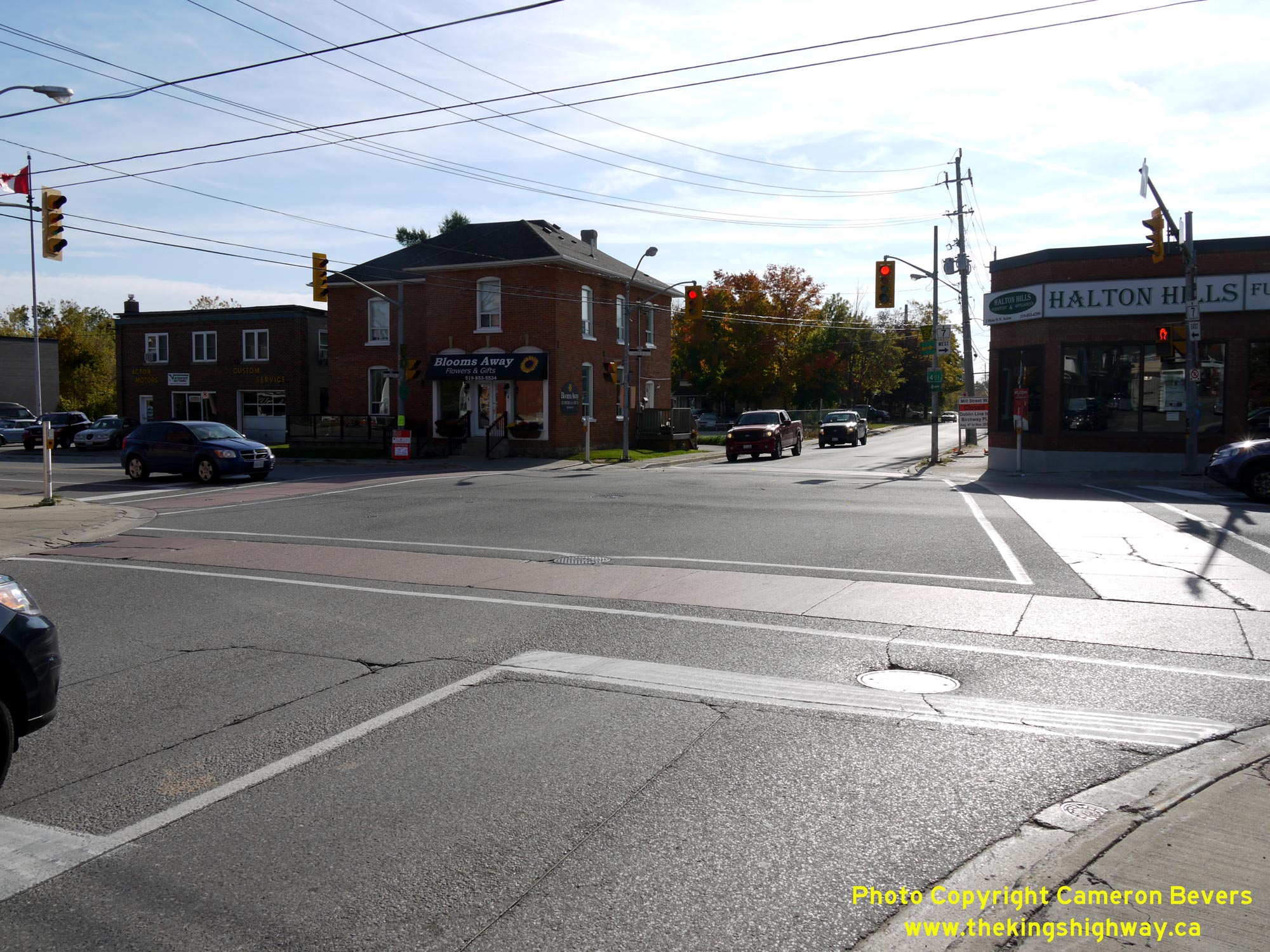
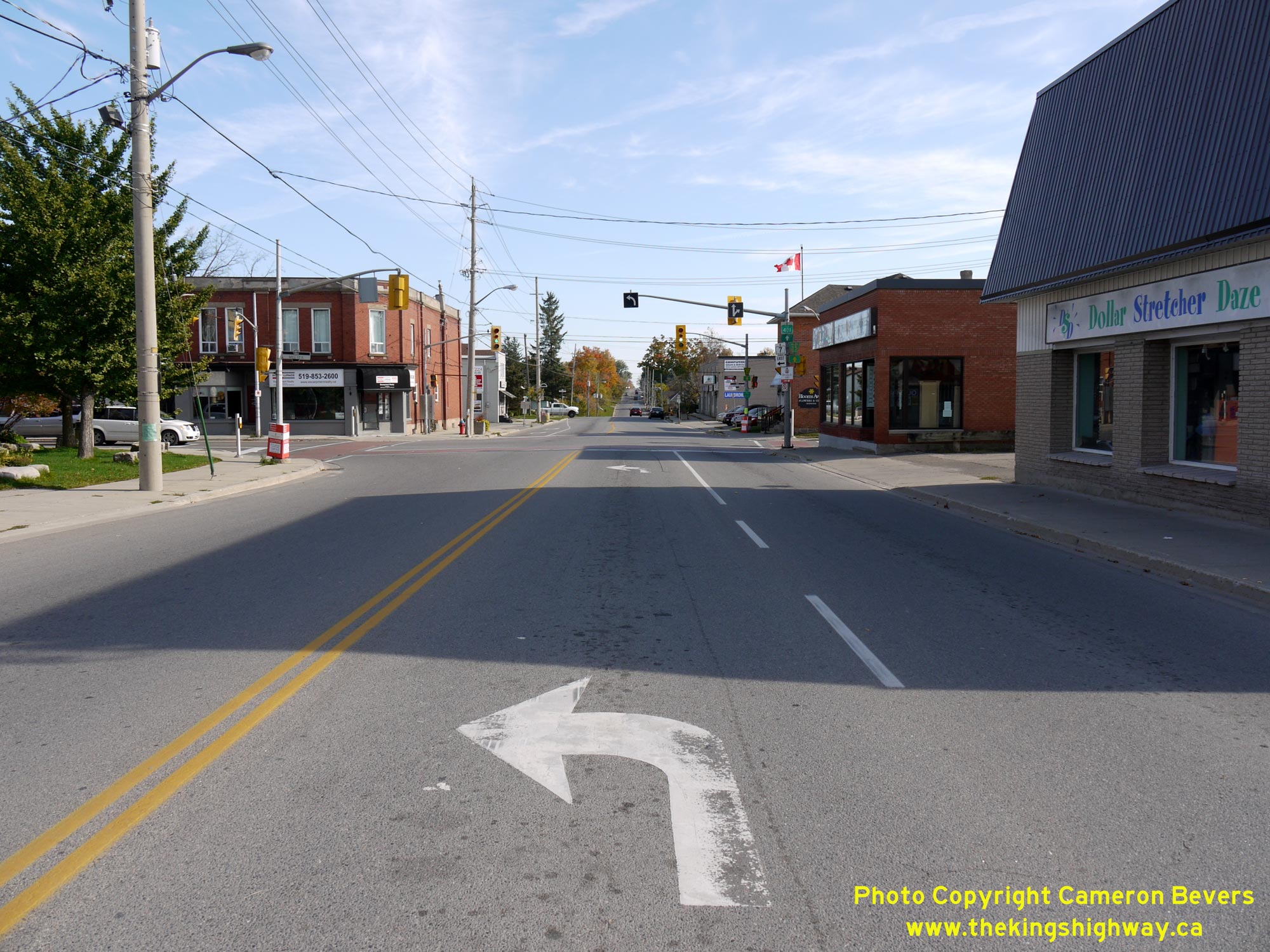
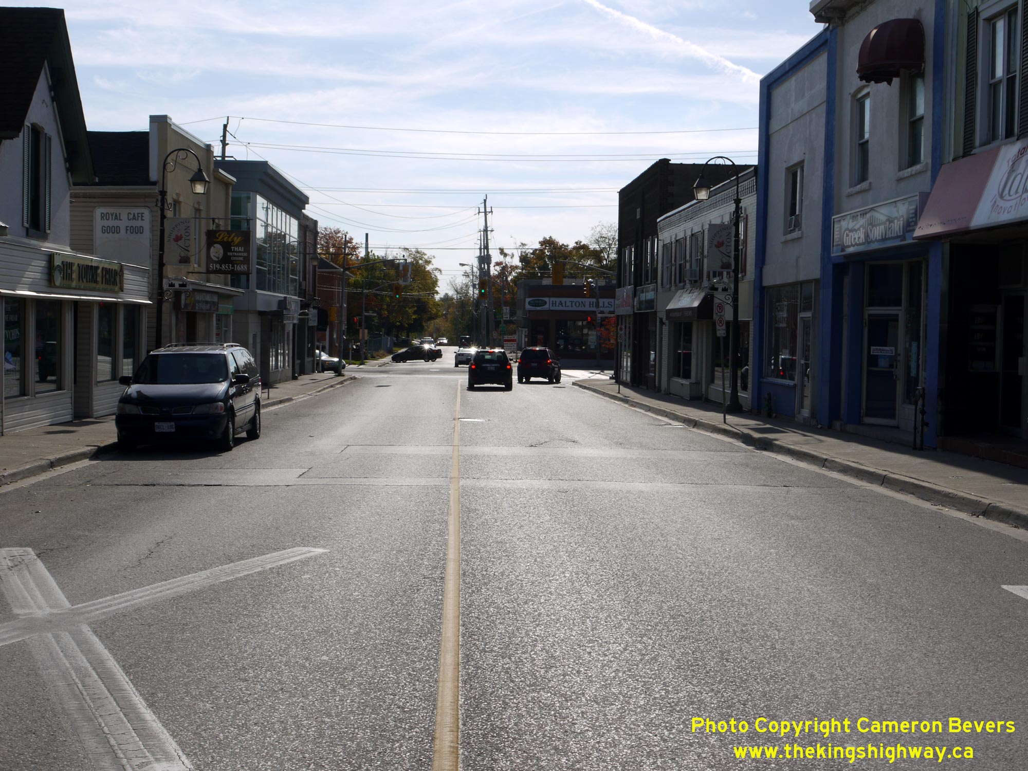
Left - Intersection of Mill Street and Main Street in Downtown Acton, facing west. At left, Hwy 25 heads south towards Milton, while at right, Hwy 7 &
Hwy 25 begin their brief overlapped route through Acton via Main Street. See an
Enlarged Photo Here. (Photograph taken on October 12, 2015 - © Cameron Bevers) Right - Facing south along Main Street (Hwy 7 & Hwy 25) approaching Mill Street in Downtown Acton. At this intersection, Hwy 7 turns left and heads easterly towards Brampton while Hwy 25 continues straight ahead towards Milton. The extension of Hwy 25 between Milton and Acton in 1937 provided a new continuous north-south King's Highway link between Hwy 7 and other major highway routes through Halton County (Hwy 2, Hwy 5 & the Queen Elizabeth Way). See an Enlarged Photo Here. (Photograph taken on October 12, 2015 - © Cameron Bevers) 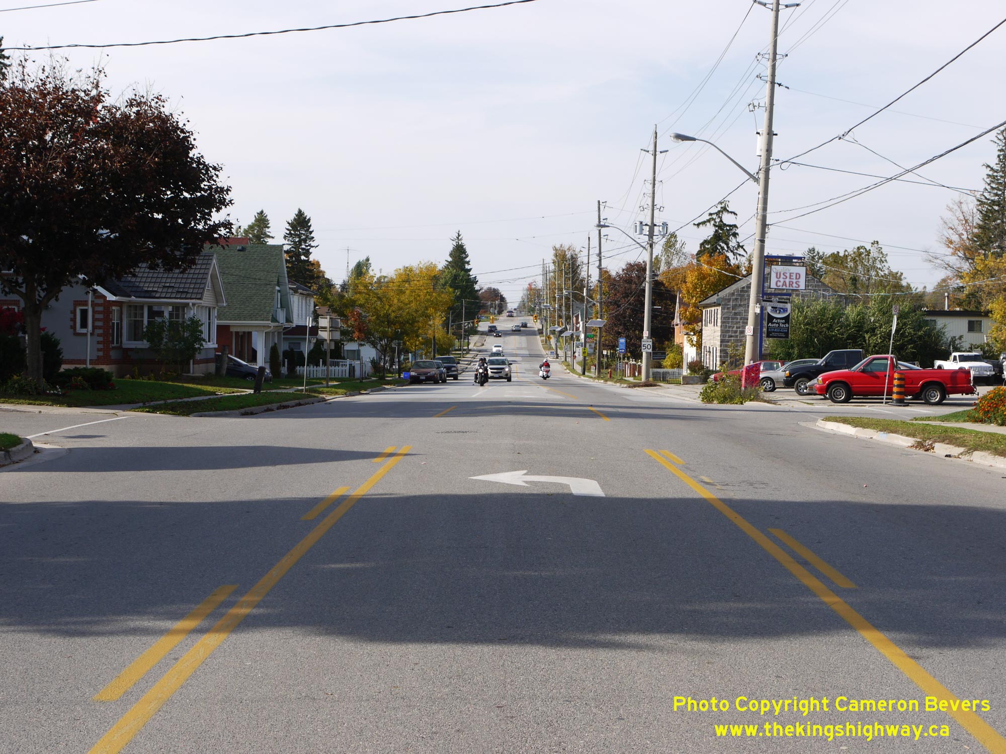
Left - Facing north along Hwy 7 & Hwy 25 (Main Street) from Mill Street in Downtown Acton. During the early 1960s, Hwy 25 was extended northerly from
Acton so that it connected with Hwy 24 at Ospringe. The overlapped highway route along Main Street through Acton was created in 1963, when the DHO acquired
jurisdiction over the Acton-Ospringe Road and designated the new route as an extension of Hwy 25. See an
Enlarged Photo Here. (Photograph taken on October 12, 2015 - © Cameron Bevers) Right - View of Hwy 7 & Hwy 25 (Main Street) facing south from Guelph Avenue in Acton. See an Enlarged Photo Here. (Photograph taken on October 12, 2015 - © Cameron Bevers) 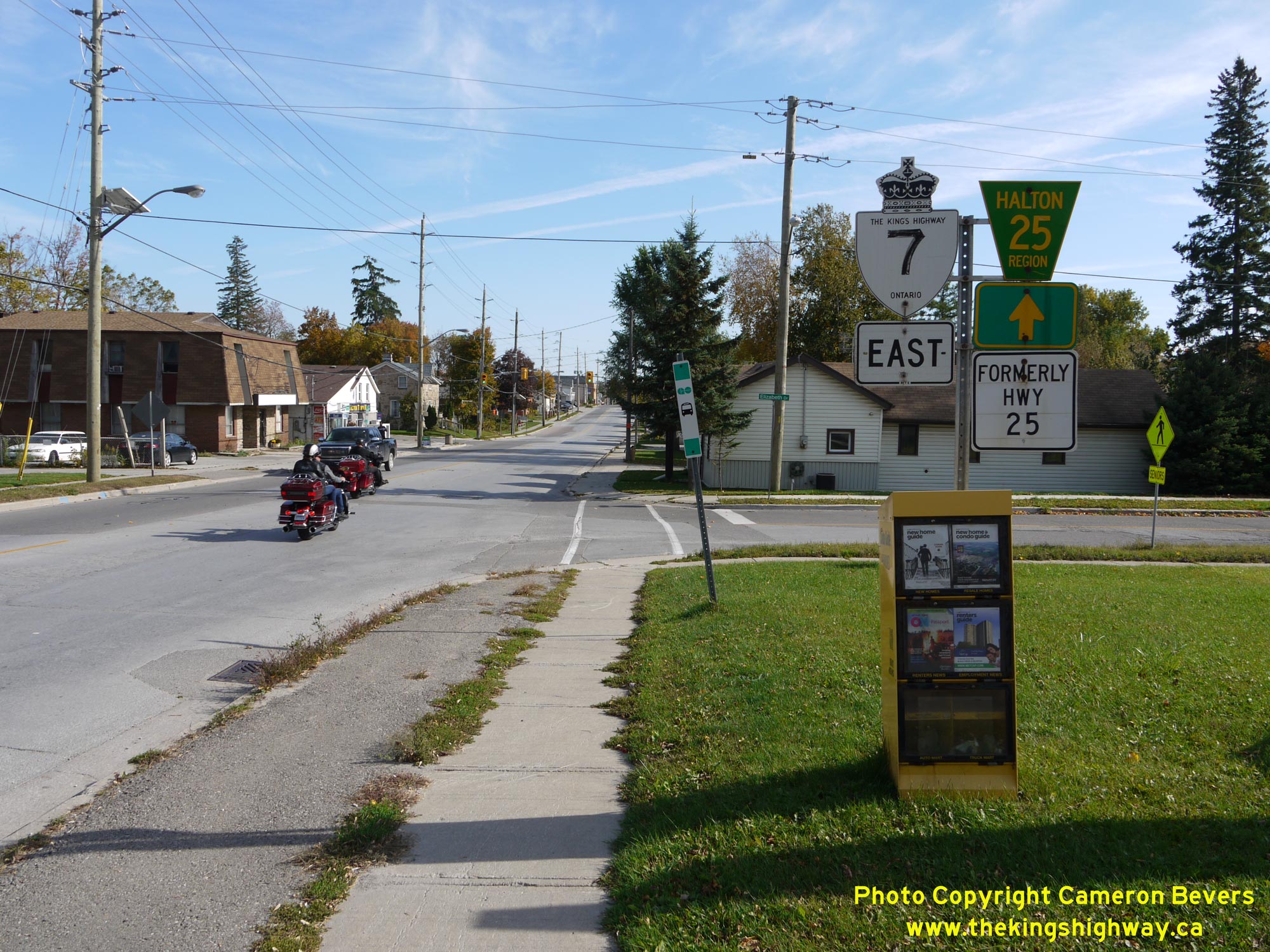
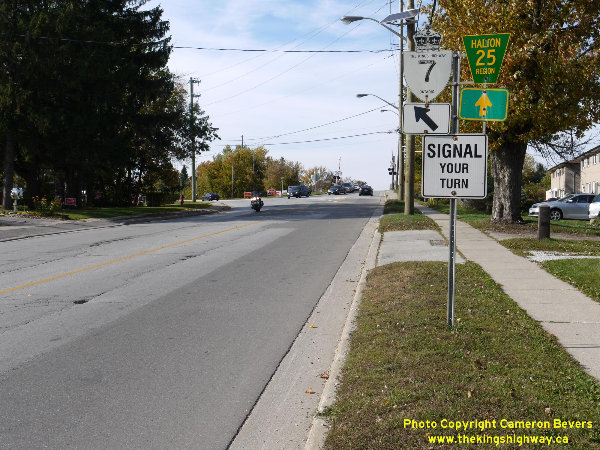
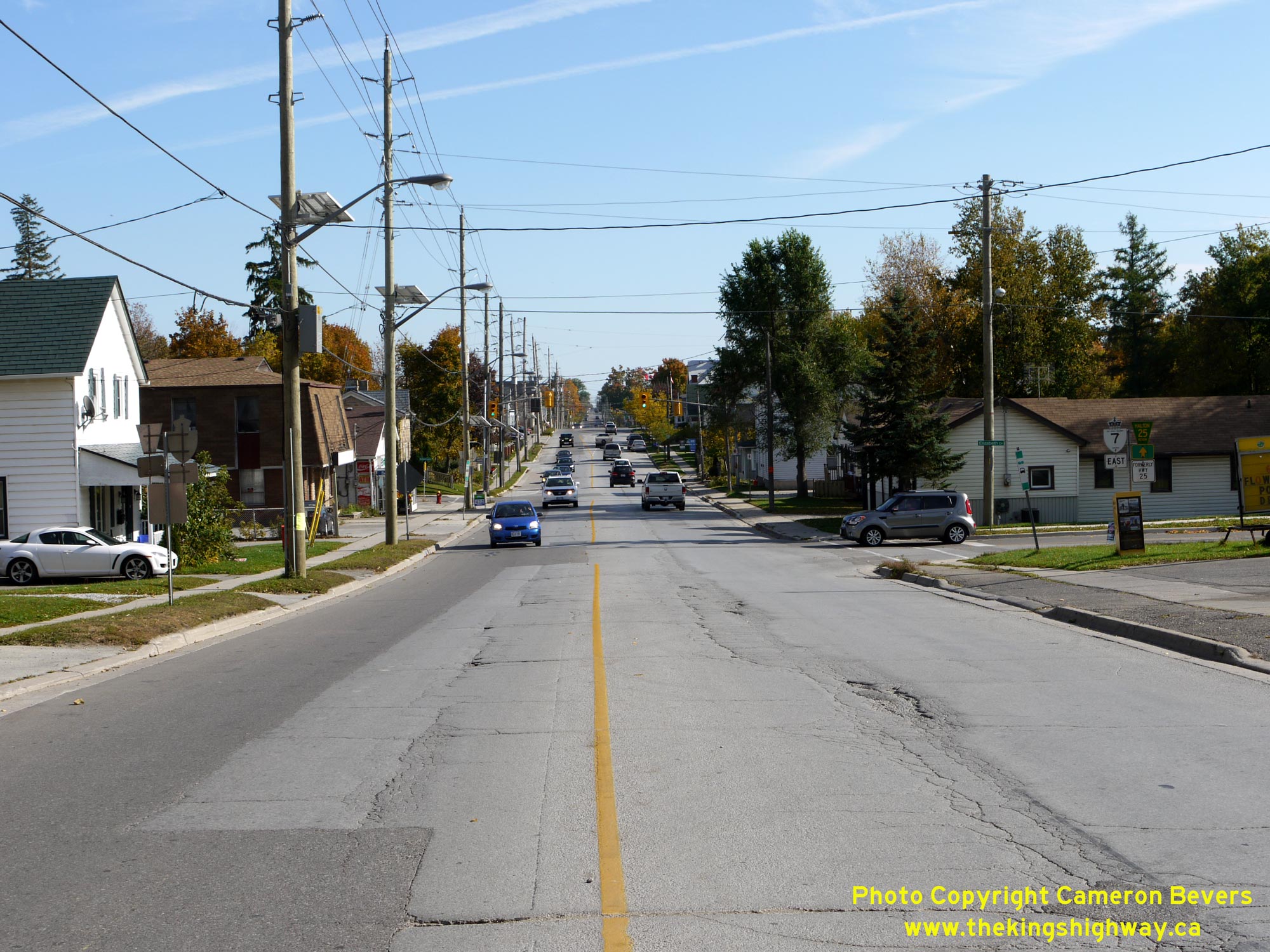
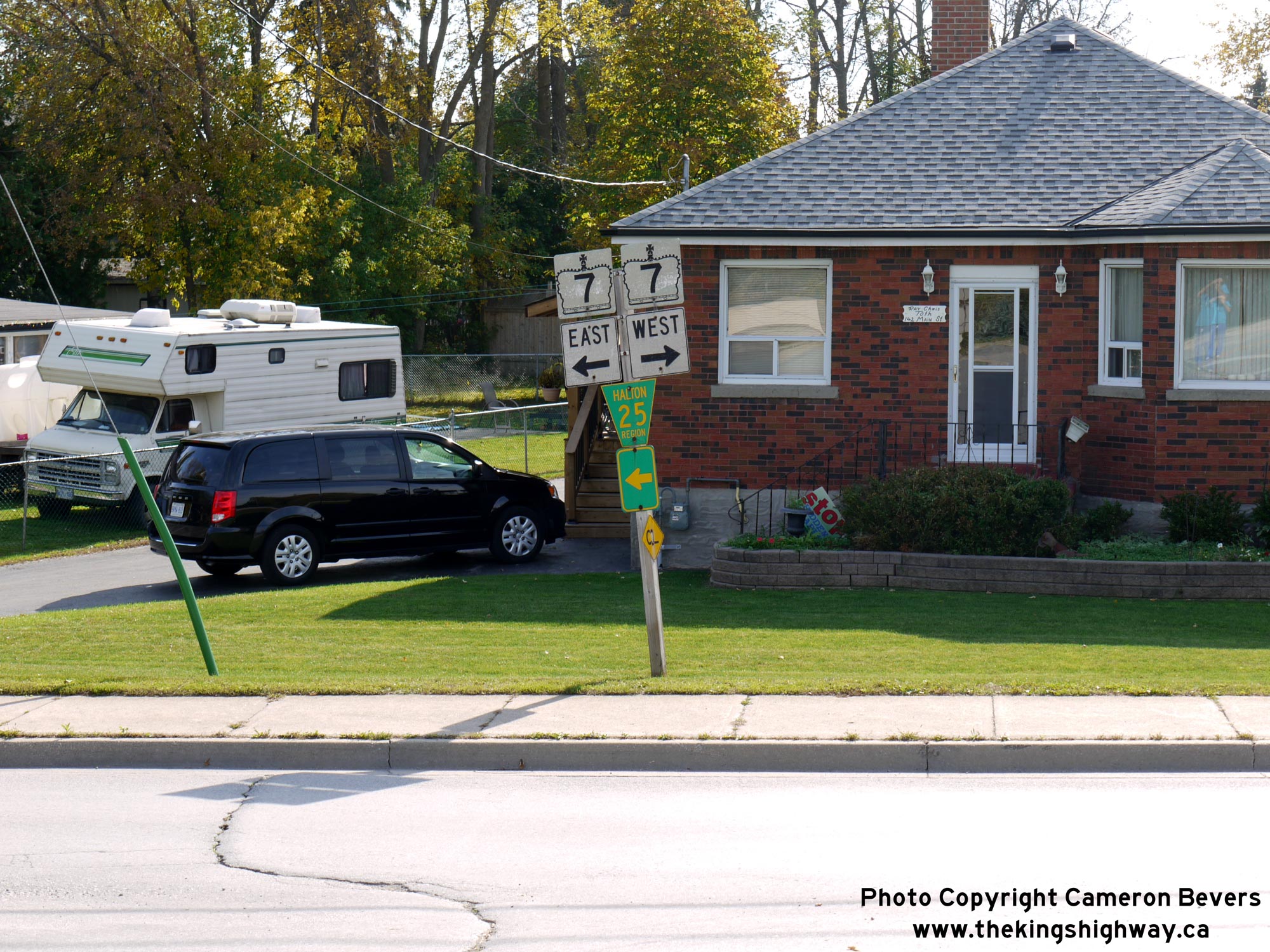
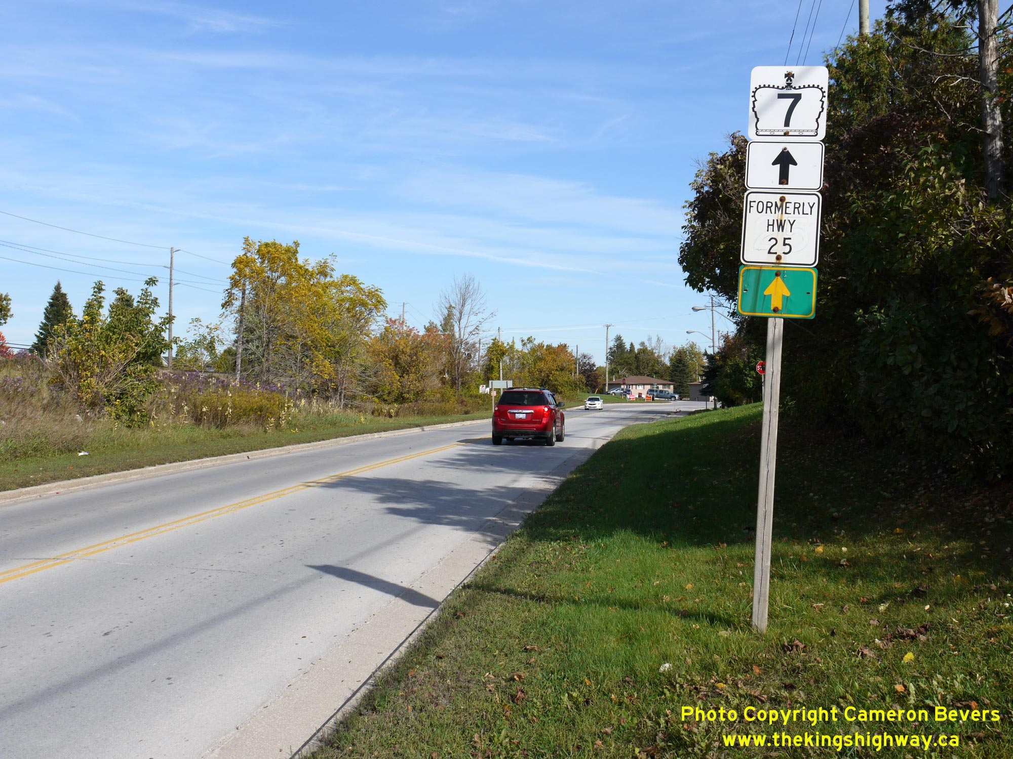
Left - Route marker assembly on southbound Hwy 7 & Hwy 25 (Main Street) in Acton, facing south from Guelph Avenue. Prior to Hwy 25's downloading in the
1990s, there would have been a King's Highway 25 route marker at right. This overlapped route of Hwy 7 & Hwy 25 through Acton existed from 1963 up until 1998. See
an Enlarged Photo Here. (Photograph taken on October 12, 2015 - © Cameron Bevers) Right - Junction sign assembly on northbound Hwy 7 & Hwy 25 (Main Street) approaching the Hwy 7 West Junction in Acton. See an Enlarged Photo Here. (Photograph taken on October 12, 2015 - © Cameron Bevers) 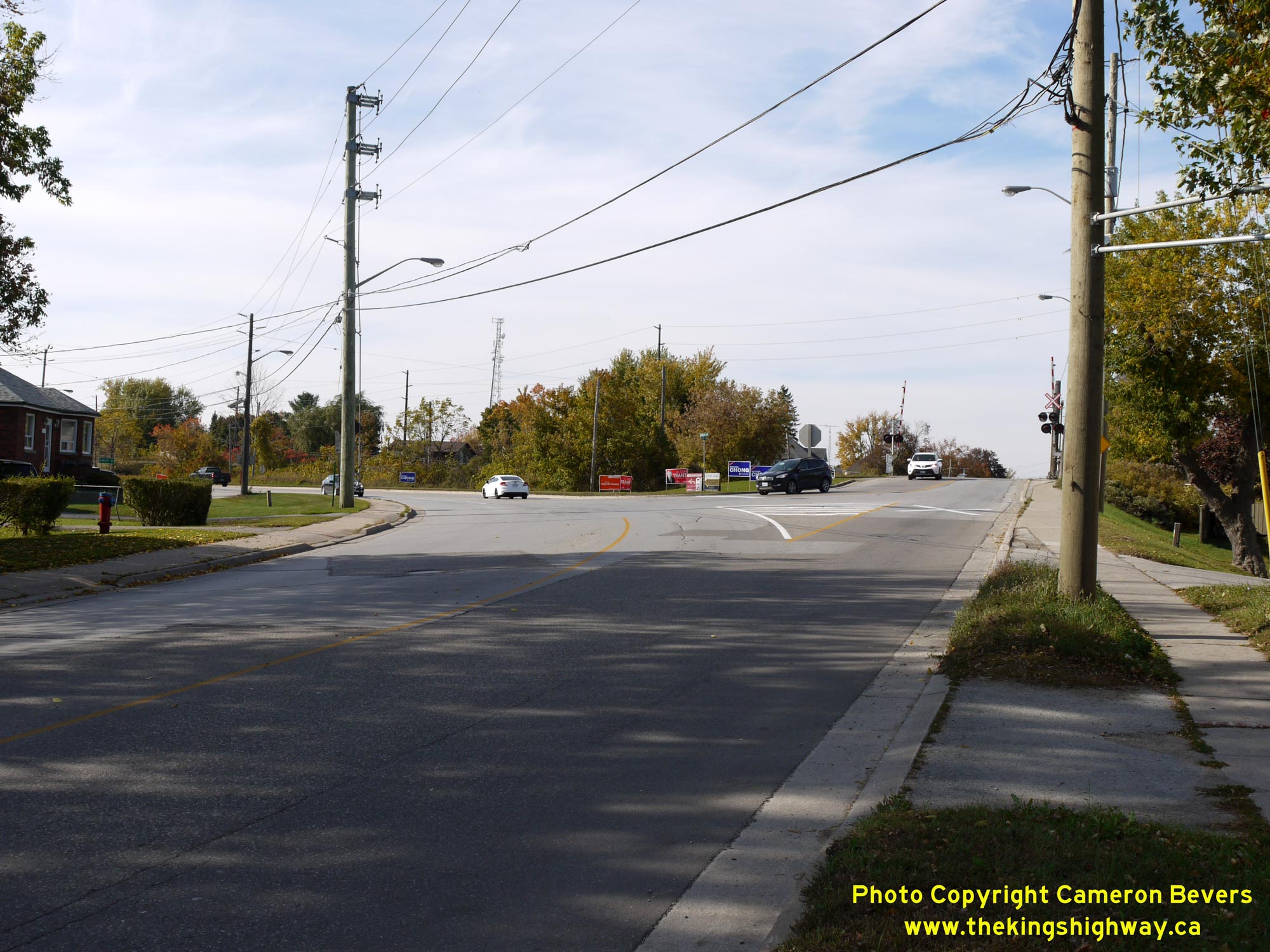
Left - Facing north along Main Street (Hwy 7 & Hwy 25) in Acton approaching the intersection of Guelph Avenue. At the northern entrance to Acton, Hwy 7 and
Hwy 25 part ways. The route of Hwy 7 curves to the left onto Guelph Avenue and resumes its route west towards Guelph while Hwy 25 continues straight ahead via Main
Street towards Ospringe. See an Enlarged Photo Here. (Photograph taken on October 12, 2015 - © Cameron Bevers) Right - Junction sign assembly at the Hwy 7 & Hwy 25 Junction at the intersection of Main Street and Guelph Avenue in Acton. See an Enlarged Photo Here. (Photograph taken on October 12, 2015 - © Cameron Bevers) 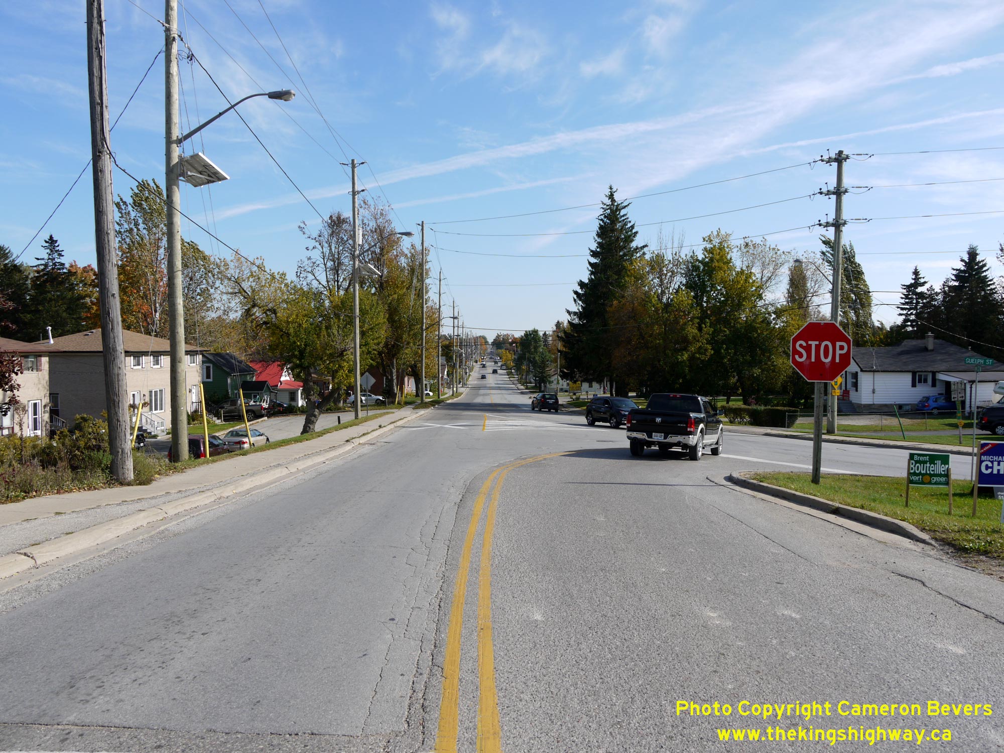
Left - View of the Hwy 7 and Hwy 25 Junction in Acton, facing south. This skewed highway junction is set up with southbound Hwy 25 under Stop-control. Although
Hwy 25 may appear at first glance to be the "through" move at this highway junction, it is in fact a left turn onto Hwy 7. The northern leg of Hwy 25 lying to the
north of Acton was a county road for many decades and didn't become a King's Highway until 1963. The intersecting highway (Hwy 7) was considered to be the "through
highway" at this junction, since Hwy 7 was established several decades earlier in 1921. See an
Enlarged Photo Here. (Photograph taken on October 12, 2015 - © Cameron Bevers) Right - Facing north along Hwy 25 towards Ospringe from Guelph Avenue (Hwy 7 West). The section of Hwy 25 between Acton and Ospringe was first assumed as a King's Highway in April 1963. Like the southern section of Hwy 25 from Milton to Acton, jurisdiction over the section of Hwy 25 between Acton and Ospringe was transferred from the province to the municipal tier in 1998. See an Enlarged Photo Here. (Photograph taken on October 12, 2015 - © Cameron Bevers) 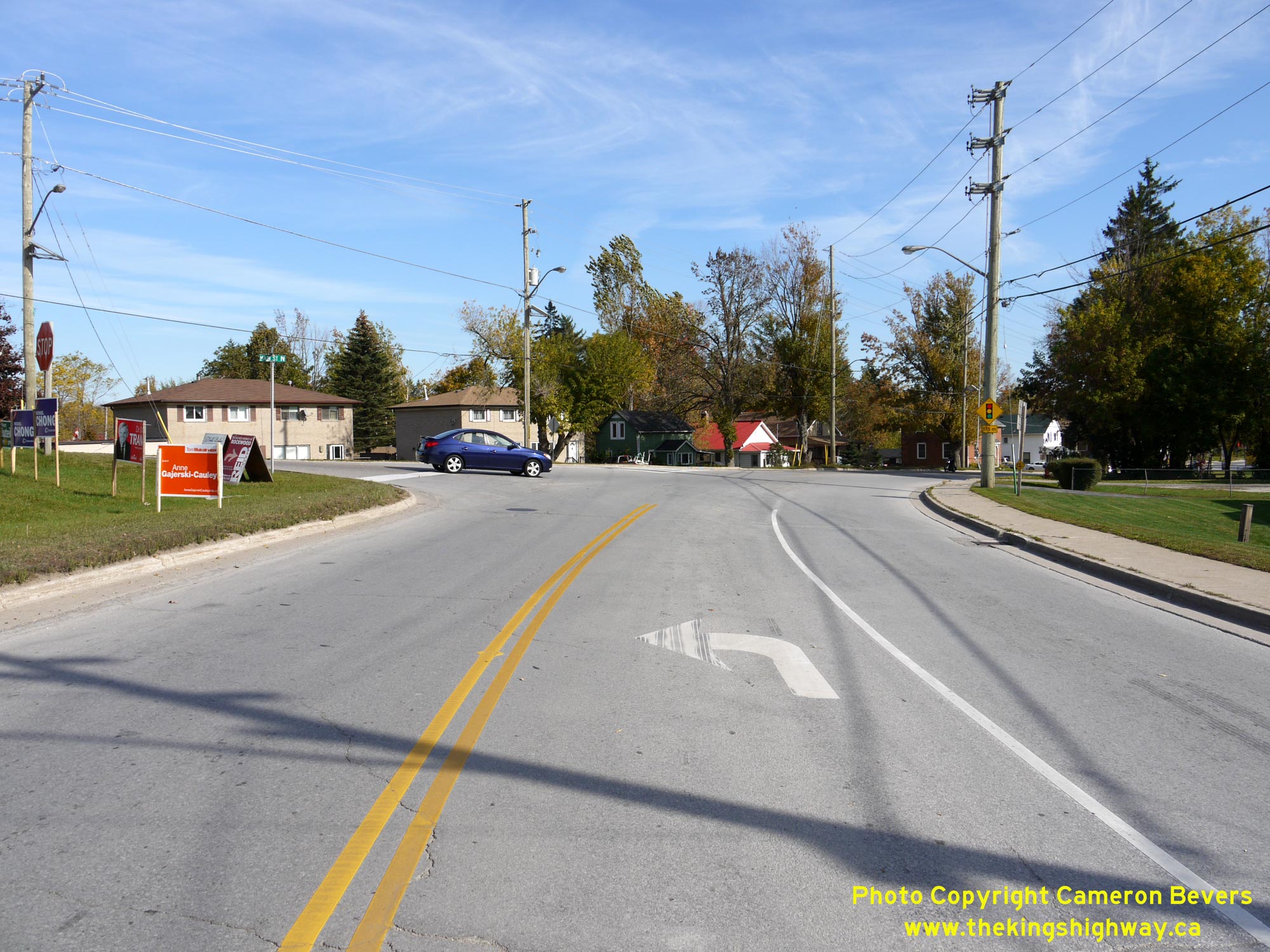
Left - Facing east along Guelph Avenue (Hwy 7 West) at the intersection of Main Street (Hwy 25). At this junction, traffic can either turn left and follow
Hwy 25 north to Ospringe or curve to the right and follow Main Street (Hwy 7 & Hwy 25) into Downtown Acton. This photo was taken during the 2015 Canadian Federal
Election campaign, so the roadside was absolutely littered with political party signs. See an
Enlarged Photo Here. (Photograph taken on October 12, 2015 - © Cameron Bevers) Right - View of Guelph Avenue (Hwy 7 West), facing west from the Hwy 25 Junction in Acton. From Acton, Hwy 7 heads westerly via Rockwood to Guelph and Kitchener-Waterloo. Until the completion of Hwy 401 west of Milton in November 1960, most long-distance traffic travelling between Toronto and Guelph would have utilized this section of Hwy 7. Traffic volumes on Hwy 7 plummeted following the completion of Hwy 401. It wasn't until the 1970s that traffic volumes on Hwy 7 finally exceeded the peaks observed during the 1950s prior to the completion of Hwy 401. See an Enlarged Photo Here. (Photograph taken on October 12, 2015 - © Cameron Bevers) 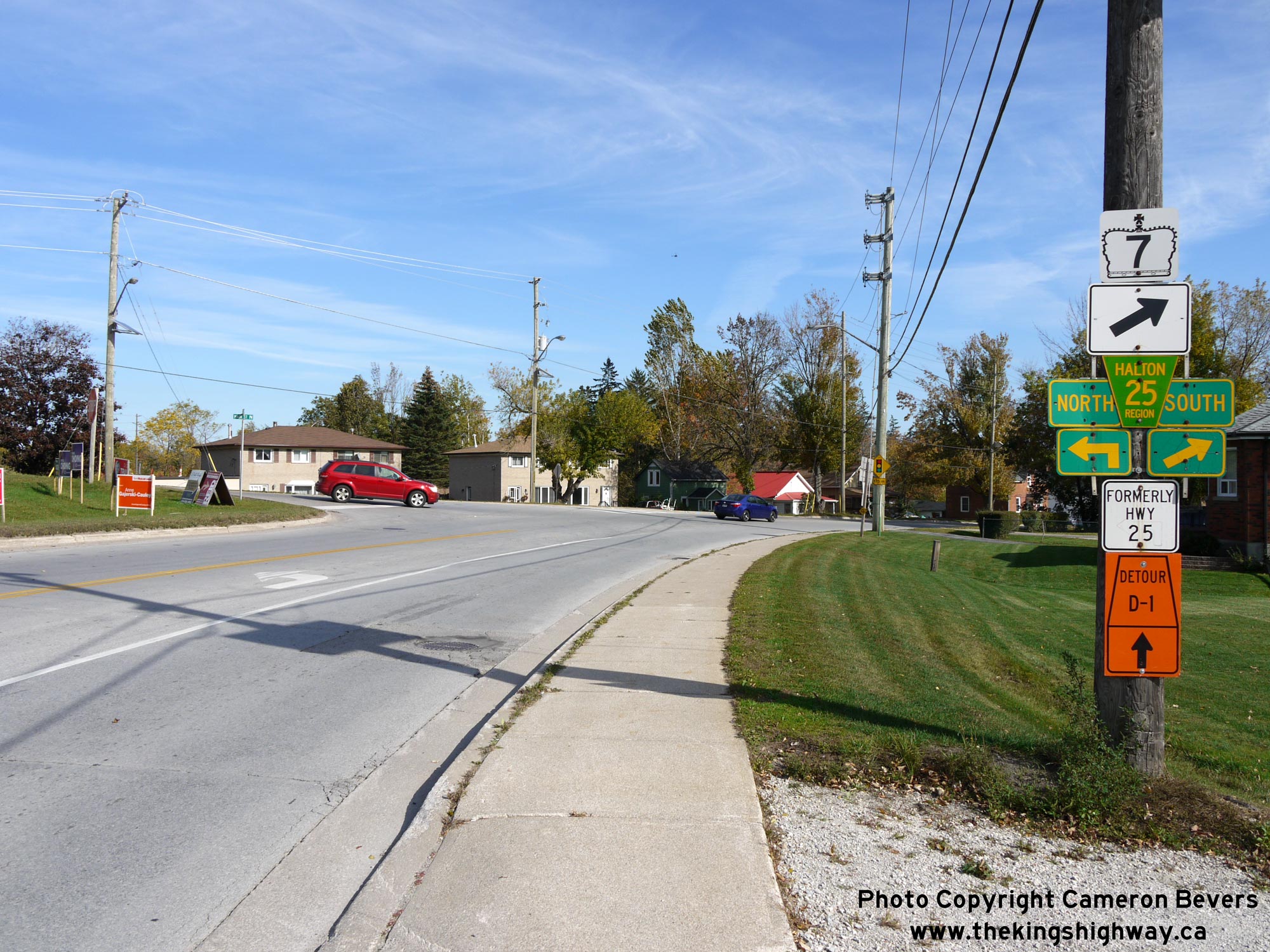
Left - Junction sign assembly on eastbound Hwy 7 approaching the Hwy 25 Junction in Acton. See an
Enlarged Photo Here. (Photograph taken on October 12, 2015 - © Cameron Bevers) Right - Hwy 7 route marker and a black-and-white "Formerly Hwy 25" sign tab on Guelph Avenue in Acton. See an Enlarged Photo Here. (Photograph taken on October 12, 2015 - © Cameron Bevers) 

Left - Facing north along Hwy 24 towards the Hwy 25 Junction at Ospringe. See an
Enlarged Photo Here. (Photograph taken on May 13, 2007 - © Cameron Bevers) Right - Facing north along Hwy 24 from the Hwy 25 Junction at Ospringe. The highway passes through a glacial drumlin field northeast of Guelph, resulting in some surprisingly steep and rather abrupt hills along the road. See an Enlarged Photo Here. (Photograph taken on May 13, 2007 - © Cameron Bevers) 

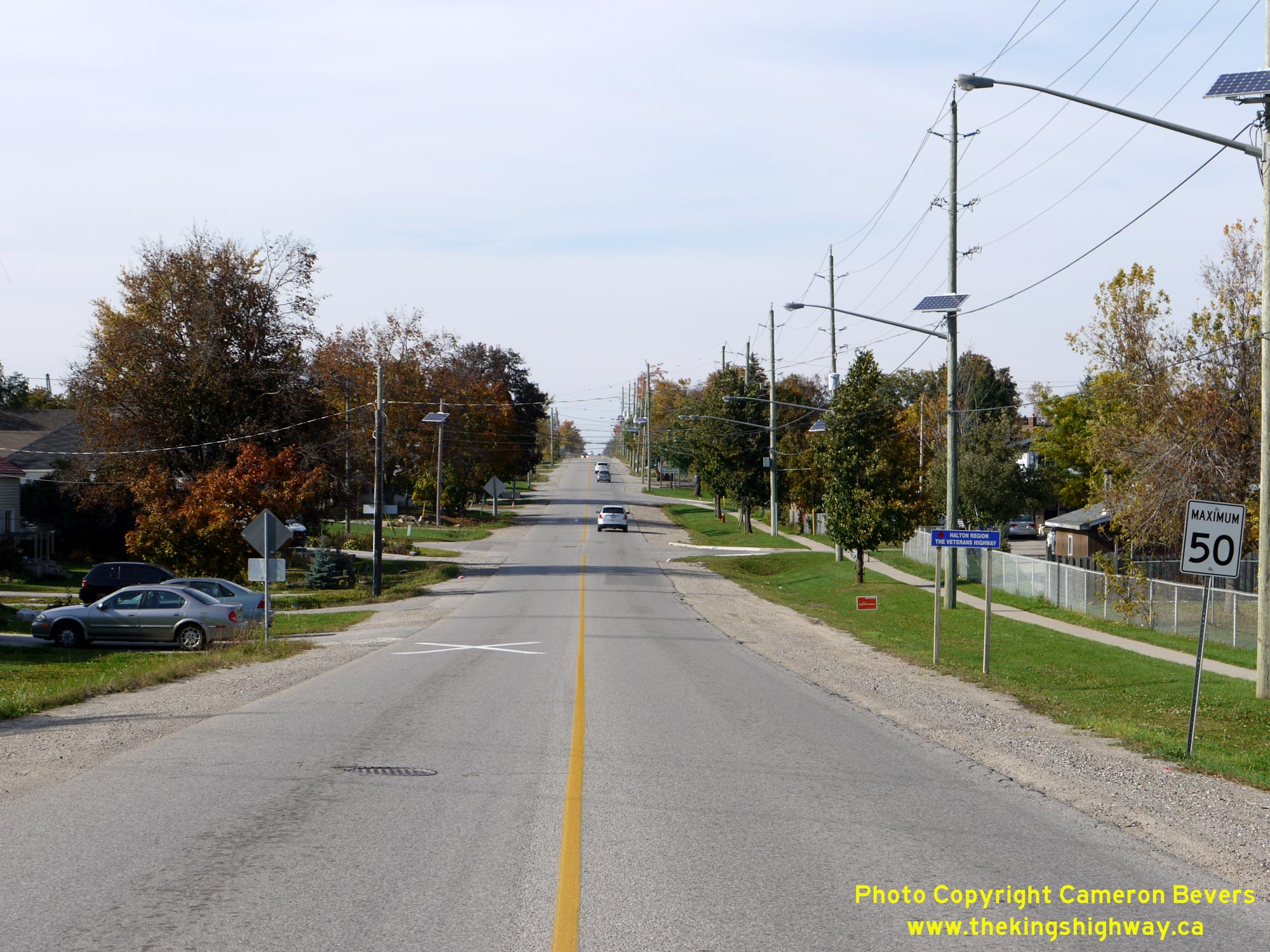
Left - Facing south along Hwy 25 towards Acton from the Hwy 24 Junction at Ospringe. See an
Enlarged Photo Here. (Photograph taken on May 13, 2007 - © Cameron Bevers) Right - Distance guide sign on eastbound Hwy 9, located just east of the Hwy 25 South Junction at Waldemar. See an Enlarged Photo Here. (Photograph taken on October 10, 2024 - © Cameron Bevers) 

Left - Approaching the Hwy 25 South Junction on Hwy 9 at Waldemar, facing west towards Arthur. Prior to the downloading of both highways over to municipal
control in the late 1990s, Hwy 9 & Hwy 25 began a short overlapped route at this intersection. The two routes parted ways about 3 km to the west, where Hwy 25
turned right and headed north into Grand Valley, while Hwy 9 continued west towards Arthur. See an
Enlarged Photo Here. (Photograph taken on October 10, 2024 - © Cameron Bevers) Right - Facing east along Hwy 9 towards Orangeville from the Hwy 25 South Junction at Waldemar. As indicated by the municipal route marker at right, this section of Hwy 9 is now officially known as Dufferin County Road 109. This route ceased to be a provincially-owned King's Highway in 1998. See an Enlarged Photo Here. (Photograph taken on October 10, 2024 - © Cameron Bevers) 

Left - Facing south along Hwy 25 from the Hwy 9 Junction at Waldemar. Like Hwy 9, Hwy 25 was transferred over to municipal control in the late 1990s and is now
officially known as Dufferin County Road 24. Prior to the highway's downloading in the 1990s, this section of Hwy 25 was a comparatively new King's Highway in the
provincial highway system. The province designated the Brisbane-Waldemar Road via Hillsburgh as a new King's Highway, effective May 22, 1974. See an
Enlarged Photo Here. (Photograph taken on October 10, 2024 - © Cameron Bevers) Right - Junction of Hwy 9 & Hwy 25 at Waldemar, facing north. Historically, Hwy 25 turned left at this junction and followed a concurrent overlapped route with Hwy 9 for about 3 km. At a turn-off south of Grand Valley, Hwy 25 resumed its route north via Grand Valley to the Hwy 89 Junction west of Shelburne. See an Enlarged Photo Here. (Photograph taken on October 10, 2024 - © Cameron Bevers) 

Left - View of the Hwy 9 & Hwy 25 South Junction at Waldemar, facing east towards Orangeville. Prior to the mass highway downloading spree of the late
1990s, motorists could turn right at this junction and follow Hwy 25 south to Acton, Milton and Oakville. While this journey can still be accomplished today, the
roads which form this route are now a collection of municipal roads rather than a continuous provincially-owned King's Highway. See an
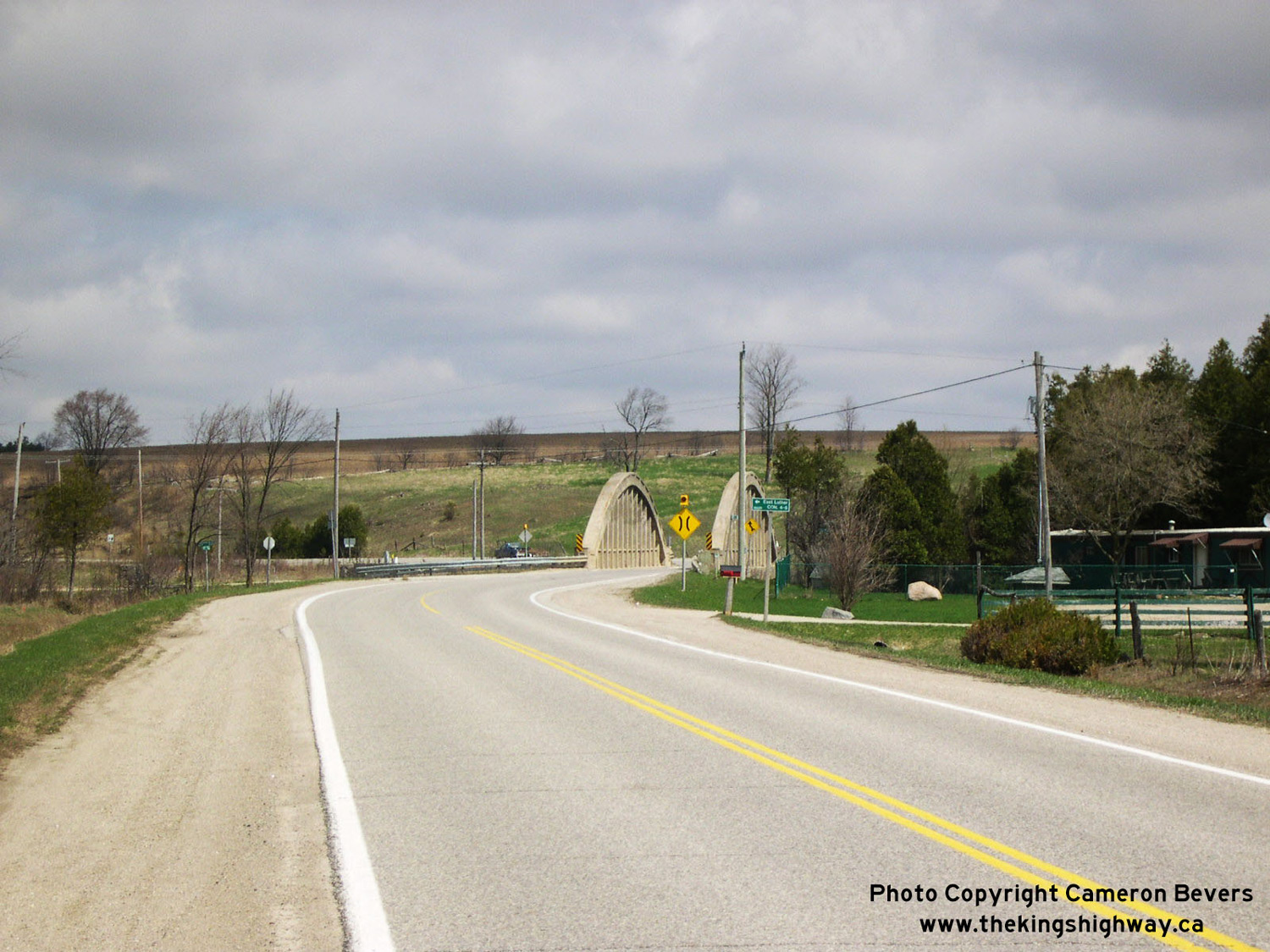
Enlarged Photo Here. (Photograph taken on October 10, 2024 - © Cameron Bevers) Right - Facing west along Hwy 9 & Hwy 25 from the Hwy 25 South Junction at Waldemar. Immediately west of this highway junction, Hwy 9 & Hwy 25 cross a bridge over the Grand River. Historically, this was a narrow one-lane through truss bridge, but it was replaced by the current two-lane structure in 1954. See an Enlarged Photo Here. (Photograph taken on October 10, 2024 - © Cameron Bevers) 

Left - Southern side of the Waldemar Bridge over the Grand River on Hwy 9 & Hwy 25. This impressive three-span concrete rigid frame structure was
constructed under Contract #1953-23 and was completed in 1954. Prior to the construction of the new Grand River Bridge in the 1950s, motorists using Hwy 9 had to
squeeze through a narrow single-lane through truss bridge in only one direction at a time. Southern Ontario's King's Highways had numerous single-lane bridges up
until the 1950s, when an ambitious bridge replacement program was undertaken to widen narrow bridges so that both directions of highway traffic could be accommodated
simultaneously. These investments in highway infrastructure by the Department of Highways of Ontario (DHO) proved to be very prudent - given how busy Hwy 9 has become
in recent decades, it is unthinkable that this was once a single-lane bridge! See an
Enlarged Photo Here. (Photograph taken on October 10, 2024 - © Cameron Bevers) Right - Facing east across the Grand River Bridge towards Orangeville on Hwy 9 & Hwy 25 at Waldemar. The previous through truss bridge at Waldemar was built exactly on-alignment with its approaches. These site conditions created a constructibility and design problem for DHO's engineers. In order to maintain the existing alignment of Hwy 9 for the new replacement bridge, the reconstruction of Hwy 9 at the bridge site had to be carried out during a long-term full closure of the highway. All Hwy 9 traffic was temporarily detoured around the construction site for a distance of about 4 miles between September 1953 and July 1954. This full closure of Hwy 9 allowed the old bridge to be demolished and the new bridge constructed in-place without the need of a permanent diversion of the highway's alignment. See an Enlarged Photo Here. (Photograph taken on October 10, 2024 - © Cameron Bevers) 

Left - Northern side of the Waldemar Bridge (Site #4-115) on Hwy 9 & Hwy 25. At first glance, it may appear that all three of the bridge's spans are
equal in length. However, the centre span is actually 50 feet in length, while the two outer spans are 40 feet in length. While this structure is indeed impressive when viewed from
the riverbank below due to its height above the Grand River, it isn't the longest bridge along Hwy 9. The longest structure on Hwy 9 is the Black Horse Railway
Overhead, located south of Tottenham. See an Enlarged Photo Here. (Photograph taken on October 10, 2024 - © Cameron Bevers) Right - View underneath the Waldemar Bridge over the Grand River on Hwy 9 & Hwy 25. Note the impressions of the timber planks used for falsework for this bridge during the original concrete pour. Bridges of this design use cast-in-place concrete, with formwork required to support the wet concrete until it has properly cured and is self-supporting. See an Enlarged Photo Here. (Photograph taken on October 10, 2024 - © Cameron Bevers) 

Left - Facing east along Hwy 9 & Hwy 25 approaching the Grand River Bridge at Waldemar. The route of Hwy 25 South was renamed as Dufferin County Road 24
following the mass highway downloading spree of the late 1990s. Dufferin County Road 24 is also known as Trafalgar Road - yes, this is the same Trafalgar Road which
passes through Georgetown and Oakville located a considerable distance to the south. Trafalgar Road is a very long road indeed! See an
Enlarged Photo Here. (Photograph taken on October 10, 2024 - © Cameron Bevers) Right - Scenic view of Hwy 9 & Hwy 25 at Waldemar, facing east towards the Grand River Bridge and the Hwy 25 South Junction. A short westbound passing lane appears along Hwy 9 immediately west of the Waldemar Bridge. For motorists stuck beyond a slow-moving truck, this passing lane is a welcome relief! As part of the construction of the Waldemar Bridge in 1953-1954, the approach grades along Hwy 9 were flattened out. The earth cut on the western side of the bridge was deepened and the earth fill built up on the eastern side of the bridge. Prior to the highway's reconstruction in the 1950s, the approach grades to the Waldemar Bridge were much steeper than they are today. See an Enlarged Photo Here. (Photograph taken on October 10, 2024 - © Cameron Bevers) 

Left - Facing east along Hwy 9 & Hwy 25 from the Hwy 25 North Junction to Grand Valley. The routes of Hwy 9 & Hwy 25 were overlapped for about 3 km
between this junction and the Hwy 25 South Junction at Waldemar. After these two King's Highways were downloaded to the County of Dufferin in the late 1990s, each leg
of Hwy 25 was assigned a different county road number. The Grand Valley leg (Hwy 25 North) became Dufferin County Road 25, while the Waldemar leg (Hwy 25 South) became
Dufferin County Road 24. There is no longer any overlapped route between Grand Valley and Waldemar, with Former Hwy 9 being signed as Dufferin County Road 109 only.
See an Enlarged Photo Here. (Photograph taken on October 10, 2024 - © Cameron Bevers) Right - Close-up of the distance guide sign on eastbound Hwy 9 & Hwy 25 located just east of the Hwy 25 North Junction to Grand Valley. Although this is a replacement sign installed in recent years by the County of Dufferin, it is interesting to note that Acton is still listed as a control city on this sign. This is a vestige of the past, when MTO owned both Hwy 9 and Hwy 25 and Acton was the signed control city for Hwy 25 South. Until the downloading of the late 1990s, the other destinations (Orangeville & Newmarket) were both accessible via Hwy 9. See an Enlarged Photo Here. (Photograph taken on October 10, 2024 - © Cameron Bevers) 

Left - Facing west towards the Hwy 9 & Hwy 25 North Junction near Grand Valley. Up until the highway's downloading through Dufferin County in 1997, Hwy 25
turned right at this junction and resumed its route north towards Grand Valley and the Hwy 89 Junction. Historically, the highway from this point northerly into Grand
Valley was known as Hwy 104, but it was renumbered as part of the Hwy 25 Extension during 1974. See an
Enlarged Photo Here. (Photograph taken on October 10, 2024 - © Cameron Bevers) Right - Former southern terminus of Hwy 104 (later known as Hwy 25) at the Hwy 9 Junction south of Grand Valley. After the Hwy 104 designation was retired in 1974 and replaced by the Hwy 25 designation, the route of Hwy 25 was overlapped with Hwy 9 from this highway junction easterly to Waldemar. See an Enlarged Photo Here. (Photograph taken on October 10, 2024 - © Cameron Bevers) 

Left - Dufferin County Road 109 route marker and destination guide signs at the Hwy 9 & Hwy 25 Junction south of Grand Valley. See an
Enlarged Photo Here. (Photograph taken on October 10, 2024 - © Cameron Bevers) Right - Facing north along Hwy 25 towards Grand Valley from the Hwy 9 Junction. Before this highway was renumbered as part of the Hwy 25 Extension in 1974, Hwy 104 was among the shortest King's Highway routes in the provincial highway system with a total length of only 1.8 miles (2.9 km). The route of Hwy 104 reached its northern terminus in Downtown Grand Valley at the intersection of Main Street and Amaranth Street. See an Enlarged Photo Here. (Photograph taken on October 10, 2024 - © Cameron Bevers) 

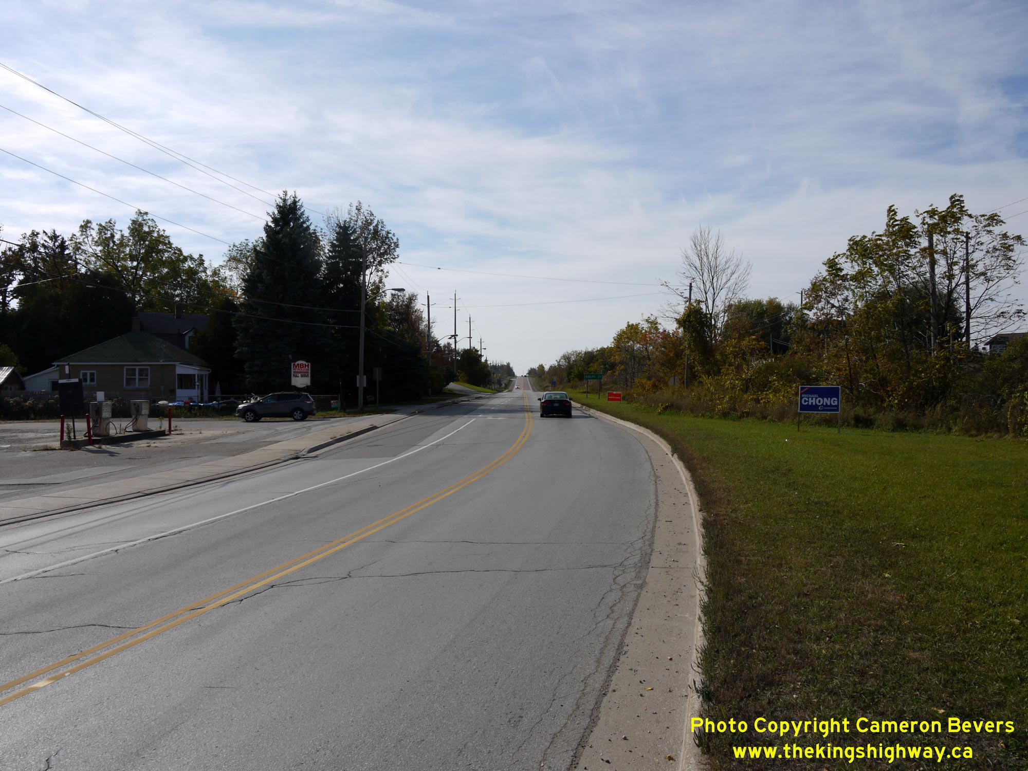
Left - Facing east along Hwy 9 towards Orangeville approaching the Hwy 25 North Junction to Grand Valley. See an
Enlarged Photo Here. (Photograph taken on October 10, 2024 - © Cameron Bevers) Right - Green guide sign on eastbound Hwy 9 marking the upcoming Dufferin Road 25 (Former Hwy 25) Junction south of Grand Valley. See an Enlarged Photo Here. (Photograph taken on October 10, 2024 - © Cameron Bevers) 
Left - Facing west along Hwy 9 towards Arthur from the Hwy 25 North Junction to Grand Valley. The section of Hwy 9 from the Grand Valley turn-off westerly was
the final section of Hwy 9 paved between Arthur and Orangeville. Concrete pavement was constructed along Hwy 9 for a distance of about 6 miles from the Grand Valley
turn-off westerly during 1934, which completed a paved highway link between Arthur and Orangeville. Within only 4 years of the Arthur-Orangeville Road's assumption as
an easterly extension of Hwy 9 in 1930, the route was transformed from a narrow rural gravel road into a modern concrete-surfaced traffic artery. See an
Enlarged Photo Here. (Photograph taken on October 10, 2024 - © Cameron Bevers) Right - Southern approach to the Grand River Bridge on Hwy 25 north of Grand Valley. Note the flashing warning beacon at right approaching the bridge. See an Enlarged Photo Here. (Photograph taken on April 24, 2004 - © Cameron Bevers) 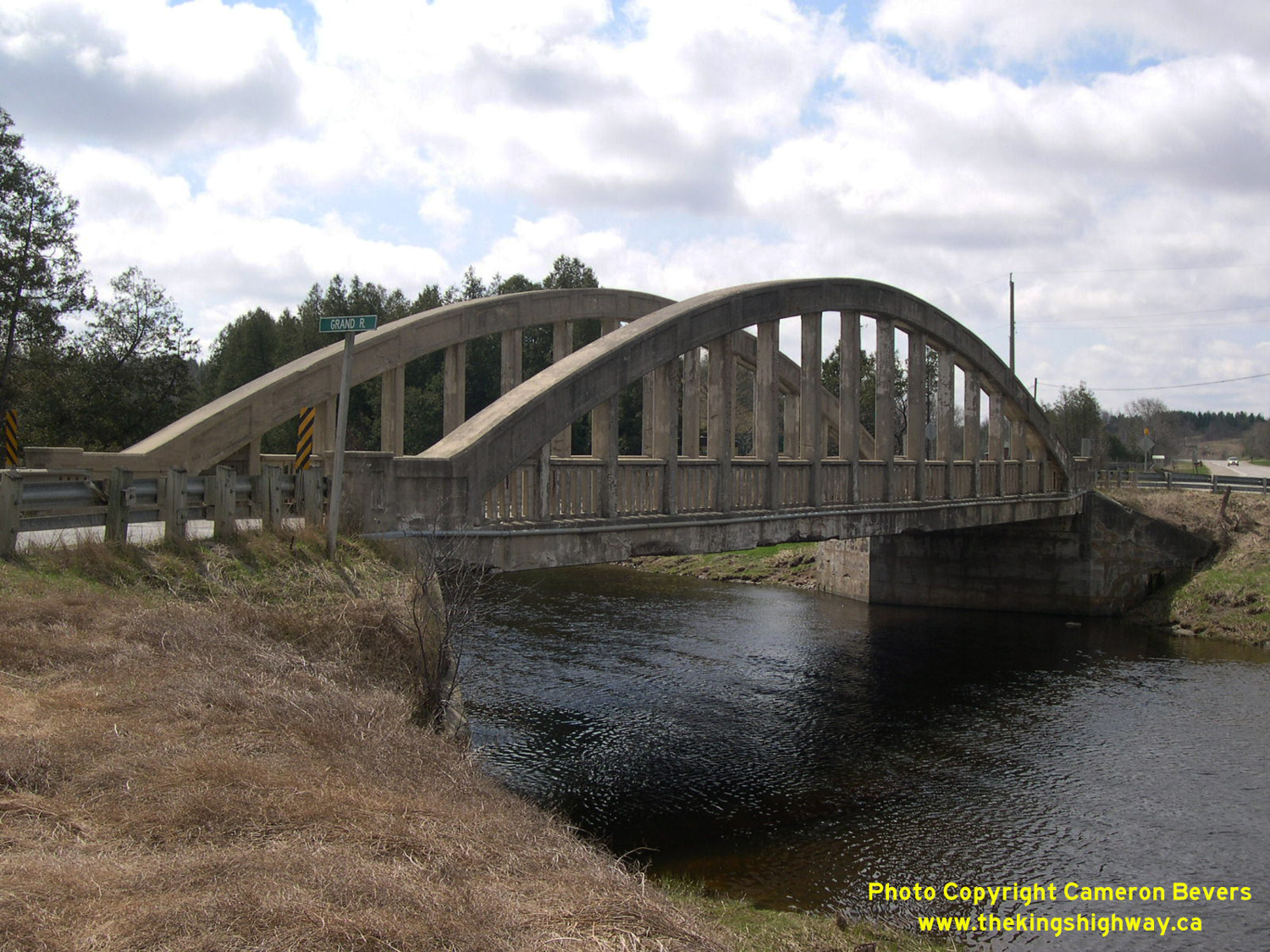
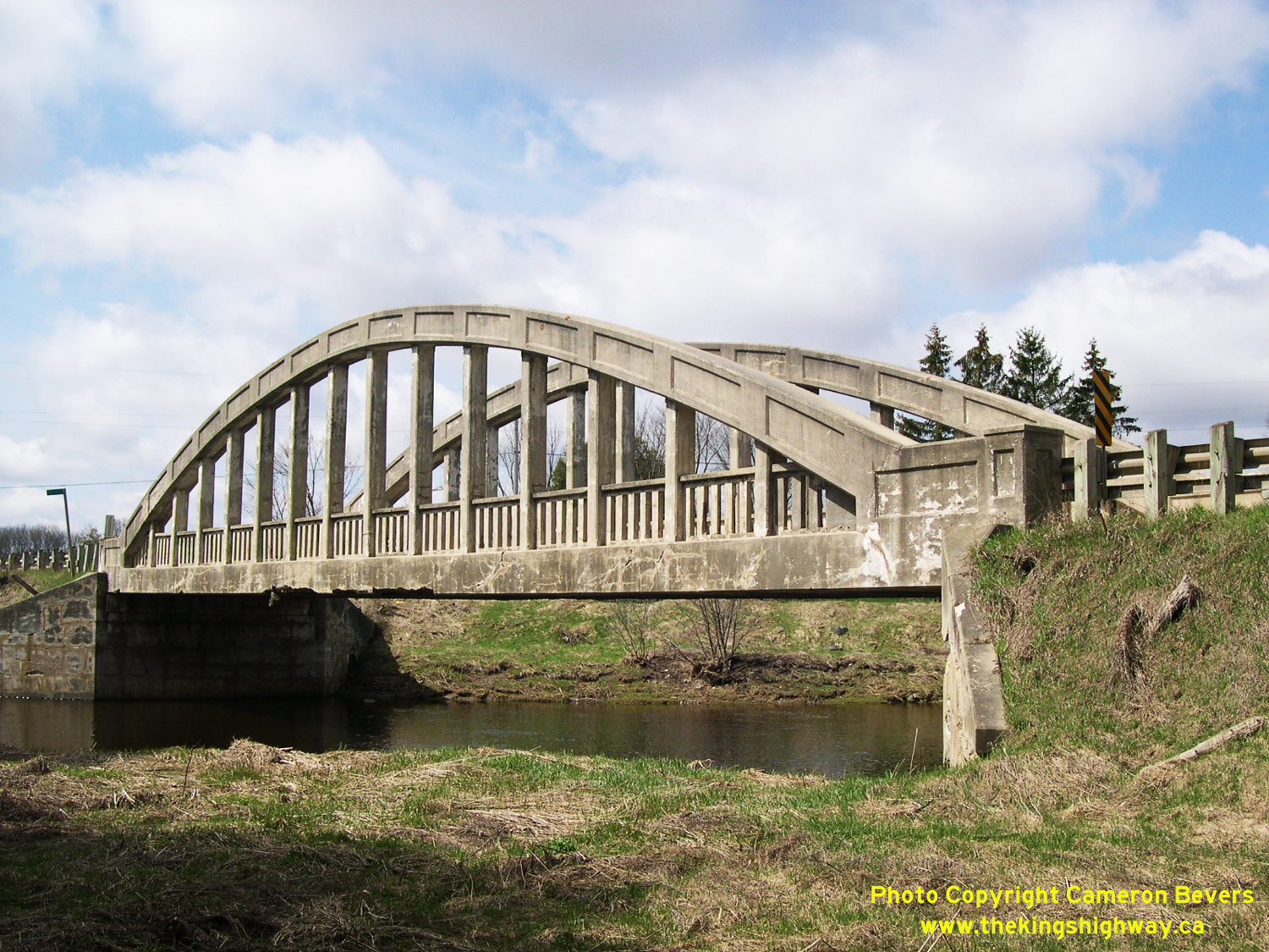
Left - Western side of the Grand Valley Bridge on Hwy 25. This single-span concrete "bowstring" arch truss structure was completed around 1925. See an
Enlarged Photo Here. (Photograph taken on April 24, 2004 - © Cameron Bevers) Right - Eastern side of the concrete "bowstring" truss bridge on Hwy 25 over the Grand River north of Grand Valley. See an Enlarged Photo Here. (Photograph taken on April 24, 2004 - © Cameron Bevers) 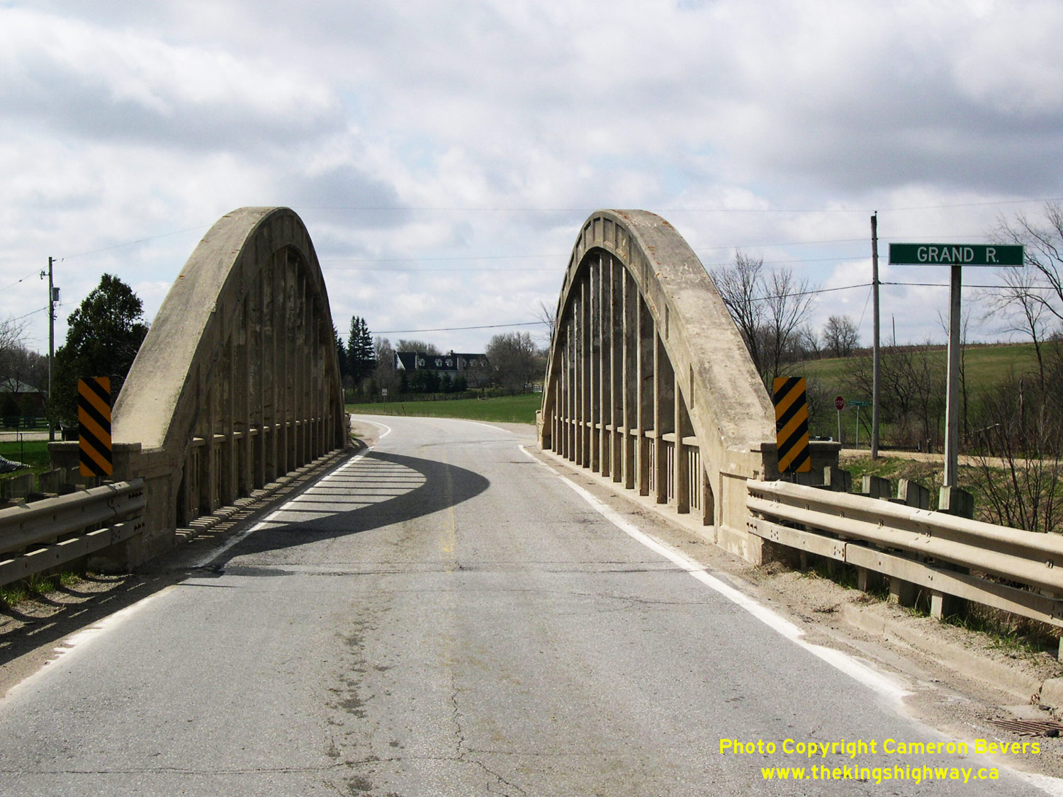
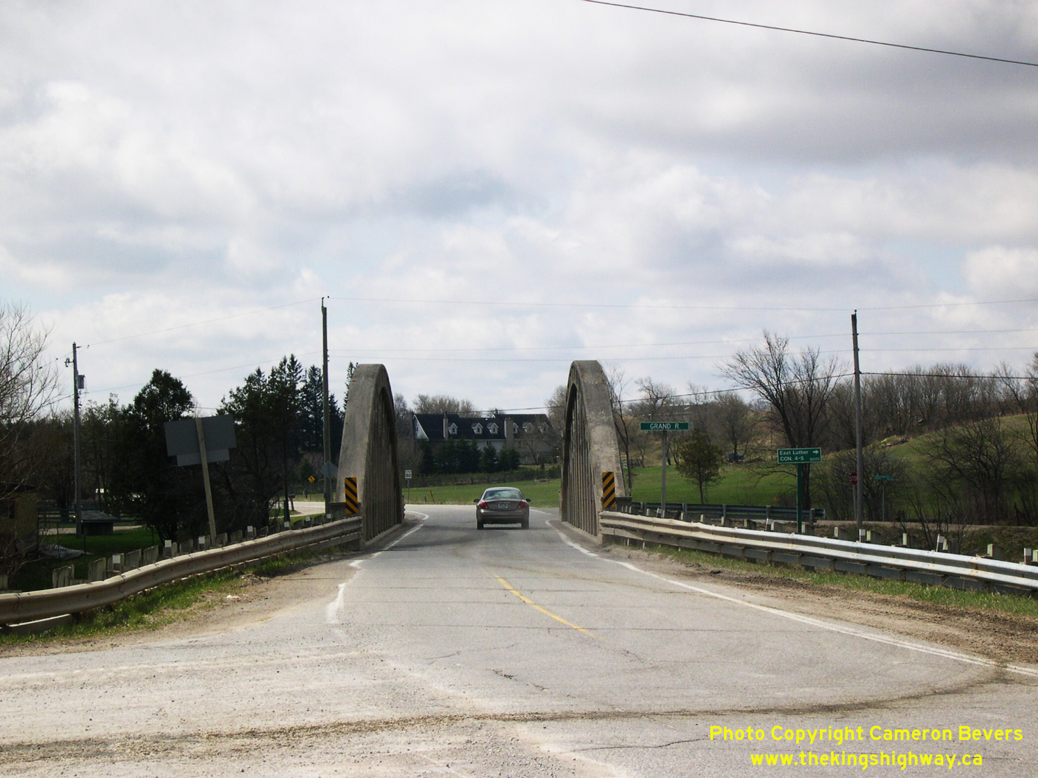
Left - Looking south across the Grand Valley Bridge. Note the narrow lane widths across this structure! See an
Enlarged Photo Here. (Photograph taken on April 24, 2004 - © Cameron Bevers) Right - A small sedan passes across the Grand Valley Bridge on Hwy 25, occupying the majority of its lane. This bridge is really only one lane in width when used by trucks and other large vehicles. See an Enlarged Photo Here. (Photograph taken on April 24, 2004 - © Cameron Bevers) 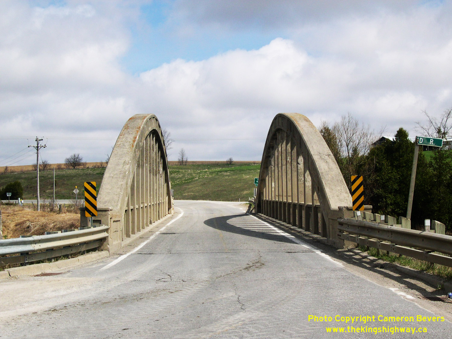
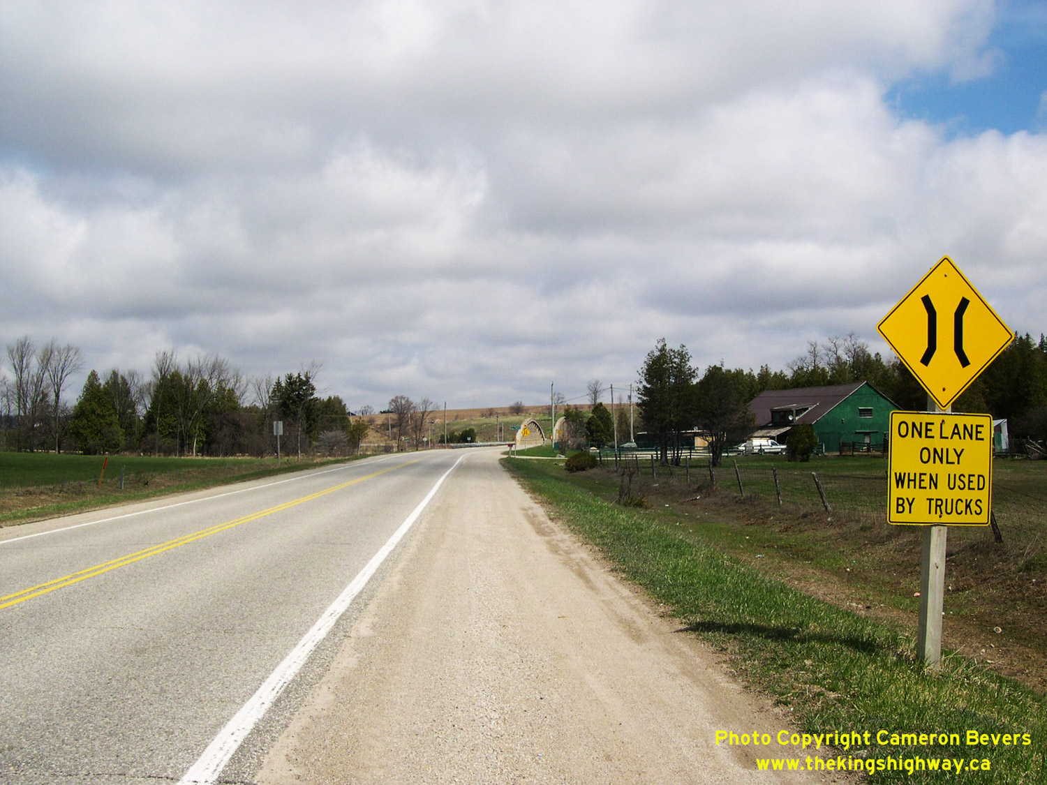
Left - Looking north along Hwy 25 across the Grand Valley Bridge. See an
Enlarged Photo Here. (Photograph taken on April 24, 2004 - © Cameron Bevers) Right - Advance warning sign for Grand Valley Bridge on Hwy 25. See an Enlarged Photo Here. (Photograph taken on April 24, 2004 - © Cameron Bevers) 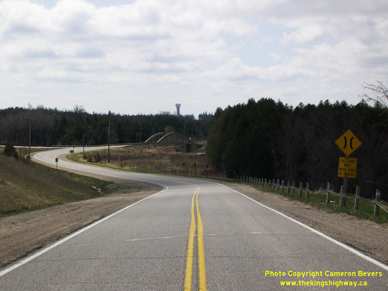
Above - Curve along northern approach to Grand River Bridge on Hwy 25 north of Grand Valley. See an
Enlarged Photo Here. (Photograph taken on April 24, 2004 - © Cameron Bevers)
More King's Highway 25 Photographs Coming Soon!
|
|---|
Links to Adjacent King's Highway Photograph Pages:
Back to King's Highway 24 Photos /
King's Highway 25 History /
On to King's Highway 26 Photos
Ontario Highway History - Main Menu / Back to List of Highways Website contents, photos & text © 2002-2026, Cameron
Bevers (Webmaster) - All Rights Reserved / Contact Me
|
|---|