
| 
|  |
|
|
This page contains present day photos (Year 2000 to date) of Ontario's King's Highway 28, arranged by location from Port Hope
northerly to Peterborough. All photographs displayed on this page were taken by the Webmaster (Cameron Bevers), unless specifically noted otherwise. Click on any
thumbnail to see a larger image!
Please note that all photographs displayed on this
website are protected by copyright. These photographs must not be reproduced, published,
electronically stored or copied, distributed, or posted onto other websites without
my written permission. If you want to use photos from this website, please
email me first for permission. Thank-you!
|
|---|
|
Page 2: Present Day King's Highway 28 Photographs (Port Hope to Peterborough)

Above - Highway signs at the junction of Hwy 2 and Hwy 28 in Port Hope. See an
Enlarged Photo Here. (Photograph taken on July 9, 2006 - © Cameron Bevers) 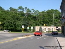

Left - Junction of Hwy 2 & Hwy 28 in Downtown Port Hope. See an
Enlarged Photo Here. (Photograph taken on July 9, 2006 - © Cameron Bevers) Right - Western side of the Hwy 28 Overpass on Hwy 401 in Port Hope. This three-span concrete rigid frame girder and slab structure was completed in 1959. See an Enlarged Photo Here. (Photograph taken on August 16, 2008 - © Cameron Bevers) 

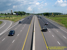
Left - Facing west along Hwy 401 towards Newcastle from the Hwy 28 Overpass in Port Hope in 2006, before the six-laning of Hwy 401 was completed east of Port
Hope. The outermost eastbound lane drops immediately east of the Hwy 28 Overpass, while the outermost westbound lane commences from the Hwy 28 on-ramp and becomes an
"away" lane. See an Enlarged Photo Here. (Photograph taken on May 7, 2006 - © Cameron Bevers) Right - View of Hwy 401 at the Hwy 28 Overpass in Port Hope in 2008, facing west towards Newcastle. Note that there are now six through lanes on the highway, and the westbound on-ramp coming from Hwy 28 now has a dedicated speed-change lane. When the Hwy 401 & Hwy 28 Interchange first opened to traffic in 1960, the exit ramps from Hwy 401 had direct tapers with no speed change lanes. The exit ramps were elongated through the construction of speed change lanes as part of an interchange retrofit project carried out in 1971. See an Enlarged Photo Here. (Photograph taken on August 16, 2008 - © Cameron Bevers) 
Left - Facing east along Hwy 401 towards Trenton from the Hwy 28 Overpass in Port Hope in 2006. See an
Enlarged Photo Here. (Photograph taken on May 7, 2006 - © Cameron Bevers) Right - Widened section of Hwy 401 through Port Hope in 2008, facing east from the Hwy 28 Overpass. See an Enlarged Photo Here. (Photograph taken on August 16, 2008 - © Cameron Bevers) 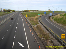
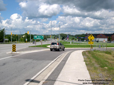
Left - End of the six-lane section on Hwy 401 in Port Hope in 2006, before being widened east of the Hwy 28 Interchange. Note the arrows painted on the
pavement directing traffic to change lanes before the lane drop. After Hwy 401 was widened east of the Hwy 28 Interchange, the right-most lane became continuous. See
an Enlarged Photo Here. (Photograph taken on May 7, 2006 - © Cameron Bevers) Right - Facing north along Hwy 28 from the Hwy 401 Interchange in Port Hope. The ramps at the Hwy 28 Interchange are in a modified "A-B Parclo" configuration. See an Enlarged Photo Here. (Photograph taken on August 16, 2008 - © Cameron Bevers) 

Left - Approaching the Hwy 28 Junction on Northumberland Road 74 (Formerly Hwy 106), facing east. The two highways intersect at Dale, located about 2 km north
of Port Hope. At one time, Hwy 106 provided a short but important highway link between Hwy 2 and Hwy 28, as it essentially formed a bypass around Port Hope. Once
Hwy 401 was completed between Newcastle and Port Hope in 1960, traffic volumes on Hwy 2 dropped considerably. Most long-distance through traffic began to use Hwy 401
instead. Accordingly, Hwy 106 became a far less important highway which served only local traffic. In the late 1980s, jurisdiction over Hwy 106 was transferred to the
County of Northumberland and was subsequently renamed County Road 74. In 1998, provincial jurisdiction over Hwy 28 between Port Hope and Peterborough also ceased. This
southern section of Hwy 28 is now maintained by the Counties of Northumberland and Peterborough. See an
Enlarged Photo Here. (Photograph taken on August 31, 2012 - © Cameron Bevers) Right - Facing north towards Bewdley along Hwy 28, about 3 km north of Port Hope. The province first assumed responsibility for the Port Hope-Peterborough Highway in 1920. Initially, this highway was numbered as Hwy 12A, but it was ultimately renumbered as Hwy 28 in 1928. See an Enlarged Photo Here. (Photograph taken on August 31, 2012 - © Cameron Bevers) 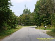

Left - Facing north along Old Hwy 28 (Rice Lake Drive) just north of the Hwy 28 Junction at Rossmount. A lengthy diversion was built for Hwy 28 in the Bewdley
area during the 1970s. The diversion bypassed Bewdley and an old, winding section of Hwy 28 which extended south from Rice Lake towards Port Hope. See an
Enlarged Photo Here. (Photograph taken on August 31, 2012 - © Cameron Bevers) Right - Another view of Old Hwy 28 (Rice Lake Drive) near Rossmount. This interesting and lengthy bypassed section of Hwy 28 shows many characteristics of early highway design practices in Ontario. There was a time when all of Ontario's highways looked like this - narrow lanes, tight horizontal curves and virtually no roadside shoulders. It's only when looking at a former highway alignment like this that one can truly appreciate just how much Ontario's highways have improved over the decades! See an Enlarged Photo Here. (Photograph taken on August 31, 2012 - © Cameron Bevers) 

Left - This slight reverse curve on Old Hwy 28 (Rice Lake Drive) about 4 km south of Bewdley still shows subtle traces of the old centreline markings, with
restricted and permissive passing zones. It may seem hard to believe, but this narrow road was actually a part of Hwy 28 right up until 1974! See an
Enlarged Photo Here. (Photograph taken on August 31, 2012 - © Cameron Bevers) Right - Facing north along Old Hwy 28 (Rice Lake Drive) about 4 km south of Bewdley. Preparatory clearing work began along the 7 km route of the Bewdley Diversion (Hwy 28 New) in 1971. A construction contract was awarded in 1973 to complete the Bewdley Diversion. The new route of Hwy 28 was completed in 1974, which bypassed miles of winding highway such as this scene here. This former Hwy 28 alignment also provides road enthusiasts with a fascinating, living example of what Ontario's King's Highways used to look like in decades past. See an Enlarged Photo Here. (Photograph taken on August 31, 2012 - © Cameron Bevers) 

Left - A winding road warning sign on Old Hwy 28, facing south towards Donaldson Road. This sign couldn't be any more correct! See an
Enlarged Photo Here. (Photograph taken on August 31, 2012 - © Cameron Bevers) Right - A rare tangent section along the old route of Hwy 28 near Donaldson Road, located about 3 km south of Bewdley. This area would have represented the only substantial passing opportunity for motorists using this section of Hwy 28. When Hwy 28 New was constructed in the 1970s, it was built with long tangent sections with ample passing opportunities. See an Enlarged Photo Here. (Photograph taken on August 31, 2012 - © Cameron Bevers) 

Left - Facing north along Old Hwy 28 (Rice Lake Drive) about 2 km south of Bewdley. The bypassed section of Hwy 28 has several long tangent sections connecting
to relatively short superelevated horizontal curves. This was a typical highway design practice in the earliest years of Ontario's highways. At that time, vehicles
could very seldom attain a rate of speed that could pose any significant hazard when approaching a curve such as this. However, as the years went by, vehicles became
faster and heavier. Short horizontal curves such as this started to become a safety problem. By the 1940s, highway designers elected to use longer and more gradual
horizontal curves for new highways to better accommodate faster traffic. See an
Enlarged Photo Here. (Photograph taken on August 31, 2012 - © Cameron Bevers) Right - Sharp horizontal curve on Old Hwy 28 south of Bewdley, facing south. The old section of Hwy 28 has a composite pavement structure. It has a concrete base which has been topped off with an asphalt layer. The concrete base, which set the overall superelevation for this horizontal curve, was constructed during a highway improvement project carried out back in 1927. Curves of this general design were commonly used on Ontario's highways during the 1920s. They were mostly removed during reconstruction of the King's Highway System over the years. Surviving examples are now only found on bypassed or abandoned highway sections such as this. See an Enlarged Photo Here. (Photograph taken on August 31, 2012 - © Cameron Bevers) 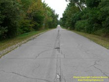
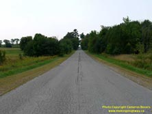
Left - Approaching the Northumberland Road 9 Junction on Old Hwy 28 (Rice Lake Drive) near Bewdley. The slight roller-coaster appearance of the highway's
profile was a common design characteristic along many of Ontario's earliest highways, where the road's profile closely matched the existing ground line. More often
than not, there was insufficient right-of-way available to widen an earth cut or fill, in order to flatten out the highway's profile. Most of Ontario's highways only
had a 66-foot (20-metre) road allowance when they were first designated, which proved to be a considerable constraint for highway designers once drainage ditches and
utility pole lines had been taken into account. See an Enlarged Photo Here. (Photograph taken on August 31, 2012 - © Cameron Bevers) Right - Facing south along Old Hwy 28 (Rice Lake Drive) from the Northumberland Road 9 Junction near Bewdley. See an Enlarged Photo Here. (Photograph taken on August 31, 2012 - © Cameron Bevers) 

Left - Abandoned section of Hwy 28 immediately north of Bewdley. This section of the highway was bypassed as part of the construction of the Bewdley Diversion
(Hwy 28 New) in the 1970s. The Bewdley Diversion was completed in 1974 on a vastly-improved highway alignment. See an
Enlarged Photo Here. (Photograph taken on August 31, 2012 - © Cameron Bevers) Right - Facing north towards Peterborough along the abandoned section of Hwy 28 near Bewdley. This is the only bypassed section of Hwy 28 in the Bewdley area which is no longer open to traffic. The vast majority of the former route of Hwy 28 is still open to traffic (Rice Lake Drive). See an Enlarged Photo Here. (Photograph taken on August 31, 2012 - © Cameron Bevers) 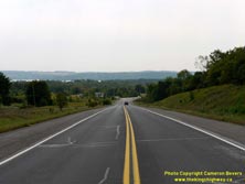
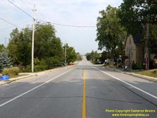
Left - Approaching Rice Lake on Hwy 28, facing south towards Bewdley. See an
Enlarged Photo Here. (Photograph taken on August 31, 2012 - © Cameron Bevers) Right - View of Hwy 28 in the community of Bailieboro, located about 5 km north of Bewdley. See an Enlarged Photo Here. (Photograph taken on August 31, 2012 - © Cameron Bevers) 
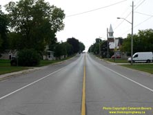
Left - Hwy 28 descends this long grade through Bailieboro as the highway heads north towards Peterborough. See an
Enlarged Photo Here. (Photograph taken on August 31, 2012 - © Cameron Bevers) Right - Facing south towards Bewdley along Hwy 28 through Bailieboro. See an Enlarged Photo Here. (Photograph taken on August 31, 2012 - © Cameron Bevers) 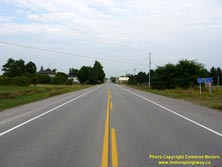

Left - Approaching the community of South Monaghan on Hwy 28, facing north towards Peterborough. See an
Enlarged Photo Here. (Photograph taken on August 31, 2012 - © Cameron Bevers) Right - Old MTO-made guide sign for Peterborough County Road 21 on northbound Hwy 28. This intersecting county road was once known as Peterborough Road 28, but was renumbered as Peterborough Road 21 in the 1990s. Note the patch covering over the old route number. The mass transfer of King's Highways from the province to various municipalities in the late 1990s forced many counties to renumber existing roads in their county road network. In this particular instance, Peterborough County chose to assign the County Road 28 designation to former King's Highway 28, and thus renumbered their existing County Road 28 as County Road 21 in order to free up the route number for the downloaded King's Highway. See an Enlarged Photo Here. (Photograph taken on August 31, 2012 - © Cameron Bevers) 

Left - Facing north along Hwy 28 towards the Peterborough County Road 21 Junction. This intersection was converted into a modern roundabout by Peterborough
County after this photo was taken. Roundabouts are becoming a popular alternative to traffic signals throughout Ontario. The safety benefits of roundabouts are
especially evident at rural locations, where there tends to be a much higher risk of right-angle vehicle collisions at high speeds. Right-angle vehicle collisions
cannot be eliminated by installing traffic signals, but can be mitigated through the introduction of a roundabout. Roundabouts encourage all motorists to slow
down approaching a junction, which greatly reduces the risk of a severe collision. See an
Enlarged Photo Here. (Photograph taken on August 31, 2012 - © Cameron Bevers) Right - Facing north towards Fowlers Corners at the Hwy 28 Interchange on Hwy 7 & Hwy 115 at Springville, southwest of Peterborough. Prior to the extension of Hwy 115 from Springville to Peterborough in 1978, Hwy 115 used to end at this interchange. Until 1984, Hwy 28 used to continue straight through (north) towards Five Mile Corners, located south of Fowlers Corners. Hwy 28 was rerouted southwest of Peterborough in the 1980s and was signed concurrently with Hwy 115 between 1984 and 2003. Originally, Hwy 7 did not pass through this interchange at all. However, the Hwy 7 designation was applied to the highway through Springville in 2003, in order to close a gap left over when a section of Hwy 7 (North Monaghan Parkway and Sir Sandford Fleming Drive) was downloaded to the County of Peterborough in 1997. See an Enlarged Photo Here. (Photograph taken on September 23, 2007 - © Cameron Bevers) 

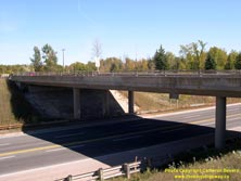
Left - Dual underpass structures carry the freeway over Hwy 28. The northbound Hwy 115 structure is much older than the southbound Hwy 115 structure, due to
the fact that Hwy 115 was constructed as a staged freeway through this interchange. Hwy 115 was initially built as an undivided two-lane highway, but was later
expanded to a four-lane freeway in the mid-1980s. Click here to see a Historical 1972 Photo
of the partially-completed Hwy 28 Interchange on Hwy 115, showing the former northern terminus of Hwy 115. See an
Enlarged Photo Here. (Photograph taken on September 23, 2007 - © Cameron Bevers) Right - Northbound Hwy 115 underpass at the Hwy 28 Interchange near Peterborough. This three-span post-tensioned concrete structure was completed in 1966. See an Enlarged Photo Here. (Photograph taken on September 23, 2007 - © Cameron Bevers) 
Left - Date stamp (1966) and structure identification number (Site #21-338) on the northbound Hwy 115 structure at the Hwy 28 Interchange. See an
Enlarged Photo Here. (Photograph taken on September 23, 2007 - © Cameron Bevers) Right - Western side of the northbound Hwy 115 structure at the Hwy 28 Interchange at Springville. See an Enlarged Photo Here. (Photograph taken on September 23, 2007 - © Cameron Bevers) 

Left - Southbound Hwy 115 structure at the Hwy 28 Interchange. This three-span post-tensioned concrete structure was completed in 1985. See an
Enlarged Photo Here. (Photograph taken on September 23, 2007 - © Cameron Bevers) Right - Date stamp (1985) on the southbound Hwy 115 structure at the Hwy 28 Interchange. See an Enlarged Photo Here. (Photograph taken on September 23, 2007 - © Cameron Bevers) 
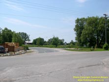
Left - Facing north along Hwy 7 & Hwy 115 (Formerly Hwy 28 & Hwy 115) towards Peterborough from the Hwy 28 Interchange near Springville. See an
Enlarged Photo Here. (Photograph taken on September 23, 2007 - © Cameron Bevers) Right - Former alignment of Hwy 28 (Cathcart Crescent) at Scott's Corners, facing south towards Port Hope. The old alignment of Hwy 28 was bypassed by a new relocated highway in 1959-1960. It was one of several sections of Hwy 28 to be relocated between Port Hope and Peterborough in an effort to improve the highway's alignment. See an Enlarged Photo Here. (Photograph taken on July 9, 2006 - © Cameron Bevers) 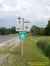
Above - Hwy 7 & Formerly Hwy 7A route markers near Springville. These route markers have remained on the road ever since the recent renumbering of a
section of Hwy 7A as Hwy 7 through Springville in 2003. This section of highway west of Peterborough has been renumbered more times than any other route in Ontario's
provincial highway history. The highway route number(s) through Springville has changed no fewer than seven times since highway numbering was first introduced in Ontario
in 1925. Initially the highway was known as Hwy 12A (1925-1928), which later changed to Hwy 28 (1928-1938), which then became Hwy 28 & Hwy 7A (1938-1960), then
Hwy 28 (1960-1964), then Hwy 28 & Hwy 115 (1964-1970), then Hwy 28 (1970-1984), then Hwy 7A (1984-2003), and then finally Hwy 7 (2003-Present). Anyone lost yet? (Photograph taken on July 9, 2006 - © Cameron Bevers) 
Above - Hwy 7 (Former Hwy 28) descends this steep grade at Springville, just west of Peterborough. The Hwy 115 Interchange lies about 3 km ahead. See an
Enlarged Photo Here. (Photograph taken on July 9, 2006 - © Cameron Bevers) 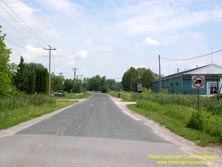

Left - Facing north along Old Hwy 28 (Davis Road) at Scott's Corners. A curvy section of the original Hwy 28 between Springville and Five Mile Corners
was bypassed when a new highway was constructed along the western side of Peterborough in 1959-1960. The old highway is now a local access road at Scotts Corners.
See an Enlarged Photo Here. (Photograph taken on July 9, 2006 - © Cameron Bevers) Right - Five Mile Corners on Hwy 7 at Lansdowne Street (Old Hwy 28), facing east. This junction has a very complicated past. Originally, Hwy 28 simply curved to the right and merged with Lansdowne Street on its route between Port Hope and Peterborough. In the 1950s, a new highway was built along the western side of Peterborough, extending south from Hwy 7 at Fowlers Corners and joining Hwy 28 at this junction. Initially, this new highway was known as Hwy 133. As part of the Peterborough Bypass construction in 1959-1960, another leg was built onto this intersection, extending Hwy 133 south towards Springville. Once the highway was completed between Five Mile Corners and Scott's Corners in 1960, Hwy 133 was re-designated as Hwy 7. The route of Hwy 28 seen here was diverted onto the new alignment concurrently with Hwy 7 from this point southerly to Scott's Corners. However, the route of Hwy 28 heading east from Five Mile Corners continued to follow Lansdowne Street into Peterborough for many years. In 1984, Hwy 28 was rerouted onto Hwy 115 and The Parkway. See an Enlarged Photo Here. (Photograph taken on July 9, 2006 - © Cameron Bevers) 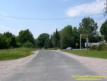

Left - Facing south along Old Hwy 28 (Davis Road) from the Hwy 7 Junction at Five Mile Corners. Although it hasn't carried provincial highway traffic in over
50 years, this road still looks like an old King's Highway from a geometric perspective. Note the slight curve superelevation, designed so that high-speed traffic
could negotiate the change in the highway alignment. (Photograph taken on July 9, 2006 - © Cameron Bevers) Right - Facing east along Charlotte Street (Former Hwy 28 & Hwy 115) at Monaghan Road (Former Hwy 7B). Prior to 1997, Hwy 28 turned left at this intersection and headed north along Monaghan Road concurrently with Hwy 7B. The route of Hwy 115 reached its pre-1997 northern terminus at this junction. The route of Hwy 7B also continued south from here along Monaghan Road to Lansdowne Street, where the route of Hwy 7B turned easterly towards the Peterborough Bypass and Ottawa. As a result of the downloading of various highways and revocation of municipal connecting links in the Peterborough area in 1997-1998, there are no longer any provincial highways which pass through the urbanized sections of Peterborough. See an Enlarged Photo here. (Photograph taken on July 9, 2006 - © Cameron Bevers)
Continue on to King's Highway 28 Photos: Peterborough to Bancroft
|
|---|
Links to Adjacent King's Highway Photograph Pages:
Back to Hwy 28 - Historical Photos (1928-1999)
Hwy 28 Photo Index
On to Hwy 28 - Peterborough to Bancroft
Back to King's Highway 27 Photos /
King's Highway 28 History /
Back to King's Highway 29 Photos
Ontario Highway History - Main Menu / Back to List of Highways Website contents, photos & text © 2002-2025, Cameron
Bevers (Webmaster) - All Rights Reserved / Contact Me |
|---|