
| 
|  |
|
|
This page contains present day photos (Year 2000 to date) of Ontario's King's Highway 28, arranged by location from Bancroft
easterly to Denbigh. All photographs displayed on this page were taken by the Webmaster (Cameron Bevers), unless specifically noted otherwise. Click on any thumbnail
to see a larger image!
Please note that all photographs displayed on this
website are protected by copyright. These photographs must not be reproduced, published,
electronically stored or copied, distributed, or posted onto other websites without
my written permission. If you want to use photos from this website, please
email me first for permission. Thank-you!
|
|---|
|
Page 4: Present Day King's Highway 28 Photographs (Bancroft to Denbigh)


Left - Junction of Hwy 28 & Hwy 62 in Bancroft, facing east towards the York River Bridge. See an
Enlarged Photo Here. (Photograph taken on October 11, 2008 - © Cameron Bevers) Right - Junction sign assembly at the Hwy 28 & Hwy 62 Junction in Bancroft. At this junction, Hwy 62 South turns right and heads south towards Madoc and Belleville. Straight ahead, Hwy 28 & Hwy 62 North join together along a short concurrent route via Bridge Street into Downtown Bancroft, where the two highways again part ways. Up until the early 1980s, Hwy 28 ended at this intersection. However, Hwy 28 was extended east to Denbigh along the former route of Hwy 500 in 1982. See an Enlarged Photo Here. (Photograph taken on October 11, 2008 - © Cameron Bevers) 

Left - Junction sign assembly at the Hwy 28 & Hwy 62 Junction in Bancroft. Downtown Bancroft lies a short distance to the east along Bridge Street (Hwy 28
East & Hwy 62 North). At left, Hwy 28 heads south towards Lakefield and Peterborough. As the signpost indicates, the cardinal directions for Hwy 28 change from
north-south to east-west in Bancroft. See an Enlarged Photo Here. (Photograph taken on October 11, 2008 - © Cameron Bevers) Right - York River Bridge on Hwy 28 & Hwy 62 in Bancroft. This single span steel beam structure was completed in 1965. See an Enlarged Photo Here. (Photograph taken on October 11, 2008 - © Cameron Bevers) 

Left - Facing east along Bridge Street (Hwy 28 & Hwy 62) towards Hastings Street in Downtown Bancroft. After sharing a concurrent route for scarcely 150
metres, Hwy 62 turns left onto Hastings Street and continues north towards Barry's Bay. Hwy 28 continues east beyond the traffic signals via Bridge Street towards
Denbigh. See an Enlarged Photo Here. (Photograph taken on October 11, 2008 - © Cameron Bevers) Right - Facing north along Hastings Street (Hwy 62) from the Hwy 28 Junction at Bridge Street in Downtown Bancroft. See an Enlarged Photo Here. (Photograph taken on October 11, 2008 - © Cameron Bevers) 

Left - Junction sign assembly at Bridge Street and Hastings Street in Downtown Bancroft. At Hastings Street, Hwy 62 turns left and continues north towards
Maynooth and Barry's Bay. Hwy 28 continues straight ahead towards Denbigh, where the route connects with Hwy 41. Until the early 1980s, the route between
Bancroft and Denbigh was a Secondary Highway known as Hwy 500. The entire length of Hwy 500 from Bancroft to Denbigh was renumbered as Hwy 28 in 1982. See an
Enlarged Photo Here. (Photograph taken on October 11, 2008 - © Cameron Bevers) Right - Facing south along Hastings Street (Hwy 62) towards Bridge Street (Hwy 28) in Downtown Bancroft. At the traffic signals, Hwy 62 turns right and crosses the York River Bridge concurrently with Hwy 28. At the west end of the bridge, Hwy 62 turns left and continues south towards Madoc. See an Enlarged Photo Here. (Photograph taken on October 11, 2008 - © Cameron Bevers) 

Left - Facing west along Bridge Street (Hwy 28 & Hwy 62) from Hastings Street. Immediately after crossing the York River Bridge, Hwy 62 turns left and
continues south towards Madoc and Belleville, while Hwy 28 continues straight ahead towards Lakefield and Peterborough. See an Enlarged Photo Here. (Photograph taken on May 30, 2010 - © Cameron Bevers) Right - Junction sign assembly on westbound Hwy 28 approaching Hastings Street (Hwy 62) in Downtown Bancroft. See an Enlarged Photo Here. (Photograph taken on May 30, 2010 - © Cameron Bevers) 
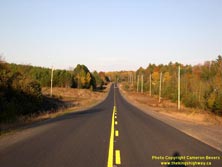
Left - Facing east along Hwy 28 departing from Bancroft's urbanized area. The route of Hwy 28 crosses a sparsely-populated region of Eastern Ontario east of
Bancroft. See an Enlarged Photo Here. (Photograph taken on October 11, 2008 - © Cameron Bevers) Right - Facing east along Hwy 28 about 1 km east of the York River Bridge, between Bancroft and McArthurs Mills. See an Enlarged Photo Here. (Photograph taken on October 11, 2008 - © Cameron Bevers) 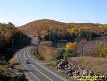
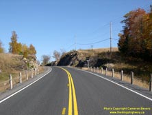
Left - This spectacular autumn scene unfolds as Hwy 28 rounds Belton Lake, located about 3 km west of Hermon. This beautiful reverse curve is actually a
diversion of the original highway. At one time, the highway followed Belton Road around the north side of the lake. See an
Enlarged Photo Here. (Photograph taken on October 12, 2008 - © Cameron Bevers) Right - This rock cut was excavated in the early 1960s, in order to carry a diversion of Hwy 500 (now Hwy 28) through this rugged area near Belton Lake. See an Enlarged Photo Here. (Photograph taken on October 12, 2008 - © Cameron Bevers) 
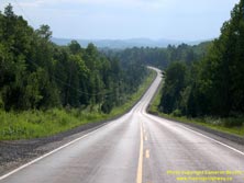
Left - Facing east along Hwy 28, about 1 km east of McArthurs Mills. See an
Enlarged Photo Here. (Photograph taken on August 5, 2008 - © Cameron Bevers) Right - As Hwy 28 descends this grade about 2 km east of McArthurs Mills, the hazy distant highlands of northern Hastings County became rather evident on the horizon. This part of Ontario is home to by some surprisingly mountainous terrain - certainly by Ontario standards anyways. See an Enlarged Photo Here. (Photograph taken on August 5, 2008 - © Cameron Bevers) 
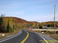
Left - Renfrew County boundary sign on Hwy 28 east of McArthurs Mills. See an
Enlarged Photo Here. (Photograph taken on October 12, 2008 - © Cameron Bevers) Right - Facing east along Hwy 28 towards Hardwood Lake, about 5 km east of McArthurs Mills. The route of Hwy 28 winds on for many miles through scenic pastoral valleys and forested hills, making this lightly-travelled highway just a delight to drive! See an Enlarged Photo Here. (Photograph taken on October 12, 2008 - © Cameron Bevers) 

Left - Distance guide sign on westbound Hwy 28 at the Hwy 514 Junction at Hardwood Lake. See an
Enlarged Photo Here. (Photograph taken on September 1, 2012 - © Cameron Bevers) Right - Facing west along Hwy 28 towards Bancroft from the Hwy 514 Junction at Hardwood Lake. See an Enlarged Photo Here. (Photograph taken on September 1, 2012 - © Cameron Bevers) 
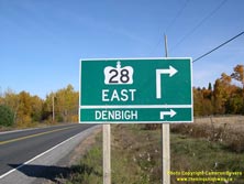
Left - Facing east along Hwy 28 approaching the Hwy 514 Junction at Hardwood Lake. At the upcoming intersection, Hwy 28 turns right and continues east towards
Hwy 41 and Denbigh, while Hwy 514 continues straight ahead towards Schutt. Although less direct than taking Hwy 62, motorists travelling between Bancroft and the
Combermere-Barry's Bay area can instead use the route offered by Hwy 28, Hwy 514 and Hwy 515 between these two destinations. See an
Enlarged Photo Here. (Photograph taken on October 12, 2008 - © Cameron Bevers) Right - Green guide sign marking the Hwy 28 turn-off to Denbigh. This turn-off at Hardwood Lake is very prominently signed heading eastbound on Hwy 28, as it is easy for motorists to unknowingly depart from Hwy 28 by driving straight through at this intersection. Motorists who inadvertently miss this turn will end up on northbound Hwy 514 to Schutt. At the end of Hwy 514 (which lies about 13 km ahead), motorists can turn west on Hwy 515 to return to Hwy 62 at Combermere or turn east on Hwy 515 towards Foymount and Eganville. See an Enlarged Photo Here. (Photograph taken on October 12, 2008 - © Cameron Bevers) 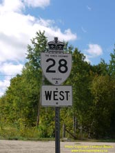
Above - An older King's Highway 28 route marker at Hardwood Lake. See an
Enlarged Photo Here. (Photograph taken on September 1, 2012 - © Cameron Bevers) 

Left - Facing north along Hwy 514 towards Schutt from the Hwy 28 Junction at Hardwood Lake. This highway continues north from Hardwood Lake for about 13 km,
where it comes to an end at Hwy 515 near Palmer Rapids. Like all of the other provincially-owned Secondary Highways lying within Renfrew County, Hwy 514 was
downloaded by the province to the county in the late 1990s. Although it has retained its former route number, Hwy 514 is now officially known as Renfrew County
Road 514 (Schutt Road). See an Enlarged Photo Here. (Photograph taken on October 11, 2004 - © Cameron Bevers) Right - Junction of Hwy 28 & Hwy 514 at Hardwood Lake, facing west. At the Stop sign, Hwy 28 turns left and resumes its route west towards Bancroft, while Hwy 514 turns right and begins its route north towards Schutt and Palmer Rapids. As one can likely deduce from this photo, the tiny settlement at Hardwood Lake has no services for motorists. See an Enlarged Photo Here. (Photograph taken on October 12, 2008 - © Cameron Bevers) 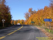

Left - Approaching the small community of Hardwood Lake on Hwy 28, facing west towards the Hwy 514 Junction. See an
Enlarged Photo Here. (Photograph taken on October 12, 2008 - © Cameron Bevers) Right - Facing east along Hwy 28 towards Denbigh from the Hwy 514 Junction at Hardwood Lake. For the next 18 km, Hwy 28 winds its way through a particularly mountainous and sparsely-populated region of Eastern Ontario, before joining Hwy 41 at Denbigh. See an Enlarged Photo Here. (Photograph taken on October 11, 2004 - © Cameron Bevers) 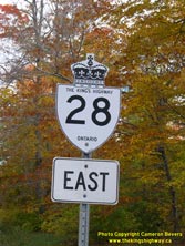

Left - An older King's Highway 28 route marker at Hardwood Lake. Careful observers might notice the letters "MTC" appearing below the word "ONTARIO" on this
Hwy 28 shield. The letters stand for "Ministry of Transportation and Communications", the former name of the present-day MTO. Many highway signs produced by the MTC
in the 1970s and 1980s bore these identification letters. This sign most likely dates from 1982, when Hwy 500 was re-designated as a King's Highway and became an
easterly extension of Hwy 28. See an Enlarged Photo Here. (Photograph taken on October 11, 2004 - © Cameron Bevers) Right - Junction sign assembly on westbound Hwy 28 approaching Hardwood Lake. Until the late 1990s, Renfrew County Road 514 was an Ontario Secondary Highway. See an Enlarged Photo Here. (Photograph taken on October 12, 2008 - © Cameron Bevers) 

Left - Hwy 28 curves its way up a long grade as the highway approaches the Hwy 514 Junction at Hardwood Lake from the east. See an
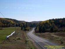
Enlarged Photo Here. (Photograph taken on October 12, 2008 - © Cameron Bevers) Right - Descending into the scenic Snake Creek Valley on Hwy 28, about 1 km east of Hardwood Lake. The section of Hwy 28 between Hardwood Lake and Denbigh is especially pretty in the fall, when the valley's trees explode into a stunning, colourful canvas. See an Enlarged Photo Here. (Photograph taken on October 11, 2004 - © Cameron Bevers) 
Left - This rock cut was built in the 1960s to carry an extension of Hwy 500 (now Hwy 28) between the Bancroft area and Denbigh. Prior to the completion of
Hwy 500 to Denbigh, east-west travel through this area was particularly cumbersome. Long distance through traffic heading between Bancroft and Renfrew had to use
Hwy 62 and Hwy 60 via Combermere, Barry's Bay and Eganville in order to traverse this area. The new route of Hwy 500 reduced the highway distance between Bancroft and
Renfrew by about 23 miles (37 km). See an Enlarged Photo Here. (Photograph taken on October 12, 2008 - © Cameron Bevers) Right - This scenic rural view of Hwy 28 can be found about 2 km east of Hardwood Lake. See an Enlarged Photo Here. (Photograph taken on October 12, 2008 - © Cameron Bevers) 

Left - Hwy 28 rounds this scenic curve as it crosses the Snake Creek Bridge, located about 5 km east of Hardwood Lake. See an
Enlarged Photo Here. (Photograph taken on October 12, 2008 - © Cameron Bevers) Right - Facing west along Hwy 28 towards Hardwood Lake from the Snake Creek Bridge. See an Enlarged Photo Here. (Photograph taken on October 12, 2008 - © Cameron Bevers) 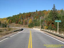

Left - Facing west across the Snake Creek Bridge on Hwy 28 between Hardwood Lake and Denbigh. See an
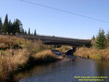
Enlarged Photo Here. (Photograph taken on October 12, 2008 - © Cameron Bevers) Right - Southern side of the Snake Creek Bridge on Hwy 28. This single span concrete rigid frame structure was completed in 1983. The new concrete bridge replaced a narrow timber structure that was constructed back in 1952, long before the Department of Highways assumed jurisdiction over the road east of Hardwood Lake as a provincial highway. See an Enlarged Photo Here. (Photograph taken on October 12, 2008 - © Cameron Bevers) 
Left - Structure identification number and date stamp (1983) on the Snake Creek Bridge. See an
Enlarged Photo Here. (Photograph taken on October 12, 2008 - © Cameron Bevers) Right - Northern side of the Snake Creek Bridge on Hwy 28. This structure is located on a horizontal curve on the highway and thus has a superelevated deck. See an Enlarged Photo Here. (Photograph taken on October 12, 2008 - © Cameron Bevers) 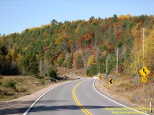
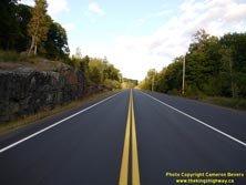
Left - Facing west along Hwy 28 approaching the Snake Creek Bridge between Hardwood Lake and Denbigh. The bridge lies within a reverse curve on Hwy 28. See an
Enlarged Photo Here. (Photograph taken on October 12, 2008 - © Cameron Bevers) Right - During a recent highway reconstruction project, full-width paved shoulders were provided along sections of Hwy 28 through the Snake Creek Valley. See an Enlarged Photo Here. (Photograph taken on September 1, 2012 - © Cameron Bevers) 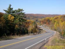
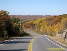
Left - View of Hwy 28 descending into the Snake Creek Valley, facing west towards Hardwood Lake. This spectacular section of Hwy 28 easily qualifies as one of
the most scenic drives in Ontario. With its curvilinear alignment, steep hills and dramatic scenery at virtually every turn, this section of Hwy 28 certainly does not
disappoint! See an Enlarged Photo Here. (Photograph taken on October 12, 2008 - © Cameron Bevers) Right - Steep downhill grade on Hwy 28, facing west towards the Snake River Bridge. The westbound descent into the valley has grades approaching 12 percent. See an Enlarged Photo Here. (Photograph taken on October 12, 2008 - © Cameron Bevers) 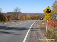

Left - Warning sign on westbound Hwy 28, advising motorists of the steep downhill grade ahead. See an
Enlarged Photo Here. (Photograph taken on October 12, 2008 - © Cameron Bevers) Right - The descent into the Snake Creek Valley on Hwy 28 begins rather unassumingly, but does quickly steepen beyond the next curve. See an Enlarged Photo Here. (Photograph taken on October 12, 2008 - © Cameron Bevers) 

Left - Dusk falls over a mountainous section of Hwy 28 between Denbigh and Hardwood Lake. The northernmost section of Hwy 28 is one of Ontario's most scenic
highways. Motorists wishing to enjoy a scenic drive of this area should refer to the Renfrew County Highlands Tour section of my
Ontario Scenic Highway Tours page. See an
Enlarged Photo Here. (Photograph taken on October 31, 2003 - © Cameron Bevers) Right - View of the old bituminous tar-and-chip pavement on Hwy 28 approaching the Snake Creek Valley, facing west. In recent years, Hwy 28 was reconstructed with a hot-mix asphalt pavement structure, which provided a much smoother ride quality and a longer-lasting road surface. See an Enlarged Photo Here. (Photograph taken on August 1, 2005 - © Cameron Bevers) 

Left - Facing west along Hwy 28 towards Hardwood Lake from the Renfrew-Lennox & Addington County Boundary at Ruby Mine. The county boundary lies
immediately to the east of the Snake Creek Valley, which can be seen opening up in the background. Note the new hot-mix asphalt pavement structure. See an
Enlarged Photo Here. (Photograph taken on October 12, 2008 - © Cameron Bevers) Right - Facing west along Hwy 28, about 8 km west of Denbigh. See an Enlarged Photo Here. (Photograph taken on October 12, 2008 - © Cameron Bevers) 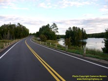

Left - View of Hwy 28 at Big Yirkie Lake, facing east towards Denbigh. See an
Enlarged Photo Here. (Photograph taken on September 1, 2012 - © Cameron Bevers) Right - Reverse curve on Hwy 28 about 1 km west of Denbigh, facing west approaching Addington Road 7. See an Enlarged Photo Here. (Photograph taken on September 1, 2012 - © Cameron Bevers) 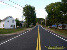
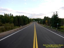
Left - Approaching Denbigh on Hwy 28, facing east. After a long journey across Central and Eastern Ontario, Hwy 28 comes to an end in Denbigh. See an
Enlarged Photo Here. (Photograph taken on September 1, 2012 - © Cameron Bevers) Right - Departing from Denbigh on Hwy 28, facing west towards Hardwood Lake. See an Enlarged Photo Here. (Photograph taken on September 1, 2012 - © Cameron Bevers) 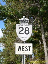
Above - An older King's Highway 28 route marker in Denbigh. See an
Enlarged Photo Here. (Photograph taken on September 1, 2012 - © Cameron Bevers) 

Left - Facing west along Hwy 28 From Lane Street in Denbigh. See an
Enlarged Photo Here. (Photograph taken on September 1, 2012 - © Cameron Bevers) Right - Facing west along Hwy 28 from Bridge Street (Old Hwy 41) in Denbigh. See an Enlarged Photo Here. (Photograph taken on September 1, 2012 - © Cameron Bevers) 
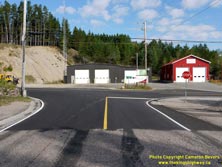
Left - Approaching the Hwy 28 Junction on Old Hwy 41 (Bridge Street) in Denbigh. See an
Enlarged Photo Here. (Photograph taken on September 2, 2012 - © Cameron Bevers) Right - Junction of Old Hwy 41 and Hwy 28 in Denbigh. Up until 1969, the route of Hwy 41 turned right at this intersection and continued north towards Eganville and Pembroke along the route of today's Hwy 28. At left, Hwy 28 continues west from Bridge Street in Denbigh towards Hardwood Lake and Bancroft. See an Enlarged Photo Here. (Photograph taken on September 2, 2012 - © Cameron Bevers) 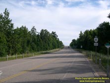

Left - Facing south along Hwy 41 towards Kaladar from the Hwy 28 Junction at Denbigh. See an
Enlarged Photo Here. (Photograph taken on August 4, 2008 - © Cameron Bevers) Right - Approaching the Hwy 28 Junction on northbound Hwy 41 at Denbigh. See an Enlarged Photo Here. (Photograph taken on August 4, 2008 - © Cameron Bevers) 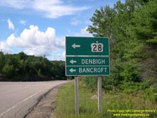
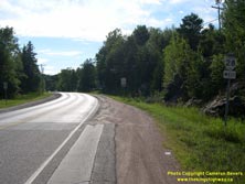
Left - An older green guide sign on northbound Hwy 41 approaching the Hwy 28 Junction at Denbigh. See an
Enlarged Photo Here. (Photograph taken on August 4, 2008 - © Cameron Bevers) Right - Facing west along Hwy 28 towards Bancroft from the Hwy 41 Junction at Denbigh. This highway continues west for 60 km to Bancroft, before swinging south towards Peterborough. See an Enlarged Photo Here. (Photograph taken on August 4, 2008 - © Cameron Bevers) 

Left - Eastern terminus of Hwy 28 at the Hwy 41 Junction at Denbigh. Until the late 1990s, the route of Hwy 28 extended all the way to Port Hope, about 100 km
east of Toronto. Although the southern section of Hwy 28 from Port Hope to the Peterborough area was downloaded in 1997-1998, Hwy 28 still remains one of Central
Ontario's longest King's Highways. See an Enlarged Photo Here. (Photograph taken on August 4, 2008 - © Cameron Bevers) Right - Guide signs at the Hwy 28 & Hwy 41 Junction at Denbigh. See an Enlarged Photo Here. (Photograph taken on August 4, 2008 - © Cameron Bevers) 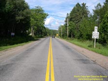
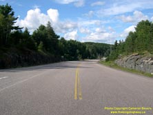
Left - Approaching the Hwy 41 Junction at the end of Hwy 28 in Denbigh. Originally, this section of Hwy 28 was actually a part of Hwy 41. During the 1960s, the
community of Denbigh was bypassed by a new Hwy 41 alignment east of town. A portion of the old section of Hwy 41 through Denbigh was renumbered as Hwy 500, which was
subsequently re-designated as Hwy 28 in 1982. See an Enlarged Photo Here. (Photograph taken on August 4, 2008 - © Cameron Bevers) Right - Facing north along Hwy 41 towards Griffith from the Hwy 28 Junction at Denbigh. See an Enlarged Photo Here. (Photograph taken on August 4, 2008 - © Cameron Bevers) 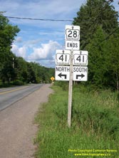
Above - Junction sign assembly at the end of Hwy 28 at the Hwy 41 Junction at Denbigh. See an
Enlarged Photo Here. (Photograph taken on August 4, 2008 - © Cameron Bevers) 

Left - Approaching the Hwy 28 Junction on Hwy 41 at Denbigh, facing south. See an
Enlarged Photo Here. (Photograph taken on September 2, 2012 - © Cameron Bevers) Right - Junction sign assembly on southbound Hwy 41 approaching the Hwy 28 Junction at Denbigh. See an Enlarged Photo Here. (Photograph taken on September 2, 2012 - © Cameron Bevers)
More King's Highway 28 Photographs Coming Soon!
|
|---|
Links to Adjacent King's Highway Photograph Pages:
Back to King's Highway 27 Photos /
King's Highway 28 History /
Back to King's Highway 29 Photos
Ontario Highway History - Main Menu / Back to List of Highways Website contents, photos & text © 2002-2025, Cameron
Bevers (Webmaster) - All Rights Reserved / Contact Me |
|---|