
| 
| |
|
|
This page contains historical and present day photos of Ontario's King's Highway 32. All photographs displayed on this page
were taken by the Webmaster (Cameron Bevers), unless specifically noted otherwise. Historical photographs are arranged in approximate chronological order, while
present day photographs (Year 2000 to date) are arranged by location from south to north. Click on any thumbnail to see a larger image!
Please note that all photographs displayed on this
website are protected by copyright. These photographs must not be reproduced, published,
electronically stored or copied, distributed, or posted onto other websites without
my written permission. If you want to use photos from this website, please
email me first for permission. Thank-you!
|
|---|
|
Historical King's Highway 32 Photographs

Above - Circa 1958 postcard view of King Street (Hwy 2) facing east from Stone Street (Hwy 32) in Downtown Gananoque. See an
Enlarged Photo Here. Photo taken circa 1958. (Photo courtesy of The Gananoque Reporter, Gananoque) 
Above - Circa 1965 postcard view of the Hwy 2 & Hwy 32 Junction in Downtown Gananoque, facing east. See an
Enlarged Photo Here. Photo taken circa 1965. (Photo courtesy of the Gananoque Reporter, Gananoque) |
|---|
|
Present Day King's Highway 32 Photographs


Left - Facing east along Hwy 2 (King Street) from the Hwy 32 Junction in Downtown Gananoque. See an
Enlarged Photo here. (Photograph taken on July 2, 2012 - © Cameron Bevers) Right - Facing east along Hwy 2 (King Street) in Downtown Gananoque, approaching the Hwy 32 Junction. See an Enlarged Photo here. (Photograph taken on July 2, 2012 - © Cameron Bevers) 

Left - Junction route marker assembly on Eastbound Hwy 2 approaching the Hwy 32 Junction in Downtown Gananoque. See an
Enlarged Photo here. (Photograph taken on July 2, 2012 - © Cameron Bevers) Right - King's Highway 2 route marker on King Street in Downtown Gananoque, facing west from the Hwy 32 Junction. See an Enlarged Photo here. (Photograph taken on July 2, 2012 - © Cameron Bevers) 

Left - Facing east along Hwy 2 (King Street) at the Hwy 32 Junction in Downtown Gananoque. See an
Enlarged Photo here. (Photograph taken on July 2, 2012 - © Cameron Bevers) Right - Hwy 32 (Stone Street), facing north from the Hwy 2 Junction. From Gananoque, Hwy 32 heads north for roughly 20 km, where it connects to Hwy 15 near Seeleys Bay. Hwy 32 also forms the main access route into Downtown Gananoque from Hwy 401. See an Enlarged Photo here. (Photograph taken on July 2, 2012 - © Cameron Bevers) 

Left - Southern terminus of Hwy 32 at the Hwy 2 Junction in Downtown Gananoque. These two highways have met at this location since Hwy 32 was first designated
as a new provincial highway in 1929. Although the route of Hwy 32 ends here, Stone Street continues south towards Gananoque's waterfront. See an
Enlarged Photo here. (Photograph taken on July 2, 2012 - © Cameron Bevers) Right - Facing west along Hwy 2 (King Street) at the Hwy 32 Junction in Downtown Gananoque. See an Enlarged Photo here. (Photograph taken on July 2, 2012 - © Cameron Bevers) 

Left - Junction route marker assembly at the southern terminus of Hwy 32 at the Hwy 2 Junction in Downtown Gananoque. See an
Enlarged Photo here. (Photograph taken on July 2, 2012 - © Cameron Bevers) Right - King's Highway 2 route marker on King Street in Downtown Gananoque, facing east from the Hwy 32 Junction. See an Enlarged Photo here. (Photograph taken on July 2, 2012 - © Cameron Bevers) 

Left - Western side of the Hwy 32 Overpass (Site #16-101) on Hwy 401 in Gananoque. This single-span concrete rigid frame structure was constructed under
Contract #1956-130 and was completed in 1958. The designer's thoughtful use of curved lines on the wing walls and barriers complement the overall arched design of the
superstructure. The Hwy 32 Overpass is one of the most aesthetically-pleasing structures along Hwy 401. See an
Enlarged Photo Here. (Photograph taken on July 31, 2005 - © Cameron Bevers) Right - Facing north towards Seeleys Bay at the Hwy 32 Overpass on Hwy 401 in Gananoque. See an Enlarged Photo Here. (Photograph taken on July 31, 2005 - © Cameron Bevers) 

Left - Facing south across the Hwy 32 Overpass on Hwy 401 towards Downtown Gananoque. See an
Enlarged Photo Here. (Photograph taken on July 31, 2005 - © Cameron Bevers) Right - Eastern side of the Hwy 32 Overpass on Hwy 401 in Gananoque. See an Enlarged Photo Here. (Photograph taken on July 31, 2005 - © Cameron Bevers) 

Left - Close-up of the unusual concrete bar-and-post bridge handrails on the Hwy 32 Overpass on Hwy 401. While many highway bridges were built between the
1940s and 1960s with the standard single bar-and-post handrail, a small number of bridges were constructed with a triple concrete bar like this example here. This
handrail design never saw widespread use on Ontario's provincial highway bridges, but was used on some municipal road bridges from this era. See an
Enlarged Photo Here. (Photograph taken on July 31, 2005 - © Cameron Bevers) Right - The design of the Hwy 32 Overpass is among the most unusual of all of the structures located along Hwy 401. The four wing walls of the bridge are stylishly streamlined into the bridge's handrails. Only one other bridge along Hwy 401 features this interesting design treatment. The other example is located at the Sydenham Road (Old Hwy 38) Interchange in Kingston, which was most likely designed by the same structural engineer. See an Enlarged Photo Here. (Photograph taken on July 31, 2005 - © Cameron Bevers) 

Left - Facing east along Hwy 401 towards Brockville from the Hwy 32 Overpass in Gananoque. The first construction contract for the Gananoque Bypass section of
Hwy 401 was awarded in October 1955, for seven miles of dual highway grading from Gananoque westerly under Contract #1955-198. Granular base and final paving took
place under Contract #1958-121. After nearly 4 years of construction, the Gananoque Bypass was completed and officially opened to traffic between Joyceville Road
located in Frontenac County and the Hwy 2 Interchange located at Gananoque's eastern entrance on August 6, 1959. The Gananoque Bypass was constructed at a cost of
$4,965,000 (in 1959 Dollars), the equivalent of about $50 Million in 2023 Dollars. See an
Enlarged Photo Here. (Photograph taken on July 31, 2005 - © Cameron Bevers) Right - Northern approach to the Canadian National Railway (CNR) Subway on Hwy 32, facing south towards Gananoque. See an Enlarged Photo here. (Photograph taken on July 31, 2005 - © Cameron Bevers) 

Left - Low clearance CNR Subway on Hwy 32 north of Gananoque, facing south. See an
Enlarged Photo here. (Photograph taken on July 31, 2005 - © Cameron Bevers) Right - Facing north along Hwy 32 at the CNR Subway. This 19th-century railway bridge north of Gananoque also spans the adjacent Gananoque River. The bridge is located on a sharp horizontal curve in the highway. See an Enlarged Photo here. (Photograph taken on July 31, 2005 - © Cameron Bevers) 

Left - Unusual Metric/Imperial height warning sign at CNR Subway on Hwy 32. While Ontario's roads are officially Metric, this sign is located on a
highway which is popular with American tourists heading for the Rideau Lakes District from the Ivy Lea International Bridge. These signs were presumably designed to
show both measurements to warn American motorists who may not necessarily understand the Metric height restriction at this low subway. See an
Enlarged Photo here. (Photograph taken on July 31, 2005 - © Cameron Bevers) Right - A modern steel girder was placed on either side of the original steel structural girders of the CNR bridge to protect the bridge from damage in the event of a collision with an overheight vehicle. See an Enlarged Photo here. (Photograph taken on July 31, 2005 - © Cameron Bevers) 

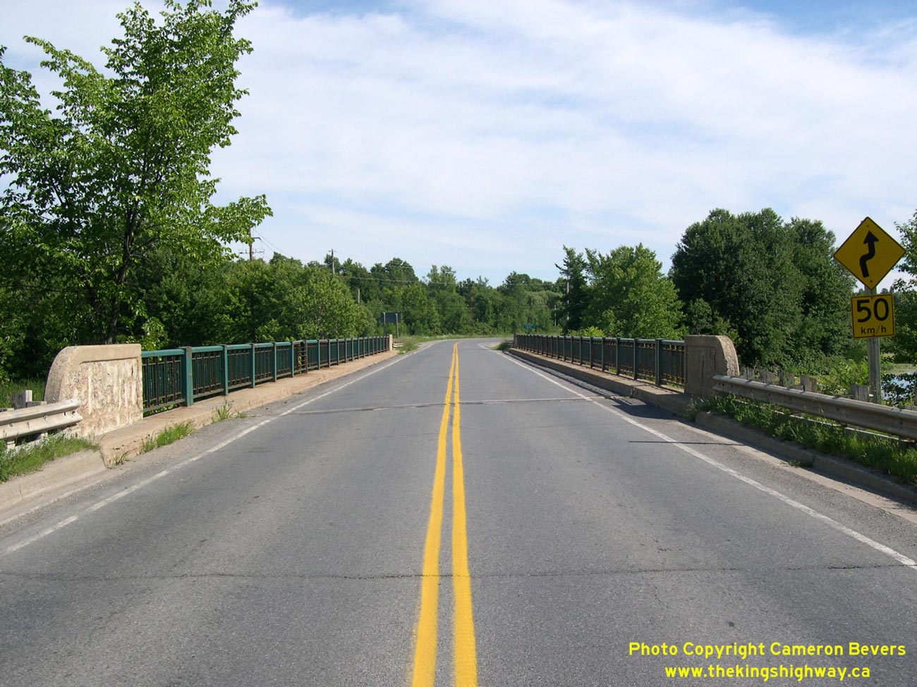
Left - Facing north along Hwy 32 at the Gananoque River Bridge. See an
Enlarged Photo here. (Photograph taken on July 31, 2005 - © Cameron Bevers) Right - Gananoque River Bridge on Hwy 32. Structure completed in 1961. See an Enlarged Photo here. (Photograph taken on July 31, 2005 - © Cameron Bevers) 

Left - Western side of the Gananoque River Bridge on Hwy 32. See an
Enlarged Photo here. (Photograph taken on July 31, 2005 - © Cameron Bevers) Right - Facing south along Hwy 32 at the Gananoque River Bridge. See an Enlarged Photo here. (Photograph taken on July 31, 2005 - © Cameron Bevers) 
Above - Bypassed Hwy 32 alignment north of the Gananoque River Bridge. This old section of Hwy 32 was bypassed when a new bridge was built across the Gananoque
River in 1961. This former highway alignment was truncated at both the old bridge site and at the northern end, with access to the current route of Hwy 32 via Maple
Grove Road. Given that both the north and south ends of this former Hwy 32 alignment end at a cul-de-sac, it seems rather appropriate that this former highway
alignment is now called "Turn Around Road". See an Enlarged Photo here. (Photograph taken on July 31, 2005 - © Cameron Bevers)
More King's Highway 32 Photographs Coming Soon!
|
|---|
Links to Adjacent King's Highway Photograph Pages:
Back to King's Highway 31 Photos /
King's Highway 32 History /
On to King's Highway 33 Photos
Ontario Highway History - Main Menu / Back to List of Highways Website contents, photos & text © 2002-2026, Cameron
Bevers (Webmaster) - All Rights Reserved / Contact Me
|
|---|