
| 
|  |
|
|
This page contains present day photos (Year 2000 to date) of Ontario's King's Highway 35, arranged by location from the
Highway 401 Interchange near Newcastle northerly to Orono. All photographs displayed on this page were taken by the Webmaster (Cameron Bevers), unless specifically
noted otherwise. Click on any thumbnail to see a larger image!
Please note that all photographs displayed on this
website are protected by copyright. These photographs must not be reproduced, published,
electronically stored or copied, distributed, or posted onto other websites without
my written permission. If you want to use photos from this website, please
email me first for permission. Thank-you!
|
|---|
|
Page 3: Present Day King's Highway 35 Photographs (Newcastle to Orono)

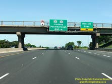
Left - Pre-advance guide sign on eastbound Hwy 401, showing the distance to the Hwy 35 & Hwy 115 Interchange between Bowmanville and Newcastle. See an
Enlarged Photo Here. (Photograph taken on May 29, 2010 - © Cameron Bevers) Right - Bridge-mounted freeway guide signs on eastbound Hwy 401, showing the distance to the upcoming Hwy 35 & Hwy 115 Interchange and the exit sign for Bennett Road. These two interchanges are less than 1 km apart and are located along Hwy 401 between Bowmanville and Newcastle. Compare this present-day photo of the Bennett Road Interchange with this Historic 1967 Photo of the interchange. See an Enlarged Photo Here. (Photograph taken on May 29, 2010 - © Cameron Bevers) 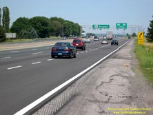

Left - Old overhead signs for the Hwy 35 & Hwy 115 Interchange west of Newcastle. These older overhead freeway signs were likely installed in 1982, as
part of the reconstruction and widening of Hwy 35 & Hwy 115 between Hwy 401 and Hwy 2 near Newcastle. Sadly, this interesting highway sign structure has since
been replaced. See an Enlarged Photo Here. (Photograph taken on July 8, 2006 - © Cameron Bevers) Right - Newer overhead signs on eastbound Hwy 401 marking the Hwy 35 & Hwy 115 Interchange between Bowmanville and Newcastle. This is the last overhead sign structure on Hwy 401 until Kingston. See an Enlarged Photo Here. (Photograph taken on May 29, 2010 - © Cameron Bevers) 
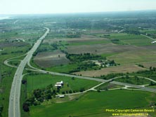
Left - Aerial view of the Hwy 35 & Hwy 115 Interchange on Hwy 401 near Newcastle, facing south. See an
Enlarged Photo Here. (Photograph taken on May 30, 2004 - © Cameron Bevers) Right - Aerial view of the Hwy 35 & Hwy 115 Interchange on Hwy 401, facing west towards Bowmanville. See an Enlarged Photo Here. (Photograph taken on May 30, 2004 - © Cameron Bevers) 

Left - Aerial view of the Hwy 35 & Hwy 115 Interchange on Hwy 401 near Newcastle, facing north. This interchange marks the southern terminus of
Hwy 35 & Hwy 115. See an Enlarged Photo Here. (Photograph taken on May 30, 2004 - © Cameron Bevers) Right - Hwy 35 & Hwy 115 Underpass on Hwy 401 near Newcastle. The southernmost portion of today's Hwy 35 & Hwy 115 was actually a temporary route for Hwy 401 back in 1950s. When the Oshawa-Newcastle section of Hwy 401 first opened in 1952, Hwy 401 curved northeasterly at this point and came to an end at Hwy 2 between Bowmanville and Newcastle. This single-span precast concrete girder structure was originally completed in 1958, as part of a project to extend Hwy 401 easterly from Newcastle towards Port Hope. The new bridge carried the eastern extension of Hwy 401 across the existing route of Hwy 401 (which became today's Hwy 35 & Hwy 115). The easterly extension of Hwy 401 from Newcastle to Port Hope was completed and opened to traffic on June 30, 1960. This bridge was expanded when Hwy 401 was widened from 4 to 6 lanes in the Newcastle area in 1997-1998. See an Enlarged Photo Here. (Photograph taken on September 25, 2020 - © Cameron Bevers) 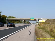

Left - Facing north along Hwy 35 & Hwy 115 towards the Lovekin Road Overpass located just north of the Hwy 401 Interchange near Newcastle. See an
Enlarged Photo Here. (Photograph taken on September 25, 2020 - © Cameron Bevers) Right - Lovekin Road Overpass on Hwy 35 & Hwy 115, facing south towards the Hwy 401 Interchange. This two-span concrete girder structure was completed in 1984. See an Enlarged Photo Here. (Photograph taken on September 25, 2020 - © Cameron Bevers) 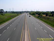
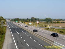
Left - Facing south towards the Hwy 401 Interchange from the Lovekin Road Overpass. Hwy 35 & Hwy 115 both reach their southern termini at Hwy 401 just
ahead. The ramps at the Hwy 401 Interchange serve the predominant traffic movement to and from Toronto. Both entry and exit ramps on the Toronto-oriented side of the
interchange are two-lane ramps, whereas the Kingston-oriented side of the interchange has single lane ramps. The section of Hwy 35 & Hwy 115 seen here
temporarily served as the route for Hwy 401 between 1952 and 1960, until the Newcastle-Port Hope section of Hwy 401 was completed and opened to traffic. See an
Enlarged Photo Here. (Photograph taken on July 9, 2006 - © Cameron Bevers) Right - View of the Lovekin Road Interchange on Hwy 35 & Hwy 115. Between Newcastle and Enterprise Hill, Hwy 35 & Hwy 115 is a limited-access divided highway with periodic grade separations and interchanges. The Hwy 2 Interchange can be seen in the distance. There is limited spacing between the Lovekin Road Interchange and the Hwy 2 & Hwy 401 Interchanges lying to the north and south, respectively. As a result, continuous auxiliary lanes were provided in both directions along Hwy 35 & Hwy 115 between Hwy 401 and Hwy 2, effectively creating a six-lane cross section for about 1 km. See an Enlarged Photo Here. (Photograph taken on September 25, 2020 - © Cameron Bevers) 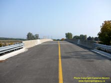

Left - Facing east across the Lovekin Road Overpass on Hwy 35 & Hwy 115 near Newcastle. See an
Enlarged Photo Here. (Photograph taken on September 25, 2020 - © Cameron Bevers) Right - Date stamp (1984) and structure identification number (Site #21-437) on the Lovekin Road Overpass on Hwy 35 & Hwy 115. See an Enlarged Photo Here. (Photograph taken on September 25, 2020 - © Cameron Bevers) 
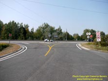
Left - Green-and-white trailblazer route markers for Hwy 35 & Hwy 115 on Lovekin Road. Due to the complex configuration of partial expressway interchanges,
service roads and flyover/underpass connections along Hwy 35 & Hwy 115, these green-and-white trailblazer markers are a common sight anywhere adjacent to the
highway corridor. See an Enlarged Photo Here. (Photograph taken on September 25, 2020 - © Cameron Bevers) Right - View of the expressway ramps at Lovekin Road on Hwy 35 & Hwy 115. These small on-and-off ramps are typical for most of the lower-volume roads intersecting with the Hwy 35 & Hwy 115 corridor between Newcastle and Enterprise Hill. Only major interchanges such as Hwy 2 and Taunton Road feature more typical freeway ramp configurations. See an Enlarged Photo Here. (Photograph taken on September 25, 2020 - © Cameron Bevers) 
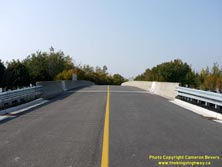
Left - Facing north along Hwy 35 & Hwy 115 towards the Hwy 2 Interchange from the Lovekin Road Overpass. When the Oshawa-Newcastle section of Hwy 401 was
first opened to traffic in 1952, the freeway terminated temporarily at Hwy 2 about 1 km ahead. Initially, Hwy 401 ended at an at-grade T-intersection with Hwy 2. A
grade-separated interchange was built at Hwy 2 in 1955, in conjunction with the opening of the Newcastle Diversion (today's Hwy 35 & Hwy 115). See an
Enlarged Photo Here. (Photograph taken on July 9, 2006 - © Cameron Bevers) Right - Facing west across the Lovekin Road Overpass on Hwy 35 & Hwy 115 near Newcastle. See an Enlarged Photo Here. (Photograph taken on September 25, 2020 - © Cameron Bevers) 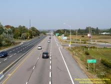
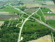
Left - Facing north along Hwy 35 & Hwy 115 showing the ramp configuration at Lovekin Road. See an
Enlarged Photo Here. (Photograph taken on September 25, 2020 - © Cameron Bevers) Right - Aerial view of the Hwy 2 Interchange on Hwy 35 & Hwy 115, facing west towards Bowmanville. See an Enlarged Photo Here. (Photograph taken on May 30, 2004 - © Cameron Bevers) 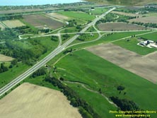

Left - Aerial view of the Hwy 2 Interchange on Hwy 35 & Hwy 115 near Newcastle, facing south. Originally, these interchange ramps were in a "Parclo A-2"
configuration. The Hwy 2 Interchange was converted into a diamond interchange when Hwy 35 & Hwy 115 was widened from two to four lanes in 1982. See an
Enlarged Photo Here. (Photograph taken on May 30, 2004 - © Cameron Bevers) Right - Green guide sign on eastbound Hwy 2 marking the on-ramp to southbound Hwy 35 & Hwy 115. Until recently, the southbound on-ramp was just marked "TO 401". See an Enlarged Photo Here. (Photograph taken on July 9, 2006 - © Cameron Bevers) 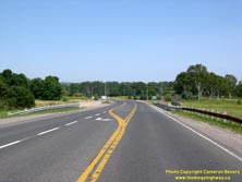
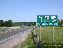
Left - Facing east towards Newcastle at the Hwy 2 Overpass on Hwy 35 & Hwy 115. See an
Enlarged Photo Here. (Photograph taken on July 9, 2006 - © Cameron Bevers) Right - Green guide sign on eastbound Hwy 2 marking the on-ramp to northbound Hwy 35 & Hwy 115. See an Enlarged Photo Here. (Photograph taken on July 9, 2006 - © Cameron Bevers) 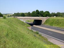
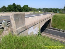
Left - Southern side of the Hwy 2 Overpass on Hwy 35 & Hwy 115 west of Newcastle. This single-span concrete rigid frame structure was completed in 1955.
See an Enlarged Photo Here. (Photograph taken on July 9, 2006 - © Cameron Bevers) Right - The Hwy 2 Overpass originally had a steel handrail. During the 1980s, the bridge was rehabilitated and the steel portions of the handrail were removed, leaving only the curved concrete handrails on the bridge approaches. A newer concrete parapet wall was installed just inside the original handrail. See an Enlarged Photo Here. (Photograph taken on July 9, 2006 - © Cameron Bevers) 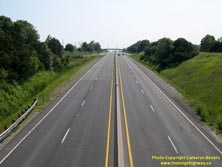
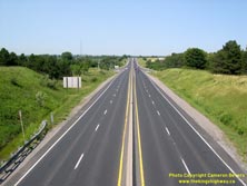
Left - Facing south along Hwy 35 & Hwy 115 towards the Hwy 401 Interchange from the Hwy 2 Overpass west of Newcastle. At one time, this interchange marked
the common terminus of three major Ontario highways - Hwy 35, Hwy 115 & Hwy 401 all ended at this point until 1960. Once Hwy 401 was completed and opened to
traffic between Newcastle and Port Hope in 1960, the temporary Hwy 401 connection to Hwy 2 seen here became a southerly extension of Hwy 35 & Hwy 115. See an
Enlarged Photo Here. (Photograph taken on July 9, 2006 - © Cameron Bevers) Right - View of the Newcastle Diversion (Hwy 35 & Hwy 115) facing north towards Orono from the Hwy 2 Overpass. The 3 km Newcastle Diversion was completed in 1955. The new highway offered motorists a convenient and much more direct connection between Hwy 401 and the existing route of Hwy 35 between Newcastle and Orono. See an Enlarged Photo Here. (Photograph taken on July 9, 2006 - © Cameron Bevers) 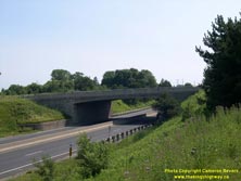
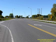
Left - Northern side of the Hwy 2 Overpass on Hwy 35 & Hwy 115 near Newcastle. See an
Enlarged Photo Here. (Photograph taken on July 9, 2006 - © Cameron Bevers) Right - Facing west along Hwy 2 approaching the Hwy 35 & Hwy 115 Interchange west of Newcastle. See an Enlarged Photo Here. (Photograph taken on September 24, 2016 - © Cameron Bevers) 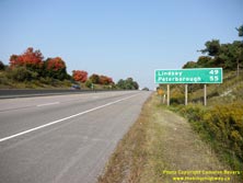
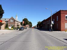
Left - Distance guide sign on northbound Hwy 35 & Hwy 115 near the Hwy 2 Interchange west of Newcastle. See an
Enlarged Photo Here. (Photograph taken on September 25, 2020 - © Cameron Bevers) Right - Facing east along King Avenue (Hwy 2) towards Mill Street (Old Hwy 35) in Downtown Newcastle. Hwy 2 passes through numerous town centres along its route across Ontario. At one time, Hwy 2 was the province's main east-west traffic artery. The function on Hwy 2 as a through highway in Central and Eastern Ontario was greatly diminished once the various phases of Hwy 401 were completed and opened to traffic between 1947 and 1968. See an Enlarged Photo Here. (Photograph taken on September 24, 2016 - © Cameron Bevers) 

Left - Facing west towards Oshawa along King Avenue (Hwy 2) from Mill Street (Old Hwy 35) in Downtown Newcastle. See an
Enlarged Photo Here. (Photograph taken on September 24, 2016 - © Cameron Bevers) Right - Facing north along Mill Street (Old Hwy 35) from King Avenue (Hwy 2) in Newcastle. For many years, Hwy 35 ended in Downtown Newcastle. However, in the mid-1950s, a diversion was completed along the western side of Newcastle which bypassed the town entirely. The old route of Hwy 35 from the Newcastle Diversion to Hwy 2 ceased to be a provincial highway in 1955. Today, the old route of Hwy 35 is known as Durham Road 17 (Mill Street). See an Enlarged Photo Here. (Photograph taken on September 24, 2016 - © Cameron Bevers) 

Left - Approaching King Avenue (Hwy 2) on Mill Street (Old Hwy 35), facing south. From 1938 until 1955, this intersection marked the southern terminus of
Hwy 35. Today, Hwy 35 ends alongside Hwy 115 at the Hwy 401 Interchange about 3 km west of Newcastle. See an
Enlarged Photo Here. (Photograph taken on September 24, 2016 - © Cameron Bevers) Right - Facing west along King Avenue (Hwy 2) at Mill Street (Old Hwy 35) in Downtown Newcastle. See an Enlarged Photo Here. (Photograph taken on September 24, 2016 - © Cameron Bevers) 
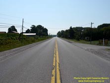
Left - Facing east towards Port Hope along King Avenue (Hwy 2) from Mill Street (Old Hwy 35) in Downtown Newcastle. See an
Enlarged Photo Here. (Photograph taken on September 24, 2016 - © Cameron Bevers) Right - Facing south along Durham Road 17 (Old Hwy 35) towards Newcastle from the Newcastle Diversion (the current route of Hwy 35 & Hwy 115) south of Orono. This bypassed section of Hwy 35 carried through traffic from Newcastle to Lindsay from 1938 up until the mid-1950s. In 1955, the Newcastle Diversion was completed and opened to traffic. This new route for Hwy 35 & Hwy 115 allowed through traffic to access Hwy 401 directly without having to pass through Downtown Newcastle. See an Enlarged Photo Here. (Photograph taken on August 25, 2012 - © Cameron Bevers) 

Left - Approaching the interchange with the Newcastle Diversion on Durham Road 17 (Old Hwy 35), facing north. Originally, Hwy 35 continued straight ahead
towards Orono and Lindsay through the present-day site of the McDonald's Restaurant seen in the background. Once the Newcastle Diversion opened in 1955, traffic on
Hwy 35 & Hwy 115 curved southwesterly towards Hwy 401 rather than pass through nearby Newcastle. Durham Road 17 was an at-grade intersection along Hwy 35 &
Hwy 115 up until the mid-1980s, when an underpass and interchange ramps were built. See an
Enlarged Photo Here. (Photograph taken on August 25, 2012 - © Cameron Bevers) Right - Facing north along Hwy 35 & Hwy 115 at the Durham Road 17 Interchange. This is the first of four highway commercial strips situated along Hwy 35 & Hwy 115 between Newcastle and Enterprise Hill. The highway commercial strip extending north from Durham Road 17 at Newcastle is the longest of the four, with many restaurants and gas stations lining the highway. At one time, this was only a two-lane highway. Intersection improvements were carried out here in 1979, which included a new two-way centre left turn lane. This turned out to be an interim improvement only, as the highway was expanded from two to four lanes in 1984-1985, along with the construction of a new centre median barrier and interchanges. See an Enlarged Photo Here. (Photograph taken on August 25, 2012 - © Cameron Bevers) 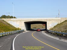
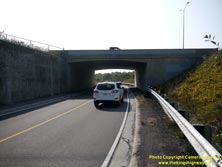
Left - Western side of the Durham Road 17 Underpass on Hwy 35 & Hwy 115 north of Newcastle. When Hwy 35 & Hwy 115 was expanded to four lanes and
converted into a divided highway in the 1980s, a series of grade separations were built in order to carry cross traffic above or below the expressway. This was done
to avoid having to install traffic signals along the highway corridor and thereby keep through traffic moving. By the late 1970s and early 1980s, many of the
intersections along Hwy 35 & Hwy 115 had met the engineering warrants for traffic signal installation. Thanks to the foresight of Ministry of Transportation
planners who decided to grade-separate these crossing roads, Hwy 35 & Hwy 115 operates fairly efficiently as a high-capacity arterial expressway. Had these grade
separations not been provided, the highway corridor would have just become another signal-choked urban street. See an
Enlarged Photo Here. (Photograph taken on September 25, 2020 - © Cameron Bevers) Right - Durham Road 17 Underpass on Hwy 35 & Hwy 115 near Newcastle, facing west. Note the large retaining wall at left. See an Enlarged Photo Here. (Photograph taken on September 25, 2020 - © Cameron Bevers) 

Left - Date stamp (1984) and structure identification number (Site #21-429) on the Durham Road 17 Underpass on Hwy 35 & Hwy 115. See an
Enlarged Photo Here. (Photograph taken on September 25, 2020 - © Cameron Bevers) Right - Facing south along Hwy 35 & Hwy 115 at the Durham Road 17 Underpass near Newcastle. See an Enlarged Photo Here. (Photograph taken on September 25, 2020 - © Cameron Bevers) 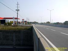

Left - View of Hwy 35 & Hwy 115, facing south from the Durham Road 17 Interchange. When this section of Hwy 35 was first assumed as a provincial highway in
the 1930s, the highway went through the present-day location of the McDonald's Restaurant in the background on its route south towards Newcastle. The Newcastle
Diversion was opened to traffic in 1955, which diverted traffic on Hwy 35 & Hwy 115 away from Newcastle and provided a direct connection to Hwy 401. Today, Hwy 35
& Hwy 115 seamlessly curves to the right at the McDonald's, leaving no trace of the old 1930s route anywhere immediately adjacent to the expressway. The balance
of Old Hwy 35 from this point southerly to Newcastle is now known as Durham Road 17. See an
Enlarged Photo Here. (Photograph taken on September 25, 2020 - © Cameron Bevers) Right - Facing north along Hwy 35 & Hwy 115 from the Durham Road 17 Interchange towards Orono. The highway commercial strip near Newcastle is one of the original sections of Hwy 35. The Department of Highways of Ontario (DHO) assumed jurisdiction over the Newcastle-Lindsay Road as a southerly extension of Hwy 35 in April, 1938. Almost two-thirds of the original 1930s highway alignment between Newcastle and Enterprise Hill was bypassed over the years by an improved highway corridor. The sections of the current Hwy 35 & Hwy 115 expressway which still follow the original 1938 highway alignment are fairly obvious and easy to spot today, as these are typically the more built-up sections of the route with highway commercial development on both sides. At the time this section of Hwy 35 was established in 1938, it was very difficult for the DHO to prohibit access to a King's Highway. The Highway Improvement Act was eventually amended to allow for the designation of a "Controlled Access Highway", which empowered the DHO to carefully control (or outright prohibit) local access to a King's Highway. See an Enlarged Photo Here. (Photograph taken on September 25, 2020 - © Cameron Bevers) 
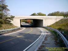
Left - Facing north along Hwy 35 & Hwy 115 from the Durham Road 17 Interchange towards Orono. When the median barrier was constructed in the 1980s, a
chain-link fence was also installed on top of the barrier in an effort to discourage pedestrians from crossing the highway. See an
Enlarged Photo Here. (Photograph taken on September 25, 2020 - © Cameron Bevers) Right - Western side of the Clarke Concession Road 4 Underpass on Hwy 35 & Hwy 115 north of Newcastle. See an Enlarged Photo Here. (Photograph taken on September 25, 2020 - © Cameron Bevers) 
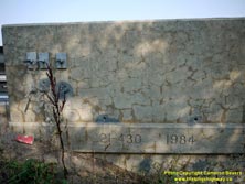
Left - Eastern side of the Clarke Concession Road 4 Underpass on Hwy 35 & Hwy 115 between Newcastle and Orono. See an
Enlarged Photo Here. (Photograph taken on September 25, 2020 - © Cameron Bevers) Right - Date stamp (1984) and structure identification number (Site #21-430) on the Clarke Concession Road 4 Underpass on Hwy 35 & Hwy 115. See an Enlarged Photo Here. (Photograph taken on September 25, 2020 - © Cameron Bevers) 
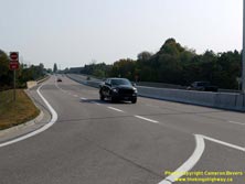
Left - Facing south along Hwy 35 & Hwy 115 towards Newcastle at the Clarke Concession Road 4 Underpass. See an
Enlarged Photo Here. (Photograph taken on September 25, 2020 - © Cameron Bevers) Right - View of Hwy 35 & Hwy 115, facing south from the Clarke Concession Road 4 Interchange towards Newcastle. A short diversion was built here in 1954-1955 to eliminate an awkward offset intersection in the original 1938 route of Hwy 35. The two-lane diversion was expanded to the four-lane expressway seen here in the 1980s. See an Enlarged Photo Here. (Photograph taken on September 25, 2020 - © Cameron Bevers) 

Left - View of Hwy 35 & Hwy 115 facing north from Clarke Concession Road 4 towards Orono. Another short highway commercial strip extends south along the
expressway from Orono. The expansion of Hwy 35 & Hwy 115 to a four-lane divided facility was built in several stages throughout the 1980s. Construction began on
the second phase of the expansion project between the Hwy 2 Interchange and the southern entrance to Orono in late 1983. The four-lane divided highway seen here was
completed in the summer of 1985, supplanting the original two-lane highway. See an
Enlarged Photo Here. (Photograph taken on September 25, 2020 - © Cameron Bevers) Right - Facing south along the Orono Bypass (Hwy 35 & Hwy 115) from the Clarke Concession Road 5 Overpass. Although initially built in the 1950s as a two-lane highway, the Orono Bypass was built as a limited access highway with roadside development strictly-controlled. The newer sections of Hwy 35 & Hwy 115 built after World War II are usually discernible by their near-absence of roadside development. See an Enlarged Photo Here. (Photograph taken on August 25, 2012 - © Cameron Bevers) 

Left - View of the Orono Bypass (Hwy 35 & Hwy 115), facing north from the Clarke Concession Road 5 Overpass. The bypass was built between 1953 and 1955 as
part of a larger construction program to provide a new highway link between Newcastle and Peterborough (Hwy 115). The original two-lane Orono Bypass was expanded to a
four-lane divided arterial expressway in the mid-1980s. See an Enlarged Photo Here. (Photograph taken on August 25, 2012 - © Cameron Bevers) Right - Date stamp (1985) and structure identification number (Site #21-431) on the Clarke Concession Road 5 Overpass on Hwy 35 & Hwy 115. See an Enlarged Photo Here. (Photograph taken on August 25, 2012 - © Cameron Bevers) 

Left - Facing west across the Clarke Concession Road 5 Overpass on Hwy 35 & Hwy 115 in Orono. This overpass provides the main access point to Orono from
northbound Hwy 35 & Hwy 115. The exit ramp itself is actually signed as "Main Street". See an
Enlarged Photo Here. (Photograph taken on August 25, 2012 - © Cameron Bevers) Right - Northern side of the Clarke Concession Road 5 Overpass on Hwy 35 & Hwy 115. This two-span post-tensioned concrete structure was completed in 1985. See an Enlarged Photo Here. (Photograph taken on August 25, 2012 - © Cameron Bevers) 
Above - Dual King's Highway route markers on Hwy 35 & Hwy 115 in Orono. See an
Enlarged Photo Here. (Photograph taken on June 19, 2004 - © Cameron Bevers) 

Left - Facing south along Main Street (Old Hwy 35) at the southern entrance to Orono. At this point, the original 1938 route of Hwy 35 through Orono merges
back in with the current route of Hwy 35 & Hwy 115 (the Orono Bypass). All traffic reaching the end of Main Street in Orono must take southbound Hwy 35 &
Hwy 115 to the Clarke Concession Road 4 Interchange in order to turn around and go northbound towards Lindsay and Peterborough. An alternate access to northbound
Hwy 35 & Hwy 115 is available a short distance to the north by using Concession Road 5 and Station Street. See an
Enlarged Photo Here. (Photograph taken on September 25, 2020 - © Cameron Bevers) Right - Facing north along Old Hwy 35 (Main Street) at the southern entrance to Orono. Up until the mid-1950s, Hwy 35 used to pass directly through Orono. A new bypass was constructed around the eastern side of Orono to keep long-distance through traffic away from the village centre. See an Enlarged Photo Here. (Photograph taken on September 25, 2020 - © Cameron Bevers) 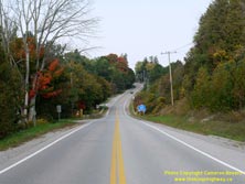
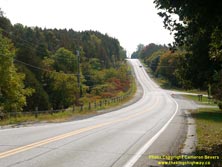
Left - Steep grades on Old Hwy 35 approaching Orono. Although it has been many decades since Main Street was under provincial jurisdiction, the southern
approach to Orono still has the look and feel of an older King's Highway. Jurisdiction over Old Hwy 35 through Orono reverted from the DHO back to local control in
November, 1955. See an Enlarged Photo Here. (Photograph taken on September 25, 2020 - © Cameron Bevers) Right - Facing south along Old Hwy 35 (Main Street) towards Newcastle from Orono. See an Enlarged Photo Here. (Photograph taken on September 25, 2020 - © Cameron Bevers) 
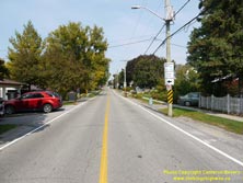
Left - Facing north along Old Hwy 35 (Main Street) from Sommerville Drive in Orono. See an
Enlarged Photo Here. (Photograph taken on September 25, 2020 - © Cameron Bevers) Right - Facing north along Old Hwy 35 (Main Street) from Bowen Street in Orono. The highway's right-of-way was so constrained through Orono that utility poles had to be placed immediately next to the pavement. Even the parked cars in some of the residential driveways nearly encroach out onto Old Hwy 35. Looking at this narrow village street in retrospect, it's actually unfathomable to think that this was once a King's Highway. It's little wonder that the Orono Bypass was constructed as early as it was. See an Enlarged Photo Here. (Photograph taken on September 25, 2020 - © Cameron Bevers) 
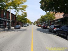
Left - Facing south from Downtown Orono along Old Hwy 35 (Main Street) at Park Street. See an
Enlarged Photo Here. (Photograph taken on September 25, 2020 - © Cameron Bevers) Right - View of Old Hwy 35 (Main Street) in Downtown Orono, facing north from Park Street. Like Newcastle lying to the south, Orono was also bypassed entirely as a result of upgrades made to Hwy 35 during the 1950s. Prior to 1955, through traffic heading between Newcastle and Lindsay had to compete for space with local traffic along Orono's Main Street. See an Enlarged Photo Here. (Photograph taken on September 25, 2020 - © Cameron Bevers) 

Left - Facing south along Old Hwy 35 (Main Street) towards Downtown Orono from Mill Street. See an
Enlarged Photo Here. (Photograph taken on September 25, 2020 - © Cameron Bevers) Right - Facing north along Main Street at Mill Street in Orono. At one time, this badly-skewed intersection used to carry all long-distance through traffic between Newcastle and Lindsay. Up until the completion of the Orono Bypass in 1955, Hwy 35 curved to the right from Main Street onto Mill Street. See an Enlarged Photo Here. (Photograph taken on September 25, 2020 - © Cameron Bevers) 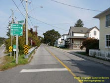

Left - Green guide signs at the intersection of Main Street and Mill Street in Orono. Even today, Old Hwy 35 (Mill Street) still leads north from Downtown
Orono out to Hwy 35 & Hwy 115, but traffic can only proceed southbound due to the ramp configuration along the expressway. Traffic bound for northbound Hwy 35
& Hwy 115 must use the Taunton Road Interchange, which is accessible by continuing north along Main Street. See an
Enlarged Photo Here. (Photograph taken on September 25, 2020 - © Cameron Bevers) Right - Facing south along Old Hwy 35 (Mill Street) approaching Main Street in Orono. Prior to the completion of the Orono Bypass in the mid-1950s, southbound Hwy 35 traffic heading towards Newcastle and Toronto had to turn left onto Main Street at the intersection lying ahead. See an Enlarged Photo Here. (Photograph taken on September 25, 2020 - © Cameron Bevers) 

Left - Facing north along Old Hwy 35 (Mill Street) from Main Street in Orono. This once-busy King's Highway is now just a quiet residential street. See an
Enlarged Photo Here. (Photograph taken on September 25, 2020 - © Cameron Bevers) Right - View of Old Hwy 35 (Mill Street) north of Downtown Orono. It may seem hard to believe that this narrow street was once a King's Highway - but at one time, this was the main route leading north from the Bowmanville and Newcastle area to Lindsay and the Kawartha Lakes region. In the 1940s, the DHO initiated planning for a new highway connection to Peterborough (Hwy 115), which triggered the need to do some fairly significant upgrades to the Hwy 35 corridor through Orono. Construction began on the Orono Bypass (the current route of Hwy 35 & Hwy 115) in 1953. See an Enlarged Photo Here. (Photograph taken on September 25, 2020 - © Cameron Bevers) 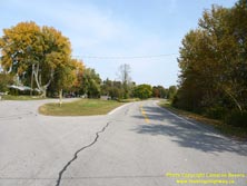
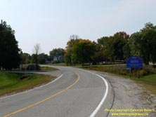
Left - Beginning of the Orono-Kirby Diversion on Old Hwy 35 (Mill Street) departing from Orono. Construction began in 1947 on a major upgrade to Hwy 35 between
Orono and the base of Enterprise Hill. A significant portion of the highway was rebuilt on a brand new alignment with smoother curves and greatly-improved geometry,
including 1 1/4 miles of new highway from Orono northerly. The newer curve at right was completed in 1948, while the original 1938 highway alignment can be seen
at left (Mill Lane). This is the only portion of this late 1940s diversion that is still visible today in its original design state. The majority of the 1948
Diversion was supplanted by the present-day expressway route of Hwy 35 & Hwy 115 in the mid-1980s. See an
Enlarged Photo Here. (Photograph taken on September 25, 2020 - © Cameron Bevers) Right - Facing south along Old Hwy 35 (Mill Street) from the Orono Bypass (today's Hwy 35 & Hwy 115). Although the road itself was removed long ago, the original 1938 alignment of Hwy 35 passed just to the right of the Orono community sign in the foreground. The highway then rounded a sharp curve to the left at Mill Lane. The old highway curve was mostly abandoned in 1948 when the new Orono-Kirby Diversion was completed. A portion of the old 1938 highway serves as a local street (Mill Lane). See an Enlarged Photo Here. (Photograph taken on September 25, 2020 - © Cameron Bevers) 

Left - Mill Street (Old Hwy 35) emerges at the Orono Bypass (Hwy 35 & Hwy 115). Due to the configuration of these expressway ramps, traffic can only head
southbound along Hwy 35 & Hwy 115 towards Newcastle. See an Enlarged Photo Here. (Photograph taken on September 25, 2020 - © Cameron Bevers) Right - A short section of the 1948 Orono-Kirby Diversion was bypassed in 1955, when the Orono Bypass (today's Hwy 35 & Hwy 115) was completed. This abandoned section of Hwy 35 still has a patch of original pavement. The former highway now serves as a private driveway. See an Enlarged Photo Here. (Photograph taken on September 25, 2020 - © Cameron Bevers)
Continue on to King's Highway 35 Photos: Orono to Enterprise Hill
|
|---|
Links to Adjacent King's Highway Photograph Pages:
Back to Hwy 35 - Historical Photos (1980-1999)
Hwy 35 Photo Index
On to Hwy 35 - Orono to Enterprise Hill
Back to King's Highway 34 Photos /
King's Highway 35 History /
Back to King's Highway 36 Photos
Ontario Highway History - Main Menu / Back to List of Highways Website contents, photos & text © 2002-2025, Cameron
Bevers (Webmaster) - All Rights Reserved / Contact Me |
|---|