
| 
| |
|
|
This page contains present day photos (Year 2000 to date) of Ontario's King's Highway 35, arranged by location from the
Highway 115 Interchange at Enterprise Hill northerly to Lindsay. All photographs displayed on this page were taken by the Webmaster (Cameron Bevers), unless
specifically noted otherwise. Click on any thumbnail to see a larger image!
Please note that all photographs displayed on this
website are protected by copyright. These photographs must not be reproduced, published,
electronically stored or copied, distributed, or posted onto other websites without
my written permission. If you want to use photos from this website, please
email me first for permission. Thank-you!
|
|---|
|
Page 5: Present Day King's Highway 35 Photographs (Enterprise Hill to Lindsay)


Left - Sign marking the turn-off to Hwy 35 North at the Hwy 7A Junction near Yelverton. (Photograph taken on September 30, 2007 - © Cameron Bevers) Right - Route marker assembly at the Hwy 7A and Hwy 35 Junction near Yelverton. The two highways run concurrently from this point south for 1.5 km, before Hwy 7A turns east again towards Bethany and Peterborough. (Photograph taken on September 30, 2007 - © Cameron Bevers) 

Left - Approaching the Hwy 35 Junction on Hwy 7A near Yelverton. See an
Enlarged Photo here. (Photograph taken on September 30, 2007 - © Cameron Bevers) Right - Facing north along Hwy 35 towards Lindsay from the Hwy 7A Junction. (Photograph taken on September 30, 2007 - © Cameron Bevers) 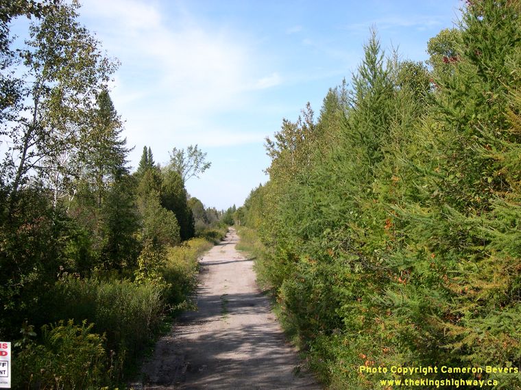
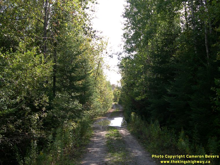
Left - Abandoned Hwy 35 alignment south of Lindsay. This section of Hwy 35 was relocated onto a new alignment in 1957-1958. (Photograph taken on September 30, 2007 - © Cameron Bevers) Right - The original route of Hwy 35 south of Lindsay is now just an ATV trail. It was bypassed over 50 years ago. (Photograph taken on September 30, 2007 - © Cameron Bevers)
Continue on to King's Highway 35 Photos: Lindsay to Coboconk
|
|---|
Links to Adjacent King's Highway Photograph Pages:
Back to King's Highway 34 Photos /
King's Highway 35 History /
Back to King's Highway 36 Photos
Ontario Highway History - Main Menu / Back to List of Highways Website contents, photos & text © 2002-2026, Cameron
Bevers (Webmaster) - All Rights Reserved / Contact Me
|
|---|