
| 
| |
|
|
This page contains present day photos (Year 2000 to date) of Ontario's King's Highway 3, arranged by location from Windsor
easterly to Wheatley. All photographs displayed on this page were taken by the Webmaster (Cameron Bevers), unless specifically noted otherwise. Click on any
thumbnail to see a larger image!
Please note that all photographs displayed on this
website are protected by copyright. These photographs must not be reproduced, published,
electronically stored or copied, distributed, or posted onto other websites without
my written permission. If you want to use photos from this website, please
email me first for permission. Thank-you!
|
|---|
|
Page 2: Present Day King's Highway 3 Photographs (Windsor to Wheatley)


Left - Sign marking the western terminus of Hwy 401 at the Hwy 3 Interchange in Windsor. From this point, it is approximately 11 km to the Ambassador Bridge to
Detroit, Michigan. For the time being, all traffic reaching the end of Hwy 401 at Windsor must follow Hwy 3 and Huron Church Road to reach the Ambassador Bridge.
However, the design for a new Detroit-Windsor Gateway is now complete. This elaborate plan will include an extension of Hwy 401 along the proposed Windsor-Essex
Parkway to a new International Bridge crossing south of Windsor. The first construction contracts for the new bridge and the associated highway improvements needed to
connect Hwy 401 directly to Michigan's Interstate 75 will be awarded in 2009-2010. See an
Enlarged Photo Here. (Photograph taken on December 5, 2004 - © Cameron Bevers) Right - Western terminus of Hwy 401 at the Hwy 3 Interchange in Windsor. At this point, eastbound traffic may take either Hwy 3 to Essex and Leamington (right lanes) or Hwy 401 to London (left lanes). The overpass in the background carries westbound Hwy 3 traffic from Essex and Leamington across the dual lanes of Hwy 401. See an Enlarged Photo Here. (Photograph taken on December 5, 2004 - © Cameron Bevers) 

Left - Hwy 3 Overpass across Hwy 401 in Windsor. This is the very first bridge on Hwy 401 heading west out of Windsor. This two-span concrete rigid frame
girder structure was completed in 1956. See an Enlarged Photo Here. (Photograph taken on August 4, 2007 - © Cameron Bevers) Right - Facing west along Hwy 401 from the Hwy 3 Overpass. The official western terminus of Hwy 401 is roughly 390 metres from the Hwy 3 Overpass. The highway ends just beyond this curve where it merges with the westbound lanes of Hwy 3 coming from Essex and Leamington. See an Enlarged Photo Here. (Photograph taken on December 5, 2004 - © Cameron Bevers) 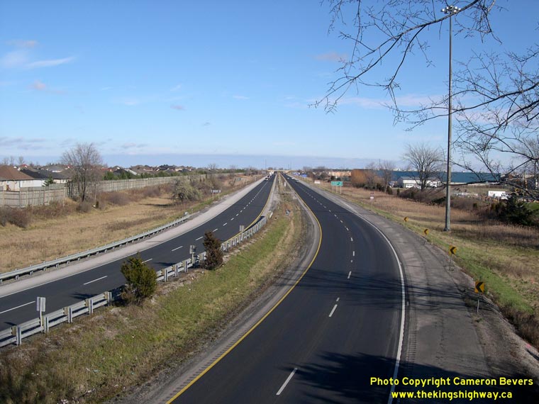

Left - Facing east along Hwy 401 from the Hwy 3 Overpass. This is the first freeway interchange on Hwy 401 when leaving Windsor. Although the Hwy 3 Interchange
does not have a posted interchange number, it is at the 11 km mark. All mileages along Hwy 401 are based on their distance from the Ambassador Bridge in Windsor, even
though the actual terminus of Hwy 401 is at the Hwy 3 Interchange, located 11 km from the Ambassador Bridge. Measuring 818 km in length, Hwy 401 is by far Ontario's
longest and most important freeway corridor. The highway connects most major cities and towns in Southern, Central and Eastern Ontario together. See an
Enlarged Photo Here. (Photograph taken on December 5, 2004 - © Cameron Bevers) Right - Facing west across the Hwy 3 Overpass at the Hwy 401 Interchange in Windsor. See an Enlarged Photo Here. (Photograph taken on December 5, 2004 - © Cameron Bevers) 
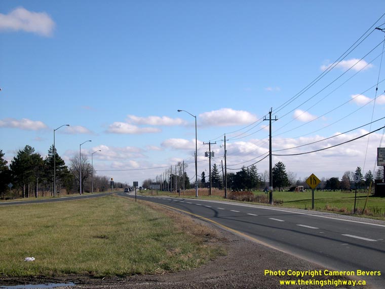
Left - Facing east along Hwy 3 towards Leamington from the Hwy 401 Interchange in Windsor. The at-grade intersection in the foreground is Outer Drive, which
was extensively reconfigured in 2005/2006. The divided portion of Hwy 3 ends just beyond Outer Drive. The highway continues east towards Essex and Leamington as a
two-lane highway, although plans are now in place to convert most of Hwy 3 from Windsor to Essex into a four-lane arterial facility. See an
Enlarged Photo Here. Right - Facing east along Hwy 3 towards the end of the divided highway between Windsor and Oldcastle. See an Enlarged Photo Here. (Photograph taken on December 5, 2004 - © Cameron Bevers) 
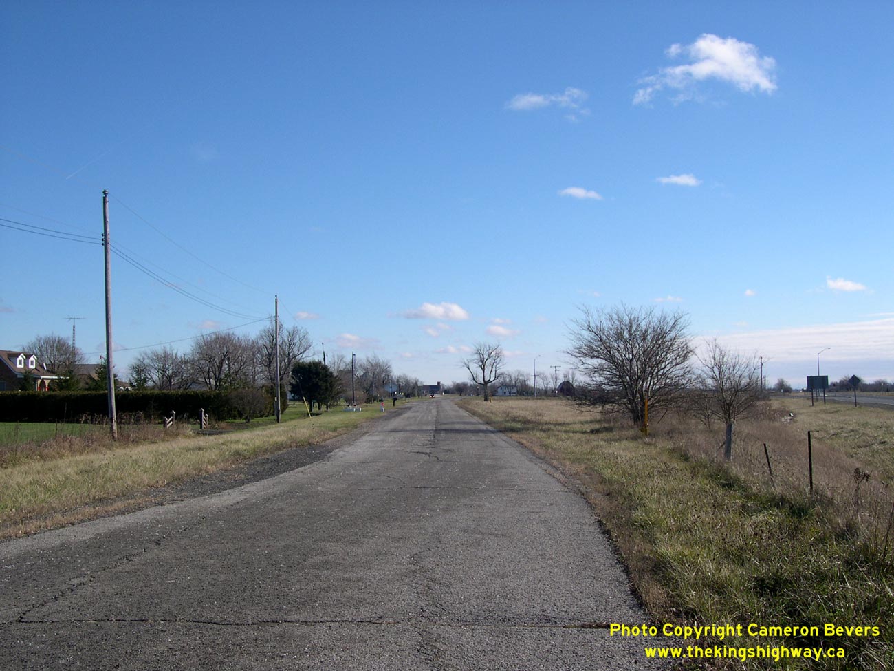
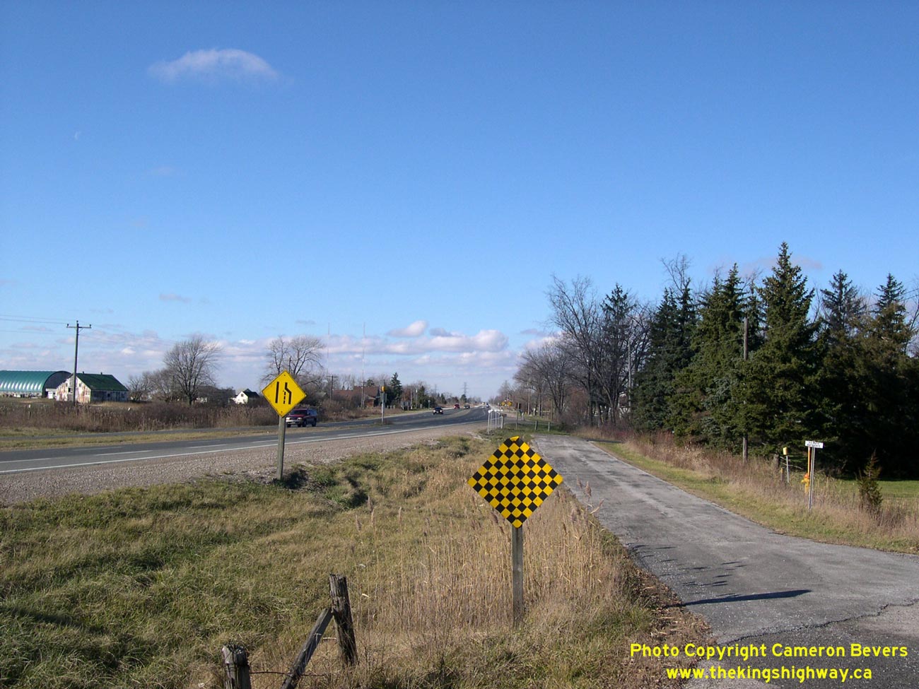
Left - Old Hwy 3 alignment west of Maidstone, made obsolete by the completion of the Essex Bypass in the 1970s. See an
Enlarged Photo Here. (Photograph taken on December 5, 2004 - © Cameron Bevers) Right - Another view of Old Hwy 3, facing west towards Windsor. Note the newer Essex Bypass at left. See an Enlarged Photo Here. (Photograph taken on December 5, 2004 - © Cameron Bevers) 

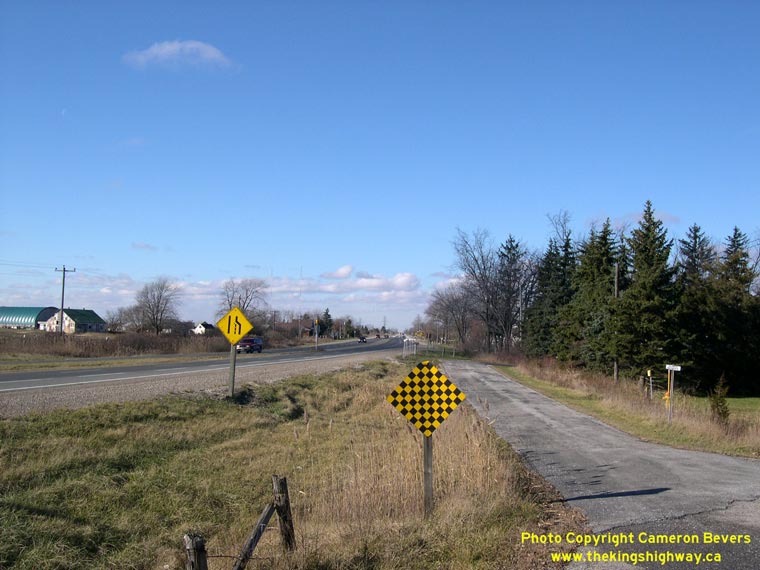
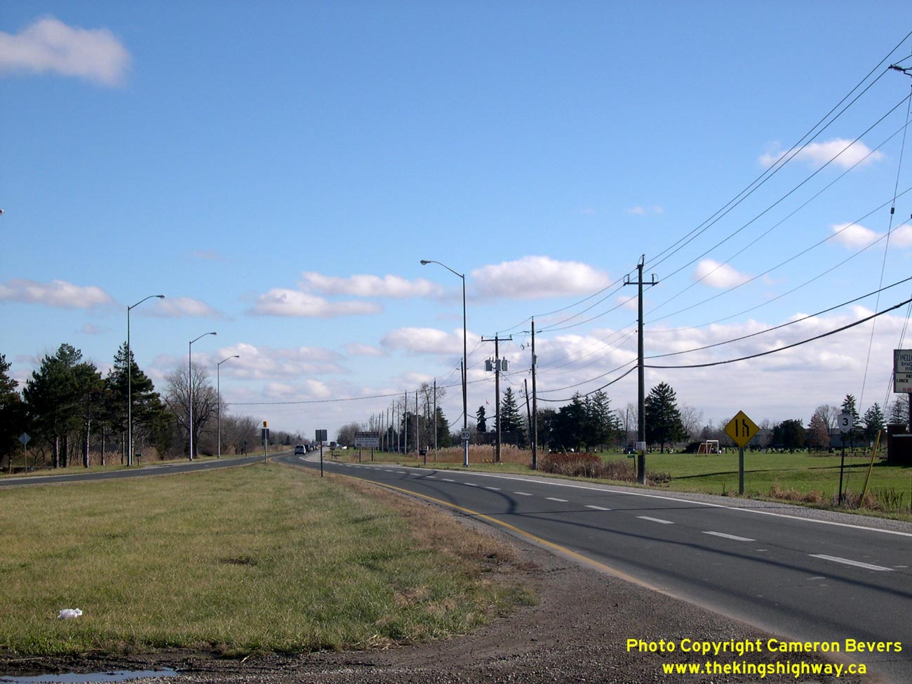
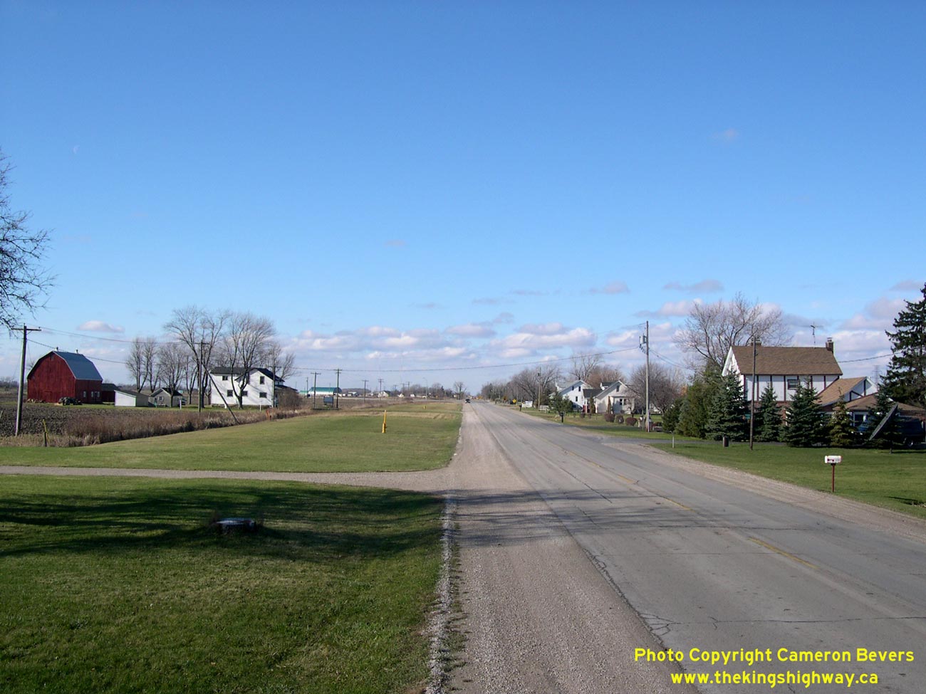
Left - This photo of Hwy 3 west of Maidstone shows the graded right-of-way for a dual roadway that was proposed in the 1930s, but was never actually completed.
Note the distance of the utility poles at left from the edge of the highway and the wide grass right-of-way in between. See an
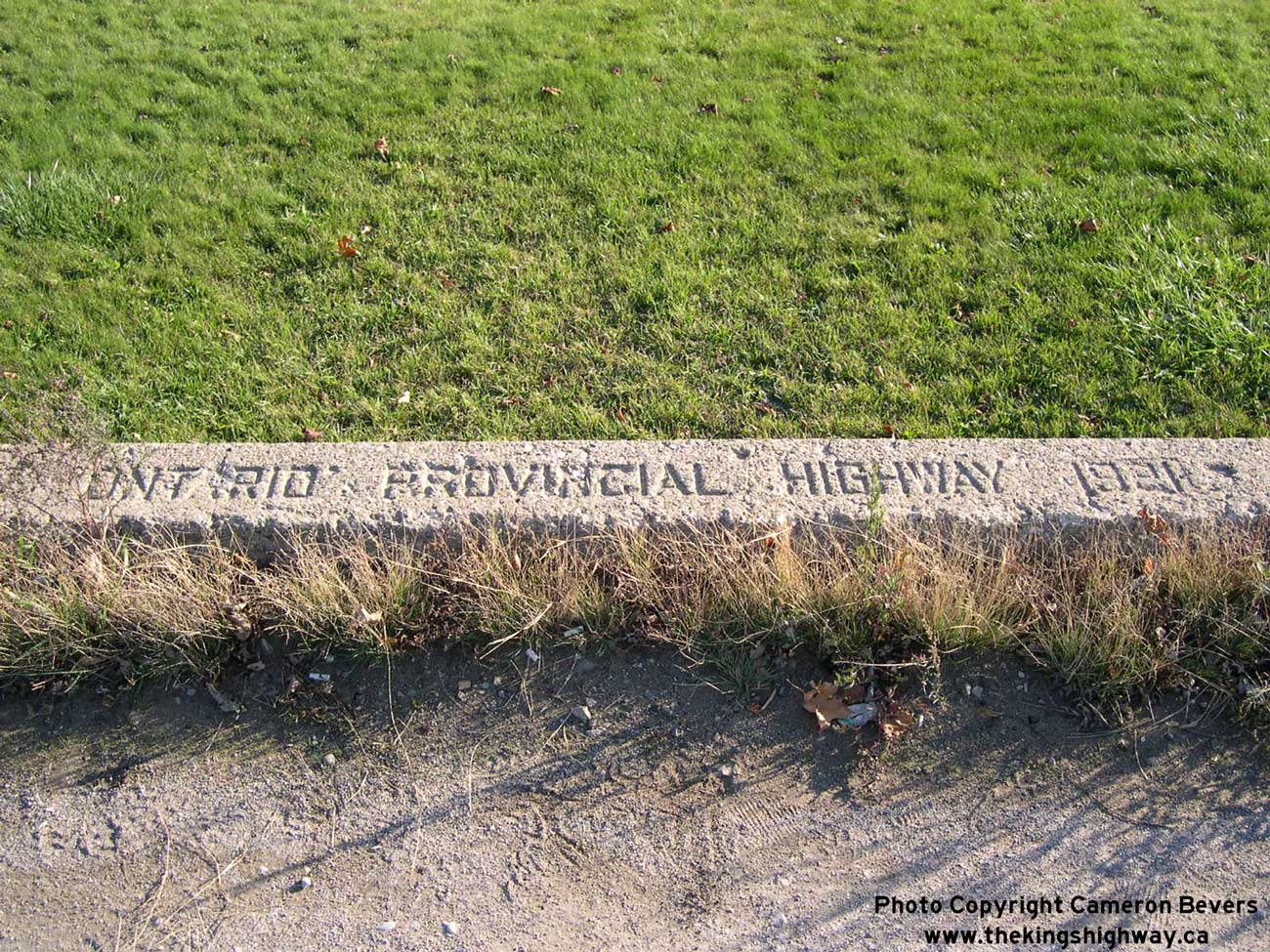
Enlarged Photo Here. (Photograph taken on December 5, 2004 - © Cameron Bevers) Right - Inscription on a concrete culvert east of Leamington - "ONTARIO PROVINCIAL HIGHWAY 1921". See an Enlarged Photo Here. (Photograph taken on November 8, 2003 - © Cameron Bevers) 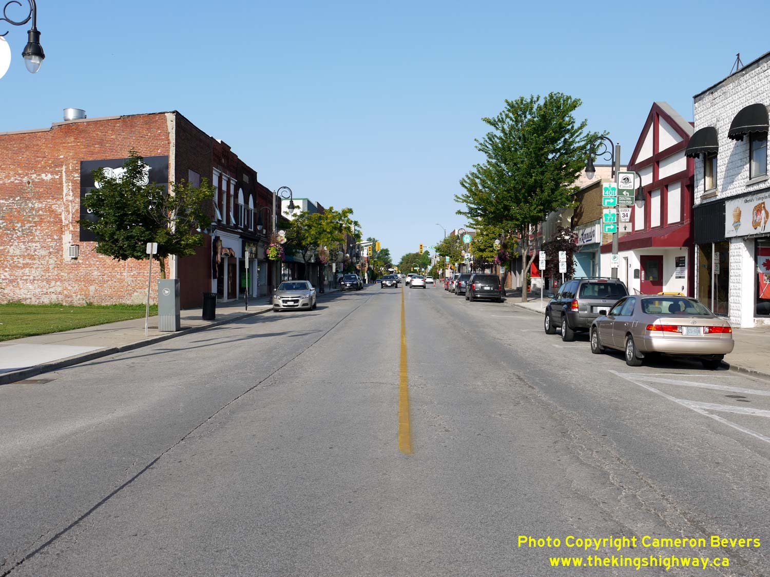

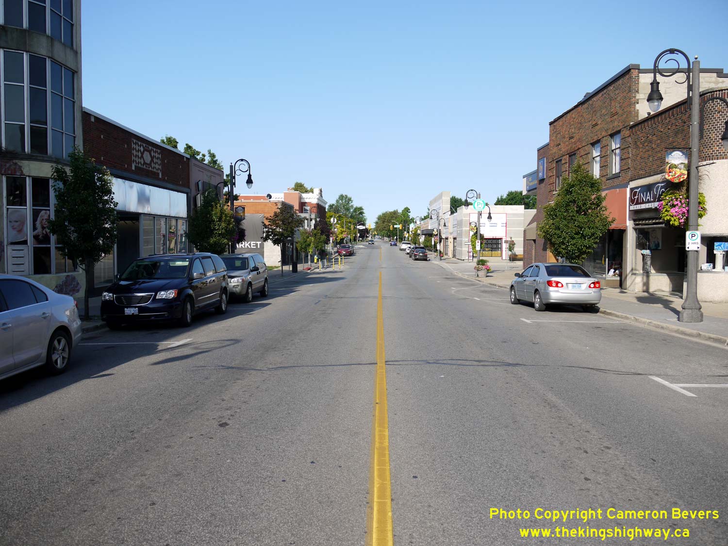
Left - Facing west along Talbot Street (Old Hwy 3) towards the Hwy 18 & Hwy 77 Junction at Erie Street in Downtown Leamington. See an
Enlarged Photo Here. (Photograph taken on August 2, 2019 - © Cameron Bevers) Right - Junction sign assembly facing westbound traffic at Talbot Street & Erie Street. Old Hwy 3 (now Essex Road 34) continues straight ahead, while at right, Hwy 77 heads north towards Hwy 401 via Erie Street. The route of Hwy 77 through Downtown Leamington has always been under municipal jurisdiction. Today, provincial jurisdiction over Hwy 77 begins at the Leamington Bypass (Hwy 3) at the northern entrance to Leamington's urbanized area. Although it is no longer signed today, the former route of Hwy 18 began at this intersection and headed south via Erie Street. See an Enlarged Photo Here. (Photograph taken on August 2, 2019 - © Cameron Bevers) 

Left - Facing east along Talbot Street (Old Hwy 3) from the Hwy 18 & Hwy 77 Junction at Erie Street in Downtown Leamington. See an
Enlarged Photo Here. (Photograph taken on August 2, 2019 - © Cameron Bevers) Right - Approaching the historical terminus of Hwy 18 at Erie Street & Talbot Street in Downtown Leamington, facing north. Erie Street continues north beyond the traffic signals towards Hwy 401 as Hwy 77, while Talbot Street (Old Hwy 3) crosses Erie Street at the traffic signals. See an Enlarged Photo Here. (Photograph taken on August 2, 2019 - © Cameron Bevers) 

Left - Facing south along Erie Street (Hwy 18) from Talbot Street in Downtown Leamington. Up until the 1990s, Hwy 18 began at Talbot Street (Old Hwy 3) and
continued south through Leamington along Erie Street. At Seacliff Drive, Hwy 18 turned west towards Kingsville and Amherstburg. See an
Enlarged Photo Here. (Photograph taken on August 2, 2019 - © Cameron Bevers) Right - Junction sign assembly facing northbound traffic on Erie Street (Hwy 18). Green-and-white trailblazer route markers at Talbot Street (Old Hwy 3) direct traffic northbound along Erie Street to reach Hwy 77 & Hwy 401. The signs which once marked the historical terminus of Hwy 18 at this intersection were removed long ago. See an Enlarged Photo Here. (Photograph taken on August 2, 2019 - © Cameron Bevers) 

Left - Facing south along Erie Street (Hwy 77) approaching Talbot Street (Old Hwy 3) in Downtown Leamington. Up until 2000, Hwy 77 reached its southern
terminus at the traffic signals. Erie Street continues straight ahead towards the Pelee Island Ferry Dock. Historically, this intersection also marked the beginning
of Hwy 18, which continued west towards Kingsville and Amherstburg after a brief southerly jaunt via Erie Street. See an
Enlarged Photo Here. (Photograph taken on August 2, 2019 - © Cameron Bevers) Right - Junction sign assembly facing southbound traffic at Erie Street & Talbot Street. Old Hwy 3 (Talbot Street) through Leamington is now known as Essex Road 34. The former route of Hwy 18 via southbound Erie Street is no longer signed at this intersection, leaving no evidence that this street was once a King's Highway. There is also no remaining evidence that Hwy 77 ended at this intersection prior to 2000. See an Enlarged Photo Here. (Photograph taken on August 2, 2019 - © Cameron Bevers) 

Left - Facing north along Hwy 77 (Erie Street) from Talbot Street (Old Hwy 3) in Downtown Leamington. See an
Enlarged Photo Here. (Photograph taken on August 2, 2019 - © Cameron Bevers) Right - View of Talbot Street (Old Hwy 3) approaching Erie Street (Hwy 18 & Hwy 77) in Downtown Leamington, facing east. See an Enlarged Photo Here. (Photograph taken on August 2, 2019 - © Cameron Bevers) 
Left - Junction of Old Hwy 3, Hwy 18 & Hwy 77 (Talbot Street & Erie Street) in Downtown Leamington, facing northeast. See an
Enlarged Photo Here. (Photograph taken on August 2, 2019 - © Cameron Bevers) Right - Facing west along Talbot Street (Old Hwy 3) from the Hwy 18 & Hwy 77 Junction at Erie Street in Downtown Leamington. See an Enlarged Photo Here. (Photograph taken on August 2, 2019 - © Cameron Bevers) 

Left - Facing south towards Downtown Leamington along Erie Street (Hwy 77) from the Hwy 3 Junction (Leamington Bypass). See an
Enlarged Photo Here. (Photograph taken on August 1, 2019 - © Cameron Bevers) Right - Junction sign assembly on northbound Erie Street (Hwy 77) approaching the Leamington Bypass (Hwy 3). Provincial jurisdiction over Hwy 77 begins at this highway junction and continues uninterrupted to the Hwy 401 Interchange near Comber. Coincidentally, this highway junction also marks the terminus of the provincially-owned section of Hwy 3 from Windsor to Leamington. The leg of Hwy 3 from Leamington easterly to Talbotville has been under municipal jurisdiction since the mass provincial highway downloading spree of the late 1990s. See an Enlarged Photo Here. (Photograph taken on August 1, 2019 - © Cameron Bevers) 

Left - Approaching the Leamington Bypass (Hwy 3) on Erie Street (Hwy 77), facing north. See an
Enlarged Photo Here. (Photograph taken on August 1, 2019 - © Cameron Bevers) Right - Facing east along the Leamington Bypass (Essex Road 33) from the Hwy 77 Junction. See an Enlarged Photo Here. (Photograph taken on August 1, 2019 - © Cameron Bevers) 

Left - Approaching the Hwy 77 Junction on the Leamington Bypass (Hwy 3), facing west towards Windsor. See an
Enlarged Photo Here. (Photograph taken on August 1, 2019 - © Cameron Bevers) Right - Facing west along the Leamington Bypass (Hwy 3) towards Windsor from the Hwy 77 Junction. See an Enlarged Photo Here. (Photograph taken on August 1, 2019 - © Cameron Bevers) 

Left - King's Highway 3 route marker on the Leamington Bypass at the Hwy 77 Junction. Provincial jurisdiction over Hwy 3 resumes at the Hwy 77 Junction in
Leamington and continues westerly to Windsor. The Leamington Bypass is a fairly new highway facility. It opened to traffic in 1999, bypassing the rather congested old
route of Hwy 3 through Leamington and nearby Ruthven. See an Enlarged Photo Here. (Photograph taken on August 1, 2019 - © Cameron Bevers) Right - King's Highway 3 & King's Highway 77 route markers on the eastbound Leamington Bypass. East of Hwy 77, the Leamington Bypass is known as Essex County Road 33. See an Enlarged Photo Here. (Photograph taken on August 1, 2019 - © Cameron Bevers) 

Left - King's Highway 3 & King's Highway 77 route markers approaching the Leamington Bypass, facing south. As the sign indicates, provincial jurisdiction over Hwy 77 ends at the
Hwy 3 Junction. Up until 2000, Hwy 77 continued south into Downtown Leamington via Erie Street to join the original route of Hwy 3 & Hwy 18 at Talbot Street. See
an Enlarged Photo Here. (Photograph taken on August 1, 2019 - © Cameron Bevers) Right - Directional guide signs at the Hwy 3 & Hwy 77 Junction marking the routes to the Leamington and Kingsville Pelee Island Ferry Terminals. See an Enlarged Photo Here. (Photograph taken on August 1, 2019 - © Cameron Bevers) 

Left - Facing south along Hwy 77 approaching the Leamington Bypass (Hwy 3). See an
Enlarged Photo Here. (Photograph taken on August 1, 2019 - © Cameron Bevers) Right - Green guide sign for Essex Road 33 on southbound Hwy 77. The eastern leg of the Leamington Bypass is maintained by the County of Essex. The Leamington Bypass offers a convenient cut-off route to Point Pelee National Park and Old Hwy 3 (Essex Road 34). Prior to the completion of the Leamington Bypass in 1999, all through traffic had to pass through Downtown Leamington, which resulted in significant traffic congestion in the town centre. See an Enlarged Photo Here. (Photograph taken on August 1, 2019 - © Cameron Bevers) 
Above - Facing north along Hwy 77 towards Comber from the Leamington Bypass (Hwy 3). Unlike many of Southern Ontario's King's Highways which were established
back in the 1920s and 1930s, Hwy 77 is a relative newcomer to the provincial highway system. The Department of Highways of Ontario (DHO) assumed jurisdiction over
the Leamington-Comber Road (Essex Road 12) in April, 1963. The new provincial highway from Leamington to Comber was designated as King's Highway 77. See an
Enlarged Photo Here. (Photograph taken on August 1, 2019 - © Cameron Bevers)
Continue on to King's Highway 3 Present Day Photos: Wheatley to Blenheim
|
|---|
Links to Adjacent King's Highway Photograph Pages:
Back to King's Highway 2 Photos /
King's Highway 3 History /
On to King's Highway 4 Photos
Ontario Highway History - Main Menu / Back to List of Highways Website contents, photos & text © 2002-2026, Cameron
Bevers (Webmaster) - All Rights Reserved / Contact Me
|
|---|