
| 
| |
|
|
This page contains present day photos (Year 2000 to date) of Ontario's King's Highway 3, arranged by location from Blenheim
easterly to St. Thomas. All photographs displayed on this page were taken by the Webmaster (Cameron Bevers), unless specifically noted otherwise. Click on any
thumbnail to see a larger image!
Please note that all photographs displayed on this
website are protected by copyright. These photographs must not be reproduced, published,
electronically stored or copied, distributed, or posted onto other websites without
my written permission. If you want to use photos from this website, please
email me first for permission. Thank-you!
|
|---|
|
Page 4: Present Day King's Highway 3 Photographs (Blenheim to St. Thomas)


Left - Facing west along Hwy 3 approaching Chatham-Kent Road 11 (Communication Road), about 2 km east of Blenheim. See an
Enlarged Photo Here. (Photograph taken on September 14, 2010 - © Cameron Bevers) Right - A row of 19th-century trees line Hwy 3, about 3 km east of Blenheim. Scenes like this were once very common along Ontario's King's Highways. Over the years, many tree-lined sections of highways such as this were drastically changed in order to implement wider traffic lanes, roadside shoulders, new utility lines and improved drainage features. It is fairly rare to see mature trees such as this along a highway anymore. See an Enlarged Photo Here. (Photograph taken on September 14, 2010 - © Cameron Bevers) 

Left - Facing east along Hwy 3 towards St. Thomas, about 3 km east of Blenheim. Following the transfer of Hwy 3 from the province to the Municipality of
Chatham-Kent in the late 1990s, the posted speed limit on the highway was increased from 80 km/h to 90 km/h. This was done to ensure consistency with the posted speed
limit on many other county roads in the Chatham area which are also posted at 90 km/h. See an
Enlarged Photo Here. (Photograph taken on September 14, 2010 - © Cameron Bevers) Right - Facing west along Hwy 3 approaching the small community of Guilds, located 7 km east of Blenheim. See an Enlarged Photo Here. (Photograph taken on September 14, 2010 - © Cameron Bevers) 

Left - Pleasant rural scenery along Hwy 3 between Guilds and Eatonville, facing west towards Blenheim. See an
Enlarged Photo Here. (Photograph taken on September 14, 2010 - © Cameron Bevers) Right - Green guide sign for Chatham-Kent Road 15 (Former Hwy 51) on eastbound Hwy 3. Up until the 1990s, Hwy 51 was a short King's Highway which connected Rondeau Provincial Park to Hwy 3 at Eatonville. Jurisdiction over Hwy 51 was transferred from the province to the Municipality of Chatham-Kent in 1997. On the top sign, traces of the old Hwy 51 crown route marker can still be seen underneath the newer flowerpot route marker sticker. See an Enlarged Photo Here. (Photograph taken on September 14, 2010 - © Cameron Bevers) 

Left - Facing east along Hwy 3 towards St. Thomas at the Hwy 51 Junction at Eatonville. The turn-off to southbound Hwy 51 from eastbound Hwy 3 has been
channelized. See an Enlarged Photo Here. (Photograph taken on September 14, 2010 - © Cameron Bevers) Right - Facing west along Hwy 3 towards Blenheim from the Hwy 51 Junction at Eatonville. These two highways intersect about 11 km east of Blenheim. See an Enlarged Photo Here. (Photograph taken on September 14, 2010 - © Cameron Bevers) 
Left - Facing south along Hwy 51 towards Rondeau Provincial Park from the Hwy 3 Junction at Eatonville. See an
Enlarged Photo Here. (Photograph taken on September 14, 2010 - © Cameron Bevers) Right - Approaching the historical northern terminus of Hwy 51 at the Hwy 3 Junction at Eatonville. Kent Bridge Road continues north from Hwy 3 towards Hwy 401 and Kent Bridge as Chatham-Kent Road 15. After the province downloaded Hwy 51, the Municipality of Chatham-Kent extended the route of County Road 15 south via the former route of Hwy 51. See an Enlarged Photo Here. (Photograph taken on September 14, 2010 - © Cameron Bevers) 

Left - Facing south along Former Hwy 51 (now Chatham-Kent Road 15) from Eatonville. The entrance to Rondeau Provincial Park lies about 6 km south of the Hwy 3
Junction. Rondeau is one of Southern Ontario's most popular provincial parks, with old growth Carolinian forests that are very uncommon in Ontario. It is also one of
the oldest provincial parks in Ontario, having been established well over a century ago, in 1894. See an
Enlarged Photo Here. (Photograph taken on September 14, 2010 - © Cameron Bevers) Right - Junction of Hwy 3 & Hwy 51, facing west towards Blenheim. The turn-off to eastbound Hwy 3 from northbound Hwy 51 is also channelized. The westbound left turn lane at this junction was offset to the right of the highway's centreline, presumably to avoid property and building displacements on the south side of Hwy 3. See an Enlarged Photo Here. (Photograph taken on September 14, 2010 - © Cameron Bevers) 

Left - Approaching the Hwy 51 Junction on Hwy 3 at Eatonville, facing west towards Blenheim. See an
Enlarged Photo Here. (Photograph taken on September 14, 2010 - © Cameron Bevers) Right - Green guide sign for Chatham-Kent Road 15 (Former Hwy 51) on westbound Hwy 3 at Eatonville. The See an Enlarged Photo Here. (Photograph taken on September 14, 2010 - © Cameron Bevers) 

Left - Facing east along Hwy 3 towards St. Thomas from the Hwy 51 Junction at Eatonville. See an
Enlarged Photo Here. (Photograph taken on September 14, 2010 - © Cameron Bevers) Right - Facing west along Hwy 3 towards Blenheim from the Hwy 21 Junction in Morpeth. See an Enlarged Photo Here. (Photograph taken on September 10, 2010 - © Cameron Bevers) 

Left - Distance guide sign on westbound Hwy 3 at the Hwy 21 Junction. See an
Enlarged Photo Here. (Photograph taken on September 10, 2010 - © Cameron Bevers) Right - Approaching the Hwy 21 Junction on Hwy 3 in Morpeth, facing east. See an Enlarged Photo Here. (Photograph taken on September 10, 2010 - © Cameron Bevers) 

Left - Approaching the Hwy 21 Junction on Hwy 3 in Morpeth, facing west. See an
Enlarged Photo Here. (Photograph taken on September 10, 2010 - © Cameron Bevers) Right - Old fingerboard directional guide signs at the Hwy 3 & Hwy 21 Junction in Morpeth. See an Enlarged Photo Here. (Photograph taken on September 10, 2010 - © Cameron Bevers) 

Left - Facing east along Hwy 3 towards St. Thomas from the Hwy 21 Junction in Morpeth. See an
Enlarged Photo Here. (Photograph taken on September 10, 2010 - © Cameron Bevers) Right - Facing north along Hwy 21 towards Ridgetown from the Hwy 3 Junction in Morpeth. Since the mass highway downloading spree of the late 1990s, the section of Hwy 21 north of Morpeth has been under municipal jurisdiction. In 1997, jurisdiction over Hwy 21 from Morpeth northerly to Hwy 401 near Ridgetown was transferred from the province to the Municipality of Chatham-Kent. The highway is now officially known as Chatham-Kent Road 17. See an Enlarged Photo Here. (Photograph taken on September 10, 2010 - © Cameron Bevers) 

Left - Historical southern terminus of Hwy 21 at the Hwy 3 Junction in Morpeth. This intersection marked the terminus of Hwy 21 for 70 years, from the time
it was first commissioned as a provincial highway in 1927 up until the mass highway downloading spree of the late 1990s. During 1997-1998, the provincially-owned
route of Hwy 21 was shortened by 100 km. The entire portion of Hwy 21 lying south of Hwy 402 was transferred to Lambton County and the Municipality of Chatham-Kent.
As a result of the highway downloading, the provincially-owned section of Hwy 21 now begins at the Hwy 402 Interchange near Sarnia and continues northerly to Owen
Sound. See an Enlarged Photo Here. (Photograph taken on September 10, 2010 - © Cameron Bevers) Right - A large wind turbine farm exists along Hwy 3 immediately east of Morpeth. Wind turbine farms such as this have become a much more common sight along Ontario's Highways in recent years, as the province has moved away from its dependence on fossil fuel power plants. However, as can be seen in the following 2010 photo of the same section of Hwy 3, a pair of small woodlots beside the highway were cut down and cultivated, presumably to offset the loss of arable land consumed by the wind turbine farm's infrastructure. It serves as a reminder that even the most well-intended environmental initiatives can have unintended and often inconspicuous consequences. See an Enlarged Photo Here. (Photograph taken on July 31, 2019 - © Cameron Bevers) 

Left - View of Hwy 3 east of Morpeth before the construction of the wind turbine farm. Note the small woodlots beside the highway at left. See an
Enlarged Photo Here. (Photograph taken on September 10, 2010 - © Cameron Bevers) Right - Facing west along Hwy 3 towards Blenheim, about 2 km east of Morpeth. This is one of the only notable vertical grades along Hwy 3 through Chatham-Kent. This part of Ontario is extremely flat, with very little discernible change in topography from one mile to the next. See an Enlarged Photo Here. (Photograph taken on July 31, 2019 - © Cameron Bevers) 

Left - View of Hwy 3 about 6 km east of Morpeth at Kenesserie Road, facing east towards St. Thomas. See an
Enlarged Photo Here. (Photograph taken on July 31, 2019 - © Cameron Bevers) Right - Facing east along Hwy 3 approaching the community of Palmyra, located 25 km east of Blenheim. See an Enlarged Photo Here. (Photograph taken on September 10, 2010 - © Cameron Bevers) 
Above - An older Talbot Trail tourist route marker along Hwy 3 near MacPherson Road, about 33 km east of Blenheim. See an
Enlarged Photo Here. (Photograph taken on September 10, 2010 - © Cameron Bevers) 

Left - Facing west along Hwy 3 towards Blenheim from the boundary line between the Municipality of Chatham-Kent and Elgin County at MacPherson Road. See an
Enlarged Photo Here. (Photograph taken on September 10, 2010 - © Cameron Bevers) Right - View of Hwy 3 at the Elgin County Boundary at MacPherson Road, facing east towards St. Thomas. The posted speed limit on Hwy 3 drops from 90 km/h to 80 km/h at the boundary line between the Municipality of Chatham-Kent and Elgin County. See an Enlarged Photo Here. (Photograph taken on September 10, 2010 - © Cameron Bevers) 

Left - Facing east along Hwy 3 towards St. Thomas, about 1 km east of the Elgin County Boundary. See an
Enlarged Photo Here. (Photograph taken on September 10, 2010 - © Cameron Bevers) Right - Facing west along Hwy 3 towards Blenheim from Furnival Road at New Glasgow. See an Enlarged Photo Here. (Photograph taken on September 13, 2010 - © Cameron Bevers) 

Left - Approaching Furnival Road on Hwy 3 at New Glasgow, facing east. Historically, Furnival Road between the Hwy 3 Junction at New Glasgow and nearby Rodney
was a King's Highway (Former Hwy 77) between 1936 and 1957. This historical route of Hwy 77 in Elgin County should not be confused with the present day route of
Hwy 77 in Essex County, which extends from Leamington northerly to Hwy 401 near Comber. See an
Enlarged Photo Here. (Photograph taken on September 13, 2010 - © Cameron Bevers) Right - Facing north along Furnival Road (Former Hwy 77) from the Hwy 3 Junction at New Glasgow. The Department of Highways of Ontario (DHO) assumed ownership of a 4-mile section of Furnival Road from New Glasgow to Rodney in August, 1936. After remaining in the provincial highway system for over 20 years, jurisdiction over Hwy 77 was transferred from the province to Elgin County in December, 1957. Former Hwy 77 subsequently became Elgin County Road 3. When the province transferred ownership of Hwy 3 west of Talbotville to Elgin County in 1998, the county made a wise decision to renumber Furnival Road as County Road 103, so that their County Road 3 designation could be reassigned to the downloaded section of Hwy 3 instead. See an Enlarged Photo Here. (Photograph taken on September 13, 2010 - © Cameron Bevers) 

Left - Approaching the historical southern terminus of Hwy 77 at the Hwy 3 Junction at New Glasgow. Furnival Road itself continues south beyond the Hwy 3
Junction to Port Glasgow on the Lake Erie shoreline. See an Enlarged Photo Here. (Photograph taken on September 13, 2010 - © Cameron Bevers) Right - Distance guide sign at Hwy 3 and Furnival Road in New Glasgow. This guide sign was produced by Elgin County using the same Federal Highways Administration (FHWA) letter fonts as those seen on MTO-produced provincial highway signs. Not all counties in Ontario make use of FHWA letter fonts for their signs. See an Enlarged Photo Here. (Photograph taken on September 13, 2010 - © Cameron Bevers) 

Left - Facing west along Hwy 3 towards Furnival Road (Former Hwy 77) at New Glasgow. See an
Enlarged Photo Here. (Photograph taken on September 13, 2010 - © Cameron Bevers) Right - View of Hwy 3 at New Glasgow, facing east towards St. Thomas from Furnival Road. See an Enlarged Photo Here. (Photograph taken on September 13, 2010 - © Cameron Bevers) 

Left - Facing east along Hwy 3 towards St. Thomas from New Glasgow. See an
Enlarged Photo Here. (Photograph taken on September 13, 2010 - © Cameron Bevers) Right - The profile of Hwy 3 was lowered substantially on the eastern approach to New Glasgow in order to improve the highway's vertical alignment. Many vertical profile corrections were done along Ontario's King's Highways over the years to provide motorists with an improved view of the highway ahead of them and also to allow for greater passing opportunities. In this particular instance, a large concrete retaining wall was built beside the highway in order to avoid disturbing an adjacent cemetery. Originally, the highway would have crested over a hill at approximately the same height as the retaining wall. See an Enlarged Photo Here. (Photograph taken on September 13, 2010 - © Cameron Bevers) 

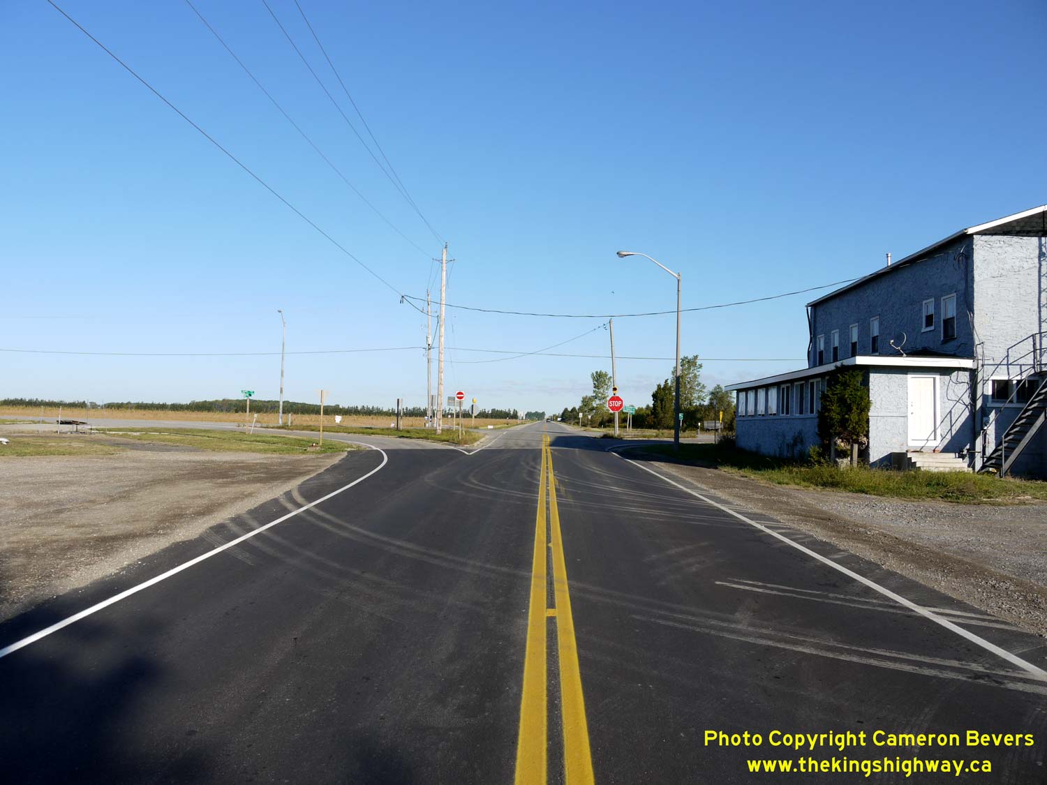
Left - Facing east along Hwy 3 approaching the community of Eagle, located 47 km east of Blenheim. See an
Enlarged Photo Here. (Photograph taken on September 13, 2010 - © Cameron Bevers) Right - Distance guide sign on westbound Hwy 3 at the Hwy 76 Junction at Eagle. See an Enlarged Photo Here. (Photograph taken on September 10, 2010 - © Cameron Bevers) 

Left - Facing west along Hwy 3 towards Blenheim from the Hwy 76 Junction at Eagle. See an
Enlarged Photo Here. (Photograph taken on September 13, 2010 - © Cameron Bevers) Right - Southern terminus of Hwy 76 at the Hwy 3 Junction at Eagle. Prior to the highway's downloading in 1997, Hwy 76 was one of Southwestern Ontario's shortest King's Highways. See an Enlarged Photo Here. (Photograph taken on September 13, 2010 - © Cameron Bevers) 

Left - Approaching the Hwy 76 Junction on Hwy 3 at Eagle, facing east towards St. Thomas. See an
Enlarged Photo Here. (Photograph taken on September 13, 2010 - © Cameron Bevers) Right - Facing north along Hwy 76 towards West Lorne from the Hwy 3 Junction at Eagle. See an Enlarged Photo Here. (Photograph taken on September 13, 2010 - © Cameron Bevers) 

Left - Old fingerboard guide signs at the Hwy 3 & Hwy 76 Junction. See an
Enlarged Photo Here. (Photograph taken on September 13, 2010 - © Cameron Bevers) Right - Facing east along Hwy 3 towards St. Thomas from the Hwy 76 Junction at Eagle. See an Enlarged Photo Here. (Photograph taken on September 13, 2010 - © Cameron Bevers) 

Left - Approaching the Hwy 76 Junction on Hwy 3 at Eagle, facing west towards Blenheim. See an
Enlarged Photo Here. (Photograph taken on September 13, 2010 - © Cameron Bevers) Right - Facing east along Hwy 3 towards St. Thomas from Eagle. See an Enlarged Photo Here. (Photograph taken on September 13, 2010 - © Cameron Bevers) 

Left - Facing east along Hwy 3 towards St. Thomas, about 3 km east of Eagle. See an
Enlarged Photo Here. (Photograph taken on September 13, 2010 - © Cameron Bevers) Right - A newer Talbot Trail tourist route marker on Hwy 3 east of Eagle. A significant portion of Hwy 3 through Southwestern Ontario follows the historical route of the Talbot Road, which was a crude 19th Century settlement road constructed under the direction of Colonel Thomas Talbot. Construction of the Talbot Road began in 1809, with many sections constructed using felled timber logs to form a "corduroy road". Early written accounts by travellers indicated that the Talbot Road was often in deplorable condition and was "scarcely passable" in places. In an effort to improve the dreadful travel conditions, tolls were ultimately implemented on the Talbot Road to fund improvements. By 1830, the Talbot Road was improved to a point where a regular stagecoach service was provided. A stagecoach journey from London to York (Toronto) via the Talbot Road took two days in the 19th Century. However, as this 1927 Historical Photo clearly illustrates, travelling Hwy 3 by automobile between Eagle and Wallacetown was still not an easy task - even a century later! See an Enlarged Photo Here. (Photograph taken on September 13, 2010 - © Cameron Bevers) 

Left - Facing east along Hwy 3 towards St. Thomas at the Eagle Roadside Park. See an
Enlarged Photo Here. (Photograph taken on July 31, 2019 - © Cameron Bevers) Right - View of the Eagle Roadside Park on Hwy 3, located about 4 km east of Eagle. This small roadside park was originally built by the DHO as a stopping point for motorists using Hwy 3 between Blenheim and St. Thomas. The roadside park is located in a treed grove and features picnic tables, parking spaces and toilets for the convenience of motorists. See an Enlarged Photo Here. (Photograph taken on July 31, 2019 - © Cameron Bevers) 

Left - Approaching Wallacetown on Hwy 3, facing east towards St. Thomas. See an
Enlarged Photo Here. (Photograph taken on September 13, 2010 - © Cameron Bevers) Right - Facing west along Hwy 3 from Currie Road (Former Hwy 75) in Wallacetown. The old verandaed false-fronted store at left really adds to the rural, yesteryear charm of this section of Hwy 3. Many of the once-important King's Highways through Southwestern Ontario such as Hwy 2, Hwy 3, Hwy 7 and Hwy 22 have fallen out of favour with motorists, due to the construction of newer, high-speed 400-Series Highways. Those seeking a more leisurely pace will find Hwy 3 from St. Thomas to Blenheim to be a very pleasant alternate route to Hwy 401. See an Enlarged Photo Here. (Photograph taken on September 13, 2010 - © Cameron Bevers) 

Left - Approaching Currie Road (Former Hwy 75) on Hwy 3 at Wallacetown, facing east towards St. Thomas. See an
Enlarged Photo Here. (Photograph taken on September 13, 2010 - © Cameron Bevers) Right - Approaching the historical southern terminus of Hwy 75 at the Hwy 3 Junction at Wallacetown. See an Enlarged Photo Here. (Photograph taken on September 13, 2010 - © Cameron Bevers) 

Left - Facing north along Currie Road (Former Hwy 75) from the Hwy 3 Junction at Wallacetown. The DHO assumed ownership of Currie Road between Wallacetown and
Dutton in August, 1936. The new highway to Dutton was designated as Hwy 75. This short route was about 4 miles in length and it remained in service for over two
decades. Jurisdiction over Hwy 75 was transferred from the province to Elgin County in December, 1957. Former Hwy 75 was subsequently renamed as Elgin County Road 8.
See an Enlarged Photo Here. (Photograph taken on September 13, 2010 - © Cameron Bevers) Right - Facing west along Hwy 3 towards Blenheim approaching Currie Road (Former Hwy 75) at Wallacetown. See an Enlarged Photo Here. (Photograph taken on September 13, 2010 - © Cameron Bevers) 

Left - Facing east along Hwy 3 towards St. Thomas from Currie Road (Former Hwy 75) at Wallacetown. See an
Enlarged Photo Here. (Photograph taken on September 13, 2010 - © Cameron Bevers) Right - Old fingerboard guide signs on Hwy 3 at Iona Road. See an Enlarged Photo Here. (Photograph taken on September 10, 2010 - © Cameron Bevers) 

Left - Facing west along Hwy 3 (Iona Diversion) towards Blenheim from Iona Road. In 1949, construction began on a short diversion of Hwy 3 north of Iona in
order to remove an awkward jog along the original route of Hwy 3. At one time, Hwy 3 passed directly through the community of Iona. Note the highway transfer
notification sign at right. These white signs were placed on many downloaded King's Highways in the late 1990s to advise motorists that they are no longer travelling
on a provincially-maintained highway. The 83 km section of Hwy 3 from Blenheim to Talbotville near St. Thomas was turned over from the province to the Municipality of
Chatham-Kent and Elgin County on January 1, 1998. See an Enlarged Photo Here. (Photograph taken on September 10, 2010 - © Cameron Bevers) Right - Facing south along Iona Road (Old Hwy 3) from the Hwy 3 Junction. See an Enlarged Photo Here. (Photograph taken on September 10, 2010 - © Cameron Bevers) 

Left - Facing north along Old Hwy 3 (Iona Road) from Back Street in Iona. Prior to the completion of the Iona Diversion in 1950, motorists heading east from
Blenheim had to turn left from Back Street onto Iona Road in order to continue east towards St. Thomas. At the north entrance to Iona, Hwy 3 turned right and
continued east towards St. Thomas along the present day route of Hwy 3. See an
Enlarged Photo Here. (Photograph taken on September 10, 2010 - © Cameron Bevers) Right - Approaching Back Street (Old Hwy 3) on Iona Road, facing south. The original 1920 route of Hwy 3 turned right onto Back Street just beyond the parked minivan and continued west towards Blenheim. The completion of the Iona Diversion in 1950 allowed through traffic to bypass Iona altogether. See an Enlarged Photo Here. (Photograph taken on September 10, 2010 - © Cameron Bevers) 

Left - Approaching Iona Road on Back Street (Old Hwy 3). At the intersection, the original route of Hwy 3 turned left and briefly continued north through Iona.
See an Enlarged Photo Here. (Photograph taken on September 10, 2010 - © Cameron Bevers) Right - Facing west along Back Street (Old Hwy 3) towards Blenheim from Iona Road. Jurisdiction over the bypassed former route of Hwy 3 through Iona was transferred from the province to the Township of Dunwich in April, 1951. See an Enlarged Photo Here. (Photograph taken on September 10, 2010 - © Cameron Bevers) 

Left - Facing east towards Iona along Back Street (Old Hwy 3) from the present day route of Hwy 3 (Iona Diversion). The realigned route of Hwy 3 can be seen in
the distance at left, curving away from the community of Iona. See an Enlarged Photo Here. (Photograph taken on September 10, 2010 - © Cameron Bevers) Right - Facing east along Hwy 3 towards Blenheim from the western entrance to Shedden. See an Enlarged Photo Here. (Photograph taken on July 31, 2019 - © Cameron Bevers) 

Left - Approaching Shedden on Hwy 3, facing east towards St. Thomas. See an
Enlarged Photo Here. (Photograph taken on July 31, 2019 - © Cameron Bevers) Right - Facing east along Hwy 3 at Union Road in Shedden. In addition to serving as an access route from Shedden to Hwy 401, Union Road forms a rather strategic road link between Hwy 3 and Port Stanley, which is a popular summer tourist destination located on Lake Erie's northern shoreline. See an Enlarged Photo Here. (Photograph taken on July 31, 2019 - © Cameron Bevers) 

Left - View of Hwy 3 approaching Union Road in Shedden, facing west towards Blenheim. Shedden is one of the larger villages along Hwy 3 between St. Thomas and
Blenheim. Shedden is not an incorporated municipality in its own right, as it forms part of the much larger Southwold Township. See an
Enlarged Photo Here. (Photograph taken on July 31, 2019 - © Cameron Bevers) Right - Facing east along Hwy 3 towards St. Thomas from John Street in Shedden. A former church with its impressive circular window peers out onto Hwy 3 at left. See an Enlarged Photo Here. (Photograph taken on July 31, 2019 - © Cameron Bevers) 

Left - Eastern entrance to Shedden on Hwy 3, facing west towards Blenheim. See an
Enlarged Photo Here. (Photograph taken on July 31, 2019 - © Cameron Bevers) Right - Facing east along Hwy 3 towards St. Thomas from the eastern entrance to Shedden. The topography along Hwy 3 in the Shedden area starts to become slightly rolling, in stark contrast to the pancake-flat topography seen in Essex County, the Municipality of Chatham-Kent and the western portion of Elgin County. See an Enlarged Photo Here. (Photograph taken on July 31, 2019 - © Cameron Bevers) 

Left - Facing east along Hwy 3 towards St. Thomas at Frome, located 3 km east of Shedden. See an
Enlarged Photo Here. (Photograph taken on September 10, 2010 - © Cameron Bevers) Right - A rural scene along Hwy 3 about 5 km west of Talbotville, facing east towards St. Thomas. See an Enlarged Photo Here. (Photograph taken on July 31, 2019 - © Cameron Bevers) 
Above - Approaching Talbotville on Hwy 3 near St. Thomas, facing east. At Talbotville, traffic has the option of turning north towards Hwy 401 and London via
Hwy 4. Traffic bound for St. Thomas can either turn south onto Hwy 4 or continue straight ahead via Hwy 3, as both highways ultimately lead to St. Thomas. See an
Enlarged Photo Here. (Photograph taken on July 31, 2019 - © Cameron Bevers)
Continue on to King's Highway 3 Present Day Photos: St. Thomas to Tillsonburg
|
|---|
Links to Adjacent King's Highway Photograph Pages:
Back to King's Highway 2 Photos /
King's Highway 3 History /
On to King's Highway 4 Photos
Ontario Highway History - Main Menu / Back to List of Highways Website contents, photos & text © 2002-2026, Cameron
Bevers (Webmaster) - All Rights Reserved / Contact Me
|
|---|