
| 
|  |
|
|
This page contains present day photos (Year 2000 to date) of Ontario's King's Highway 400, arranged by location from the
Highway 88 Interchange near Bradford northerly to the Mapleview Drive Interchange in Barrie. All photographs displayed on this page were taken by the Webmaster
(Cameron Bevers), unless specifically noted otherwise. Click on any thumbnail to see a larger image!
Please note that all photographs displayed on this
website are protected by copyright. These photographs must not be reproduced, published,
electronically stored or copied, distributed, or posted onto other websites without
my written permission. If you want to use photos from this website, please
email me first for permission. Thank-you!
|
|---|
|
Page 13: Present Day King's Highway 400 Photographs (Hwy 88 to Barrie)

Left - Facing north along Hwy 400 towards Barrie from the Hwy 88 Overpass near Bradford. At the time this photo was taken in 2003, the Hwy 88 Interchange was
still a full eight-ramp cloverleaf. The four inner loop ramps at the Hwy 88 Interchange were closed off to traffic in 2011. See an
Enlarged Photo here. (Photograph taken on December 28, 2003 - © Cameron Bevers) Right - Facing south along Hwy 400 towards Toronto from the Hwy 88 Overpass. The Hwy 88 Interchange provides the main access route into Bradford from Hwy 400. A second interchange was built at nearby 5th Line in 2016-2017, in order to serve this rapidly expanding town. See an Enlarged Photo here. (Photograph taken on December 28, 2003 - © Cameron Bevers) 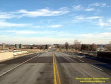

Left - Facing east along Hwy 88 towards Bradford from the Hwy 400 Interchange. Hwy 88 was recently widened from two to four lanes between Hwy 400 and Bradford.
See an Enlarged Photo here. (Photograph taken on December 28, 2003 - © Cameron Bevers) Right - Facing west along Hwy 88 towards Bond Head from the Hwy 400 Interchange. When the inner loop ramps of the cloverleaf interchange were closed off to traffic, new traffic signals were installed at the two remaining ramps terminals. The west ramp terminal was converted to a four-leg intersection a number of years ago, due to the construction of a commuter carpool lot within the southwest loop ramp. See an Enlarged Photo here. (Photograph taken on December 28, 2003 - © Cameron Bevers) 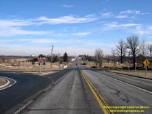

Left - Facing east along Hwy 88, showing the old cloverleaf ramps to and from Hwy 400. When Hwy 400 first opened to traffic between Toronto and Barrie in the
early 1950s, there were a total of five full eight-ramp cloverleaf interchanges along the highway. Over the years, the other four cloverleaf interchanges were gradually
reconstructed. The Hwy 88 Cloverleaf was the last of its kind along Hwy 400, until it too was reconfigured into a diamond interchange in 2011. See an
Enlarged Photo here. (Photograph taken on December 28, 2003 - © Cameron Bevers) Right - Facing west along Hwy 88, showing the cloverleaf ramp configuration on the east side of the Hwy 400 Interchange. See an Enlarged Photo here. (Photograph taken on December 28, 2003 - © Cameron Bevers) 
Left - Northeast quadrant of the Hwy 88 and Hwy 400 Interchange near Bradford, showing the older bi-directional ramp. Interchanges built in Ontario during the
1940s and 1950s commonly had shared two-way ramps, which were then split off into one-way roadways by a traffic island on the approach to the freeway. Bi-directional
ramps such as these are becoming very uncommon on today's freeways, as older interchanges are upgraded or replaced. See an
Enlarged Photo here. (Photograph taken on December 28, 2003 - © Cameron Bevers) Right - Southern side of the Hwy 88 Overpass on Hwy 400 near Bradford. This single-span concrete rigid frame structure was completed in 1950. See an Enlarged Photo here. (Photograph taken on December 28, 2003 - © Cameron Bevers) 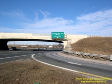

Left - Heading down the eastbound Hwy 88 on-ramp to northbound Hwy 400. Full eight-ramp cloverleaf interchanges such as the one at Hwy 400 & Hwy 88 were
once quite common on Ontario's freeways. Over the past few decades, nearly all of them have been replaced with new interchanges or retrofitted in some way. The Hwy 88
Cloverleaf on Hwy 400 was somewhat unique, in that it remained more or less the same for 60 years. It was retrofitted into a diamond interchange configuration in
2011. See an Enlarged Photo here. (Photograph taken on December 28, 2003 - © Cameron Bevers) Right - Hwy 400 merge lane underneath the Hwy 88 Overpass, showing the short and very narrow weaving lane. Over the years, highway lanes in Ontario have gotten progressively wider from 3.05 metres (10 feet) in the 1930s to 3.75 metres (12.3 feet) today. As a result, the weaving lanes at older interchanges tend to get squeezed through narrow bridge structures. See an Enlarged Photo here. (Photograph taken on December 28, 2003 - © Cameron Bevers) 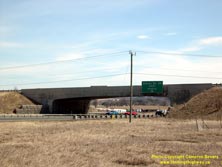

Left - Northern side of the Hwy 88 Overpass on Hwy 400 west of Bradford. See an
Enlarged Photo here. (Photograph taken on April 10, 2005 - © Cameron Bevers) Right - Eastern side of the West Gwillimbury 9th Line Underpass on Hwy 400 near Bradford. See an Enlarged Photo here. (Photograph taken on October 17, 2010 - © Cameron Bevers) 

Left - Western side of the West Gwillimbury 9th Line Underpass on Hwy 400. This single-span concrete rigid frame structure was completed in 1951. See an
Enlarged Photo here. (Photograph taken on October 17, 2010 - © Cameron Bevers) Right - View of Hwy 400 south of Coulson Road, facing south towards the Hwy 88 Interchange near Bradford. See an Enlarged Photo here. (Photograph taken on June 15, 2014 - © Cameron Bevers) 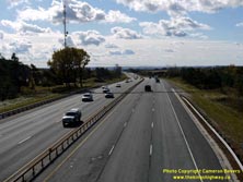
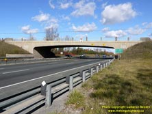
Left - Facing south along Hwy 400 towards Bradford from the Coulson Road Overpass. See an
Enlarged Photo here. (Photograph taken on October 17, 2010 - © Cameron Bevers) Right - Coulson Road (West Gwillimbury Line 11) Overpass on Hwy 400 between Bradford and Cookstown. The Coulson Road Overpass was one of many single-span concrete rigid frame structures built along the Toronto-Barrie Highway (Hwy 400) in the late 1940s and early 1950s. As was typical for bridges along the corridor, the Coulson Road Overpass features the Ontario coat-of-arms embossed into the bridge approaches. See an Enlarged Photo here. (Photograph taken on October 17, 2010 - © Cameron Bevers) 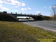

Left - Northern side of the Coulson Road Overpass on Hwy 400. This single-span concrete rigid frame structure was completed in 1950. This bridge was demolished
on June 13-14, 2015, in order to make way for long-term expansion of Hwy 400. The old Coulson Road Overpass was only designed to accommodate six traffic lanes below
the structure. The new structure, which was completed in 2016, can accommodate up to ten traffic lanes below the structure. See an
Enlarged Photo here. (Photograph taken on October 17, 2010 - © Cameron Bevers) Right - Facing east across the Coulson Road Overpass on Hwy 400 north of Bradford. See an Enlarged Photo here. (Photograph taken on October 17, 2010 - © Cameron Bevers) 

Left - Facing west across the Coulson Road Overpass on Hwy 400 north of Bradford. See an
Enlarged Photo here. (Photograph taken on October 17, 2010 - © Cameron Bevers) Right - The curved concrete handrail of the Coulson Road Overpass adds to its overall streamlined appearance. These single-span concrete rigid frame overpasses built along Hwy 400 and Hwy 401 in the late 1940s and early 1950s were the finest bridge structures ever built on Ontario's freeways. Although relatively simple in appearance, they provided the perfect balance between artistic appearance and engineering functionality. See an Enlarged Photo here. (Photograph taken on October 17, 2010 - © Cameron Bevers) 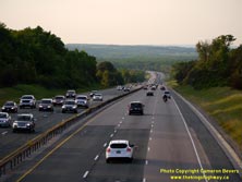

Left - Facing north along Hwy 400 towards Barrie from the Coulson Road Overpass. Perched on the top of Coulson's Hill, the Coulson Road Overpass actually marks
the highest elevation reached along the Hwy 400 corridor within Simcoe County. The highway crests at 313 metres (1,025 feet) above sea level at this point. The Hwy 89
Interchange lies down in the valley about 3 km beyond the curve in the distance. See an
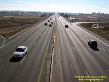
Enlarged Photo here. (Photograph taken on June 15, 2014 - © Cameron Bevers) Right - Hwy 400 descends a very long 3 km downhill grade north of Coulson Road. The long tangent down the grade enhances this dramatic vantage point. See an Enlarged Photo here. (Photograph taken on June 15, 2014 - © Cameron Bevers) 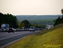

Left - Across Coulson's Hill, Hwy 400 develops an urban cross section with an outside edge curb-and-gutter drainage system. The use of urban cross sections
such as this one reduced the widths of many of the earth cuts along Hwy 400, since roadside drainage ditches were no longer required. See an
Enlarged Photo here. (Photograph taken on June 15, 2014 - © Cameron Bevers) Right - Facing south along Hwy 400 up Coulson's Hill from the West Gwillimbury Line 13 Underpass near Cookstown. The Coulson Road Overpass can be seen 3 km away at the crest of the hill. The 1970s-era steel box-beam median barrier along this section of Hwy 400 was replaced with a new concrete median barrier in 2015. See an Enlarged Photo here. (Photograph taken on June 15, 2014 - © Cameron Bevers) 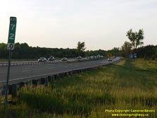

Left - Facing north along Hwy 400 from the West Gwillimbury Line 13 Underpass near Cookstown. The median widens slightly as Hwy 400 curves around this bend
south of the Hwy 89 Interchange. The steel box beam median barrier ends temporarily, and a pair of steel beam guide rail barriers protects the open grass median. See
an Enlarged Photo here. (Photograph taken on June 15, 2014 - © Cameron Bevers) Right - Facing north along Hwy 400 towards Barrie from the Hwy 89 Overpass east of Cookstown. See an Enlarged Photo here. (Photograph taken on December 28, 2003 - © Cameron Bevers) 

Left - Facing south along Hwy 400 towards Toronto from the Hwy 89 Overpass. See an
Enlarged Photo here. (Photograph taken on December 28, 2003 - © Cameron Bevers) Right - Eastern approach to the Hwy 89 Overpass at Hwy 400, facing west towards Cookstown. See an Enlarged Photo here. (Photograph taken on December 28, 2003 - © Cameron Bevers) 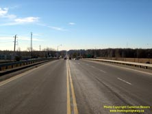

Left - Facing west along Hwy 89 towards Cookstown from the Hwy 400 Interchange. See an
Enlarged Photo here. (Photograph taken on December 28, 2003 - © Cameron Bevers) Right - Facing east along Hwy 89 towards Fennell from the Hwy 400 Interchange. See an Enlarged Photo here. (Photograph taken on December 28, 2003 - © Cameron Bevers) 

Left - Western approach to the Hwy 89 Overpass on Hwy 400, facing east towards Fennell. See an
Enlarged Photo here. (Photograph taken on December 28, 2003 - © Cameron Bevers) Right - Northern side of the Hwy 89 Overpass on Hwy 400 near Cookstown. This single-span concrete rigid frame structure was completed in 1949. See an Enlarged Photo here. (Photograph taken on December 28, 2003 - © Cameron Bevers) 

Left - Southern side of the Hwy 89 Overpass on Hwy 400 near Cookstown. See an
Enlarged Photo here. (Photograph taken on April 14, 2005 - © Cameron Bevers) Right - View of the Hwy 400 Service Centre from Hwy 89. The Cookstown Service Centre was located within the northwest quadrant on the Hwy 89 Interchange, so access to the centre was possible from both directions on Hwy 400 and Hwy 89. See an Enlarged Photo here. (Photograph taken on October 17, 2010 - © Cameron Bevers) 

Left - Until recently, the Cookstown Service Centre was the oldest on Ontario 400-Series Highways. The centre had been in operation at this location since
1954. However, the Cookstown Service Centre was closed in 2013 and relocated to a new site south of Innisfil Beach Road. See an
Enlarged Photo here. (Photograph taken on October 17, 2010 - © Cameron Bevers) Right - Eastern side of the Innisfil 6th Line Underpass on Hwy 400 south of Barrie. See an Enlarged Photo here. (Photograph taken on October 17, 2010 - © Cameron Bevers) 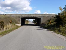
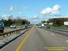
Left - Western side of the Innisfil 6th Line Underpass on Hwy 400. This single-span concrete rigid frame structure was completed in 1951. See an
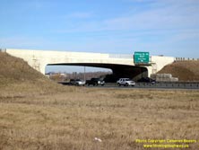
Enlarged Photo here. (Photograph taken on October 17, 2010 - © Cameron Bevers) Right - Approaching the Innisfil Beach Road Interchange on northbound Hwy 400 between the Hwy 89 Interchange and Barrie. The steel box-beam median barrier at left was installed during the widening of Hwy 400 between Toronto and Barrie in 1971-1972. It was the first time that a continuous box-beam median barrier was installed on an Ontario freeway. See an Enlarged Photo here. (Photograph taken on October 17, 2010 - © Cameron Bevers) 

Left - Guide sign on northbound Hwy 400 directing traffic bound for Downtown Barrie to exit at Essa Road. See an
Enlarged Photo here. (Photograph taken on October 17, 2010 - © Cameron Bevers) Right - McKay Road (Innisfil 10th Line) Overpass on Hwy 400 near Barrie. This two-span concrete rigid frame structure was completed in 1947. Until recently, this was one of the oldest overpasses on Hwy 400. However, the bridge was demolished on June 11-12, 2016. A new bridge will be constructed here during 2017. See an Enlarged Photo here. (Photograph taken on October 17, 2010 - © Cameron Bevers) 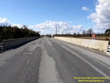
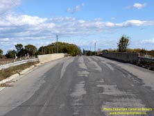
Left - Facing west across the McKay Road Overpass south of Barrie. What makes this structure interesting is that the top of the overpass is actually at the
original ground level, while Hwy 400 runs through a graded earth cut below the structure. For most of the structures on Hwy 400, the freeway follows the original
ground line, while the roads crossing the freeway are built up on fills on the approaches to the structures. See an
Enlarged Photo here. (Photograph taken on October 17, 2010 - © Cameron Bevers) Right - Facing east across the McKay Road Overpass on Hwy 400 south of Barrie. See an Enlarged Photo here. (Photograph taken on October 17, 2010 - © Cameron Bevers) 

Left - Northern side of the McKay Road Overpass on Hwy 400 south of Barrie. See an
Enlarged Photo here. (Photograph taken on October 17, 2010 - © Cameron Bevers) Right - Facing north along Hwy 400 towards Barrie from the McKay Road Overpass. See an Enlarged Photo here. (Photograph taken on October 17, 2010 - © Cameron Bevers)
Continue on to King's Highway 400 Photos: Barrie to Crown Hill
|
|---|
Links to Adjacent King's Highway Photograph Pages:
Back to King's Highway 169 Photos /
King's Highway 400 History /
On to King's Highway 401 Photos
Ontario Highway History - Main Menu / Back to List of Highways Website contents, photos & text © 2002-2025, Cameron
Bevers (Webmaster) - All Rights Reserved / Contact Me
|
|---|