| 
|  |
|
|
This page contains historical photos of Ontario's King's Highway 401 dating from 1938 to 1954. Please note that up until 1952,
King's Highway 401 was called King's Highway 2A between Toronto and Oshawa. During early planning and construction phases, it was referred to as the "Toronto-Oshawa
Highway". All photographs displayed on this page were taken by the Ontario Ministry of Transportation, unless specifically noted otherwise. Historical photographs are
arranged in approximate chronological order. Click on any thumbnail to see a larger image!
Please note that all photographs displayed on this
website are protected by copyright. These photographs must not be reproduced, published,
electronically stored or copied, distributed, or posted onto other websites without
my written permission. If you want to use photos from this website, please
email me first for permission. Thank-you!
|
|---|
|
Page 1: Historical King's Highway 401 Photographs (1938 to 1954)

Above - Original 1930s plan for the new dual highway through Oshawa. This road was initially known as Hwy 2A, but later became a portion of Hwy 401. This
sketch was prepared by the Department of Highways in February 1939 and the plan was approved by Oshawa City Council later that same month. Construction began on the
new dual highway between Toronto and Oshawa before World War II, but shortages of construction materials delayed the completion of many of the grade separations and
interchanges. The partially-completed freeway was unofficially opened to traffic in 1942, despite the fact that many sections were still under construction. The new
freeway was formally opened to traffic on December 3, 1947. (Photo courtesy of Ontario Ministry of Transportation - © King's Printer for Ontario, 1939) 

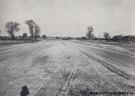
Left - New earth cut and grading underway on Hwy 2A (Hwy 401) approaching the Rouge River. Photo taken on September 29, 1938. (Photo courtesy of Ontario Ministry of Transportation - © King's Printer for Ontario, 1938) Right - Grading for the new Hwy 2A (Hwy 401) west of Whitby, looking east. Photo taken on October 17, 1938. (Photo courtesy of Ontario Ministry of Transportation - © King's Printer for Ontario, 1938) 

Left - Graders at work on Hwy 2A (Hwy 401) east of Pickering Village. Photo taken on October 17, 1938. (Photo courtesy of Ontario Ministry of Transportation - © King's Printer for Ontario, 1938) Right - Completed Hwy 2A (Hwy 401) grading approaching the Rouge River, looking east. Photo taken on September 20, 1939. (Photo courtesy of Ontario Ministry of Transportation - © King's Printer for Ontario, 1939) 

Left - New Hwy 2A (Hwy 401) at West Hill. South side of dual highway facing east. See an
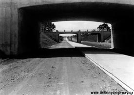
Enlarged Photo here. Photo taken on April 3, 1946. (Photo © Archives of Ontario - Series RG-14-162-2-27, Photo #G62) Right - CN Subway and Albert & Simcoe Street Overpasses at Hwy 2A in Oshawa. See an Enlarged Photo here. Photo taken on August 27, 1946. (Photo © Archives of Ontario - Series RG-14-162-3, Photo #G308) 
Above - Facing west along Hwy 2A (Hwy 401) from the Simcoe Street Interchange in Oshawa. Photo taken on October 8, 1946. (Photo courtesy of Ontario Ministry of Transportation - © King's Printer for Ontario, 1946) 

Left - Construction of steel frame for the new Thickson Road Overpass on Hwy 2A (Hwy 401) between Whitby and Oshawa. Photo taken on October 8, 1946. (Photo courtesy of Ontario Ministry of Transportation - © King's Printer for Ontario, 1946) Right - Concrete paving machines in operation on Hwy 2A (Hwy 401) east of Brock Street in Whitby (1946) (Photo courtesy of Ontario Ministry of Transportation - © King's Printer for Ontario, 1946) 
Above - Facing east along Hwy 2A (Hwy 401) from the Simcoe Street Overpass in Oshawa, showing 3 of 4 lanes paved. Photo taken on October 8, 1946. (Photo courtesy of Ontario Ministry of Transportation - © King's Printer for Ontario, 1946) 
Above - Looking east along Hwy 2A (Hwy 401) near the Thickson Road Interchange near Whitby. See an
Enlarged Photo here. Photo taken on October 8, 1946. (Photo © Archives of Ontario - Series RG-14-162-3, Box A1367, Photo #6496) 
Above - Facing west towards the western terminus of the Toronto-Oshawa Highway (Hwy 2A) at the Highland Creek Overpass in 1948. Just beyond the bridge, the
freeway ends and Hwy 2A merges with Kingston Road (Hwy 2). Photo taken on August 4, 1948. (Photo courtesy of Ontario Ministry of Transportation - © King's Printer for Ontario, 1948) 
Above - Facing east towards Oshawa along Hwy 2A (Hwy 401) approaching the Whitby Interchange at Brock Street in 1948. See an
Enlarged Photo here. Photo taken on August 4, 1948. (Photo courtesy of Ontario Ministry of Transportation - © King's Printer for Ontario, 1948) 

Left - Construction of the CPR underpass on Hwy 401 near Weston Road in Toronto. Photo taken on October 31, 1950. (Photo courtesy of Ontario Ministry of Transportation - © King's Printer for Ontario, 1950) Right - Construction of the CNR underpass on Hwy 401 near Keele Street in Toronto. Photo taken on October 31, 1950. (Photo courtesy of Ontario Ministry of Transportation - © King's Printer for Ontario, 1950) 
Above - Hwy 401 under construction in Toronto approaching the new Keele Street Overpass. Photo taken on June 26, 1951. (Photo courtesy of Ontario Ministry of Transportation - © King's Printer for Ontario, 1951) 
Above - Grading operations on a new section of Hwy 401 near Tilbury. Photo taken on September 30, 1953. (Photo courtesy of Ontario Ministry of Transportation - © King's Printer for Ontario, 1953) 

Left - Four-lane grading work and concrete drainage culvert on the new Windsor to Tilbury section of Hwy 401 in Rochester Township. Photo taken on September 30, 1953. (Photo courtesy of Ontario Ministry of Transportation - © King's Printer for Ontario, 1953) Right - Earth cut prior to grass seeding on the new London to Woodstock section of Hwy 401. Photo taken on November 3, 1953. (Photo courtesy of Ontario Ministry of Transportation - © King's Printer for Ontario, 1953) 

Left - New highway bridge over Big Creek on the Windsor to Tilbury section of Hwy 401. Photo taken on September 30, 1953. (Photo courtesy of Ontario Ministry of Transportation - © King's Printer for Ontario, 1953) Right - Ditching and drainage work on the new Trenton to Belleville section of Hwy 401 (1953) (Photo courtesy of Ontario Ministry of Transportation - © King's Printer for Ontario, 1953) 

Left - Advance tree clearing work on the proposed route of Hwy 401 east of London near Hwy 73. Photo taken on November 3, 1953. (Photo courtesy of Ontario Ministry of Transportation - © King's Printer for Ontario, 1953) Right - Grading operations on a new section of Hwy 401 east of Putnam Side Road, between London and Ingersoll. Photo taken on November 3, 1953. (Photo courtesy of Ontario Ministry of Transportation - © King's Printer for Ontario, 1953) 
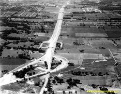
Above - Aerial view of the Hwy 401 & Hwy 11A (Avenue Road) Cloverleaf in Toronto, facing east. Photo taken on October 1, 1953. See an
Enlarged Photo Here. (Photo courtesy of Ontario Ministry of Transportation - © King's Printer for Ontario, 1953) 
Above - Aerial view of Hwy 401 at Weston Road in 1953, facing southwest. For three years, this interchange marked the end of the Toronto Bypass.
The ill-fated Humber River Bridge (seen in this photo at upper-right) was never actually put into service. Shortly before the portion of Hwy 401 from
Weston Road to Hwy 27 was scheduled to open, Hurricane Hazel swept across Southern Ontario. The devastating flood which ensued on October 15-16, 1954
washed away a considerable portion of the Hwy 401 bridge over the Humber River. The structure was so badly damaged by the flood that the Department of
Highways (DHO) was forced to dynamite the bridge and replace it with a new structure, delaying the completion of the west section of the Toronto
Bypass by nearly a full year. Photo taken on October 1, 1953. See an
Enlarged Photo Here. (Photo courtesy of Ontario Ministry of Transportation - © King's Printer for Ontario, 1953) 
Above - Aerial View of the Hwy 400 & Hwy 401 Cloverleaf in Toronto, looking southeast in 1953. This interchange was built as a full eight-ramp cloverleaf
in 1951, although the ramps that served the south leg of the interchange were never actually opened to traffic. By the time Hwy 400 was extended south to Jane Street
in 1966, the original 1951 cloverleaf had been replaced with a multi-level semi-directional interchange. Photo taken on October 1, 1953. See an
Enlarged Photo Here. (Photo © Archives of Ontario - Series RG-14-162-2, Box B986, Photo #648-10) 

Left - Culvert construction on the new London to Woodstock section of Hwy 401. Photo taken on November 4, 1953. (Photo courtesy of Ontario Ministry of Transportation - © King's Printer for Ontario, 1953) Right - Rock cut and grading on the Kingston Bypass (Hwy 401) east of Division Street. Photo taken on July 22, 1954. (Photo courtesy of Ontario Ministry of Transportation - © King's Printer for Ontario, 1954) 

Left - Aerial view of Hwy 27 facing south from the Hwy 401 Interchange in 1954. This great photograph shows the reconstruction of Hwy 27 as a freeway (today's
Hwy 427) as it passes through a rural section of Etobicoke before urban sprawl completely devoured the area. The overpasses over Hwy 27 (from foreground to background)
are the Toronto Bypass (Hwy 401, still under construction), Richview Sideroad (today's Eglinton Avenue), Rathburn Road, Burnhamthorpe Road, and Bloor Street. Today's
Pearson Airport is located just off the photo to the right, and the massive Hwy 401 & Hwy 427 interchange is now located just to the right of the centre of this
photo. Photo taken on July 9, 1954. See an Enlarged Photo Here. (Photo © Archives of Ontario - Series RG-14-162-2, Photo #550) Right - Hwy 401 approaching the Hwy 400 Cloverleaf in Toronto, looking east in 1954. The low traffic volumes on this section of Hwy 401 may surprise people who are familiar with the highway today. At the time this photo was taken, Hwy 401 ended a short distance away at Weston Road. It was not until 1955 that Hwy 401 was completed out to Hwy 27. Note the ground-mounted guide sign at right, marking the upcoming Hwy 400 Interchange on eastbound Hwy 401. Photo taken on October 7, 1954. See an Enlarged Photo Here. (Photo © Archives of Ontario - Series RG-14-151-5-15, Box B1103, Photo #414) 

Left - Workers assembling reinforcing steel for the London & Port Stanley Railway Overhead on Hwy 401 south of London. Photo taken on August 17, 1954. (Photo courtesy of Ontario Ministry of Transportation - © King's Printer for Ontario, 1954) Right - Interchange construction at the western end of the Toronto Bypass (Hwy 401) at Hwy 27, facing north from the Richview Sideroad Overpass in 1954. This interesting photo shows the extension of the Toronto Bypass to Hwy 27 in the background and the reconstruction of existing Hwy 27 as a four-lane controlled-access freeway in the foreground. The completion and opening of the Hwy 401 & Hwy 27 Interchange in 1955 allowed long-distance through traffic to travel between Hwy 400 and the Queen Elizabeth Way without passing through a single set of traffic signals. Photo taken on October 7, 1954. (Photo courtesy of Ontario Ministry of Transportation - © King's Printer for Ontario, 1954) 

Left - Aerial photo showing the western end of the Toronto Bypass (Hwy 401) at the Hwy 27 Interchange in 1954. Hwy 401 ended here for several years in the
mid-1950s, before it was extended westerly towards Hwy 25 in Milton. The Richview Sideroad (today's Eglinton Avenue) passes across the right corner of this photo. (Photo courtesy of Ontario Ministry of Transportation - © King's Printer for Ontario, 1954) Right - Mimico Creek arch culvert on the Toronto Bypass (Hwy 401) at the Hwy 27 Interchange (1954) (Photo courtesy of Ontario Ministry of Transportation - © King's Printer for Ontario, 1954) 
Above - Grading operations on a new section of the Toronto Bypass (Hwy 401) between Leslie Street and Woodbine Avenue. Photo taken on November 10, 1954. (Photo courtesy of Ontario Ministry of Transportation - © King's Printer for Ontario, 1954)
Continue on to King's Highway 401 Photos: Historical Photos: 1955 to 1959
|
|---|
Links to Adjacent King's Highway Photograph Pages:
Back to King's Highway 400 Photos /
King's Highway 401 History /
On to King's Highway 402 Photos
Ontario Highway History - Main Menu / Back to List of Highways Website contents, photos & text © 2002-2026, Cameron
Bevers (Webmaster) - All Rights Reserved / Contact Me
|
|---|