
| 
|  |
|
|
This page contains present day photos (Year 2000 to date) of Ontario's King's Highway 401, arranged by location from
Gananoque easterly to Brockville. All photographs displayed on this page were taken by the Webmaster (Cameron Bevers), unless specifically noted otherwise.
Click on any thumbnail to see a larger image!
Please note that all photographs displayed on this
website are protected by copyright. These photographs must not be reproduced, published,
electronically stored or copied, distributed, or posted onto other websites without
my written permission. If you want to use photos from this website, please
email me first for permission. Thank-you!
|
|---|
|
Page 35: Present Day King's Highway 401 Photographs (Gananoque to Brockville)

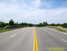
Left - Western side of the Hwy 32 Overpass (Site #16-101) on Hwy 401 in Gananoque. This single-span concrete rigid frame structure was constructed under
Contract #1956-130 and was completed in 1958. The designer's thoughtful use of curved lines on the wing walls and barriers complement the overall arched design of the
superstructure. The Hwy 32 Overpass is one of the most aesthetically-pleasing structures along Hwy 401. See an
Enlarged Photo Here. (Photograph taken on July 31, 2005 - © Cameron Bevers) Right - Facing north towards Seeleys Bay at the Hwy 32 Overpass on Hwy 401 in Gananoque. See an Enlarged Photo Here. (Photograph taken on July 31, 2005 - © Cameron Bevers) 
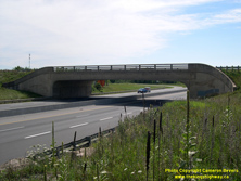
Left - Facing south across the Hwy 32 Overpass on Hwy 401 towards Downtown Gananoque. See an
Enlarged Photo Here. (Photograph taken on July 31, 2005 - © Cameron Bevers) Right - Eastern side of the Hwy 32 Overpass on Hwy 401 in Gananoque. See an Enlarged Photo Here. (Photograph taken on July 31, 2005 - © Cameron Bevers) 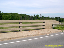

Left - Close-up of the unusual concrete bar-and-post bridge handrails on the Hwy 32 Overpass on Hwy 401. While many highway bridges were built between the
1940s and 1960s with the standard single bar-and-post handrail, a small number of bridges were constructed with a triple concrete bar like this example here. This
handrail design never saw widespread use on Ontario's provincial highway bridges, but was used on some municipal road bridges from this era. See an
Enlarged Photo Here. (Photograph taken on July 31, 2005 - © Cameron Bevers) Right - The design of the Hwy 32 Overpass is among the most unusual of all of the structures located along Hwy 401. The four wing walls of the bridge are stylishly streamlined into the bridge's handrails. Only one other bridge along Hwy 401 features this interesting design treatment. The other example is located at the Sydenham Road (Old Hwy 38) Interchange in Kingston, which was most likely designed by the same structural engineer. See an Enlarged Photo Here. (Photograph taken on July 31, 2005 - © Cameron Bevers) 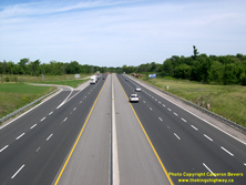

Left - Facing east along Hwy 401 towards Brockville from the Hwy 32 Overpass in Gananoque. The first construction contract for the Gananoque Bypass section of
Hwy 401 was awarded in October 1955, for seven miles of dual highway grading from Gananoque westerly under Contract #1955-198. Granular base and final paving took
place under Contract #1958-121. After nearly 4 years of construction, the Gananoque Bypass was completed and officially opened to traffic between Joyceville Road
located in Frontenac County and the Hwy 2 Interchange located at Gananoque's eastern entrance on August 6, 1959. The Gananoque Bypass was constructed at a cost of
$4,965,000 (in 1959 Dollars), the equivalent of about $50 Million in 2023 Dollars. See an
Enlarged Photo Here. (Photograph taken on July 31, 2005 - © Cameron Bevers) Right - Thousand Islands Parkway Interchange on Hwy 401 in Gananoque. The flyover at this partial directional interchange carries westbound traffic on the Thousand Islands Parkway across the eastbound lanes of Hwy 401. It mirrors a similar partial directional interchange at the other end of the Thousand Islands Parkway near Brockville. This three-span pre-stressed concrete girder structure was constructed under Contract #1964-169 and was completed in 1965. Due to construction sequencing, the bridge didn't actually open to traffic until 1967. See an Enlarged Photo Here. (Photograph taken on July 31, 2005 - © Cameron Bevers) 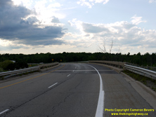
Left - Thousand Islands Parkway Flyover (Site #16-159) across the eastbound lanes of Hwy 401 in Gananoque, facing west. This was the very last structure built
with the concrete bar-and-post handrail on a provincial highway. The concrete bar-and-post handrail design had been used on many Department of Highways' built bridges
since being introduced in 1943, but the design was retired and supplanted by other concrete and steel handrails of various designs by the mid-1960s. See an
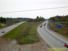
Enlarged Photo Here. (Photograph taken on July 2, 2012 - © Cameron Bevers) Right - Facing west along Hwy 401 towards Kingston from the Hwy 2 Overpass just east of Gananoque. In the background, the flyover carrying the westbound Thousand Islands Parkway ramp can be seen crossing over the eastbound lanes of Hwy 401. The parkway merges into the westbound lanes of Hwy 401 on the left-hand side of the highway. Construction began in 1964 on the first few miles of the Gananoque-Crystal Beach Diversion of Hwy 401, which saw many miles of the highway relocated onto a more direct four-lane alignment. Previously, Hwy 401 followed a two-lane route along the St. Lawrence River on what is now the Thousand Islands Parkway. Grading for the first 4 1/2 miles of the diversion was built under Contract #1964-303, which included a new interchange at Hwy 2. See an Enlarged Photo Here. (Photograph taken on October 9, 2004 - © Cameron Bevers) 
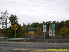
Left - Unusual green guide sign at the Hwy 2 Interchange in Gananoque, marking the on-ramps to Hwy 401 East and Hwy 401 West. See an
Enlarged Photo Here. (Photograph taken on October 9, 2004 - © Cameron Bevers) Right - Junction route marker assembly on the exit ramp from westbound Hwy 401 to Hwy 2 at Gananoque. This ramp marks the eastern limits of the Ministry of Transportation's very brief ownership of Hwy 2 in this part of Eastern Ontario. About 1 km of Hwy 2 east of Gananoque remains under provincial jurisdiction. The remainder of Hwy 2 from this point easterly to Lancaster, near the Quebec Boundary was transferred or "downloaded" to local municipalities in sections between 1993 and 1999. Note the bilingual "Heritage Highway" route marker - a vestige from the past when the province signed numerous long-distance tourist routes along Ontario's Highways. See an Enlarged Photo Here. (Photograph taken on October 9, 2004 - © Cameron Bevers) 
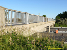
Left - Facing south across the Cliffe Road Overpass (Site #16-157) on Hwy 401 east of Gananoque. See an
Enlarged Photo Here. (Photograph taken on June 24, 2016 - © Cameron Bevers) Right - Western side of the Cliffe Road Overpass on Hwy 401. This four-span pre-stressed concrete girder structure was built under Contract #1966-113 and was completed in 1967. The median along Hwy 401 east of Gananoque is very wide, so the crossing road bridges in this area are extraordinarily long. Although it is not the longest structure in the area, the Cliffe Road Overpass has a hefty length of 242 feet. See an Enlarged Photo Here. (Photograph taken on June 24, 2016 - © Cameron Bevers) 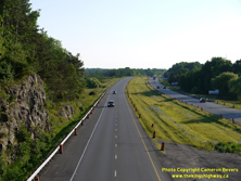

Left - View of Hwy 401 facing west towards Gananoque from the Cliffe Road Overpass. In the Gananoque and Thousand Islands area, Hwy 401 passes through the
Canadian Shield - a vast expanse of rocky terrain which is more typically seen in Northern Ontario. The bedrock lies very close to the surface in this area. Several
rather dramatic rock cuts can be observed in this area, such as the one which towers above Hwy 401 traffic at left. This is the only location along the entire route
of Hwy 401 where the highway passes through the Canadian Shield. See an Enlarged Photo Here. (Photograph taken on June 24, 2016 - © Cameron Bevers) Right - Eastern side of the Cliffe Road Overpass on Hwy 401 east of Gananoque. See an Enlarged Photo Here. (Photograph taken on June 24, 2016 - © Cameron Bevers) 
Left - Facing north across the Cliffe Road Overpass on Hwy 401 east of Gananoque. See an
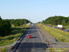
Enlarged Photo Here. (Photograph taken on June 24, 2016 - © Cameron Bevers) Right - View of the westbound lanes of Hwy 401, facing east towards Brockville from the Cliffe Road Overpass. About 25 miles (40 km) of Hwy 401 was relocated onto a new more direct route east of Gananoque during the mid-to-late 1960s. It was decided that it would be too difficult to upgrade the existing two-lane route of Hwy 401 along the St. Lawrence River, which operated more like a scenic parkway rather than a long-distance through highway. See an Enlarged Photo Here. (Photograph taken on June 24, 2016 - © Cameron Bevers) 

Left - Facing west along Hwy 401 towards Gananoque from the Reynolds Road Interchange. Grading work for the realignment of Hwy 401 in this area was carried
out under Contract #1965-165, which included the construction of the overpass and interchange at Reynolds Road. See an
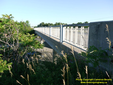
Enlarged Photo Here. (Photograph taken on June 24, 2016 - © Cameron Bevers) Right - Western side of the Reynolds Road Overpass (Site #16-155) on Hwy 401 near Ivy Lea. This four-span pre-stressed concrete girder structure was built under Contract #1965-165 and was completed in 1966. The interchange at Reynolds Road was one of six new interchanges built along the relocated route of Hwy 401 between Gananoque and Brockville during the 1960s. Nearly 40 km of Hwy 401 was reconstructed on a new inland alignment between 1964 and 1968. Originally, Hwy 401 was signed via the present-day route of the Thousand Islands Parkway. See an Enlarged Photo Here. (Photograph taken on June 24, 2016 - © Cameron Bevers) 
Left - Facing north across the Reynolds Road Overpass on Hwy 401 towards Lansdowne. The ramps at the Reynolds Road Interchange are in a diamond configuration,
with offset north and south ramp terminal intersections. See an Enlarged Photo Here. (Photograph taken on June 24, 2016 - © Cameron Bevers) Right - Eastern side of the Reynolds Road Overpass on Hwy 401 near Ivy Lea. See an Enlarged Photo Here. (Photograph taken on June 24, 2016 - © Cameron Bevers) 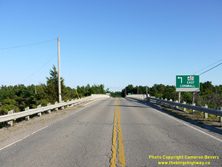

Left - Facing south across the Reynolds Road Overpass on Hwy 401 near Ivy Lea. Cornwall is listed as the eastbound control city for Hwy 401 beyond Kingston.
Cornwall is a mid-sized Eastern Ontario city which lies about 30 km west of the Ontario-Quebec Boundary. See an
Enlarged Photo Here. (Photograph taken on June 24, 2016 - © Cameron Bevers) Right - Concrete and steel handrail design of the Reynolds Road Overpass on Hwy 401. See an Enlarged Photo Here. (Photograph taken on June 24, 2016 - © Cameron Bevers) 

Left - Facing east along Hwy 401 towards Brockville from the Reynolds Road Overpass. The next interchange along Hwy 401 to the east is Hwy 137, which
connects to Hill Island, the Thousand Islands-Ivy Lea Bridge and Interstate 81 in New York State. The section of Hwy 401 between Gananoque and the Hwy 137 Interchange
was completed and officially opened to traffic on September 1, 1967. Hwy 401 temporarily ended at the Hwy 137 Interchange for about one year, while the final section of Hwy 401
from the Hwy 137 Interchange to Crystal Beach west of Brockville was being constructed. See an
Enlarged Photo Here. (Photograph taken on June 24, 2016 - © Cameron Bevers) Right - Green exit guide sign for Hwy 137 on eastbound Hwy 401. After decades of being an unsigned King's Highway, a posted route number was reintroduced on Hwy 137 in 2006. Previously, Hwy 137 was simply signed as "Bridge to USA" and trailblazed to Interstate 81 with no Ontario highway number shown. Interestingly, Hill Island was named as the destination control city for southbound Hwy 137. See an Enlarged Photo Here. (Photograph taken on August 11, 2007 - © Cameron Bevers) 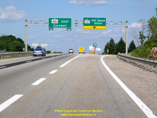
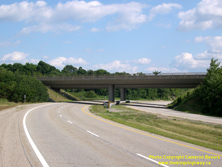
Left - Overhead exit guide signs on eastbound Hwy 401 at the Hwy 137 Interchange near Ivy Lea. See an
Enlarged Photo Here. (Photograph taken on August 11, 2007 - © Cameron Bevers) Right - Northern side of the Hwy 137 Underpass (Site #16-164) on Hwy 401 near Ivy Lea. These two-span post-tensioned concrete structures carry the eastbound and westbound lanes of Hwy 401 across Hwy 137. Both structures were completed in 1967 and were opened to through traffic on Hwy 401 in the Fall of 1968. The Hwy 137 & Hwy 401 Interchange itself was constructed under Contract #1965-250, along with a 1-mile extension of Hwy 137 from the existing two-lane route of Hwy 401 northerly to the new Hwy 401 Diversion. This work included the construction of the dual Hwy 401 structures over the ramps to Hwy 137 and dual highway grading along the relocated route of Hwy 401 for a distance of about 2 miles. See an Enlarged Photo Here. (Photograph taken on August 11, 2007 - © Cameron Bevers) 

Left - Southern side of the Hwy 137 Underpass on Hwy 401 near Ivy Lea. Granular base and final paving on Hwy 401 from Gananoque to the Hwy 137 Interchange and
southerly along Hwy 137 to the existing two-lane route of Hwy 401 was constructed under Contract #1966-113, which enabled the opening of this section of Hwy 401 in
September 1967. See an Enlarged Photo Here. (Photograph taken on August 11, 2007 - © Cameron Bevers) Right - Overhead guide signs at the northern terminus of Hwy 137 at the Hwy 401 Interchange. The ramps at the Hwy 137 Interchange are in a "Trumpet-B" configuration, with westbound Hwy 401 traffic exiting from the freeway to southbound Hwy 137 via a loop ramp in the northwest interchange quadrant. See an Enlarged Photo Here. (Photograph taken on August 11, 2007 - © Cameron Bevers) 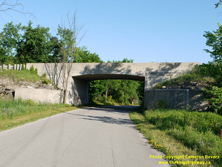

Left - Escott-Rockport Road Underpass (Site #16-154) below the westbound lanes of Hwy 401 west of Brockville. This single-span concrete rigid frame structure
was completed in 1966. This was one of two bridges constructed along the new route of Hwy 401 under Contract #1965-217. A similar bridge exists below the eastbound
lanes of Hwy 401 just a short distance ahead. This bridge work was included with the grading work for an additional 6 1/2 miles of highway relocation from east of the
Hwy 137 Interchange to west of Mallorytown Road. See an Enlarged Photo Here. (Photograph taken on June 24, 2016 - © Cameron Bevers) Right - Southern side of the Escott-Rockport Road Underpass below the westbound lanes of Hwy 401. See an Enlarged Photo Here. (Photograph taken on June 24, 2016 - © Cameron Bevers) 
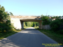
Left - Date stamp (1966) and structure identification number (Site #16-153) on the Escott-Rockport Road Underpass below the eastbound lanes of Hwy 401. See an
Enlarged Photo Here. (Photograph taken on June 24, 2016 - © Cameron Bevers) Right - Northern side of the Escott-Rockport Road Underpass below the eastbound lanes of Hwy 401. See an Enlarged Photo Here. (Photograph taken on June 24, 2016 - © Cameron Bevers) 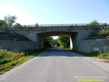

Left - Southern side of the Escott-Rockport Road Underpass below the eastbound lanes of Hwy 401 west of Brockville. This single-span concrete rigid frame
structure was completed in 1966. This township road also passes below the westbound lanes of Hwy 401 in the background. The width of Hwy 401's median expands to an
unprecedented 200 m in this area. The highway was built this way to avoid the construction of a deep rock cut though a hill which lies east of Escott-Rockport Road.
Rather than grade through the hill, the highway's designers simply flared out the centre median and the hill was left in place between the eastbound and westbound
carriageways. See an Enlarged Photo Here. (Photograph taken on June 24, 2016 - © Cameron Bevers) Right - Facing north across the La Rue Mills Road Overpass (Site #16-138) on Hwy 401 near Mallorytown. At a length of about 295 feet (90 metres), the La Rue Mills Road Overpass is the second-longest structure along Hwy 401 between Gananoque and Brockville, second only to the skewed Hwy 2 Overpass immediately east of Gananoque which measures a whopping 331 feet (101 metres) in length. See an Enlarged Photo Here. (Photograph taken on June 24, 2016 - © Cameron Bevers) 

Left - Facing east along Hwy 401 towards Brockville from the La Rue Mills Road Overpass. See an
Enlarged Photo Here. (Photograph taken on June 24, 2016 - © Cameron Bevers) Right - Concrete and steel handrail design of the La Rue Mills Road Overpass on Hwy 401. This structure was built under Contract #1967-21, which also included granular base and paving of about 6 1/2 miles of the Hwy 401 Diversion in the vicinity of La Rue Mills Road. See an Enlarged Photo Here. (Photograph taken on June 24, 2016 - © Cameron Bevers) 
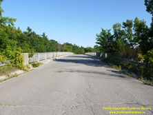
Left - View of the eastbound lanes of Hwy 401, facing west towards Gananoque from the La Rue Mills Road Overpass. See an
Enlarged Photo Here. (Photograph taken on June 24, 2016 - © Cameron Bevers) Right - Facing south across the La Rue Mills Road Overpass near Mallorytown. See an Enlarged Photo Here. (Photograph taken on June 24, 2016 - © Cameron Bevers) 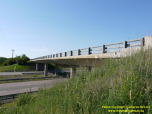
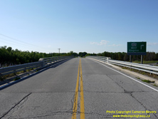
Left - Western side of the Mallorytown Road Overpass (Site #16-162) on Hwy 401 near Mallorytown. This four-span post-tensioned concrete structure was
built under Contract #1966-136 and was completed in 1967. See an Enlarged Photo Here. (Photograph taken on June 24, 2016 - © Cameron Bevers) Right - Facing north towards Mallorytown across the Mallorytown Road Overpass on Hwy 401. This road provides a fairly direct connection between Hwy 2 which lies just to the north of Hwy 401 and the Thousand Islands Parkway at Mallorytown Landing. Interestingly, Mallorytown Road itself was being considered for assumption by the Department of Highways of Ontario (DHO) as a new King's Highway in the mid-1930s. Prior to the construction of the Thousand Islands Bridge, a ferry service connected Ontario to New York State across the St. Lawrence River. The proposed King's Highway would have provided improved road access to Hwy 2 from the ferry dock near Rockport, via Mallorytown Landing. The proposal to assume Mallorytown Road as a King's Highway was ultimately scrapped before a highway number was ever assigned to the route. Although the reasons may never be known for certain, it is quite possible that the proposal was shelved once the new Thousand Islands Bridge was proposed just a few miles to the west. Once constructed, the fixed bridge link would naturally become the preferred route for motorists. See an Enlarged Photo Here. (Photograph taken on June 24, 2016 - © Cameron Bevers) 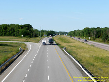
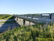
Left - View of Hwy 401 facing east towards Brockville from the Mallorytown Road Overpass. The ramps at the Mallorytown Road Interchange are in a "Parclo A-2"
configuration, with two ramps in each of the northeast and southwest interchange quadrants. See an
Enlarged Photo Here. (Photograph taken on June 24, 2016 - © Cameron Bevers) Right - Eastern side of the Mallorytown Road Overpass on Hwy 401. This structure is not as skewed as some of the other crossings along Hwy 401 in this area, and has a length of 295 feet, 8 inches (90 metres) even though this structure also accommodates the interchange speed change lanes below the structure. See an Enlarged Photo Here. (Photograph taken on June 24, 2016 - © Cameron Bevers) 

Left - Facing west along Hwy 401 towards Gananoque from the Mallorytown Road Overpass. With Hwy 401 rapidly nearing completion in the mid-1960s, a decision was
made to tender one large contract during 1966 for the completion of grading, culverts and structures from east of La Rue Mills Road to the end of the proposed Hwy 401
Diversion at Crystal Beach. This final 8 1/2 mile grading project included all structures from Mallorytown easterly to Crystal Beach, including the Mallorytown Road
and Crystal Beach Interchanges. All were constructed under Contract #1966-136. See an
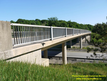
Enlarged Photo Here. (Photograph taken on June 24, 2016 - © Cameron Bevers) Right - Facing south towards Mallorytown Landing at the Mallorytown Road Overpass on Hwy 401. See an Enlarged Photo Here. (Photograph taken on June 24, 2016 - © Cameron Bevers) 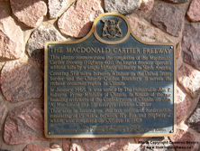
Left - Department of Highways' historical plaque at the Mallorytown Service Centre commemorating the completion of Hwy 401 in 1968. This plaque is situated
within the final section of Hwy 401, which was completed and officially opened to traffic between the Hwy 137 Interchange and the Thousand Islands Parkway Interchange
at Crystal Beach on October 11, 1968. The construction of Hwy 401 was a monumental, if not defining, achievement for the DHO - a four-lane link across the
heavily-populated southern half of Ontario. The concept of a superhighway link across Ontario had been considered by the DHO as early as 1937, but 31 years later,
that dream had finally come to fruition. Regardless of whether one loves or hates Hwy 401, one cannot deny that the highway's impact on Ontario's economy and our way
of life has been both obvious and profound. While many of us take Hwy 401 for granted, the province would simply not be as we know it today had Hwy 401 not been
built. See an Enlarged Photo Here. (Photograph taken on October 9, 2004 - © Cameron Bevers) Right - Western side of the Sherwood Springs Road Overpass (Site #16-177) on Hwy 401 west of Brockville. This four-span post-tensioned concrete structure was built under Contract #1966-136 and was completed in 1967. See an Enlarged Photo Here. (Photograph taken on June 24, 2016 - © Cameron Bevers) 
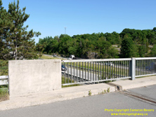
Left - Facing north across the Sherwood Springs Road Overpass on Hwy 401 west of Brockville. See an
Enlarged Photo Here. (Photograph taken on June 24, 2016 - © Cameron Bevers) Right - Concrete and steel handrail design of the Sherwood Springs Road Overpass on Hwy 401. See an Enlarged Photo Here. (Photograph taken on June 24, 2016 - © Cameron Bevers) 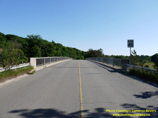
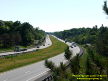
Left - Facing south across the Sherwood Springs Road Overpass on Hwy 401. See an
Enlarged Photo Here. (Photograph taken on June 24, 2016 - © Cameron Bevers) Right - View of Hwy 401 from the Sherwood Springs Road Overpass west of Brockville, facing west towards Gananoque. The granular base and final paving for the last 8-mile gap in the Hwy 401 Diversion from Gananoque to Crystal Beach was constructed under Contract #1967-217, which permitted the opening of Hwy 401 to traffic in the Fall of 1968. See an Enlarged Photo Here. (Photograph taken on June 24, 2016 - © Cameron Bevers) 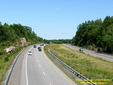
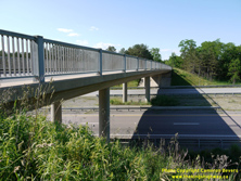
Left - Facing east along Hwy 401 towards Brockville from the Sherwood Springs Road Overpass. The section of Hwy 401 between the Hwy 137 Interchange and the
Crystal Beach Interchange was the final gap in the completion of the four-lane route of Hwy 401 across Ontario. The final gap in Hwy 401 was officially opened to
traffic on Friday, October 11, 1968 - just in time for the Canadian Thanksgiving Weekend. See an
Enlarged Photo Here. (Photograph taken on June 24, 2016 - © Cameron Bevers) Right - Eastern side of the Sherwood Springs Road Overpass on Hwy 401 near Brockville. See an Enlarged Photo Here. (Photograph taken on June 24, 2016 - © Cameron Bevers) 
Left - Eastern terminus of the Thousand Islands Parkway at the Crystal Beach Interchange on Hwy 401. The ramp at right leads to eastbound Hwy 401, while
westbound traffic which has exited from Hwy 401 can be seen using the ramp at left. When the Thousand Islands Parkway was first constructed in the 1930s and 1940s,
the highway actually curved to the right towards Brockville at this point. The Crystal Beach Interchange was constructed under Contract #1966-136 and was fully opened
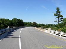
to traffic in the Fall of 1968. See an Enlarged Photo Here. (Photograph taken on June 24, 2016 - © Cameron Bevers) Right - An iconic windswept white pine towers over the Crystal Beach Overpass at the Thousand Islands Parkway and Hwy 401 Interchange west of Brockville. This interchange features a left-hand exit ramp from westbound Hwy 401, so this flyover crosses over the eastbound lanes of Hwy 401 only. See an Enlarged Photo Here. (Photograph taken on June 24, 2016 - © Cameron Bevers) 

Left - Eastern side of the Crystal Beach Overpass at the Thousand Islands Parkway and Hwy 401 Interchange. This three-span post-tensioned concrete structure
was completed in 1967. At right, the eastbound lanes of Hwy 401 approach the merge with the ramp from the eastbound Thousand Islands Parkway. This is a partial
interchange, with east-oriented ramps only. Traffic wishing to access the Thousand Islands Parkway from the west, or access westbound Hwy 401 can turn around using
the Hwy 2 Interchange at Long Beach, which is located a short distance to the east. See an
Enlarged Photo Here. (Photograph taken on June 24, 2016 - © Cameron Bevers) Right - Facing west across the Crystal Beach Overpass on Hwy 401. This ramp carries the westbound exit ramp from Hwy 401 to the westbound Thousand Islands Parkway. This structure features the uncommon single-rail DHO parapet wall, which was used on a limited number of provincial highway structures during the late 1960s. The more commonly seen double-rail DHO parapet wall became the preferred barrier type on highway bridges for many years and was used extensively throughout Ontario until well into the 1970s. See an Enlarged Photo Here. (Photograph taken on June 24, 2016 - © Cameron Bevers) 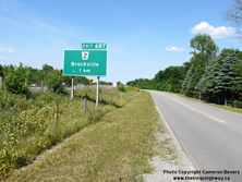

Left - Green exit guide sign for the upcoming Hwy 2 Interchange on eastbound Hwy 401. This sign features an older exit number tab from the 1980s which still
has the word "EXIT" on it. Newer exit number tabs in Ontario only feature the numerical exit number with no accompanying text. See an
Enlarged Photo Here. (Photograph taken on June 24, 2016 - © Cameron Bevers) Right - Approaching the Hwy 2 Interchange on Hwy 401 at Long Beach, facing east. This curve marks the beginning of the Brockville Bypass section of Hwy 401, which was one of the earlier sections of Hwy 401 to be constructed. Construction began on the Brockville Bypass in late 1954 and took about 6 years to complete. See an Enlarged Photo Here. (Photograph taken on June 24, 2016 - © Cameron Bevers) 
Left - View of Hwy 401 at the Hwy 2 Interchange at Long Beach, facing west. Hwy 401 nearly touches the shores of the St. Lawrence River as the highway rounds
this curve. The riverbank lies less than 100 metres from the edge of the highway, which marks the closest point the highway gets to the St. Lawrence River or any of
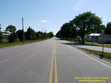
the Great Lakes. See an Enlarged Photo Here. (Photograph taken on June 24, 2016 - © Cameron Bevers) Right - Facing west along Hwy 2 towards Mallorytown from the Long Beach Interchange on Hwy 401. This once-important section of Hwy 2 was first established as a Provincial Highway in 1919. It was bypassed by the Thousand Islands Parkway (Hwy 2S) during the 1940s and by the new four-lane route of Hwy 401 in 1968. Since the route of Hwy 2 had become somewhat redundant due to the construction of parallel highways nearby, jurisdiction over Hwy 2 was ultimately transferred from the province to the United Counties of Leeds and Grenville in 1993. See an Enlarged Photo Here. (Photograph taken on June 24, 2016 - © Cameron Bevers) 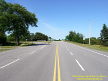
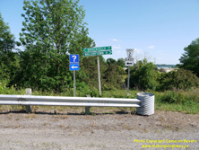
Left - Facing east along Hwy 2 approaching the Long Beach Interchange on Hwy 401. This is one of several points along the route of Hwy 401 across Ontario where
Hwy 2 crosses the freeway. East of this point, Hwy 2 does not intersect with Hwy 401 again until Lancaster, located near the Ontario-Quebec Boundary. See an
Enlarged Photo Here. (Photograph taken on June 24, 2016 - © Cameron Bevers) Right - Old fingerboard guide signs at the Hwy 2 Interchange on Hwy 401 at Long Beach, west of Brockville. Although Gananoque is the next major centre located along Hwy 2, through traffic is encouraged to use Hwy 401 rather than Hwy 2. Accordingly, motorists are only guided to nearby Mallorytown via Hwy 2. See an Enlarged Photo Here. (Photograph taken on June 24, 2016 - © Cameron Bevers) 
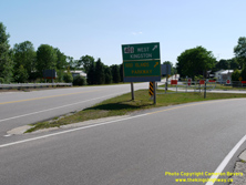
Left - Facing east towards Brockville at the Hwy 2 Overpass on Hwy 401 at Long Beach. The ramps at the Hwy 2 Interchange are in a "Parclo A-2"
configuration on the northwestern side and a diamond configuration on the southeastern side. See an
Enlarged Photo Here. (Photograph taken on June 24, 2016 - © Cameron Bevers) Right - Green guide signs marking the entrance ramp to westbound Hwy 401 from westbound Hwy 2. This ramp is also signed as the Thousand Islands Parkway, which exits from the left-hand side of Hwy 401 a short distance to the west. It is not possible to access the Thousand Islands Parkway directly from Hwy 2 in the Brockville area, although the two routes are connected by a small number of municipal roads located west of Brockville. However, the quickest access to the Thousand Islands Parkway from Hwy 2 is via Hwy 401, as signed. See an Enlarged Photo Here. (Photograph taken on June 24, 2016 - © Cameron Bevers) 

Left - Facing west towards Mallorytown at the Hwy 2 Overpass at the Long Beach Interchange on Hwy 401. See an
Enlarged Photo Here. (Photograph taken on June 24, 2016 - © Cameron Bevers) Right - Eastern side of the Hwy 2 Overpass on Hwy 401 at Long Beach. This single-span concrete rigid frame structure was built under Contract #1958-197 and was completed in 1959. This was among the last of the single-span concrete rigid frame bridges built along Ontario's 400-Series Highways. This graceful bridge design was retired in the early 1960s, once wider centre medians were implemented along Ontario's freeways. The widened centre medians necessitated the use of much longer bridges to span across the freeway. See an Enlarged Photo Here. (Photograph taken on June 24, 2016 - © Cameron Bevers) 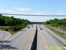
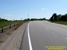
Left - Facing east along Hwy 401 towards Brockville from the Hwy 2 Overpass at Long Beach. About 5 1/2 miles of dual highway grading was carried out from
the Hwy 2 Interchange easterly to the Hwy 29 Interchange under Contract #1957-74. Granular base and final paving of Hwy 401 was carried out between the Hwy 2 and
Hwy 29 Interchanges under Contract #1959-32. The Brockville Bypass was opened to traffic as a two-lane highway on November 13, 1959. Initially, all traffic used the
south (eastbound) carriageway until the north (westbound) carriageway was completed. The north carriageway of the Brockville Bypass was officially opened to traffic
on September 16, 1960, after which time the existing south carriageway was converted to carry eastbound Hwy 401 traffic only. See an
Enlarged Photo Here. (Photograph taken on June 24, 2016 - © Cameron Bevers) Right - Approaching the Hwy 401 Interchange along Hwy 2, facing west towards Mallorytown. The route of Hwy 2 seen here is actually not the original highway's alignment. During construction of the Long Beach Interchange in the late 1950s, the route of Hwy 2 was reconstructed on a new alignment further to the south. This was done to improve the crossing angle where Hwy 2 intersected with the proposed route of Hwy 401. Previously, Hwy 2 crossed the proposed freeway at a badly-skewed location, which would have greatly complicated bridge and interchange ramp connection design. See an Enlarged Photo Here. (Photograph taken on June 24, 2016 - © Cameron Bevers) 

Left - View of Hwy 2 facing east towards Brockville from the Long Beach Interchange at Hwy 401. At this curve, a four-lane divided highway begins and heads
easterly towards Brockville. This dual highway was one of Ontario's earliest, having been constructed in the late 1930s. The four-lane route once tied directly into
the Thousand Islands Parkway (Hwy 2S), although the easternmost portion of the connection to Hwy 2S was obliterated during construction of various phases of Hwy 401.
See an Enlarged Photo Here. (Photograph taken on June 24, 2016 - © Cameron Bevers) Right - An older guide sign on westbound Hwy 2 marking the route of the Thousand Islands Parkway via Hwy 401. See an Enlarged Photo Here. (Photograph taken on June 24, 2016 - © Cameron Bevers)
Continue on to King's Highway 401 Photos: Brockville to Quebec Boundary
|
|---|
Links to Adjacent King's Highway Photograph Pages:
Back to Hwy 401 - Kingston to Gananoque
Hwy 401 Photo Index
On to Hwy 401 - Brockville to Quebec Boundary
Back to King's Highway 400 Photos /
King's Highway 401 History /
On to King's Highway 402 Photos
Ontario Highway History - Main Menu / Back to List of Highways Website contents, photos & text © 2002-2026, Cameron
Bevers (Webmaster) - All Rights Reserved / Contact Me
|
|---|