
| 
| |
|
|
This page contains historical photos of Ontario's King's Highway 401 dating from 1980 to 1984. All photographs displayed on
this page were taken by the Ontario Ministry of Transportation, unless specifically noted otherwise. Historical photographs are arranged in approximate chronological
order. Click on any thumbnail to see a larger image!
Please note that all photographs displayed on this
website are protected by copyright. These photographs must not be reproduced, published,
electronically stored or copied, distributed, or posted onto other websites without
my written permission. If you want to use photos from this website, please
email me first for permission. Thank-you!
|
|---|
|
Page 7: Historical King's Highway 401 Photographs (1980 to 1984)

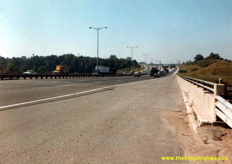
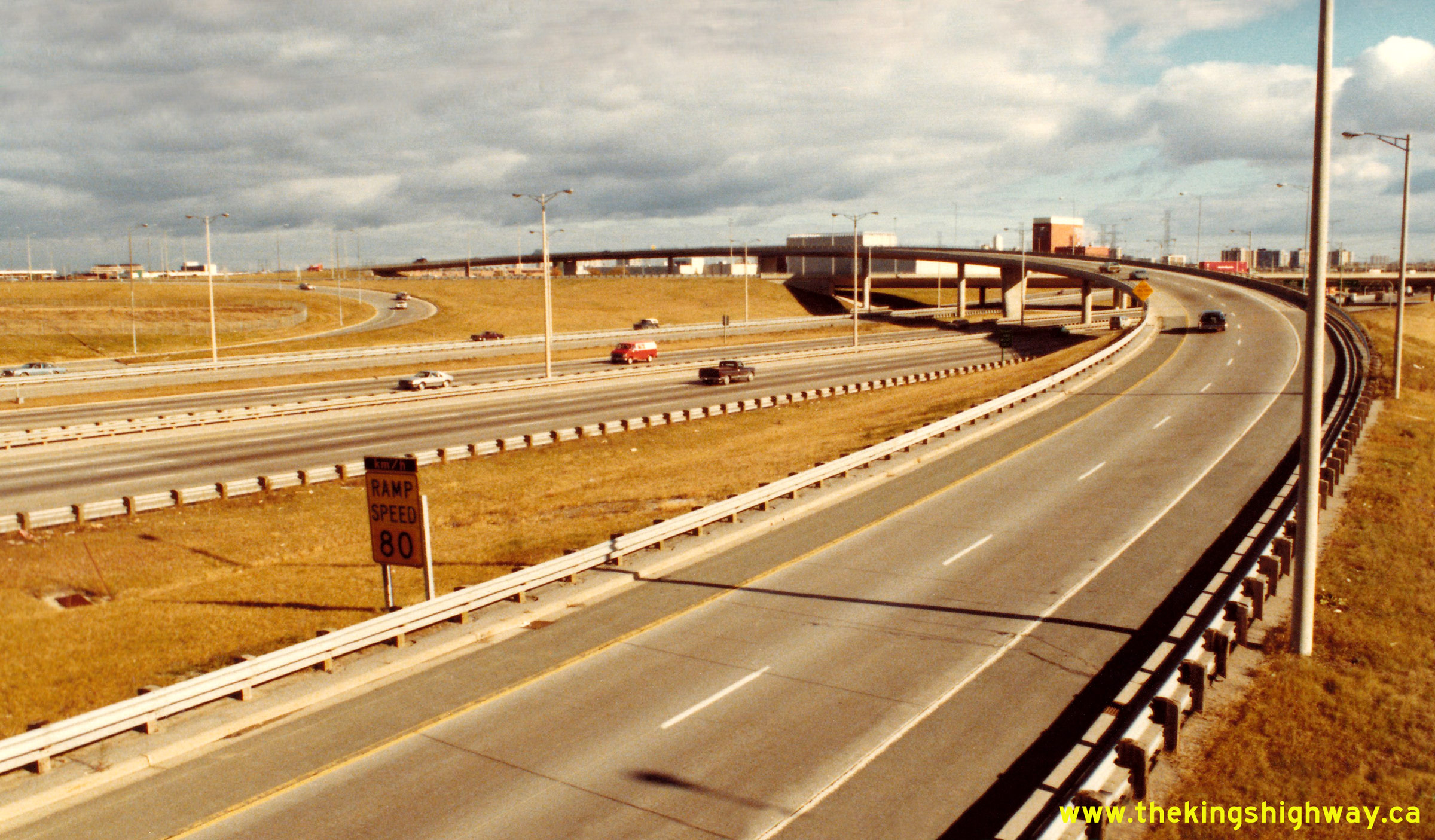
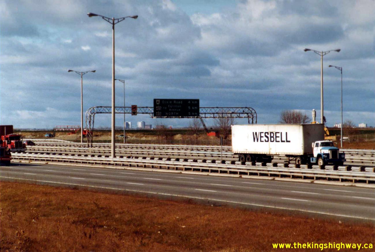
Above - Facing east along Eastbound Hwy 401 from the Hwy 410 Interchange in Mississauga in 1980. Originally, traffic entering Eastbound Hwy 401 from
Southbound Hwy 410 had to use the sub-collector lanes approaching Dixie Road, which can be seen in the foreground. The Dixie Road sub-collector lanes were
separated from the Eastbound Hwy 401 lanes by a steel beam guide rail median to minimize weaving conflicts. A temporary transfer existed near Tomken Road
to allow traffic from Hwy 410 to leave the Dixie Road sub-collector lanes and join the Eastbound Hwy 401 lanes. This temporary transfer was removed in the
early 1990s, when a new flyover was built from Southbound Hwy 410 to Eastbound Hwy 401. Photo taken on October 7, 1980. (Photo courtesy of Ontario Ministry of Transportation - © King's Printer for Ontario, 2011) 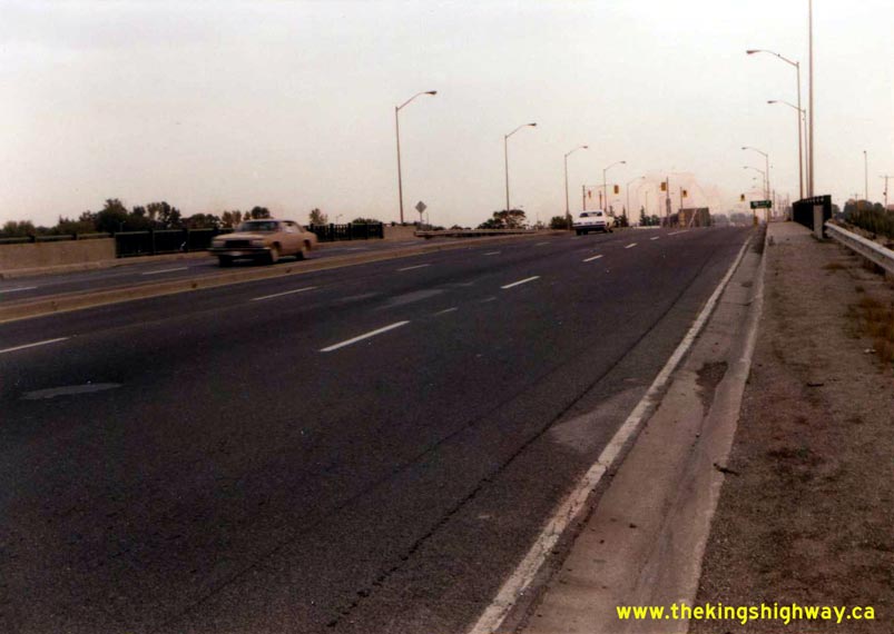
Above - Facing south across the Hwy 10 (Hurontario Street) Overpass at the Hwy 401 Interchange in Mississauga (October 7, 1980) (Photo courtesy of Ontario Ministry of Transportation - © King's Printer for Ontario, 2011) 

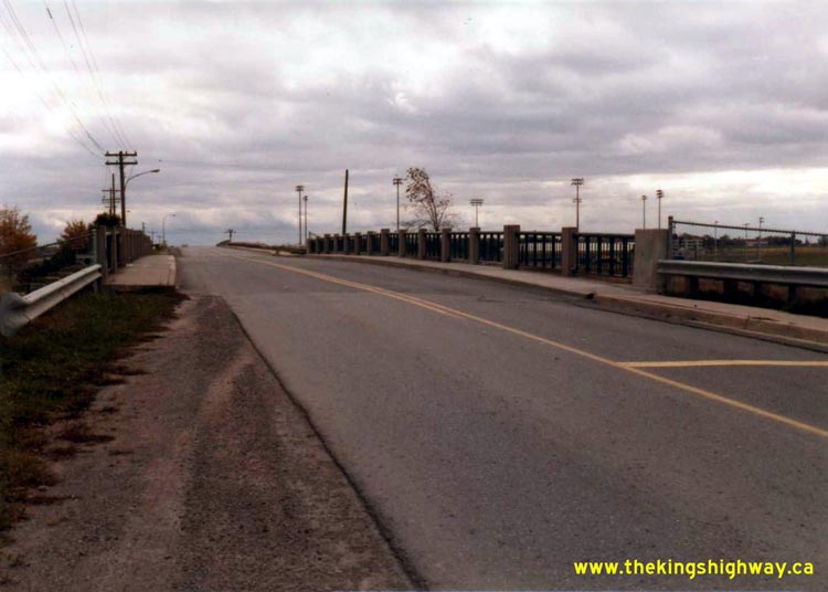
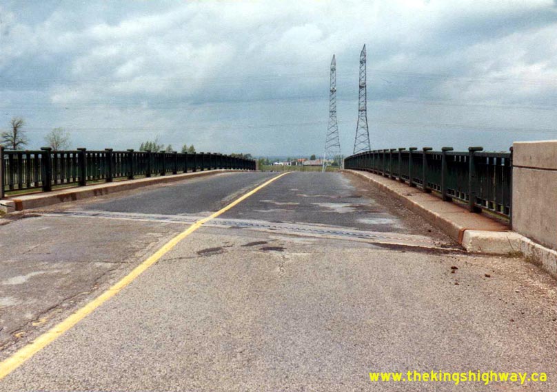
Left - Facing west along Hwy 401 towards Toronto at the Duffins Creek Bridge in Ajax (October 21, 1980) (Photo courtesy of Ontario Ministry of Transportation - © King's Printer for Ontario, 2011) Right - Facing west along Westbound Hwy 401 from the Duffins Creek Bridge in Ajax in 1980. The acceleration lane on the right side of Hwy 401 is the on-ramp from Church Street. The Church Street Interchange (Former Exit #400) was one of Hwy 401's original 1940s-era interchanges. The Church Street Interchange was closed off to traffic permanently in 1987, when the new Westney Road Interchange was completed nearby. Photo taken on October 21, 1980. (Photo courtesy of Ontario Ministry of Transportation - © King's Printer for Ontario, 2011) 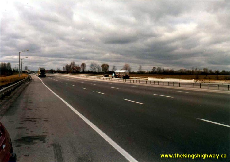

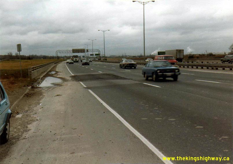
Left - Facing west along the eastbound lanes of Hwy 401 towards the Whitby Truck Scales at Lynde Creek (October 29, 1980) (Photo courtesy of Ontario Ministry of Transportation - © King's Printer for Ontario, 2011) Right - Facing east along Hwy 401 towards the Simcoe Street Overpass, showing the completed highway widening through Oshawa (October 29, 1980) (Photo courtesy of Ontario Ministry of Transportation - © King's Printer for Ontario, 2011) 
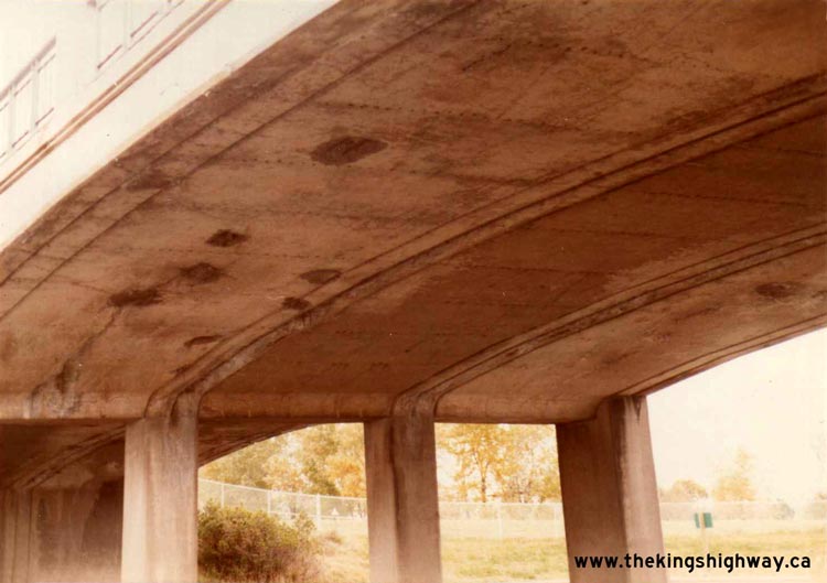
Left - Facing east along the eastbound lanes of Hwy 401 at the Henry Street Overpass in Whitby (October 29, 1980) (Photo courtesy of Ontario Ministry of Transportation - © King's Printer for Ontario, 2011) Right - Soffit of the Henry Street Overpass on Hwy 401 in Whitby in 1980. The Henry Street Overpass was completed in 1940. The design is nearly identical to the original Rougemount Drive Overpass that was built on Hwy 401 in Pickering in 1939. Photo taken on October 29, 1980. (Photo courtesy of Ontario Ministry of Transportation - © King's Printer for Ontario, 2011) 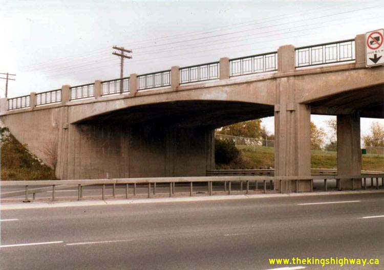
Left - Western side of the Henry Street Overpass on Hwy 401 in Whitby (October 29, 1980) (Photo courtesy of Ontario Ministry of Transportation - © King's Printer for Ontario, 2011) Right - Facing south across the Henry Street Overpass on Hwy 401 in Whitby (October 29, 1980) (Photo courtesy of Ontario Ministry of Transportation - © King's Printer for Ontario, 2011) 

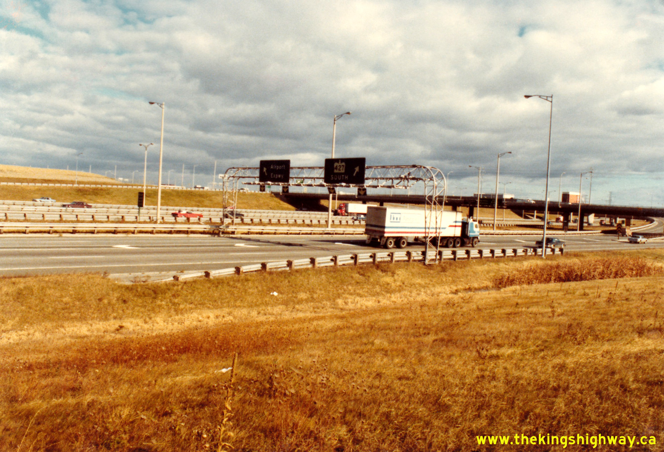
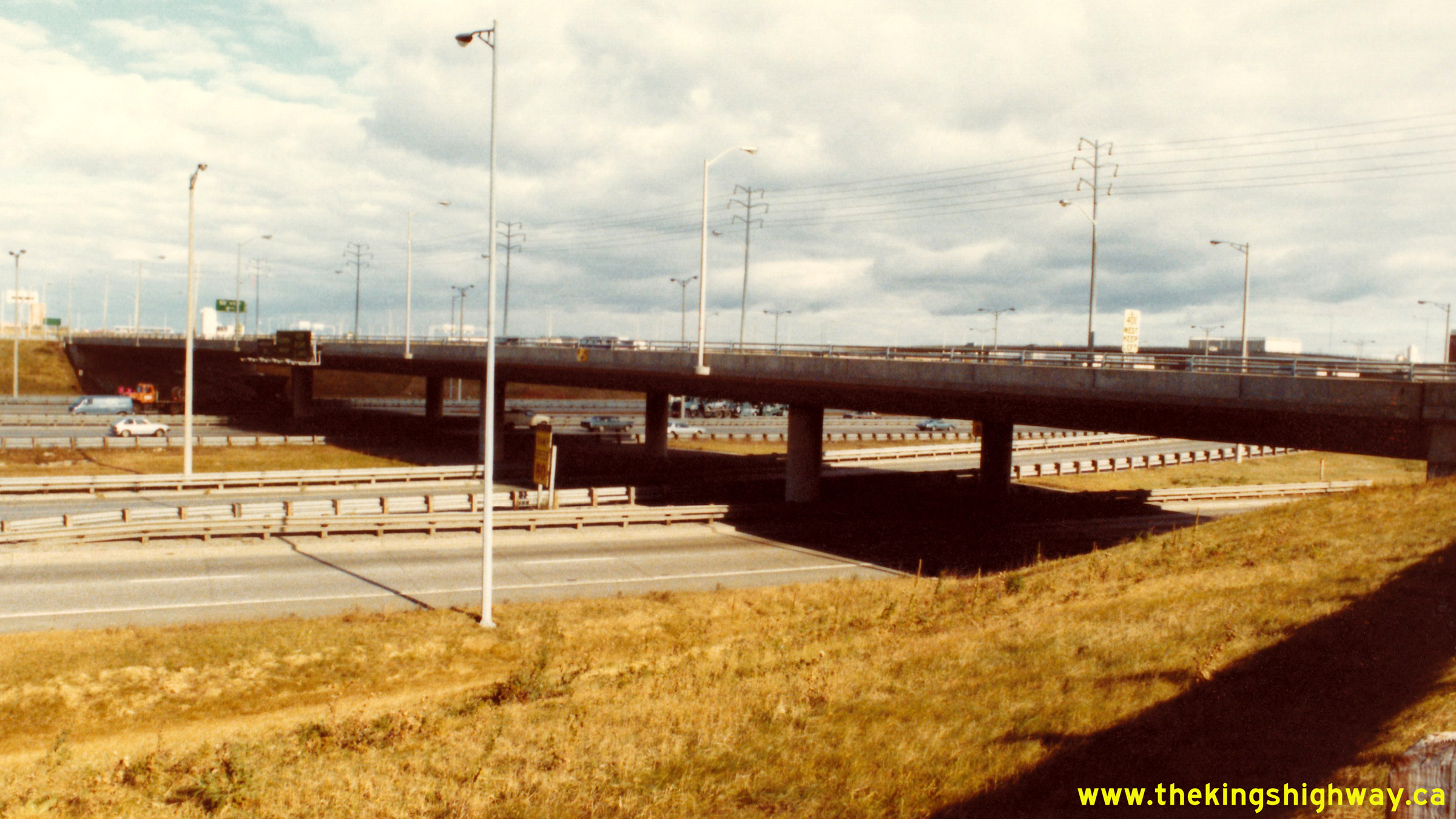
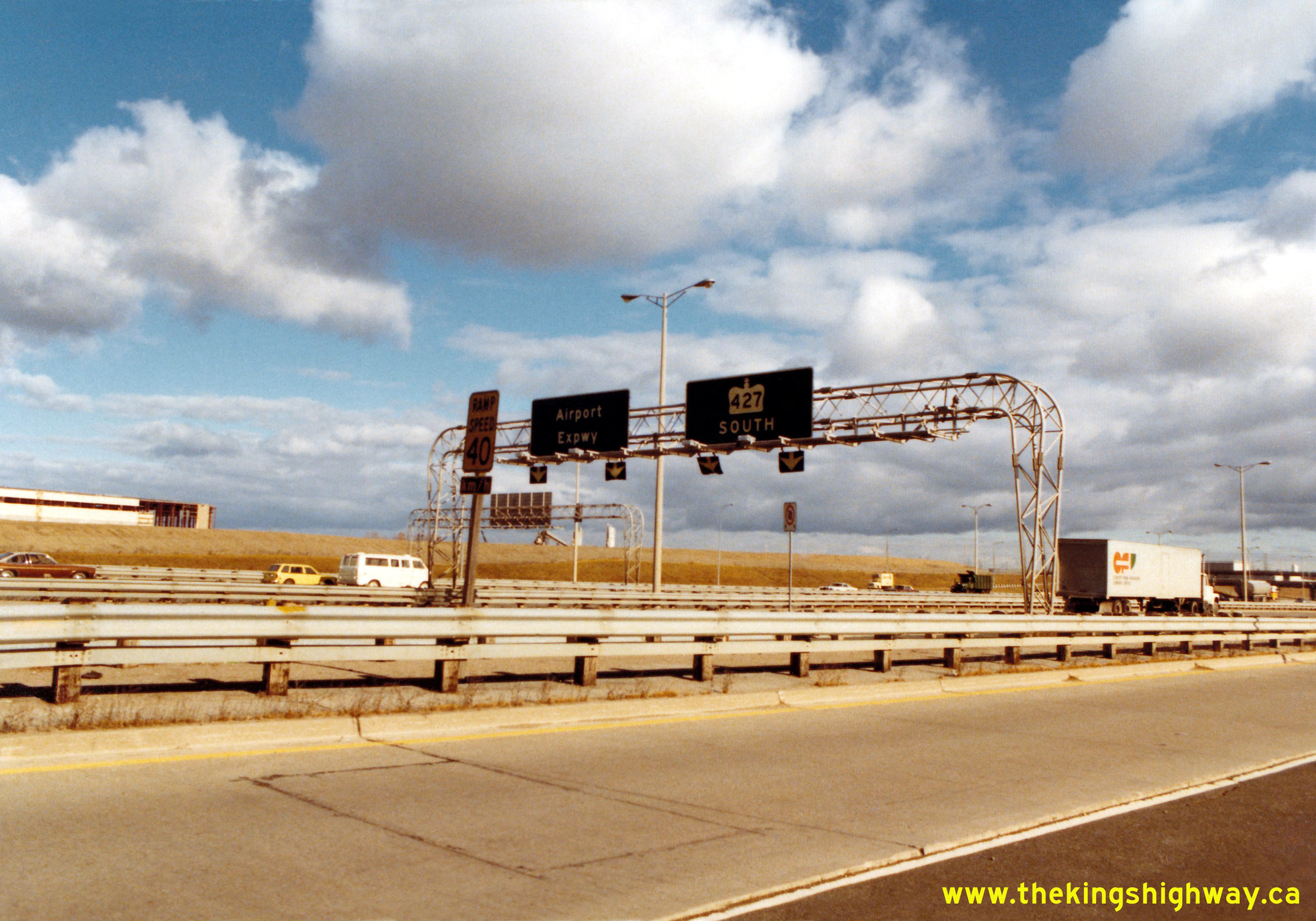
Left - Airport Expressway (Hwy 427 North) Interchange on Hwy 401 in Toronto in 1980, facing northeast from Renforth Drive. The ramp in the foreground carries
traffic from eastbound Hwy 401 to the northbound Airport Expressway. See an
Enlarged Photo here. Photo taken on November 5, 1980. (Photo courtesy of Ontario Ministry of Transportation - © King's Printer for Ontario, 2015) Right - Western side of the Renforth Drive Overpass on Hwy 401 in Toronto. See an Enlarged Photo here. Photo taken on November 5, 1980. (Photo courtesy of Ontario Ministry of Transportation - © King's Printer for Ontario, 2015) 

Left - Facing west along Hwy 401 towards Mississauga from the Renforth Drive Overpass in 1980. Until the extension of the eastbound and westbound Hwy 401
Collector Lanes began in the early 1980s, the Express-Collector Lane system seen here collapsed into a conventional eight-lane freeway about 2 km west of Renforth Drive.
See an Enlarged Photo here. Photo taken on November 5, 1980. (Photo courtesy of Ontario Ministry of Transportation - © King's Printer for Ontario, 2015) Right - Ramps to the Airport Expressway and Hwy 427 South from the eastbound Hwy 401 Collector Lanes, as seen from the Renforth Drive Overpass in 1980. Note the lack of development south of Hwy 401. The entire vacant parcel of land at left has since been developed into a large business park. See an Enlarged Photo here. Photo taken on November 5, 1980. (Photo courtesy of Ontario Ministry of Transportation - © King's Printer for Ontario, 2015) 

Left - Facing west along the westbound Hwy 401 Express Lanes towards Mississauga from the Renforth Drive Overpass in 1980. The on-ramp from westbound Eglinton
Avenue can be seen joining into the westbound Hwy 401 Express Lanes at right. Originally, this was a two-lane on-ramp. During the widening of Hwy 401 at Hwy 427 in
2002-2003, the Eglinton Avenue ramp was reduced to a single lane in order to allow for the construction of a fourth through lane on westbound Hwy 401. See an
Enlarged Photo here. Photo taken on November 5, 1980. (Photo courtesy of Ontario Ministry of Transportation - © King's Printer for Ontario, 2015) Right - On-ramp to the westbound Hwy 401 Collector Lanes from Renforth Drive. See an Enlarged Photo here. Photo taken on November 5, 1980. (Photo courtesy of Ontario Ministry of Transportation - © King's Printer for Ontario, 2015) 

Left - Facing southwest at the Renforth Drive Interchange's south ramp terminal at Hwy 401 & Hwy 427. Note the extensive use of overhead guide signs to
mark the freeway entrance ramps. In recent years, this practice has become less common. See an
Enlarged Photo here. Photo taken on November 5, 1980. (Photo courtesy of Ontario Ministry of Transportation - © King's Printer for Ontario, 2015) Right - Eastern side of the Renforth Drive Overpass on Hwy 401 in Toronto. See an Enlarged Photo here. Photo taken on November 5, 1980. (Photo courtesy of Ontario Ministry of Transportation - © King's Printer for Ontario, 2015) 

Left - Facing southeast at the Renforth Drive Interchange's south ramp terminal at Hwy 401 & Hwy 427. See an
Enlarged Photo here. Photo taken on November 5, 1980. (Photo courtesy of Ontario Ministry of Transportation - © King's Printer for Ontario, 2015) Right - Facing west along the westbound Hwy 401 Collector Lanes from the Renforth Drive Overpass. See an Enlarged Photo here. Photo taken on November 5, 1980. (Photo courtesy of Ontario Ministry of Transportation - © King's Printer for Ontario, 2015) 

Left - South ramp terminal at the Renforth Drive Interchange, facing north towards Hwy 401 in 1980. Note the internally-illuminated black and white "No Left
Turn" signs mounted to the traffic signal poles. The MTO used these internally-illuminated regulatory signs at its signalized intersections up until the 1990s, when
they were replaced with the symbolic red-and-white regulatory signs seen today. See an
Enlarged Photo here. Photo taken on November 5, 1980. (Photo courtesy of Ontario Ministry of Transportation - © King's Printer for Ontario, 2015) Right - Overhead guide sign for Renforth Drive at the end of the eastbound Hwy 401 off-ramp. See an Enlarged Photo here. Photo taken on November 5, 1980. (Photo courtesy of Ontario Ministry of Transportation - © King's Printer for Ontario, 2015) 

Left - Renforth Creek Culvert on Hwy 401 west of Renforth Drive. See an
Enlarged Photo here. Photo taken on November 5, 1980. (Photo courtesy of Ontario Ministry of Transportation - © King's Printer for Ontario, 2015) Right - Overhead guide sign on the westbound Hwy 401 Collector Lanes, marking the distance to the Dixie Road, Hwy 403 and Hwy 410 Interchanges in 1980. An identical sign existed over the westbound Hwy 401 Express Lanes, which can be seen more clearly in the subsequent photo. See an Enlarged Photo here. Photo taken on November 5, 1980. (Photo courtesy of Ontario Ministry of Transportation - © King's Printer for Ontario, 2015) 

Left - Overhead guide sign on the westbound Hwy 401 Express Lanes, marking the distance to the Dixie Road, Hwy 403 and Hwy 410 Interchanges in 1980. Note that
Hwy 403 is signed "To Eglinton Avenue". At the time this photo was taken, Hwy 403 ended about 2 km south of Hwy 401 at the Eglinton Avenue Interchange. The highway
was not completed through to the Queen Elizabeth Way in Oakville until December, 1982. See an
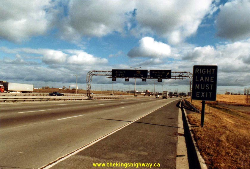
Enlarged Photo here. Photo taken on November 5, 1980. (Photo courtesy of Ontario Ministry of Transportation - © King's Printer for Ontario, 2015) Right - Advance overhead guide sign for the Hwy 427 and Renforth Drive Exit on eastbound Hwy 401 in 1980. These two closely-spaced exits were essentially the first phase of the Express-Collector Lane System along Hwy 401 through Mississauga. Note that this exit was once signed as "Interchange #45". In the early 1960s, an exit numbering system was introduced along Hwy 401. Under this numbering system, interchanges were numbered sequentially from Windsor to the Quebec Boundary (west to east). Unfortunately, this sequential exit numbering system began to cause problems as new interchanges were constructed along Hwy 401 in subsequent years. Suffixed exits like Interchange 36A, for example, had to be implemented in order to prevent advancing all of the existing freeway exit numbers ahead by one. This problem was solved in 1982, when a new distance-based interchange numbering system was introduced on Ontario's freeways. Interchanges were numbered based on their approximate mileage point instead of their sequence. This new system allowed additional interchange numbers to be easily added in the future, since there would generally be a distance offset between a proposed and existing interchange. See an Enlarged Photo here. Photo taken on November 5, 1980. (Photo courtesy of Ontario Ministry of Transportation - © King's Printer for Ontario, 2015) 
Left - Beginning of the eastbound Hwy 401 Collector Lanes near Toronto International (Pearson) Airport in 1980. In 1982, the first contract was called in a
multi-year program to extend the Express-Collector Lane System westerly from this point to the Hwy 403 & Hwy 410 Interchange. See an
Enlarged Photo here. Photo taken on November 5, 1980. (Photo courtesy of Ontario Ministry of Transportation - © King's Printer for Ontario, 2015) Right - Approaching the Renforth Drive Interchange on the eastbound Hwy 401 Collector Lanes. When the Collector Lanes were first built here in 1971, Lane #4 exited to Renforth Drive, while Lanes #1 to #3 continued through to Hwy 427 and the Airport Expressway. When Metro Toronto decided against building the Richview Expressway along Eglinton Avenue, it changed the traffic patterns at the Hwy 401 & Hwy 427 Interchange. As a consequence of that decision, far more traffic began using Hwy 427 South than highway engineers had initially anticipated when the Hwy 401 & Hwy 427 Interchange was designed in the late 1960s. In order to provide more lane capacity in the eastbound Hwy 401 Collector Lanes, the lanes at the Renforth Drive exit were reconfigured during a highway widening project which began in 1983. Accordingly, Lane #4 was extended through to Hwy 427, so that four through lanes were provided on the approach to Hwy 427 instead of the original three through lanes seen here. See an Enlarged Photo here. Photo taken on November 5, 1980. (Photo courtesy of Ontario Ministry of Transportation - © King's Printer for Ontario, 2015) 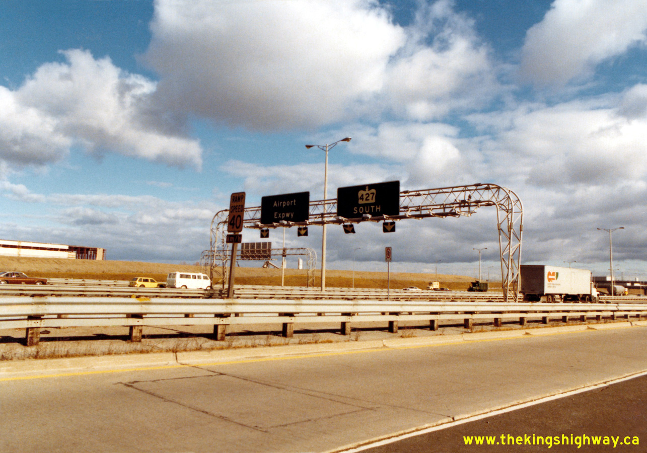
Left - Overhead guide sign approaching the end of the eastbound Hwy 401 Collector Lanes, with pull-though arrows marking the lane arrangements for the ramps to
the Airport Expressway (Hwy 427 North) and Hwy 427 South. Until this section of the eastbound Hwy 401 Collector Lanes was widened in 1983-1984, the second lane to
Hwy 427 South developed from the right immediately upstream of this overhead sign. See an
Enlarged Photo here. Photo
taken on November 5, 1980. (Photo courtesy of Ontario Ministry of Transportation - © King's Printer for Ontario, 2015) Right - Overhead guide sign at the end of the eastbound Hwy 401 Collector Lanes, at the split between the Airport Expressway (Hwy 427 North) and Hwy 427 South. Note the diagonal arrows on the signboards indicating the turn-off. Shortly after these photos were taken, references to the Airport Expressway were removed and replaced with new signs indicating "Hwy 427 North" during a highway reconstruction project in 1981. See an Enlarged Photo here. Photo taken on November 5, 1980. (Photo courtesy of Ontario Ministry of Transportation - © King's Printer for Ontario, 2015) 

Left - Heart Lake Road (Tomken Road) Underpass on Hwy 401 and Hwy 403 in Mississauga. See an
Enlarged Photo here. Photo taken on November 5, 1980. (Photo courtesy of Ontario Ministry of Transportation - © King's Printer for Ontario, 2015) Right - Heart Lake Road (Tomken Road) Underpass on Hwy 403 and Hwy 401 in Mississauga in 1980. The high-level ramp carries the eastbound lanes of Hwy 403 over Heart Lake Road, while the ramp below carries traffic from eastbound Hwy 401 to nearby Dixie Road across Heart Lake Road. See an Enlarged Photo here. Photo taken on November 5, 1980. (Photo courtesy of Ontario Ministry of Transportation - © King's Printer for Ontario, 2015) 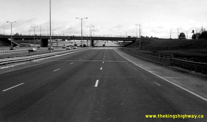
Above - Facing east along the Eastbound Collector Lanes of Hwy 401 approaching the Weston Road Overpass in Toronto in 1981. The fact that the
photographer was able to stand in the middle of the roadway to take this photo attests to the comparatively low traffic volumes using Hwy 401 through
Toronto at the time. It would be impossible to stand here and take a photo from this location today. (Photo courtesy of Ontario Ministry of Transportation - © King's Printer for Ontario, 2011) 
Left - Facing west from the Weston Road Overpass towards the Humber River Bridge on the Eastbound Hwy 401 Collector Lanes in Toronto (1981) (Photo courtesy of Ontario Ministry of Transportation - © King's Printer for Ontario, 2011) Right - Facing east along the Westbound Hwy 401 Collector Lanes towards the Weston Road Overpass in Toronto (1981) (Photo courtesy of Ontario Ministry of Transportation - © King's Printer for Ontario, 2011) 
Left - Facing west from the Weston Road Overpass along the Westbound Hwy 401 Collector Lanes in Toronto (1981) (Photo courtesy of Ontario Ministry of Transportation - © King's Printer for Ontario, 2011) Right - Facing west along the ramp from Southbound Weston Road to Westbound Hwy 401 in Toronto (1981) (Photo courtesy of Ontario Ministry of Transportation - © King's Printer for Ontario, 2011) 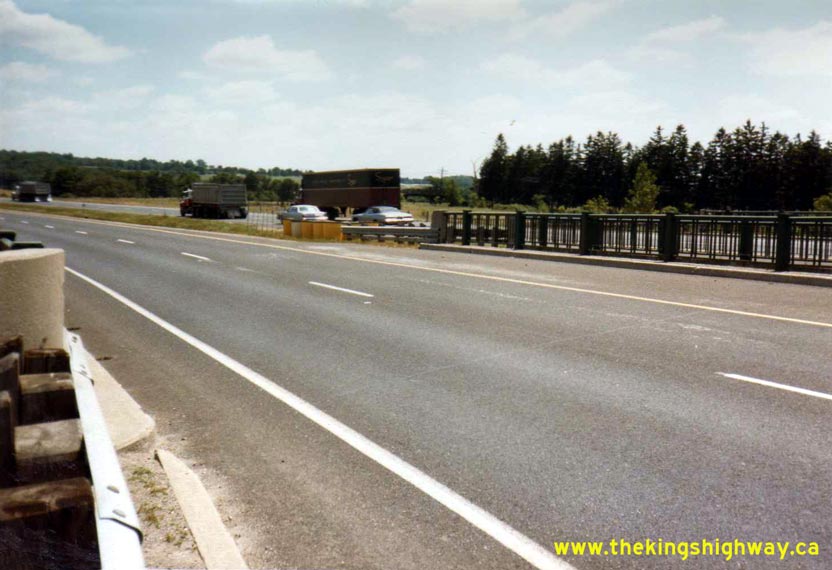
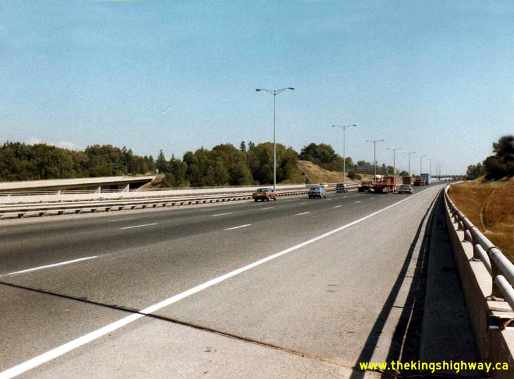
Left - Dual bridges over Oakville Creek on Hwy 401 near Milton in 1981. Before Hwy 401 was widened between Milton and Kitchener in the 1990s, most
of the underpasses and watercourse crossings were dual structures. During the widening of Hwy 401, the median gap between the structures was filled in.
Photo taken on July 8, 1981. (Photo courtesy of Ontario Ministry of Transportation - © King's Printer for Ontario, 2011) Right - Facing west along Hwy 401 from Etobicoke Creek near Toronto International Airport in 1981, before the construction of the Express-Collector Lane System west of Hwy 427. Note the graded right-of-way on the left side of the highway, which is for the future Eastbound Hwy 401 Collector Lanes. Construction of the Eastbound Collector Lanes began in this area in late 1982 and was completed in 1985. Photo taken on October 29, 1981. See an Enlarged Photo here. (Photo courtesy of Ontario Ministry of Transportation - © King's Printer for Ontario, 2011) 

Left - Facing west along Westbound Hwy 401 at the Hwy 410 Interchange in Mississauga (October 30, 1981) (Photo courtesy of Ontario Ministry of Transportation - © King's Printer for Ontario, 2011) Right - Exit from Westbound Hwy 401 to Hwy 403 & Hwy 410 in Mississauga. Although it isn't particularly clear in this photo, the left-hand overhead guide sign in the background reads "403 to 10 Mississauga". At the time this photo was taken in the Summer of 1982, Hwy 403 ended at Hwy 10 near the Square One Shopping Centre. The Mississauga-to-Oakville section of Hwy 403 wasn't opened to traffic until December, 1982. Photo taken on August 18, 1982. (Photo courtesy of Ontario Ministry of Transportation - © King's Printer for Ontario, 2011) 

Left - Facing east along the Eastbound Hwy 401 Collector Lanes approaching Weston Road in 1982. (Photo courtesy of Averill Hecht - © 1982) Right - Overhead sign for Hwy 409 and Hwy 427 on the Westbound Hwy 401 Collector Lanes near Weston Road in 1982. (Photo courtesy of Averill Hecht - © 1982) 
Above - Aerial view of the "The Basketweave" on Hwy 401 between Hwy 400 and Keele Street in Toronto in 1982. See an
Enlarged Photo here. (Photo courtesy of Ontario Ministry of Transportation - © King's Printer for Ontario, 2015) 

Left - Facing north along Hwy 10 from the Hwy 401 Interchange in Mississauga (August 26, 1982) (Photo courtesy of Ontario Ministry of Transportation - © King's Printer for Ontario, 2011) Right - Facing west along Eastbound Hwy 401 from the Hwy 410 Interchange in Mississauga (October 18, 1982) (Photo courtesy of Ontario Ministry of Transportation - © King's Printer for Ontario, 2011) 
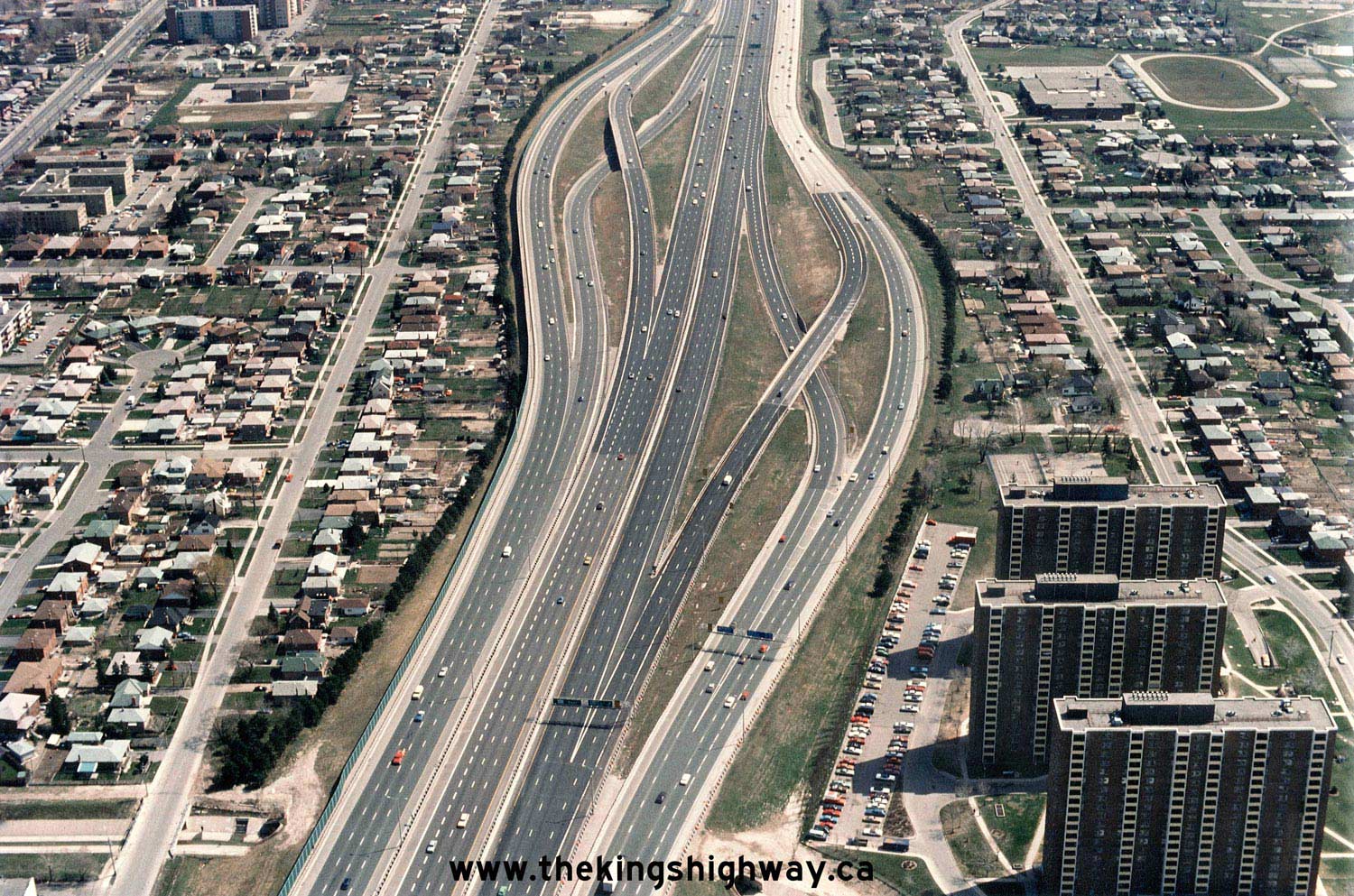
Above - Facing south along the Southbound Hwy 410 loop ramp to Eastbound Hwy 401 in Mississauga in 1982. The structure in the foreground carries the
eastbound lanes of Hwy 401. The Hwy 410 loop ramp was closed off to traffic in 1990 when a new flyover was completed between Southbound Hwy 410 and
Eastbound Hwy 401. During the early 1990s, the hill in the background was removed in order to provide a direct ramp connection between Hwy 410 and Hwy 403.
Photo taken on October 18, 1982. (Photo courtesy of Ontario Ministry of Transportation - © King's Printer for Ontario, 2011) 
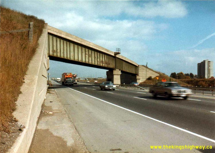
Above - Facing south along Hwy 400 towards the Hwy 401 Interchange in Toronto (December 10, 1982) (Photo courtesy of Ontario Ministry of Transportation - © King's Printer for Ontario, 2011) 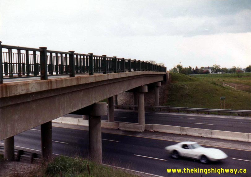
Left - Winston Churchill Boulevard Overpass on Hwy 401 in Mississauga in 1983. The original 1958 structure shown here was demolished during the
construction of a new interchange at this location in 1986-1987. Photo taken on May 31, 1983. (Photo courtesy of Ontario Ministry of Transportation - © King's Printer for Ontario, 2011) Right - Facing north across the Winston Churchill Boulevard Overpass on Hwy 401 in Mississauga in 1983. The rural two-lane road shown here has changed quite dramatically since this photo was taken. In 1987, a new interchange was built at Winston Churchill Boulevard. In addition, the road was widened to six lanes, in response to several new housing and business park developments in the area. Photo taken on May 31, 1983. (Photo courtesy of Ontario Ministry of Transportation - © King's Printer for Ontario, 2011) 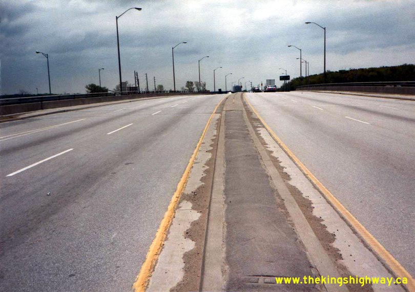

Left - Facing south across the Dixie Road Overpass on Hwy 401 in Mississauga (June 1, 1983) (Photo courtesy of Ontario Ministry of Transportation - © King's Printer for Ontario, 2011) Right - Facing west along Hwy 401 from the Hwy 410 Interchange in Mississauga (June 1, 1983) (Photo courtesy of Ontario Ministry of Transportation - © King's Printer for Ontario, 2011) 

Left - Facing north across the McCowan Road Overpass on Hwy 401 in Toronto (June 29, 1983) (Photo courtesy of Ontario Ministry of Transportation - © King's Printer for Ontario, 2011) Right - Western side of the Hwy 25 Overpass on Hwy 401 in Milton, shortly after the freeway was widened to six lanes in 1982. During the reconstruction, the concrete curb and gutter installations within the cloverleaf ramps were removed and replaced with drainage swales. Photo taken in July, 1983. (Photo courtesy of Ontario Ministry of Transportation - © King's Printer for Ontario, 2011) 

Left - Facing north across the Hwy 25 Overpass on Hwy 401 in Milton in 1983. Note that the original cloverleaf ramp configuration at the Hwy 401
& Hwy 25 Interchange was retained, even though Hwy 401 had just been reconstructed and widened to six lanes the previous year. The full cloverleaf
interchange at Hwy 401 & Hwy 25 was replaced with a standard "A-4 Parclo" interchange in the late 1980s. Photo taken in July, 1983. (Photo courtesy of Ontario Ministry of Transportation - © King's Printer for Ontario, 2011) Right - Newly-widened section of Hwy 401 near the Hwy 25 Interchange in Milton (July, 1983) (Photo courtesy of Ontario Ministry of Transportation - © King's Printer for Ontario, 2011) 
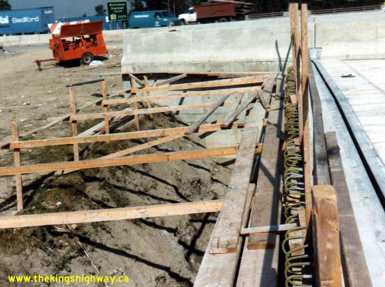
Left - New Etobicoke Creek Bridge for the future Eastbound Hwy 401 Collector Lanes near Toronto's Pearson Airport (August 19, 1983) (Photo courtesy of Ontario Ministry of Transportation - © King's Printer for Ontario, 2011) Right - Construction of the new Etobicoke Creek Bridge for the Eastbound Hwy 401 Collector Lanes in Mississauga (August 19, 1983) (Photo courtesy of Ontario Ministry of Transportation - © King's Printer for Ontario, 2011) 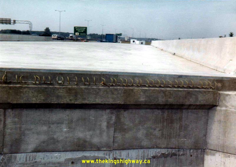

Left - Facing west across the new Etobicoke Creek Bridge for the future Westbound Hwy 401 Collector Lanes in Mississauga (August 19, 1983) (Photo courtesy of Ontario Ministry of Transportation - © King's Printer for Ontario, 2011) Right - Widening of the existing Etobicoke Creek Bridge on Hwy 401 in Mississauga, facing west (August 19, 1983) (Photo courtesy of Ontario Ministry of Transportation - © King's Printer for Ontario, 2011) 
Above - Facing east along Hwy 401 towards the new Whites Road Interchange in Pickering in 1983, shortly after the new interchange was opened to traffic.
Prior to 1983, there were no interchanges on Hwy 401 between Port Union Road and Liverpool Road. During the 1970s, a new interchange was planned for Moore
Road (now known as Whites Road) in order to provide improved access to the quickly-developing urban areas of Pickering. The interchange at Whites Road was
one of several new interchanges constructed along Hwy 401 between Toronto and Oshawa over the past 30 years. Photo taken on September 2, 1983. (Photo courtesy of Ontario Ministry of Transportation - © King's Printer for Ontario, 2011) 
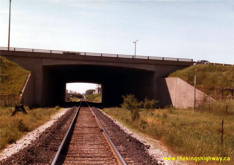
Left - Facing north across the new Whites Road Overpass on Hwy 401 in Pickering (September 2, 1983) (Photo courtesy of Ontario Ministry of Transportation - © King's Printer for Ontario, 2011) Right - Facing south towards the CNR Underpass on Hwy 401 near Keele Street in Toronto (June, 1984) (Photo courtesy of Ontario Ministry of Transportation - © King's Printer for Ontario, 2011) 

Left - Facing north towards the CNR Underpass on Hwy 401 near Keele Street in Toronto (June, 1984) (Photo courtesy of Ontario Ministry of Transportation - © King's Printer for Ontario, 2011) Right - Facing south across the Kipling Avenue Overpass on Hwy 401 in Toronto (July 22, 1984) (Photo courtesy of Ontario Ministry of Transportation - © King's Printer for Ontario, 2011) 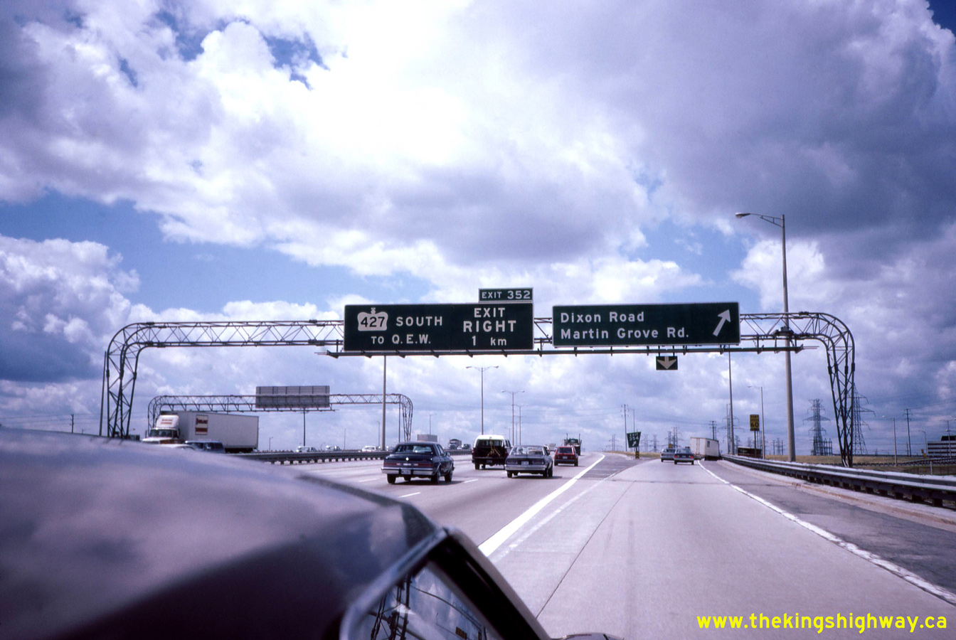
Left - Overhead freeway guide signs on westbound Hwy 401 at the Dixon Road Interchange in Toronto in 1984. Note the older pre-advance guide sign for the upcoming
Hwy 427 Interchange, which contains the unusual phrase "EXIT RIGHT" along with the distance to the exit ramp. As part of an effort to make freeway guide signs less
"wordy" in complex driving environments, this phrase is no longer used on freeway guide signs anymore. Motorists anticipate that the vast majority of freeway exit
ramps they encounter while driving will appear on the right-hand side of the freeway, so this phrase was dropped from newer signs as it was considered to be
unnecessary information. This phrase was likely included on this particular sign as the original exit ramp to southbound Hwy 427 from westbound Hwy 401 did indeed
develop and exit on the left-hand side of Hwy 401 at one time. See an Enlarged Photo Here.
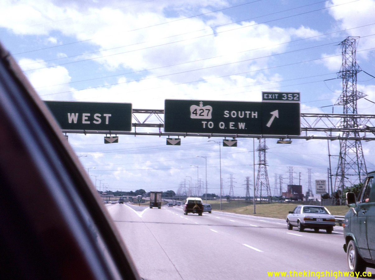
Photo taken in July 1984. (Photo courtesy of Ontario Ministry of Transportation - © King's Printer for Ontario, 2026) . Right - Overhead freeway guide sign on westbound Hwy 401, marking the exit ramp to southbound Hwy 427 in 1984. When Hwy 401 was extended westerly from Toronto towards Milton in the late 1950s, the extension resulted in an exit ramp to Hwy 27 (later known as Hwy 427) which developed on the left-hand side of the freeway. This ramp configuration created a lot of operational problems at this interchange. When the interchange was reconstructed in the late 1960s and early 1970s, this exit ramp was changed to the right-hand exit we see today. See an Enlarged Photo Here. Photo taken in July 1984. (Photo courtesy of Ontario Ministry of Transportation - © King's Printer for Ontario, 2026) 
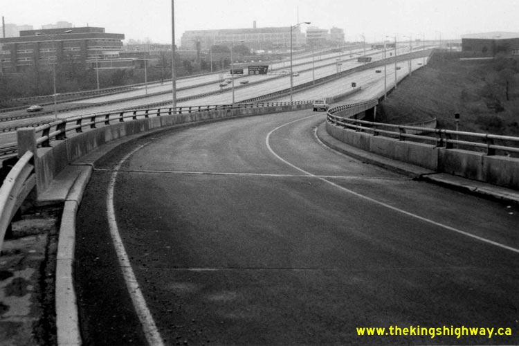
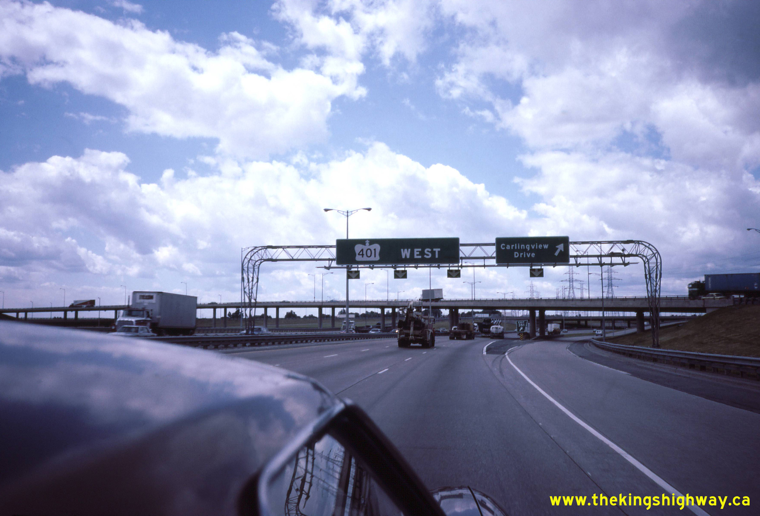
Left - Facing west along the westbound lanes of Hwy 401 at the Carlingview Drive Interchange. This two-ramp interchange is situated within the complex Hwy 401
& Hwy 427 Interchange. The large flyover in the background carries traffic from westbound Hwy 401 to southbound Hwy 427. Constructed under Contract #1968-24 and
completed in 1969, this 12-span flyover is the longest structure at this interchange with a total length of 1,490 feet (454 metres). See an
Enlarged Photo Here. Photo taken in July 1984. (Photo courtesy of Ontario Ministry of Transportation - © King's Printer for Ontario, 2026) Right - Overhead freeway guide sign at the exit to Eglinton Avenue on eastbound Hwy 401 at the Hwy 427 Interchange in Toronto. The structure in the background carries the southbound lanes of Hwy 427 across Hwy 401, along with the southbound Hwy 427 exit ramp traffic to Eglinton Avenue. This structure was built under Contract #1970-129 and was completed in 1971. When the Hwy 401 & Hwy 427 Interchange was originally being designed, it was anticipated that a new municipal expressway known as the Richview Expressway was going to be constructed by Metropolitan Toronto easterly from here via Eglinton Avenue. Accordingly, this exit ramp was designed as if it were to one day become a freeway-to-freeway ramp movement. However, the Richview Expressway was never built, which left behind this interesting ramp connection to Eglinton Avenue which was designed to freeway standards. See an Enlarged Photo Here. Photo taken in July 1984. (Photo courtesy of Ontario Ministry of Transportation - © King's Printer for Ontario, 2026) 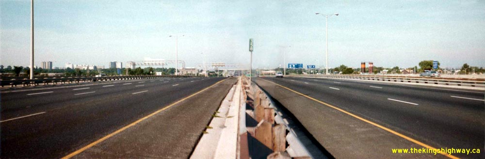
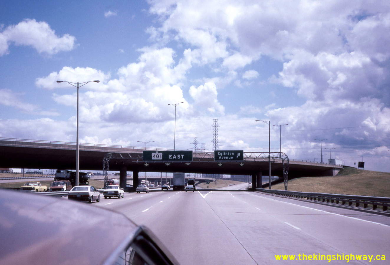
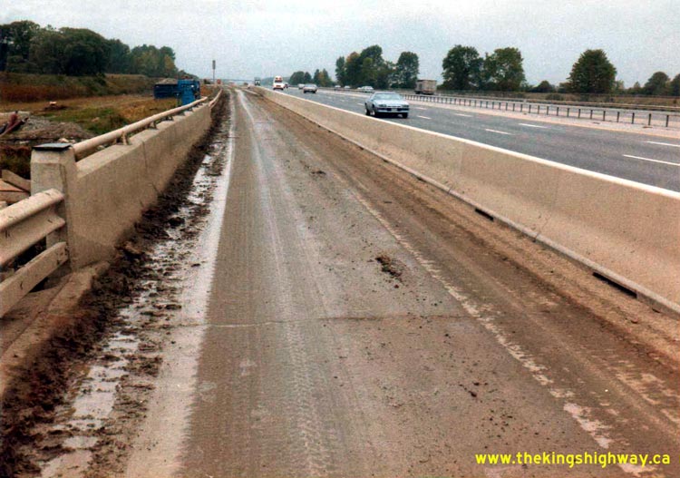
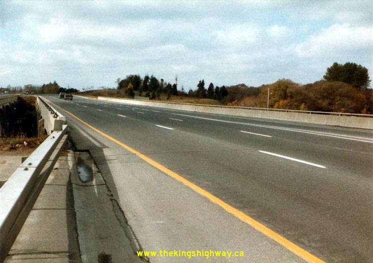
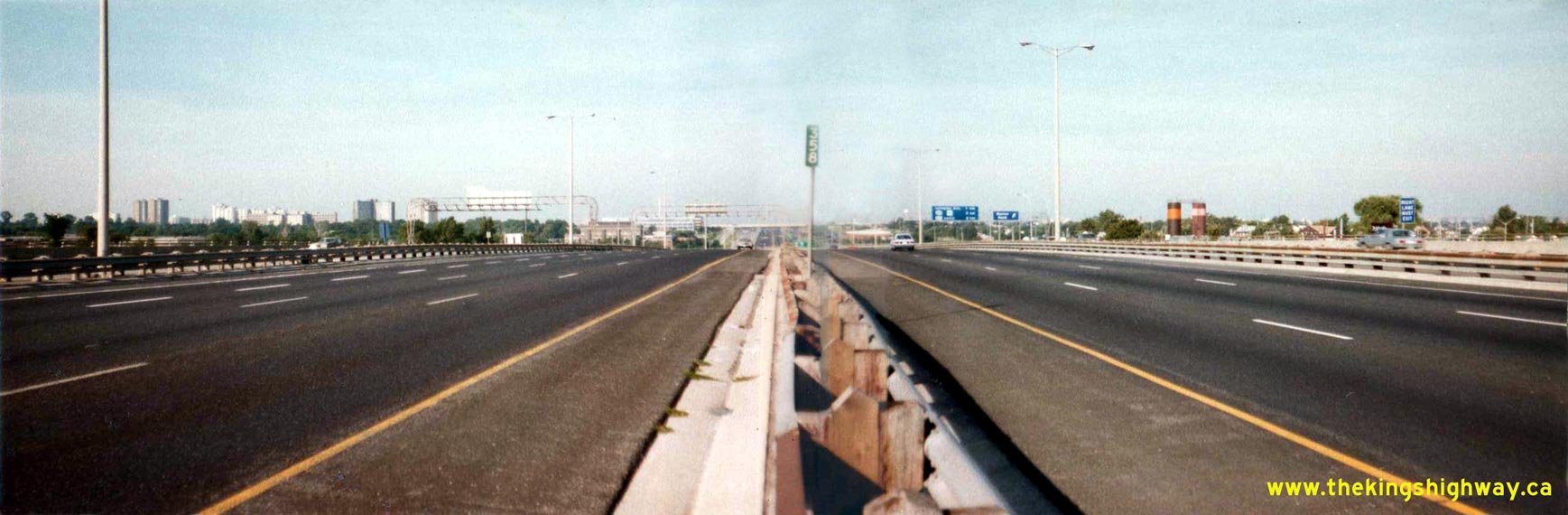
Above - Facing west along the centreline of Hwy 401 between Hwy 400 and Weston Road in Toronto (September 9, 1984). See an
Enlarged Photo here. (Photo courtesy of Ontario Ministry of Transportation - © King's Printer for Ontario, 2011) 
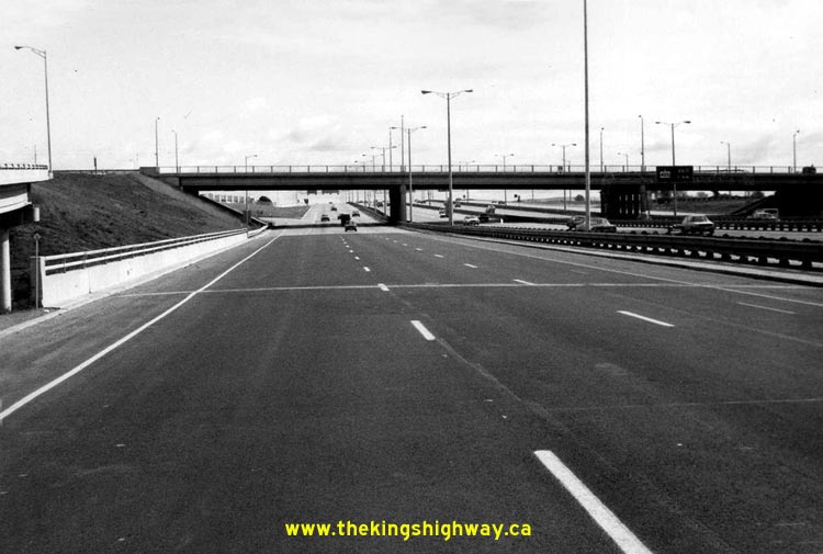
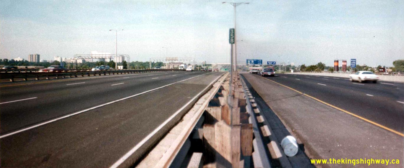
Above - Facing west along the westbound Hwy 401 Express and Collector Lanes between Hwy 400 and Weston Road (September 9, 1984). See an
Enlarged Photo here. (Photo courtesy of Ontario Ministry of Transportation - © King's Printer for Ontario, 2011) 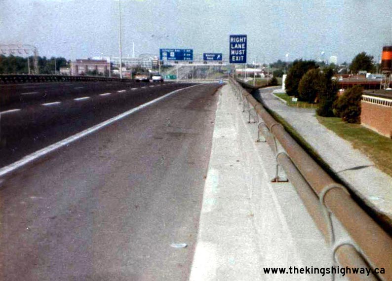
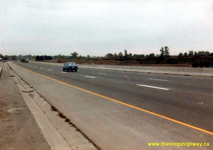
Left - Approaching the Weston Road Interchange on westbound Hwy 401 in Toronto (September 9, 1984) (Photo courtesy of Ontario Ministry of Transportation - © King's Printer for Ontario, 2011) Right - Facing east along the eastbound lanes of Hwy 401 at the Rouge River Bridge in Toronto (September 18, 1984) (Photo courtesy of Ontario Ministry of Transportation - © King's Printer for Ontario, 2011) 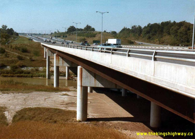
Left - Southern side of the Rouge River Bridge on Hwy 401 in Toronto (September 18, 1984) (Photo courtesy of Ontario Ministry of Transportation - © King's Printer for Ontario, 2011) Right - Facing west along the westbound lanes of Hwy 401 at the Rouge River Bridge in Toronto (September 18, 1984) (Photo courtesy of Ontario Ministry of Transportation - © King's Printer for Ontario, 2011) 

Left - Facing north across the Henry Street Overpass at Hwy 401 in Whitby (September 19, 1984) (Photo courtesy of Ontario Ministry of Transportation - © King's Printer for Ontario, 2011) Right - Western side of the Henry Street Overpass on Hwy 401 in Whitby (September 19, 1984) (Photo courtesy of Ontario Ministry of Transportation - © King's Printer for Ontario, 2011) 
Left - Whites Road Overpass on Hwy 401 in Pickering (September 25, 1984) (Photo courtesy of Ontario Ministry of Transportation - © King's Printer for Ontario, 2011) Right - Facing north along the northbound lanes of the Whites Road Overpass in Pickering (September 25, 1984) (Photo courtesy of Ontario Ministry of Transportation - © King's Printer for Ontario, 2011) 
Left - Facing north along the southbound lanes of the Whites Road Overpass in Pickering (September 25, 1984) (Photo courtesy of Ontario Ministry of Transportation - © King's Printer for Ontario, 2011) Right - Facing west across the eastbound lanes of Hwy 401 at the Lynde Creek Bridge in Whitby in 1984. Note that the Whitby Truck Scales that were visible in the 1980 photo above have been removed. Photo taken on September 25, 1984. (Photo courtesy of Ontario Ministry of Transportation - © King's Printer for Ontario, 2011) 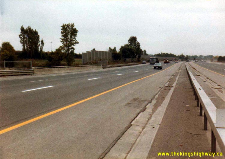
Left - Facing east along the westbound lanes of Hwy 401 at Lynde Creek in Whitby (September 25, 1984) (Photo courtesy of Ontario Ministry of Transportation - © King's Printer for Ontario, 2011) Right - Facing east along the eastbound lanes of Hwy 401 at Lynde Creek in Whitby (September 25, 1984) (Photo courtesy of Ontario Ministry of Transportation - © King's Printer for Ontario, 2011) 

Left - Southern side of the Lynde Creek Bridge on Hwy 401 in Whitby (September 25, 1984) (Photo courtesy of Ontario Ministry of Transportation - © King's Printer for Ontario, 2011) Right - Facing west along Eastbound Hwy 401 from the Hwy 410 Interchange in Mississauga (October 3, 1984) (Photo courtesy of Ontario Ministry of Transportation - © King's Printer for Ontario, 2011) 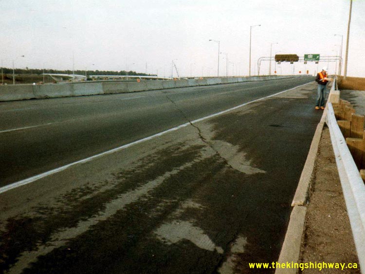
Left - Exit from Westbound Hwy 401 to Hwy 403 & Hwy 410 in Mississauga in 1984. At the time this photo was taken, access to Hwy 403 was closed
while the flyover across the future Hwy 401 Express Lanes was being constructed. During this construction project, traffic on Westbound Hwy 401 bound for
Westbound Hwy 403 was able to utilize the newly-completed Hwy 403 Express Lanes instead, which had opened to traffic earlier in 1984. Photo taken on
October 3, 1984. (Photo courtesy of Ontario Ministry of Transportation - © King's Printer for Ontario, 2011) Right - Facing east along the westbound lanes of Hwy 401 towards the Pickering CNR Subway (October 18, 1984) (Photo courtesy of Ontario Ministry of Transportation - © King's Printer for Ontario, 2011) 
Left - Facing south across the Pickering CNR Subway on Hwy 401 between Liverpool Road and Whites Road (October 18, 1984) (Photo courtesy of Ontario Ministry of Transportation - © King's Printer for Ontario, 2011) Right - Facing west across the Westbound Hwy 401 structure over Duffins Creek in Ajax (October 18, 1984) (Photo courtesy of Ontario Ministry of Transportation - © King's Printer for Ontario, 2011) 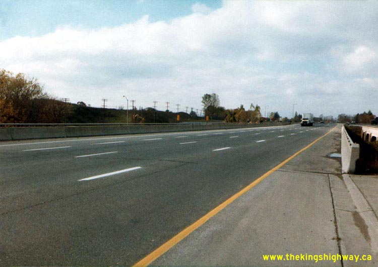

Left - Facing west across the Eastbound Hwy 401 structure over Duffins Creek in Ajax (October 18, 1984) (Photo courtesy of Ontario Ministry of Transportation - © King's Printer for Ontario, 2011) Right - Southern side of the Duffins Creek Bridge on Hwy 401 in Ajax in 1984, showing the extension added to the original 1941 structure when the highway was widened to six lanes in 1973. Photo taken on October 18, 1984. (Photo courtesy of Ontario Ministry of Transportation - © King's Printer for Ontario, 2011) 

Left - Facing east along Hwy 401 at Duffins Creek in Ajax, showing the original dual 1941 structures (October 18, 1984) (Photo courtesy of Ontario Ministry of Transportation - © King's Printer for Ontario, 2011) Right - Parapet wall of the Duffins Creek Bridge on Hwy 401 in Ajax. Note the old interchange ramps at Church Street in the background, which were closed off to traffic when the Westney Road Interchange opened in 1987. Photo taken on October 18, 1984. (Photo courtesy of Ontario Ministry of Transportation - © King's Printer for Ontario, 2011)
Continue on to King's Highway 401 Photos: Historical Photos (1985-1989)
|
|---|
Links to Adjacent King's Highway Photograph Pages:
Back to Hwy 401 - Historical Photos (1975-1979)
Hwy 401 Photo Index
On to Hwy 401 - Historical Photos (1985-1989)
Back to King's Highway 400 Photos /
King's Highway 401 History /
On to King's Highway 402 Photos
Ontario Highway History - Main Menu / Back to List of Highways Website contents, photos & text © 2002-2026, Cameron
Bevers (Webmaster) - All Rights Reserved / Contact Me
|
|---|