
| 
| |
|
|
This page contains present day photos (Year 2000 to date) of Ontario's King's Highway 406, arranged by location from the Queen
Elizabeth Way Interchange in St. Catharines southerly to the Highway 58 Interchange in Thorold. All photographs displayed on this page were taken by the Webmaster
(Cameron Bevers), unless specifically noted otherwise. Click on any thumbnail to see a larger image!
Please note that all photographs displayed on this
website are protected by copyright. These photographs must not be reproduced, published,
electronically stored or copied, distributed, or posted onto other websites without
my written permission. If you want to use photos from this website, please
email me first for permission. Thank-you!
|
|---|
|
Page 3: Present Day King's Highway 406 Photographs (St. Catharines to Thorold)


Left - Facing north along Hwy 406 from the Fourth Avenue Overpass in St. Catharines. (Photograph taken on May 8, 2005 - © Cameron Bevers) Right - The Fourth Avenue Overpass was completed in 1981. The interchange design at Fourth Avenue is known as a "Single Point Urban Interchange" (commonly abbreviated as "SPUI"), meaning that the ramp terminals intersect at a common point on the overpass directly above the freeway. A single set of traffic signals controls all traffic movement at the intersection. See an Enlarged Photo here. (Photograph taken on May 8, 2005 - © Cameron Bevers) 

Left - Facing south along Hwy 406 from the Fourth Avenue Overpass in St. Catharines. See an
Enlarged Photo here. (Photograph taken on May 8, 2005 - © Cameron Bevers) Right - On-ramp to Hwy 406 South from Fourth Avenue. The SPUI is an ideal interchange design in heavily built-up areas where land for the highway's right-of-way is scarce or there are significant space constraints due to natural obstacles like rivers. This SPUI on-ramp clearly demonstrates just how compact these interchanges really are. Despite the benefits of the SPUI, no subsequent examples of this interchange type were ever constructed on an Ontario provincial highway. The SPUI at Fourth Avenue was the only one of its kind ever built by the MTO, making it a historically significant highway feature despite the fact that it is only about 30 years old. See an Enlarged Photo here. (Photograph taken on May 8, 2005 - © Cameron Bevers) 

Left - Facing west along Fourth Avenue towards the Hwy 406 Interchange in St. Catharines. (Photograph taken on May 8, 2005 - © Cameron Bevers) Right - The main feature of the SPUI is a single set of traffic signals which controls all intersection movements. In this photo, left-turning traffic exiting from Hwy 406 Northbound is awaiting a green signal. Across the intersection, traffic exiting from Hwy 406 Southbound is also awaiting a green signal. Both of these groups will be released on a simultaneous protected green left-turn arrow. (Photograph taken on May 8, 2005 - © Cameron Bevers) 
Above - View of the overhead traffic signal gantry at the Fourth Avenue Interchange on Hwy 406 in St. Catharines. (Photograph taken on May 8, 2005 - © Cameron Bevers) 

Left - View of the Fourth Avenue SPUI from the opposite corner after the left-turning phase has completed. Now, through traffic along Fourth Avenue
will resume. One drawback of the SPUI is the inevitably complicated traffic signal phasing sequence, which can be somewhat hard for motorists and
pedestrians using the interchange to predict and anticipate. See an
Enlarged Photo here. (Photograph taken on May 8, 2005 - © Cameron Bevers) Right - Facing west along Fourth Avenue towards the Hwy 406 Interchange. (Photograph taken on May 8, 2005 - © Cameron Bevers) 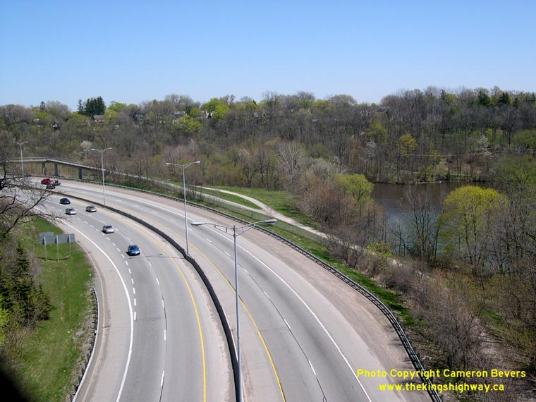

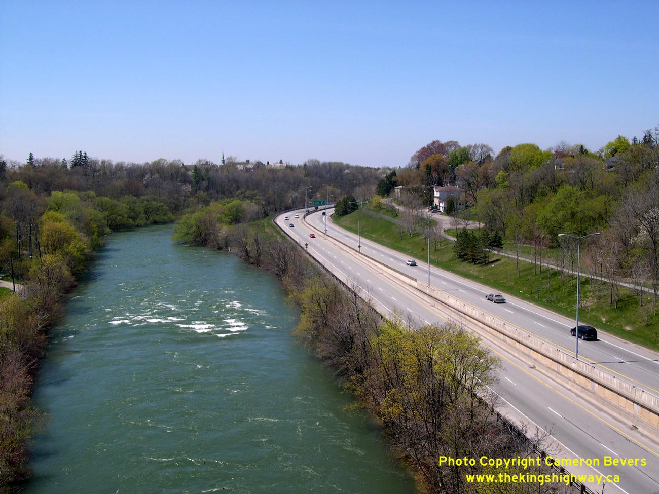
Left - Facing south along Hwy 406 from the St. Paul Street Overpass in St. Catharines. (Photograph taken on May 8, 2005 - © Cameron Bevers) Right - A pedestrian overpass was built across Hwy 406 just south of St. Paul Street. See an Enlarged Photo here. (Photograph taken on May 8, 2005 - © Cameron Bevers) 

Left - View of Twelve Mile Creek and Hwy 406 from the St. Paul Street Overpass (Burgoyne Bridge). See an
Enlarged Photo here. (Photograph taken on May 8, 2005 - © Cameron Bevers) Right - Facing north along Hwy 406 from the St. Paul Street Overpass in St. Catharines. See an Enlarged Photo here. (Photograph taken on May 8, 2005 - © Cameron Bevers) 

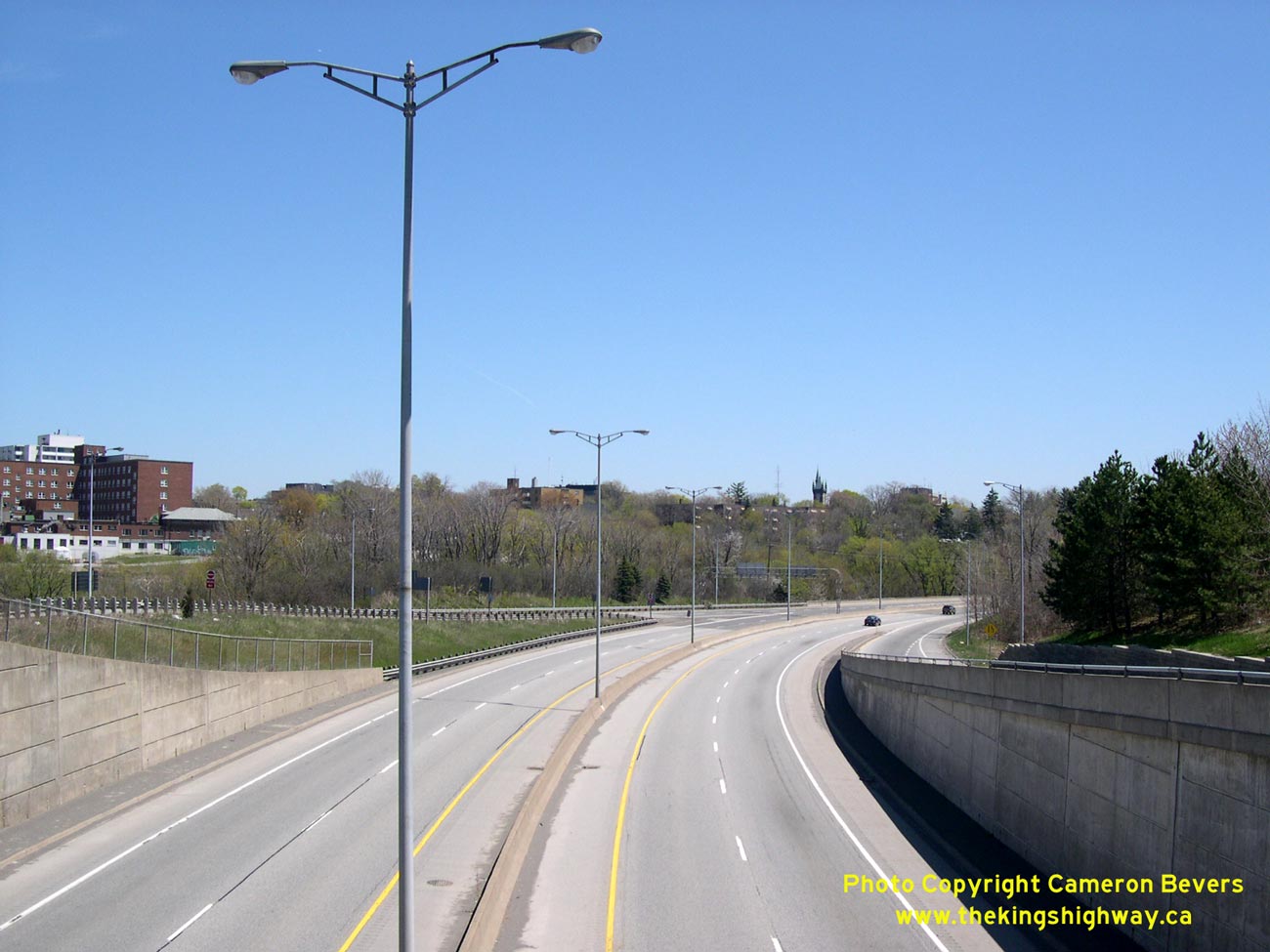
Left - Facing north along Hwy 406 towards the Burgoyne Bridge in St. Catharines. (Photograph taken on May 8, 2005 - © Cameron Bevers) Right - Facing south along Hwy 406 towards the Westchester Avenue Overpass in Downtown St. Catharines. Ontario has very few 400-Series Highways that pass directly through city centres, making this section of freeway especially noteworthy. See an Enlarged Photo here. (Photograph taken on May 8, 2005 - © Cameron Bevers)  Above - Facing north along Hwy 406 from the Westchester Avenue Overpass in Downtown St. Catharines. (Photograph taken on May 8, 2005 - © Cameron Bevers)
Continue on to King's Highway 406 Photos: Thorold to Welland River
|
|---|
Links to Adjacent King's Highway Photograph Pages:
Back to Hwy 406 Historical Photos (1980-1999)
Hwy 406 Photo Index
On to Hwy 406 Photos - Thorold to Welland River
Back to King's Highway 405 Photos /
King's Highway 406 History /
On to Highway 407 (ETR) Photos
Ontario Highway History - Main Menu / Back to List of Highways Website contents, photos & text © 2002-2026, Cameron
Bevers (Webmaster) - All Rights Reserved / Contact Me
|
|---|