
| 
|  |
|
|
This page contains present day photos (Year 2000 to date) of Ontario's King's Highway 406, arranged by location from
the Welland River Bridge southerly to East Main Street in Welland. All photographs displayed on this page were taken by the Webmaster (Cameron Bevers), unless
specifically noted otherwise. Click on any thumbnail to see a larger image!
Please note that all photographs displayed on this
website are protected by copyright. These photographs must not be reproduced, published,
electronically stored or copied, distributed, or posted onto other websites without
my written permission. If you want to use photos from this website, please
email me first for permission. Thank-you!
|
|---|
|
Page 5: Present Day King's Highway 406 Photographs (Welland River to East Main Street)


Left - Facing north along the two-lane route of Hwy 406 towards Merritt Road from the Welland River Bridge in 2011, prior to reconstruction and widening. This
section of Hwy 406 was twinned shortly after this photo was taken, when a new carriageway was constructed at right to accommodate northbound Hwy 406 traffic. The
two-lane carriageway seen here was subsequently converted to carry southbound Hwy 406 traffic only. See an
Enlarged Photo Here. (Photograph taken on June 19, 2011 - © Cameron Bevers) Right - As part of the construction of the adjacent overpass structure at Merritt Road, a short section of the future northbound carriageway of Hwy 406 was graded and constructed up to granular base immediately north of the Welland River Bridge. See an Enlarged Photo Here. (Photograph taken on June 19, 2011 - © Cameron Bevers) 

Left - Facing south approaching the Welland River Bridge on Hwy 406. This single structure once carried both directions of traffic on Hwy 406. A twin structure
was built immediately to the east when the highway was expanded from two to four lanes. See an
Enlarged Photo Here. (Photograph taken on April 2, 2008 - © Cameron Bevers) Right - Eastern side of the Welland River Bridge (Site #34-304) on Hwy 406 in Welland. This lengthy 11-span concrete girder structure was built under Contract #1993-76 and was completed in 1995. This bridge spans both the Welland River and an abandoned section of the Old Welland Canal, which was closed to commercial shipping traffic in the early 1970s. See an Enlarged Photo Here. (Photograph taken on April 2, 2008 - © Cameron Bevers) 

Left - View of the piers of the Welland River Bridge on Hwy 406. Since the structure is situated on a long horizontal highway curve, the bridge deck is
superelevated. See an Enlarged Photo Here. (Photograph taken on April 2, 2008 - © Cameron Bevers) Right - A dusk view of the western side of the Welland River Bridge, facing south from the bank of the Old Welland Canal. The bridge's piers were designed so that they ran parallel to water flow within the river, rather than perpendicular to the highway. See an Enlarged Photo Here. (Photograph taken on April 2, 2008 - © Cameron Bevers) 
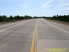
Left - Although it is a relatively new concrete girder structure built during the 1990s, the Welland River Bridge is quite aesthetically pleasing. The long
horizontal highway curve on the bridge deck and the tapered design of the bridge's piers make for an attractive, but yet relatively simple highway structure. The
completion of this structure in 1995 filled in a missing gap in the route of Hwy 406. The north leg of the highway was united with the discontinuous south leg of
Hwy 406 which extended from East Main Street northerly to Woodlawn Road. See an Enlarged Photo Here. (Photograph taken on April 2, 2008 - © Cameron Bevers) Right - Facing south across the Welland River Bridge on Hwy 406 towards Welland. The bridge has 11 spans, each with a length of 27.5 metres. Accordingly, the total length of the bridge's spans across the Welland River is 302.5 metres, excluding approaches. See an Enlarged Photo Here. (Photograph taken on June 19, 2011 - © Cameron Bevers) 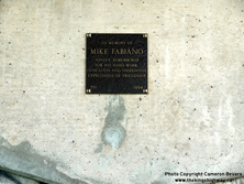

Left - This memorial plaque dedicated to Mike Fabiano was installed on one of the piers of the Hwy 406 bridge over the Welland River during its construction in
1994. See an Enlarged Photo Here. (Photograph taken on June 19, 2011 - © Cameron Bevers) Right - Western side of the Welland River Bridge, facing north from the bank of the Old Welland Canal. The bridge was designed with small semi-circular extensions protruding from the bridge deck so that luminaires could be installed on the bridge if illumination was ever required in the future. See an Enlarged Photo Here. (Photograph taken on June 19, 2011 - © Cameron Bevers) 

Left - View of the location of the future northbound Hwy 406 structure over the Welland River. Construction began on the future northbound structure as part of
a multi-year project to expand Hwy 406 to a four-lane divided highway shortly after this photo was taken in 2011. See an
Enlarged Photo Here. (Photograph taken on June 19, 2011 - © Cameron Bevers) Right - Date stamp (1995) and structure identification number (Site #34-304) on the Welland River Bridge on Hwy 406. See an Enlarged Photo Here. (Photograph taken on June 19, 2011 - © Cameron Bevers) 

Left - Facing north along Hwy 406 approaching the Welland River Bridge. For a period during the 1980s and 1990s, the Ministry of Transportation used concrete
Jersey Barrier walls on the approaches to bridges, rather than using steel beam guide rail with a transition plate connection to the bridge's barrier walls. See an
Enlarged Photo Here. (Photograph taken on June 19, 2011 - © Cameron Bevers) Right - Deck view of the Welland River Bridge on Hwy 406, showing the Jersey Barrier wall approach treatment. See an Enlarged Photo Here. (Photograph taken on June 19, 2011 - © Cameron Bevers) 
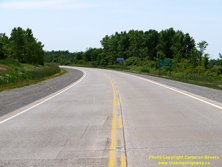
Left - A newer Hwy 406 route marker in Welland between Woodlawn Road and Merritt Road. Once Hwy 406 was expanded between Port Robinson Road and East Main
Street in Welland, the last 2-lane section on the 400-Series Highway network was eliminated. Historically, some 400-Series Highways were built as "staged freeways",
where only one-half of the divided highway was built initially. See an Enlarged Photo Here. (Photograph taken on June 19, 2011 - © Cameron Bevers) Right - Facing south along Hwy 406 from the Welland River Bridge towards Woodlawn Road in Welland. See an Enlarged Photo Here. (Photograph taken on June 19, 2011 - © Cameron Bevers) 

Left - Aerial view of Hwy 406 facing south from the Welland River Bridge, prior to reconstruction and widening. After deliberating the route of Hwy 406 through
Welland for more than two decades, the province ultimately selected an eastern bypass route for the new highway. Earlier iterations of the route would have seen
Hwy 406 enter Welland a considerable distance to the west, as seen in this
Historical 1962 Plan. The proposed Hwy 406 corridor around the eastern side of Welland was
designated as a Controlled-Access Highway in April 1987 and was opened to traffic in stages during the 1990s. See an
Enlarged Photo Here. (Photograph taken on June 18, 2011 - © Cameron Bevers) Right - Aerial view of the Welland River Bridge on Hwy 406, facing southwest towards Downtown Welland. See an Enlarged Photo Here. (Photograph taken on June 18, 2011 - © Cameron Bevers) 
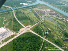
Left - Aerial view of the Welland River Bridge on Hwy 406, facing northeast towards Thorold. Both the current and old Welland Canals are visible in this photo.
The Old Welland Canal in the foreground operated up until the early 1970s, when it was bypassed by a diversion of the canal around the eastern side of Welland. An
interesting aqueduct structure carries the Welland River below the Welland Canal Diversion in the background. The relocation of the Welland Canal in the early 1970s
opened up an opportunity for the Ministry of Transportation to consider potential routes for Hwy 406 which bypassed Welland to the east. Such a route was previously
considered unfeasible, unless a high-level structure or tunnel was built to cross the canal. Once the old canal was closed to commercial shipping traffic, it was
possible to built a low-level crossing for Hwy 406 without the need to accommodate the vertical clearance requirements of lake freighters. See an
Enlarged Photo Here. (Photograph taken on June 18, 2011 - © Cameron Bevers) Right - Aerial view of Hwy 406 facing north towards the Welland River Bridge from the Woodlawn Road Junction in Welland. See an Enlarged Photo Here. (Photograph taken on June 18, 2011 - © Cameron Bevers) 
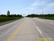
Left - Facing north along Hwy 406 towards the Welland River Bridge from the Woodlawn Road Junction. See an
Enlarged Photo Here. (Photograph taken on June 19, 2011 - © Cameron Bevers) Right - Approaching the Woodlawn Road Junction on Hwy 406 in Welland, facing south. See an Enlarged Photo Here. (Photograph taken on June 19, 2011 - © Cameron Bevers) 

Left - Approaching the Hwy 406 Junction on Daimler Parkway, facing west. This access road was constructed many years after Hwy 406 was built. It is effectively
a continuation of Woodlawn Road on the eastern side of Hwy 406, which leads into a residential subdivision. Note the privately-made Hwy 406 route marker assembly at
right, which was produced using different fonts than the ones used by the Ministry of Transportation of Ontario (MTO). See an
Enlarged Photo Here. (Photograph taken on June 19, 2011 - © Cameron Bevers) Right - Facing west along Daimler Parkway at the Hwy 406 Junction. Woodlawn Road continues straight ahead beyond the traffic signals into Welland. Like other signalized intersections located along Hwy 406 south of Thorold, this intersection was replaced with a grade-separated interchange during a multi-year highway widening project which began in 2011. See an Enlarged Photo Here. (Photograph taken on June 19, 2011 - © Cameron Bevers) 

Left - Green guide signs marking the upcoming intersection of Woodlawn Road and Daimler Parkway on northbound Hwy 406 in Welland. See an
Enlarged Photo Here. (Photograph taken on June 19, 2011 - © Cameron Bevers) Right - Facing north along Hwy 406 towards the Woodlawn Road Junction in Welland. Up until 1995, northbound motorists on Hwy 406 were forced to turn left onto Woodlawn Road and follow Niagara Street (Hwy 58) north in order to reach Thorold and St. Catharines. A gap existed in Hwy 406 between Woodlawn Road and the resumption of the highway at Merritt Road. Once the new leg of Hwy 406 was completed across the Welland River, through traffic on Hwy 406 was able to bypass Welland altogether. This relieved traffic congestion along Niagara Street, which was previously the only practical route leading into Welland's City Centre from the north. See an Enlarged Photo Here. (Photograph taken on June 19, 2011 - © Cameron Bevers) 

Left - Eastern terminus of Woodlawn Road approaching the Hwy 406 Junction in Welland. A series of construction contracts were awarded in the late 1980s to
extend Woodlawn Road east from Hwy 58 (Niagara Street) at Seaway Mall out to the new route of Hwy 406. This 2.1 km extension of Woodlawn Road was an unsigned
7000-Series Highway (Hwy 7236). See an Enlarged Photo Here. (Photograph taken on June 19, 2011 - © Cameron Bevers) Right - Facing west along Woodlawn Road (Hwy 7236) from the Hwy 406 Junction. Woodlawn Road was constructed with a rigid (concrete) highway pavement, just like the southern portion of Hwy 406 through Welland. While there have been periods in the past where rigid pavements have been used for provincial highway construction, concrete-surfaced highways are still relatively uncommon in Ontario. Flexible (asphalt) pavements are far more widely used. See an Enlarged Photo Here. (Photograph taken on June 19, 2011 - © Cameron Bevers) 

Left - Junction sign assembly marking the upcoming Hwy 406 Junction on Woodlawn Road. These types of route marker assemblies are seldom seen along the
400-Series Highways, as intersecting highways normally cross via a grade separation and interchange. Although Woodlawn Road was a provincial highway for many years
following its construction, it was never signed with provincial highway route markers. All guide signs simply marked Hwy 7236 as "Woodlawn Road", which made it
indistinguishable from other municipal roads in this area. See an Enlarged Photo Here. (Photograph taken on June 19, 2011 - © Cameron Bevers) Right - Aerial view of Woodlawn Road approaching the Hwy 406 Junction in Welland, facing east. A partial eastern bypass route was built around Welland via Hwy 406 and the easterly extension of Woodlawn Road (Hwy 7236) under Contract #1989-104. This partial bypass route opened to traffic in 1991, although it was not contiguous with the northern section of Hwy 406 to Thorold until 1995. Traffic still had to use Niagara Street (Hwy 58) between Woodlawn Road and the northern leg of Hwy 406 until the bridge across the Welland River was opened to traffic in 1995. See an Enlarged Photo Here. (Photograph taken on June 18, 2011 - © Cameron Bevers) 

Left - Aerial view of the Hwy 406 and Woodlawn Road Junction in Welland, facing northwest. See an
Enlarged Photo Here. (Photograph taken on June 18, 2011 - © Cameron Bevers) Right - Aerial view of Hwy 406, facing south at the Woodlawn Road Junction in Welland. See an Enlarged Photo Here. (Photograph taken on June 18, 2011 - © Cameron Bevers) 

Left - Aerial view of the Hwy 406 and Woodlawn Road Junction in Welland, facing west towards the city centre. Prior to the 1980s, Woodlawn Road came to an end
near Niagara Street (Hwy 58) at the Seaway Mall Shopping Centre located in the background. As part of the staged construction of Hwy 406 through Welland, Woodlawn
Road was extended easterly from Seaway Mall across the Old Welland Canal and out to the new highway. See an
Enlarged Photo Here. (Photograph taken on June 18, 2011 - © Cameron Bevers) Right - Aerial view of Hwy 406 at the Trillium Railway Crossing, facing north towards the Woodlawn Road Junction. See an Enlarged Photo Here. (Photograph taken on June 18, 2011 - © Cameron Bevers) 
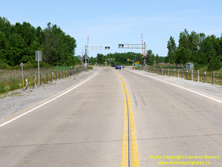
Left - Facing south along Hwy 406 from the Woodlawn Road Junction approaching the Trillium Railway Crossing. One of the curiosities about the two-lane Hwy 406
was this at-grade railway crossing, which was built as a temporary measure until such time as the four-lane highway was constructed. Although it may seem odd today to
see an at-grade railway crossing along a 400-Series Highway, it should be noted that this wasn't unprecedented. The Queen Elizabeth Way, Hwy 400, Hwy 401, Hwy 402,
Hwy 410 and the Ottawa Queensway all had at-grade railway crossings on them historically. See an
Enlarged Photo Here. (Photograph taken on June 19, 2011 - © Cameron Bevers) Right - Approaching the Trillium Railway Crossing on Hwy 406, facing north towards Woodlawn Road. This at-grade railway crossing was removed through the construction of a grade separation during 2013 as part of the Hwy 406 twinning project carried out under Contract #2011-2005. See an Enlarged Photo Here. (Photograph taken on June 19, 2011 - © Cameron Bevers) 

Left - Advance green guide signs for Woodlawn Road and Daimler Parkway, facing north towards the Trillium Railway Crossing. See an
Enlarged Photo Here. (Photograph taken on June 19, 2011 - © Cameron Bevers) Right - Aerial view of Hwy 406 along the eastern side of Welland. The relocation of the Welland Canal during the 1970s opened up a new transportation corridor for Hwy 406. All roads crossing the new canal's location had to be closed as a result of the St. Lawrence Seaway's construction, which left a largely unimpeded corridor available through which to construct Hwy 406 southerly to East Main Street. The golf course and the commercial developments which flank Hwy 406 were not there when this section of Hwy 406 first opened to traffic in the early 1990s. See an Enlarged Photo Here. (Photograph taken on June 19, 2011 - © Cameron Bevers) 

Left - Warning sign on northbound Hwy 406 approaching the Trillium Railway Crossing from the south. See an
Enlarged Photo Here. (Photograph taken on June 19, 2011 - © Cameron Bevers) Right - Facing south along Hwy 406 towards East Main Street from the Trillium Railway Crossing. See an Enlarged Photo Here. (Photograph taken on June 19, 2011 - © Cameron Bevers) 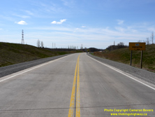

Left - Sign marking the upcoming southern terminus of Hwy 406 in 2011, prior to reconstruction and widening. See an
Enlarged Photo Here. (Photograph taken on April 30, 2011 - © Cameron Bevers) Right - Facing north along Hwy 406 between East Main Street and Woodlawn Road during the highway widening in 2013. See an Enlarged Photo Here. (Photograph taken on May 16, 2013 - © Cameron Bevers) 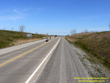

Left - Facing north along Hwy 406 about 1 km north of the highway's southern terminus at East Main Street in 2011, prior to reconstruction and widening. See an
Enlarged Photo Here. (Photograph taken on April 30, 2011 - © Cameron Bevers) Right - View of Hwy 406 about 1 km north of East Main Street in 2013 during the highway's widening. See an Enlarged Photo Here. (Photograph taken on May 16, 2013 - © Cameron Bevers) 
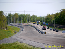
Left - Facing south along Hwy 406 about 1 km north of the highway's southern terminus at East Main Street in 2011, prior to reconstruction and widening. See an
Enlarged Photo Here. (Photograph taken on April 30, 2011 - © Cameron Bevers) Right - View of Hwy 406 approaching East Main Street in Welland in 2013 during the highway's widening. In this photo, the new northbound carriageway is nearing completion. Both northbound and southbound traffic were still using the original (southbound) carriageway. See an Enlarged Photo Here. (Photograph taken on May 16, 2013 - © Cameron Bevers) 

Left - Sign marking the upcoming East Main Street Junction at the southern terminus of Hwy 406 in 2011. See an
Enlarged Photo Here. (Photograph taken on April 30, 2011 - © Cameron Bevers) Right - Close-up view of the concrete pavement along Hwy 406 near East Main Street in Welland in 2011, prior to reconstruction and widening. See an Enlarged Photo Here. (Photograph taken on April 30, 2011 - © Cameron Bevers) 

Left - A group of "truss" luminaires mark the approach to Hwy 406's southern terminus at East Main Street. These luminaires were installed in the early 1990s
and were among the last installations of this type of highway luminaire along the King's Highways. The truss luminaire design saw almost 30 years of continuous use
along Ontario's Highways. See an Enlarged Photo Here. (Photograph taken on April 30, 2011 - © Cameron Bevers) Right - Facing north along Hwy 406 near East Main Street in 2011, prior to reconstruction and widening. See an Enlarged Photo Here. (Photograph taken on April 30, 2011 - © Cameron Bevers) 

Left - A reverse curve exists along Hwy 406 immediately north of the East Main Street Junction, as this was originally intended to be part of a freeway exit
ramp. A future corridor for Hwy 406 was designated from East Main Street southerly to Townline Road (Hwy 58A) back in the 1990s, but no plans have been advanced yet
to construct the proposed highway. See an Enlarged Photo Here. (Photograph taken on April 30, 2011 - © Cameron Bevers) Right - A "TO/VERS 140" green-and-white trailblazer route marker at the end of Hwy 406 approaching the East Main Street Junction. The route of Hwy 140 begins at East Main Street and continues south from Welland to Port Colborne along the eastern side of the Welland Canal. See an Enlarged Photo Here. (Photograph taken on April 30, 2011 - © Cameron Bevers) 

Left - Aerial view of the Hwy 406 and East Main Street Junction in Welland, facing southwest. See an
Enlarged Photo Here. (Photograph taken on June 18, 2011 - © Cameron Bevers) Right - Aerial view of Hwy 406, facing south towards the highway's southern terminus at East Main Street in Welland. There was a proposal at one time to extend Hwy 406 south from East Main Street in Welland to Hwy 58A (Townline Road). Any further extension of Hwy 406 would be subject to the province securing construction funding, completing property acquisition and obtaining all necessary environmental approvals. Accordingly, any further extension of Hwy 406 southerly through Welland is not likely to occur for some time. See an Enlarged Photo Here. (Photograph taken on June 18, 2011 - © Cameron Bevers) 
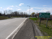
Left - Southern terminus of Hwy 406 at East Main Street in Welland in 2011, prior to reconstruction and widening. See an
Enlarged Photo Here. (Photograph taken on June 19, 2011 - © Cameron Bevers) Right - Green guide sign marking East Main Street in Welland at the southern terminus of Hwy 406. The section of East Main Street through the tunnel situated between the Hwy 406 Junction and the Hwy 140 Junction is an unsigned 7000-Series Highway, known as Hwy 7146. See an Enlarged Photo Here. (Photograph taken on April 30, 2011 - © Cameron Bevers) 

Left - Facing north along Hwy 406 from the East Main Street Junction in Welland. Prior to this intersection's reconstruction in the 2010s, southbound motorists
on Hwy 406 had to choose between a single left or single right turn lane at the end of the highway. By turning right, motorists could follow East Main Street into
Downtown Welland. Motorists wishing to continue south to Port Colborne could turn left and pass below the Welland Canal via a tunnel to reach nearby Hwy 140. See an
Enlarged Photo Here. (Photograph taken on April 30, 2011 - © Cameron Bevers) Right - View of the Hwy 406 and East Main Street Junction, facing north towards St. Catharines. As part of the highway reconstruction in the 2010s, a second southbound left turn lane was required at this intersection in order to meet projected future traffic demand. Rather than retrofit the existing traffic signals with a dual left turn lane, a new roundabout was constructed at this location instead. See an Enlarged Photo Here. (Photograph taken on April 30, 2011 - © Cameron Bevers) 
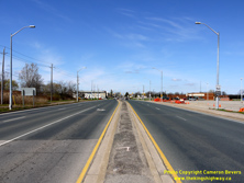
Left - Traffic signals at the Hwy 406 and East Main Street Junction. During reconstruction and widening of Hwy 406 under Contract #2011-2005, a modern
roundabout was constructed in place of these traffic signals. To date, it is the only roundabout located at the terminus of a 400-Series Highway. See an
Enlarged Photo Here. (Photograph taken on April 30, 2011 - © Cameron Bevers) Right - Facing west along East Main Street towards Welland's City Centre from the Hwy 406 Junction. See an Enlarged Photo Here. (Photograph taken on April 30, 2011 - © Cameron Bevers) 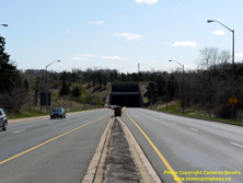
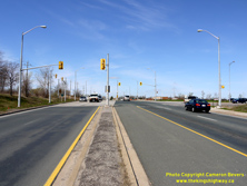
Left - Approaching the East Main Street Tunnel, as seen from the Hwy 406 Junction in Welland. See an
Enlarged Photo Here. (Photograph taken on April 30, 2011 - © Cameron Bevers) Right - Facing west along East Main Street at the Hwy 406 Junction, prior to the construction of the roundabout. See an Enlarged Photo Here. (Photograph taken on April 30, 2011 - © Cameron Bevers) 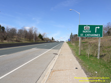

Left - Advance green guide sign marking Hwy 406 on westbound East Main Street in Welland. See an
Enlarged Photo Here. (Photograph taken on April 30, 2011 - © Cameron Bevers) Right - Green guide sign on East Main Street marking the turn-off to St. Catharines via Hwy 406. See an Enlarged Photo Here. (Photograph taken on April 30, 2011 - © Cameron Bevers) 
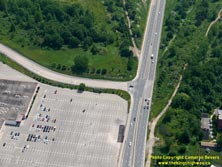
Left - Aerial view of the Hwy 406 and East Main Street Junction in Welland, facing southeast towards the tunnel below the Welland Canal. See an
Enlarged Photo Here. (Photograph taken on June 18, 2011 - © Cameron Bevers) Right - Aerial view of the traffic signals at the Hwy 406 and East Main Street Junction in Welland, facing east. See an Enlarged Photo Here. (Photograph taken on June 18, 2011 - © Cameron Bevers) 

Left - Aerial view of the southern terminus of Hwy 406 at East Main Street in Welland, facing northeast. The entire East Main Street Tunnel and its approaches
can be seen in this photo, along with the Hwy 140 Junction adjacent to the east tunnel entrance. The East Main Street Tunnel was built by the Department of Highways
of Ontario (DHO) under Contract #1970-10, through a cost-sharing agreement with the St. Lawrence Seaway Authority. The new highway tunnel opened to traffic in 1972
under a relocated section of the Welland Canal. This was one of three highway tunnels built below the Welland Canal during the late 1960s and early 1970s. See an
Enlarged Photo Here. (Photograph taken on June 18, 2011 - © Cameron Bevers) Right - Aerial view of Hwy 406 and the Welland Canal, facing north towards St. Catharines from East Main Street in Welland. See an Enlarged Photo Here. (Photograph taken on June 18, 2011 - © Cameron Bevers) 
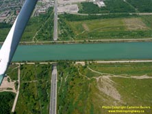
Left - Aerial view of the Hwy 406 and East Main Street Junction in Welland, facing northwest. East Main Street briefly disappears from view as it passes
through a highway tunnel below the relocated Welland Canal. See an Enlarged Photo Here. (Photograph taken on June 18, 2011 - © Cameron Bevers) Right - Aerial view of the East Main Street Tunnel in Welland, facing west towards the Hwy 406 Junction. See an Enlarged Photo Here. (Photograph taken on June 18, 2011 - © Cameron Bevers) 
Above - Aerial view of East Main Street approaching the Hwy 406 Junction, facing southwest. See an
Enlarged Photo Here. (Photograph taken on June 18, 2011 - © Cameron Bevers)
More King's Highway 406 Photographs Coming Soon!
|
|---|
Links to Adjacent King's Highway Photograph Pages:
Back to King's Highway 405 Photos /
King's Highway 406 History /
On to Highway 407 (ETR) Photos
Ontario Highway History - Main Menu / Back to List of Highways Website contents, photos & text © 2002-2026, Cameron
Bevers (Webmaster) - All Rights Reserved / Contact Me
|
|---|