
| 
| |
|
|
This page contains present day photos (Year 2000 to date) of Ontario's King's Highway 41, arranged by location from the
Highway 132 Junction northerly to Pembroke. All photographs displayed on this page were taken by the Webmaster (Cameron Bevers), unless specifically noted otherwise. Click on any
thumbnail to see a larger image!
Please note that all photographs displayed on this
website are protected by copyright. These photographs must not be reproduced, published,
electronically stored or copied, distributed, or posted onto other websites without
my written permission. If you want to use photos from this website, please
email me first for permission. Thank-you!
|
|---|
|
Page 5: Present Day King's Highway 41 Photographs (Hwy 132 to Pembroke)


Left - Facing north along Hwy 41 towards the Hwy 132 Junction near Dacre. (Photograph taken on August 4, 2008 - © Cameron Bevers) Right - Facing south along Hwy 41 towards Griffith at Tooey's Hill, at the Hwy 132 Junction. Tooey's Hill marks the edge of the Opeongo Mountains, a series of steep-sided hills which stretch from the eastern side of Algonquin Park down towards the Arnprior area. The Opeongo Mountains formed a rather formidable natural barrier along the southern side of the Ottawa Valley, which prohibited railway construction and discouraged settlement into these highlands for the better part of a century. The construction of Hwy 41 across the highlands greatly improved transportation through the area. (Photograph taken on August 4, 2008 - © Cameron Bevers) 

Left - A very large right turn channel exists at the Junction of Hwy 41 & Hwy 132 near Dacre. This right turn channel (at left) carries Southbound
Hwy 41 traffic bound for Griffith. (Photograph taken on August 4, 2008 - © Cameron Bevers) Right - Facing south along Hwy 41 towards Tooey's Hill from the Hwy 132 Junction. Hwy 41 crosses the Opeongo Mountains at Tooey's Hill, which is one of the only low points in the highlands south of Barry's Bay. Up until the 1930s, travel into the region beyond the Opeongo Mountains was very difficult. No railways had ever been built through this area due to the rugged terrain and the roads leading into the highlands were only seasonal. After Hwy 41 was designated as a new provincial highway between Kaladar and Eganville in 1937, an aggressive highway improvement program commenced which resulted in Hwy 41 being reconstructed from a seasonal dirt road into a reliable year-round through highway. By 1948, Hwy 41 had been fully paved through the highlands as far south as Denbigh. (Photograph taken on August 4, 2008 - © Cameron Bevers) 

Left - Approaching the Hwy 132 Junction on Hwy 41 near Dacre. The green directional sign at right advises drivers that they must turn left to
proceed to Eganville. (Photograph taken on August 4, 2008 - © Cameron Bevers) Right - Hwy 41 & Hwy 132 Junction near Dacre. At this intersection, Hwy 41 turns left to continue north towards Eganville and Pembroke, while Hwy 132 is actually the through route which continues east to Dacre and Renfrew. (Photograph taken on August 4, 2008 - © Cameron Bevers) 

Left - Oversized crown signs at the Hwy 41 & Hwy 132 Junction near Dacre. The sudden change in Hwy 41's direction at this intersection likely
comes as a surprise to many northbound Hwy 41 motorists, who have travelled along the same roadway since Napanee, 150 km to the south. (Photograph taken on August 4, 2008 - © Cameron Bevers) Right - Facing east along Hwy 132 towards Dacre from the Hwy 41 Junction. See an Enlarged Photo here. (Photograph taken on August 4, 2008 - © Cameron Bevers) 

Left - Junction sign assembly at the end of Hwy 132 at the Hwy 41 Junction near Dacre. (Photograph taken on August 4, 2008 - © Cameron Bevers) Right - Southbound junction sign assembly approaching the Hwy 41 & Hwy 132 Junction near Dacre. At this junction, Hwy 41 continues south towards Griffith via a right-turn channel, while Hwy 132 turns left at the approaching T-intersection. (Photograph taken on August 4, 2008 - © Cameron Bevers) 

Left - Green guide sign on Southbound Hwy 41 approaching the Hwy 132 Junction near Dacre. (Photograph taken on August 4, 2008 - © Cameron Bevers) Right - Facing south along Hwy 41 approaching the Hwy 132 Junction near Dacre. (Photograph taken on August 4, 2008 - © Cameron Bevers) 

Left - Southbound Hwy 41 continues beyond the Hwy 132 Junction near Dacre. However, to stay on Hwy 41, southbound traffic must turn right. To
facilitate this Southbound Hwy 41 movement, a right-turn channel was constructed at this highway junction. (Photograph taken on August 4, 2008 - © Cameron Bevers) Right - Guide signs at the Hwy 41 & Hwy 132 Junction near Dacre. A left turn at this T-intersection will lead motorists to Renfrew via Hwy 132. Although it isn't indicated by any signs, motorists who miss the right-turn channel can still continue south towards Griffith via Hwy 41 by turning right at this T-intersection. (Photograph taken on August 4, 2008 - © Cameron Bevers) 

Left - Distance sign on Northbound Hwy 41 at the Hwy 132 Junction. Eganville and Pembroke are the only major towns along Hwy 41 beyond this point. (Photograph taken on August 4, 2008 - © Cameron Bevers) Right - Facing north along Hwy 41 towards Eganville from the Hwy 132 Junction near Dacre. See an Enlarged Photo here. (Photograph taken on August 4, 2008 - © Cameron Bevers) 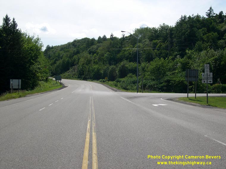
Above - Western terminus of Hwy 132 at the Hwy 41 Junction near Dacre. (Photograph taken on August 4, 2008 - © Cameron Bevers) 

Left - Facing north along Hwy 41 towards Eganville, north of the Hwy 132 Junction. (Photograph taken on August 5, 2008 - © Cameron Bevers) Right - The long road south: From Eganville, Hwy 41 passes through a beautiful but rather sparsely-populated region of Eastern Ontario. The next major town along the highway is Napanee, located roughly 170 km to the south. The Opeongo Mountains can be seen on the horizon, nearly 20 km away. See an Enlarged Photo here. (Photograph taken on August 5, 2008 - © Cameron Bevers) 

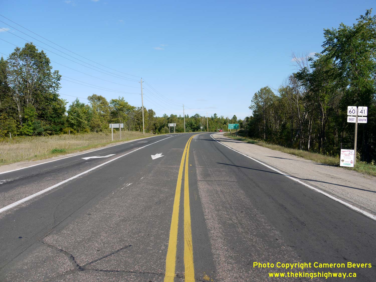
Left - Distance sign on Hwy 41 south of Eganville. Interestingly, Renfrew is marked on this distance sign, even though Hwy 41 does not form a
particularly direct route to the town. Motorists must travel 30 km east from Hwy 41 via Hwy 132 to reach Renfrew. (Photograph taken on August 5, 2008 - © Cameron Bevers) Right - Old stone arch bridge over the Bonnechere River on Hwy 41 at Eganville. Structure completed in 1903. (Photograph taken on August 1, 2004 - © Cameron Bevers) 

Left - North arch of the historic Bonnechere River Bridge on Hwy 41 at Eganville. (Photograph taken on August 1, 2004 - © Cameron Bevers) Right - Guide signs at the Hwy 41 & Hwy 60 Junction in Eganville. Northbound Hwy 41 traffic must turn left at this intersection to continue north towards Pembroke. Hwy 41 briefly shares its route with Hwy 60, which continues west from Eganville towards Barry's Bay, Algonquin Park and ultimately, Huntsville. (Photograph taken on August 5, 2008 - © Cameron Bevers) 

Left - Junction of Hwy 41 & Hwy 60 in Eganville, facing east. At this intersection, Hwy 41 turns right and heads south towards Griffith, while
Hwy 60 continues straight through towards Renfrew. See an Enlarged Photo here. (Photograph taken on August 5, 2008 - © Cameron Bevers) Right - Facing south along Hwy 41 towards the Bonnechere River Bridge from the Hwy 60 Junction in Eganville. (Photograph taken on August 5, 2008 - © Cameron Bevers) 


Left - An older Hwy 41 "JCT" Junction sign in Eganville. (Photograph taken on August 5, 2008 - © Cameron Bevers) Centre - Junction of Hwy 41 & Hwy 60 in Eganville. Note the old Department of Highways directional signpost at left, which likely dates from the 1950s. (Photograph taken on August 1, 2004 - © Cameron Bevers) Right - Dual King's Highway route markers on Hwy 41 & Hwy 60 in Eganville. The two highways share a concurrent routing for 4 km north of Eganville. (Photograph taken on August 5, 2008 - © Cameron Bevers) 

Left - Facing west along Hwy 60 towards the Hwy 41 Junction in Eganville. (Photograph taken on August 5, 2008 - © Cameron Bevers) Right - Facing south along Hwy 41 & Hwy 60 approaching Eganville. See an Enlarged Photo Here. (Photograph taken on September 2, 2012 - © Cameron Bevers) 

Left - Distance guide sign on Hwy 41 & Hwy 60 departing Eganville, facing north. See an
Enlarged Photo Here. (Photograph taken on September 2, 2012 - © Cameron Bevers) Right - Abandoned Hwy 41 & Hwy 60 alignment north of Eganville. (Photograph taken on August 1, 2004 - © Cameron Bevers) 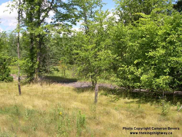

Left - A long-abandoned section of Hwy 41 & Hwy 60 is still visible in the woods north of Eganville. (Photograph taken on August 1, 2004 - © Cameron Bevers) Right - Former Hwy 41 & Hwy 60 alignment near the north junction of Hwy 60, north of Eganville. (Photograph taken on August 1, 2004 - © Cameron Bevers) 

Left - Distance guide sign on Hwy 41 & Hwy 60, facing south towards Eganville. See an
Enlarged Photo Here. (Photograph taken on September 2, 2012 - © Cameron Bevers) Right - Municipal signpost indicating the Hwy 41 & Hwy 60 Junction north of Eganville. See an Enlarged Photo Here. (Photograph taken on September 2, 2012 - © Cameron Bevers) 
Left - Junction of Hwy 41 & Hwy 60 north of Eganville. At this highway junction, these two highways part ways after sharing a short concurrent route
through the Eganville area. At right, Hwy 41 turns off and heads north towards Pembroke, while Hwy 60 curves to the west and continues towards Golden Lake and Barry's
Bay. See an Enlarged Photo Here. (Photograph taken on September 2, 2012 - © Cameron Bevers) Right - View of the overlapped route of Hwy 41 & Hwy 60, facing south from the highway junction near Eganville. See an Enlarged Photo Here. (Photograph taken on September 2, 2012 - © Cameron Bevers) 

Left - Hwy 41 & Hwy 60 crown route markers north of Eganville. Despite the concurrent routing, Hwy 60 is still signed with east-west cardinal directions
while Hwy 41 is signed with north-south cardinal directions in order to maintain consistency with the cardinal directions on the balance of the routes. See an
Enlarged Photo Here. (Photograph taken on September 2, 2012 - © Cameron Bevers) Right - Junction sign assembly on eastbound Hwy 60 approaching the Hwy 41 Junction north of Eganville. See an Enlarged Photo Here. (Photograph taken on September 2, 2012 - © Cameron Bevers) 

Left - Distance guide sign on Hwy 60, facing west from the Hwy 41 North Junction. See an
Enlarged Photo Here. (Photograph taken on September 2, 2012 - © Cameron Bevers) Right - Facing east along Hwy 60 approaching the Hwy 41 North Junction. Motorists heading to Pembroke can turn left here and follow Hwy 41 North, while continuing straight ahead via Hwy 60 East & Hwy 41 South will lead to Eganville. See an Enlarged Photo Here. (Photograph taken on September 2, 2012 - © Cameron Bevers) 

Left - Facing west along Hwy 60 towards Golden Lake from the Hwy 41 North Junction near Eganville. See an
Enlarged Photo Here. (Photograph taken on September 2, 2012 - © Cameron Bevers) Right - Junction of Hwy 41 & Hwy 60 near Eganville, facing south. See an Enlarged Photo Here. (Photograph taken on September 2, 2012 - © Cameron Bevers) 

Left - Facing north along Hwy 41 towards Pembroke from the Hwy 60 Junction near Eganville. See an
Enlarged Photo Here. (Photograph taken on September 2, 2012 - © Cameron Bevers) Right - Former Hwy 41 alignment (Point Church Drive) approaching Lake Dore north of the Hwy 60 Junction. During the late 1970s, Hwy 41 was relocated onto a brand new alignment east of Lake Dore. Several kilometres of the old, winding Hwy 41 alignment along the shores of Lake Dore were bypassed during this highway improvement project. (Photograph taken on August 1, 2004 - © Cameron Bevers) 

Left - Approaching the Hwy 17 Junction on Hwy 41, facing north towards Pembroke. (Photograph taken on June 1, 2010 - © Cameron Bevers) Right - Facing north along Hwy 41 towards the Hwy 17 Junction in Pembroke. There are no right-turn channelizations on the south side of the intersection. (Photograph taken on June 1, 2010 - © Cameron Bevers) 

Left - Facing south along Hwy 41 towards Eganville from the Hwy 17 Junction in Pembroke. (Photograph taken on June 1, 2010 - © Cameron Bevers) Right - Distance sign on Southbound Hwy 41 leaving Pembroke. Eganville and Napanee are the only towns with a population over 500 along the entire highway. (Photograph taken on June 1, 2010 - © Cameron Bevers) 

Left - Facing north along Hwy 41 at the Hwy 17 Junction in Pembroke. Although Hwy 41 continues as a signed route for an additional 4 km into
Downtown Pembroke, the assumed portion of Hwy 41 owned by the Province ends just beyond the Hwy 17 Junction. (Photograph taken on June 1, 2010 - © Cameron Bevers) Right - Guide signs on Northbound Hwy 41 at the Hwy 17 Junction in Pembroke. (Photograph taken on June 1, 2010 - © Cameron Bevers) 

Left - Approaching the Hwy 41 Junction on Hwy 17 in Pembroke, facing west. (Photograph taken on June 1, 2010 - © Cameron Bevers) Right - Advance guide signs for the Hwy 41 Junction on Hwy 17 in Pembroke. The right turn onto Northbound Hwy 41 from Westbound Hwy 17 is channelized, which is why the advance arrows are angled upwards and to the right. The turn onto Southbound Hwy 41 from Westbound Hwy 17 is accomplished via a conventional left-turn lane. (Photograph taken on June 1, 2010 - © Cameron Bevers) 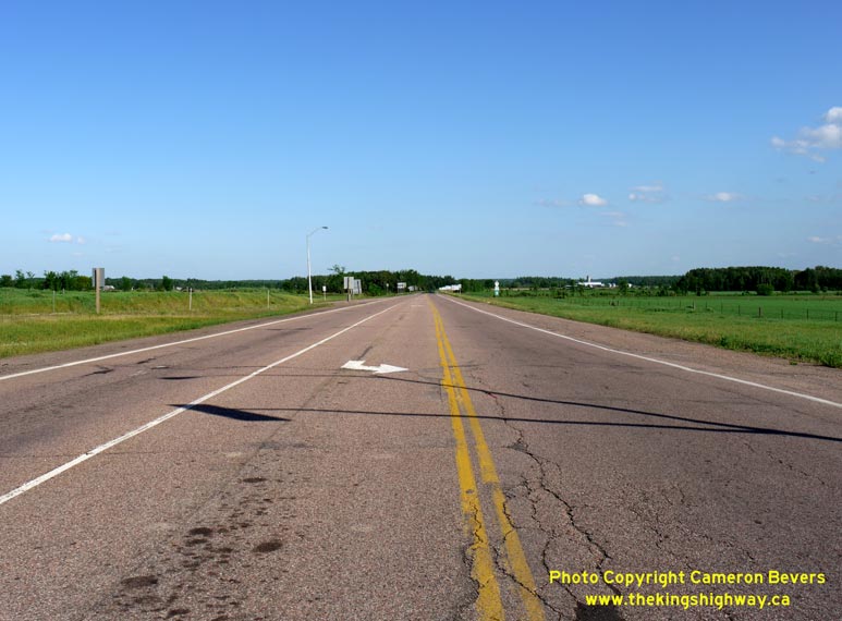

Left - Facing east along Hwy 17 towards Cobden from the Hwy 41 Junction in Pembroke. (Photograph taken on June 1, 2010 - © Cameron Bevers) Right - Turn-off guide signs for the Hwy 41 Junction on Hwy 17 in Pembroke. With 7 separate signboards and tabs, this is arguably one of the most complicated sign assemblies seen anywhere on the provincial highway network. (Photograph taken on June 1, 2010 - © Cameron Bevers) 

Left - Facing south along Hwy 41 towards the Hwy 17 Junction in Pembroke. Note the right-turn channelizations on the north side of the intersection. (Photograph taken on June 1, 2010 - © Cameron Bevers) Right - Unlike many channelized right-turn lanes built in Ontario, there was no curb and gutter constructed at the Hwy 17 & Hwy 41 Junction. Storm water drainage is accommodated through normal pavement crossfall and drainage swales. (Photograph taken on June 1, 2010 - © Cameron Bevers) 

Left - Facing south along Hwy 41 at the Hwy 17 Junction. The traffic signals at this intersection operate on a simple two-phase timing plan, with no
advance protected left-turn arrows. (Photograph taken on June 1, 2010 - © Cameron Bevers) Right - Facing east along Hwy 17 towards the Hwy 41 Junction in Pembroke. Note the amber warning beacons at right, which begin to flash when the traffic signal ahead is red. See an Enlarged Photo here. (Photograph taken on June 1, 2010 - © Cameron Bevers) 

Left - Facing east along Hwy 17 at the Hwy 41 Junction in Pembroke. The channelized right-turn lane on the left side of the photo carries traffic
from Southbound Hwy 41 to Westbound Hwy 17. (Photograph taken on June 1, 2010 - © Cameron Bevers) Right - Overview of the Hwy 17 & Hwy 41 Junction in Pembroke. Ever since the downloading of Hwy 62 & Hwy 148 west of Pembroke, the Hwy 41 Junction is the first King's Highway encountered along Hwy 17 east of the North Bay area, located 200 km to the west. (Photograph taken on June 1, 2010 - © Cameron Bevers) 

Left - Facing west along Hwy 17 towards Petawawa from the Hwy 41 Junction in Pembroke. (Photograph taken on June 1, 2010 - © Cameron Bevers) Right - Approaching the Hwy 41 Junction on Eastbound Hwy 17 in Pembroke. (Photograph taken on June 1, 2010 - © Cameron Bevers) 

Left - Guide signs on Southbound Hwy 41 at the Hwy 17 Junction in Pembroke. (Photograph taken on June 1, 2010 - © Cameron Bevers) Right - Facing north along Hwy 41 towards Pembroke from the Hwy 17 Junction. Note the large Irving Gas Station on the right-hand side of the highway. The Irving brand is somewhat of an anomaly in Ontario, where there are only a handful of gas stations operated by Irving Oil. However, these Irving Gas Stations are ubiquitous in Eastern Canada and New England, where the company operates hundreds of locations. See an Enlarged Photo here. (Photograph taken on June 1, 2010 - © Cameron Bevers) 

Left - Signs marking the Hwy 41 & Hwy 148 Junction in Downtown Pembroke. Up until 1997, Hwy 148 continued west through Downtown Pembroke to join
with Hwy 17 & Hwy 62 south of Petawawa. Since 1997, the signed routes of Hwy 41 and Hwy 148 share a common terminus in Downtown Pembroke. (Photograph taken on June 4, 2010 - © Cameron Bevers) Right - Approaching the northern terminus of Hwy 41 in Downtown Pembroke. Although Hwy 41 is fully signed through Pembroke, the section of Hwy 41 lying north of the Hwy 17 Junction is actually maintained by the municipality. (Photograph taken on June 4, 2010 - © Cameron Bevers) 
Above - Sign marking the end of Hwy 41 in Downtown Pembroke. The diminutive 6 km route of Hwy 148 begins at the Hwy 41 Junction. Like Hwy 41, the
section of Hwy 148 lying within Pembroke's City Limits is maintained by the municipality. (Photograph taken on June 4, 2010 - © Cameron Bevers)
More King's Highway 41 Photographs Coming Soon!
|
|---|
Links to Adjacent King's Highway Photograph Pages:
Back to King's Highway 40 Photos /
King's Highway 41 History /
On to King's Highway 42 Photos
Ontario Highway History - Main Menu / Back to List of Highways Website contents, photos & text © 2002-2026, Cameron
Bevers (Webmaster) - All Rights Reserved / Contact Me
|
|---|