
| 
|  |
|
|
This page contains present day photos (Year 2000 to date) of Ontario's King's Highway 41, arranged by location from Denbigh
northerly to the Highway 132 Junction. All photographs displayed on this page were taken by the Webmaster (Cameron Bevers), unless specifically noted otherwise. Click
on any thumbnail to see a larger image!
Please note that all photographs displayed on this
website are protected by copyright. These photographs must not be reproduced, published,
electronically stored or copied, distributed, or posted onto other websites without
my written permission. If you want to use photos from this website, please
email me first for permission. Thank-you!
|
|---|
|
Page 4: Present Day King's Highway 41 Photographs (Denbigh to Hwy 132)
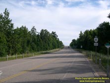

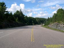
Left - Facing south along Hwy 41 towards Kaladar from the Hwy 28 Junction at Denbigh. See an
Enlarged Photo Here. (Photograph taken on August 4, 2008 - © Cameron Bevers) Right - Approaching the Hwy 28 Junction on northbound Hwy 41 at Denbigh. See an Enlarged Photo Here. (Photograph taken on August 4, 2008 - © Cameron Bevers) 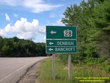
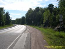
Left - An older green guide sign on northbound Hwy 41 approaching the Hwy 28 Junction at Denbigh. See an
Enlarged Photo Here. (Photograph taken on August 4, 2008 - © Cameron Bevers) Right - Facing west along Hwy 28 towards Bancroft from the Hwy 41 Junction at Denbigh. This highway continues west for 60 km to Bancroft, before swinging south towards Peterborough. See an Enlarged Photo Here. (Photograph taken on August 4, 2008 - © Cameron Bevers) 

Left - Eastern terminus of Hwy 28 at the Hwy 41 Junction at Denbigh. Until the late 1990s, the route of Hwy 28 extended all the way to Port Hope, about 100 km
east of Toronto. Although the southern section of Hwy 28 from Port Hope to the Peterborough area was downloaded in 1997-1998, Hwy 28 still remains one of Central
Ontario's longest King's Highways. See an Enlarged Photo Here. (Photograph taken on August 4, 2008 - © Cameron Bevers) Right - Guide signs at the Hwy 28 & Hwy 41 Junction at Denbigh. See an Enlarged Photo Here. (Photograph taken on August 4, 2008 - © Cameron Bevers) 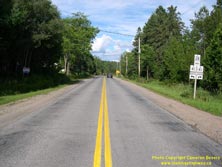
Left - Approaching the Hwy 41 Junction at the end of Hwy 28 in Denbigh. Originally, this section of Hwy 28 was actually a part of Hwy 41. During the 1960s, the
community of Denbigh was bypassed by a new Hwy 41 alignment east of town. A portion of the old section of Hwy 41 through Denbigh was renumbered as Hwy 500, which was
subsequently re-designated as Hwy 28 in 1982. See an Enlarged Photo Here. (Photograph taken on August 4, 2008 - © Cameron Bevers) Right - Facing north along Hwy 41 towards Griffith from the Hwy 28 Junction at Denbigh. See an Enlarged Photo Here. (Photograph taken on August 4, 2008 - © Cameron Bevers) 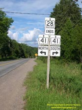
Above - Junction sign assembly at the end of Hwy 28 at the Hwy 41 Junction at Denbigh. See an
Enlarged Photo Here. (Photograph taken on August 4, 2008 - © Cameron Bevers) 

Left - Approaching the Hwy 28 Junction on Hwy 41 at Denbigh, facing south. See an
Enlarged Photo Here. (Photograph taken on September 2, 2012 - © Cameron Bevers) Right - Junction sign assembly on southbound Hwy 41 approaching the Hwy 28 Junction at Denbigh. See an Enlarged Photo Here. (Photograph taken on September 2, 2012 - © Cameron Bevers) 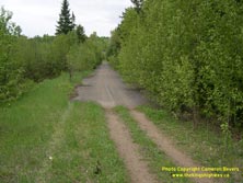

Left - Abandoned Hwy 41 alignment near Hydes Creek, between Denbigh and Griffith. (Photograph taken on May 22, 2004 - © Cameron Bevers) Right - Hydes Creek Bridge on Hwy 41 north of Denbigh. Structure completed in 1964. (Photograph taken on August 4, 2008 - © Cameron Bevers) 

Left - Facing north across the Hydes Creek Bridge on Hwy 41 north of Denbigh. (Photograph taken on August 4, 2008 - © Cameron Bevers) Right - The steel handrail design used on the Hydes Creek Bridge was typical for Ontario highway bridges built between the mid-1930s and the mid-1960s. (Photograph taken on August 4, 2008 - © Cameron Bevers) 

Left - Facing south across the Hydes Creek Bridge on Hwy 41 north of Denbigh. (Photograph taken on August 5, 2008 - © Cameron Bevers) Right - Hwy 41 near Hydes Creek, facing north towards Griffith. (Photograph taken on August 5, 2008 - © Cameron Bevers) 

Left - Approaching Griffith on Hwy 41, facing north. At this point, Hwy 41 descends into a valley where it crosses the Madawaska River. (Photograph taken on August 4, 2008 - © Cameron Bevers) Right - Hwy 41 junction sign assembly at the end of Renfrew Road 71 (Matawatchan Road) in Griffith. Renfrew Road 71 is a very scenic county road which follows the Madawaska River south from Hwy 41 at Griffith. Although the county road changes names and directions several times, the route eventually leads to Calabogie and ultimately, Arnprior. (Photograph taken on August 4, 2008 - © Cameron Bevers) 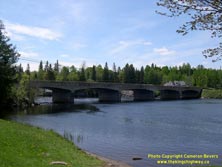

Left - Madawaska River Bridge on Hwy 41 at Griffith. Construction began on the Madawaska River Bridge in 1940. Due to Wartime shortages of
construction equipment and structural steel, the new bridge wasn't completed and opened to traffic until 1942. (Photograph taken on May 23, 2004 - © Cameron Bevers) Right - Southern side of the Madawaska River Bridge on Hwy 41 at Griffith. This bridge is a five-span concrete rigid frame structure. (Photograph taken on May 23, 2004 - © Cameron Bevers) 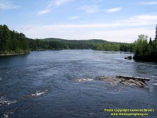
Left - View of the Madawaska River from the Hwy 41 Bridge at Griffith. The Madawaska River is one of Eastern Ontario's longest rivers, running from
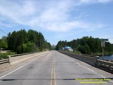
the heart of Algonquin Park to the Ottawa River at Arnprior. Some of Ontario's finest natural scenery can be found along the Madawaska River. (Photograph taken on May 23, 2004 - © Cameron Bevers) Right - Facing north along Hwy 41 towards Eganville at the Madawaska River Bridge at Griffith. (Photograph taken on May 23, 2004 - © Cameron Bevers) 
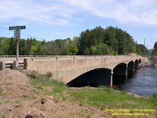
Left - Facing south along Hwy 41 towards Denbigh at the Madawaska River Bridge at Griffith. (Photograph taken on May 23, 2004 - © Cameron Bevers) Right - The original 1940s-era steel handrails were replaced on the Griffith Bridge during a bridge rehabilitation project during the 1980s. The Madawaska River Bridge was rehabilitated again in 2004-2005, shortly after this photo was taken. (Photograph taken on May 23, 2004 - © Cameron Bevers) 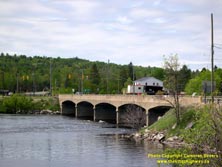

Left - At the time of its construction in 1942, the five-span Madawaska River Bridge on Hwy 41 was one of the longest concrete rigid frame
structures ever built in Ontario. Each span is 60 feet in length, giving the bridge a total length of approximately 300 feet (92 metres). (Photograph taken on May 23, 2004 - © Cameron Bevers) Right - Madawaska River Bridge on Hwy 41 at Griffith, as seen after the rehabilitation project in 2004-2005. (Photograph taken on August 4, 2008 - © Cameron Bevers) 

Left - Facing north along Hwy 41 at the Madawaska River Bridge at Griffith. The bridge deck was resurfaced during the bridge rehabilitation project in
2004-2005. (Photograph taken on August 4, 2008 - © Cameron Bevers) Right - Hwy 41 crosses a beautiful open meadow just north of Griffith, before climbing into the Opeongo Mountains. See an Enlarged Photo here. (Photograph taken on May 23, 2004 - © Cameron Bevers) 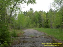

Left - Abandoned Hwy 41 alignment at the top of Tooey's Hill. Significant portions of Hwy 41 were relocated onto a new alignment at Tooey's Hill
during highway improvement projects in the 1960s. (Photograph taken on May 23, 2004 - © Cameron Bevers) Right - Rock cut at the top of Tooey's Hill on Hwy 41. From this point, Hwy 41 descends quickly out of the Opeongo Mountains to meet up with Hwy 132 about 3 km to the northeast. (Photograph taken on May 23, 2004 - © Cameron Bevers) 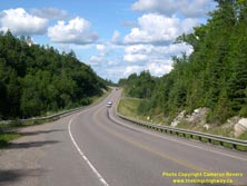
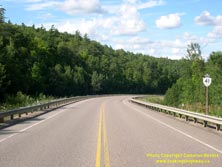
Left - Descending Tooey's Hill on Hwy 41 near Dacre. See an Enlarged Photo here. (Photograph taken on August 4, 2008 - © Cameron Bevers) Right - Hwy 41 route marker at Tooey's Hill near Dacre. (Photograph taken on August 4, 2008 - © Cameron Bevers) 

Left - The old Hwy 41 alignment at Tooey's Hill glides silently off into the woods near Dacre. Note the faded white centre lines. This abandoned
highway alignment is over 1 km in length. This old section of Hwy 41 terminates at a cul-de-sac at the bottom of Tooey's Hill, a short distance south of
the Hwy 132 Junction. (Photograph taken on May 23, 2004 - © Cameron Bevers) Right - Former Hwy 41 alignment at Tooey's Hill. This old section of Hwy 41 is the so-called "Dacre Magnetic Hill". Up until the 1980s, an optical illusion existed here that tricked drivers into thinking that their cars were actually rolling uphill when they stopped their cars on the downhill grade and released the brake. The combination of the highway's grade and the surrounding hills created this optical illusion. Unfortunately, the area is now so overgrown that the surrounding hills which created the optical illusion are now completely obscured by the advancing forest, which is quickly reclaiming the former highway alignment. (Photograph taken on May 23, 2004 - © Cameron Bevers) 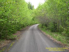
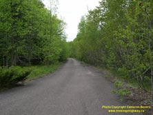
Left - Another view of the old Hwy 41 alignment at Tooey's Hill. This section of the highway was reportedly bypassed in the 1960s in order to
preserve the "Magnetic Hill", which had become a local tourist attraction. (Photograph taken on May 23, 2004 - © Cameron Bevers) Right - Looking up the old Hwy 41 alignment from the cul-de-sac at the bottom of Tooey's Hill near Dacre. (Photograph taken on May 23, 2004 - © Cameron Bevers)
Continue on to King's Highway 41 Photos: Hwy 132 to Pembroke
|
|---|
Links to Adjacent King's Highway Photograph Pages:
Back to King's Highway 40 Photos /
King's Highway 41 History /
On to King's Highway 42 Photos
Ontario Highway History - Main Menu / Back to List of Highways Website contents, photos & text © 2002-2025, Cameron
Bevers (Webmaster) - All Rights Reserved / Contact Me |
|---|