
| 
| |
|
|
This page contains historical and present day photos of Ontario's King's Highway 47. All photographs displayed on this page
were taken by the Webmaster (Cameron Bevers), unless specifically noted otherwise. Historical photographs are arranged in approximate chronological order, while
present day photographs (Year 2000 to date) are arranged by location from west to east. Click on any thumbnail to see a larger image!
Please note that all photographs displayed on this
website are protected by copyright. These photographs must not be reproduced, published,
electronically stored or copied, distributed, or posted onto other websites without
my written permission. If you want to use photos from this website, please
email me first for permission. Thank-you!
|
|---|
|
Present Day King's Highway 47 Photographs


Left - Old route of Hwy 47 near Goodwood. This former section of Hwy 47 was bypassed when a new Hwy 47 diversion opened to traffic in 1970. (Photograph taken on October 8, 2010 - © Cameron Bevers) Right - Facing east along Hwy 47 towards Uxbridge at the Goodwood Diversion. A 2 km section of Hwy 47 was relocated during a reconstruction project in 1969-1970. (Photograph taken on October 8, 2010 - © Cameron Bevers) 

Left - Sign marking the former Hwy 47 alignment near Goodwood. The highway's former route is conspicuously signed as "Old Highway 47". (Photograph taken on October 8, 2010 - © Cameron Bevers) Right - Approaching the western end of the old Hwy 47 alignment that was bypassed by the Goodwood Diversion. (Photograph taken on October 8, 2010 - © Cameron Bevers) 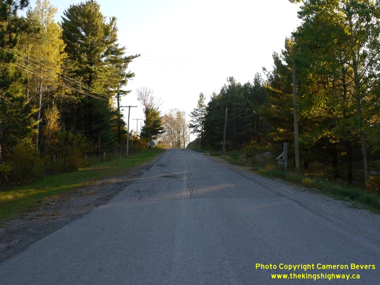

Left - Former route of Hwy 47 between Goodwood and Uxbridge. This section of the highway was bypassed due to its steep hills, sharp curves and
awkward intersections. (Photograph taken on October 8, 2010 - © Cameron Bevers) Right - The former route of Hwy 47 near Goodwood had no shoulders and a narrow pavement width. Rather than attempt to improve and widen the existing highway alignment, the Department of Highways instead chose to relocate the highway altogether onto a new route. (Photograph taken on October 8, 2010 - © Cameron Bevers) 

Left - Reverse curve on the former Hwy 47 alignment between Goodwood and Uxbridge. (Photograph taken on October 8, 2010 - © Cameron Bevers) Right - The bypassed Hwy 47 alignment between Goodwood and Uxbridge was last used by through traffic in 1970. (Photograph taken on October 8, 2010 - © Cameron Bevers) 

Left - An old Y-intersection was eliminated when the former Hwy 47 alignment between Goodwood and Uxbridge was bypassed. Originally, Hwy 47
continued through the flattened area where the concrete blocks are situated. (Photograph taken on October 8, 2010 - © Cameron Bevers) Right - The former Hwy 47 alignment between Goodwood and Uxbridge joins up with the relocated Hwy 47 at the crossroads. Up until 1970, motorists wishing to proceed east along Hwy 47 towards Uxbridge had to turn left at the intersection. The Goodwood Diversion eliminated this jog in the highway alignment. (Photograph taken on October 8, 2010 - © Cameron Bevers)
More King's Highway 47 Photographs Coming Soon!
|
|---|
Links to Adjacent King's Highway Photograph Pages:
Back to King's Highway 46 Photos /
King's Highway 47 History /
On to King's Highway 48 Photos
Ontario Highway History - Main Menu / Back to List of Highways Website contents, photos & text © 2002-2026, Cameron
Bevers (Webmaster) - All Rights Reserved / Contact Me
|
|---|