
| 
|  |
|
|
All photographs displayed on this page were taken by the
Webmaster (Cameron Bevers), unless specifically noted otherwise. Historical photographs are
arranged in approximate chronological order, while present day photographs (Year 2000 to date)
are arranged by location from south to north. Click on any thumbnail to see a larger image!
Please note that all photographs displayed on this
website are protected by copyright. These photographs must not be reproduced, published,
electronically stored or copied, distributed, or posted onto other websites without
my written permission. If you want to use photos from this website, please
email me first for permission. Thank-you!
|
|---|
|
Historical Secondary Highway 533 Photographs
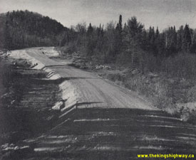
Above - Completed grading on a new resource access road (Harrington Creek Road, now Hwy 533) north of Mattawa. See an
Enlarged Photo Here. Photo taken in 1955. (Photo courtesy of Ontario Ministry of Transportation - © King's Printer for Ontario, 1955) 
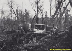
Left - Grading operations on a new resource access road (now Hwy 533), 21 miles north of Mattawa between Timber Lake and Hwy 63. See an
Enlarged Photo Here. Photo taken on October 16, 1956. (Photo courtesy of Ontario Ministry of Transportation - © King's Printer for Ontario, 1956) Right - Bulldozer clearing the way for a new resource access road (now Hwy 533), 6 miles east of Hwy 63. See an Enlarged Photo Here. Photo taken on October 16, 1956. (Photo courtesy of Ontario Ministry of Transportation - © King's Printer for Ontario, 1956) 
Above - Circa 1963 postcard view of the Hwy 17 & Hwy 533 Junction in Downtown Mattawa. Note the old provincial park sign situated just beyond the junction
sign assembly, pointing the way to Antoine Provincial Park. This small provincial park was once located on the Ottawa River about 4 miles north of Mattawa. The park
ceased operation back in the 1980s. See an Enlarged Photo Here. (Photo courtesy of Len Leiffer) 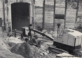
Above - Bridge widening underway in 1969 at the Canadian Pacific Railway Overhead at the Hwy 17 & Hwy 533 Junction in Mattawa, Contract #1969-03. The
overhead railway bridge at Mattawa was constructed in 1953, but it was expanded in 1969 to allow for new turning lanes at the intersection lying directly above it.
Note the work crew for scale, along with the extensive roadway protection system in place to retain the soil prior to the construction of the concrete wing walls.
Although most people take our highway infrastructure for granted, photos such as this example serve as a reminder that some of our infrastructure was incredibly
challenging to construct! See an Enlarged Photo Here. Photo taken in 1969. (Photo courtesy of Ontario Ministry of Transportation - © King's Printer for Ontario, 1969) |
|---|
|
Present Day Secondary Highway 533 Photographs
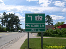

Left - Green guide sign on westbound Hwy 17 in Mattawa approaching the Hwy 533 Junction. In Downtown Mattawa, Hwy 17 abruptly turns left on its route west
towards North Bay. The through road at the junction in Mattawa is Hwy 533, which leads north to join Hwy 63 about half-way between North Bay and Eldee. See an
Enlarged Photo Here. (Photograph taken on June 4, 2006 - © Cameron Bevers) Right - Facing east along Hwy 17 towards Deep River from the Hwy 533 Junction in Mattawa. See an Enlarged Photo Here. (Photograph taken on July 19, 2012 - © Cameron Bevers) 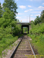
Above - View of the Mattawa Railway Overhead on Hwy 17. This railway passes directly underneath the Hwy 17 & Hwy 533 Junction. See an
Enlarged Photo Here. (Photograph taken on June 4, 2006 - © Cameron Bevers) 
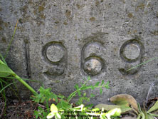
Left - Southern side of the Mattawa Railway Overhead at the Hwy 17 & Hwy 533 Junction. See an
Enlarged Photo Here. (Photograph taken on June 4, 2006 - © Cameron Bevers) Right - Date stamp (1969) on the Mattawa Railway Overhead at the Hwy 17 & Hwy 533 Junction. See an Enlarged Photo Here. (Photograph taken on June 4, 2006 - © Cameron Bevers) 

Left - Eastern approach to the Hwy 17 & Hwy 533 Junction in Mattawa in 2006, prior to reconstruction. A modern roundabout was constructed at this location
in 2011. See an Enlarged Photo Here. (Photograph taken on June 4, 2006 - © Cameron Bevers) Right - View of the new Mattawa Roundabout in 2012, facing west. Westbound Hwy 17 traffic bound for North Bay must circulate through the roundabout and take the second exit. The first roundabout exit is Hwy 533 which leads into Downtown Mattawa. Careful observers will note that there is a small external truck apron provided on this approach to allow for slight off-tracking by larger trucks. Although internal truck aprons around the central island are seen at most roundabouts, external truck aprons are rare. External truck aprons are not normally used on provincial highway roundabouts, but were necessary here due to the compact nature of this particular roundabout. In this case, the roundabout's diameter was constrained by the dimensions of the railway overhead structure lying below it. See an Enlarged Photo Here. (Photograph taken on July 19, 2012 - © Cameron Bevers) 
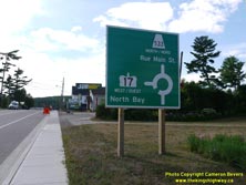
Left - Approaching the new Mattawa Roundabout at the Hwy 17 & Hwy 533 Junction in 2012, facing west. See an
Enlarged Photo Here. (Photograph taken on July 19, 2012 - © Cameron Bevers) Right - Green guide sign on westbound Hwy 17 illustrating the upcoming roundabout at the Hwy 533 Junction in Mattawa. See an Enlarged Photo Here. (Photograph taken on July 19, 2012 - © Cameron Bevers) 
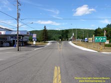
Left - Western approach to the Hwy 17 & Hwy 533 Junction in Mattawa in 2006, prior to reconstruction. The new Mattawa Roundabout, which replaced this
conventional T-intersection, was completed and opened to traffic in November 2011. See an
Enlarged Photo Here. (Photograph taken on June 4, 2006 - © Cameron Bevers) Right - Facing east along Hwy 17 approaching the new Mattawa Roundabout at the Hwy 533 Junction in 2012. See an Enlarged Photo Here. (Photograph taken on July 19, 2012 - © Cameron Bevers) 
Left - Green guide sign on eastbound Hwy 17 illustrating the upcoming roundabout at the Hwy 533 Junction in Mattawa. See an
Enlarged Photo Here. (Photograph taken on July 19, 2012 - © Cameron Bevers) Right - Facing west along Hwy 17 towards North Bay from the Hwy 533 Junction in Mattawa. See an Enlarged Photo Here. (Photograph taken on July 19, 2012 - © Cameron Bevers) 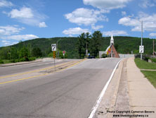

Left - Facing east towards the Hwy 533 Junction along Hwy 17 in Mattawa in 2006, prior to the intersection's reconstruction. See an
Enlarged Photo Here. (Photograph taken on June 4, 2006 - © Cameron Bevers) Right - Guide sign marking the exit to Hwy 17 East at the Mattawa Roundabout. See an Enlarged Photo Here. (Photograph taken on July 19, 2012 - © Cameron Bevers) 

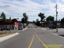
Left - Facing west along Hwy 17 towards North Bay from the Hwy 533 Junction in Mattawa in 2006, prior to reconstruction. See an
Enlarged Photo Here. (Photograph taken on June 4, 2006 - © Cameron Bevers) Right - View of the Mattawa Roundabout at the Junction of Hwy 17 & Hwy 533 in Mattawa in 2012, facing west. See an Enlarged Photo Here. (Photograph taken on July 19, 2012 - © Cameron Bevers) 
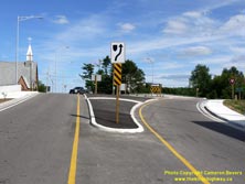
Left - Junction of Hwy 17 & Hwy 533 in Mattawa in 2006, facing east. The unfortunate location of the railway overhead below the highway junction has
resulted in poor intersection geometry and restricted sight lines at this junction. The old intersection was replaced with a modern roundabout in 2011, which has
helped to slow vehicles down while navigating through this highway junction. See an
Enlarged Photo Here. (Photograph taken on June 4, 2006 - © Cameron Bevers) Right - View of the new Mattawa Roundabout at the Junction of Hwy 17 & Hwy 533 in Mattawa in 2012, facing east. See an Enlarged Photo Here. (Photograph taken on July 19, 2012 - © Cameron Bevers) 
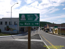
Left - Southern terminus of Hwy 533 at the Hwy 17 Junction in Mattawa in 2006, before reconstruction. See an
Enlarged Photo Here. (Photograph taken on June 4, 2006 - © Cameron Bevers) Right - Green guide sign marking the exit to Hwy 533 at the Mattawa Roundabout. See an Enlarged Photo Here. (Photograph taken on July 19, 2012 - © Cameron Bevers) 
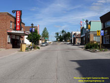
Left - View of Hwy 533 (Main Street) in Downtown Mattawa, facing north from the Mattawa Roundabout at Hwy 17. See an
Enlarged Photo Here. (Photograph taken on July 19, 2012 - © Cameron Bevers) Right - Approaching the southern terminus of Hwy 533 at the Mattawa Roundabout (Hwy 17 Junction). See an Enlarged Photo Here. (Photograph taken on July 19, 2012 - © Cameron Bevers) 

Left - Facing south along Hwy 533 (Main Street) at Bangs Street in Downtown Mattawa. See an
Enlarged Photo Here. (Photograph taken on July 19, 2012 - © Cameron Bevers) Right - Twin steel truss bridges on Hwy 533 over the Mattawa River in Downtown Mattawa. These steel pony truss structures were built in 1948-1949 and are both 108 feet in length. The identical twin bridges span the mouth of the Mattawa River, where it outlets into the Ottawa River. See an Enlarged Photo Here. (Photograph taken on June 4, 2006 - © Cameron Bevers) 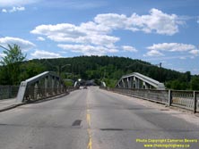
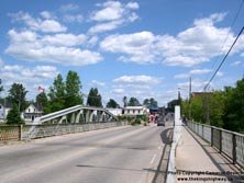
Left - Facing north along Hwy 533 across the twin Mattawa River Bridges. See an
Enlarged Photo Here. (Photograph taken on June 4, 2006 - © Cameron Bevers) Right - Angled side view of the Warren steel truss design of the southern Mattawa River Bridge. Although the steel trusses themselves were manufactured in 1948, the construction of the concrete abutments required to support the trusses was delayed. By the end of 1948, only three of the four concrete abutments had been completed. Steel erection took place the following year and both bridges were subsequently opened to traffic in 1949. See an Enlarged Photo Here. (Photograph taken on June 4, 2006 - © Cameron Bevers) 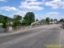

Left - At the time this photo was taken in 2006, the Mattawa River Bridges on Hwy 533 still had their original steel lattice handrails. The lattice handrail
beside the roadway was removed from both bridges during a bridge rehabilitation project soon after this photo was taken and replaced with a modified steel box-beam
handrail. See an Enlarged Photo Here. (Photograph taken on June 4, 2006 - © Cameron Bevers) Right - Facing south across the twin Mattawa River Bridges on Hwy 533 in Mattawa. These two bridges were constructed as part of an access road to the La Cave Hydroelectric Development Site on the Ottawa River north of Mattawa in the late 1940s. See an Enlarged Photo Here. (Photograph taken on June 4, 2006 - © Cameron Bevers) 
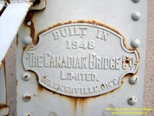
Left - Eastern side of the twin Mattawa River Bridges on Hwy 533. The bridges meet on a small island at the mouth of the Mattawa River. See an
Enlarged Photo Here. (Photograph taken on June 4, 2006 - © Cameron Bevers) Right - Bridge manufacturer's plaque (Canadian Bridge Company Limited) showing the steel truss manufacturing year of 1948. See an Enlarged Photo Here. (Photograph taken on June 4, 2006 - © Cameron Bevers) 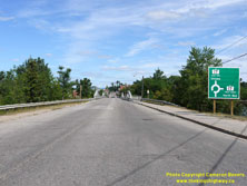

Left - Green guide sign on southbound Hwy 533 marking the upcoming Mattawa Roundabout at Hwy 17. See an
Enlarged Photo Here. (Photograph taken on July 19, 2012 - © Cameron Bevers) Right - Scenic view of the Ottawa River along Hwy 533 in Mattawa. See an Enlarged Photo Here. (Photograph taken on June 4, 2006 - © Cameron Bevers) 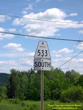
Above - An older Secondary Highway 533 route marker near the Hwy 656 Junction north of Mattawa. See an
Enlarged Photo Here. (Photograph taken on June 4, 2006 - © Cameron Bevers) 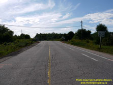

Left - Approaching the Hwy 533 & Hwy 656 Junction, facing north. See an
Enlarged Photo Here. (Photograph taken on July 19, 2012 - © Cameron Bevers) Right - Facing south along Hwy 533 towards Mattawa from the Hwy 656 Junction. See an Enlarged Photo Here. (Photograph taken on July 19, 2012 - © Cameron Bevers) 
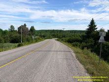
Left - Facing north along Hwy 656 from the Hwy 533 Junction. This short highway extends north from Hwy 533 for about 4 km to the Antoine Mountain Ski Club and
the Otto Holden Hydroelectric Generating Station. Although Hwy 656 has been a provincial highway since 1965, the road itself was actually built in the 1940s in order
to bring construction materials and equipment to the new hydro dam site on the Ottawa River. See an
Enlarged Photo Here. (Photograph taken on July 19, 2012 - © Cameron Bevers) Right - Approaching the Hwy 533 Junction on Hwy 656, facing south. See an Enlarged Photo Here. (Photograph taken on July 19, 2012 - © Cameron Bevers) 

Left - Southern terminus of Hwy 656 at the Hwy 533 Junction north of Mattawa. See an
Enlarged Photo Here. (Photograph taken on July 19, 2012 - © Cameron Bevers) Right - Junction sign assembly and fingerboard guide signs at the Hwy 533 & Hwy 656 Junction. The highway distance to Temiscaming, Quebec is shown as the control city for Hwy 533 North, since this area is sparsely-populated with no other communities situated along Hwy 533 north of this highway junction. See an Enlarged Photo Here. (Photograph taken on July 19, 2012 - © Cameron Bevers) 
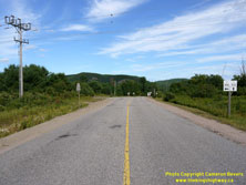
Left - Facing north along Hwy 533 from the Hwy 656 Junction. The route of Hwy 533 comes to an end about 50 km to the north at the Hwy 63 Junction, which lies
between North Bay and Eldee. There are no other highway junctions or major roads crossing Hwy 533 between this point and the Hwy 63 Junction. This highway was
originally constructed as a resource access road during the 1950s. See an Enlarged Photo Here. (Photograph taken on July 19, 2012 - © Cameron Bevers) Right - Approaching the Hwy 656 Junction on Hwy 533, facing south towards Mattawa. See an Enlarged Photo Here. (Photograph taken on July 19, 2012 - © Cameron Bevers) 

Left - Abandoned alignment of Hwy 533 near Crooked Lake, located about 30 km north of Mattawa. See an
Enlarged Photo Here. (Photograph taken on June 4, 2006 - © Cameron Bevers) Right - Facing north along Hwy 533 approaching Timber Lake. See an Enlarged Photo Here. (Photograph taken on June 4, 2006 - © Cameron Bevers) 
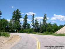
Left - View of Hwy 533 at Timber Lake, located about 38 km north of Mattawa. See an
Enlarged Photo Here. (Photograph taken on June 4, 2006 - © Cameron Bevers) Right - Approaching the northern terminus of Hwy 533 at the Hwy 63 Junction. These two highways intersect at a rather remote location about 22 km south of Temiscaming, Quebec and about 42 km north of North Bay. There is no settlement or community situated at the highway junction. See an Enlarged Photo Here. (Photograph taken on June 4, 2006 - © Cameron Bevers) 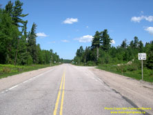

Left - Facing north along Hwy 63 towards Eldee approaching the Hwy 533 Junction. This is the only provincial highway junction along Hwy 63 north of North Bay.
After crossing the Ottawa River Bridge at Temiscaming, the highway continues north towards Rouyn-Noranda as Quebec's Hwy 101. See an
Enlarged Photo Here. (Photograph taken on June 4, 2006 - © Cameron Bevers) Right - View of Hwy 63 facing south towards North Bay from the Hwy 533 Junction. See an Enlarged Photo Here. (Photograph taken on June 4, 2006 - © Cameron Bevers) 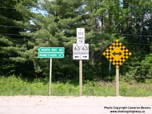

Left - Junction sign assembly and fingerboard destination guide signs at the end of Hwy 533 at the Hwy 63 Junction. See an
Enlarged Photo Here. (Photograph taken on June 4, 2006 - © Cameron Bevers) Right - Distance guide sign on northbound Hwy 63 at the Hwy 533 Junction. Note that the control or destination city is listed as the Province of Quebec, rather than Temiscaming. Aside from a few rare exceptions, Ontario does not typically sign distances to cities lying beyond its boundaries. See an Enlarged Photo Here. (Photograph taken on June 4, 2006 - © Cameron Bevers) 

Left - Facing south along Hwy 63 towards the Hwy 533 Junction between North Bay and Eldee. See an
Enlarged Photo Here. (Photograph taken on June 4, 2006 - © Cameron Bevers) Right - Facing north along Hwy 63 towards Eldee from the Hwy 533 Junction. See an Enlarged Photo Here. (Photograph taken on June 4, 2006 - © Cameron Bevers) 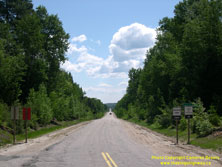
Above - Facing south along Hwy 533 towards Mattawa from the Hwy 63 Junction. See an
Enlarged Photo Here. (Photograph taken on June 4, 2006 - © Cameron Bevers)
More Secondary Highway 533 Photographs Coming Soon!
|
|---|
Links to Adjacent Highway Photograph Pages:
Back to Secondary Highway 532 (#1) Photos /
Secondary Highway 533 History /
On to Secondary Highway 535 Photos
Ontario Highway History - Main Menu / Back to List of Highways / Main Photograph Index Page Website contents, photos & text © 2002-2026, Cameron
Bevers (Webmaster) - All Rights Reserved / Contact Me
|
|---|