
| 
|  |
|
|
This page contains historical and present day photos of Ontario's Secondary Highway 532 (#1). All photographs displayed on this page were taken by the Webmaster
(Cameron Bevers), unless specifically noted otherwise. Please note that Secondary Highway 532 once extended from Bracebridge northwesterly to Highway 69 at Hayes
Corners, but the northwestern section of the highway from Patterson's Corners to Hayes Corners was renumbered as King's Highway 141 in 1974. For the purposes of
organization, all pre-1974 historical photos pertaining to Secondary Highway 532 are listed on this page regardless of location. Present day photos of the renumbered
section of Secondary Highway 532 from Patterson's Corners to Hayes Corners are located on the
King's Highway 141 Photos Page. Historical photographs are arranged in approximate chronological
order, while present day photographs (Year 2000 to date) are arranged by location from south to north. Click on any thumbnail to see a larger image!
Please note that all photographs displayed on this
website are protected by copyright. These photographs must not be reproduced, published,
electronically stored or copied, distributed, or posted onto other websites without
my written permission. If you want to use photos from this website, please
email me first for permission. Thank-you!
|
|---|
|
Historical Secondary Highway 532 (#1) Photographs
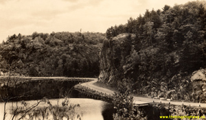
Above - Circa 1945 postcard view of the Bracebridge-Rosseau Secondary Road (Hwy 532, which later became Hwy 141) at Skeleton Bay, Lake Rosseau. Apart from
improvements to the roadway width, pavement and installation of newer roadside barriers since the 1940s, the present day route of Hwy 141 around Skeleton Bay still
looks quite similar today. See an Enlarged Photo Here. Photo taken circa 1945. (Photo courtesy of Canadian Airmaps Limited) 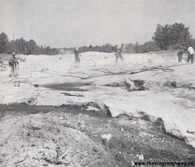
Above - Rock drilling and excavation on a diversion of Hwy 532 (later known as Hwy 141) west of Rosseau by Day Labour. See an
Enlarged Photo Here. Photo taken in 1959. (Photo courtesy of Ontario Ministry of Transportation - © King's Printer for Ontario, 1959) 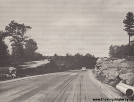
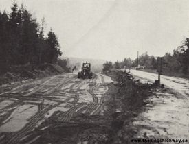
Left - Day Labour grading project on Hwy 532 (later known as Hwy 141), 1 mile east of Rosseau Road. See an
Enlarged Photo Here. Photo taken in 1964. (Photo courtesy of Ontario Ministry of Transportation - © King's Printer for Ontario, 1964) Right - Reconstruction and vertical profile correction on Hwy 532 near the Hwy 516 Junction near Patterson's Corners southeast of Raymond, Contract #1968-123. This contract included the reconstruction of both the north and south Hwy 516 & Hwy 532 Junctions north of Bracebridge, along with the reconstruction of Hwy 516 (later known as Hwy 141) from Patterson's Corners to the Hwy 11 Junction at Port Sydney. See an Enlarged Photo Here. Photo taken in 1969. (Photo courtesy of Ontario Ministry of Transportation - © King's Printer for Ontario, 1969) |
|---|
|
Present Day Secondary Highway 532 (#1) Photographs


Left - Facing south along Hwy 11 towards Gravenhurst from the Hwy 118 Overpass. While the intersecting highway is known as Hwy 118 today, it was historically
known as Hwy 532. This Secondary Highway once began at this point and extended northwesterly from Hwy 11 via Bracebridge and Rosseau to join with Hwy 69 at Hayes
Corners south of Parry Sound. Jurisdiction over the southern leg of Hwy 532 from Patterson's Corners to Bracebridge was transferred from the province to the District
Municipality of Muskoka in 1972, while the rest of the highway from Patterson's Corners northwesterly to Hayes Corners became part of the present day route of
Hwy 141. See an Enlarged Photo Here. (Photograph taken on June 17, 2006 - © Cameron Bevers) Right - Facing north along Hwy 11 towards Bracebridge from the Hwy 118 Overpass. At the time that Hwy 532 existed here prior to 1972, it would have intersected with Hwy 11 via an at-grade intersection. A grade-separated interchange wasn't constructed along Hwy 11 at this location until 1975. See an Enlarged Photo Here. (Photograph taken on June 17, 2006 - © Cameron Bevers) 
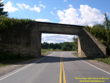
Left - Bracebridge Canadian National Railway (CNR) Subway on Ecclestone Drive (Old Hwy 11, later known as Hwy 532), facing south towards Gravenhurst. This
former section of Hwy 11 was bypassed by a new Hwy 11 route which was established east of Bracebridge in the early 1950s. Ecclestone Drive (Old Hwy 11) was
subsequently renumbered as part of Hwy 532, and more recently, as part of Hwy 118. See an
Enlarged Photo Here. (Photograph taken on September 12, 2007 - © Cameron Bevers) Right - Facing north along Ecclestone Drive (Former Hwy 532) at the Bracebridge CNR Subway. This single-span concrete slab structure was completed in 1930. See an Enlarged Photo Here. (Photograph taken on September 12, 2007 - © Cameron Bevers) 
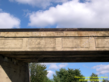
Left - Considering when it was built, the Bracebridge CNR Subway on Ecclestone Drive (Former Hwy 532) has an extraordinarily high vertical clearance of 17 feet
(approximately 5.2 metres). Many railway subways built in the first half of the 20th Century had much lower vertical clearances, as vehicles on the roads at that time
had smaller dimensions and required less room to navigate through these structures. Railway subways with poor vertical clearances often created physical barriers for
transport trucks using the provincial highway system. As trucks became progressively larger, the low vertical clearances designed into some railway subways resulted
in the premature replacement of these structures. See an Enlarged Photo Here. (Photograph taken on September 12, 2007 - © Cameron Bevers) Right - Close-up of the date stamp (1930) on the Bracebridge CNR Subway on Ecclestone Drive (Former Hwy 532). Careful observers will notice faded paint on this historic structure, which reads "CANADIAN NATIONAL RAILWAYS" and CNR's corporate pledge of "COURTESY - SAFETY - SERVICE". See an Enlarged Photo Here. (Photograph taken on September 12, 2007 - © Cameron Bevers) 
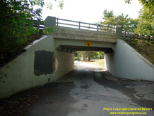
Left - Approaching the Bracebridge Motor Park Underpass on Ecclestone Drive (Former Hwy 532), facing north towards the town centre. This tiny underpass allowed
traffic on the historical Ferguson Highway to exit and enjoy the scenic views of Bracebridge's waterfront and the nearby Silver Bridge. Although the term "motor park"
is rarely used anymore, it was a name often given to municipal parks constructed in the 1920s and 1930s which had day-use facilities catering to tourists travelling
into town by motor car. Often, these motor parks featured scenic driveways through the park for motorists to enjoy at their leisure. Many Ontario towns established
these motor parks as tourism by automobile increased in popularity, although these parks often go by different names today. The Bracebridge Motor Park is now known as
Kelvin Grove Park. See an Enlarged Photo Here. (Photograph taken on August 3, 2019 - © Cameron Bevers) Right - Eastern side of the Bracebridge Motor Park Underpass on Ecclestone Drive (Former Hwy 532). This single-span concrete slab and girder structure was completed in 1935. This historical structure was only designed to accommodate passenger vehicles, as it has a limited vertical clearance of 2.5 metres (approximately 8 feet, 2 inches). Once traffic exited from the Ferguson Highway, the park's driveway looped around and passed underneath the old highway. See an Enlarged Photo Here. (Photograph taken on August 3, 2019 - © Cameron Bevers) 

Left - Soffit of the Bracebridge Motor Park Underpass on Ecclestone Drive (Former Hwy 532). Completed in 1935, this structure is comprised of a concrete slab
on concrete girders, which were all cast-in-place. Note the impressions of the timber planks used for falsework to support the poured concrete until curing had been
completed. See an Enlarged Photo Here. (Photograph taken on August 3, 2019 - © Cameron Bevers) Right - Facing south towards the Bracebridge Motor Park Underpass on Ecclestone Drive (Former Hwy 532). See an Enlarged Photo Here. (Photograph taken on August 3, 2019 - © Cameron Bevers) 
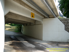
Left - Western side of the Bracebridge Motor Park Underpass on Ecclestone Drive (Former Hwy 532). See an
Enlarged Photo Here. (Photograph taken on August 3, 2019 - © Cameron Bevers) Right - A sidewalk was constructed in recent decades on the Bracebridge Motor Park Underpass. The sidewalk is supported on a newer steel beam deck extension on the western side of the structure, while Ecclestone Drive is carried on the original concrete structure. See an Enlarged Photo Here. (Photograph taken on August 3, 2019 - © Cameron Bevers) 

Left - Muskoka River Bridge on Ecclestone Drive (Old Hwy 11, later known as Hwy 532) in Downtown Bracebridge. This bridge is known locally as the Silver
Bridge. Constructed in the 1930s, the Silver Bridge formed the south gateway to Bracebridge for almost two decades. In the early 1950s, a new alignment of Hwy 11
was completed east of Bracebridge. See an Enlarged Photo Here. (Photograph taken on July 11, 2015 - © Cameron Bevers) Right - The south approach to the Silver Bridge on Old Hwy 11 was an incredibly ambitious highway construction project, given the date of construction. The Muskoka River Bridge and approach consisted of almost 200 metres of retaining walls, a separate steel deck truss span and a steel through truss main span. See an Enlarged Photo Here. (Photograph taken on July 11, 2015 - © Cameron Bevers) 

Left - Facing north across the Muskoka River Bridge on Ecclestone Drive (Former Hwy 532) in Downtown Bracebridge. See an
Enlarged Photo Here. (Photograph taken on July 11, 2015 - © Cameron Bevers) Right - Western side of the Silver Bridge on Former Hwy 532 (Ecclestone Drive) in Downtown Bracebridge. See an Enlarged Photo Here. (Photograph taken on July 11, 2015 - © Cameron Bevers) 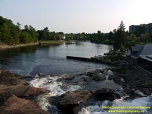

Left - A scenic view of the Muskoka River from the Silver Bridge on Ecclestone Drive (Former Hwy 532) in Downtown Bracebridge. See an
Enlarged Photo Here. (Photograph taken on July 11, 2015 - © Cameron Bevers) Right - Facing south across the Muskoka River Bridge on Ecclestone Drive (Former Hwy 532) in Downtown Bracebridge. According to historical Department of Highways of Ontario (DHO) records, the Silver Bridge was completed in 1931. See an Enlarged Photo Here. (Photograph taken on July 11, 2015 - © Cameron Bevers) 
Above - Commemorative heritage plaque beside the Silver Bridge on Ecclestone Drive (Former Hwy 532) in Bracebridge. See an
Enlarged Photo Here. (Photograph taken on July 11, 2015 - © Cameron Bevers) 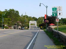

Left - Facing south along Ecclestone Drive (Former Hwy 532) towards the Silver Bridge in Downtown Bracebridge. Note the green-and-white trailblazer sign,
directing traffic to Hwy 11 South. See an Enlarged Photo Here. (Photograph taken on July 11, 2015 - © Cameron Bevers) Right - Facing north along Manitoba Street (Former Hwy 532) from Ontario Street in Downtown Bracebridge. See an Enlarged Photo Here. (Photograph taken on July 11, 2015 - © Cameron Bevers) 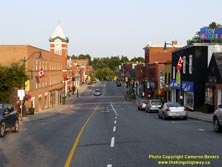

Left - Facing south along Manitoba Street (Former Hwy 532 & Hwy 118) in Downtown Bracebridge. From 1955 until the mid-1970s, Hwy 118 followed Manitoba
Street through Downtown Bracebridge. Historically, the route of Hwy 118 turned left onto Taylor Road at the traffic signals at the bottom of the hill. See an
Enlarged Photo Here. (Photograph taken on July 11, 2015 - © Cameron Bevers) Right - Facing south along Manitoba Street (Former Hwy 532 & Hwy 118) in Downtown Bracebridge. Despite being bypassed by a new highway in the 1950s, the Bracebridge Town Centre has remained quite vibrant and active. Even in this late evening photograph, many of the parking spaces along the main street are still occupied. Unfortunately, Bracebridge was the exception rather than the rule. Many small and mid-sized towns in Ontario were not as successful, and experienced some degree of decline in their downtown areas after being bypassed by new highways. See an Enlarged Photo Here. (Photograph taken on July 11, 2015 - © Cameron Bevers) 
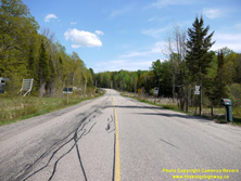
Left - Facing north along Manitoba Street (Former Hwy 532 & Hwy 118) departing Downtown Bracebridge. Historically, the route of Hwy 118 turned left onto
Monck Road about 500 metres ahead, and continued west towards Port Carling. See an
Enlarged Photo Here. (Photograph taken on July 11, 2015 - © Cameron Bevers) Right - Facing south along Former Hwy 532 (now Raymond Road) towards Bracebridge from the junction of Windermere Road (Former Hwy 516). See an Enlarged Photo Here. (Photograph taken on May 23, 2020 - © Cameron Bevers) 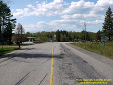
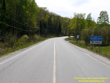
Left - Facing north along Raymond Road towards the historical junction of Hwy 516 & Hwy 532 north of Bracebridge. Up until the 1970s, both Raymond Road and
Windermere Road were Ontario Secondary Highways. The route of Hwy 516 connected Hwy 532 to the resort community of Windermere located on the eastern shores of Lake
Rosseau. Hwy 516 was one of several provincial highways that were transferred to the newly-created District Municipality of Muskoka in April 1972. Prior to 1972,
Hwy 516 & Hwy 532 shared an overlapped route for about 0.6 miles from this highway junction northerly to nearby Patterson's Corners. See an
Enlarged Photo Here. (Photograph taken on May 23, 2020 - © Cameron Bevers) Right - Former Hwy 516 (now Muskoka Road 4) facing west towards Windermere from the junction of Raymond Road (Former Hwy 532) north of Bracebridge. See an Enlarged Photo Here. (Photograph taken on May 23, 2020 - © Cameron Bevers) 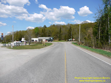
Left - Approaching Raymond Road (Former Hwy 532) on Windermere Road (Former Hwy 516), facing east. Prior to 1972, Hwy 516 turned left at
the upcoming junction and followed Raymond Road northerly to nearby Patterson's Corners concurrently with Hwy 532. At Patterson's Corners, the two highways parted
ways once again, with Hwy 516 continuing east to Hwy 11 and Port Sydney while Hwy 532 continued northwesterly towards Rosseau and Parry Sound. See an
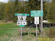
Enlarged Photo Here. (Photograph taken on May 23, 2020 - © Cameron Bevers) Right - Old fingerboard guide signs at the historical junction of Hwy 516 (Windermere Road) & Hwy 532 (Raymond Road) north of Bracebridge. See an Enlarged Photo Here. (Photograph taken on May 23, 2020 - © Cameron Bevers) 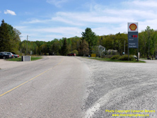
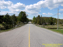
Left - Facing south along Raymond Road (Former Hwy 516 & Hwy 532) approaching Windermere Road. Prior to the routes' downloading in 1972, Hwy 516 turned
right just beyond the gas station and headed west to Windermere on Lake Rosseau, while Hwy 532 continued straight ahead on Raymond Road towards Bracebridge. See an
Enlarged Photo Here. (Photograph taken on May 23, 2020 - © Cameron Bevers) Right - Raymond Road (Former Hwy 516 & Hwy 532) facing north towards Patterson's Corners from Windermere Road. See an Enlarged Photo Here. (Photograph taken on May 23, 2020 - © Cameron Bevers) 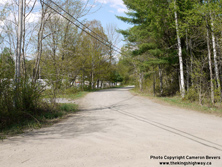
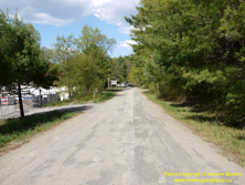
Left - View of a bypassed alignment of Hwy 516 & Hwy 532 (Patterson Road) approaching Patterson's Corners. The highway junction at Patterson's Corners was
relocated during a highway reconstruction project which took place here in the late 1960s. See an
Enlarged Photo Here. (Photograph taken on May 23, 2020 - © Cameron Bevers) Right - Traces of an old white highway centreline are still visible on Patterson Road (Old Hwy 516 & Hwy 532). This old highway alignment was left behind after the highway junction was relocated in the late 1960s. Apparently, this road has not been resurfaced since the completion of the new Hwy 516 & Hwy 532 Junction at Patterson's Corners in 1969. Ontario discontinued the use of white centreline pavement markings in the early 1970s, as part of an international effort to ensure uniform pavement marking standards throughout all United States and Canadian jurisdictions. See an Enlarged Photo Here. (Photograph taken on May 23, 2020 - © Cameron Bevers) 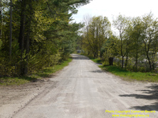
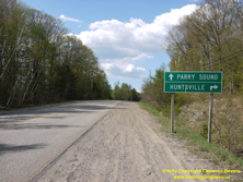
Left - Facing south along the bypassed alignment of Hwy 516 & Hwy 532 (Patterson Road) at Patterson's Corners. See an
Enlarged Photo Here. (Photograph taken on May 23, 2020 - © Cameron Bevers) Right - Destination guide signs on northbound Raymond Road (Former Hwy 516 & Hwy 532) approaching the Hwy 141 Junction at Patterson's Corners. See an Enlarged Photo Here. (Photograph taken on May 23, 2020 - © Cameron Bevers) 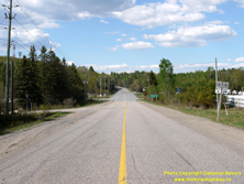
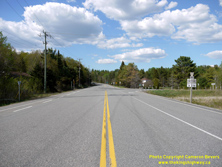
Left - Facing north along Raymond Road (Former Hwy 516 & Hwy 532) approaching the Hwy 141 Junction at Patterson's Corners. This view of the highway shows
the relocated highway junction constructed in the late 1960s. At the time of the highway junction's construction in 1968-1969, Hwy 532 was considered the "through
highway" at the junction. Today, Hwy 141 approaches Patterson's Corners along the former route of Hwy 516 East (at right) and the former route of Hwy 532 West
(straight ahead). Although these two highways also shared an overlapped route via Raymond Road south of this highway junction, jurisdiction over these two routes was
transferred from the province to the District Municipality of Muskoka in April 1972. See an
Enlarged Photo Here. (Photograph taken on May 23, 2020 - © Cameron Bevers) Right - View of Patterson's Corners, facing north along Raymond Road. Prior to 1972, Former Hwy 516 turned right and headed east towards Port Sydney, while Former Hwy 532 continued straight ahead towards Rosseau. The road from Port Sydney to Hayes Corners was designated as a King's Highway (Hwy 141) in December 1974. See an Enlarged Photo Here. (Photograph taken on May 23, 2020 - © Cameron Bevers) 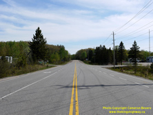
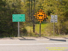
Left - Facing south along Raymond Road (Former Hwy 516 & Hwy 532) towards Bracebridge from the Hwy 141 Junction at Patterson's Corners. See an
Enlarged Photo Here. (Photograph taken on May 23, 2020 - © Cameron Bevers) Right - Junction sign assembly and fingerboard guide signs at Patterson's Corners. Today, Hwy 141 turns right heading westbound and heads northwesterly towards Rosseau. Motorists can also reach Bracebridge via Raymond Road (Muskoka Road 35) by turning left at this highway junction. See an Enlarged Photo Here. (Photograph taken on May 23, 2020 - © Cameron Bevers) 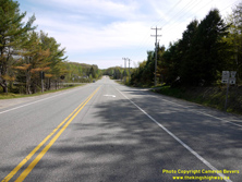
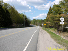
Left - Approaching Patterson's Corners on Hwy 141, facing east. The relocated highway junction at Patterson's Corners offered significantly improved geometry
and better sight lines for motorists approaching the intersection. The old highway junction at Patterson's Corners was inconspicuous on most of the approaches. One of
the curiosities of this highway junction though is that the current highway's route (Hwy 141) is not actually the through highway at the intersection. Motorists have
to turn left to continue east along Hwy 141. Historically, Hwy 532 continued straight through at this highway junction, which meant that the junction's layout was in
keeping with the route numbers in place at the time of the highway junction's construction in the late 1960s. See an
Enlarged Photo Here. (Photograph taken on May 23, 2020 - © Cameron Bevers) Right - Facing west towards Rosseau on Hwy 141 (Former Hwy 532) from Patterson's Corners. See an Enlarged Photo Here. (Photograph taken on May 23, 2020 - © Cameron Bevers) 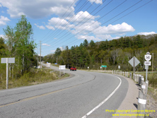
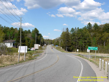
Left - View of Hwy 141 facing east towards Port Sydney from the relocated highway junction's location at Patterson's Corners. Prior to 1969, the highway
junction was located at the point where the red pickup truck is situated in this photo. See an
Enlarged Photo Here. (Photograph taken on May 23, 2020 - © Cameron Bevers) Right - Facing east along Hwy 141 towards the former location of the Hwy 516 & Hwy 532 Junction at Patterson Road. The highway junction was relocated about 100 metres west of its old location during the late 1960s, in order to improve the intersection's geometry and thereby offer better sight lines for motorists using the junction. See an Enlarged Photo Here. (Photograph taken on May 23, 2020 - © Cameron Bevers) 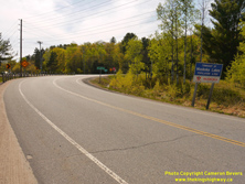
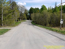
Left - Facing west along Hwy 141 approaching the highway junction at Patterson's Corners. Today, Hwy 141 turns right at this junction and continues west
towards Rosseau. Prior to 1972, Hwy 516 turned left and followed Raymond Road (Hwy 532) south to the Windermere Road. The northwestern leg of Hwy 532 from this
junction to Hayes Corners via Rosseau was renumbered as Hwy 141 in 1974. The former leg of Hwy 516 & Hwy 532 via Raymond Road was transferred to the District
Municipality of Muskoka in 1972. The old overlapped route Hwy 516 & Hwy 532 via Raymond Road is known today as Muskoka Road 35. See an
Enlarged Photo Here. (Photograph taken on May 23, 2020 - © Cameron Bevers) Right - View of the bypassed route of Hwy 516 & Hwy 532 (Patterson Road), as seen from the current route of Hwy 141. The revised highway junction completed at Patterson's Corners in 1969 bypassed a very sharp curve in the old highway's route approaching the junction from the south and a significant grade on the old highway's approach to the junction from the north. See an Enlarged Photo Here. (Photograph taken on May 23, 2020 - © Cameron Bevers) 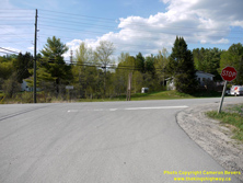
Above - View of the bypassed route of Hwy 516 & Hwy 532 (Patterson Road) where it intersects with the current route of Hwy 141. Although the road has now
been closed for many decades, Hwy 532 used to continue straight ahead across the road from this intersection towards Rosseau. Today, there is little trace of the
original route of Hwy 532 along the northern side of Hwy 141. Although it is not easy to detect anymore due to the vegetation and undergrowth, there was a significant
grade along the old north leg of this highway junction. See an Enlarged Photo Here. (Photograph taken on May 23, 2020 - © Cameron Bevers)
More Secondary Highway 532 (#1) Photographs Coming Soon!
|
|---|
Links to Adjacent Highway Photograph Pages:
Back to Secondary Highway 527 (#1) Photos /
Secondary Highway 532 (#1) History /
On to Secondary Highway 533 Photos
Ontario Highway History - Main Menu / Back to List of Highways / Main Photograph Index Page Website contents, photos & text © 2002-2025, Cameron
Bevers (Webmaster) - All Rights Reserved / Contact Me |
|---|