
| 
| |
|
|
This page contains historical photos of Ontario's King's Highway 58 dating from 1935 to 2004. All photographs displayed on
this page were taken by the Ontario Ministry of Transportation, unless specifically noted otherwise. Historical photographs are arranged in approximate chronological
order. Click on any thumbnail to see a larger image!
Please note that all photographs displayed on this
website are protected by copyright. These photographs must not be reproduced, published,
electronically stored or copied, distributed, or posted onto other websites without
my written permission. If you want to use photos from this website, please
email me first for permission. Thank-you!
|
|---|
|
Page 1: Historical King's Highway 58 Photographs
Left - Forks Road Underpass on the West Side Highway (Welland County Road 12) between Port Colborne and Welland in 1955. This structure was originally built in
1954 by Welland County during a road improvement project at the junction of Welland County Roads 7 & 12. It was the first instance where a grade-separated
interchange was constructed between two county roads. The Department of Highways of Ontario (DHO) ultimately assumed jurisdiction over the West Side Highway (Welland
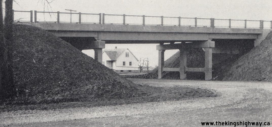
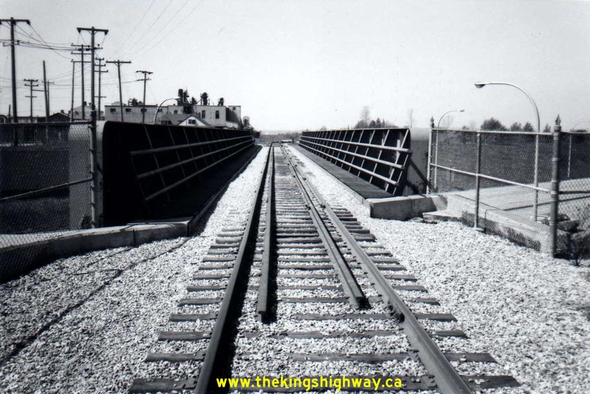
County Road 12) in 1958. Photo taken on November 25, 1955. (Photo courtesy of Ontario Ministry of Transportation - © King's Printer for Ontario, 1955) Right - Michigan Central Railway Overhead on the West Side Highway (Welland County Road 12) north of Port Colborne. Photo taken on November 25, 1955. (Photo courtesy of Ontario Ministry of Transportation - © King's Printer for Ontario, 1955) 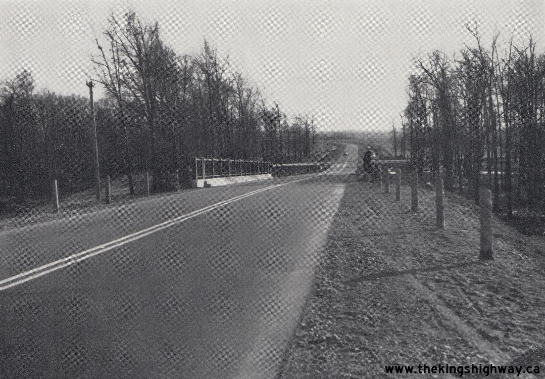
Left - Facing south towards Port Colborne along the West Side Highway (Welland County Road 12) at Forks Road (Welland County Road 7). This 1955-dated photo
was taken when the West Side Highway was still under municipal jurisdiction. This new road between Welland and Port Colborne quickly became the preferred route by
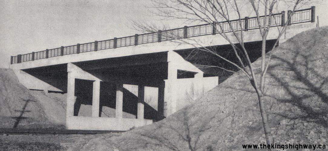
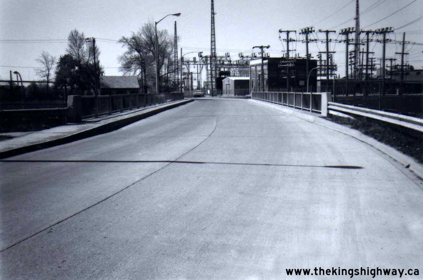
motorists between the two towns, and was ultimately designated as a King's Highway in July, 1958. Photo taken on November 25, 1955. (Photo courtesy of Ontario Ministry of Transportation - © King's Printer for Ontario, 1955) Right - Forks Road Underpass on Hwy 58 between Port Colborne and Welland (July, 1959) (Photo courtesy of Ontario Ministry of Transportation - © King's Printer for Ontario, 2012) 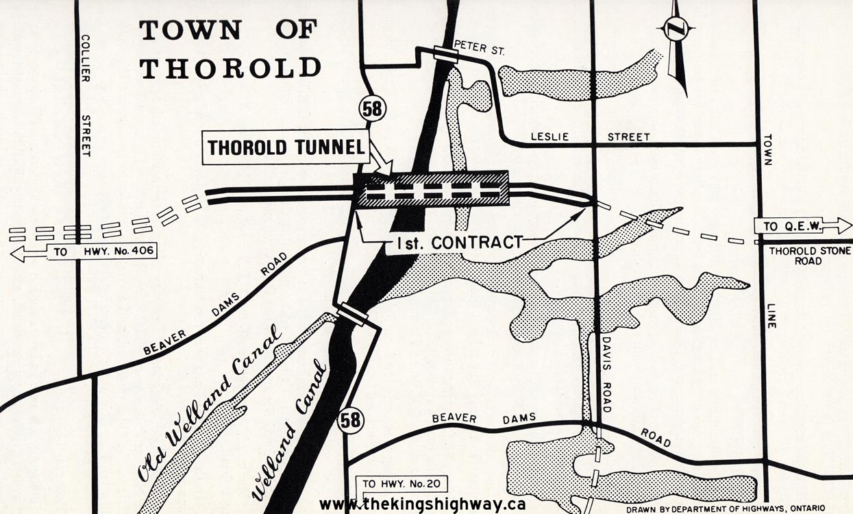
Above - Plan showing the location of the proposed Thorold Tunnel (Hwy 58 New) relative to the existing route of Hwy 58 through Thorold (1965) (Photo courtesy of Ontario Ministry of Transportation - © King's Printer for Ontario, 1965) 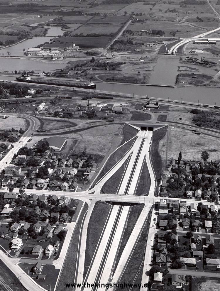
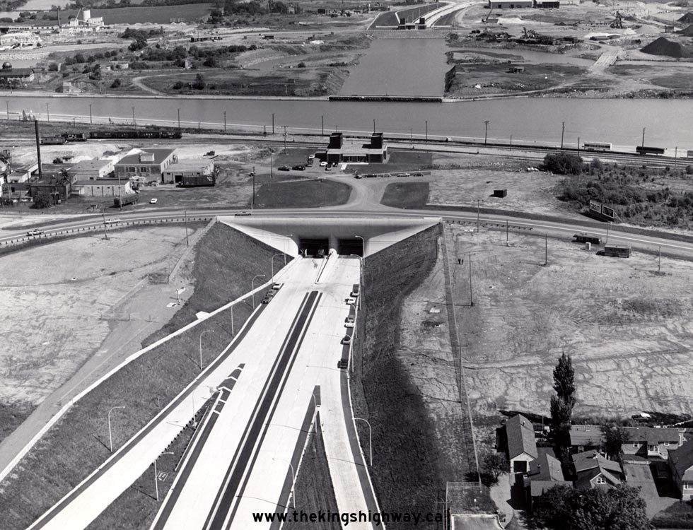
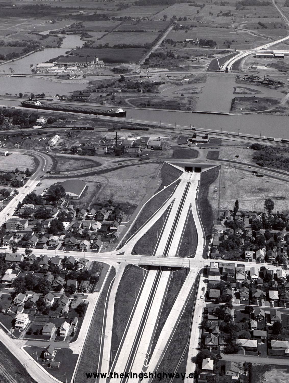
Above - Aerial view of the Pine Street Interchange and Thorold Tunnel on Hwy 58 New in 1968, facing east towards Niagara Falls. At the time this photo was
taken, the finishing touches were being done on the tunnel shortly before it was opened to traffic. Traffic was still using the existing route of Hwy 58 (Ormond
Street) which can be seen running across the top of the tunnel's west portal. The Thorold Tunnel was officially opened to traffic on September 18, 1968. See an
Enlarged Photo Here. Photo taken in 1968. (Photo courtesy of Ontario Ministry of Transportation - © King's Printer for Ontario, 1968) 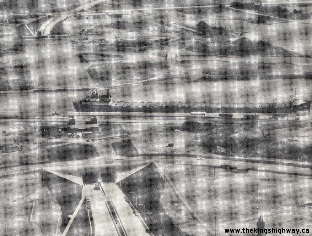
Left - Aerial view of the Thorold Tunnel on Hwy 58 New in 1968. A ship passes by on the Welland Canal above the tunnel. A short distance to the south, traffic
on the existing route of Hwy 58 (Ormond Street) was halted temporarily as this ship passed through the canal. The completion of the Thorold Tunnel in 1968 provided a
second fixed highway link across the Welland Canal. The first fixed highway link across the canal was the Garden City Skyway on the Queen Elizabeth Way, which was
opened to traffic five years earlier in October, 1963. Photo taken in 1968. (Photo courtesy of Ontario Ministry of Transportation - © King's Printer for Ontario, 1968) Right - Close-up aerial view of the west portal of the Thorold Tunnel on Hwy 58 in 1968. See an Enlarged Photo Here. (Photo courtesy of Ontario Ministry of Transportation - © King's Printer for Ontario, 1968) 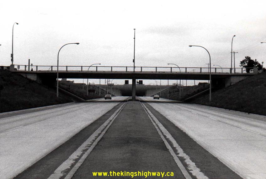
Left - Pine Street Interchange on Hwy 58 in Thorold, facing east towards the Thorold Tunnel in 1970. The Thorold Tunnel and its approaches opened to traffic
on September 18, 1968. Originally, the highway median was just a curbed asphalt island. During a reconstruction project in 2000, a new median barrier was installed
along Hwy 58 and the 1960s-era illumination system seen here was replaced. Photo taken in May, 1970. See an
Enlarged Photo Here. (Photo courtesy of Ontario Ministry of Transportation - © King's Printer for Ontario, 2012) Right - Facing south across the Pine Street Overpass on Hwy 58 in Thorold (May, 1970) (Photo courtesy of Ontario Ministry of Transportation - © King's Printer for Ontario, 2012) 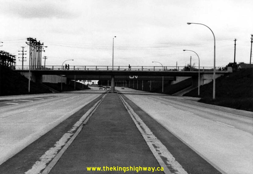
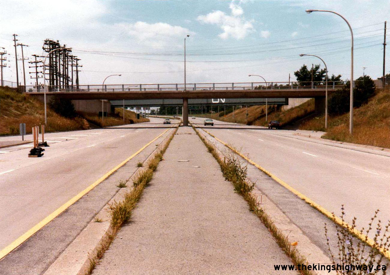
Left - Facing west along Hwy 58 towards the Queen Street Overpass in Thorold. Photo taken in May, 1970. See an
Enlarged Photo Here. (Photo courtesy of Ontario Ministry of Transportation - © King's Printer for Ontario, 2012) Right - Facing south across the Queen Street Overpass on Hwy 58 in Thorold (May, 1970) (Photo courtesy of Ontario Ministry of Transportation - © King's Printer for Ontario, 2012) 
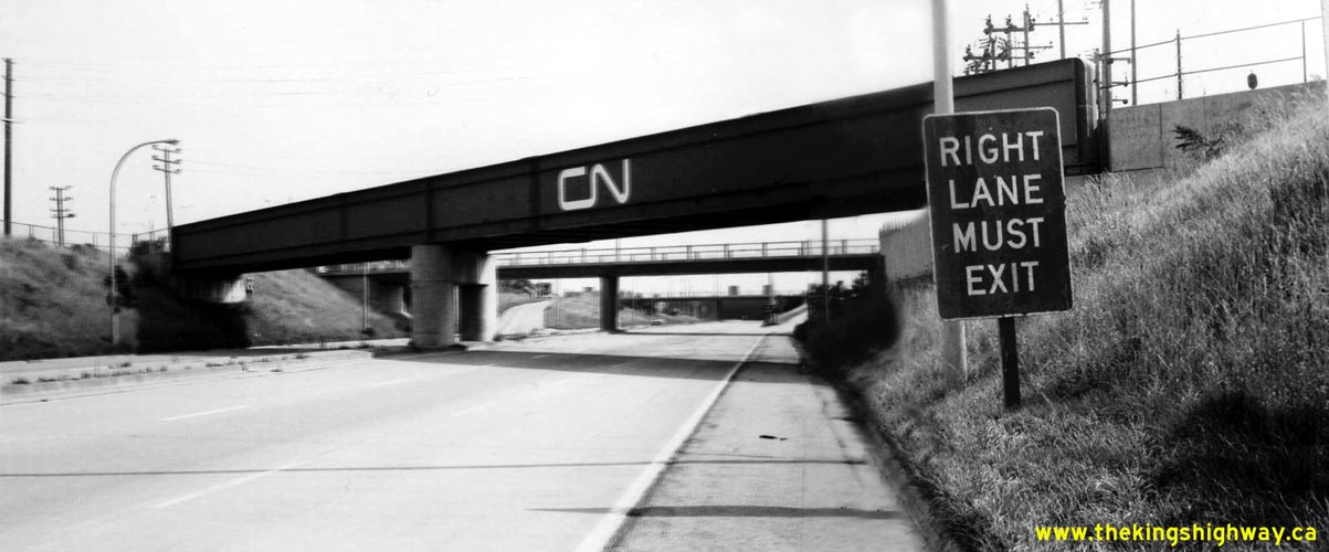
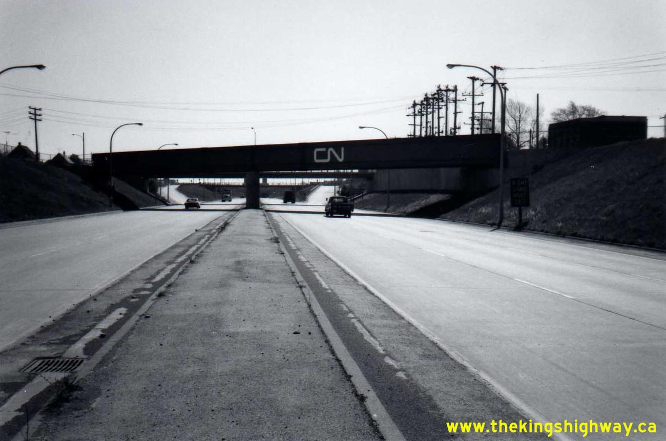
Left - Facing east along Hwy 58 towards the Pine Street Interchange at the Thorold CN Railway Subway. Photo taken on May 11, 1977. See an
Enlarged Photo Here. (Photo courtesy of Ontario Ministry of Transportation - © King's Printer for Ontario, 2012) Right - CN Railway Subway on Hwy 58 in Thorold, facing south (May 11, 1977) (Photo courtesy of Ontario Ministry of Transportation - © King's Printer for Ontario, 2012) 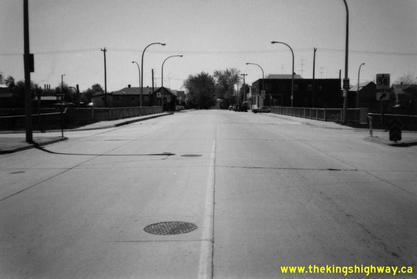
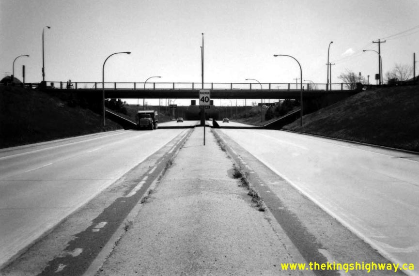
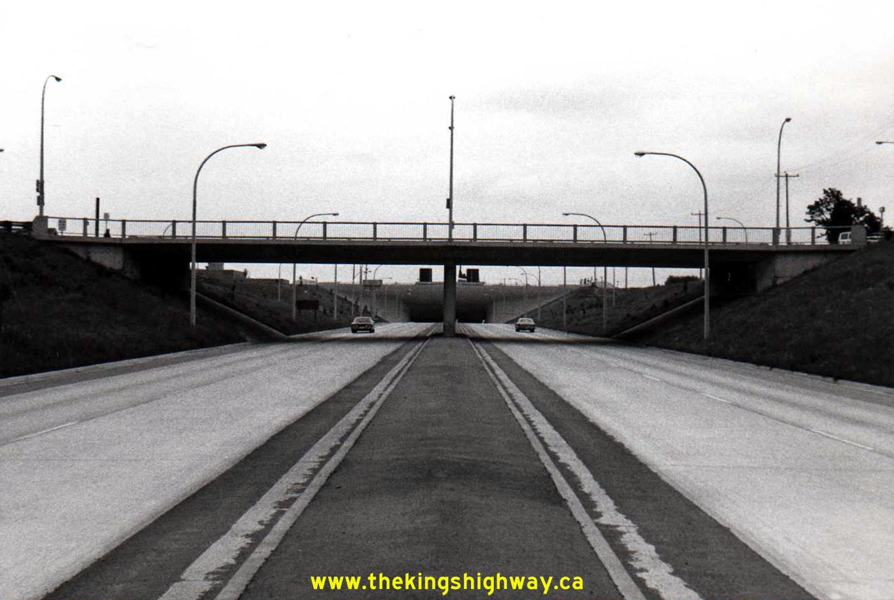
Left - Facing south across the Pine Street Overpass on Hwy 58 in Thorold (May 11, 1977) (Photo courtesy of Ontario Ministry of Transportation - © King's Printer for Ontario, 2012) Right - Pine Street Interchange on Hwy 58 in Thorold, facing east towards the Thorold Tunnel in 1977. Note the median-mounted pre-Metric 40 mph speed limit sign. Metric measurements made their debut on Ontario's highways about 4 months after this photo was taken. Photo taken on May 11, 1977. See an Enlarged Photo Here. (Photo courtesy of Ontario Ministry of Transportation - © King's Printer for Ontario, 2012) 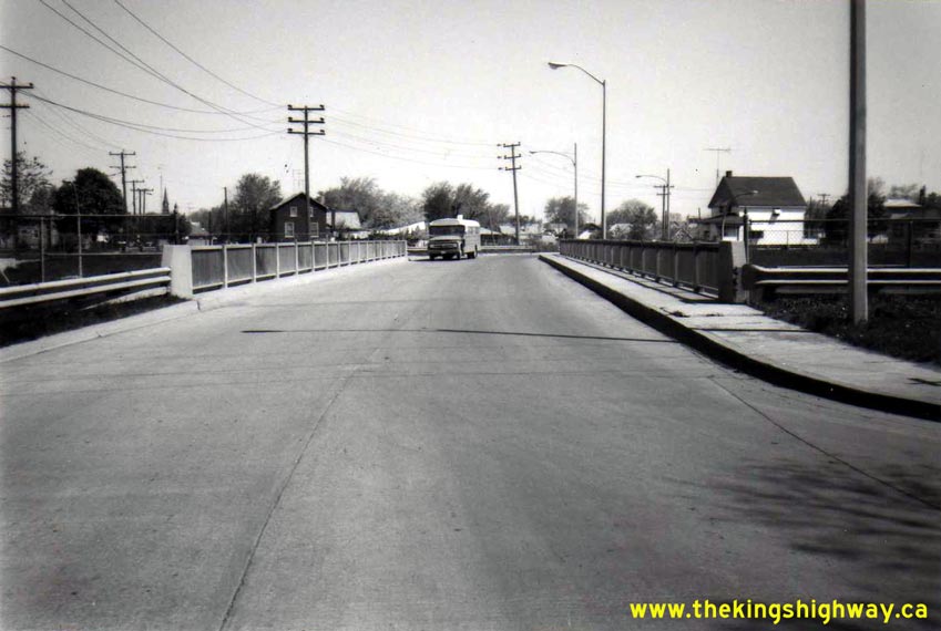
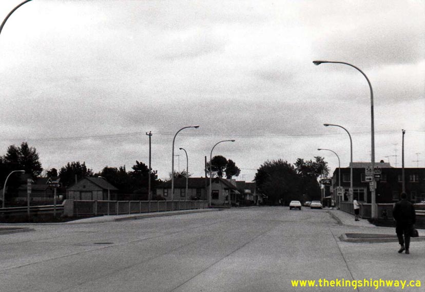
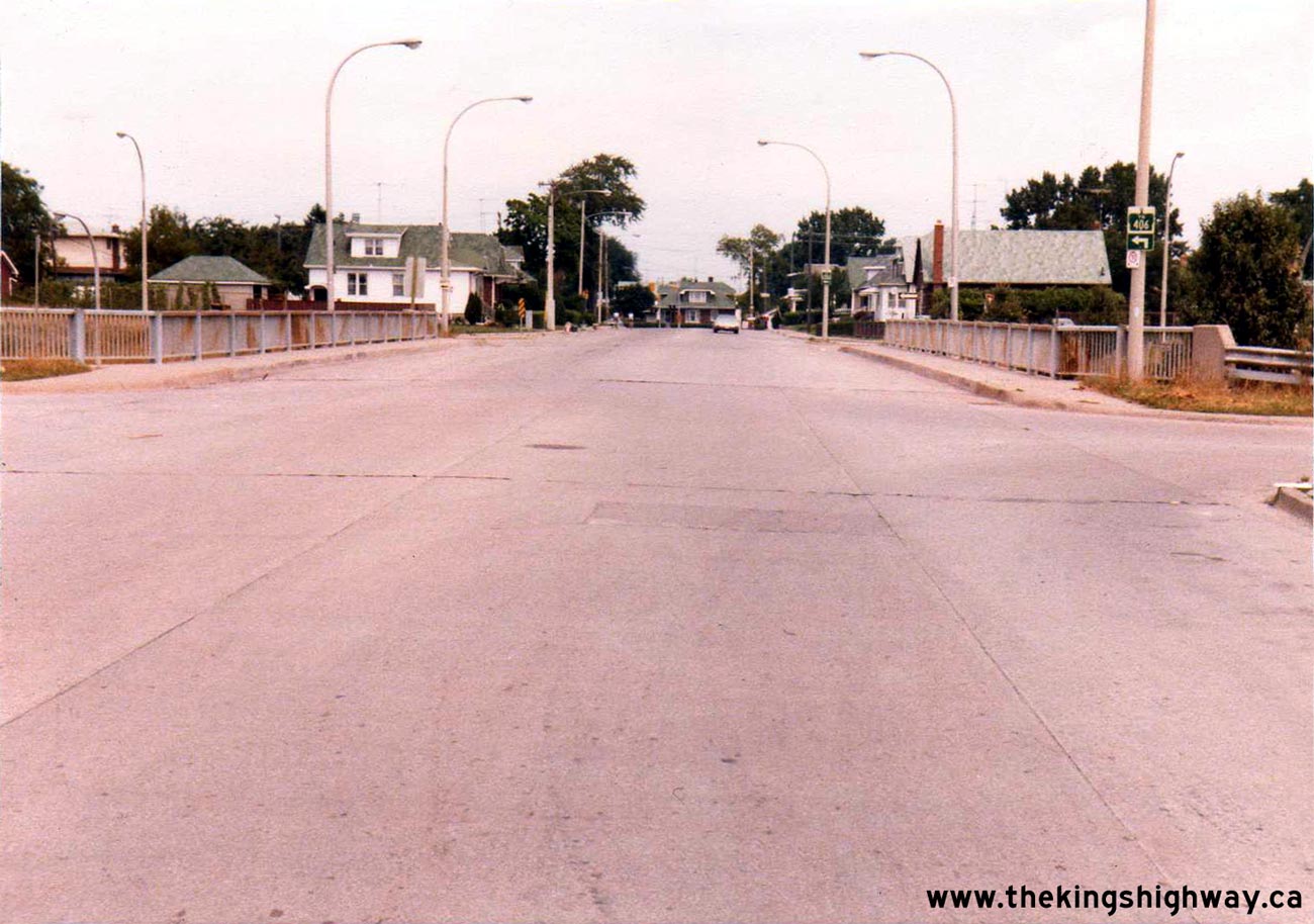
Left - Facing north along Queen Street towards Downtown Thorold from the Hwy 58 structure (May 11, 1977) (Photo courtesy of Ontario Ministry of Transportation - © King's Printer for Ontario, 2012) Right - Facing south across the Queen Street Overpass on Hwy 58 in Thorold (May 11, 1977) (Photo courtesy of Ontario Ministry of Transportation - © King's Printer for Ontario, 2012) 
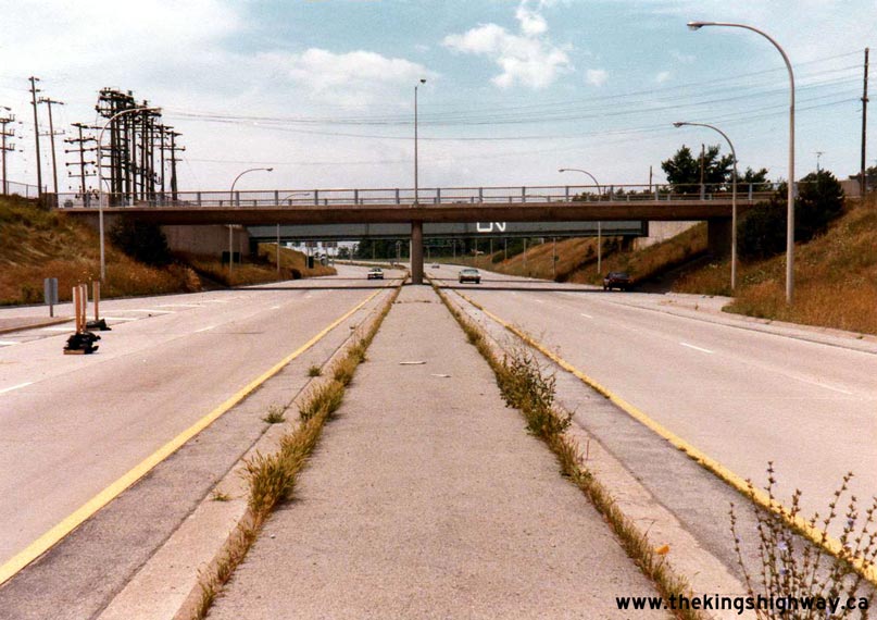
Left - Facing west along Hwy 58 from the Pine Street Interchange in Thorold. Photo taken on May 11, 1977. See an
Enlarged Photo Here. (Photo courtesy of Ontario Ministry of Transportation - © King's Printer for Ontario, 2012) Right - New Richmond Street Extension, looking north from the Hwy 58 Overpass in Thorold (September 7, 1978) (Photo courtesy of Ontario Ministry of Transportation - © King's Printer for Ontario, 2012) 
Above - New Richmond Street Overpass on Hwy 58. This structure was completed in 1976, years after Hwy 58 was completed through Thorold. Photo taken on
September 7, 1978. (Photo courtesy of Ontario Ministry of Transportation - © King's Printer for Ontario, 2012) 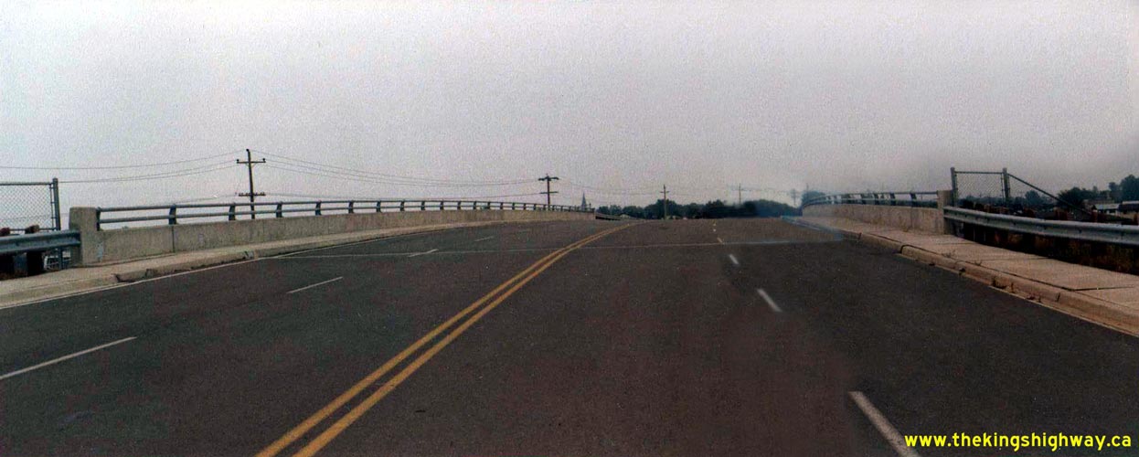
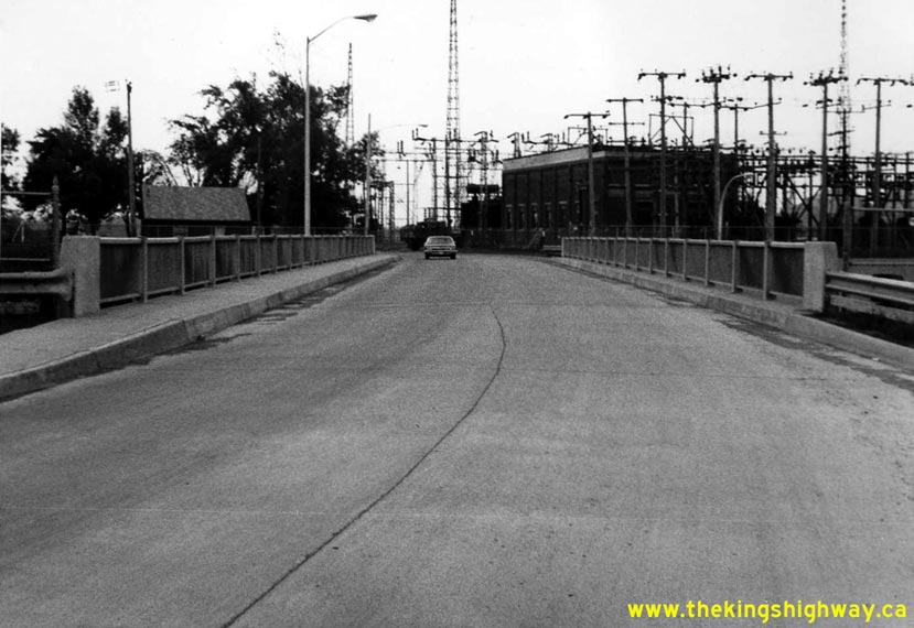
Left - New Richmond Street Overpass on Hwy 58 in Thorold, facing north (September 7, 1978) (Photo courtesy of Ontario Ministry of Transportation - © King's Printer for Ontario, 2012) Right - Facing east along Hwy 58 towards the CN Railway Subway in Thorold (October 3, 1978) (Photo courtesy of Ontario Ministry of Transportation - © King's Printer for Ontario, 2012) 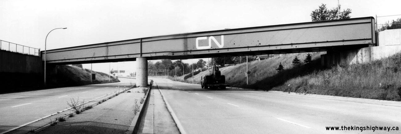
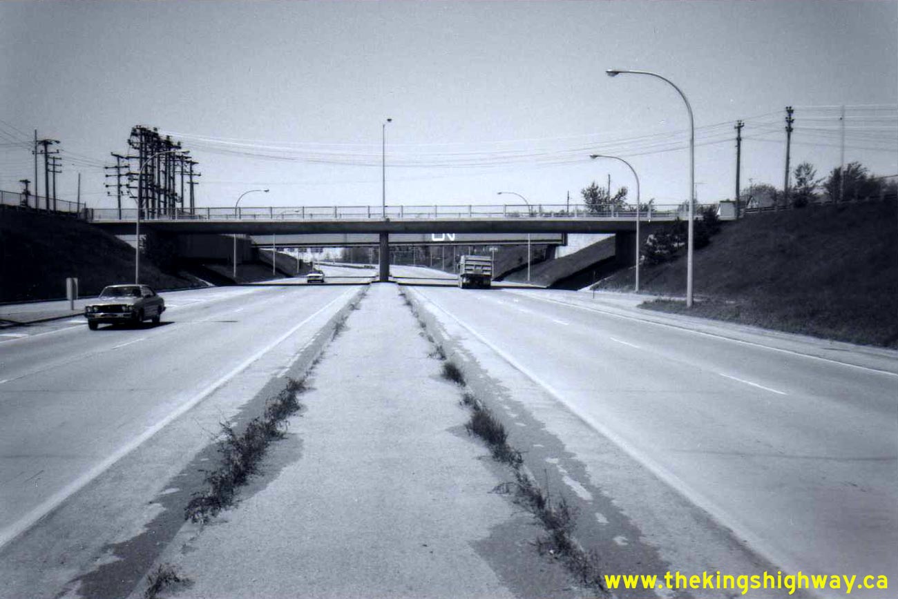
Above - Facing west along Hwy 58 towards the CN Railway Subway in Thorold (October 3, 1978) (Photo courtesy of Ontario Ministry of Transportation - © King's Printer for Ontario, 2012) 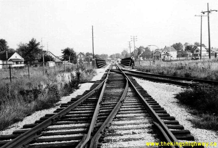
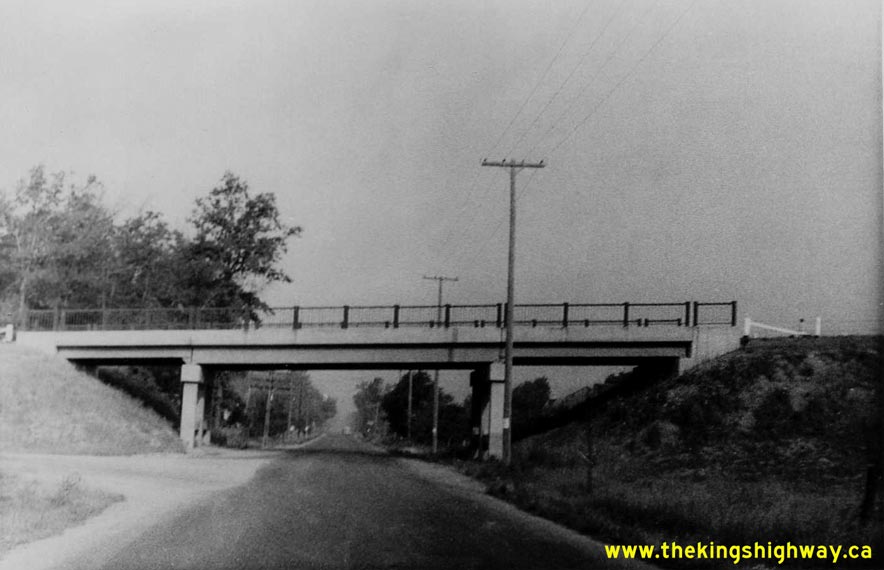
Left - Facing north across the CN Railway Subway on Hwy 58 in Thorold (October 3, 1978) (Photo courtesy of Ontario Ministry of Transportation - © King's Printer for Ontario, 2012) Right - Pine Street Overpass on Hwy 58 in Thorold, facing east towards the Thorold Tunnel (August 9, 1979) (Photo courtesy of Ontario Ministry of Transportation - © King's Printer for Ontario, 2012) 
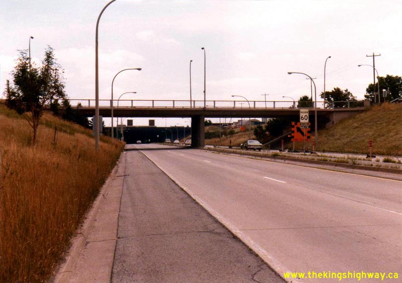
Left - Facing north along Pine Street towards Downtown Thorold from the Hwy 58 Interchange. Photo taken on August 9, 1979. See an
Enlarged Photo Here. (Photo courtesy of Ontario Ministry of Transportation - © King's Printer for Ontario, 2012) Right - Facing west along Hwy 58 from the Pine Street Interchange in Thorold. Photo taken on August 9, 1979. See an Enlarged Photo Here. (Photo courtesy of Ontario Ministry of Transportation - © King's Printer for Ontario, 2012) 
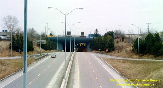
Left - East portal of the twin-tube Thorold Tunnel on Hwy 58. This tunnel carries Hwy 58 below the Welland Canal. (Photograph taken in March 2003 - © Cameron Bevers) Right - View of the Thorold Tunnel's west portal from the Pine Street Overpass. The tunnel opened to traffic on September 18, 1968. (Photograph taken in March 2003 - © Cameron Bevers)
Continue on to King's Highway 58 Present Day Photos: Port Colborne to Welland
|
|---|
Links to Adjacent King's Highway Photograph Pages:
Back to King's Highway 57 Photos /
King's Highway 58 History /
On to King's Highway 59 Photos
Ontario Highway History - Main Menu / Back to List of Highways Website contents, photos & text © 2002-2026, Cameron
Bevers (Webmaster) - All Rights Reserved / Contact Me
|
|---|