
| 
| |
|
|
This page contains historical and present day photos of Ontario's King's Highway 59 from Long Point northerly to Woodstock.
All photographs displayed on this page were taken by the Webmaster (Cameron Bevers), unless specifically noted otherwise. Historical photographs are
arranged in approximate chronological order, while present day photographs (Year 2000 to date) are arranged by location from south to north. Click on any thumbnail to
see a larger image!
Please note that all photographs displayed on this
website are protected by copyright. These photographs must not be reproduced, published,
electronically stored or copied, distributed, or posted onto other websites without
my written permission. If you want to use photos from this website, please
email me first for permission. Thank-you!
|
|---|
|
Page 1: Historical King's Highway 59 Photographs

Above - Completed hot-mix asphalt paving contract on Hwy 59, 4 miles south of Woodstock. See an
Enlarged Photo here.Photo taken on September 20, 1948. (Photo courtesy of Ontario Ministry of Transportation - © King's Printer for Ontario, 1948) 
Above - Circa 1950 view of the western approach to the Hwy 19 South Junction on Hwy 7 & Hwy 8 in Shakespeare, facing east towards Kitchener. Up until the
early 1960s, Hwy 7, Hwy 8 & Hwy 19 all shared a concurrent overlapped route between Stratford and Shakespeare. As part of a highway renumbering plan carried out
in this area in 1962, the route of Hwy 19 between Shakespeare and Woodstock was renumbered as Hwy 59. The overlapped route of Hwy 19 along Hwy 7 & Hwy 8 between
Stratford and Shakespeare was also discontinued in 1962. See an Enlarged Photo Here. Photo taken
circa 1950. (Photo from Cameron Bevers' historical photograph collection - Original photographer unknown) 
Above - Aerial view of the Hwy 59 Cloverleaf on Hwy 401 near Woodstock, facing west towards London (1957) (Photo courtesy of Ontario Ministry of Transportation - © King's Printer for Ontario, 1957) |
|---|
|
Present Day King's Highway 59 Photographs (Long Point to Woodstock)


Left - Facing south along Hwy 59 towards Long Point Provincial Park at the Big Creek Bridge. See an
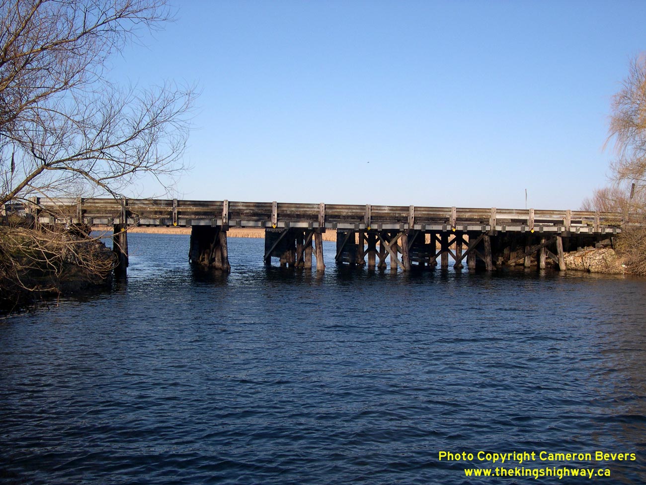
Enlarged Photo Here. (Photograph taken on April 9, 2005 - © Cameron Bevers) Right - Western side of the timber bridge over Big Creek on Hwy 59 at Long Point. Structure completed in 1957. See an Enlarged Photo Here. (Photograph taken on April 9, 2005 - © Cameron Bevers) 

Left - Eastern side of the timber bridge over Big Creek on Hwy 59 at the entrance to Long Point. See an
Enlarged Photo Here. (Photograph taken on April 8, 2006 - © Cameron Bevers) Right - Facing north along Hwy 59 towards Courtland at the Big Creek Bridge. See an Enlarged Photo Here. (Photograph taken on April 9, 2005 - © Cameron Bevers) 

Left - Close-up of the steel beam guide rail and timber curb on the Big Creek Bridge on Hwy 59. See an
Enlarged Photo Here. (Photograph taken on April 9, 2005 - © Cameron Bevers) Right - Aerial view of Hwy 401 in Woodstock, facing east towards the Hwy 59 Interchange. The Hwy 403 Interchange can also be seen in the upper left corner of this photo, marking the western terminus of Hwy 403. See an Enlarged Photo Here. (Photograph taken on April 28, 2006 - © Cameron Bevers) 
Above - Junction assembly at the Hwy 3 & Hwy 59 Junction near Courtland. Up until the mass highway downloading in the 1990s, Hwy 3 & Hwy 59 shared a
concurrent route for approximately 11 km between Courtland and Delhi. See an
Enlarged Photo Here. (Photograph taken on April 8, 2006 - © Cameron Bevers)
Continue on to King's Highway 59 Photos: Woodstock to Shakespeare
|
|---|
Links to Adjacent King's Highway Photograph Pages:
Back to King's Highway 58 Photos /
King's Highway 59 History /
On to King's Highway 60 Photos
Ontario Highway History - Main Menu / Back to List of Highways Website contents, photos & text © 2002-2026, Cameron
Bevers (Webmaster) - All Rights Reserved / Contact Me
|
|---|