
| 
|  |
|
|
This page contains present day photos (Year 2000 to date) of Ontario's King's Highway 59, arranged by location from
Woodstock northerly to Shakespeare. All photographs displayed on this page were taken by the Webmaster (Cameron Bevers), unless specifically noted otherwise. Click
on any thumbnail to see a larger image!
Please note that all photographs displayed on this
website are protected by copyright. These photographs must not be reproduced, published,
electronically stored or copied, distributed, or posted onto other websites without
my written permission. If you want to use photos from this website, please
email me first for permission. Thank-you!
|
|---|
|
Page 2: Present Day King's Highway 59 Photographs (Woodstock to Shakespeare)
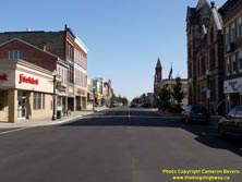
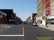
Left - Facing east along Hwy 2 & Hwy 59 (Dundas Street) near Riddell Street. Downtown Woodstock's main street has many examples of unique 19th Century
architecture and interesting landmarks, including its historic city hall at right and the turreted Church of the Epiphany in the background. For a mid-sized
Southwestern Ontario city, Woodstock has a surprisingly large downtown area. It stretches almost the entire length of the overlapped Hwy 2 & Hwy 59 route along
Dundas Street. See an Enlarged Photo Here. (Photograph taken on October 13, 2019 - © Cameron Bevers) Right - Facing west along Hwy 2 & Hwy 59 (Dundas Street) in Downtown Woodstock. Although this photo was taken on a quiet Sunday morning, the old highway route through Woodstock is certainly a lot less busy now than it once was. Before the London-Woodstock section of Hwy 401 opened to traffic on May 31, 1957, virtually all traffic travelling between Toronto and London passed along this street. Not only did this slow highway travel times immensely, but the sight of a never-ending stream of long-distance trucks, cars and buses likely would have been very detrimental to the enjoyment of the city centre. The construction of Hwy 401 through Southwestern Ontario took thousands of long-distance vehicles off of main streets such as this one. Traffic volumes on Hwy 2 between Woodstock and Ingersoll cascaded by more than 50% as soon as Hwy 401 was opened. See an Enlarged Photo Here. (Photograph taken on October 13, 2019 - © Cameron Bevers) 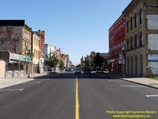
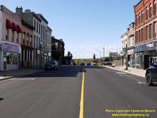
Left - Facing east along Hwy 2 & Hwy 59 towards Brock Street from Vansittart Avenue. Like many downtown areas in Southern Ontario, Woodstock has been
struggling to redefine its downtown area after decades of decline. Fortunately, pockets of new developments are starting to appear along the main street, which
suggests that things are starting to turn the corner. See an Enlarged Photo Here. (Photograph taken on October 13, 2019 - © Cameron Bevers) Right - Facing west along Hwy 2 & Hwy 59 (Dundas Street) from Brock Street in Downtown Woodstock. The route of Hwy 59 turns right (north) onto Vansittart Avenue at the crest of the hill, while Hwy 2 continues straight ahead (west) along Dundas Street towards Thamesford and London. See an Enlarged Photo Here. (Photograph taken on October 13, 2019 - © Cameron Bevers) 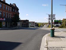
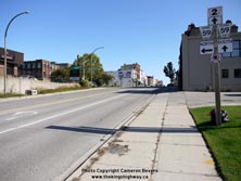
Left - Junction sign assembly on westbound Hwy 2 (Dundas Street) at Hwy 59 North (Vansittart Avenue). See an
Enlarged Photo Here. (Photograph taken on October 13, 2019 - © Cameron Bevers) Right - Junction guide signs on eastbound Hwy 2 approaching the Hwy 59 North Junction. As indicated by this junction assembly, Hwy 2 & Hwy 59 share an overlapped route along Dundas Street through Downtown Woodstock. This overlapped route extends along Dundas Street from the Hwy 59 North Junction at Vansittart Avenue to the Hwy 59 South Junction at Wilson Street, which lies about 1 km to the east. Until the late 1990s, Hwy 2 & Hwy 59 were both King's Highways. Jurisdiction over both routes was transferred from the province to the County of Oxford in 1997-1998. See an Enlarged Photo Here. (Photograph taken on October 13, 2019 - © Cameron Bevers) 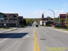
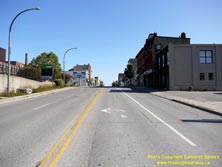
Left - Facing west along Dundas Street (Hwy 2) from Vansittart Avenue (Hwy 59 North) in Downtown Woodstock. See an
Enlarged Photo Here. (Photograph taken on October 13, 2019 - © Cameron Bevers) Right - Approaching Vansittart Avenue (Hwy 59 North) on Dundas Street (Hwy 2), facing east. See an Enlarged Photo Here. (Photograph taken on October 13, 2019 - © Cameron Bevers) 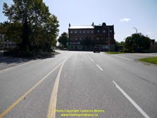
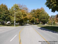
Left - Facing south along Vansittart Avenue (Hwy 59) towards Dundas Street (Hwy 2) in Downtown Woodstock, The route of Hwy 59 turns left and briefly heads east
via Dundas Street, concurrently with Hwy 2. Interestingly, this is a Stop-controlled intersection. It is uncommon to see a junction of two highways in an urban area
that is not controlled by traffic signals, although it should be noted that traffic volumes along Vansittart Avenue (Hwy 59 North) are comparatively light. See an
Enlarged Photo Here. (Photograph taken on October 13, 2019 - © Cameron Bevers) Right - Facing north along Vansittart Avenue (Hwy 59) from Dundas Street (Hwy 2). From Woodstock, Hwy 59 heads north towards Tavistock, before coming to an end at the Hwy 7 & Hwy 8 Junction in Shakespeare, located between Stratford and Kitchener. See an Enlarged Photo Here. (Photograph taken on October 13, 2019 - © Cameron Bevers) 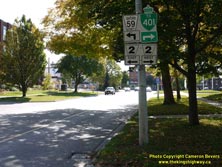
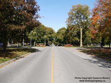
Left - Junction sign assembly on southbound Vansittart Avenue (Hwy 59) approaching Dundas Street (Hwy 2). Southbound traffic bound for Hwy 401 is directed to
turn right (west) along Dundas Street and use the Sweaburg Road Interchange. Although it is a more circuitous urban route, traffic can also access Hwy 401 directly
from Hwy 59 (Norwich Avenue) at the southern end of Woodstock. Historically, the northern leg of Hwy 59 from Woodstock to Shakespeare was a part of Hwy 19. Prior to
being renumbered as Hwy 59 in the early 1960s, Hwy 19 turned right at this junction and headed south towards Beachville and Ingersoll. See an
Enlarged Photo Here. (Photograph taken on October 13, 2019 - © Cameron Bevers) Right - Facing north along Vansittart Avenue (Hwy 59) at Drew Street in Woodstock. This beautiful tree-lined avenue is just a delight to drive, especially in the fall when the leaves show off their spectacular autumn splendour. Vansittart Avenue is lined with stately mansions which date back more than a century. See an Enlarged Photo Here. (Photograph taken on October 13, 2019 - © Cameron Bevers) 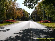

Left - View of Vansittart Avenue (Hwy 59) facing south from Ingersoll Avenue in Woodstock. It is fairly rare to see a highway approaching a city centre with
stands of mature trees on either side of the street like this. At one time, tree-lined avenues such as this were quite typical as highways entered into urban areas.
Unfortunately, as cities widened their streets from two to four lanes to accommodate increased traffic volumes and parking spaces, many trees had to be cut down in
the process. Although street widening carried out since the 1950s has removed many serious traffic bottlenecks in urban areas, it is important to note that our ease
of mobility that we enjoy today has come at a price. See an Enlarged Photo Here. (Photograph taken on October 13, 2019 - © Cameron Bevers) Right - A fairly substantial diversion was built for Hwy 59 at the northern entrance to Woodstock in the late 1960s. Originally, Hwy 59 descended a steep hill and crossed the Canadian Pacific Railway (CPR) at-grade. The highway then crossed a low-level bridge over the Thames River (South Branch). The northern part of the pre-1967 alignment of Hwy 59 (Tecumseh Street) can easily be seen from the southern end of the Thames River Bridge, which was built to span both the river and the adjacent railway. However, there is no trace of the old highway alignment south of the railway line, as it was obliterated during construction of the new bridge in 1966-1967. See an Enlarged Photo Here. (Photograph taken on April 21, 2007 - © Cameron Bevers) 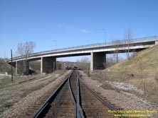

Left - Western side of the Thames River and CPR Overhead Bridge on Hwy 59 in Woodstock. This massive four-span steel girder structure is 508 feet in length.
During this two-year construction project, a temporary route was established for Hwy 59 through Woodstock. The Hwy 59 detour followed Ingersoll Avenue, Oxford Street
and Tecumseh Street. See an Enlarged Photo Here. (Photograph taken on April 21, 2007 - © Cameron Bevers) Right - The Thames River and CPR Overhead Bridge in Woodstock was completed in 1967. The realignment of Hwy 59 at this location eliminated a steep grade and a level rail crossing. The construction of this new railway grade separation was made possible by the relocation of the CPR tracks further to the north. The railway relocation was triggered by the construction of the nearby Gordon Pit tock Reservoir during the mid-1960s. See an Enlarged Photo Here. (Photograph taken on April 21, 2007 - © Cameron Bevers) 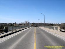

Left - Facing north along Hwy 59 towards Tavistock at the Thames River and CPR Overhead Bridge. See an
Enlarged Photo Here. (Photograph taken on April 21, 2007 - © Cameron Bevers) Right - The Thames River and CPR Overhead Bridge has a rather pronounced vertical crest curve in the middle portion of the structure. See an Enlarged Photo Here. (Photograph taken on April 21, 2007 - © Cameron Bevers) 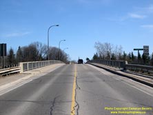
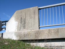
Left - Facing south along Hwy 59 at the Thames River and CPR Overhead Bridge in Woodstock. See an
Enlarged Photo Here. (Photograph taken on April 21, 2007 - © Cameron Bevers) Right - Structure identification number and date stamp (1967) on the Thames River and CPR Overhead Bridge on Hwy 59 in Woodstock. See an Enlarged Photo Here. (Photograph taken on April 21, 2007 - © Cameron Bevers) 
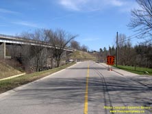
Left - Facing north along Hwy 59 towards Tavistock from the Thames River and CPR Overhead Bridge in Woodstock. See an
Enlarged Photo Here. (Photograph taken on April 21, 2007 - © Cameron Bevers) Right - The Thames River and CPR Overhead Bridge can be seen a short distance east of the former Hwy 59 alignment in Woodstock. The high-level structure eliminated a dangerous at-grade railway crossing at the bottom of a steep hill on the former highway alignment. Jurisdiction over the old route of Hwy 59 seen here was transferred from the province to the Township of East Cora in 1969. Today, this former section of Hwy 59 is part of Woodstock's Tecumseh Street. See an Enlarged Photo Here. (Photograph taken on April 21, 2007 - © Cameron Bevers) 
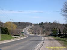
Left - The former Hwy 59 bridge over the Thames River is a low-level structure, which crosses the river immediately adjacent to the old CPR crossing location.
Despite being bypassed in the 1960s, the original structure built at this location in 1937 by the Department of Highways of Ontario (DHO) lasted up until 1995, when
it was replaced with the newer bridge seen here. See an Enlarged Photo Here. (Photograph taken on April 21, 2007 - © Cameron Bevers) Right - Facing south along Hwy 59 approaching the Thames River and CPR Overhead Bridge in Woodstock. From this vantage point, almost the entire length of the Hwy 59 Diversion can be seen. About 1 km of Hwy 59 was relocated onto a much-improved alignment as a result of the construction of the new structure over the Thames River and CPR. See an Enlarged Photo Here. (Photograph taken on April 21, 2007 - © Cameron Bevers) 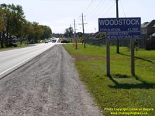
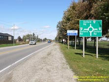
Left - Sign marking the entrance to the City of Woodstock on southbound Hwy 59. See an
Enlarged Photo Here. (Photograph taken on October 13, 2019 - © Cameron Bevers) Right - Roundabout guide sign on northbound Hwy 59 approaching Oxford Road 17. The Oxford Road 17 Junction was converted to a modern roundabout in 2009. See an Enlarged Photo Here. (Photograph taken on October 13, 2019 - © Cameron Bevers) 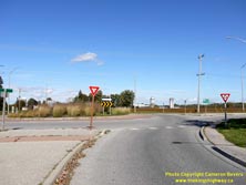
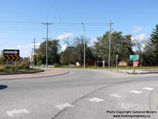
Left - Entering the roundabout at Oxford Road 17 on northbound Hwy 59 departing from Woodstock. See an
Enlarged Photo Here. (Photograph taken on October 13, 2019 - © Cameron Bevers) Right - Roundabout on Hwy 59 at Oxford Road 17 in Woodstock. The exit to northbound Oxford Road 59 (formerly King's Highway 59) can be seen at right. Jurisdiction over Hwy 59 was transferred from the province to the County of Oxford in the late 1990s. Since 1998, Hwy 59 has been an Oxford County Highway. See an Enlarged Photo Here. (Photograph taken on October 13, 2019 - © Cameron Bevers) 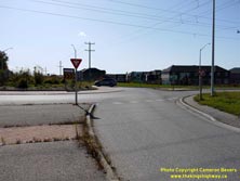

Left - Entering the roundabout at Oxford Road 17 on southbound Hwy 59 approaching Woodstock. This roundabout marks the northern limits of the City of Woodstock
and also roughly coincides with the edge of its urbanized area. Roundabouts placed at urban fringes such as this example provide a great method of transitioning
motorists from a high-speed rural highway environment to a low-speed urban street environment. See an
Enlarged Photo Here. (Photograph taken on October 13, 2019 - © Cameron Bevers) Right - Facing north along Hwy 59 near the Oxford Road 33 Junction between Woodstock and Huntingford. See an Enlarged Photo Here. (Photograph taken on April 21, 2007 - © Cameron Bevers) 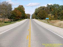
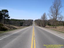
Left - Approaching the community of Huntingford on Hwy 59, facing north towards Tavistock. See an
Enlarged Photo Here. (Photograph taken on October 13, 2019 - © Cameron Bevers) Right - Facing north along Hwy 59 approaching the Mud Creek Bridge, located about 4 km south of Hickson. See an Enlarged Photo Here. (Photograph taken on April 21, 2007 - © Cameron Bevers) 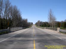

Left - Facing north along Hwy 59 towards Hickson at the Mud Creek Bridge. See an
Enlarged Photo Here. (Photograph taken on April 21, 2007 - © Cameron Bevers) Right - Facing south along Hwy 59 towards Woodstock at the Mud Creek Bridge. See an Enlarged Photo Here. (Photograph taken on April 21, 2007 - © Cameron Bevers) 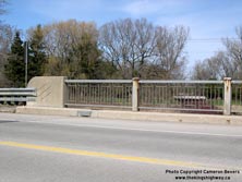

Left - Close-up of the embossed scoring on the concrete parapet wall on the Mud Creek Bridge on Hwy 59. This subtle concrete design embellishment makes this
rather plain-looking bridge more aesthetically pleasing. By the late 1950s, these types of aesthetic treatments on DHO-built bridges had become the exception, rather
than the rule. See an Enlarged Photo Here. (Photograph taken on April 21, 2007 - © Cameron Bevers) Right - Western side of the Mud Creek Bridge on Hwy 59 between Woodstock and Hickson. This single-span steel beam structure was completed in 1959. See an Enlarged Photo Here. (Photograph taken on April 21, 2007 - © Cameron Bevers) 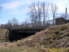

Left - Eastern side of the Mud Creek Bridge on Hwy 59 north of Woodstock. See an
Enlarged Photo Here. (Photograph taken on April 21, 2007 - © Cameron Bevers) Right - The use of steel handrails on Ontario bridges reached its zenith in the late 1950s. Unfortunately, the use of steel handrails dropped precipitously during the 1960s, with a resurgence of concrete as the preferred building material for bridge parapet walls. See an Enlarged Photo Here. (Photograph taken on April 21, 2007 - © Cameron Bevers) 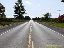
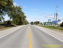
Left - Facing south along Hwy 59 towards Woodstock from Hickson. See an
Enlarged Photo Here. (Photograph taken on October 13, 2019 - © Cameron Bevers) Right - Approaching the small community of Hickson on Hwy 59, facing north towards Tavistock. Hickson is located about 13 km north of Woodstock. See an Enlarged Photo Here. (Photograph taken on October 13, 2019 - © Cameron Bevers) 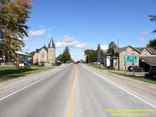
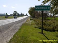
Left - Facing north along Hwy 59 approaching the Oxford Road 8 (Former Hwy 97) Junction at Hickson. See an
Enlarged Photo Here. (Photograph taken on October 13, 2019 - © Cameron Bevers) Right - Distance guide sign on southbound Hwy 59 at the Oxford Road 8 (Former Hwy 97) Junction. See an Enlarged Photo Here. (Photograph taken on October 13, 2019 - © Cameron Bevers) 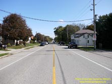
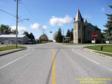
Left - Facing east along Oxford Road 8 (Former Hwy 97) towards Cambridge from the Hwy 59 Junction at Hickson. The route of Hwy 97 through Oxford County existed
from 1938 up until 1977, when jurisdiction over Hwy 97 was transferred or "downloaded" from the province to the County of Oxford. The importance of Hwy 97 in the
provincial highway system was greatly reduced once Hwy 401 was completed between Preston (Cambridge) and Woodstock in 1961. Prior to the 1990s, Hwy 97 was one of the
longest provincial highways to be transferred in its entirety to local municipalities. At one time, Hwy 97 extended for almost 70 km from Freelton on Hwy 6 to
Hickson on Hwy 59, via Galt (Cambridge). See an Enlarged Photo Here. (Photograph taken on October 13, 2019 - © Cameron Bevers) Right - Western terminus of Former Hwy 97 at the Hwy 59 Junction. Although it was never a provincial highway west of Hickson, today's Oxford Road 8 continues west from Hwy 59 to connect with Oxford Road 6 south of Stratford. Hickson's United Church is a very prominent landmark at this highway junction. See an Enlarged Photo Here. (Photograph taken on October 13, 2019 - © Cameron Bevers) 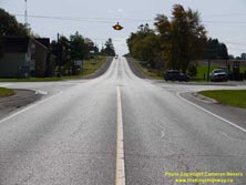
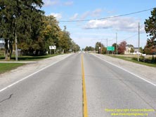
Left - Facing south along Hwy 59 towards Woodstock at the junction of Oxford Road 8 (Former Hwy 97). The intersection is marked with a flashing overhead
warning beacon. See an Enlarged Photo Here. (Photograph taken on October 13, 2019 - © Cameron Bevers) Right - Facing north along Hwy 59 towards Tavistock from the junction of Oxford Road 8 (Former Hwy 97) at Hickson. See an Enlarged Photo Here. (Photograph taken on October 13, 2019 - © Cameron Bevers) 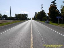
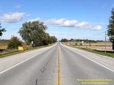
Left - Approaching Hickson on Hwy 59, facing south towards Woodstock. See an
Enlarged Photo Here. (Photograph taken on October 13, 2019 - © Cameron Bevers) Right - Facing north along Hwy 59 towards Tavistock from Hickson. See an Enlarged Photo Here. (Photograph taken on October 13, 2019 - © Cameron Bevers) 
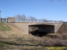
Left - Facing south along Hwy 59 at the Thames River Bridge near Tavistock. See an
Enlarged Photo Here. (Photograph taken on April 21, 2007 - © Cameron Bevers) Right - Thames River Bridge on Hwy 59 south of Tavistock. This single-span concrete rigid frame structure was completed in 1960. See an Enlarged Photo Here. (Photograph taken on April 21, 2007 - © Cameron Bevers) 

Left - Facing north along Hwy 59 at the Thames River Bridge, located about 1 km south of Tavistock. See an
Enlarged Photo Here. (Photograph taken on April 21, 2007 - © Cameron Bevers) Right - View of the current Thames River Bridge from the site of the original highway bridge. In 1933, the DHO widened the existing Thames River Bridge south of Tavistock in order to improve a bad curve in the highway. The Thames River Bridge was also retrofitted to provide for a superelevation of the highway curve across the bridge deck. The former bridge over the Thames River was replaced during a highway realignment project carried out by the DHO in the early 1960s, under saw the construction of the replacement bridge seen here. See an Enlarged Photo Here. (Photograph taken on April 21, 2007 - © Cameron Bevers) 
Above - Today, nothing remains of the old 1933 Thames River structure, apart from this treed embankment and some isolated traces of asphalt. See an
Enlarged Photo Here. (Photograph taken on April 21, 2007 - © Cameron Bevers) 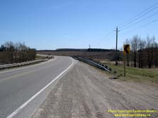

Left - The current Thames River structure on Hwy 59 is situated in the middle of a long superelevated curve. See an
Enlarged Photo Here. (Photograph taken on April 21, 2007 - © Cameron Bevers) Right - A small patch of old asphalt is still visible at the former highway's location north of the old Thames River Bridge site. See an Enlarged Photo Here. (Photograph taken on April 21, 2007 - © Cameron Bevers) 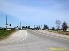

Left - Facing north along Hwy 59 towards Tavistock from the Oxford Road 34 Junction. See an
Enlarged Photo Here. (Photograph taken on April 21, 2007 - © Cameron Bevers) Right - Lines of trees are usually a good indicator of a former highway alignment. Here, a pair of older trees marks the edge of the original Hwy 59 alignment, before the new highway curve and Thames River Bridge were constructed in the early 1960s. This relocated highway alignment was a significant improvement over the curve that was built back in 1933. See an Enlarged Photo Here. (Photograph taken on April 21, 2007 - © Cameron Bevers) 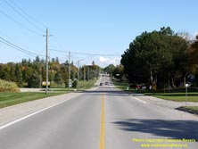
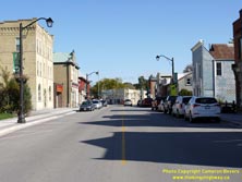
Left - Approaching Tavistock on Hwy 59, facing north. Tavistock is located about 23 km north of Woodstock, near the northern terminus of Hwy 59. See an
Enlarged Photo Here. (Photograph taken on October 13, 2019 - © Cameron Bevers) Right - Facing north along Woodstock Street (Hwy 59) from William Street in Downtown Tavistock. See an Enlarged Photo Here. (Photograph taken on October 13, 2019 - © Cameron Bevers) 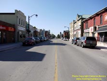
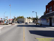
Left - View of Hwy 59 (Woodstock Street) in Downtown Tavistock, facing south from Oxford Road 24 (Hope Street). See an
Enlarged Photo Here. (Photograph taken on October 13, 2019 - © Cameron Bevers) Right - Intersection of Woodstock Street & Hope Street in Downtown Tavistock. This awkward five-leg intersection is controlled by a single set of traffic signals. See an Enlarged Photo Here. (Photograph taken on October 13, 2019 - © Cameron Bevers) 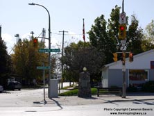
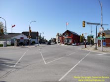
Left - The fifth leg of the intersection (Maria Street) accommodates one-way traffic heading southbound from Hwy 59 only. Note the secondary signal head at
left facing southbound Hwy 59 traffic, which features three 8 inch (20 cm) display lenses. It is becoming increasingly rare in Ontario to see traffic signal heads
with an 8 inch (20 cm) red display lens. Most jurisdictions use a 12 inch (30 cm) red display lens and 8 inch (20 cm) amber and green display lenses for all traffic
signals. In fact, many jurisdictions in Ontario are adopting 12 inch (30 cm) display lenses for all three signal indications, as they are more conspicuous to
motorists. See an Enlarged Photo Here. (Photograph taken on October 13, 2019 - © Cameron Bevers) Right - Intersection of Hwy 59 (Woodstock Street) and Hope Street in Downtown Tavistock, facing south. This unusual intersection features a pedestrian-only signal phase, which allows pedestrians to cross all streets in any direction they wish. Commonly called a "pedestrian scramble", traffic signal configurations such as this are normally only seen in major city centres where pedestrian crossing movements at intersections are extremely high. While this signal phasing provides for a very safe pedestrian crossing environment, it usually results in unacceptably heavy delays for vehicular traffic. No vehicles can move or turn in any direction until the pedestrian signal phase ends, which results in lost time, wasted fuel, more air pollution and driver frustration. See an Enlarged Photo Here. (Photograph taken on October 13, 2019 - © Cameron Bevers) 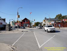
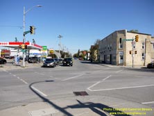
Left - Facing west along Hope Street at Hwy 59 (Woodstock Street). The traffic signals at this intersection have five separate phases, with one phase for each
direction of travel plus the pedestrian-only phase. In this photo, the eastbound phase has just commenced and traffic can turn in any direction (left, right, or
through) with no potential for conflicts. All other directions of traffic are facing a red signal indication and are thus stopped. Although this type of signal
operation is very safe, it is also fairly inefficient and can lead to long queues on the other approaches. See an
Enlarged Photo Here. (Photograph taken on October 13, 2019 - © Cameron Bevers) Right - View of Hwy 59 (Woodstock Street) facing north from Hope Street in Downtown Tavistock. The "pedestrian scramble" crosswalk markings are quite evident in this photo. This complicated and badly-skewed intersection has no fewer than nine pedestrian crosswalks! See an Enlarged Photo Here. (Photograph taken on October 13, 2019 - © Cameron Bevers) 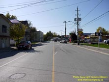
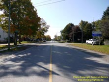
Left - Facing south along Woodstock Street (Hwy 59) towards Hope Street from Station Street in Tavistock. See an
Enlarged Photo Here. (Photograph taken on October 13, 2019 - © Cameron Bevers) Right - Oxford County boundary sign on southbound Hwy 59 approaching Tavistock. The Perth-Oxford County Boundary passes through the urbanized area of Tavistock. Historically, the old incorporated Village of Tavistock was contained entirely within Oxford County. Over the years, however, Tavistock and an unincorporated neighbouring community in Perth County (Sebastopol) grew together, giving the appearance that Tavistock actually straddles the county boundary. See an Enlarged Photo Here. (Photograph taken on October 13, 2019 - © Cameron Bevers) 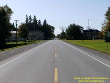
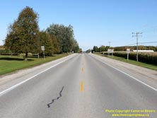
Left - Approaching Sebastopol and Tavistock on Hwy 59, facing south near Perth Line 29. See an
Enlarged Photo Here. (Photograph taken on October 13, 2019 - © Cameron Bevers) Right - Facing north along Hwy 59 from Sebastopol. The 5 km section of Hwy 59 lying between Tavistock and Shakespeare is officially known as Perth Road 107. Perth County undertook a fairly substantial road renaming exercise in the late 1990s, which led to all downloaded King's Highways such as Hwy 59 being assigned new route numbers in Perth County. See an Enlarged Photo Here. (Photograph taken on October 13, 2019 - © Cameron Bevers) 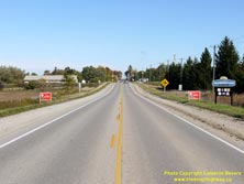

Left - Approaching Shakespeare on Hwy 59, facing north. The highway reaches its northern terminus at the Hwy 7 & Hwy 8 Junction about 1 km ahead. See an
Enlarged Photo Here. (Photograph taken on October 13, 2019 - © Cameron Bevers) Right - Distance guide sign on southbound Hwy 59 departing Shakespeare. See an Enlarged Photo Here. (Photograph taken on April 21, 2007 - © Cameron Bevers) 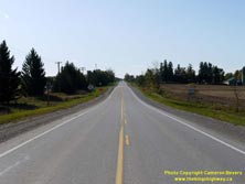
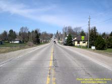
Left - Facing south along Hwy 59 towards Tavistock from the GEXR railway crossing in Shakespeare. See an
Enlarged Photo Here. (Photograph taken on October 13, 2019 - © Cameron Bevers) Right - Facing north along Hwy 59 from the GEXR railway crossing in Shakespeare. See an Enlarged Photo Here. (Photograph taken on April 21, 2007 - © Cameron Bevers) 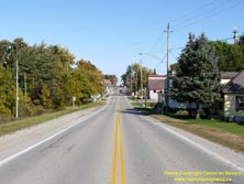

Left - Facing north along Hwy 59 towards Andrew Street in Shakespeare. See an
Enlarged Photo Here. (Photograph taken on October 13, 2019 - © Cameron Bevers) Right - Junction of Hwy 59 and Hwy 7 & Hwy 8 in Shakespeare, facing south. The route of Hwy 59 reaches its northern terminus at this highway junction, after travelling more than 120 km across Southwestern Ontario from Long Point on the Lake Erie shoreline. Although some King's Highways lost more mileage during the mass provincial highway downloading spree of 1997-1998, Hwy 59 was the longest highway designation in Southwestern Ontario that was eliminated entirely from the King's Highway System as a result of the highway downloading. See an Enlarged Photo Here. (Photograph taken on October 13, 2019 - © Cameron Bevers) 
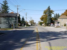
Left - Junction of Hwy 59 on Hwy 7 & Hwy 8, facing west. This is the only signalized intersection along Hwy 7 & Hwy 8 between New Hamburg and
Stratford. See an Enlarged Photo Here. (Photograph taken on October 13, 2019 - © Cameron Bevers) Right - Facing west along Hwy 7 & Hwy 8 towards Stratford from the Hwy 59 Junction in Shakespeare. The entire route of Hwy 7 & Hwy 8 through Shakespeare is under the jurisdiction of the Ministry of Transportation of Ontario (MTO). It is very unusual for MTO to maintain jurisdiction over a highway which passes through an urbanized area such as this. This is most likely due to the fact that Shakespeare is not (and never has been) an incorporated town or village. Curiously, Shakespeare's streets are lined with a disproportionate number of antique shops. See an Enlarged Photo Here. (Photograph taken on October 13, 2019 - © Cameron Bevers) 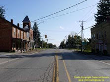
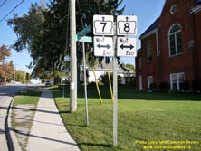
Left - Facing east along Hwy 7 & Hwy 8 at the Hwy 59 (Perth Road 107) Junction in Shakespeare. When jurisdiction over Hwy 59 was transferred from the
province to Perth County in 1998, the county chose to rename the road as Perth Road 107. Accordingly, there are no longer any highway signs at this junction which
reflect the old Hwy 59 route number. See an Enlarged Photo Here. (Photograph taken on October 13, 2019 - © Cameron Bevers) Right - Hwy 7 & Hwy 8 junction crown signs at the northern terminus of Hwy 59 in Shakespeare. The overlapped route of Hwy 7 & Hwy 8 between Stratford and Kitchener has been in place ever since route numbers were first assigned to Ontario's Highways back in 1925. It is tied for the oldest overlapped route in Ontario. Hwy 7 & Hwy 8 shares this honour with Hwy 6 & Hwy 10 between Chatsworth and Owen Sound, another overlapped route which has also been in place since 1925. See an Enlarged Photo Here. (Photograph taken on October 13, 2019 - © Cameron Bevers) 

Left - View of Hwy 7 & Hwy 8 in Shakespeare, facing east towards New Hamburg from the Hwy 59 (Perth Road 107) Junction. See an
Enlarged Photo Here. (Photograph taken on October 13, 2019 - © Cameron Bevers) Right - Facing south along Hwy 59 towards Tavistock from the Hwy 7 & Hwy 8 Junction in Shakespeare. See an Enlarged Photo Here. (Photograph taken on October 13, 2019 - © Cameron Bevers) 
Above - Approaching the Hwy 7 & Hwy 8 Junction on Hwy 59 in Shakespeare, facing north. Hwy 59 ends at the traffic signals in the background. Before being
renumbered as Hwy 59 between Woodstock and Shakespeare in the early 1960s, Hwy 19 used to turn left at this intersection and continue west to Stratford concurrently
with Hwy 7 & Hwy 8. This created a very rare situation where three King's Highways (Hwy 7, Hwy 8 & Hwy 19) all shared a single overlapped route. This
overlapped route between Shakespeare and Stratford remained in place from 1934 up until 1962, when Hwy 19 was rerouted via St. Mary's and Thamesford in an effort to
simplify route numbering in the area. See an Enlarged Photo Here. (Photograph taken on October 13, 2019 - © Cameron Bevers)
More King's Highway 59 Photographs Coming Soon!
|
|---|
Links to Adjacent King's Highway Photograph Pages:
Back to King's Highway 58 Photos /
King's Highway 59 History /
On to King's Highway 60 Photos
Ontario Highway History - Main Menu / Back to List of Highways Website contents, photos & text © 2002-2025, Cameron
Bevers (Webmaster) - All Rights Reserved / Contact Me |
|---|