
| 
| |
|
|
This page contains historical photos of Ontario's King's Highway 60 dating from 1933 to 1999. All photographs displayed on
this page were taken by the Ontario Ministry of Transportation, unless specifically noted otherwise. Historical photographs are arranged in approximate chronological
order. Click on any thumbnail to see a larger image!
Please note that all photographs displayed on this
website are protected by copyright. These photographs must not be reproduced, published,
electronically stored or copied, distributed, or posted onto other websites without
my written permission. If you want to use photos from this website, please
email me first for permission. Thank-you!
|
|---|
|
Page 1: Historical King's Highway 60 Photographs (1933-1999)
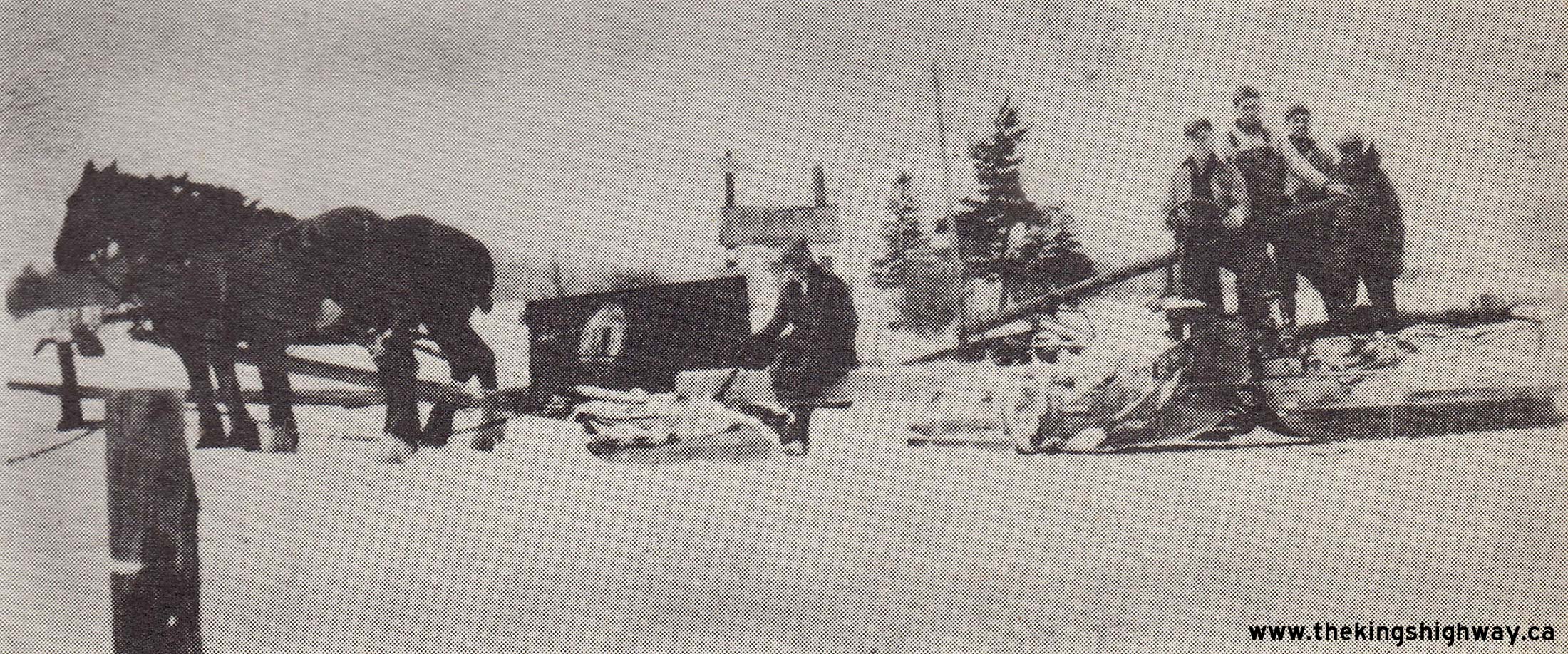
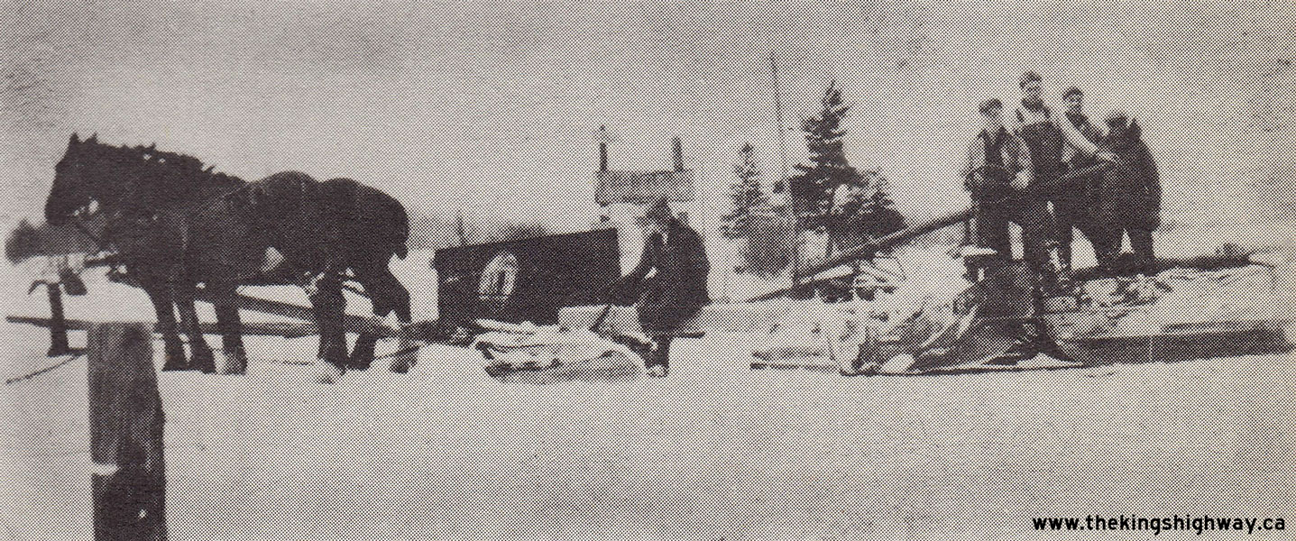  Above - Horse-drawn snowplow on the Golden Lake-Killaloe Road (later known as Hwy 60) during the Winter of 1933-1934. This type of plow, often referred to as a
"Patented Plow", required a crew of three men to operate it - a pilot and two wingmen. The pilot operated the plow using a wood pole which could be used to raise or
lower the front end of the plow, while the two wingmen controlled a screw-type wing lift on each side of a plow by means of a wheel. Taken near the Deacon Bridge,
this photo shows early snow-clearing attempts by the Department of Northern Development to keep this road open during the winter. While motorists today simply expect
roads to be maintained and plowed all winter, there was a time where winter maintenance on roads was sporadic and intermittent. In the more remote areas of the
province, roads would often close to motor traffic altogether once the snow fell and would not reopen again until the following spring. See an
Enlarged Photo Here. Photo taken in 1933. Above - Horse-drawn snowplow on the Golden Lake-Killaloe Road (later known as Hwy 60) during the Winter of 1933-1934. This type of plow, often referred to as a
"Patented Plow", required a crew of three men to operate it - a pilot and two wingmen. The pilot operated the plow using a wood pole which could be used to raise or
lower the front end of the plow, while the two wingmen controlled a screw-type wing lift on each side of a plow by means of a wheel. Taken near the Deacon Bridge,
this photo shows early snow-clearing attempts by the Department of Northern Development to keep this road open during the winter. While motorists today simply expect
roads to be maintained and plowed all winter, there was a time where winter maintenance on roads was sporadic and intermittent. In the more remote areas of the
province, roads would often close to motor traffic altogether once the snow fell and would not reopen again until the following spring. See an
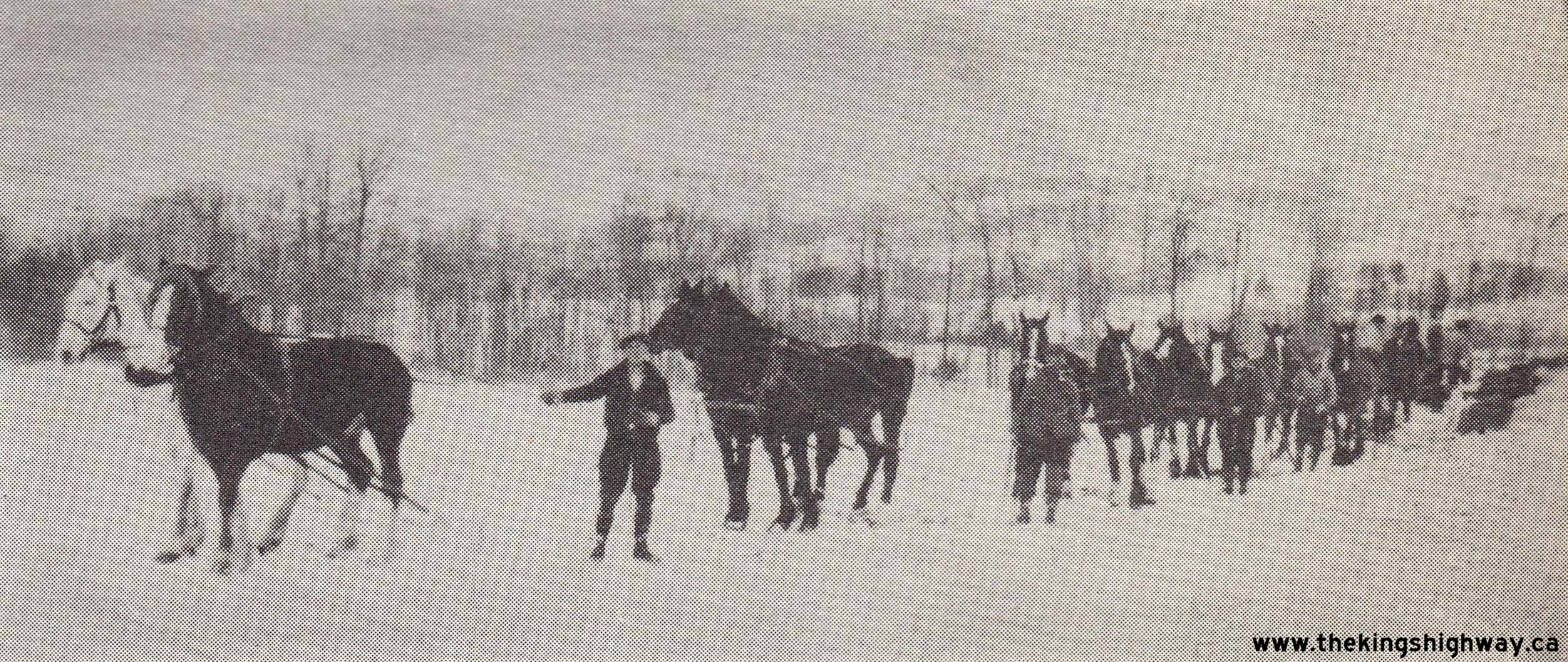
Enlarged Photo Here. Photo taken in 1933.(Photo courtesy of Ontario Department of Northern Development - © King's Printer for Ontario, 1933) 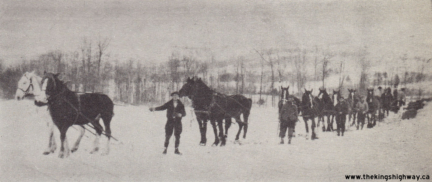 Above - A group of 10 horses can be seen in this photo pulling a snowplow on the Golden Lake-Killaloe Road (later known as Hwy 60) near the Deacon Bridge
during the Winter of 1933-1934. The Department of Northern Development would typically hire snow plowing equipment and teams of horses on a daily rental basis from
local farmers or from lumber companies. In a 1960 interview with the Department of Highways' periodical "DHO News", former plow wingman John Thur recalled that it
took him and his crew almost a week to plow the road out between Golden Lake and Killaloe using this method - a distance of about 14 miles. John was quoted as saying,
"We left Golden Lake on Monday afternoon and got to Killaloe Station on Saturday at Noon". He can be seen in the previous photo as the wingman operating the wheel -
the left-most of the four men standing at the rear of the plow. These two photos clearly illustrate the difficulty in keeping roads open to winter travel in Ontario
up until the 1930s, when motorized snowplows were acquired in larger numbers in order to keep the province's busier roads open to motor traffic all winter. See an
Enlarged Photo Here. Photo taken in 1933. Above - A group of 10 horses can be seen in this photo pulling a snowplow on the Golden Lake-Killaloe Road (later known as Hwy 60) near the Deacon Bridge
during the Winter of 1933-1934. The Department of Northern Development would typically hire snow plowing equipment and teams of horses on a daily rental basis from
local farmers or from lumber companies. In a 1960 interview with the Department of Highways' periodical "DHO News", former plow wingman John Thur recalled that it
took him and his crew almost a week to plow the road out between Golden Lake and Killaloe using this method - a distance of about 14 miles. John was quoted as saying,
"We left Golden Lake on Monday afternoon and got to Killaloe Station on Saturday at Noon". He can be seen in the previous photo as the wingman operating the wheel -
the left-most of the four men standing at the rear of the plow. These two photos clearly illustrate the difficulty in keeping roads open to winter travel in Ontario
up until the 1930s, when motorized snowplows were acquired in larger numbers in order to keep the province's busier roads open to motor traffic all winter. See an
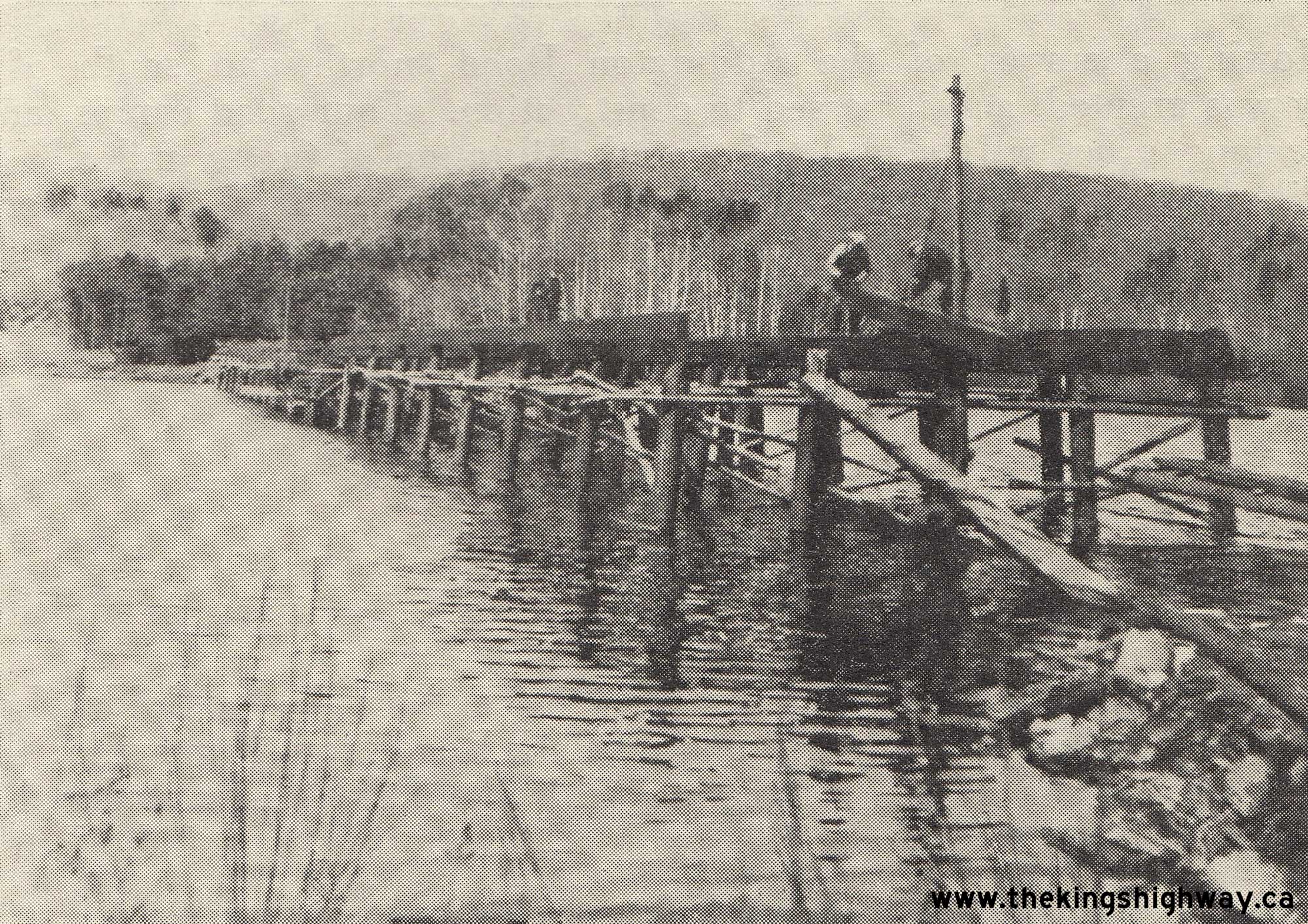
Enlarged Photo Here. Photo taken in 1933.(Photo courtesy of Ontario Department of Northern Development - © King's Printer for Ontario, 1933) 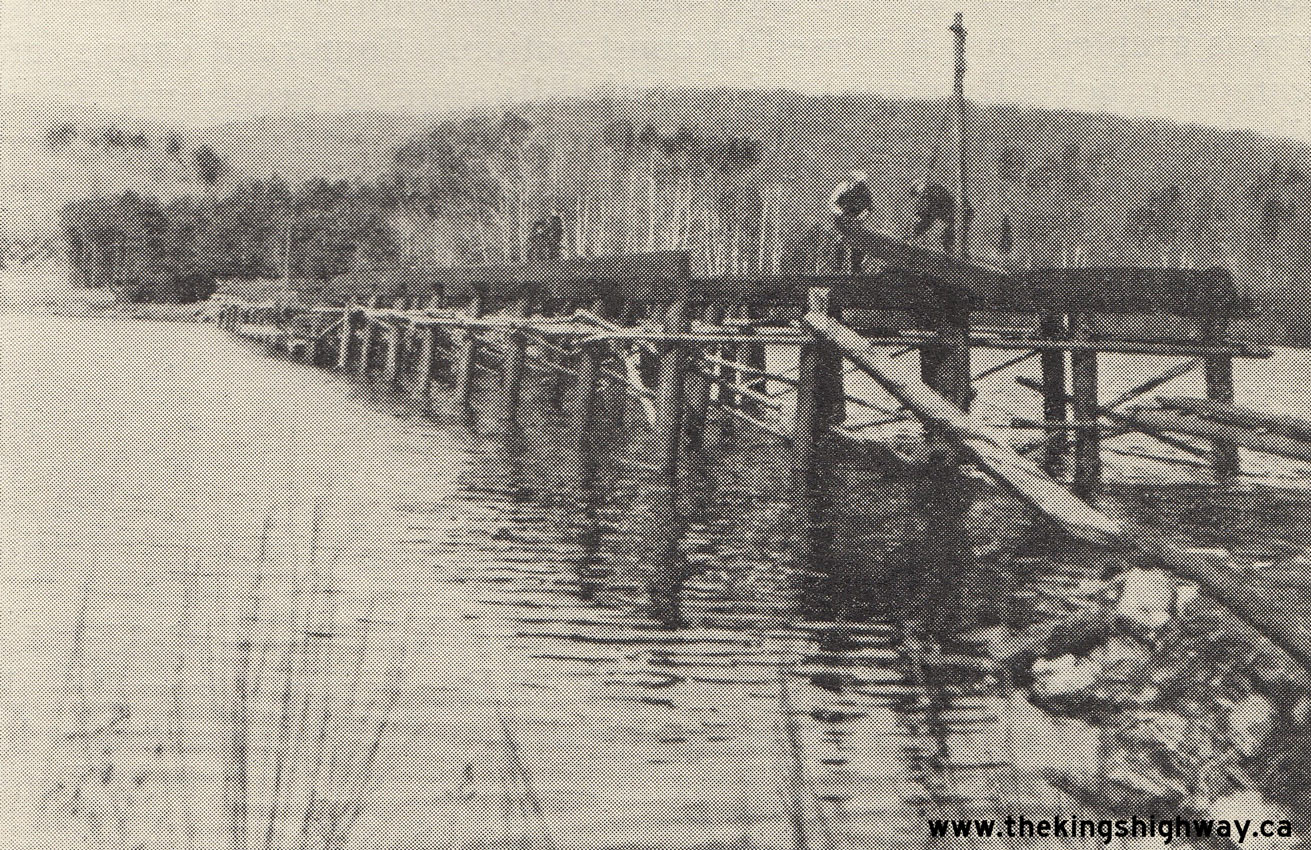 Above - Construction of the Oxtongue Lake Narrows Bridge on the Algonquin Park Road (later known as Hwy 60), located about 7 miles east of Dwight. This timber
bridge was constructed by the Department of Northern Development on the new Algonquin Park Road in 1934-1935. This photo shows a construction crew working on the
partially-completed creosoted timber trestle structure. The bridge carried traffic across the narrows at Oxtongue Lake and into Algonquin Provincial Park to the east
for almost three decades. This structure stood until 1962, when it was replaced by a newer concrete and steel bridge. See an
Enlarged Photo Here. Photo taken in 1934. Above - Construction of the Oxtongue Lake Narrows Bridge on the Algonquin Park Road (later known as Hwy 60), located about 7 miles east of Dwight. This timber
bridge was constructed by the Department of Northern Development on the new Algonquin Park Road in 1934-1935. This photo shows a construction crew working on the
partially-completed creosoted timber trestle structure. The bridge carried traffic across the narrows at Oxtongue Lake and into Algonquin Provincial Park to the east
for almost three decades. This structure stood until 1962, when it was replaced by a newer concrete and steel bridge. See an
Enlarged Photo Here. Photo taken in 1934.(Photo courtesy of Ontario Department of Northern Development - © King's Printer for Ontario, 1934) 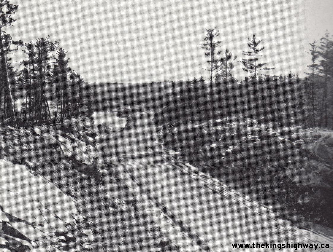
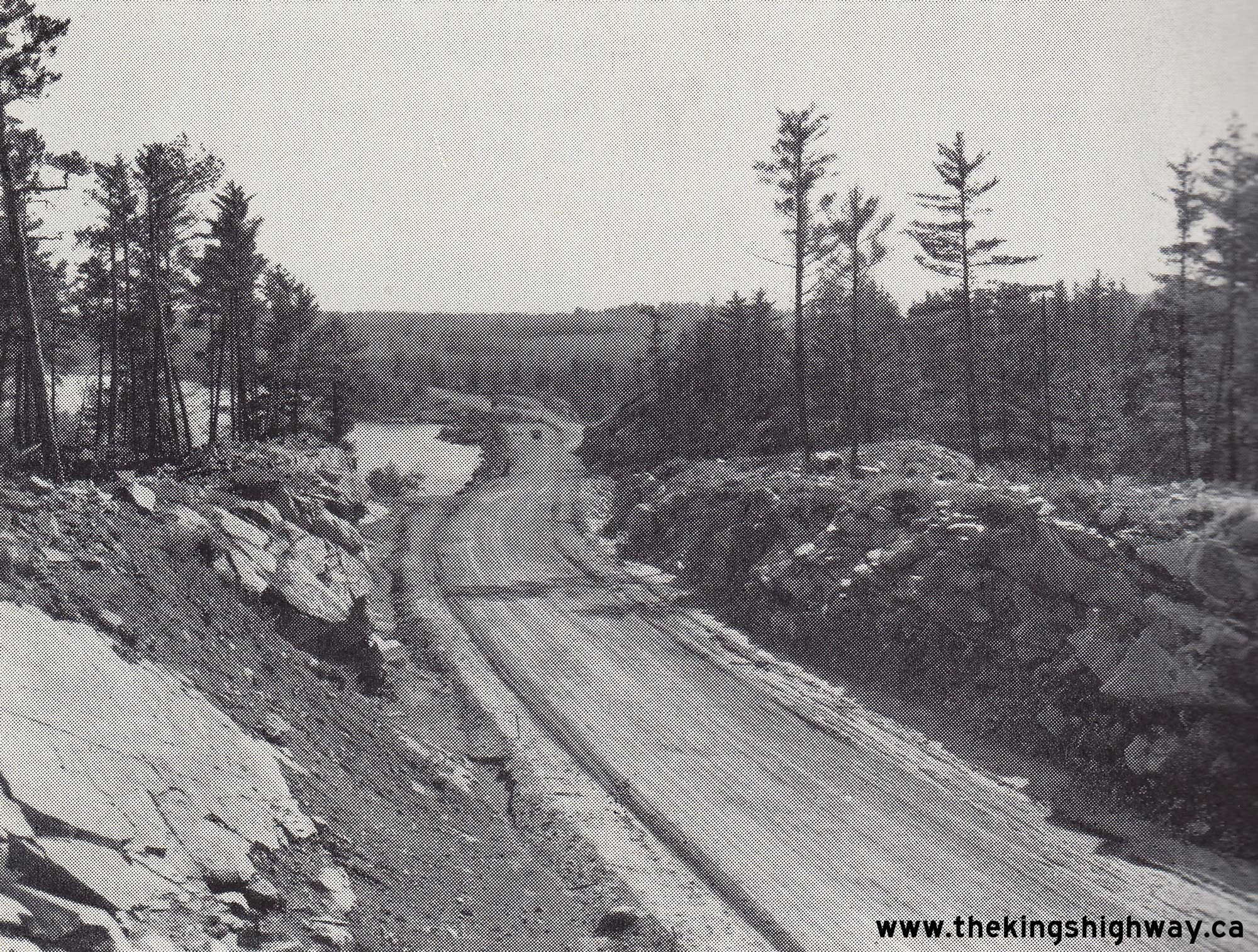
Above - Hwy 60 near Lake of Two Rivers in Algonquin Park, showing completed grading operations. See an
Enlarged Photo Here. Photo taken on August 14, 1939. (Photo courtesy of Ontario Ministry of Transportation - © King's Printer for Ontario, 1939) 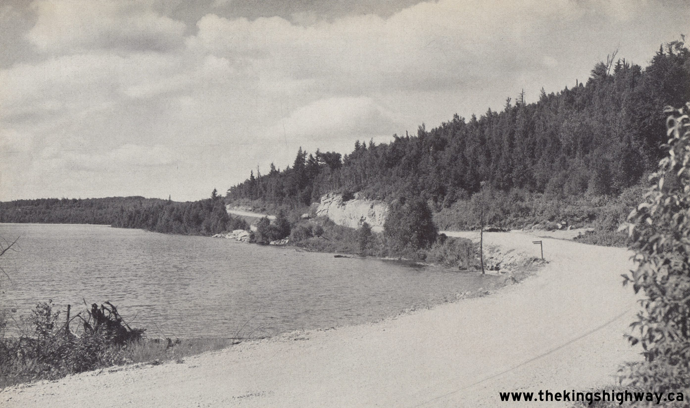
Above - View of a gravel-surfaced Hwy 60 at Cache Lake in Algonquin Park, facing west towards Huntsville. See an
Enlarged Photo Here. Photo taken on August 14, 1939. (Photo courtesy of Ontario Ministry of Transportation - © King's Printer for Ontario, 1939) 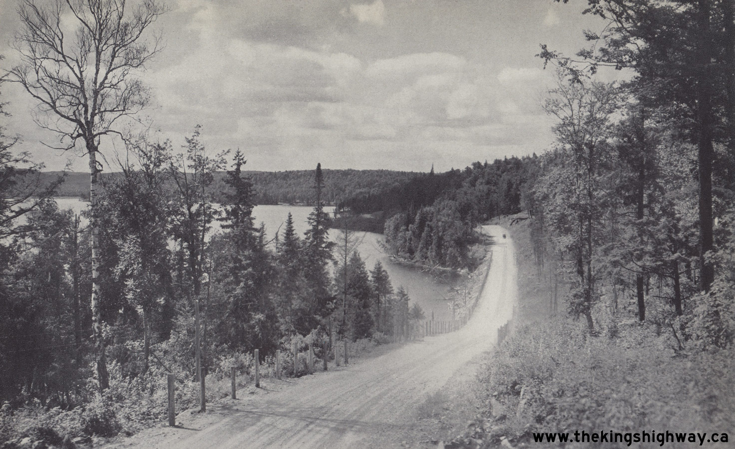

Left - View of Hwy 60 facing west towards Lake of Two Rivers in Algonquin Park in 1939, showing the completed grading and crushed gravel surface. The
Department of Highways of Ontario (DHO) took over responsibility for the Algonquin Park Road in the Fall of 1937, after the former Department of Northern Development
was amalgamated with the DHO to form a single provincial road authority. Prior to 1937, the DHO was not responsible for roads in Northern Ontario. All major roads
lying north of the Severn River were administered by the Department of Northern Development. See an
Enlarged Photo Here. Photo taken on August 14, 1939. (Photo courtesy of Ontario Ministry of Transportation - © King's Printer for Ontario, 1939) Right - Circa 1940 view of a gravel-surfaced Hwy 60 approaching the Oxtongue Lake Narrows Bridge, located about 7 miles east of Dwight. While Hwy 60 was paved between Huntsville and Dwight soon after the DHO assumed responsibility for Hwy 60 in 1937, the section of Hwy 60 between Dwight and Oxtongue Lake remained gravel-surfaced throughout World War II. This section of Hwy 60 was paved with a mulch asphalt surface in 1947, shortly after the conclusion of the war. See an Enlarged Photo Here. Photo taken circa 1940. (Photo from Cameron Bevers' historical photograph collection - Original photographer unknown) 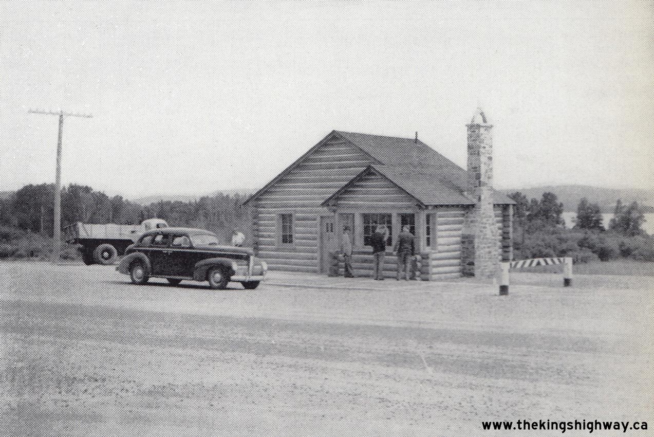
Left - New DHO Truck Weigh Scale at the Hwy 35 & Hwy 60 Junction on Hwy 11 north of Huntsville in 1941. This new truck weigh scale was constructed in 1941.
It was one of several similar facilities built at strategic points along Ontario's King's Highway System in the late 1930s and early 1940s to enforce truck loading
regulations. For many years, this building also housed an Ontario Provincial Police detachment. See an
Enlarged Photo Here. Photo taken in 1941. (Photo courtesy of Ontario Ministry of Transportation - © King's Printer for Ontario, 1941) Right - Completed section of the Bark Lake Diversion between Madawaska and Barry's Bay in 1942. As a result of a large hydro-electric development being
constructed along the Madawaska River in the early 1940s, about 16 miles of Hwy 60 had to be reconstructed on an entirely new alignment on higher ground. The original
1937 route of Hwy 60 closely followed the banks of the Madawaska River and was subsequently flooded below the hydro-electric dam's reservoir (Bark Lake) once this new
diversion of Hwy 60 was completed and opened to traffic. See an Enlarged Photo Here. Photo
taken in 1942.(Photo courtesy of Ontario Ministry of Transportation - © King's Printer for Ontario, 1942) 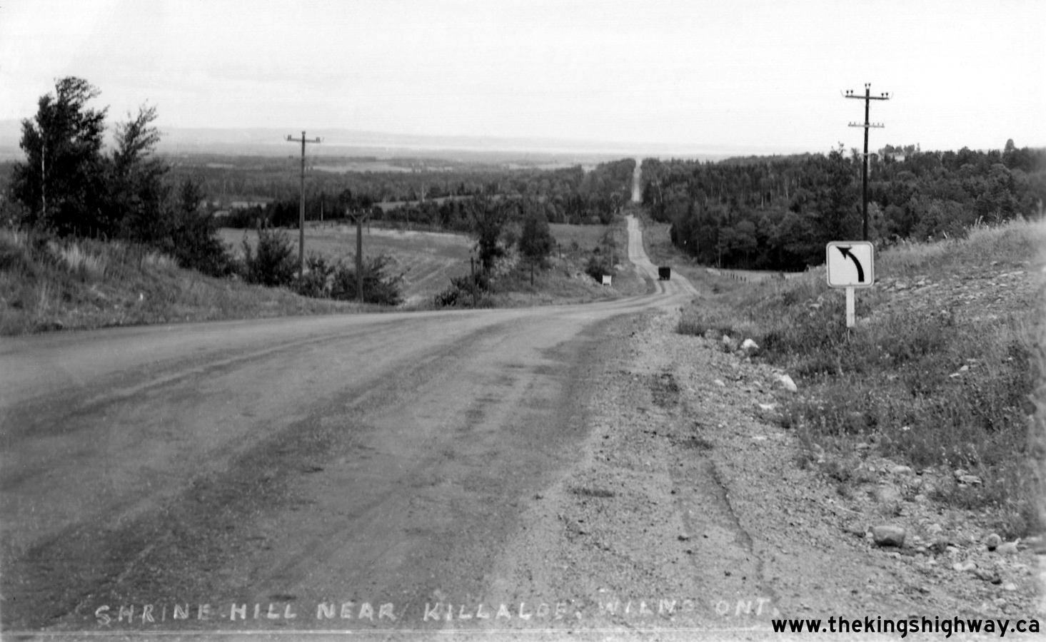
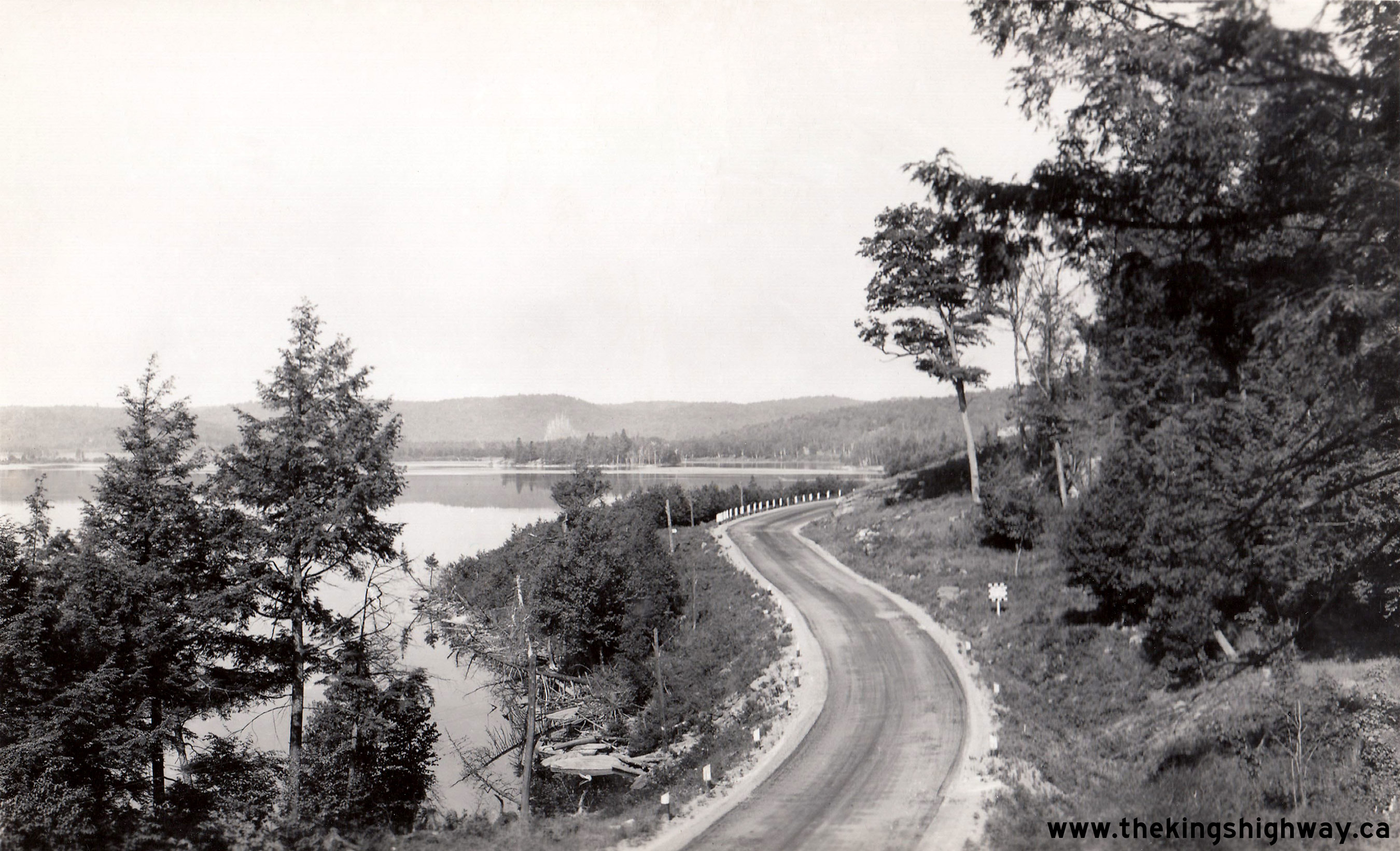
Above - Circa 1945 view of Hwy 60 at Shrine Hill near Wilno, facing east towards Killaloe. See an
Enlarged Photo Here. Photo taken circa 1945. (Photo from Cameron Bevers' historical photograph collection - Original photographer unknown) 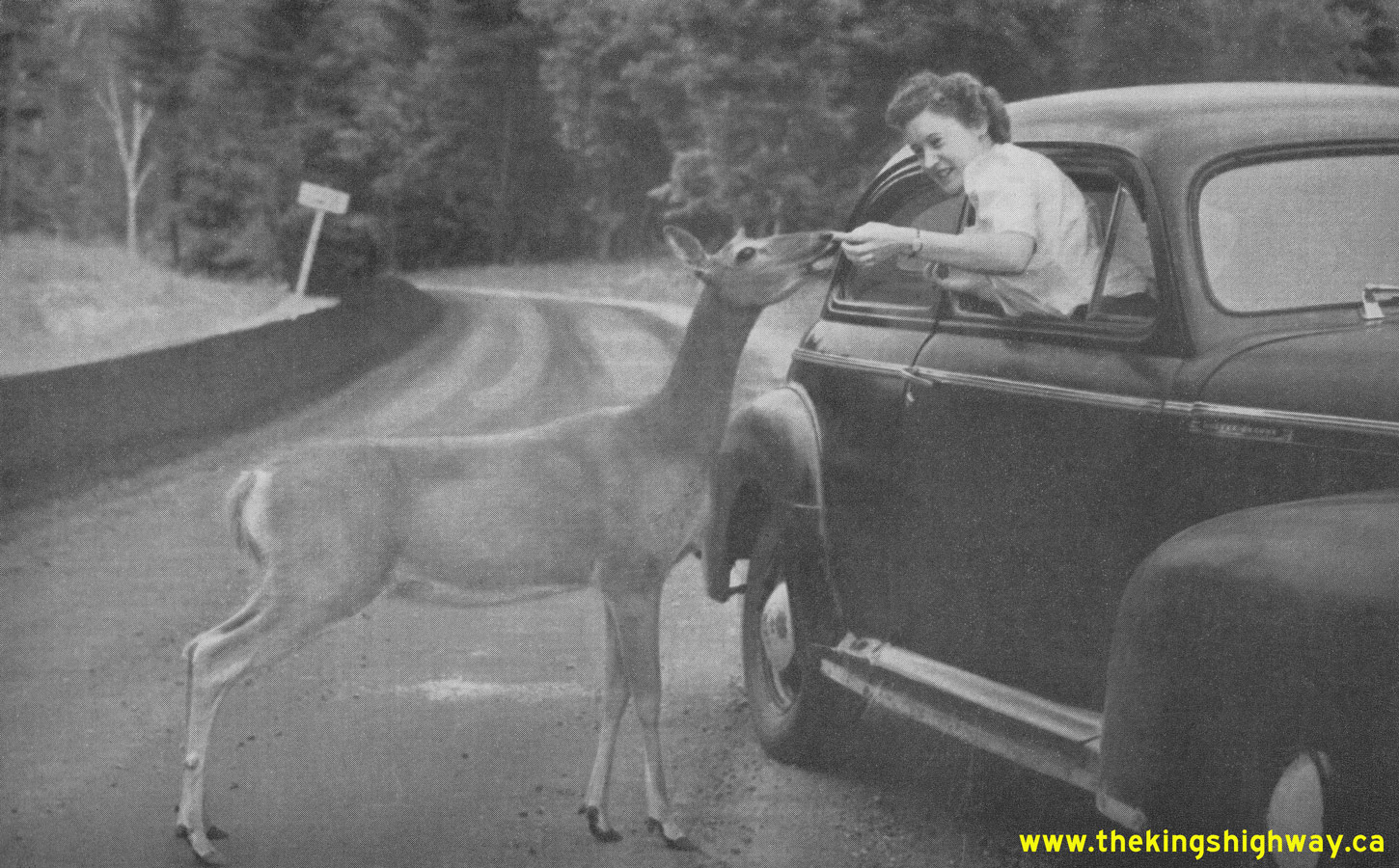
Left - Motorist feeding a deer on Hwy 60 in Algonquin Park. See an
Enlarged Photo Here. Photo taken in 1947. (Photo courtesy of Ontario Ministry of Transportation - © King's Printer for Ontario, 1947) Right - New mulch asphalt pavement along Hwy 60, facing east towards Whitney from Lake of Two Rivers in Algonquin Park. See an Enlarged Photo Here. Photo taken in 1947. (Photo courtesy of Ontario Ministry of Transportation - © King's Printer for Ontario, 1947) 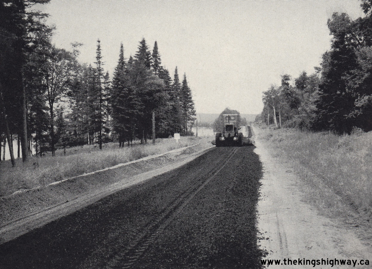
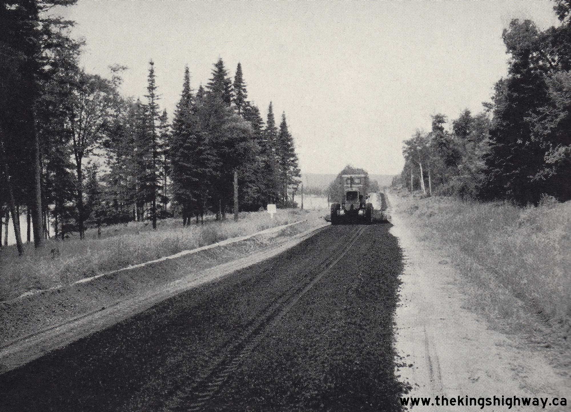
 Left - Grader spreading mulch asphalt along a section of Hwy 60 through Algonquin Park in 1947. That year, a mulch asphalt pavement was laid by crews from
DHO's District #10 (Bancroft District) between Algonquin Park and Barry's Bay. Bancroft's crews laid an astonishing 50 miles of mulch asphalt along Hwy 60 during the
1947 construction season. Although not overly suitable for heavy truck routes, mulch asphalt provided a very simple and economical way of hard-surfacing lower-volume
highways at a time when resources were scarce following World War II. These mulch-surfaced highways had a key advantage in that they could be constructed "in house"
by DHO's own highway maintenance crews, which avoided having to tender a capital construction contract in order to surface the highway. Many King's Highways in
Eastern Ontario and Northern Ontario were surfaced with mulch asphalt until such time that a more permanent hot-mix asphalt pavement structure could be built. See an
Enlarged Photo Here. Photo taken in 1947. Left - Grader spreading mulch asphalt along a section of Hwy 60 through Algonquin Park in 1947. That year, a mulch asphalt pavement was laid by crews from
DHO's District #10 (Bancroft District) between Algonquin Park and Barry's Bay. Bancroft's crews laid an astonishing 50 miles of mulch asphalt along Hwy 60 during the
1947 construction season. Although not overly suitable for heavy truck routes, mulch asphalt provided a very simple and economical way of hard-surfacing lower-volume
highways at a time when resources were scarce following World War II. These mulch-surfaced highways had a key advantage in that they could be constructed "in house"
by DHO's own highway maintenance crews, which avoided having to tender a capital construction contract in order to surface the highway. Many King's Highways in
Eastern Ontario and Northern Ontario were surfaced with mulch asphalt until such time that a more permanent hot-mix asphalt pavement structure could be built. See an
Enlarged Photo Here. Photo taken in 1947.(Photo courtesy of Ontario Ministry of Transportation - © King's Printer for Ontario, 1947) Right - Completed mulch asphalt pavement along Hwy 60 at Norway Lake in Algonquin Park. See an
Enlarged Photo Here. Photo taken on October 14, 1947.(Photo courtesy of Ontario Ministry of Transportation - © King's Printer for Ontario, 1947) 
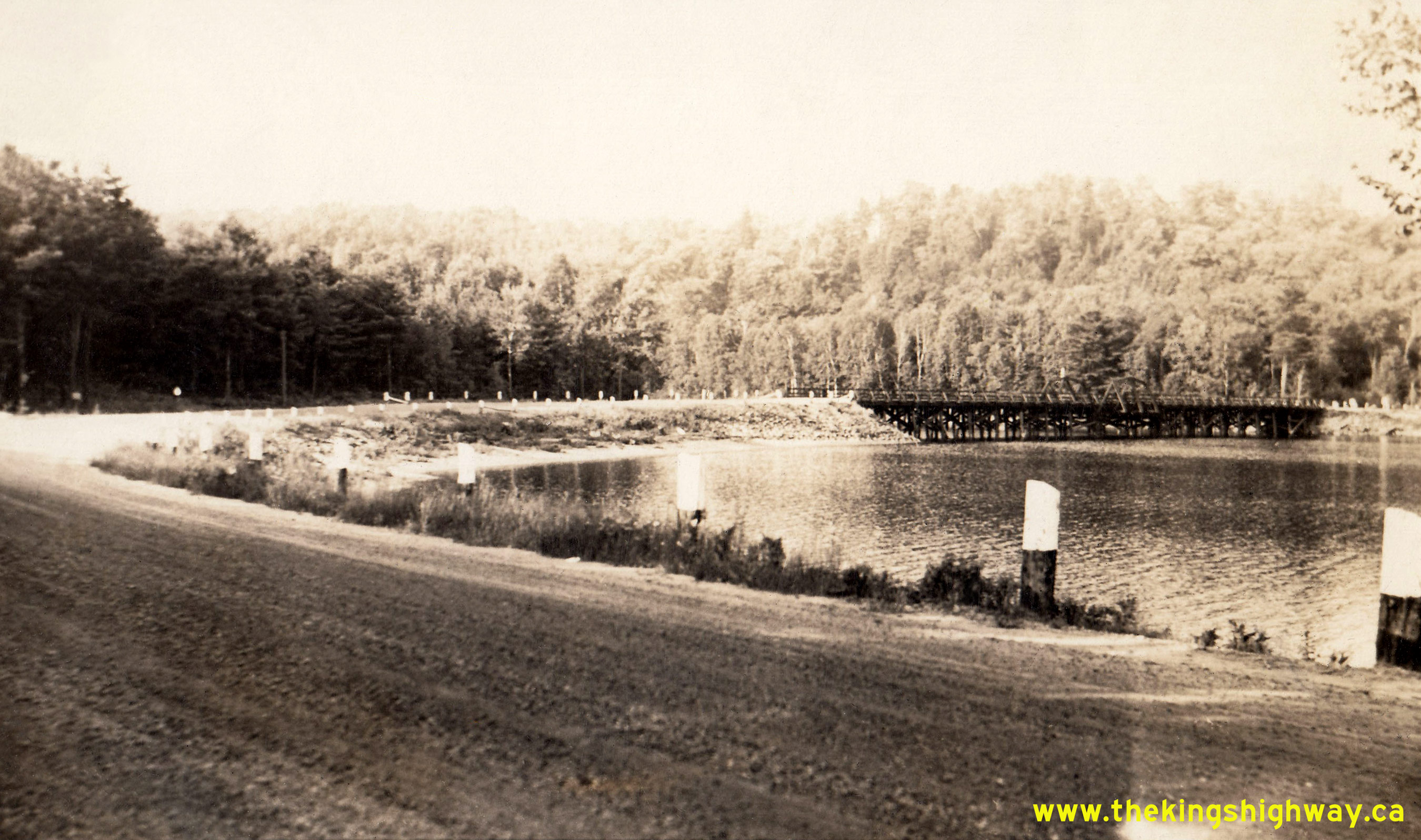
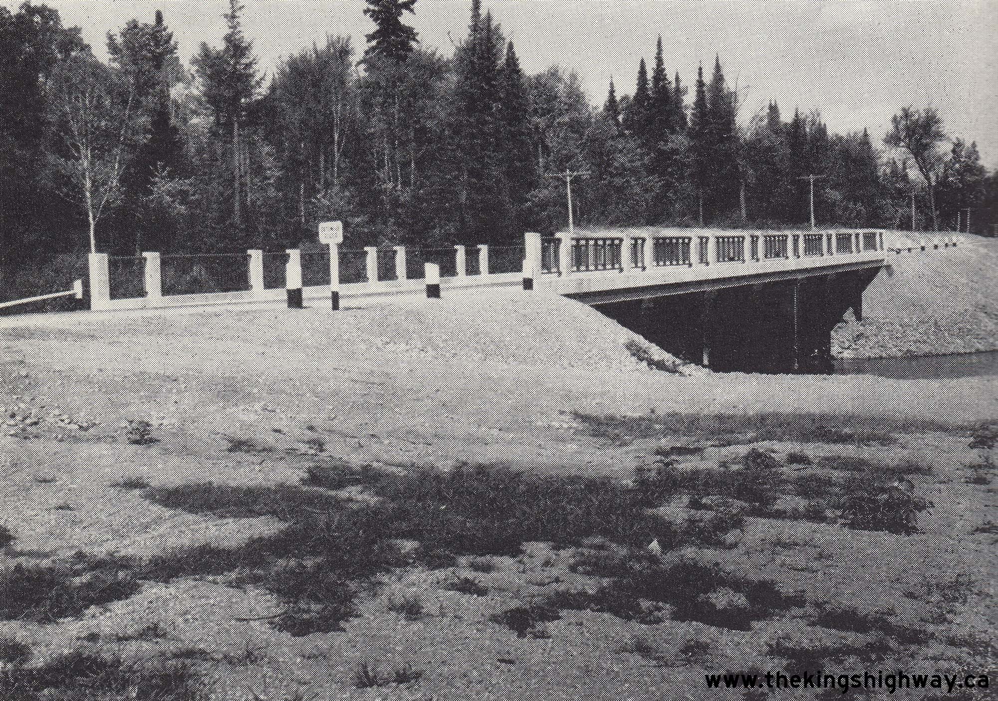
Above - New Oxtongue River Bridge on Hwy 60 located about 8 miles east of Dwight, shown shortly after completion in 1949. This creosoted timber trestle bridge
was constructed under Contract #1948-05. This new structure replaced an older timber trestle bridge built on the Algonquin Park Road in the mid-1930s by the
Department of Northern Development. In order to maintain traffic flow at all times, this bridge had to be built in two halves. During the initial construction phase,
all Hwy 60 traffic used the old bridge while one half of the new bridge was being built. Once the first half of the new bridge was completed, all Hwy 60 traffic was
shifted onto the partially-completed new structure. The old bridge was then demolished and the second half of the new bridge built in its place and then put into
service. See an Enlarged Photo Here. Photo taken on September 4, 1949. (Photo courtesy of Ontario Ministry of Transportation - © King's Printer for Ontario, 1949) 
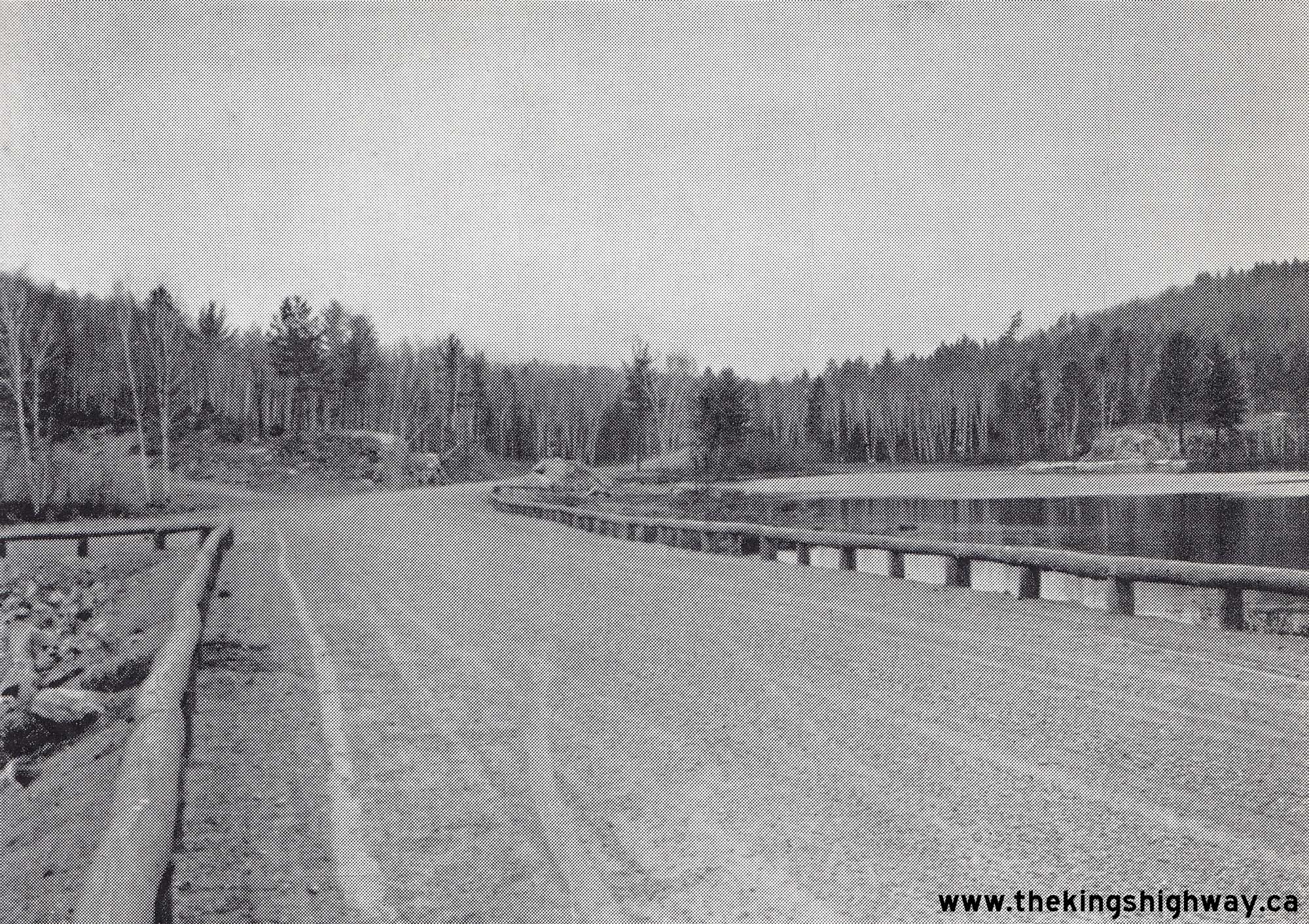
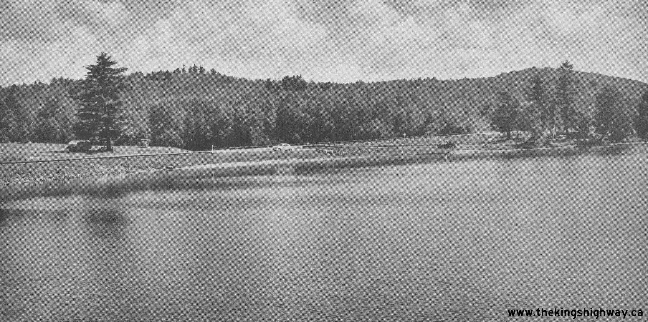
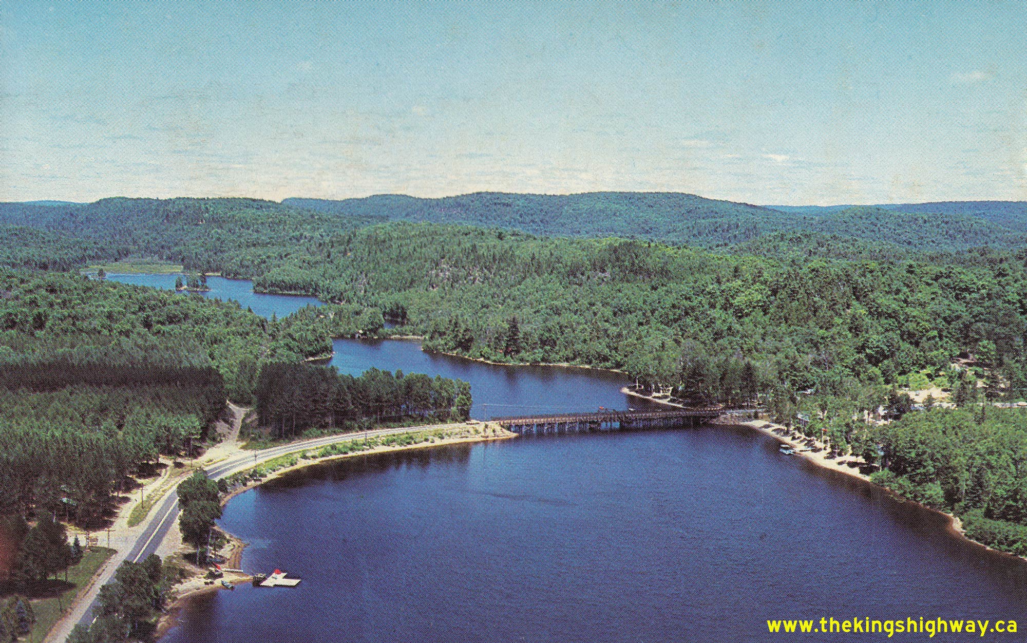
Above - Panoramic view of the DHO Roadside Park at Carson Lake in 1950. This interesting 15-acre park was established in 1941, where Hwy 60 crossed a narrow
isthmus between Carson Lake and Trout Lake about 4 miles west of Barry's Bay. At one time, camping was permitted on both the north and south sides of the highway. In
this photo, the Carson Lake side of the campground is visible on the opposite side of Hwy 60 at left, while the Trout Lake side of the campground can be seen across
the lake at right. In 1957, jurisdiction over the Carson Lake Roadside Park was transferred from the DHO to the Department of Lands and Forests, which designated it
as Carson Lake Provincial Park several years later. See an Enlarged Photo Here. Photo taken on
July 26, 1950. (Photo courtesy of Ontario Ministry of Transportation - © King's Printer for Ontario, 1950) 
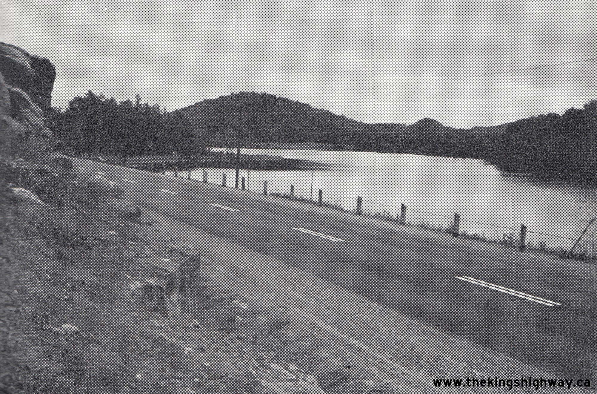
 Left - View of the Trout Lake side of the DHO Roadside Park on Hwy 60 at Carson Lake, located west of Barry's Bay. See an
Enlarged Photo Here. Photo taken on July 26, 1950. Left - View of the Trout Lake side of the DHO Roadside Park on Hwy 60 at Carson Lake, located west of Barry's Bay. See an
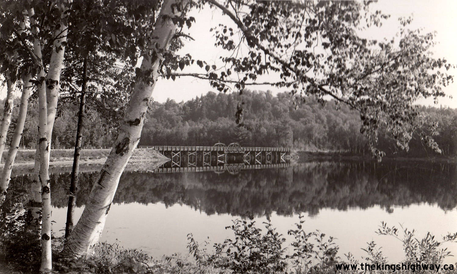
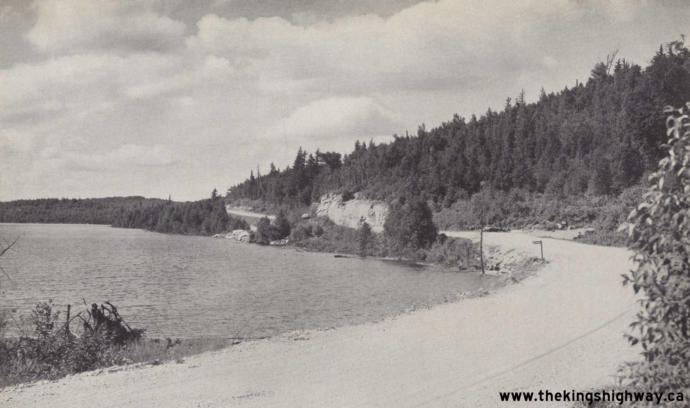
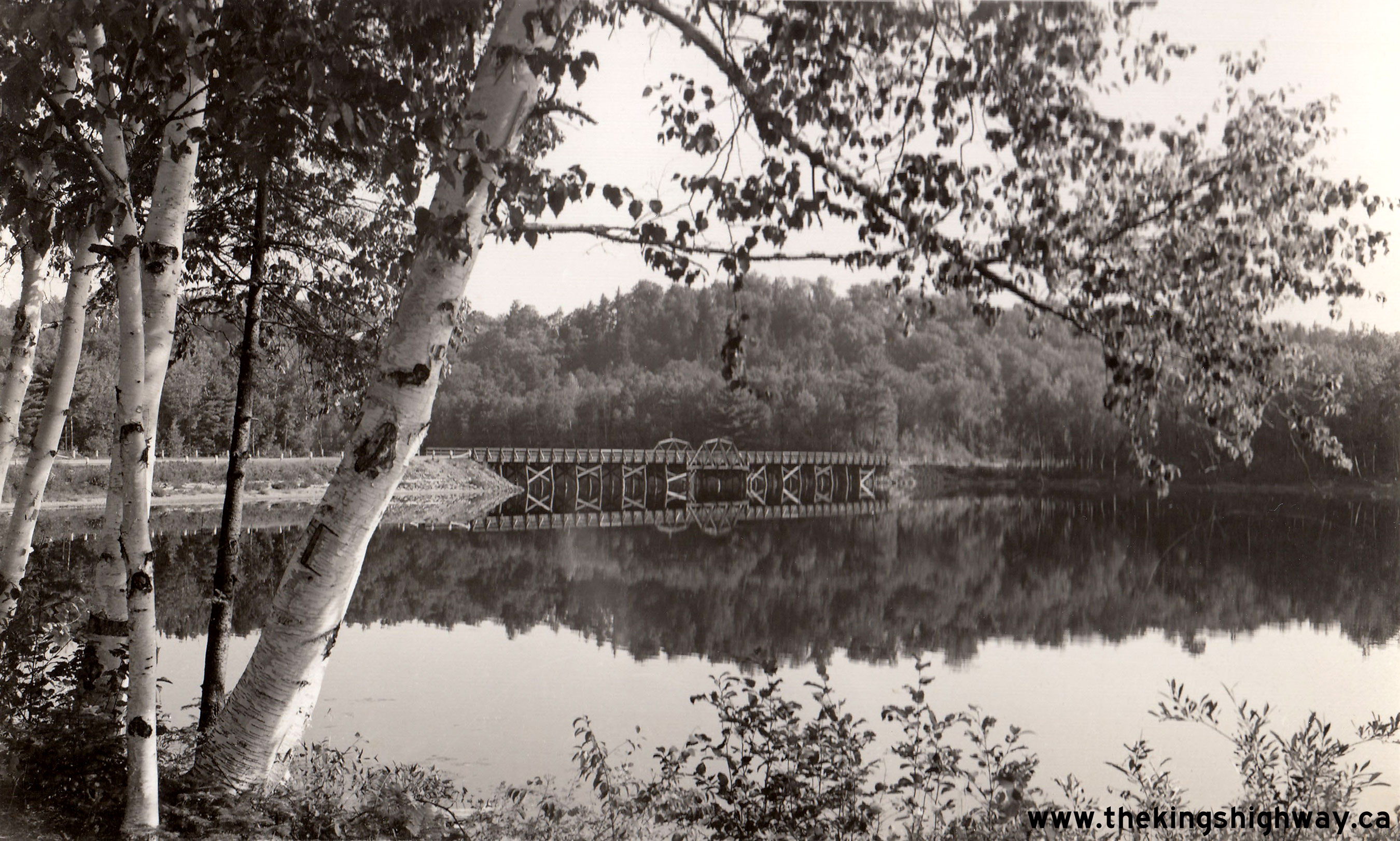
Enlarged Photo Here. Photo taken on July 26, 1950.(Photo courtesy of Ontario Ministry of Transportation - © King's Printer for Ontario, 1950) Right - Circa 1950 postcard view of the timber truss and trestle bridge on Hwy 60 crossing Oxtongue Lake Narrows east of Dwight. This interesting timber structure was completed during the original construction of the Algonquin Park Road in 1935. The bridge consisted of 18 timber beam spans on a series of timber trestle bents and a Howe-type timber truss centre span. It was one of the longest timber bridges ever constructed on the provincial highway system, with a total length of just under 400 feet (120 metres). The original timber bridge across Oxtongue Lake Narrows remained in use up until 1962, when it was replaced by a new steel beam bridge. See an Enlarged Photo Here. Photo taken circa 1950. (Photo courtesy of Annabelle Studio) 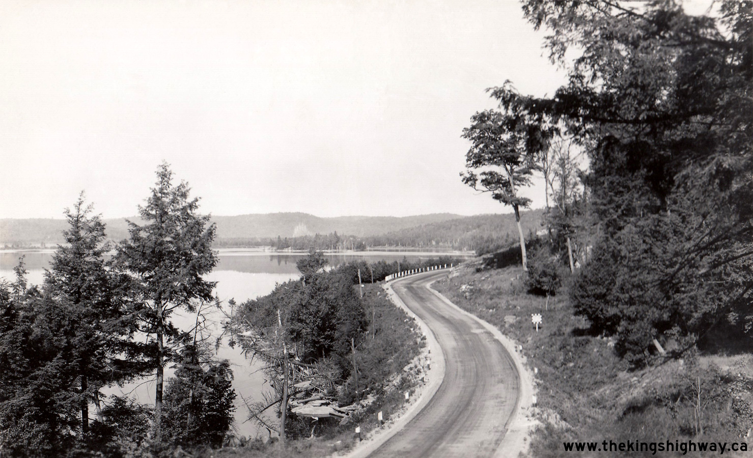
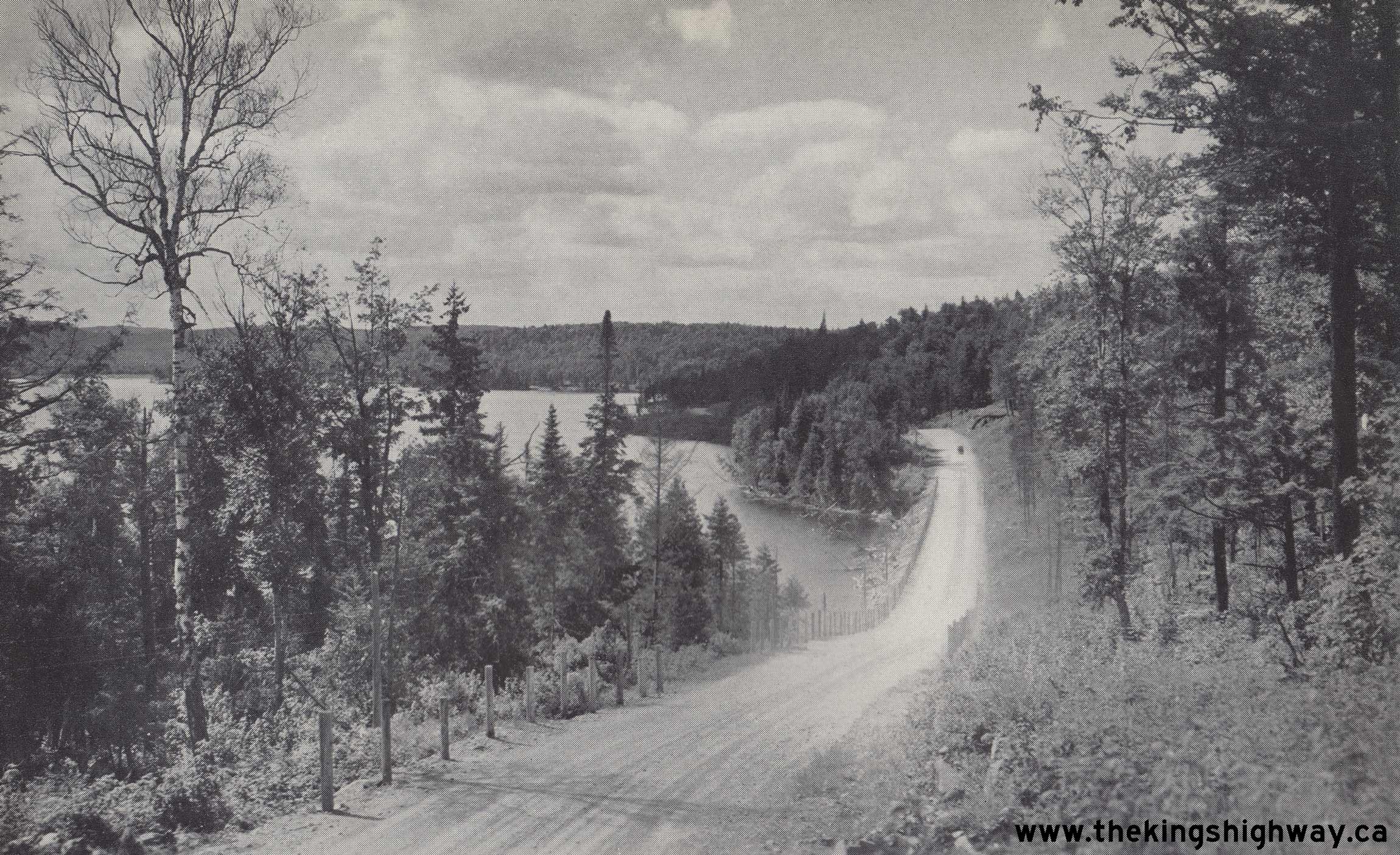
Left - Circa 1950 postcard view of Hwy 60 at Tea Lake in Algonquin Park. This photo shows a recently-surfaced section of the highway. A mulch asphalt surface
was laid along the entire Hwy 60 corridor through Algonquin Park during 1947 and 1948. See an
Enlarged Photo Here. Photo taken circa 1950. (Photo courtesy of Annabelle Studio) Right - Circa 1950 postcard view of the Fairy Lake Scenic Lookout on Hwy 35 & Hwy 60, located about 2 miles east of Huntsville. This small roadside lookout
was constructed in 1946 on the top of a rock outcrop along the north side of the highway overlooking Fairy Lake. The roadside park included picnic tables and litter
disposal barrels for the convenience of motorists using the highway. The scenic lookout closed many years ago and the former site is now occupied by a private
residence. See an Enlarged Photo Here. Photo taken circa 1950.(Photo courtesy of Winger Studio) 
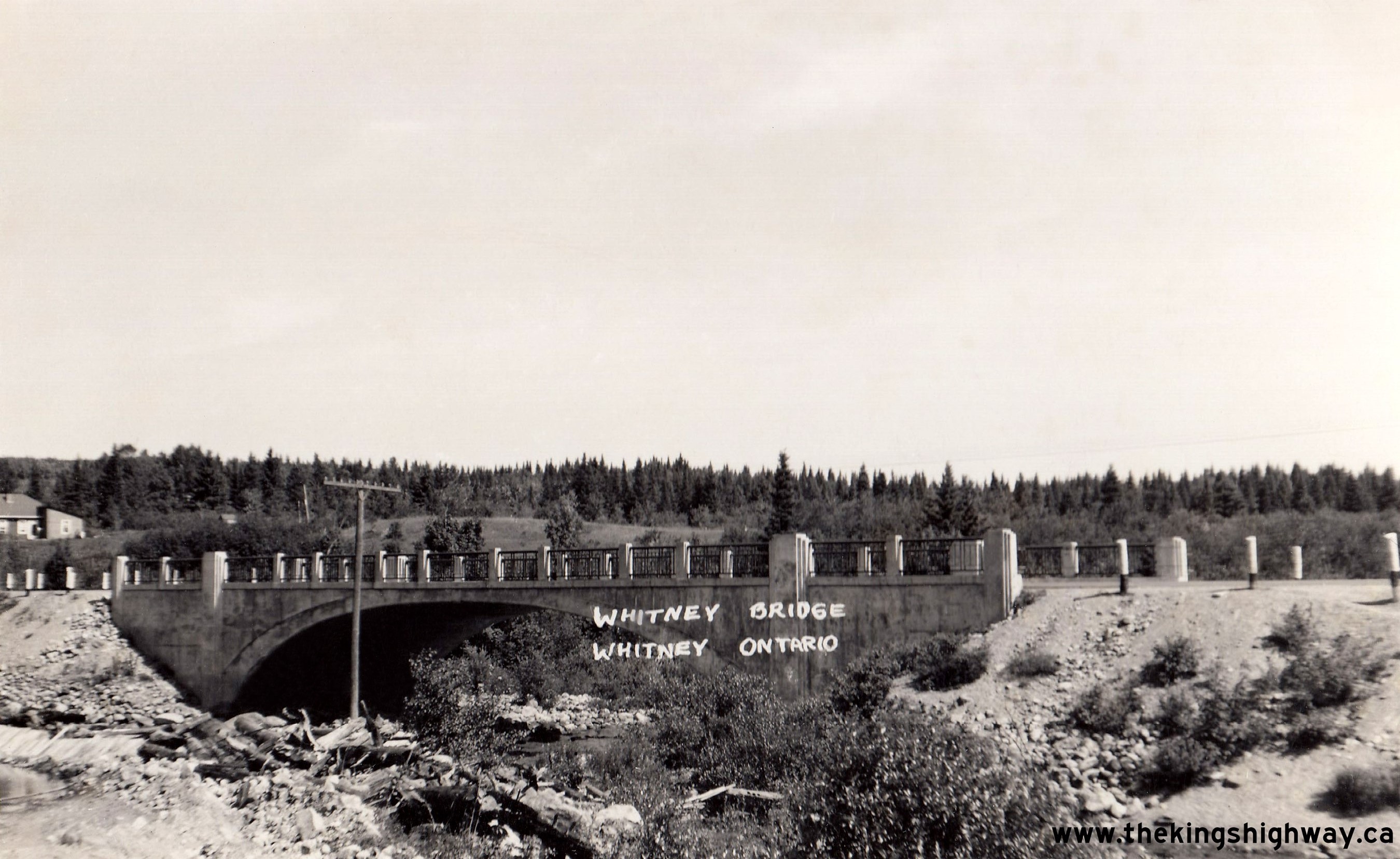
 Left - Circa 1950 view of the Madawaska River Bridge on Hwy 60 in Whitney. This attractive closed-spandrel concrete arch structure was constructed under
Contract #1941-17 and was completed during 1941. This was one of three new bridges built along Hwy 60 east of Algonquin Park during the early 1940s. See an
Enlarged Photo Here. Photo taken circa 1950. Left - Circa 1950 view of the Madawaska River Bridge on Hwy 60 in Whitney. This attractive closed-spandrel concrete arch structure was constructed under
Contract #1941-17 and was completed during 1941. This was one of three new bridges built along Hwy 60 east of Algonquin Park during the early 1940s. See an
Enlarged Photo Here. Photo taken circa 1950.(Photo from Cameron Bevers' historical photograph collection - Original photographer unknown) Right - Circa 1952 postcard view of the Hwy 35 & Hwy 60 Junction on Hwy 11 at the northern entrance to Huntsville, facing north towards North Bay. As
originally constructed in the 1930s, this highway junction was in a directional "Y" intersection configuration, with two separate curved roadways uniting Hwy 35 &
Hwy 60 together with Hwy 11. At one time, Hwy 35 and Hwy 60 both reached their western terminus in Huntsville. The overlapped route of Hwy 35 & Hwy 60 between
Huntsville and Dwight was discontinued in 1966, after which time the route became known as Hwy 60 only. This highway junction, located at today's King William Street
(Muskoka Road 3) and Hwy 60, was bypassed in the late 1950s when Hwy 11 was relocated out onto a new bypass route across Vernon Lake Narrows. This photo also shows an
interesting overlap of old "totem pole" fingerboard directional sign assemblies which were used up until the late 1940s and the new large enhanced guide signs with
selected key destinations painted in much larger letter sizes for improved visibility. It was common practice in the 1950s to install additional King's Highway route
markers directly above the reassurance destination signs beyond major highway junctions, so that motorists could easily confirm that they were on the correct highway.
Careful observers may also note that the northbound destination guide sign beyond the highway junction lists Sudbury as a control city, along with North Bay and
Cochrane. Prior to the completion of the Trans-Canada Highway at the French River in 1953, Hwy 69 came to a dead-end about 50 miles north of Parry Sound. There was no
direct highway link between Parry Sound and Sudbury until that time. Accordingly, all traffic from Southern Ontario bound for Sudbury had to access the city on Hwy 11
via Huntsville and Hwy 17 via North Bay and Sturgeon Falls. See an Enlarged Photo Here. Photo
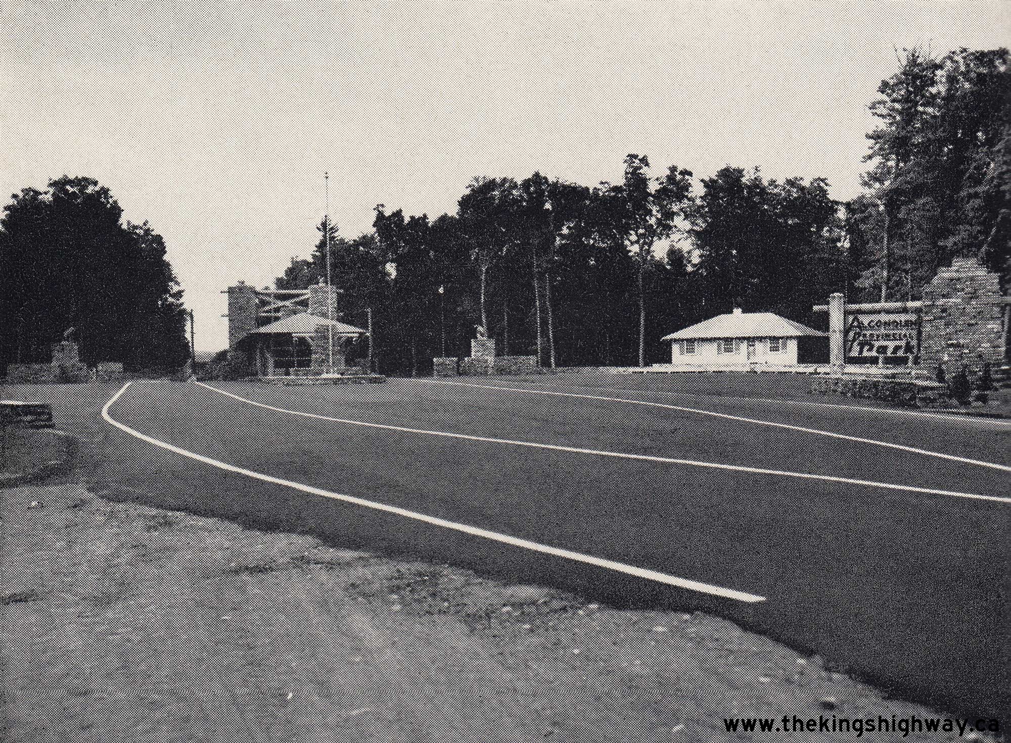
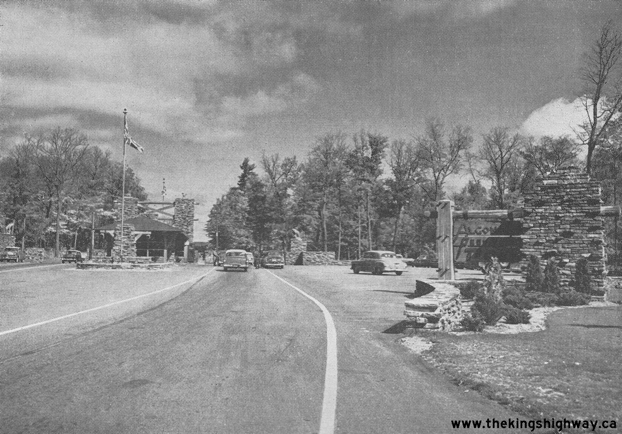
taken circa 1952.(Photo courtesy of Annabelle Studio) 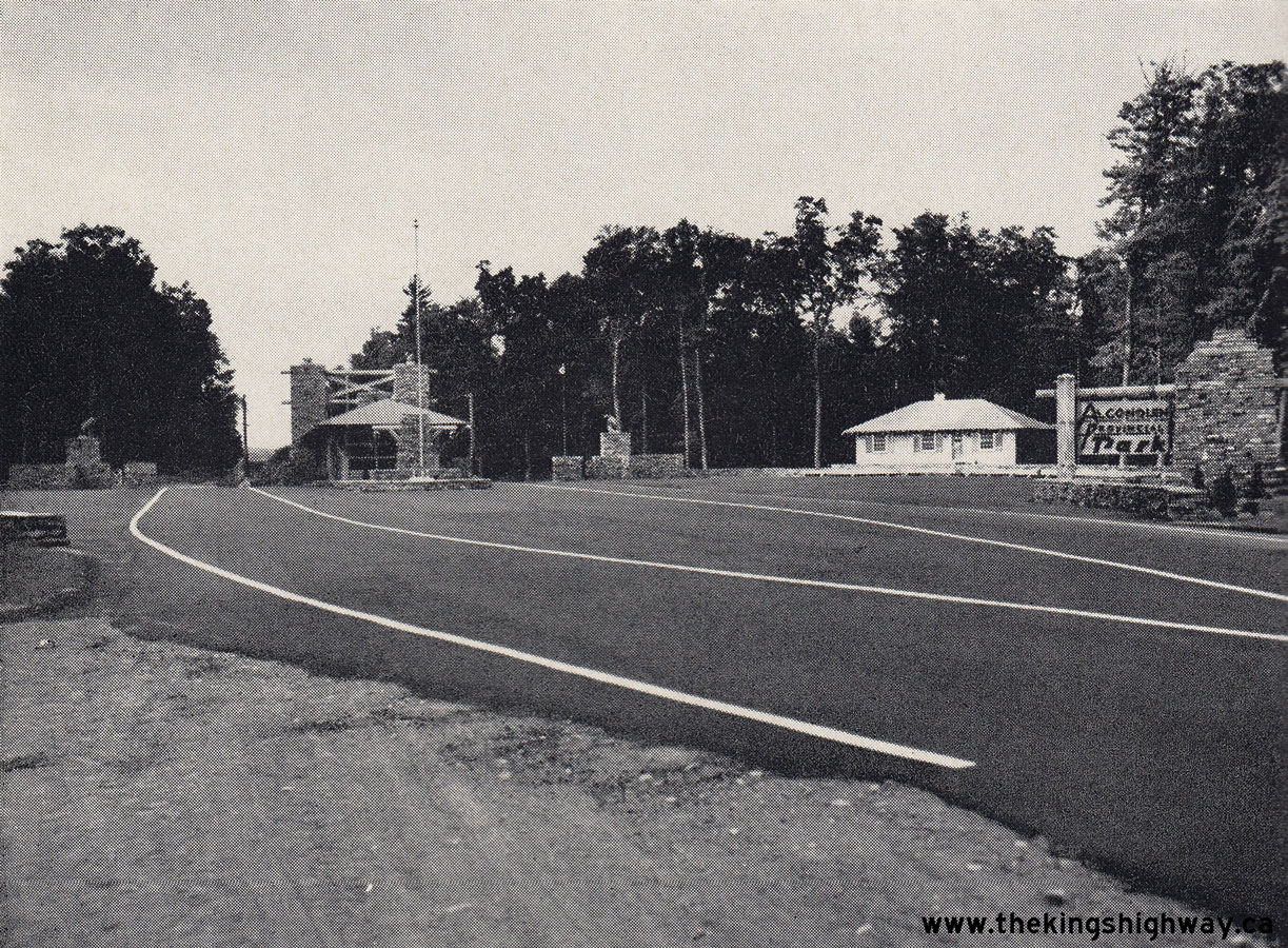 Above - New western entrance and gatehouse to Algonquin Park on Hwy 60 in 1952. The new Algonquin Park West Gate was constructed as a joint project built in
collaboration between the Department of Public Works and the DHO between 1950 and 1952. See an
Enlarged Photo Here. Photo taken on August 29, 1952. Above - New western entrance and gatehouse to Algonquin Park on Hwy 60 in 1952. The new Algonquin Park West Gate was constructed as a joint project built in
collaboration between the Department of Public Works and the DHO between 1950 and 1952. See an
Enlarged Photo Here. Photo taken on August 29, 1952.(Photo courtesy of Ontario Ministry of Transportation - © King's Printer for Ontario, 1952) 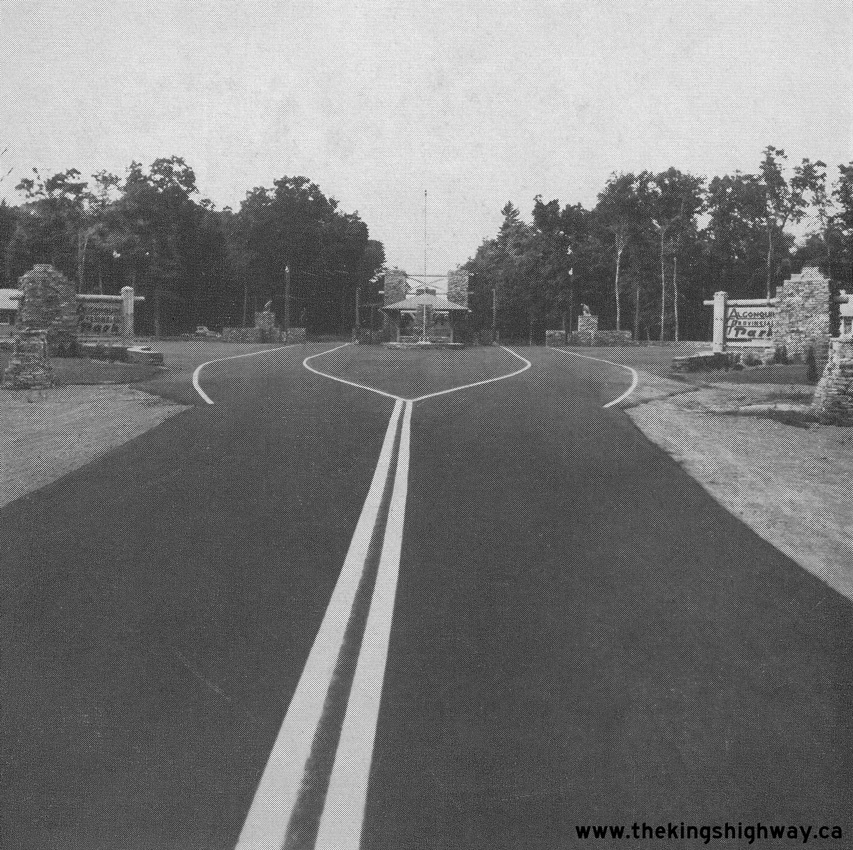
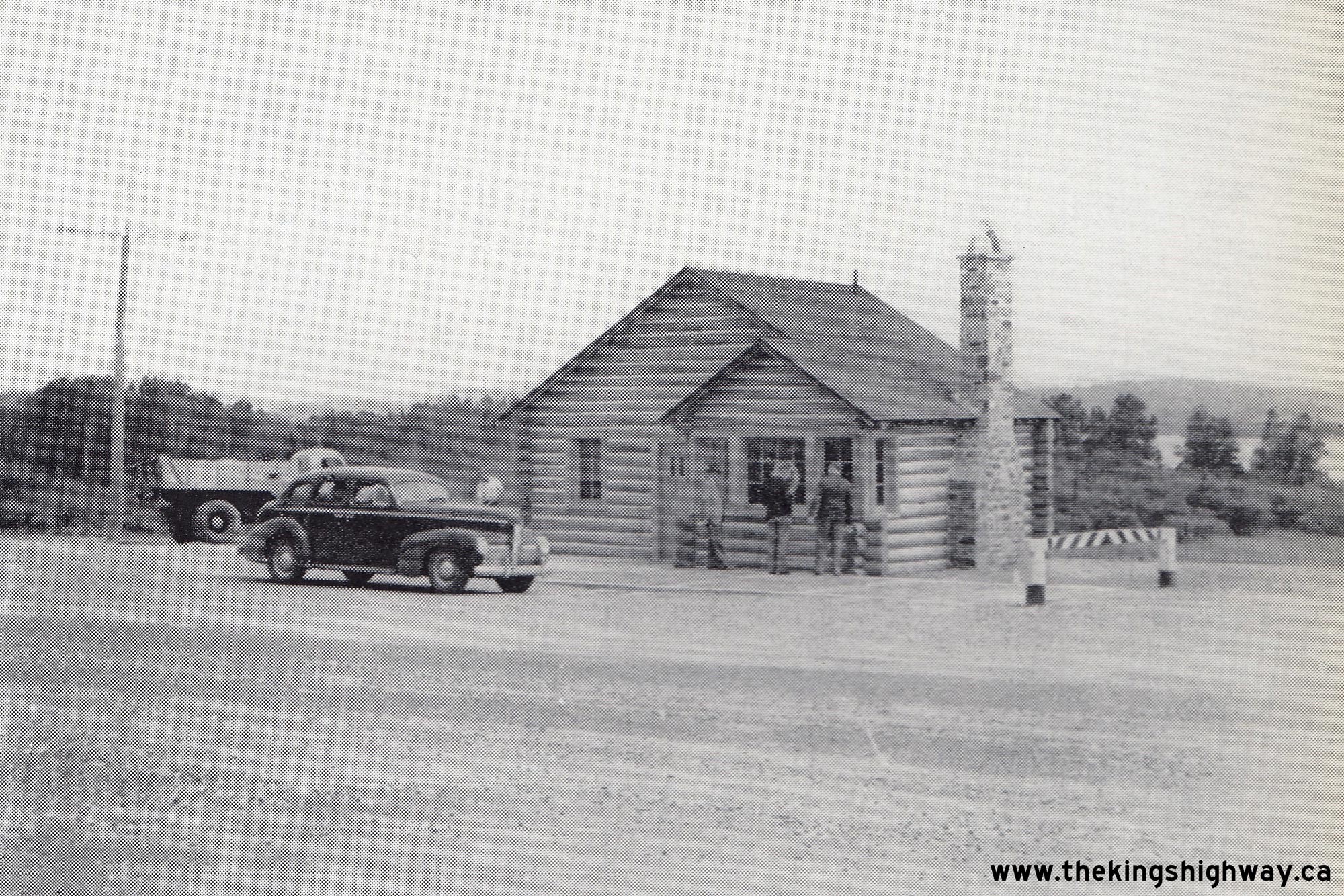
Above - View of the new Algonquin Park West Gate on Hwy 60 east of Dwight after completion in 1952. Until recent decades, all traffic on Hwy 60 had to pass
directly through the West Gate. A diversion was constructed around the West Gate in the mid-1990s to better accommodate through traffic on Hwy 60. This was done to
relieve recurring traffic congestion on the western approach to the gatehouse, where previously, all vehicles had to stop. No permit fees are collected from motorists
who merely plan to traverse the park via Hwy 60 and not make use of any of the park's amenities. Those who wish to explore the park beyond the Hwy 60 corridor must
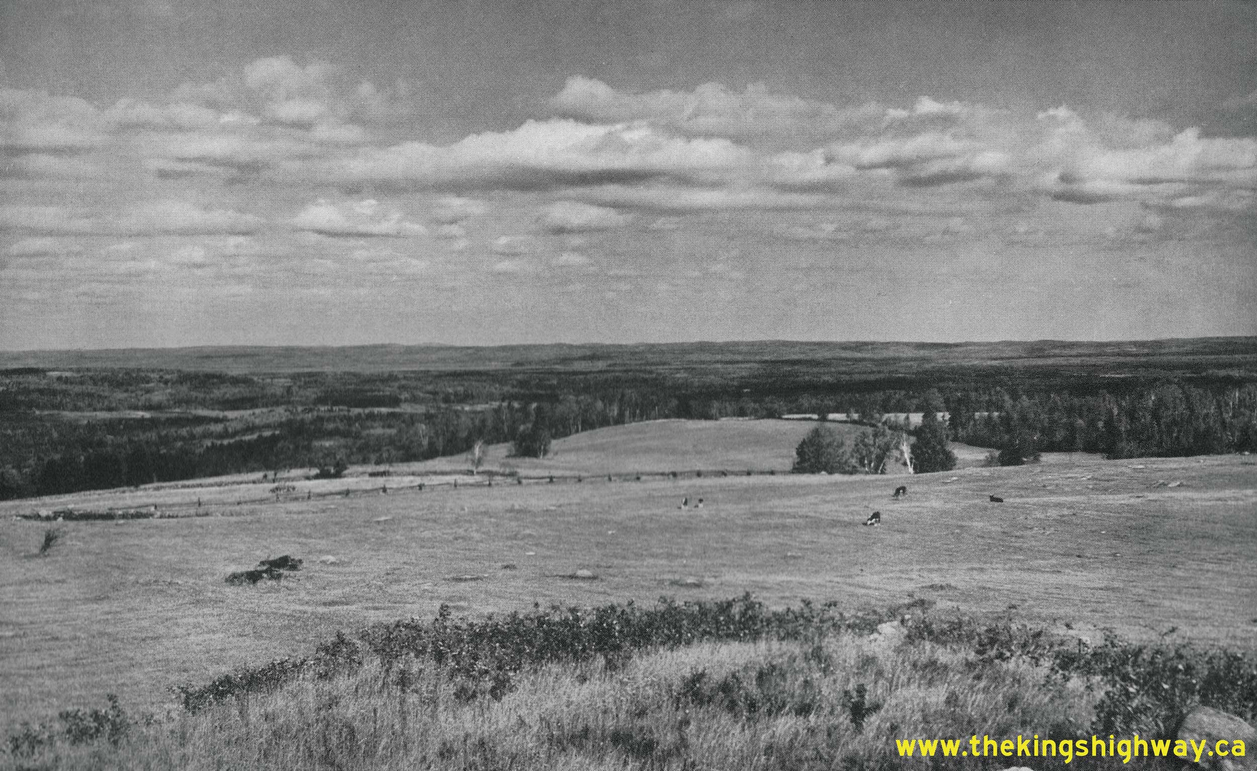
stop and obtain a park permit. See an Enlarged Photo Here. Photo taken on August 29, 1952. (Photo courtesy of Ontario Ministry of Transportation - © King's Printer for Ontario, 1952) 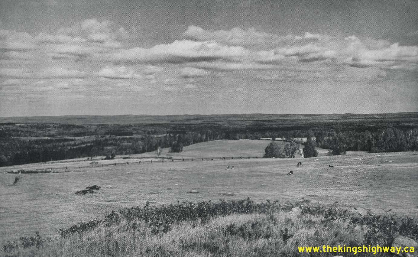 Above - Panoramic view from the DHO's Shrine Hill Lookout on Hwy 60 east of Wilno, facing north towards Round Lake. See an
Enlarged Photo Here. Photo taken on October 7, 1953. Above - Panoramic view from the DHO's Shrine Hill Lookout on Hwy 60 east of Wilno, facing north towards Round Lake. See an
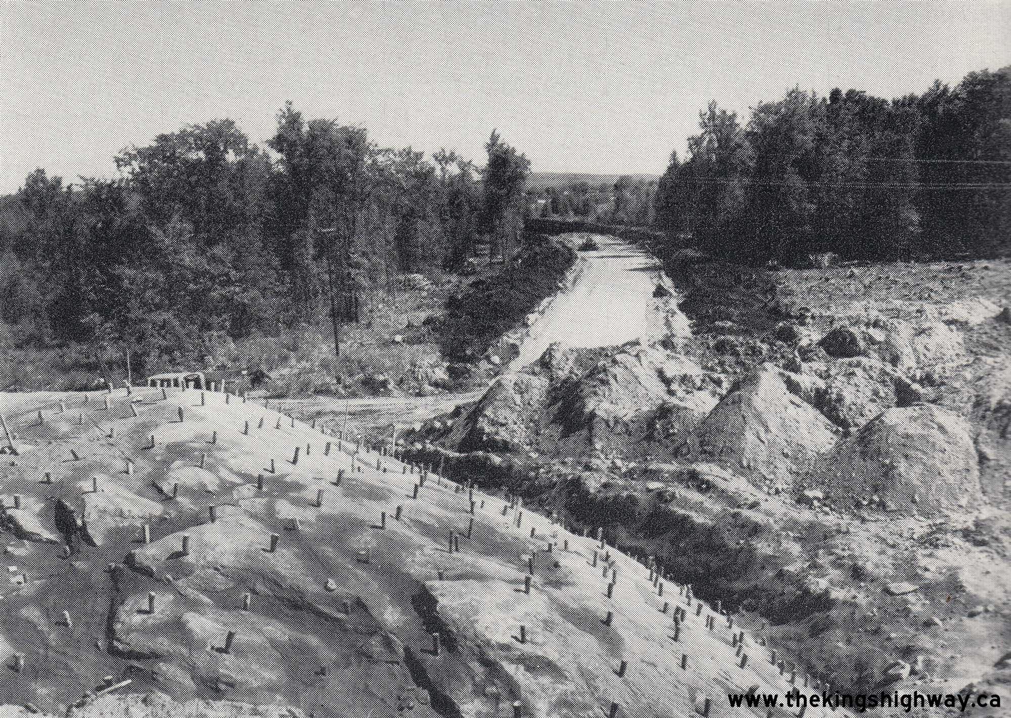
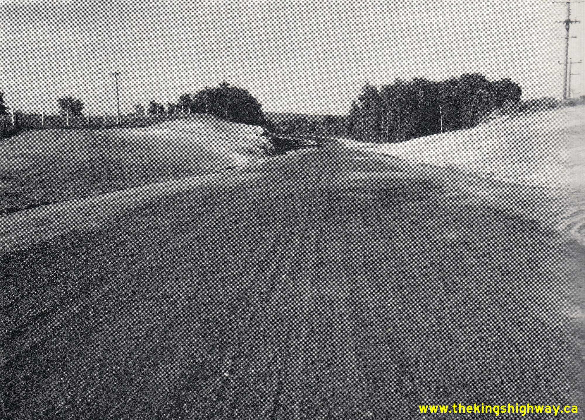
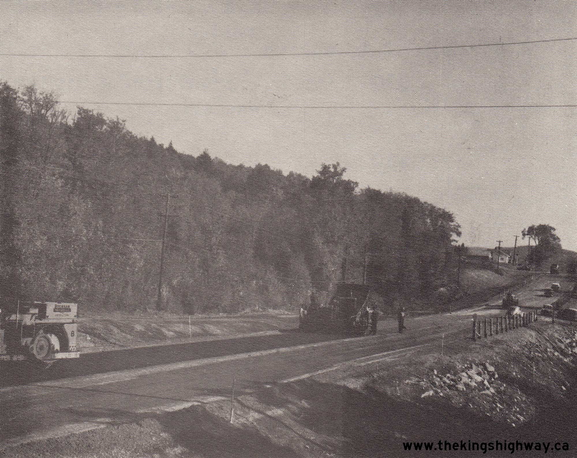
Enlarged Photo Here. Photo taken on October 7, 1953.(Photo courtesy of Ontario Ministry of Transportation - © King's Printer for Ontario, 1953) 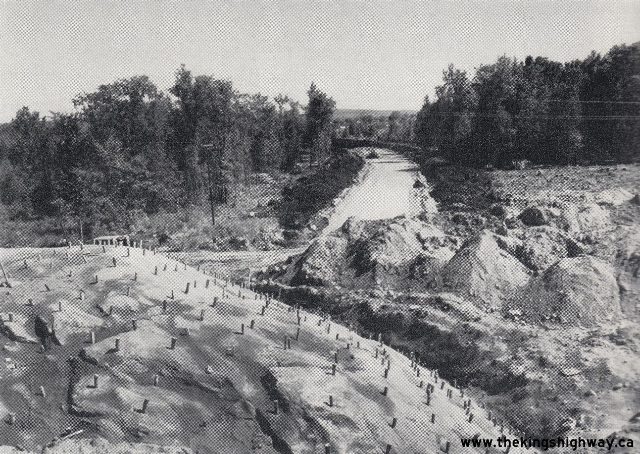 Above - Preparation for rock blasting on the new Killaloe Bypass (Hwy 60) facing east from Sta. 358+75, Contract #1954-77. Several miles of Hwy 60's original
1937 route were bypassed as a result of the new highway's construction through the Killaloe area in the mid-1950s. See an
Enlarged Photo Here. Photo taken on August 25, 1954. Above - Preparation for rock blasting on the new Killaloe Bypass (Hwy 60) facing east from Sta. 358+75, Contract #1954-77. Several miles of Hwy 60's original
1937 route were bypassed as a result of the new highway's construction through the Killaloe area in the mid-1950s. See an
Enlarged Photo Here. Photo taken on August 25, 1954.(Photo courtesy of Ontario Ministry of Transportation - © King's Printer for Ontario, 1954) 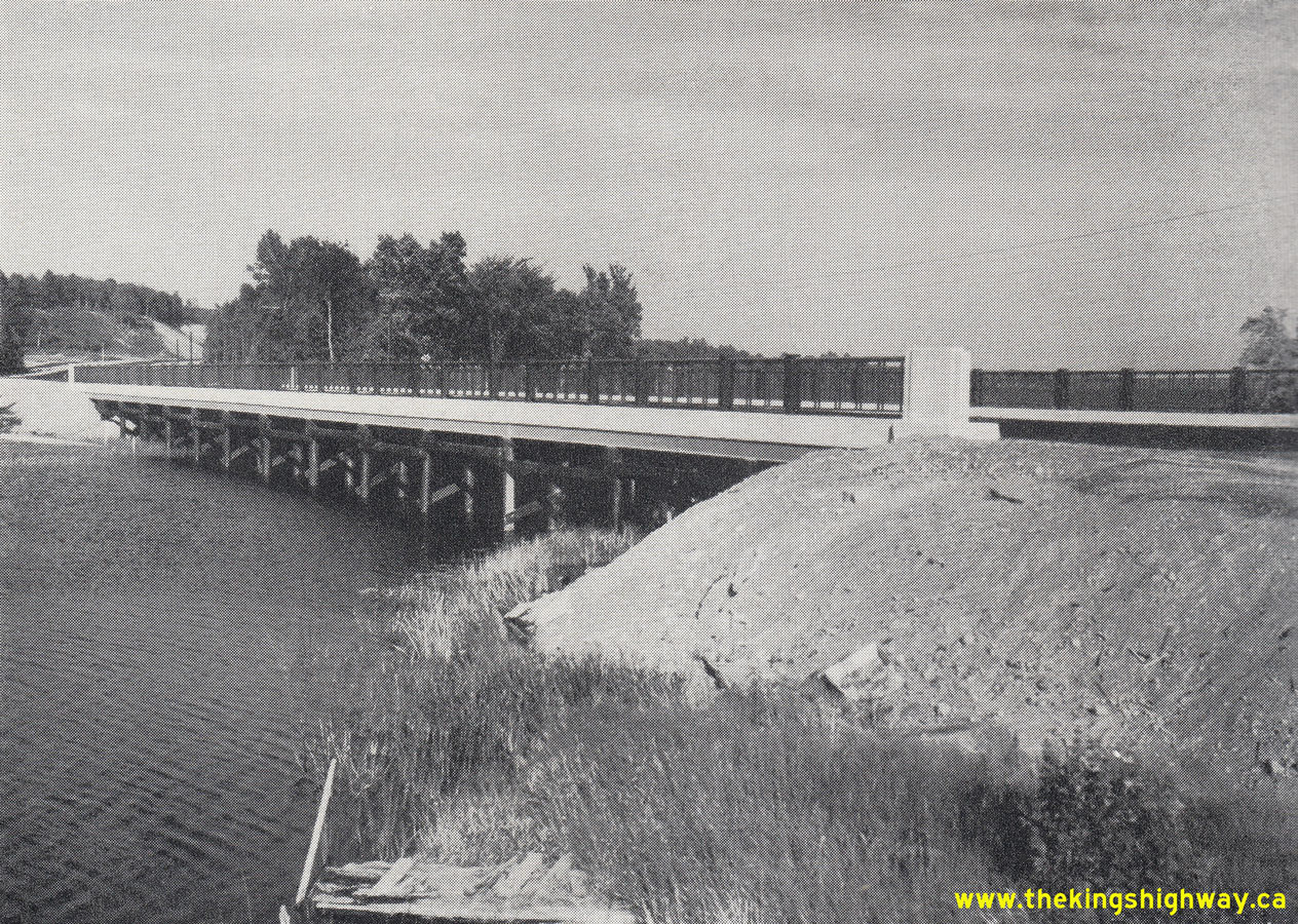
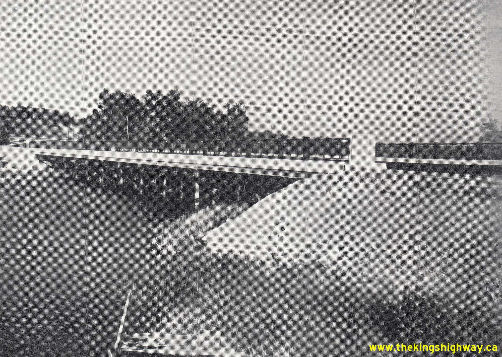
 Left - Completed Bonnechere River Bridge on Hwy 60 at Deacon, Contract #1954-145. See an
Enlarged Photo Here. Photo taken on July 14, 1955. Left - Completed Bonnechere River Bridge on Hwy 60 at Deacon, Contract #1954-145. See an
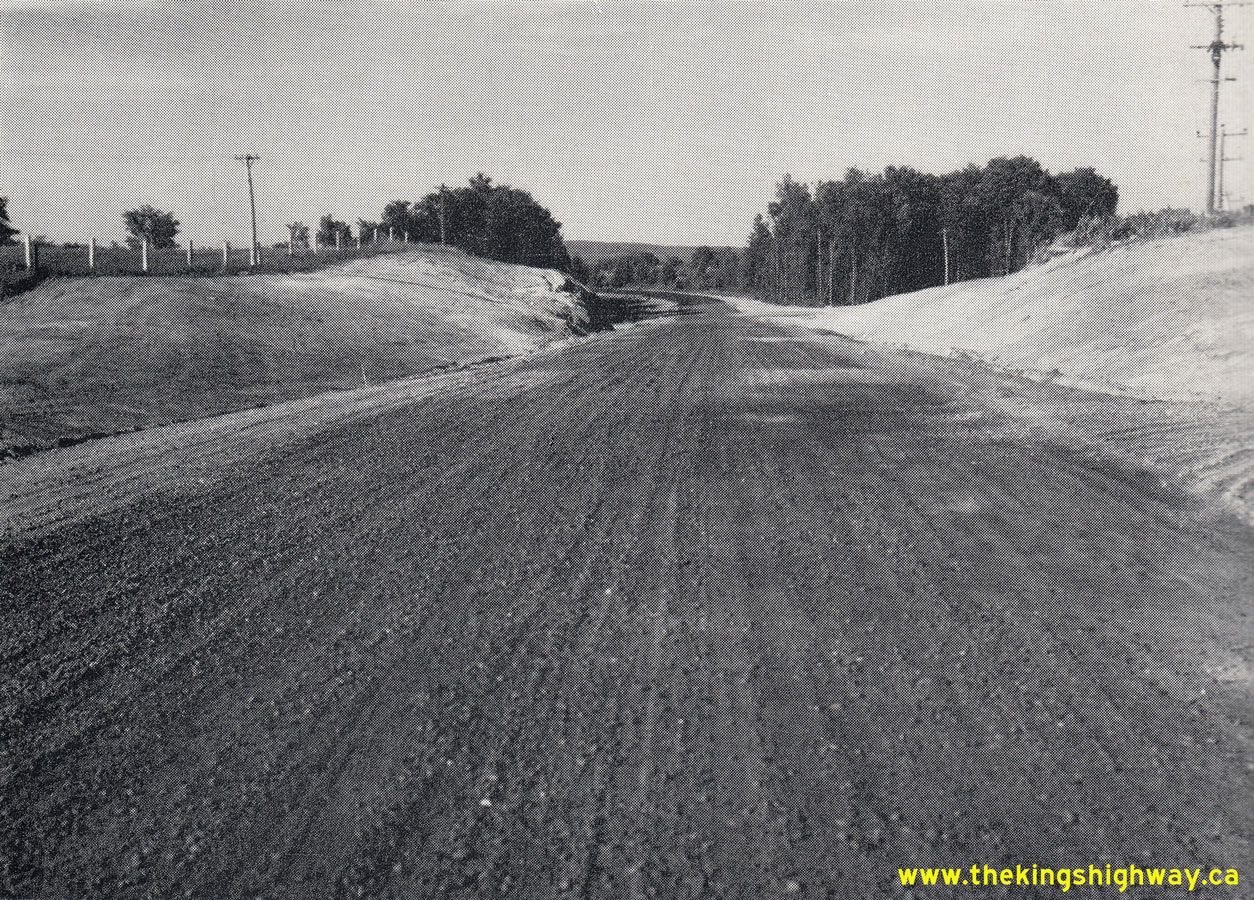
Enlarged Photo Here. Photo taken on July 14, 1955.(Photo courtesy of Ontario Ministry of Transportation - © King's Printer for Ontario, 1955) Right - Killaloe Bypass (Hwy 60) showing completed grading prior to final paving, Contract #1954-77. See an
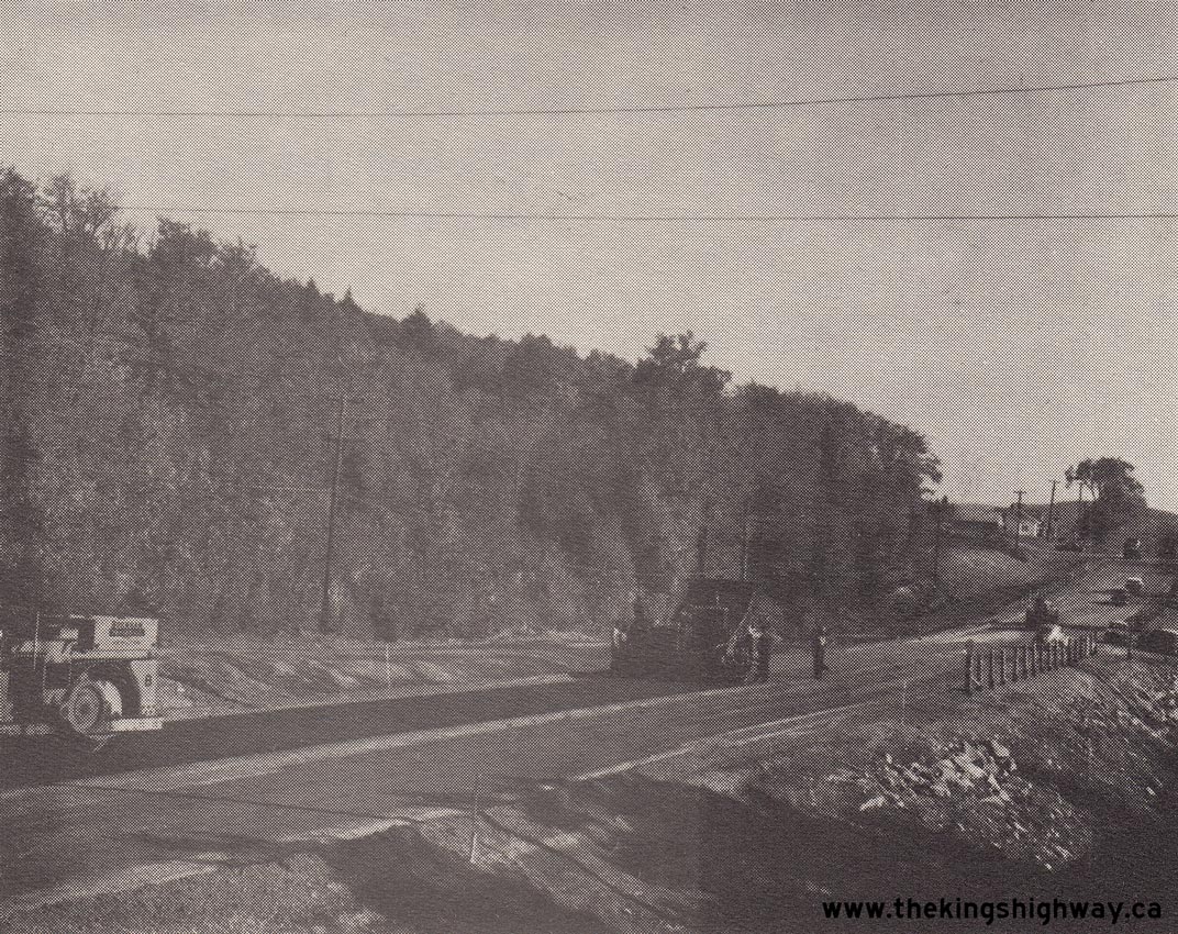
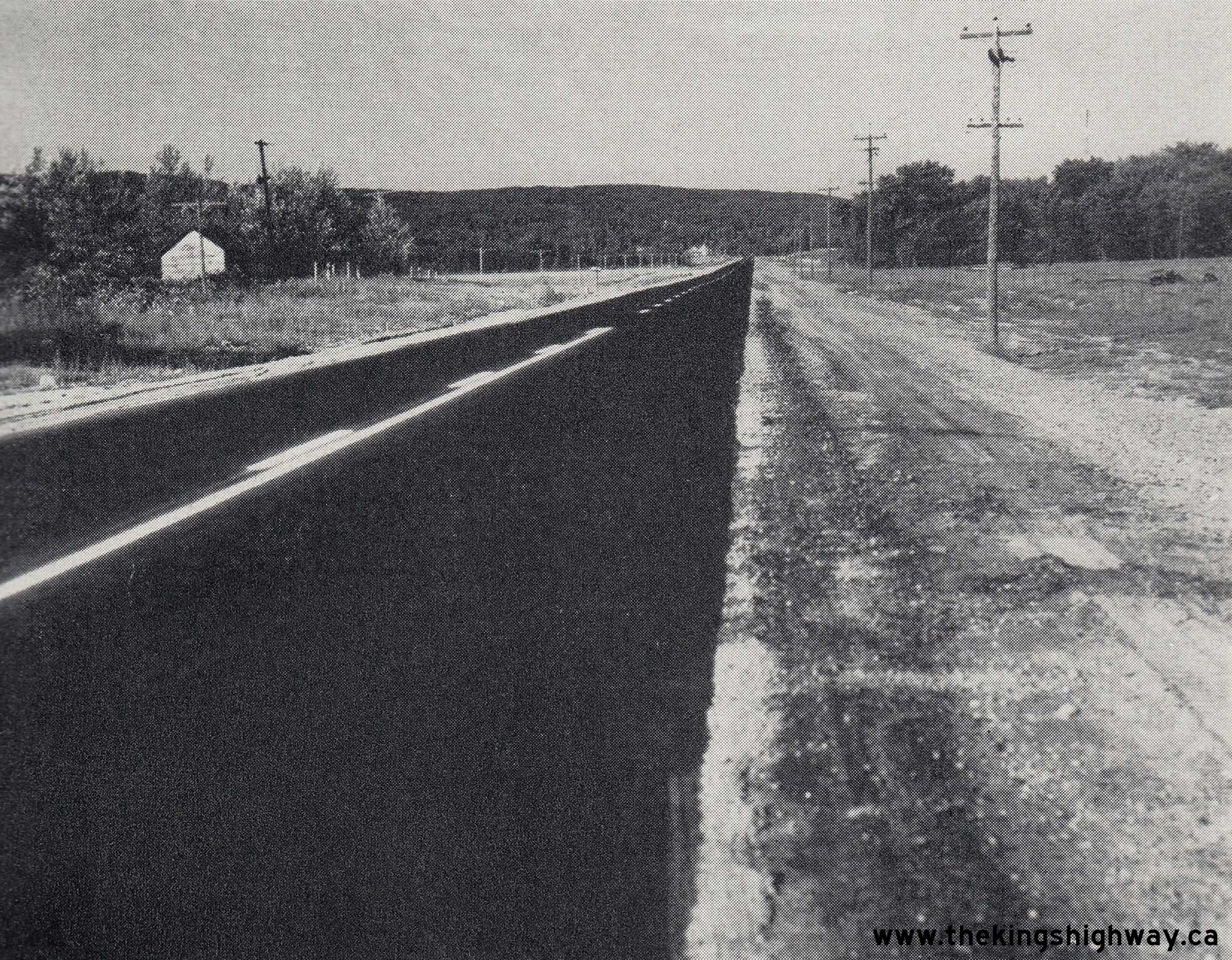
Enlarged Photo Here. Photo taken on July 14, 1955.(Photo courtesy of Ontario Ministry of Transportation - © King's Printer for Ontario, 1955) 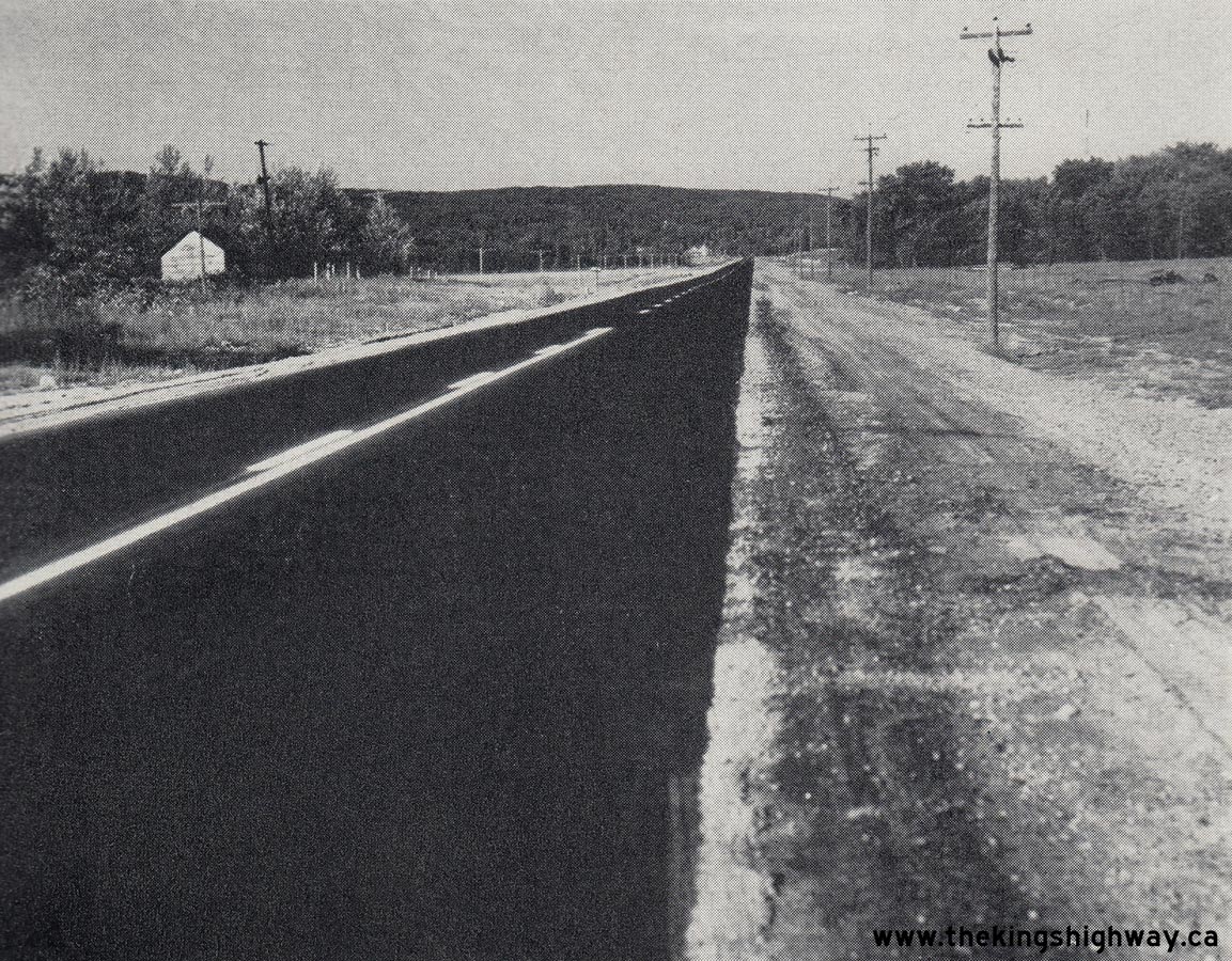 Above - Hot-mix asphalt paving and zone striping on Hwy 60 about 4 miles east of Killaloe, Contract #1955-52. See an
Enlarged Photo Here. Photo taken on July 14, 1955. Above - Hot-mix asphalt paving and zone striping on Hwy 60 about 4 miles east of Killaloe, Contract #1955-52. See an
Enlarged Photo Here. Photo taken on July 14, 1955.(Photo courtesy of Ontario Ministry of Transportation - © King's Printer for Ontario, 1955) 
Above - Circa 1955 postcard view of the Hwy 35 & Hwy 60 Junction on Hwy 11 at the northern entrance to Huntsville, facing north towards North Bay. Until
the early 1970s, it wasn't possible to reach Hwy 60 directly from the Huntsville Bypass (the relocated route of Hwy 11). This highway junction was extensively
reconfigured in 1973, when Hwy 60 was extended west from Old Hwy 11 out to the Huntsville Bypass. Both highways were realigned approaching this junction so that the
two roads intersected closer to a right angle. Significant re-grading also took place to improve the vertical grades approaching the intersection from the north.
Click here to see a 2006 View of the Hwy 60 Junction on Old Hwy 11 (now known as Muskoka Road 3)
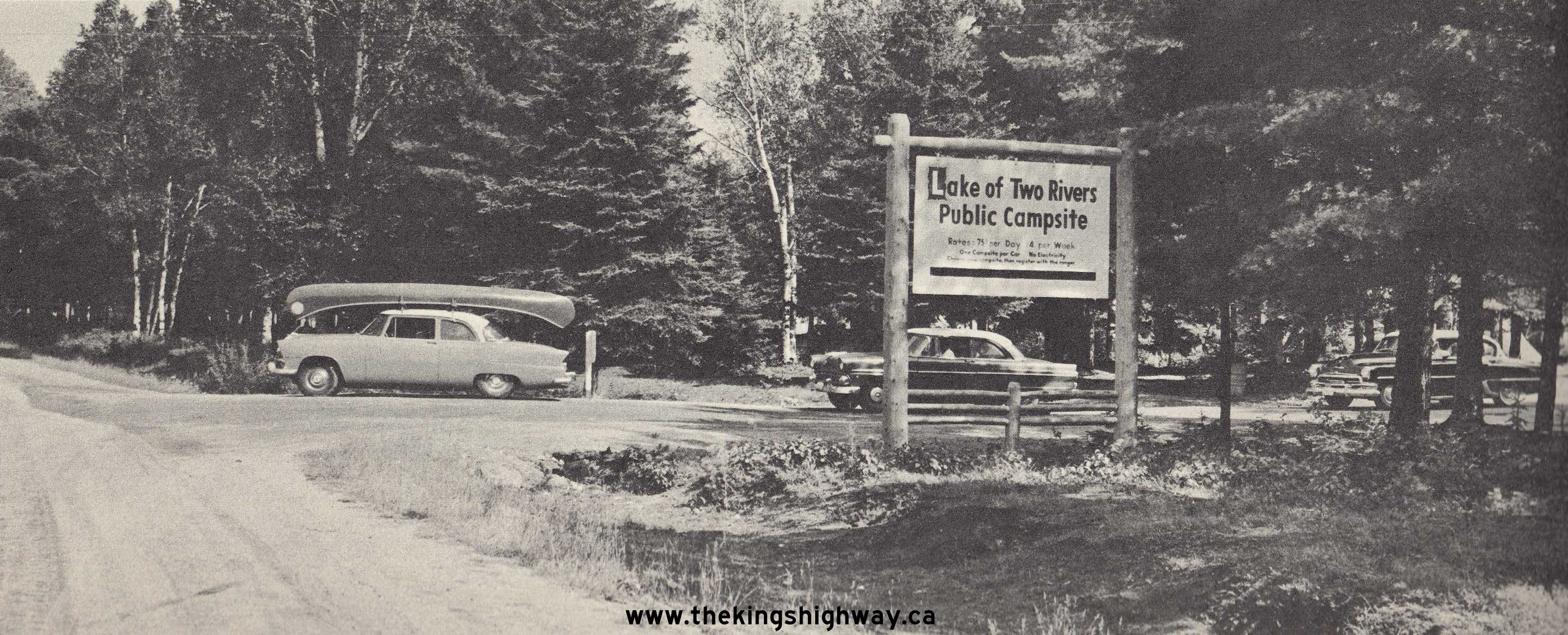
in Huntsville. See an Enlarged Photo Here. Photo taken circa 1955. (Photo courtesy of Newt Winger) 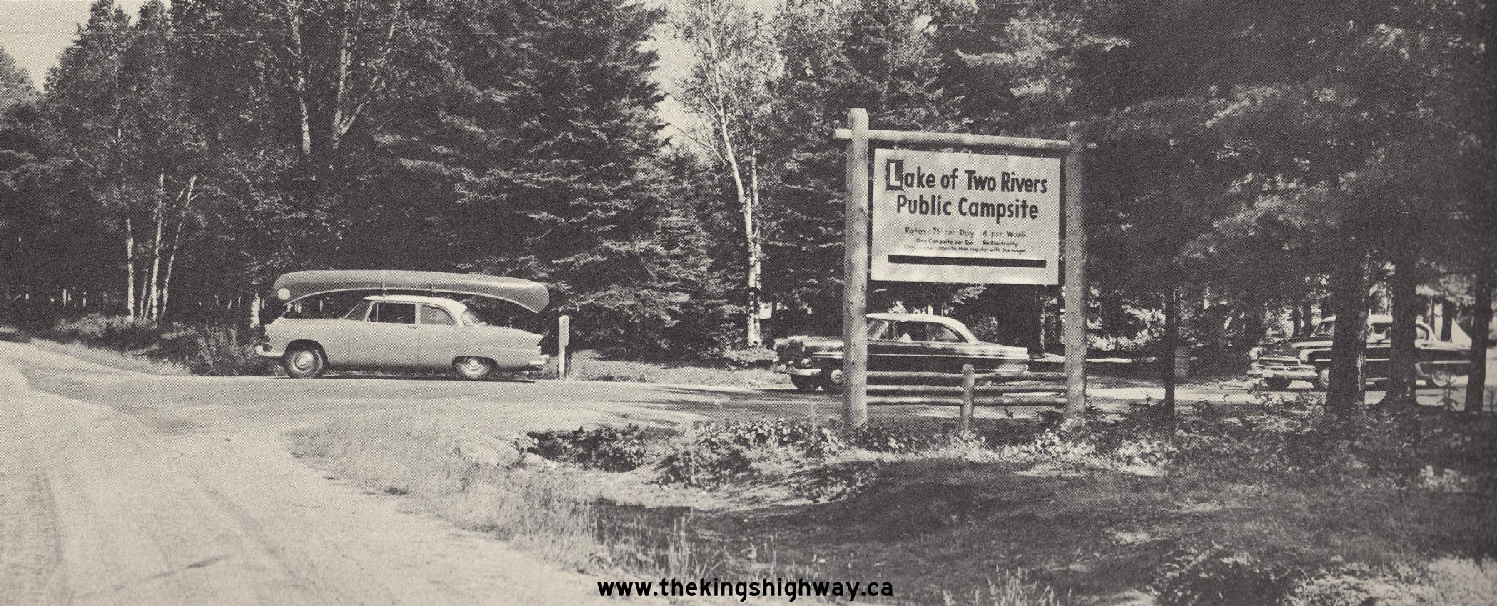 Above - Entrance to the Lake of Two Rivers Campground on Hwy 60 in Algonquin Park in 1956. This great photo shows heavy Labour Day Weekend traffic queued at
the entrance to the campground. Although this was a rustic campground at the time with no amenities, it is still interesting to note the camping fees charged by the
Department of Lands and Forests at that time - 75 cents per night, or $4.00 for the week, which is roughly the equivalent of $8.75 per night or $46.00 per week in
2025 Dollars. See an Enlarged Photo Here. Photo taken on September 1, 1956. Above - Entrance to the Lake of Two Rivers Campground on Hwy 60 in Algonquin Park in 1956. This great photo shows heavy Labour Day Weekend traffic queued at
the entrance to the campground. Although this was a rustic campground at the time with no amenities, it is still interesting to note the camping fees charged by the
Department of Lands and Forests at that time - 75 cents per night, or $4.00 for the week, which is roughly the equivalent of $8.75 per night or $46.00 per week in
2025 Dollars. See an Enlarged Photo Here. Photo taken on September 1, 1956.(Photo courtesy of Ontario Ministry of Transportation - © King's Printer for Ontario, 1956) 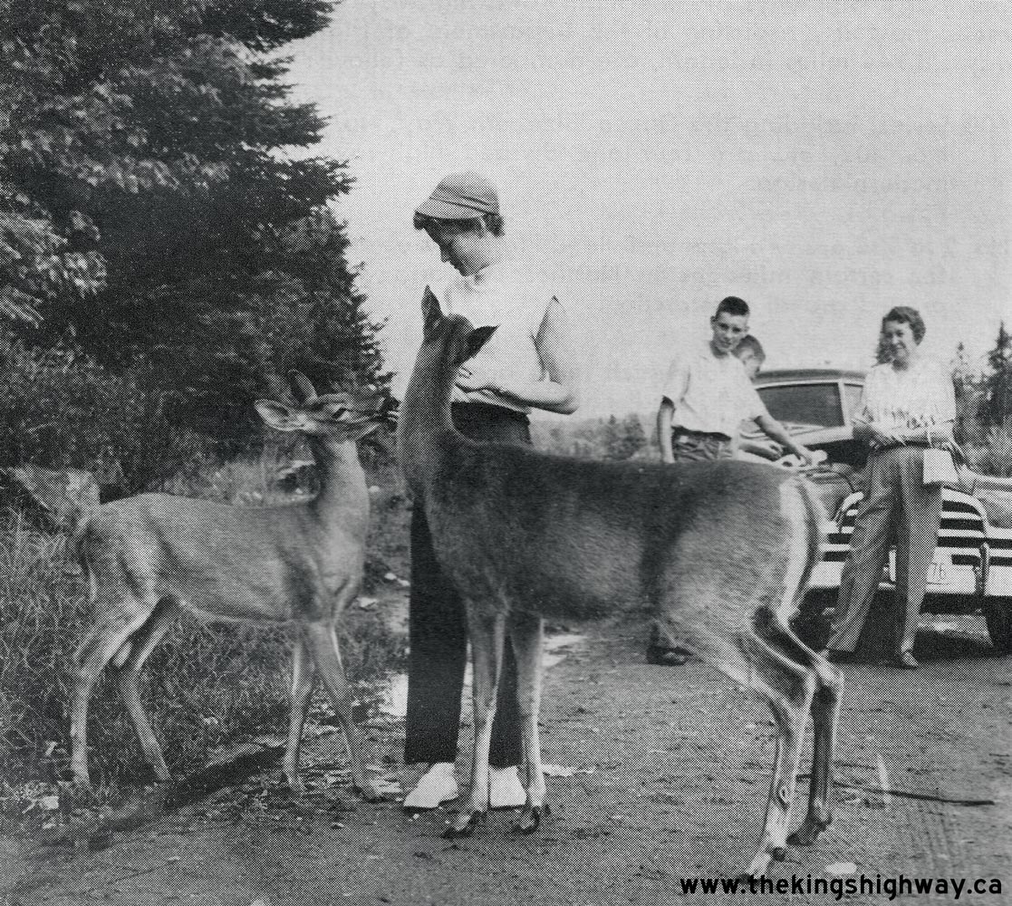 Above - Motorists feeding deer along Hwy 60 in Algonquin Park. See an
Enlarged Photo Here. Photo taken on September 1, 1956. Above - Motorists feeding deer along Hwy 60 in Algonquin Park. See an
Enlarged Photo Here. Photo taken on September 1, 1956.(Photo courtesy of Ontario Ministry of Transportation - © King's Printer for Ontario, 1956) 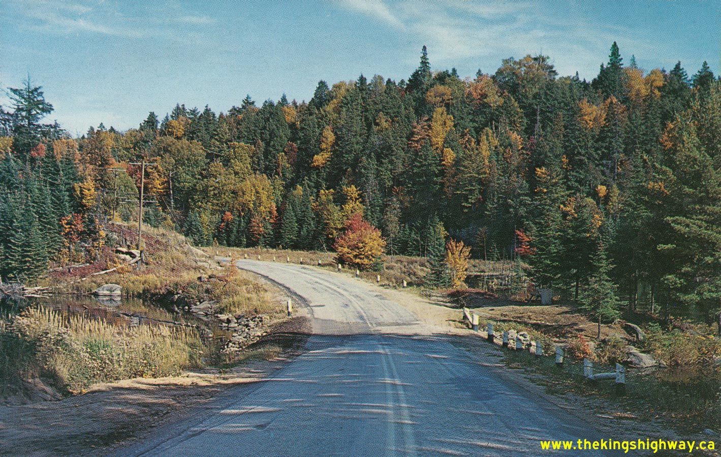 Above - Circa 1957 postcard view of the autumn colours along Hwy 60 in Algonquin Park. This photo also shows an example of a DHO "Roadside Table" on the
right-hand side of the highway. In addition to the extensive system of Roadside Parks operated by the Department, the DHO also maintained a large number of Roadside
Tables. These facilities usually just consisted of a single picnic table and litter disposal barrel with a small lay-by area for motorists to pull off of the
pavement. The sites provided motorists with an opportunity to take a break from the drive and enjoy the scenery. These DHO Roadside Tables were scattered all across
Ontario's highway system. In fact, up until the late 1960s, these facilities could even be found along rural 400-Series Highways as well! See an
Enlarged Photo Here. Photo taken circa 1957. Above - Circa 1957 postcard view of the autumn colours along Hwy 60 in Algonquin Park. This photo also shows an example of a DHO "Roadside Table" on the
right-hand side of the highway. In addition to the extensive system of Roadside Parks operated by the Department, the DHO also maintained a large number of Roadside
Tables. These facilities usually just consisted of a single picnic table and litter disposal barrel with a small lay-by area for motorists to pull off of the
pavement. The sites provided motorists with an opportunity to take a break from the drive and enjoy the scenery. These DHO Roadside Tables were scattered all across
Ontario's highway system. In fact, up until the late 1960s, these facilities could even be found along rural 400-Series Highways as well! See an
Enlarged Photo Here. Photo taken circa 1957.(Photo courtesy of Newt Winger) 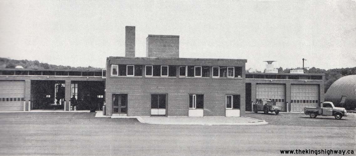
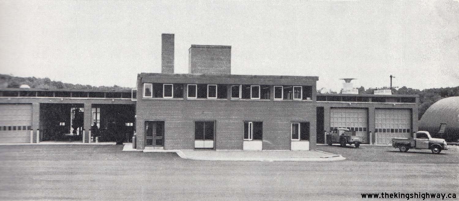
Above - New DHO District #11 Garage on Main Street (Hwy 11) in Huntsville. See an
Enlarged Photo Here. Photo taken on August 20, 1957. (Photo courtesy of Ontario Ministry of Transportation - © King's Printer for Ontario, 1957) 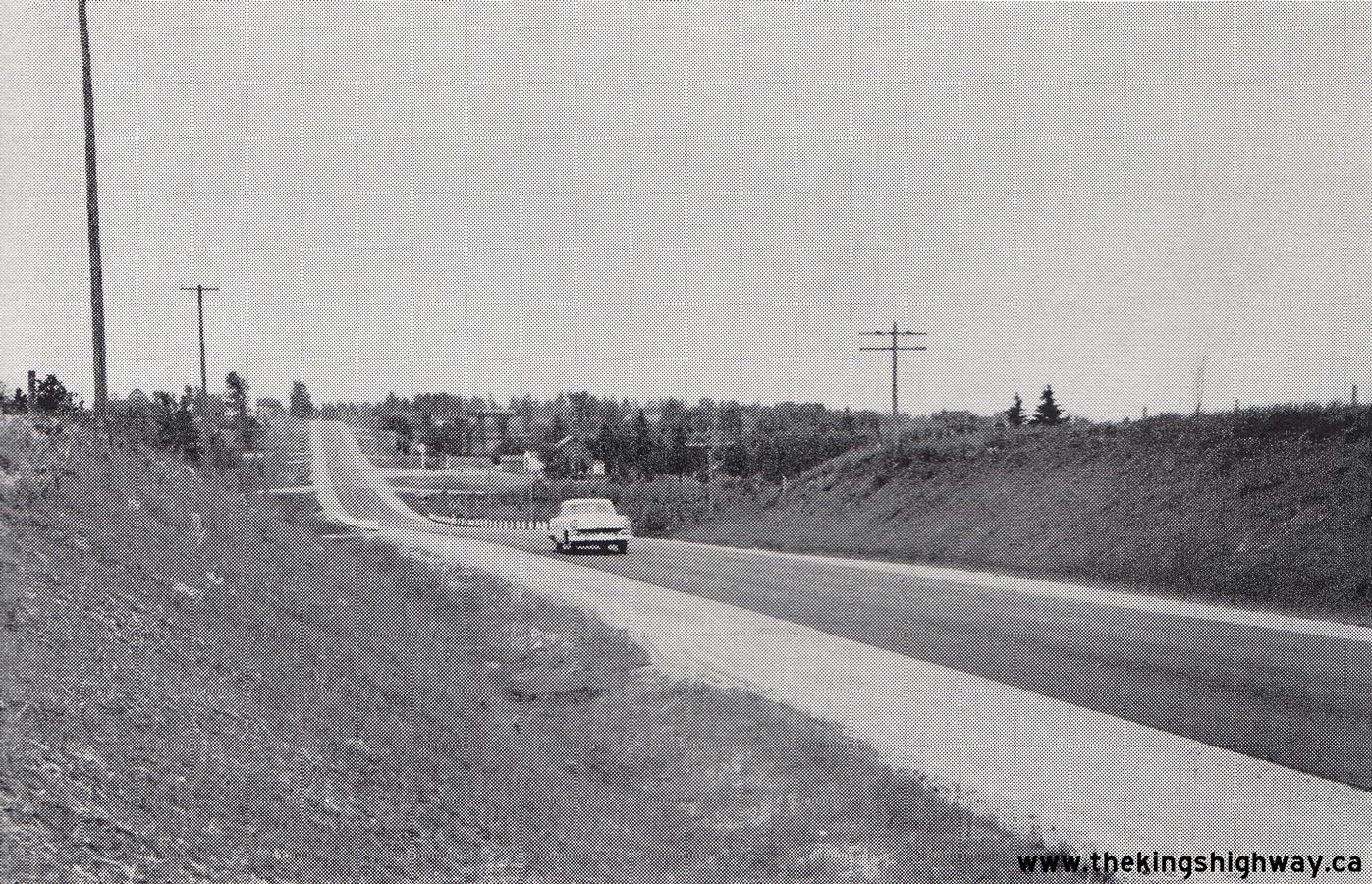 Above - New hot-mix asphalt paving on Hwy 41 & Hwy 60 north of Eganville, Contract #1957-134. See an
Enlarged Photo Here. Photo taken in 1958. Above - New hot-mix asphalt paving on Hwy 41 & Hwy 60 north of Eganville, Contract #1957-134. See an
Enlarged Photo Here. Photo taken in 1958.(Photo courtesy of Ontario Ministry of Transportation - © King's Printer for Ontario, 1958) 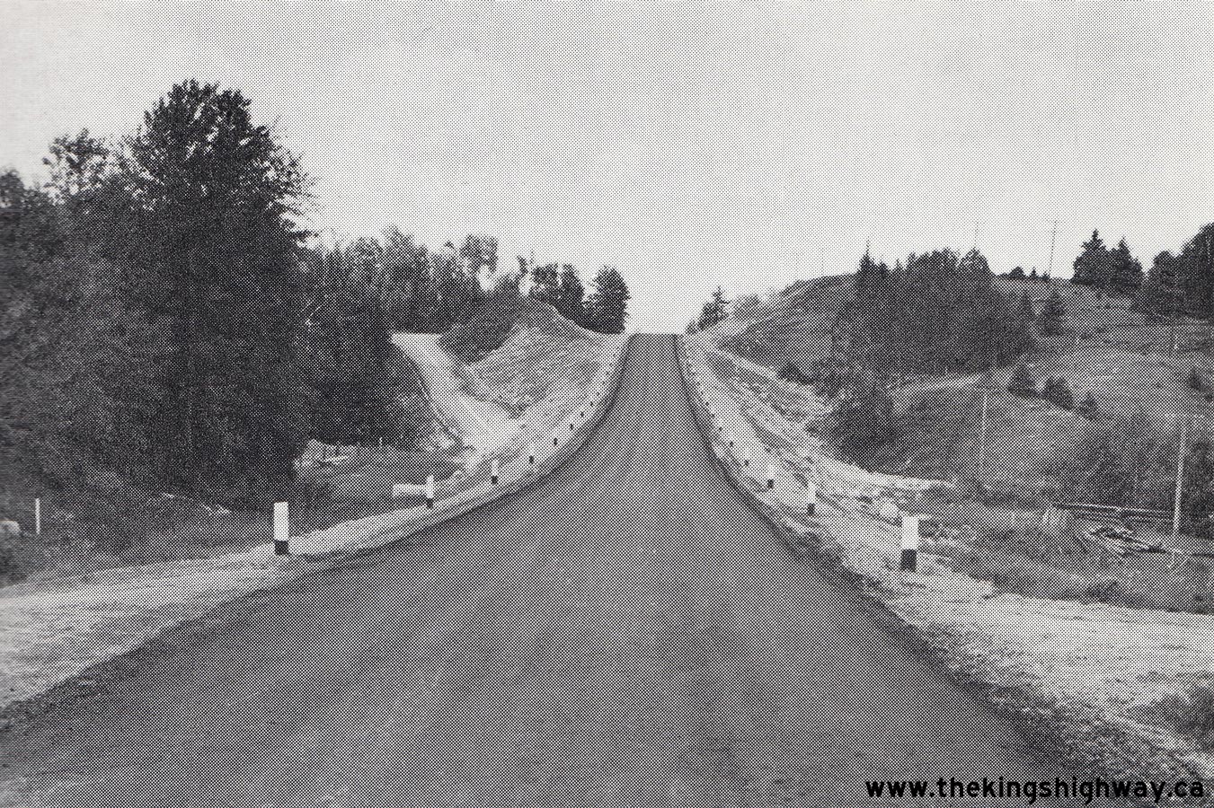
 Left - Completed highway diversion on Hwy 60 between Wilno and Killaloe, built under Day Labour Project #1957-1480. See an
Enlarged Photo Here. Photo taken in 1958. Left - Completed highway diversion on Hwy 60 between Wilno and Killaloe, built under Day Labour Project #1957-1480. See an
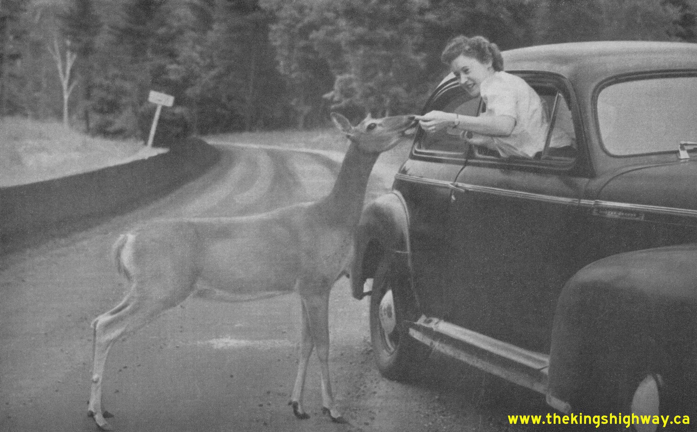
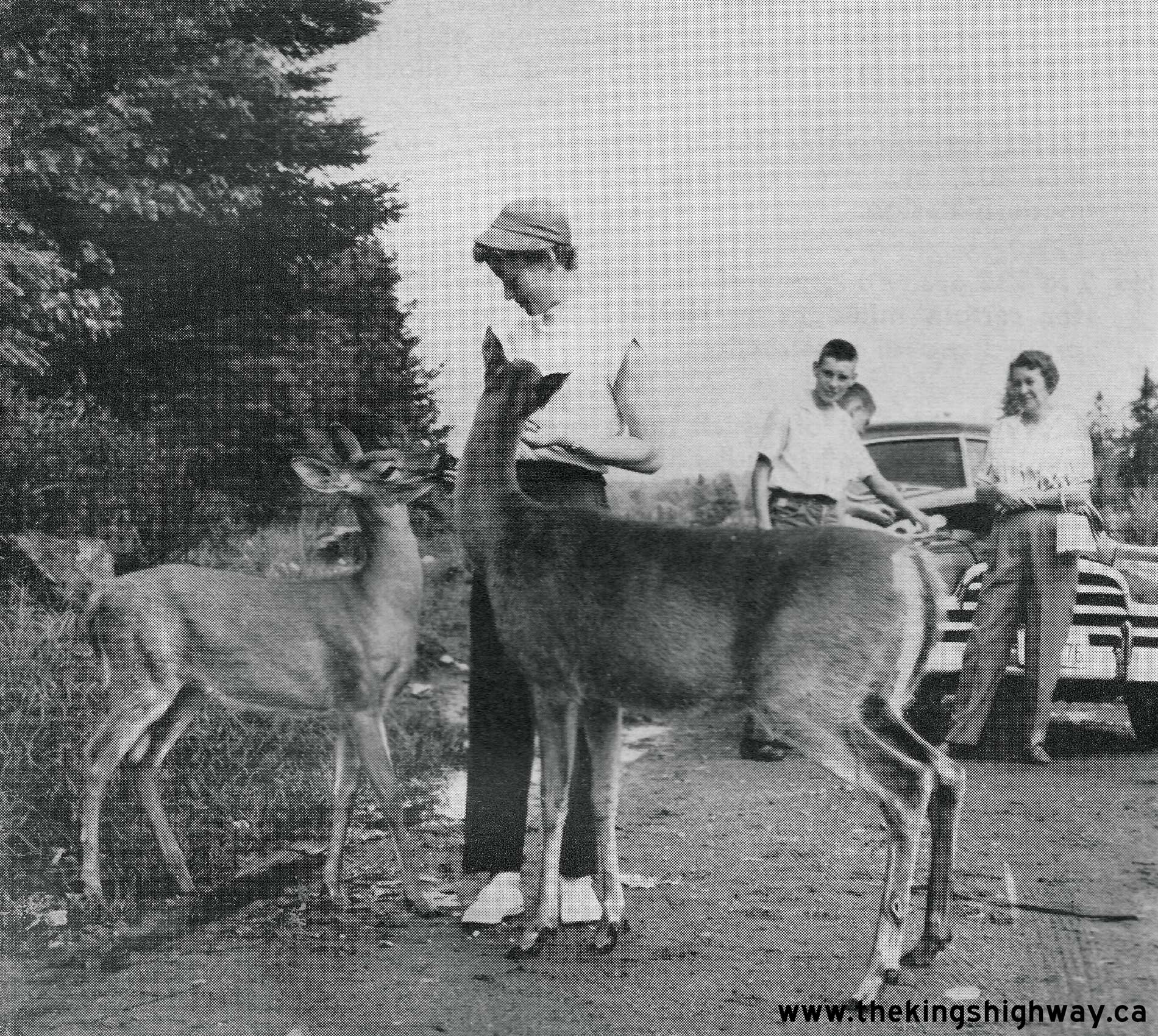
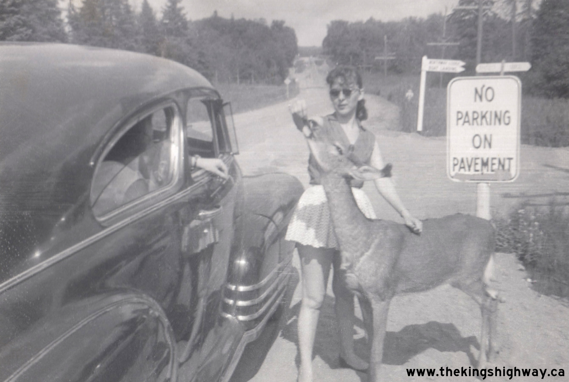
Enlarged Photo Here. Photo taken in 1958.(Photo courtesy of Ontario Ministry of Transportation - © King's Printer for Ontario, 1958) Right - Motorist feeding a deer along Hwy 60 at Cache Lake in 1958. While I have posted several old photos of these actions due to their historical interest,
I must note that deliberately feeding wildlife like this is actually very harmful to the animals. Over time, deliberate feedings like this can condition
wild animals to lose their instinctive fear of humans and ultimately consume foods which are not part of their natural diet. Deliberate feedings also encouraged deer
and other large animals to congregate along Hwy 60, as the highway corridor itself became an easy food source for the deer whenever motorists stopped along the
highway. Unfortunately, this greatly increased the risk of vehicle-wildlife collisions, which endangered not only the wildlife but also the occupants of the vehicle.
Accordingly, feeding wildlife like this is now prohibited. Please do your part - don't feed Ontario's wildlife! See an
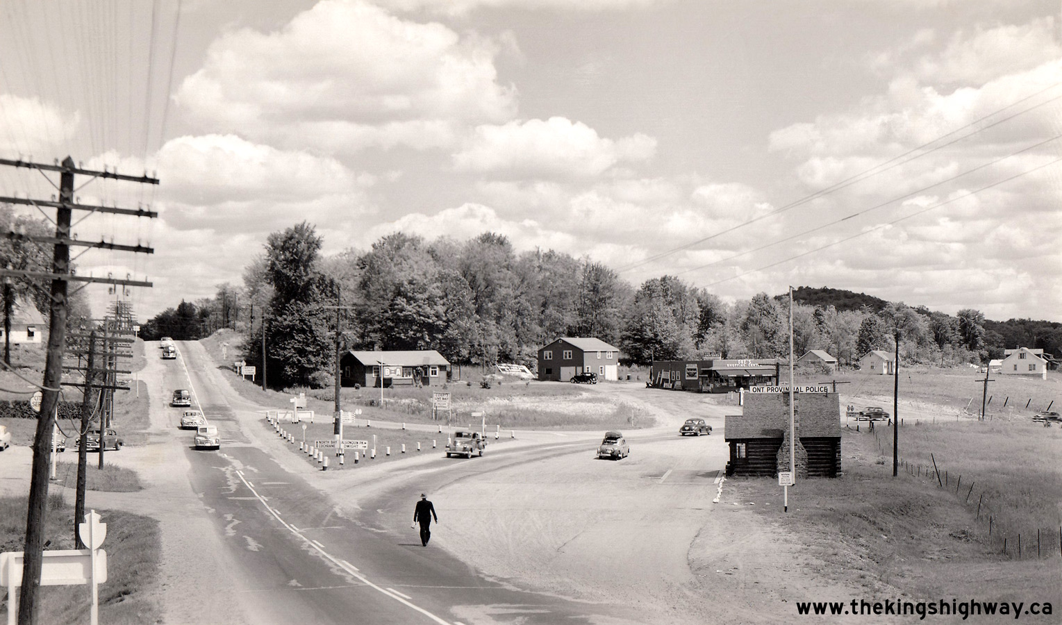
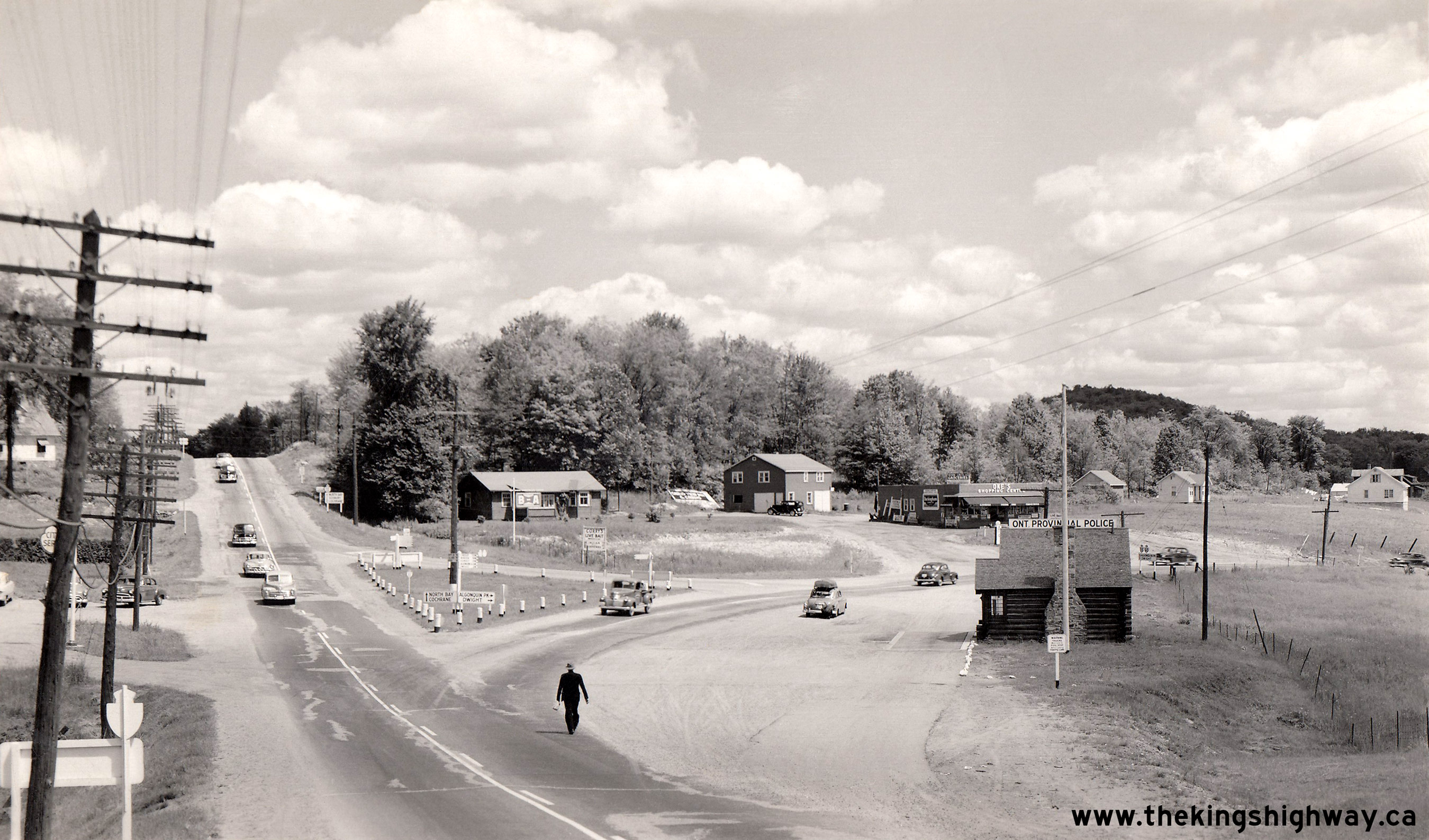
Enlarged Photo Here. Photo taken in August 1958.(Photo from Cameron Bevers' historical photograph collection - Original photographer unknown) 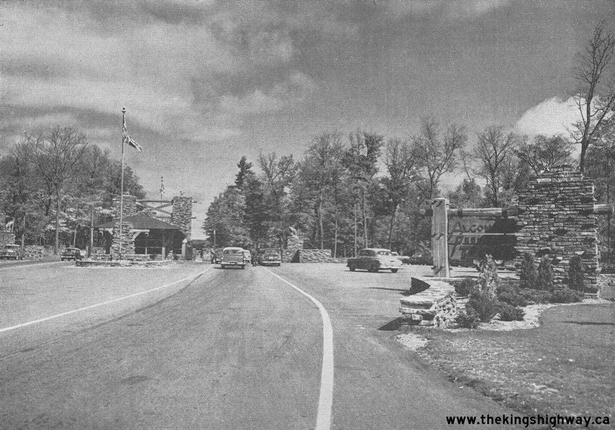 Above - Traffic approaching Algonquin Park's West Gate on Hwy 60, located about 13 miles east of Dwight. See an
Enlarged Photo Here. Photo taken in 1958. Above - Traffic approaching Algonquin Park's West Gate on Hwy 60, located about 13 miles east of Dwight. See an
Enlarged Photo Here. Photo taken in 1958.(Photo courtesy of Ontario Ministry of Transportation - © King's Printer for Ontario, 1958) 
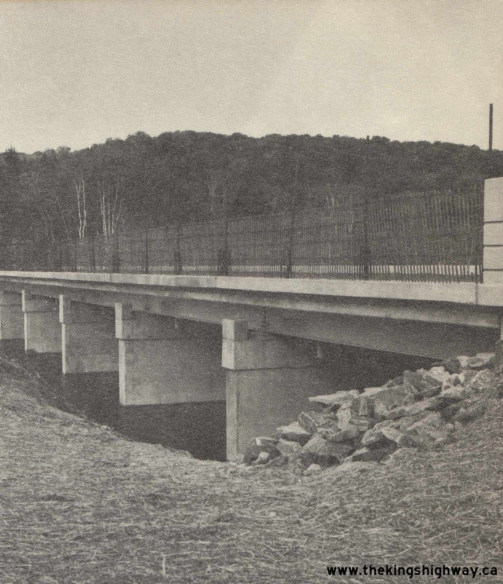
Above - Circa 1960 postcard view of the Oxtongue Lake Narrows Bridge on Hwy 60, located about 6 miles east of Dwight. This aerial view of the original
1930s-era timber bridge over Oxtongue Lake Narrows was taken only a few years before the structure was replaced with a new concrete and steel bridge in 1962. See an
Enlarged Photo Here. Photo taken circa 1960. (Photo courtesy of Ernie Dollimore) 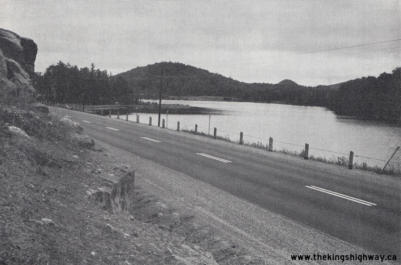
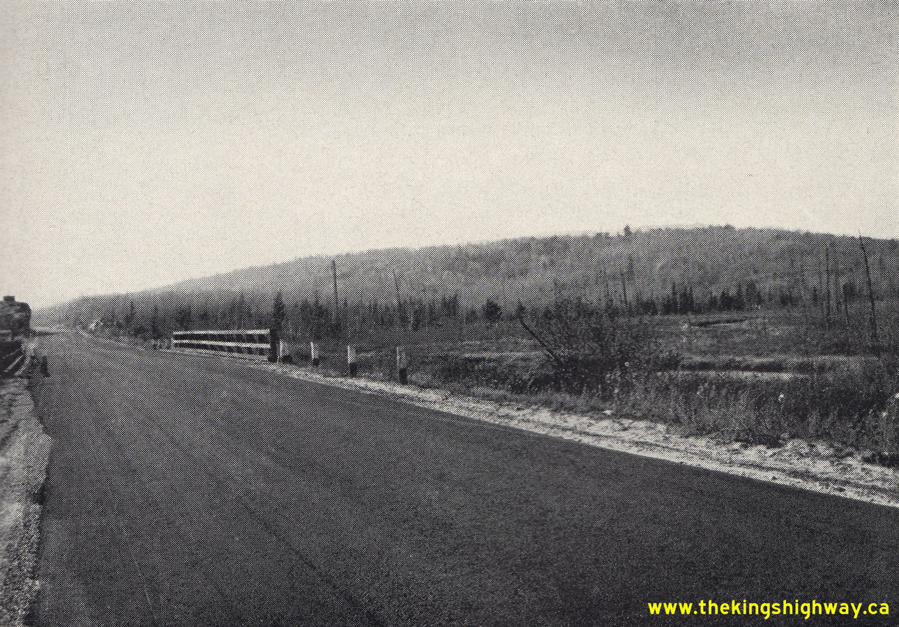
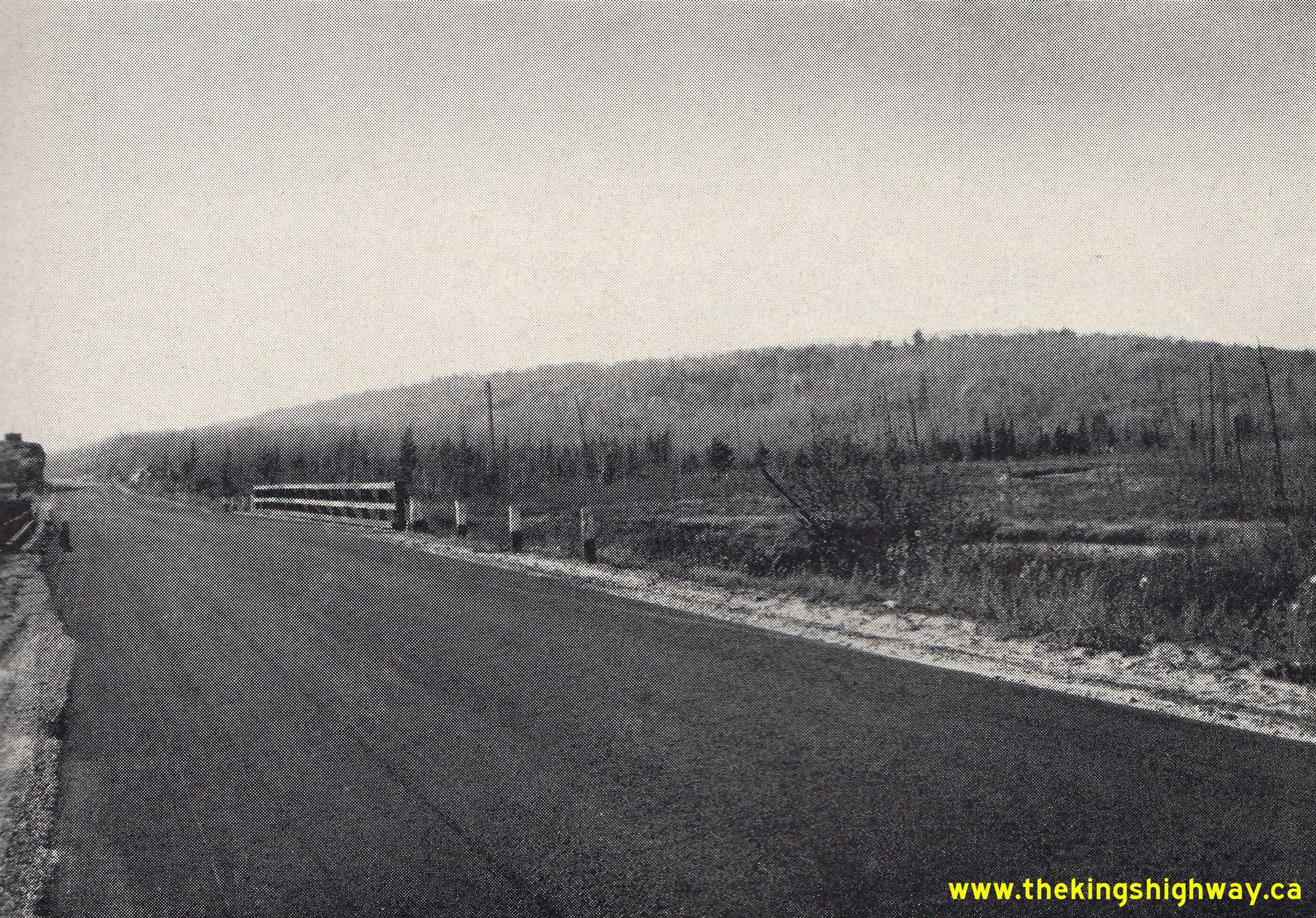
Above - New asphalt pavement on Hwy 60 at Yantha Lake in 1961, 1 mile east of Barry's Bay. A 6-mile section of Hwy 60 was resurfaced between Barry's Bay and
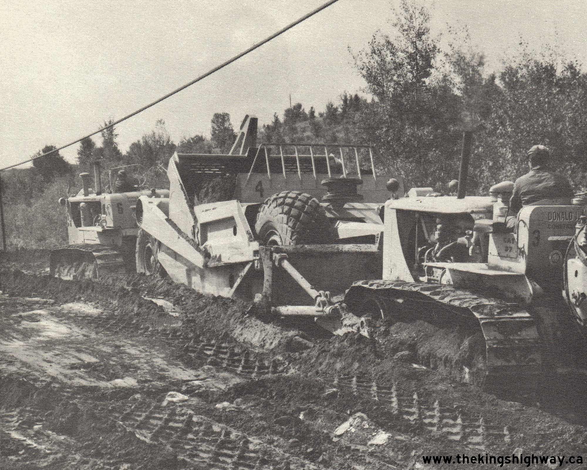
Wilno under Contract #1961-52. See an Enlarged Photo Here. Photo taken in 1961. (Photo courtesy of Ontario Ministry of Transportation - © King's Printer for Ontario, 1961) 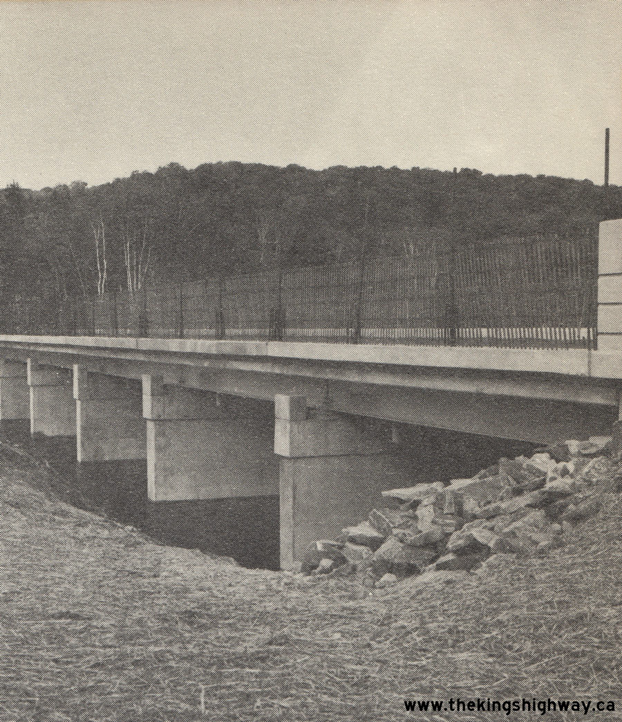 Above - Replacement Oxtongue Lake Narrows Bridge nearing completion in 1962, Contract #1961-13 (structural steel) and Contract #1961-19 (concrete substructure
and approaches). These replacement bridge contracts were both awarded in August 1961. The new bridge was opened to traffic late in the 1962 construction season. See
an Enlarged Photo Here. Photo taken in 1962. Above - Replacement Oxtongue Lake Narrows Bridge nearing completion in 1962, Contract #1961-13 (structural steel) and Contract #1961-19 (concrete substructure
and approaches). These replacement bridge contracts were both awarded in August 1961. The new bridge was opened to traffic late in the 1962 construction season. See
an Enlarged Photo Here. Photo taken in 1962.(Photo courtesy of Ontario Ministry of Transportation - © King's Printer for Ontario, 1962) 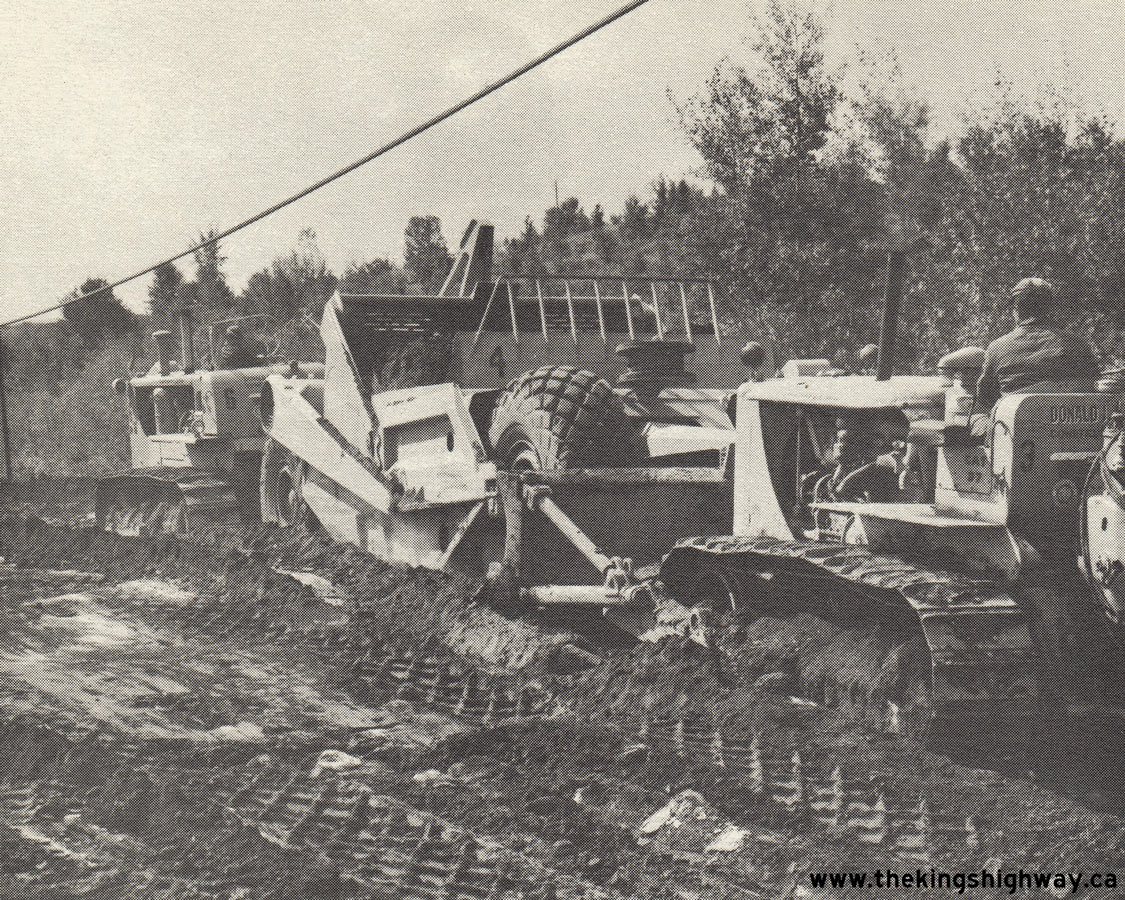 Above - Reconstruction of Hwy 35 & Hwy 60 between Huntsville and Hillside, Contract #1962-62. See an
Enlarged Photo Here. Photo taken in 1962. Above - Reconstruction of Hwy 35 & Hwy 60 between Huntsville and Hillside, Contract #1962-62. See an
Enlarged Photo Here. Photo taken in 1962.(Photo courtesy of Ontario Ministry of Transportation - © King's Printer for Ontario, 1962) 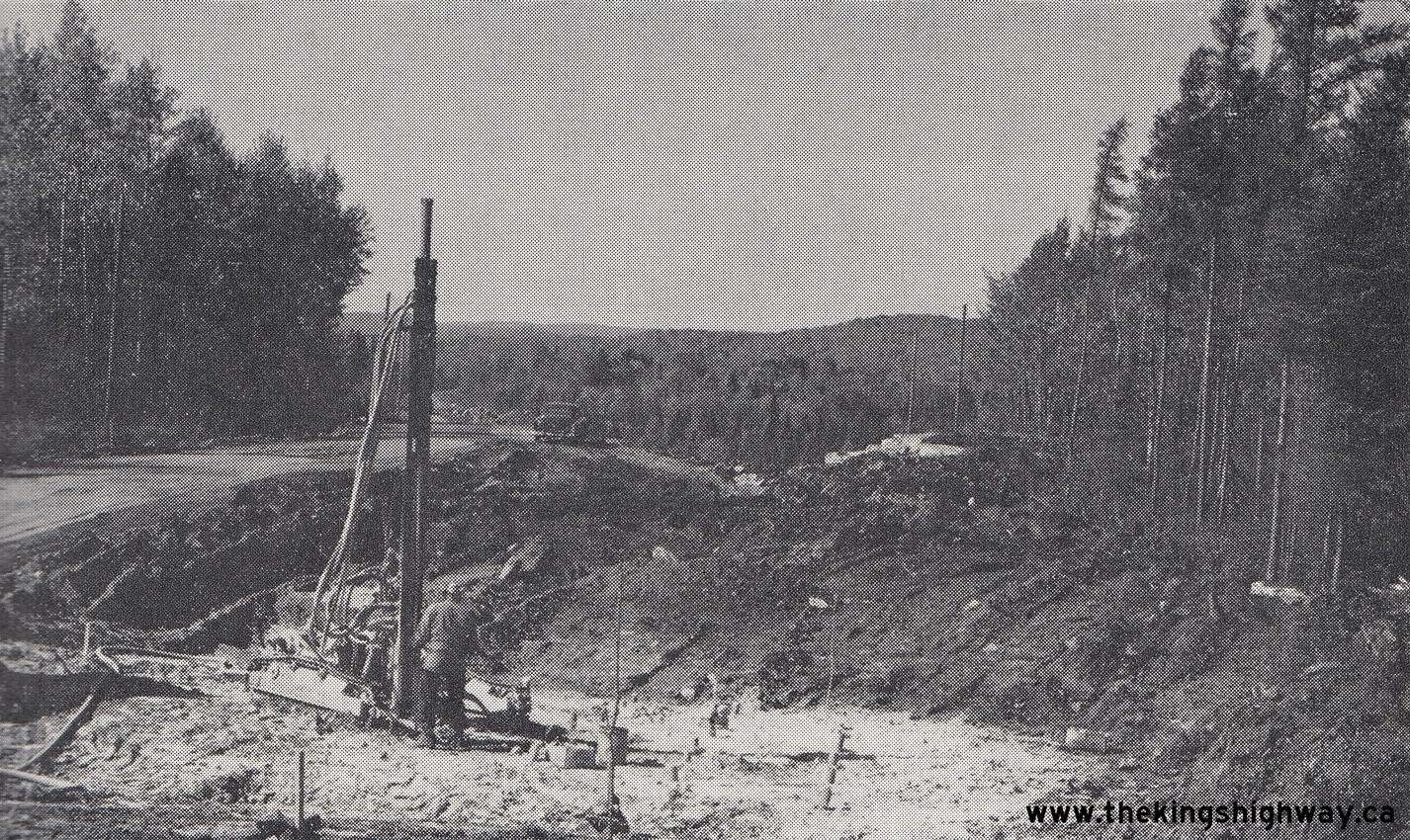
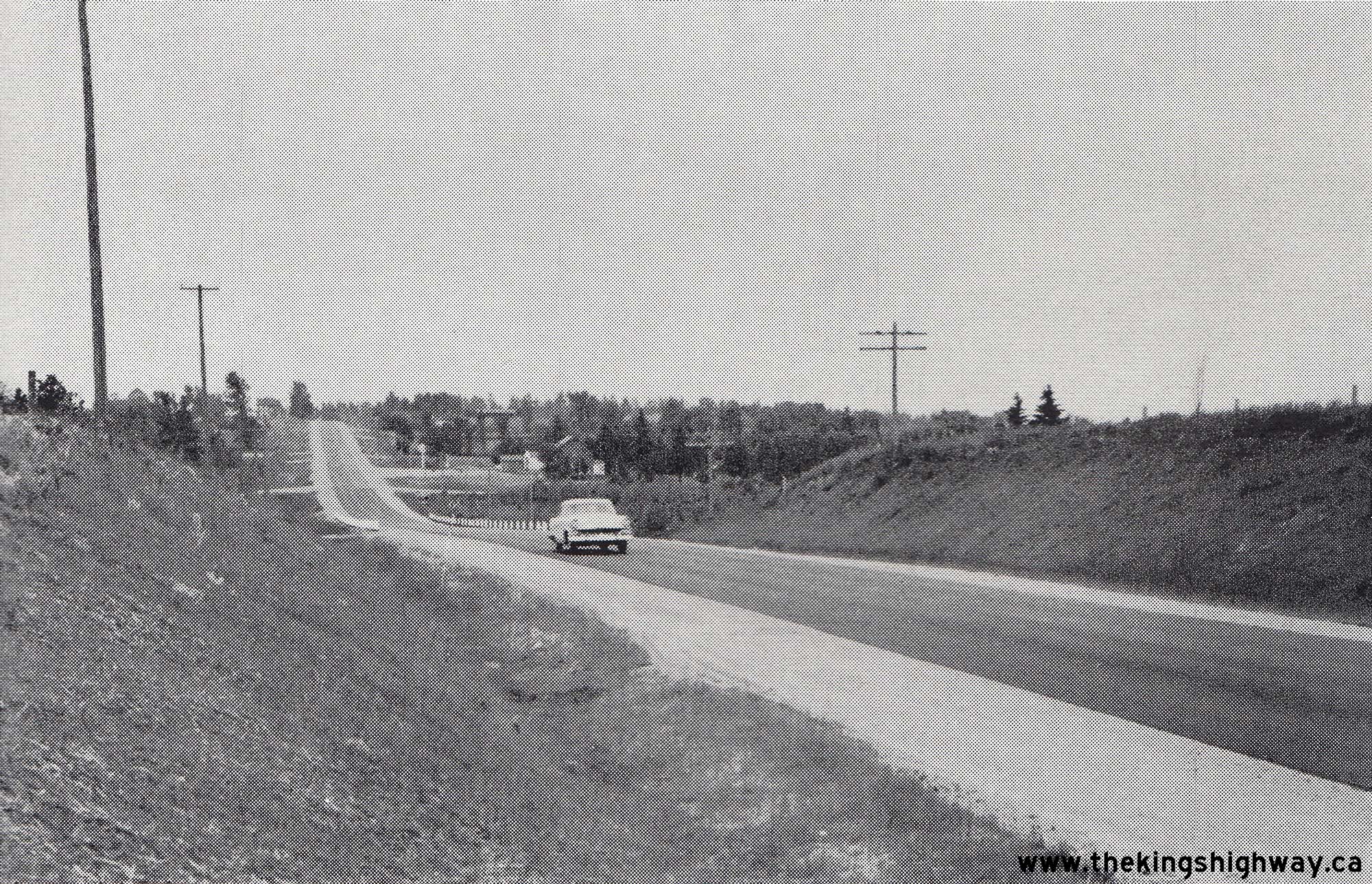
Above - Grading and reconstruction of Hwy 35 & Hwy 60 between Dwight and Huntsville. See an
Enlarged Photo Here. Photo taken in 1963. (Photo courtesy of Ontario Ministry of Transportation - © King's Printer for Ontario, 1963) 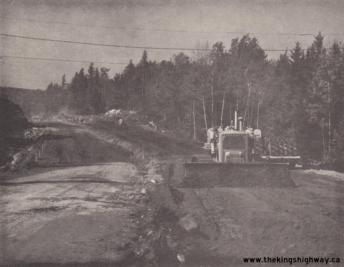
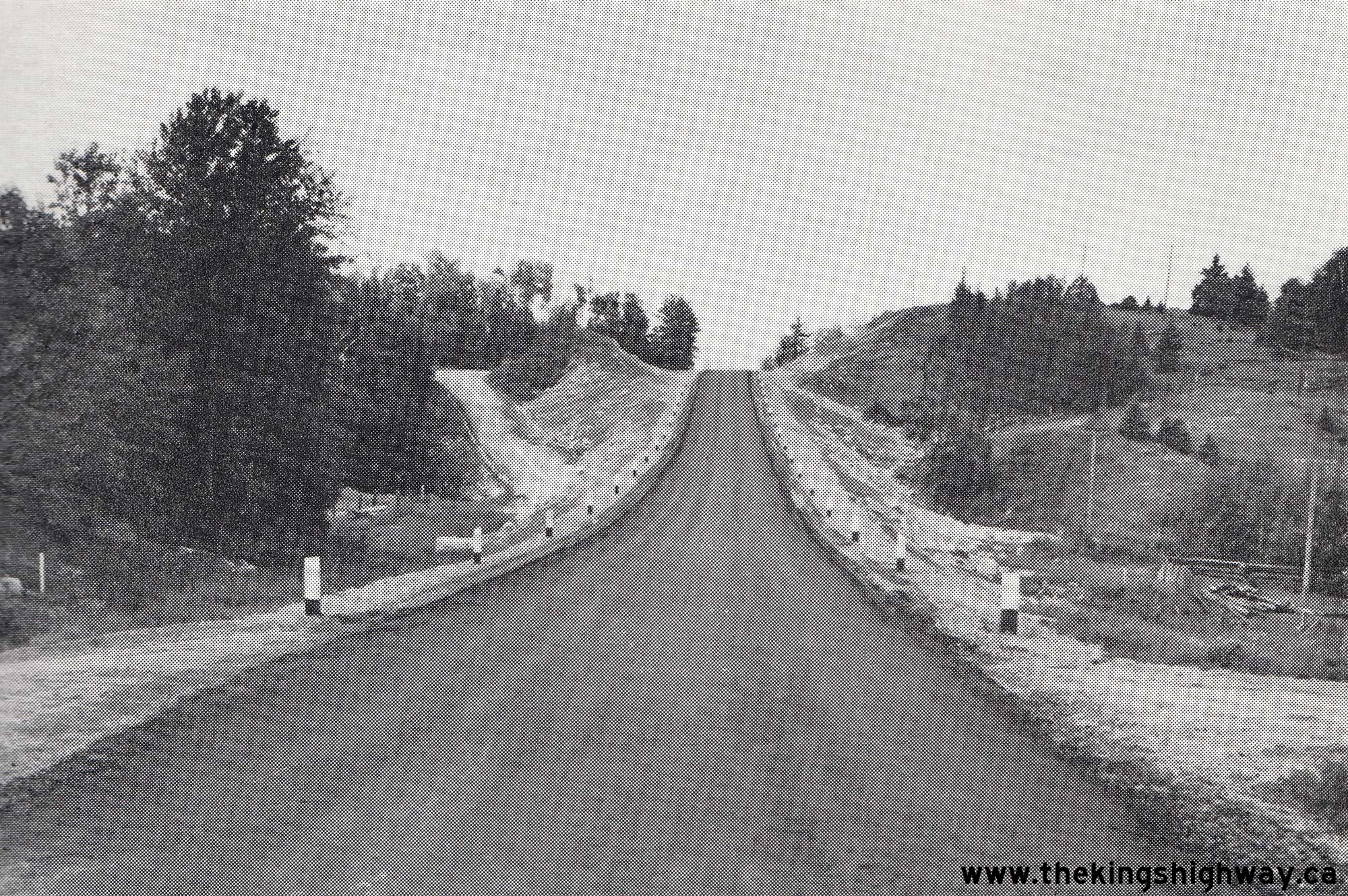
Left - Grading operations on Hwy 35 & Hwy 60 between Hillside and Dwight, Contract #1963-35. See an
Enlarged Photo Here. Photo taken in 1963. (Photo courtesy of Ontario Ministry of Transportation - © King's Printer for Ontario, 1963) Right - Hot-mix paving operations on Hwy 35 & Hwy 60 between Hillside and Huntsville, Contract #1963-47. See an Enlarged Photo Here. Photo taken in 1963. (Photo courtesy of Ontario Ministry of Transportation - © King's Printer for Ontario, 1963) 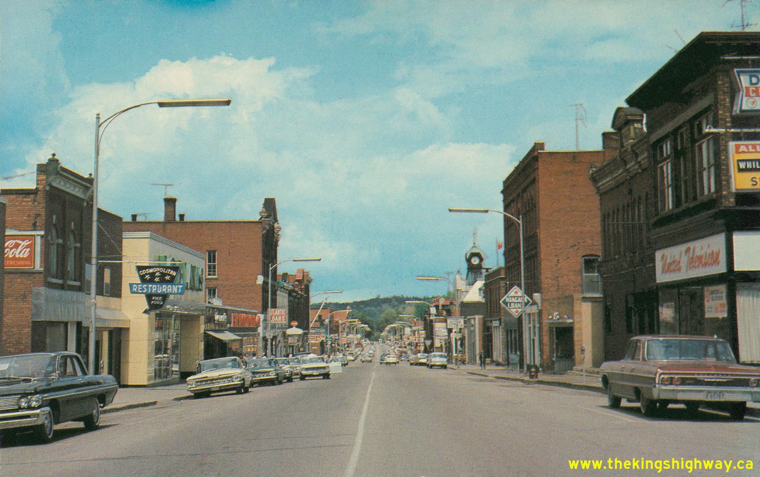
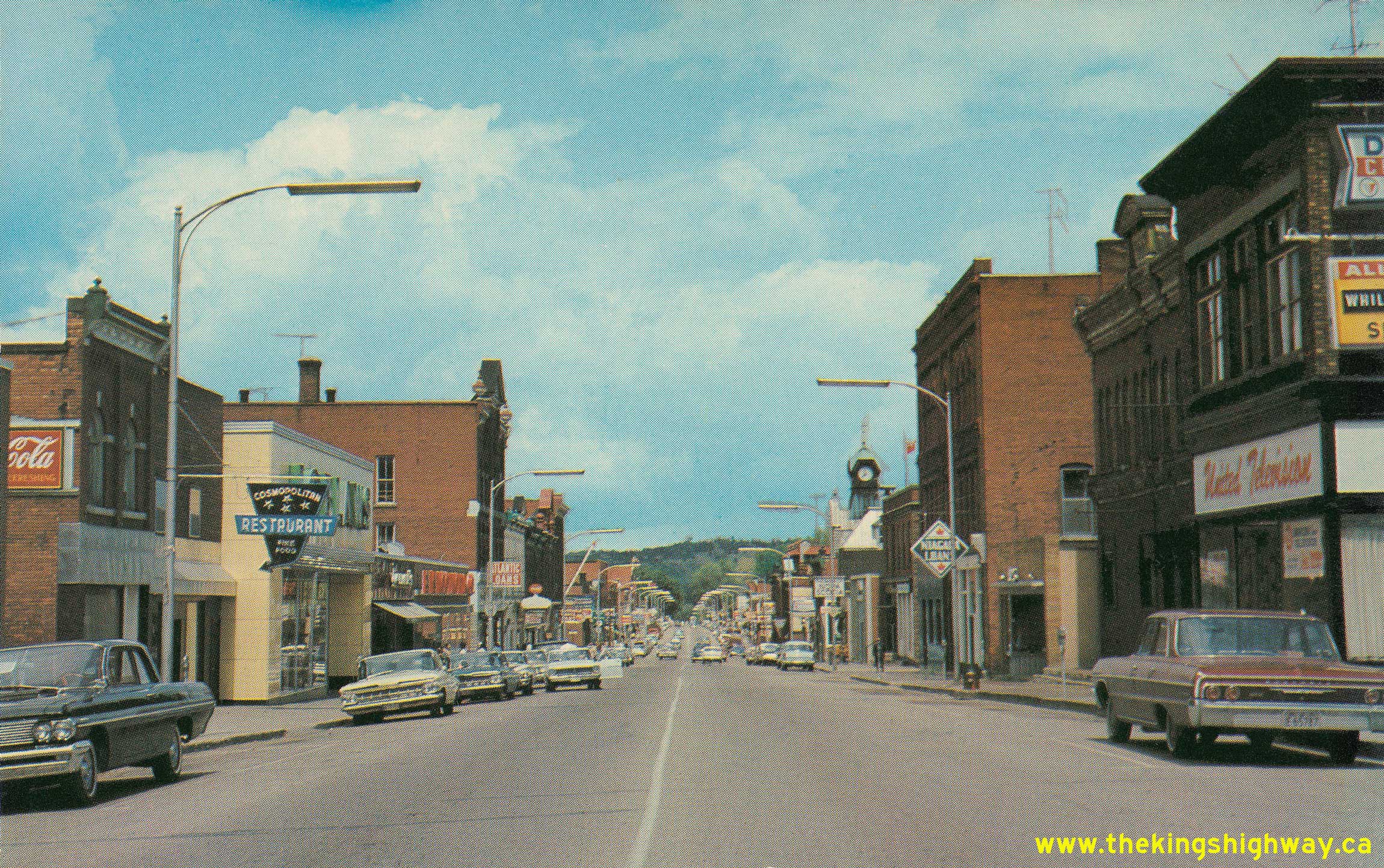
 Left - Circa 1964 postcard view of Raglan Street (Hwy 17, later known as Hwy 60) facing north from the intersection of Opeongo Road in Downtown Renfrew. See an
Enlarged Photo Here. Left - Circa 1964 postcard view of Raglan Street (Hwy 17, later known as Hwy 60) facing north from the intersection of Opeongo Road in Downtown Renfrew. See an
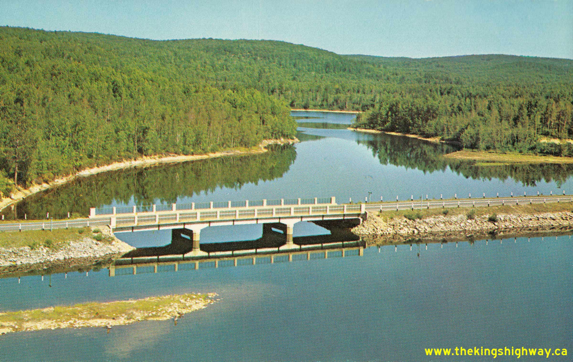
Enlarged Photo Here.(Photo courtesy of L.F Charter, Picton) Right - Circa 1965 aerial postcard view of the Opeongo River Bridge on Hwy 60, located about 2 miles east of Madawaska. This was one of two virtually
identical steel and concrete bridges completed in 1942 during construction of the Bark Lake Diversion between Madawaska and Barry's Bay. See an
Enlarged Photo Here. Photo taken circa 1965.(Photo courtesy of H.R. Oakman, Peterborough) 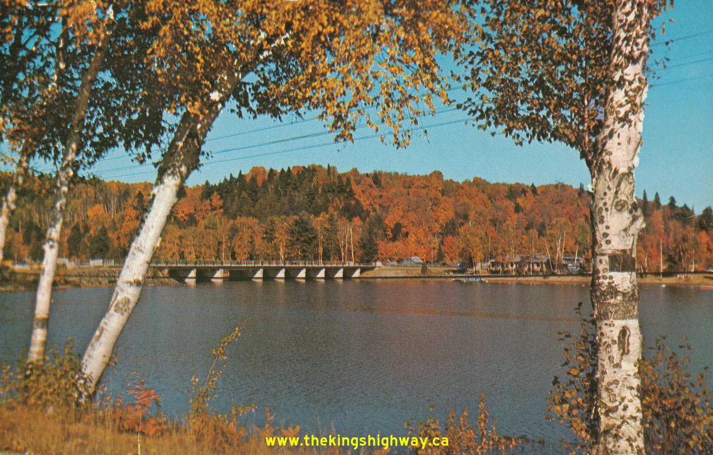 Above - Circa 1965 postcard view of the new Oxtongue Lake Narrows Bridge on Hwy 60 east of Dwight. This new steel and concrete bridge was completed in 1962. See
an Enlarged Photo Here. Photo taken circa 1965. Above - Circa 1965 postcard view of the new Oxtongue Lake Narrows Bridge on Hwy 60 east of Dwight. This new steel and concrete bridge was completed in 1962. See
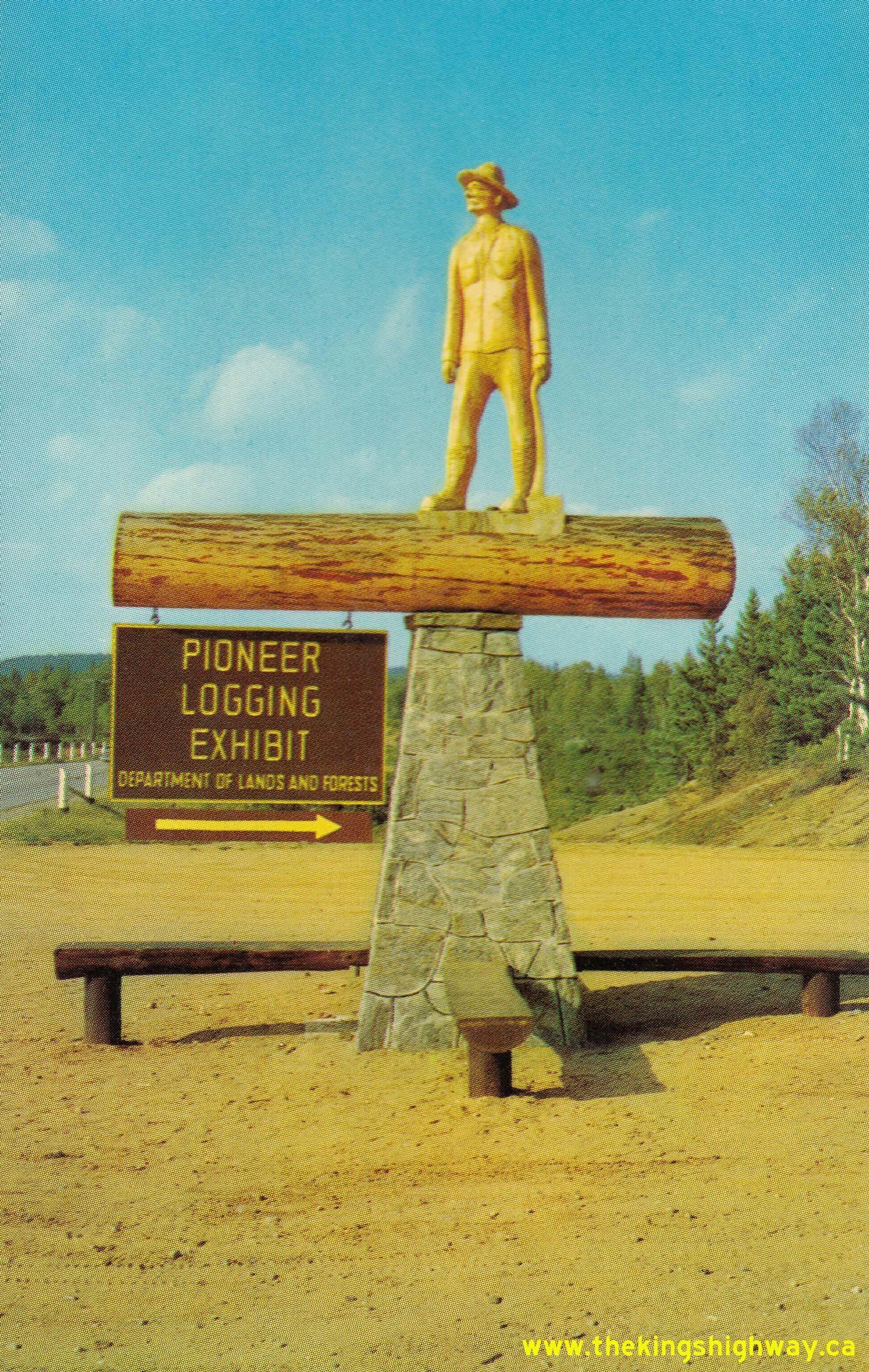
an Enlarged Photo Here. Photo taken circa 1965.(Photo courtesy of Dennis Stone)  Above - Circa 1965 postcard view of the entrance sign for the Pioneer Logging Exhibit on Hwy 60 in Algonquin Park near Whitney. See an
Enlarged Photo Here. Photo taken circa 1965. Above - Circa 1965 postcard view of the entrance sign for the Pioneer Logging Exhibit on Hwy 60 in Algonquin Park near Whitney. See an
Enlarged Photo Here. Photo taken circa 1965.(Photo courtesy of E.S & A Robinson Ltd, Leaside) 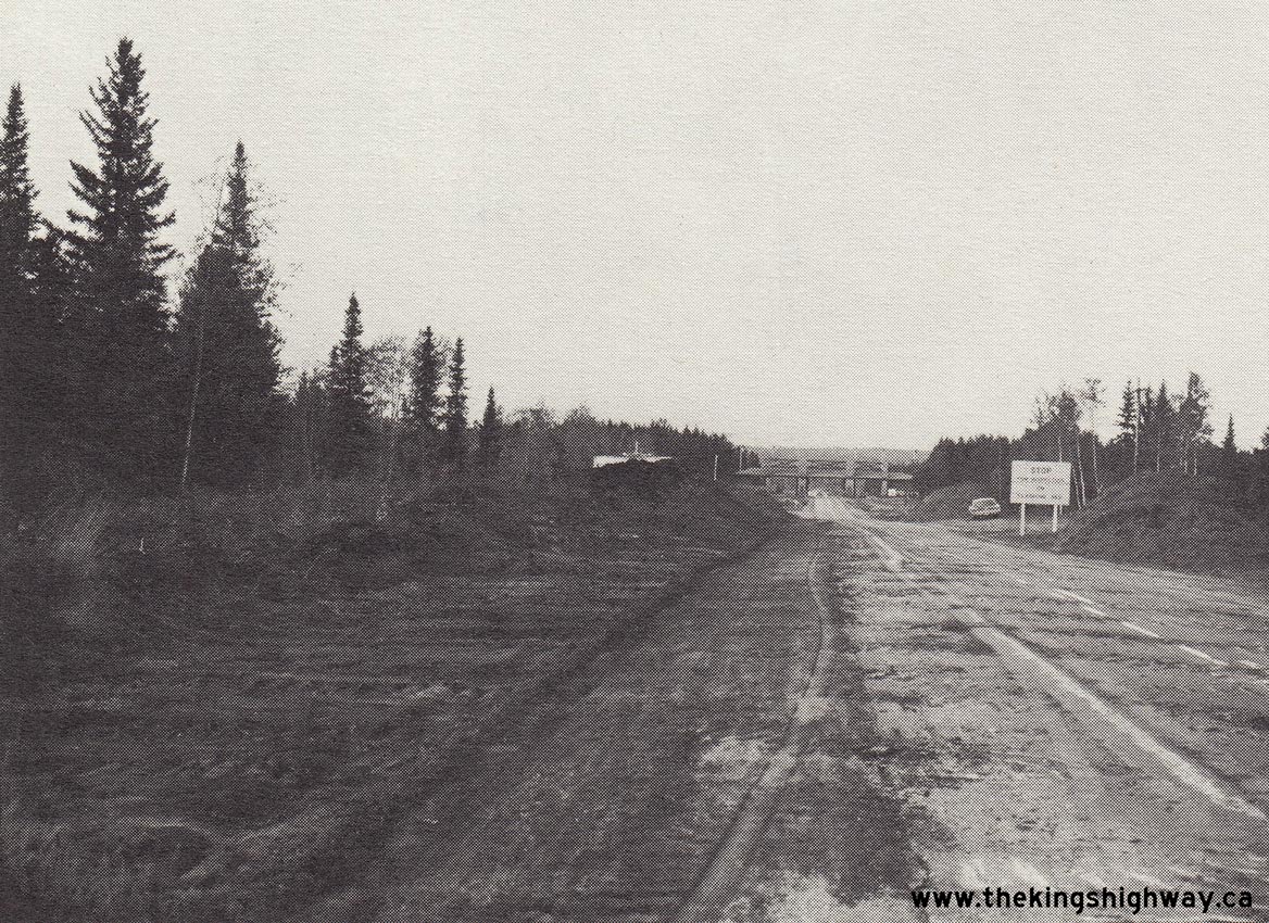
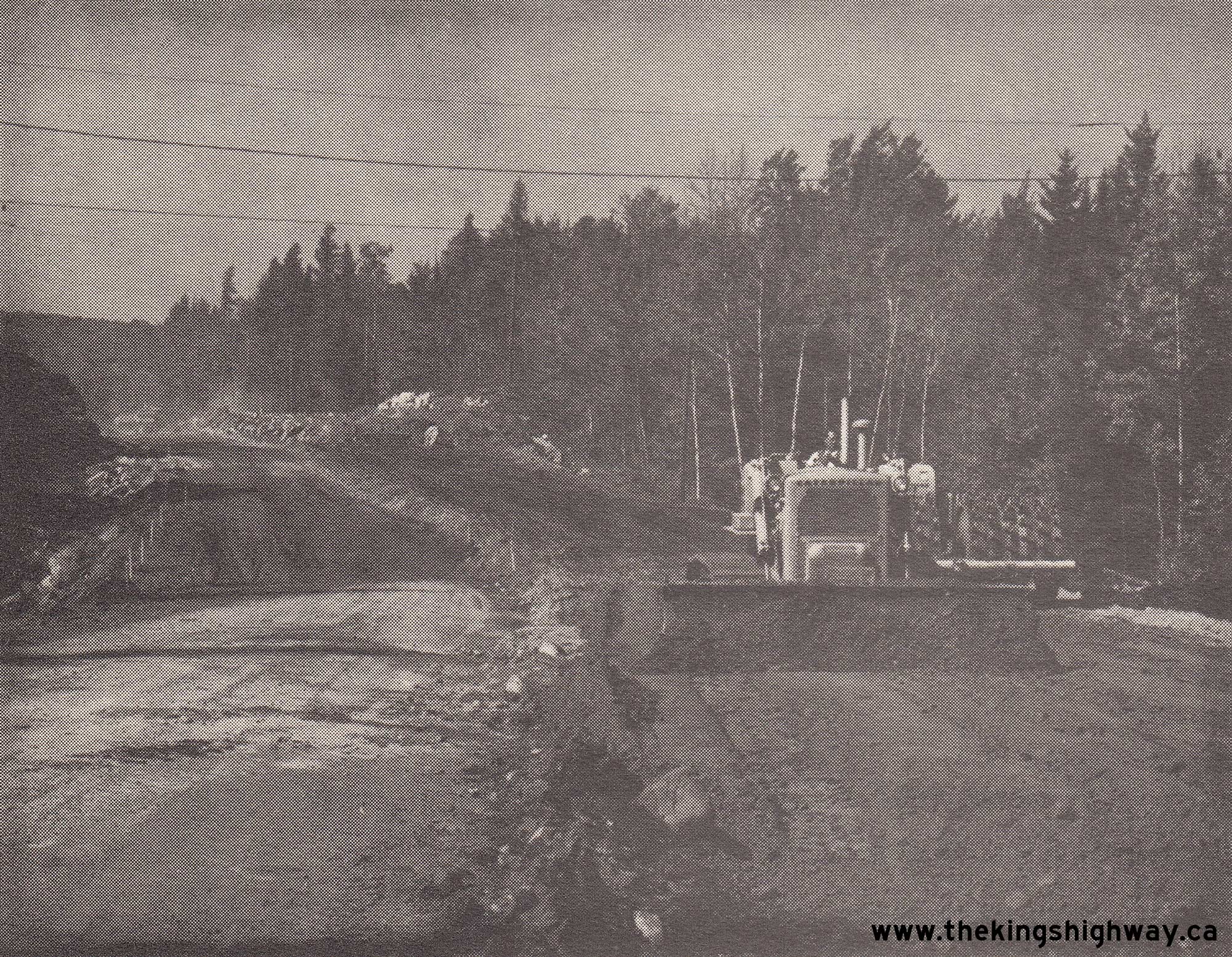
Above - Reconstruction of Hwy 60 on the approach to the Algonquin Park East Gate, Contract #1964-255. See an
Enlarged Photo Here. Photo taken in 1965. (Photo courtesy of Ontario Ministry of Transportation - © King's Printer for Ontario, 1965) 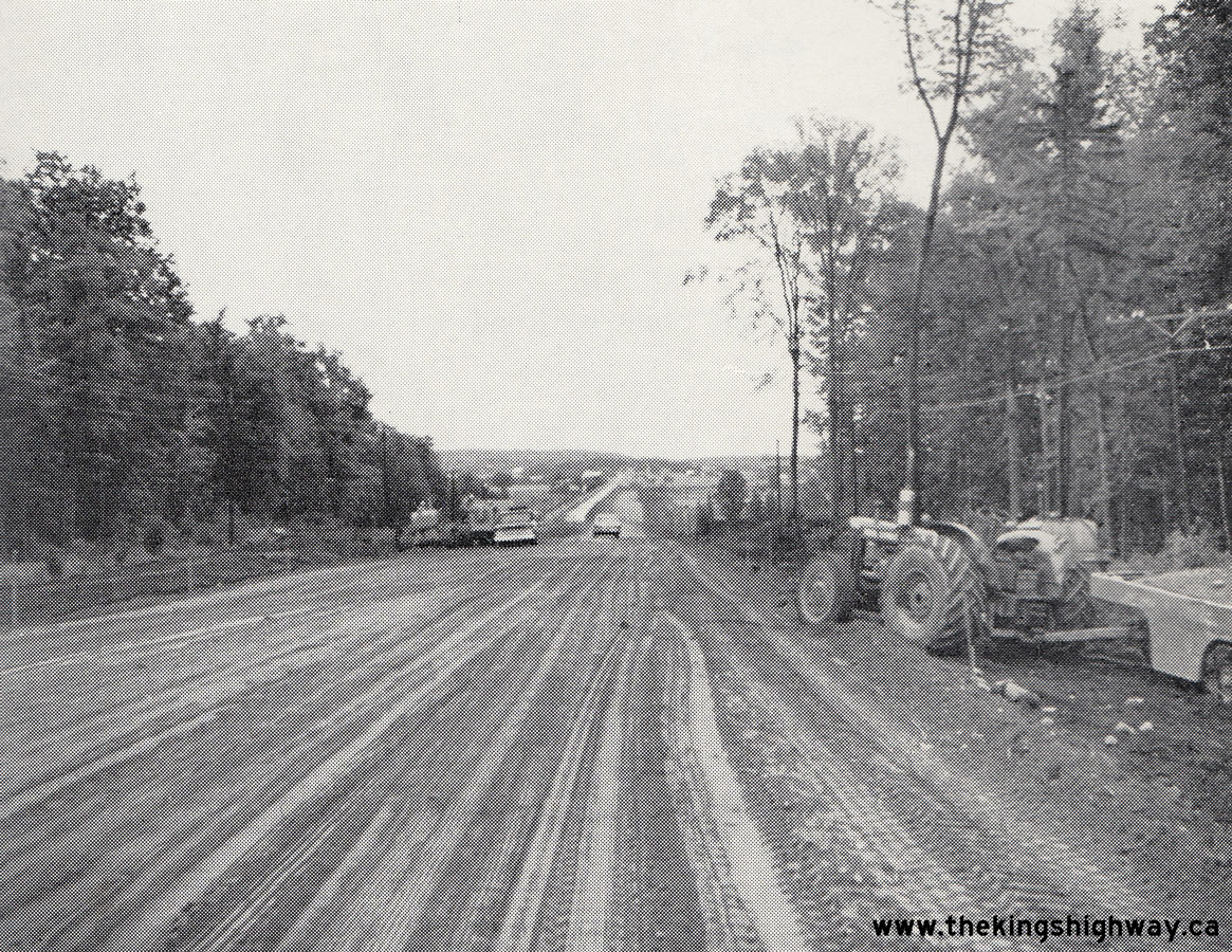
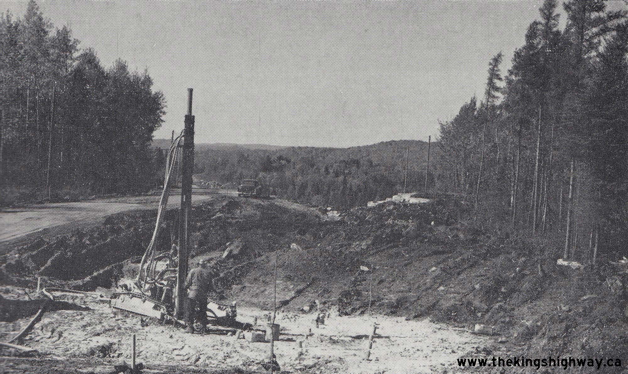
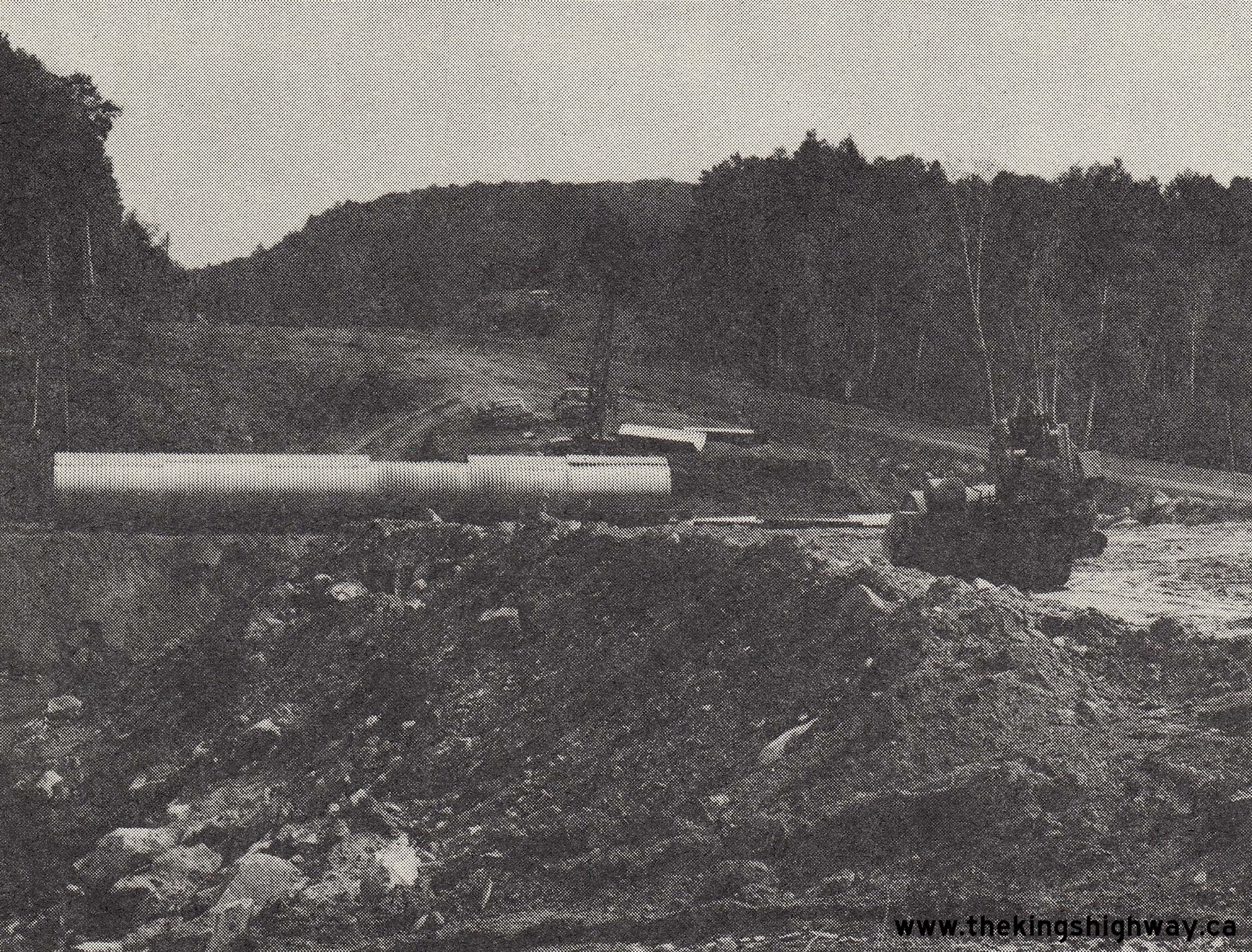
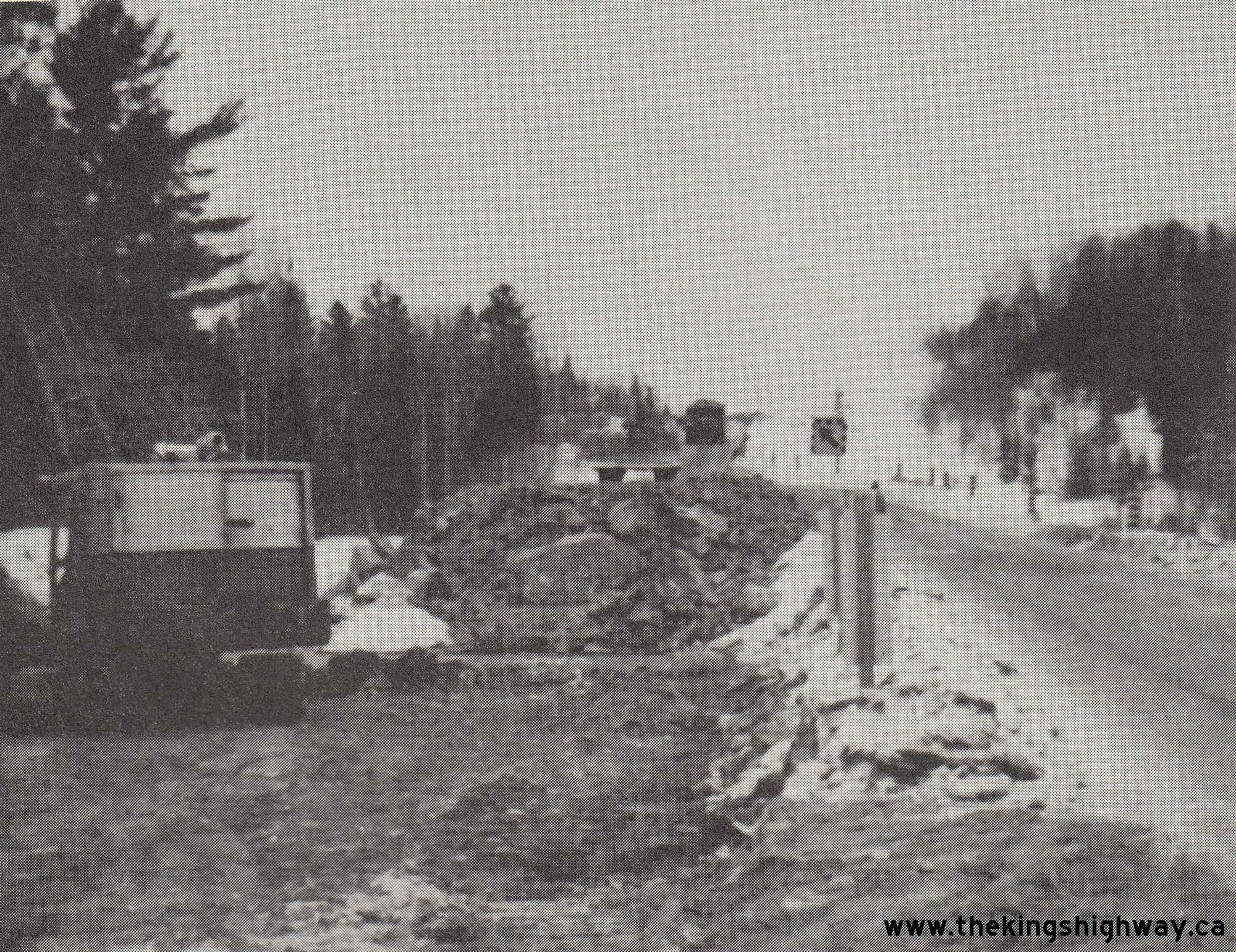
Left - Completed granular base on Hwy 60 east of Douglas, Contract #1965-225. See an
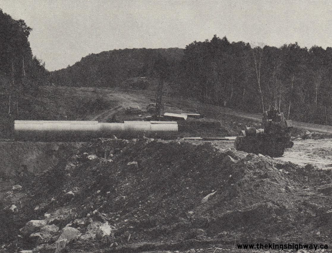
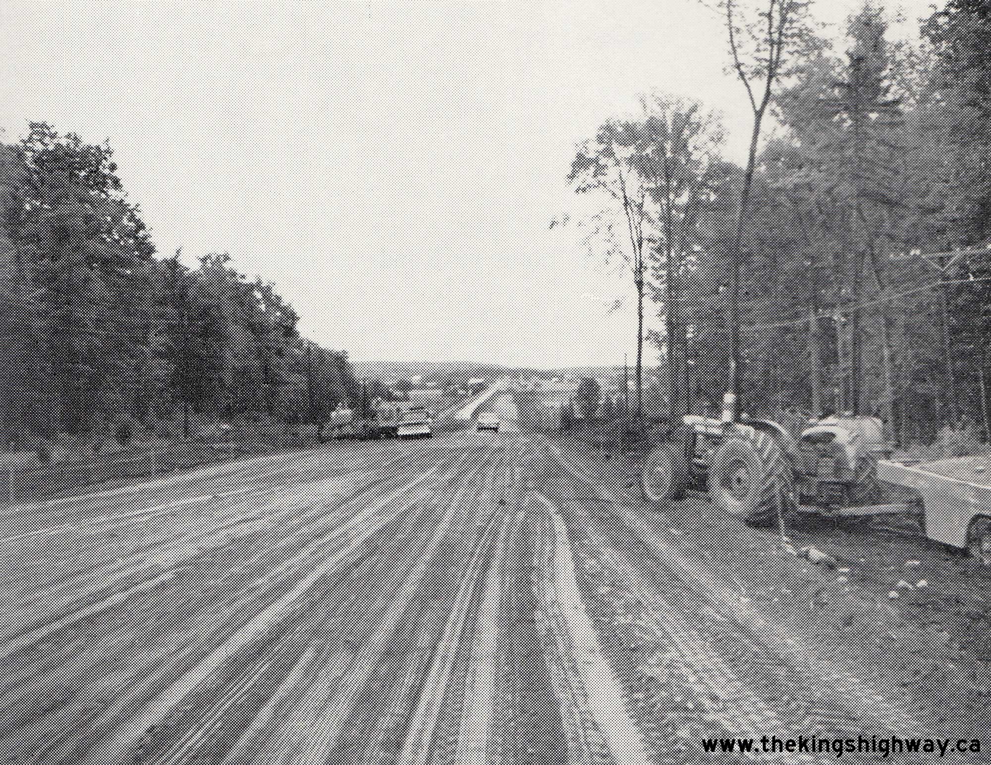
Enlarged Photo Here. Photo taken in 1966. (Photo courtesy of Ontario Ministry of Transportation - © King's Printer for Ontario, 1966) Right - Grading and culvert installation on Hwy 60 east of Algonquin Park Station Road, Contract #1967-117. See an Enlarged Photo Here. Photo taken in 1968. (Photo courtesy of Ontario Ministry of Transportation - © King's Printer for Ontario, 1968) 
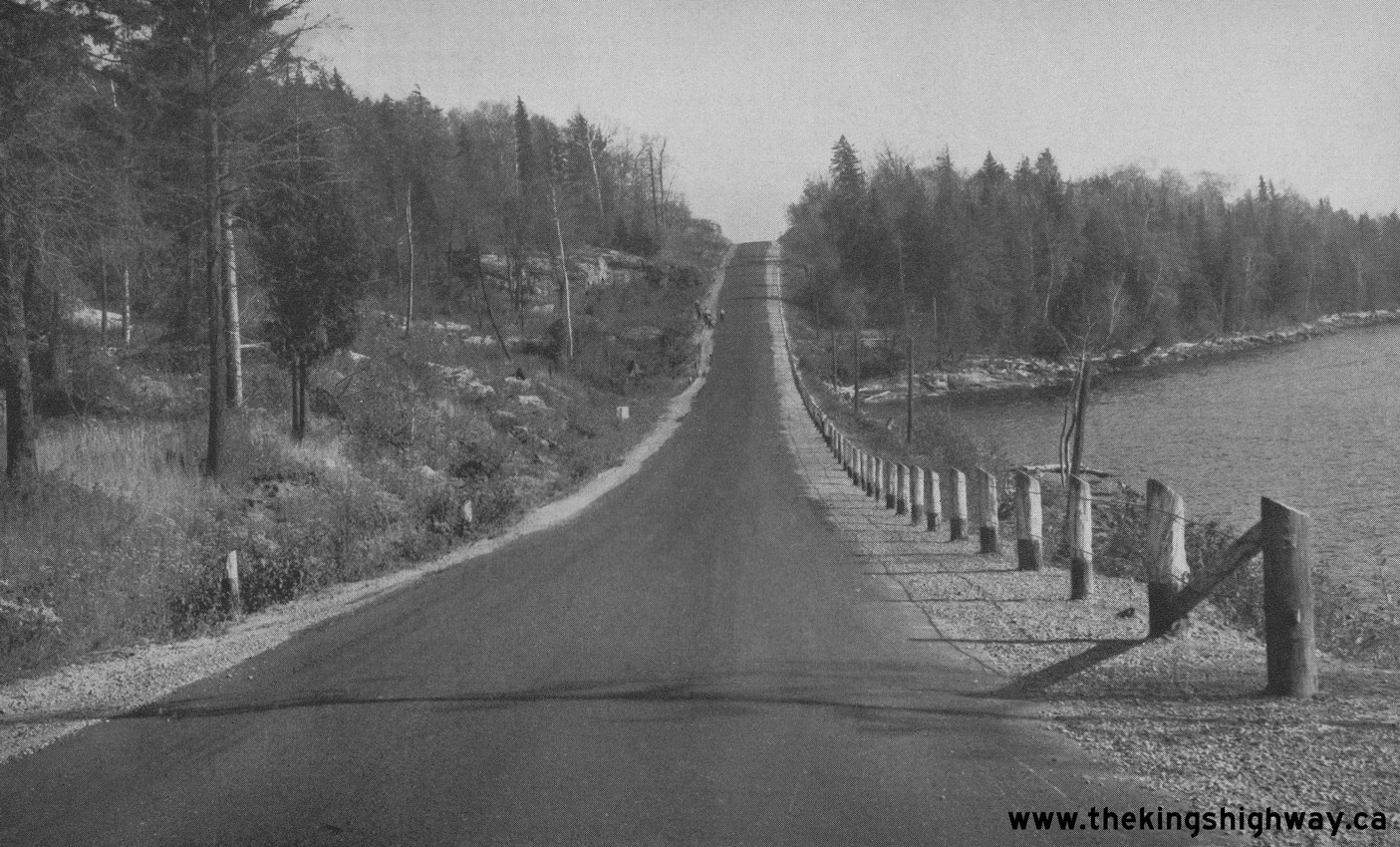
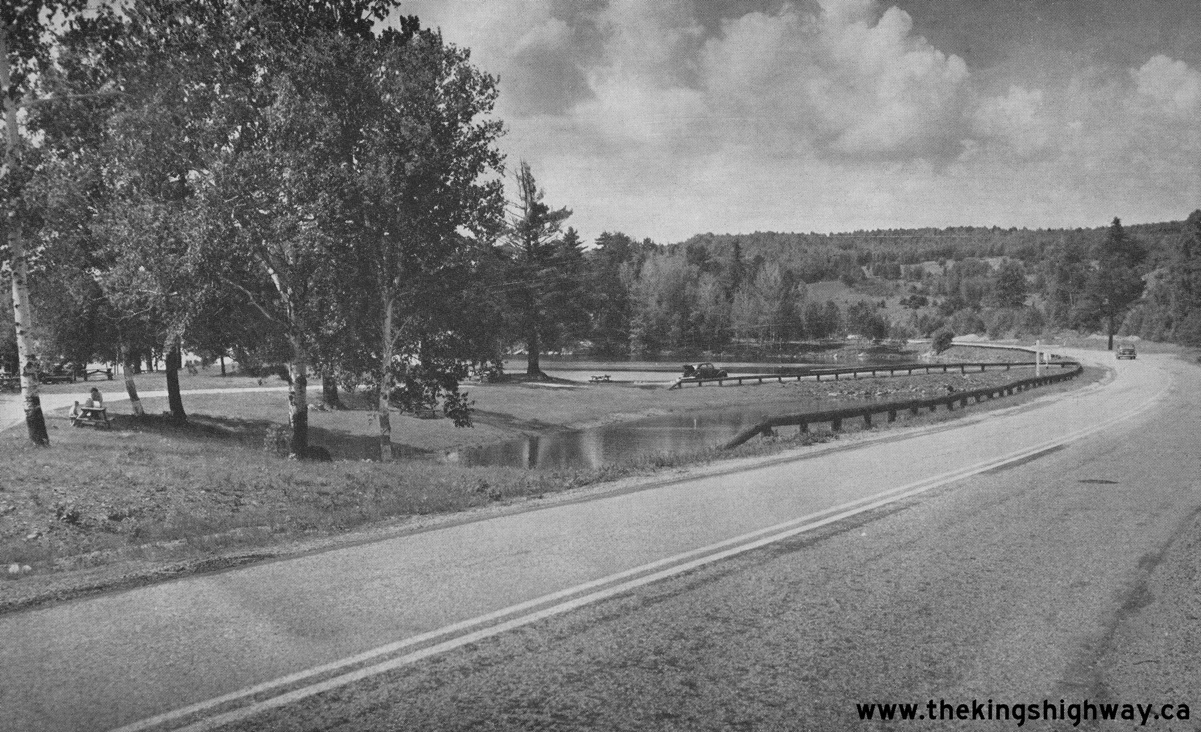
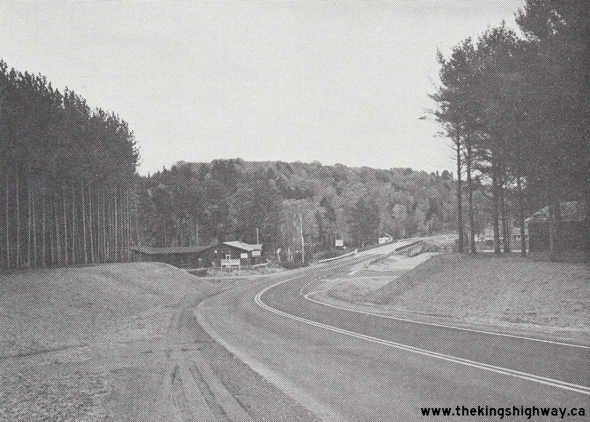
Above - Hwy 60 approaching Carson Lake and Trout Lake, west of Barry's Bay (1968) (Photo courtesy of Ontario Department of Tourism & Information - © King's Printer for Ontario, 1968) 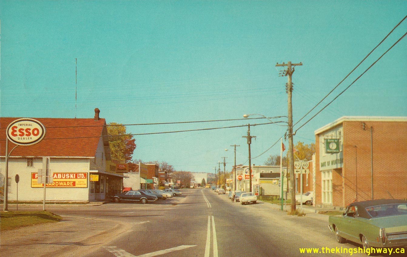
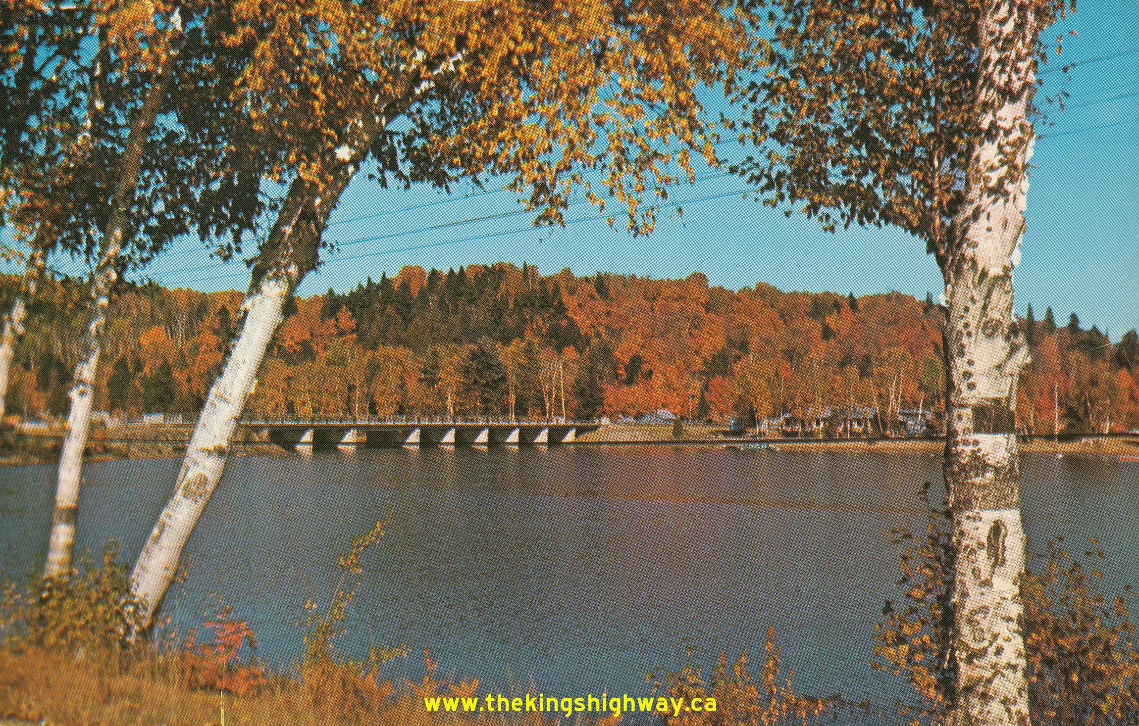
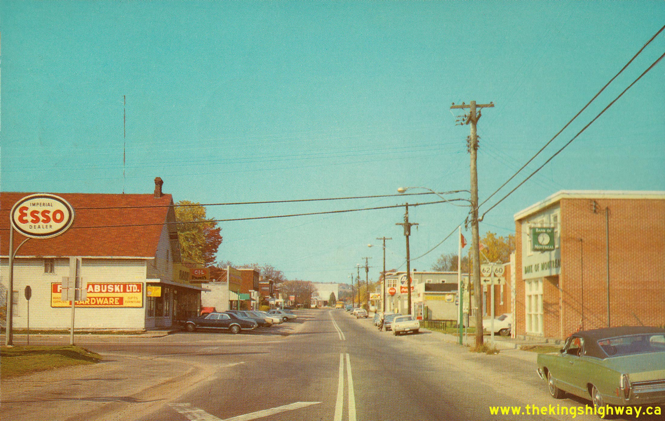
Above - Postcard view of the Hwy 60 & Hwy 62 Junction in Barry's Bay, facing west. See an
Enlarged Photo Here. Photo taken circa 1970. (Photo courtesy of Len Leiffer) 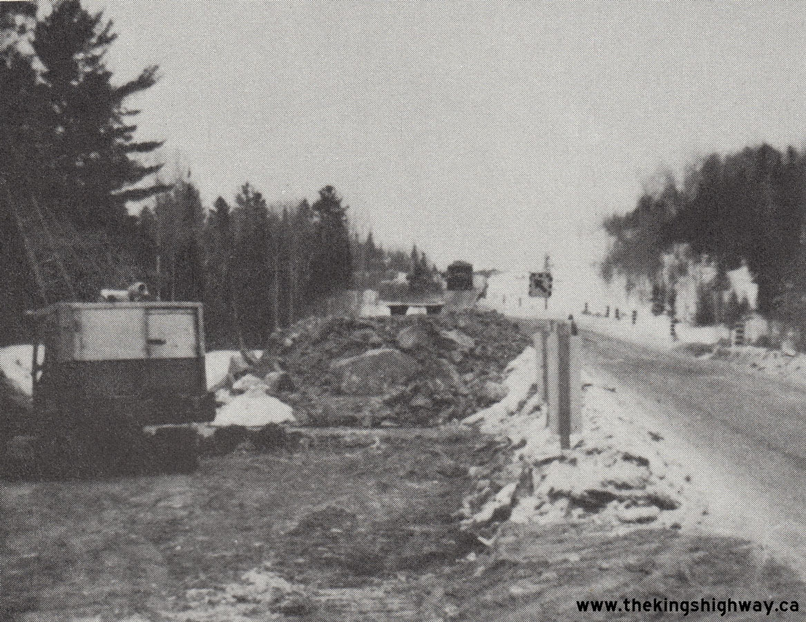 Above - Reconstruction of a section of Hwy 60 east of Madawaska, Contract #1972-171. See an
Enlarged Photo Here. Photo taken in 1972. Above - Reconstruction of a section of Hwy 60 east of Madawaska, Contract #1972-171. See an
Enlarged Photo Here. Photo taken in 1972.(Photo courtesy of Ontario Ministry of Transportation - © King's Printer for Ontario, 1972) 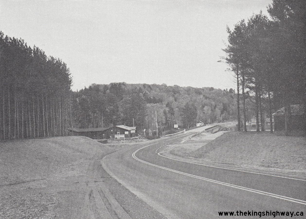 Above - Completed realignment of Hwy 60 at the western approach to the Oxtongue Lake Narrows Bridge, Contract #1977-64. See an
Enlarged Photo Here. Photo taken in 1978. Above - Completed realignment of Hwy 60 at the western approach to the Oxtongue Lake Narrows Bridge, Contract #1977-64. See an
Enlarged Photo Here. Photo taken in 1978.(Photo courtesy of Ontario Ministry of Transportation - © King's Printer for Ontario, 1978)
Continue on to King's Highway 60 Present Day Photos: Huntsville to Dwight
|
|---|
Links to Adjacent King's Highway Photograph Pages:
Back to King's Highway 59 Photos /
King's Highway 60 History /
On to King's Highway 61 Photos
Ontario Highway History - Main Menu / Back to List of Highways Website contents, photos & text © 2002-2026, Cameron
Bevers (Webmaster) - All Rights Reserved / Contact Me
|
|---|