
| 
| |
|
|
This page contains historical photos of Ontario's King's Highway 62 dating from 1910 to 1999. All photographs displayed on
this page were taken by the Ontario Ministry of Transportation, unless specifically noted otherwise. Historical photographs are arranged in approximate chronological
order. Click on any thumbnail to see a larger image!
Please note that all photographs displayed on this
website are protected by copyright. These photographs must not be reproduced, published,
electronically stored or copied, distributed, or posted onto other websites without
my written permission. If you want to use photos from this website, please
email me first for permission. Thank-you!
|
|---|
|
Page 1: Historical King's Highway 62 Photographs
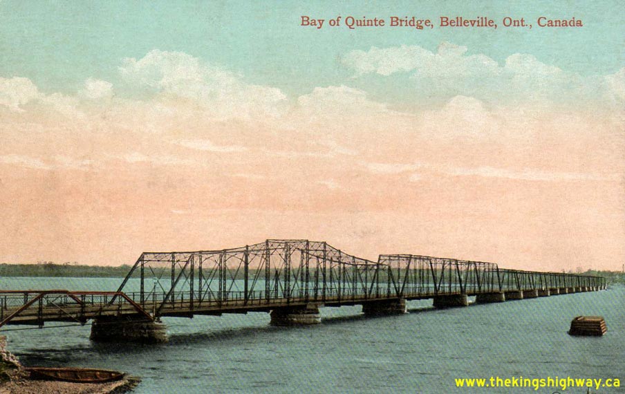
Above - Circa 1910 postcard view of the original Belleville Bay Bridge on Hwy 14 (now Hwy 62). The structure shown above was completed as a toll bridge in
1890. It was replaced by the Department of Public Highways in stages between 1927 and 1931 with new steel truss spans, a swing span, and a short causeway. This
Belleville Bay Swing Bridge was replaced with the current high-level structure (the Norris Whitney Bridge) in 1982. See an
Enlarged Photo Here. 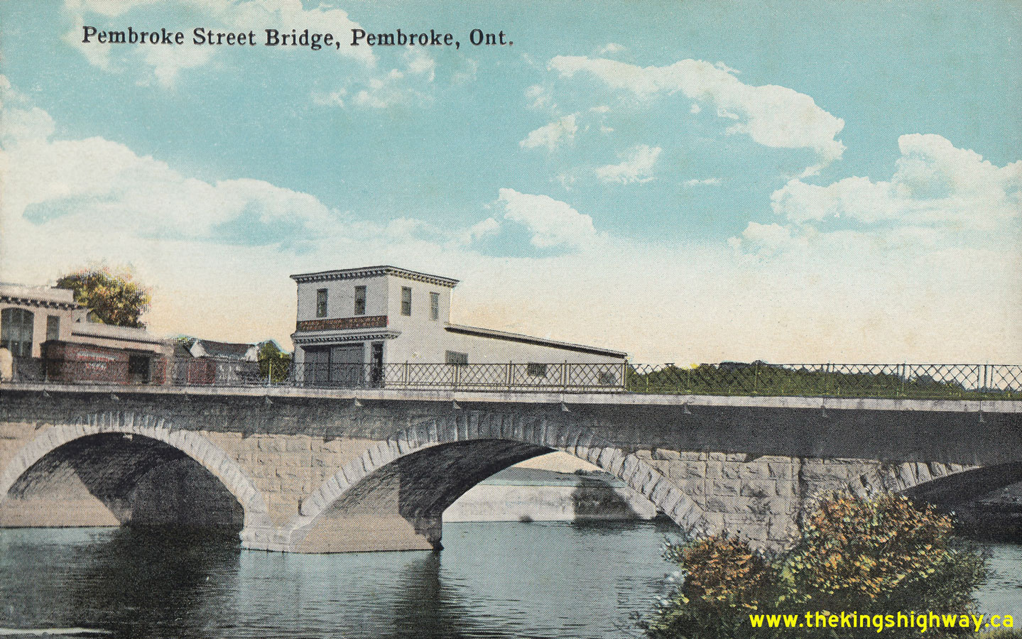
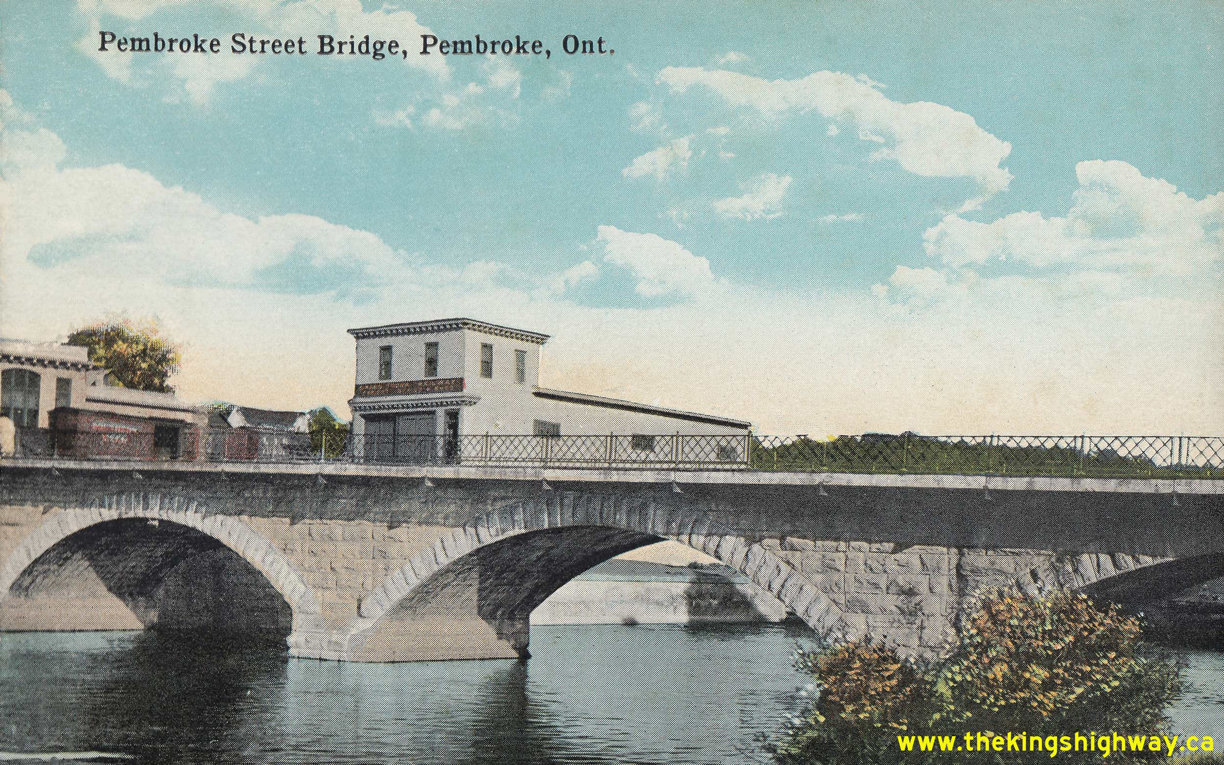
Above - Circa 1925 postcard view of the Muskrat River Bridge on Pembroke Street (Hwy 17, later known as Hwy 17 & Hwy 62) in Downtown Pembroke. This attractive
Victorian-era stone arch bridge was constructed in 1887. The bridge was widened by the Department of Highways of Ontario (DHO) in 1939. This postcard view shows the
Muskrat River Bridge's original 19th-Century appearance, as it existed prior to the DHO's widening of Hwy 17 during the 1930s. See an
Enlarged Photo Here. Photo taken circa 1925. (Photo from Cameron Bevers' historical photograph collection - Original photographer unknown) 
Above - Junction sign assembly in front of the Bancroft Theatre on Bridge Street (Hwy 62) approaching the Hwy 28 Junction in Bancroft in 1950. Note the unusual
"Straight Ahead" tab below the Hwy 28 route marker. These sign tabs were used in lieu of a through arrow at early highway junction sign assemblies. For many years in
fact, arrows were not used at all on the "advance" junction sign assembly in Ontario. Small "L" and "R" shields used to be placed below the highway route marker to
indicate whether the highway turned to the left or right at an upcoming intersection. See an
Enlarged Photo Here. Photo taken in 1950. (Photo © Archives of Ontario - Series RG-56-11, Photo #I-0027139) 

Left - New rock fill and culvert construction on the L'Amable Lake Diversion on Hwy 62 south of Bancroft. See an
Enlarged Photo Here. Photo taken on July 25, 1950. (Photo courtesy of Ontario Ministry of Transportation - © King's Printer for Ontario, 1950) Right - Circa 1950 postcard view of the old York River Bridge on Hwy 62 in Bancroft. This historic concrete arch structure was built in 1913. The bridge was quite narrow and was difficult for trucks to negotiate, especially at the Hwy 28 Junction which lay at the western end of the bridge. The old arch bridge was replaced by the current Hwy 62 bridge in 1965. See an Enlarged Photo Here. (Photo courtesy of the Gazette Publishing Company, Picton) 
Above - Heavy grading on the L'Amable Lake Diversion on Hwy 62 south of Bancroft. Photo taken on July 25, 1950. (Photo courtesy of Ontario Ministry of Transportation - © King's Printer for Ontario, 1950) 
Above - A Department of Highways' zone striping truck performing line painting operations on Hwy 14 (now Hwy 62) near Mountain View south of Belleville in
1950. Pavement markings were first introduced on Ontario's Highways in 1930. Originally, line paint was only used to mark the highway centreline approaching the crest
of hills on asphalt-surfaced highways. This was done to improve highway safety by encouraging motorists to stay in their own traffic lane in places where visibility
of oncoming traffic was restricted. No line paint was used on concrete-surfaced highways at first, as it was initially assumed that the centre construction joint
between the two concrete slabs provided adequate lane guidance to motorists. The use of line paint became much more prevalent on both concrete and asphalt-surfaced
highways by the end of the 1930s. However, line paint was still only warranted for use under certain traffic or geometric conditions. Line paint was introduced on
narrow highway pavements, sharp curves, approaching traffic signals and railway crossings, on multi-lane highways and on all heavily-traveled two-lane King's
Highways. The introduction of line paint was also helpful to mark safe passing zone opportunities on busy highways, hence why the Department of Highways originally
called this maintenance practice "zone painting" or "zone striping". As the King's Highway System became progressively busier after World War II, the painting of
highway centrelines just became a standard maintenance practice on all King's Highways. See an
Enlarged Photo Here. Photo taken on September 26, 1950. (Photo courtesy of Ontario Ministry of Transportation - © King's Printer for Ontario, 1950) 
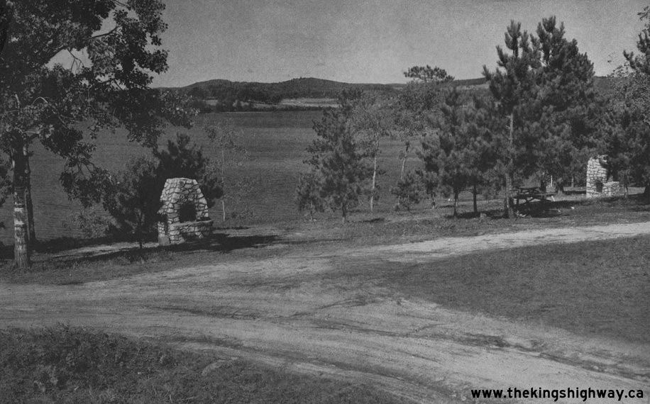
Left - New rock cut on Hwy 62 between Bancroft and Maynooth, located 3 miles north of Birds Creek. See an
Enlarged Photo Here. Photo taken on October 22, 1952. (Photo courtesy of Ontario Ministry of Transportation - © King's Printer for Ontario, 1952) Right - Roadside park on Hwy 62 at Kamaniskeg Lake, 1 mile south of Barry's Bay in 1954. This roadside park was developed by the Department of Highways in 1951. The park provided picnic facilities, fireplaces, a swimming area along with a small campground for use by motorists travelling along Hwy 62. See an Enlarged Photo Here. Photo taken on August 25, 1954. (Photo courtesy of Ontario Ministry of Transportation - © King's Printer for Ontario, 1954) 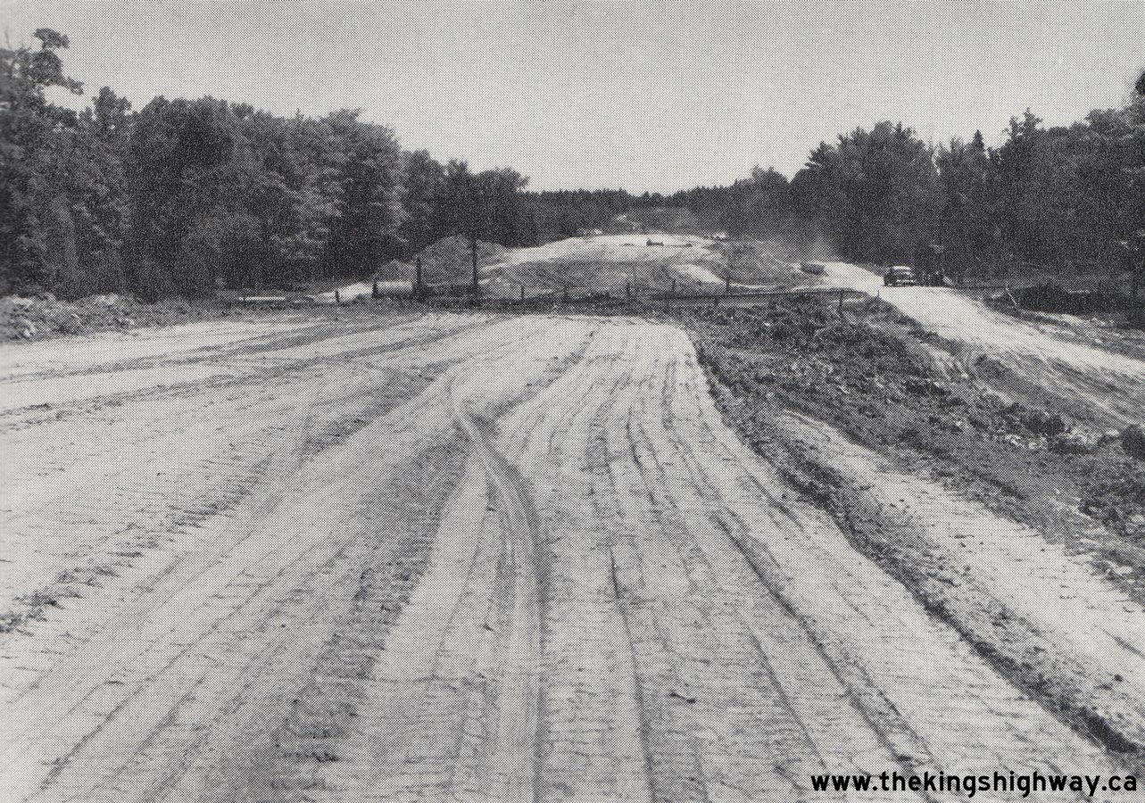
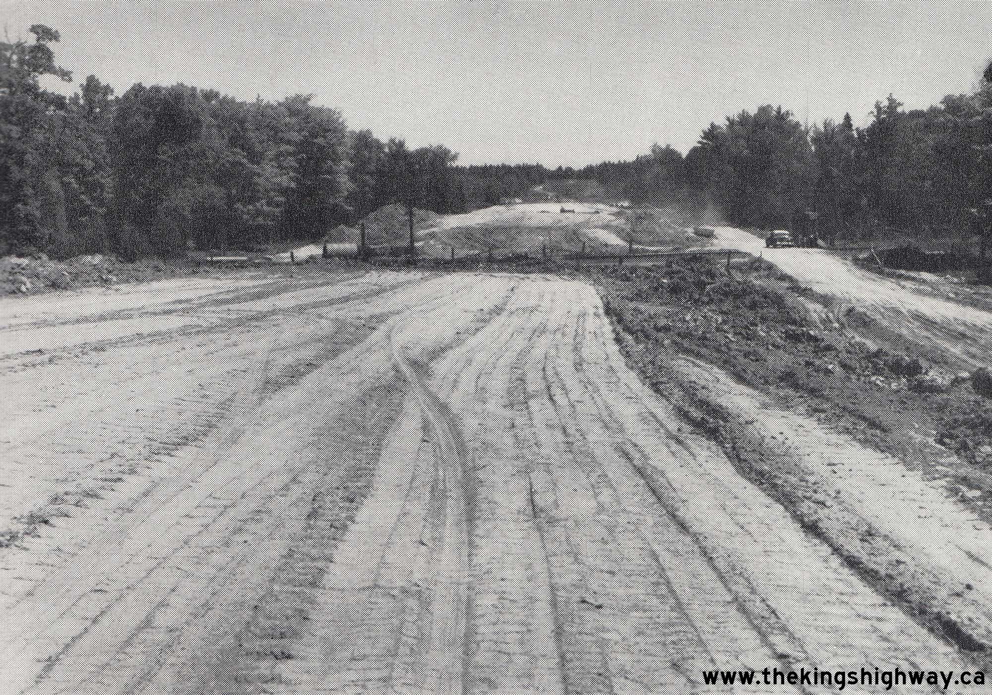
Above - Preliminary grading at Sta. 8+00 for the new Des Allumettes Road (Hwy 62, later known as Hwy 148) under Contract #1955-47, approaching the proposed
Canadian Pacific Railway (CPR) Overhead near Pembroke. The DHO tendered three construction contracts during 1955 to construct about 1 mile of new highway for the
Ontario approach to the proposed Des Allumettes Interprovincial Bridge being constructed by the Government of Canada. See an
Enlarged Photo Here. Photo taken on July 29, 1955. (Photo courtesy of Ontario Ministry of Transportation - © King's Printer for Ontario, 1955) 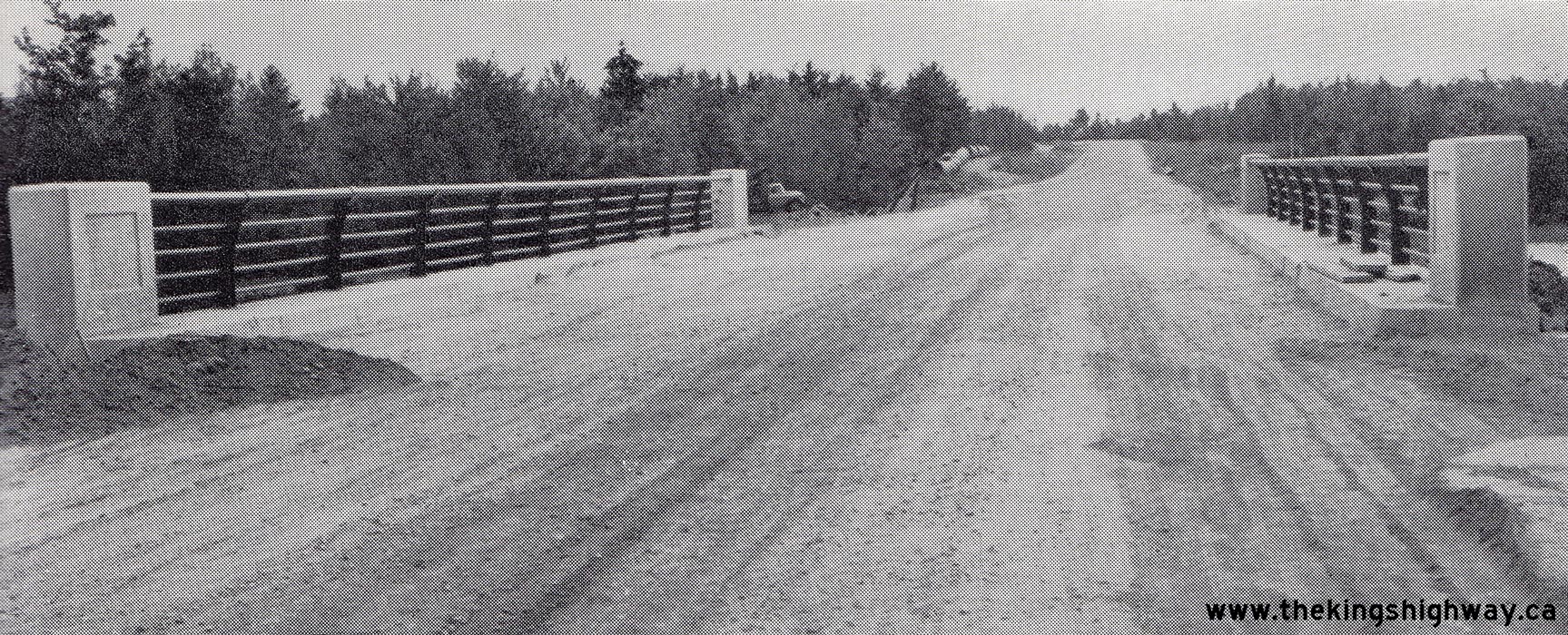
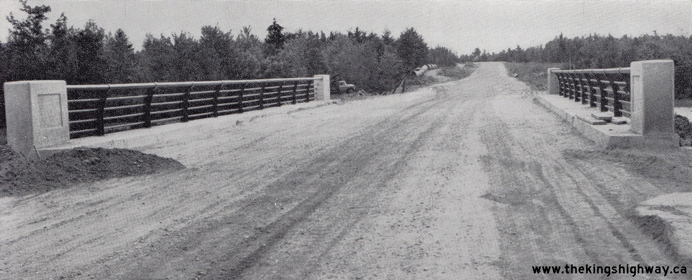
Above - Completed Hazley Bay Bridge on the new Des Allumettes Road (Hwy 62, later known as Hwy 148) east of Pembroke. Constructed under Contract #1955-100,
this was one of two new highway bridges built by the DHO on the Ontario approach to the proposed Des Allumettes Bridge. This proposed interprovincial bridge across
the Ottawa River linked Pembroke, Ontario to Waltham, Quebec. See an Enlarged Photo Here.
Photo taken on August 10, 1956. (Photo courtesy of Ontario Ministry of Transportation - © King's Printer for Ontario, 1956) 
Above - View of L'Amable Lake from Hwy 62, south of Bancroft in 1956. See an
Enlarged Photo Here. (Photo courtesy of Ontario Ministry of Transportation - © King's Printer for Ontario, 1956) 
Above - Circa 1957 postcard view of Hastings Street (Hwy 62) in Downtown Bancroft, facing north from the Hwy 500 Junction (later known as Hwy 28). See an
Enlarged Photo Here. (Photo courtesy of the Canadian Post Card Company, Ltd. Toronto) 
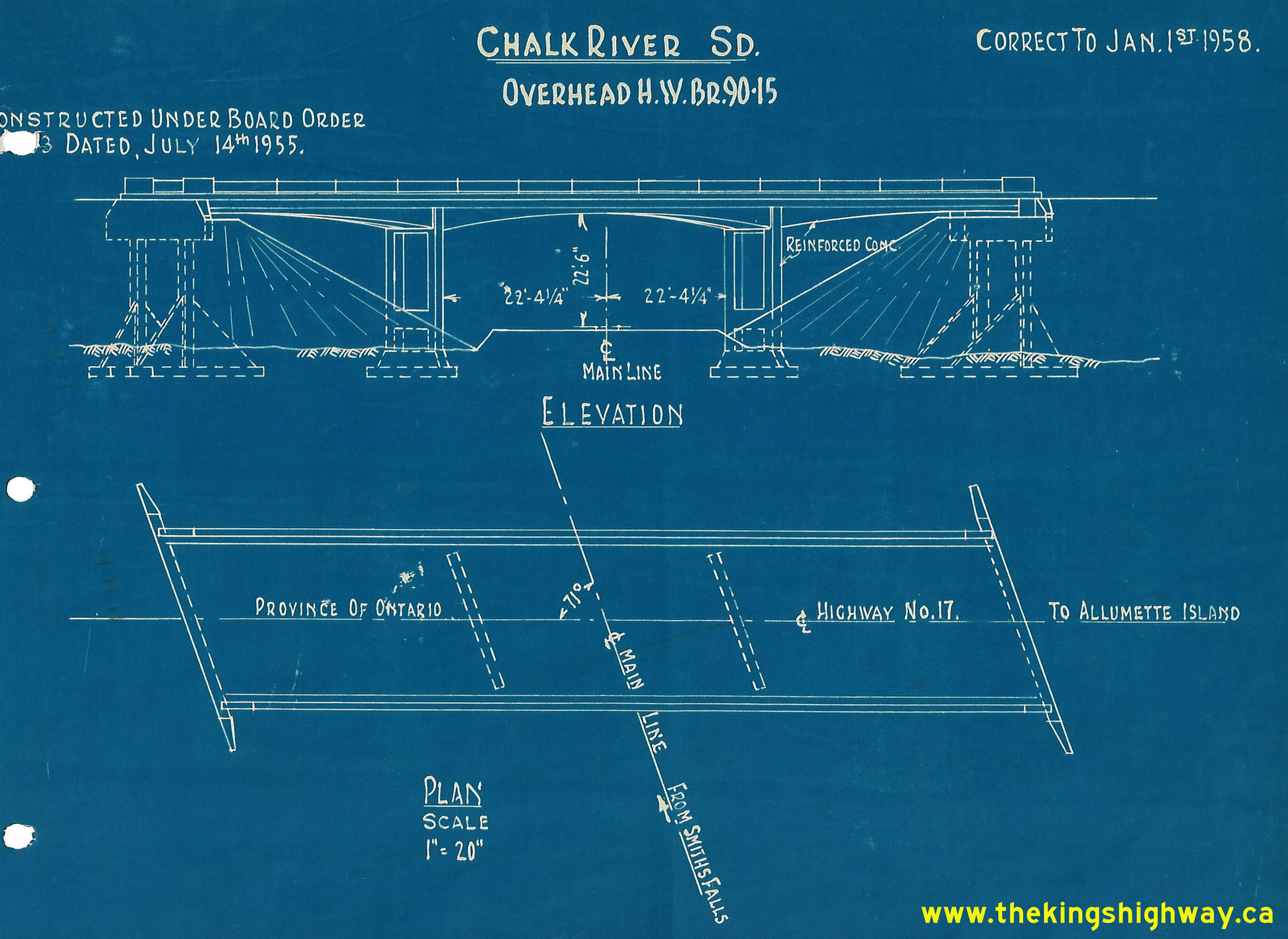
Above - Circa 1958 CPR file drawing of Des Allumettes Road Overhead on Hwy 62 (later known as Hwy 148) southeast of Pembroke, showing as-built elevations.
See an Enlarged Photo Here. (Photo from Josh Anderchek's historical photograph collection) 
Left - Postcard view of the new Des Allumettes Interprovincial Bridge across the Ottawa River on Hwy 62 (later known as Hwy 148) east of Pembroke. The new
highway bridge was built by the Government of Canada and was completed in 1957. Prior to the construction of this bridge, traffic wishing to cross between Ontario and
Quebec had to travel south to the bridge between Chenaux and Portage-du-Fort near Renfrew, or use a ferry service in order to cross the Ottawa River. See an
Enlarged Photo Here. Photo taken circa 1959. (Photo courtesy of C.R Sterling Photos) Right - Postcard view of Pembroke Street (Hwy 17, later known as Hwy 17 & Hwy 62) in 1959, facing east from Moffat Street in Downtown Pembroke. See an Enlarged Photo Here. Photo taken in 1959. (Photo courtesy of C.R Sterling Photos) 
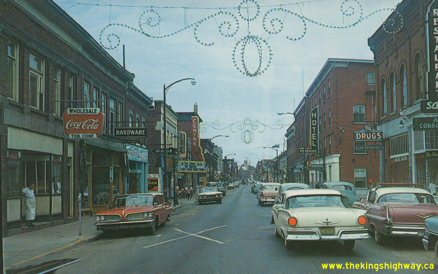
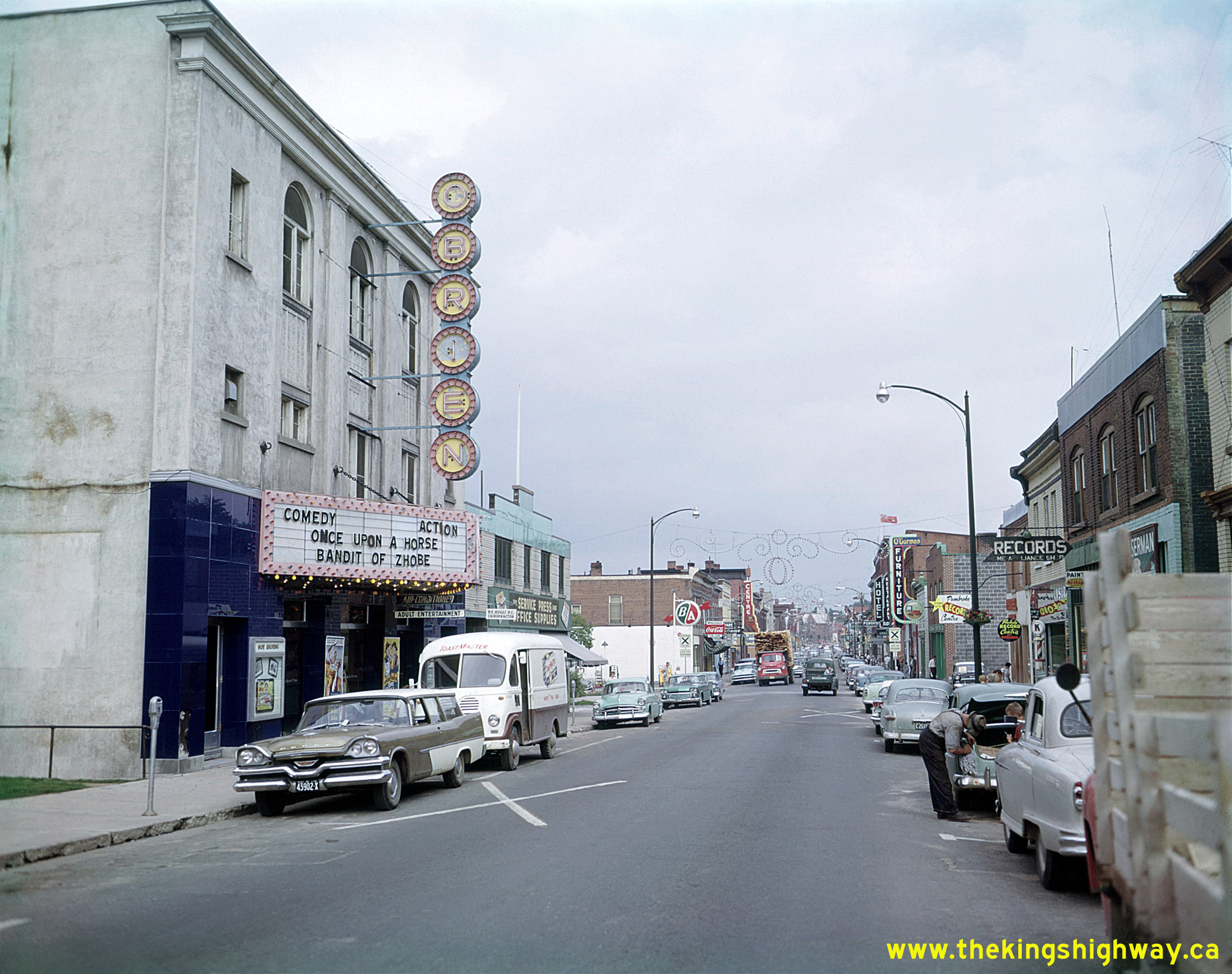
Above - View of Pembroke Street (Hwy 17, later known as Hwy 17 & Hwy 62) in 1959, facing east towards Agnes Street in Downtown Pembroke. While Hwy 17 served as
Pembroke's main street, it also served as a link in the Trans-Canada Highway and also served as the Ottawa Valley's main through highway. This great photo perfectly
captures daily life in small-town Ontario during the 1950s - busy downtown shops, movie theatres, a downtown gas station and lots of traffic. Over the years, many of
Pembroke's downtown businesses have closed or relocated to suburban shopping centres - a fate not at all uncommon in towns and smaller cities throughout Ontario. It
is interesting to note that the stationery store located beside the movie theatre at left in this photo is still in operation today, although the movie theatre
building beside it has since been demolished. See an Enlarged Photo Here. Photo taken in
1959. (Photo © Archives of Ontario - Series RG-65-35, Photo #I-0005681) 
Above - Construction of a new diversion on Hwy 62 north of Combermere (1959) (Photo courtesy of Ontario Ministry of Transportation - © King's Printer for Ontario, 1959) 

Left - Construction of a new bridge over the Madawaska River in Combermere (1959) (Photo courtesy of Ontario Ministry of Transportation - © King's Printer for Ontario, 1959) Right - Grade revision on Hwy 62 south of Barry's Bay (1959) (Photo courtesy of Ontario Ministry of Transportation - © King's Printer for Ontario, 1959) 
Above - Circa 1960 postcard view of the Belleville Bay Bridge on Hwy 14 (now Hwy 62). See an
Enlarged Photo Here. (Photo courtesy of L.F. Charter) 
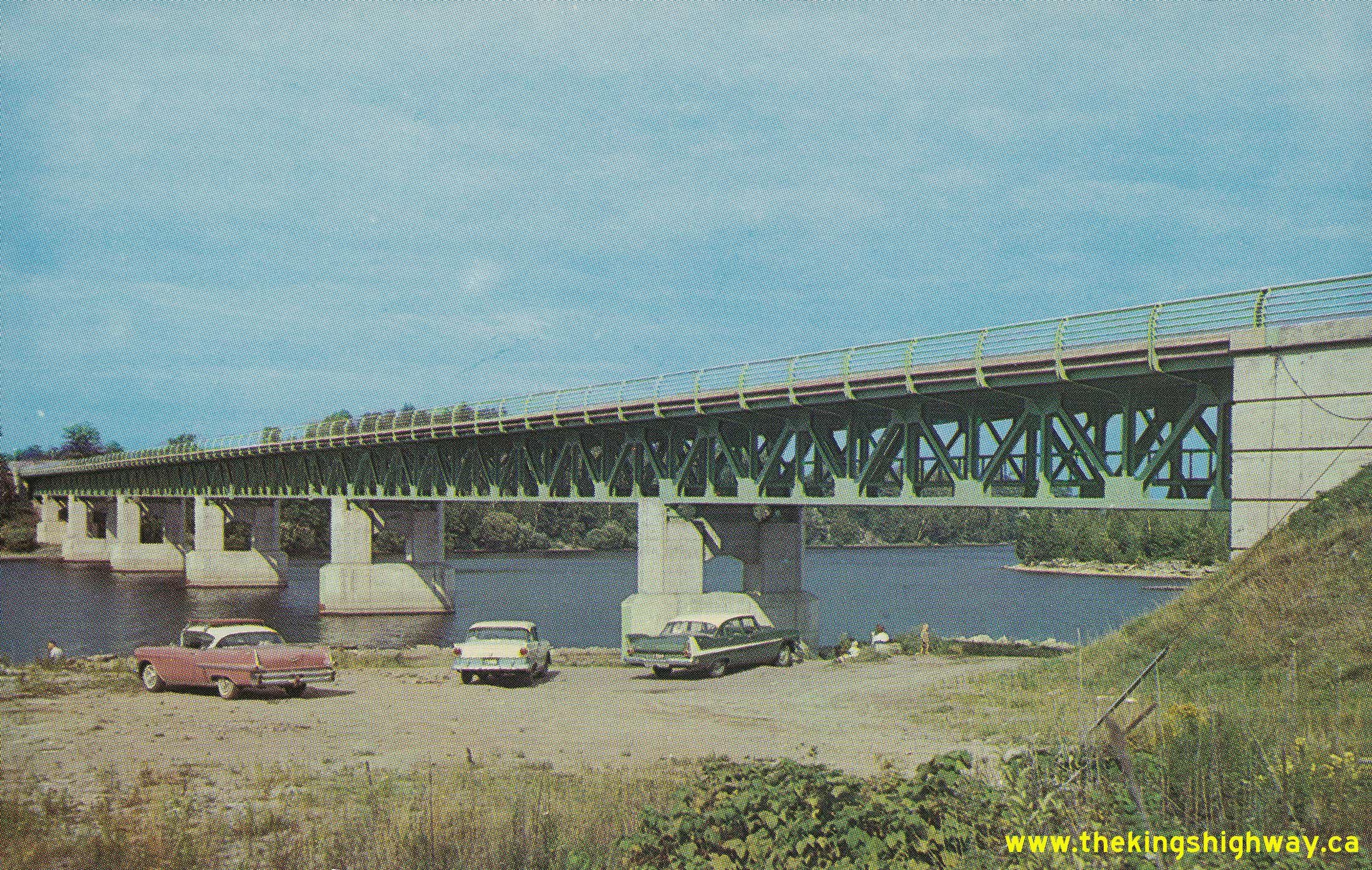
Above - Final painting of the new Madawaska River Bridge on Hwy 62 in Combermere in 1960. This two-span steel plate girder structure was 285 feet in length and
was built at a total construction cost of just over $320,000 (in 1960 Dollars). See an
Enlarged Photo Here. (Photo courtesy of Ontario Ministry of Transportation - © King's Printer for Ontario, 1960) 
Above - Reconstruction of Hwy 62 at Blackfish Bay, between Combermere and Barry's Bay. Photo taken in 1961. See an
Enlarged Photo Here. (Photo courtesy of Ontario Ministry of Transportation - © King's Printer for Ontario, 1961) 
Above - Roadway platform widening and reconstruction of Hwy 14 (now Hwy 62) between Belleville and Foxboro (1963) (Photo courtesy of Ontario Ministry of Transportation - © King's Printer for Ontario, 1963) 
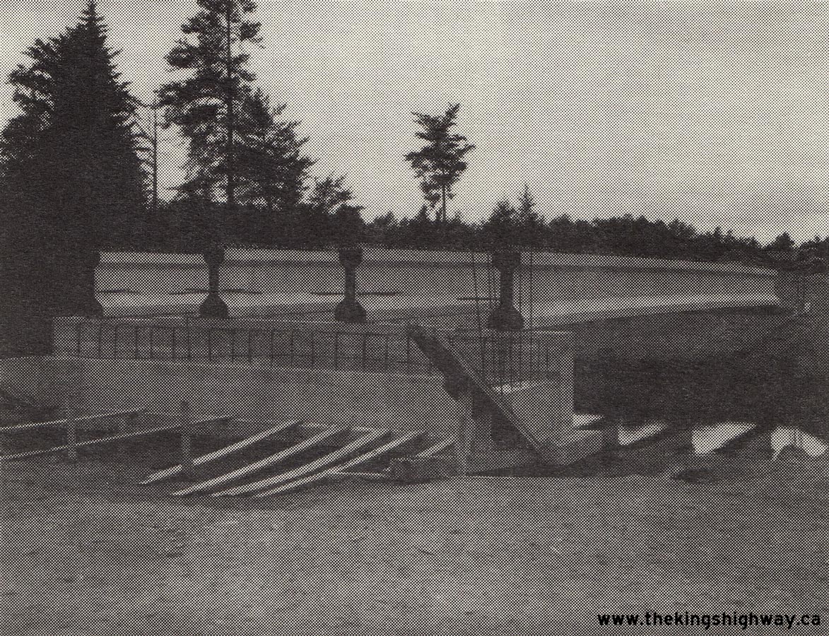
Left - Resurfacing operations on Hwy 62 west of Pembroke (1964) (Photo courtesy of Ontario Ministry of Transportation - © King's Printer for Ontario, 1964) Right - Concrete girder placement for the new Sherwood River Bridge on Hwy 62 (Formerly Hwy 521) near Round Lake, Contract #1966-214. This new concrete bridge replaced a narrow steel beam structure with a curb-to-curb roadway width of only 14 feet (4.27 m). The old bridge was so narrow that traffic had to take turns in alternating directions in order to cross over the Sherwood River. See an Enlarged Photo Here. Photo taken in 1967. (Photo courtesy of Ontario Ministry of Transportation - © King's Printer for Ontario, 1967) 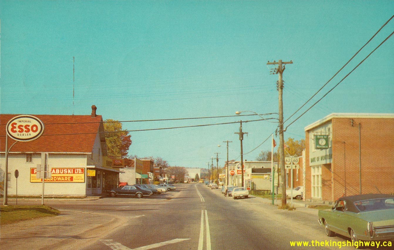
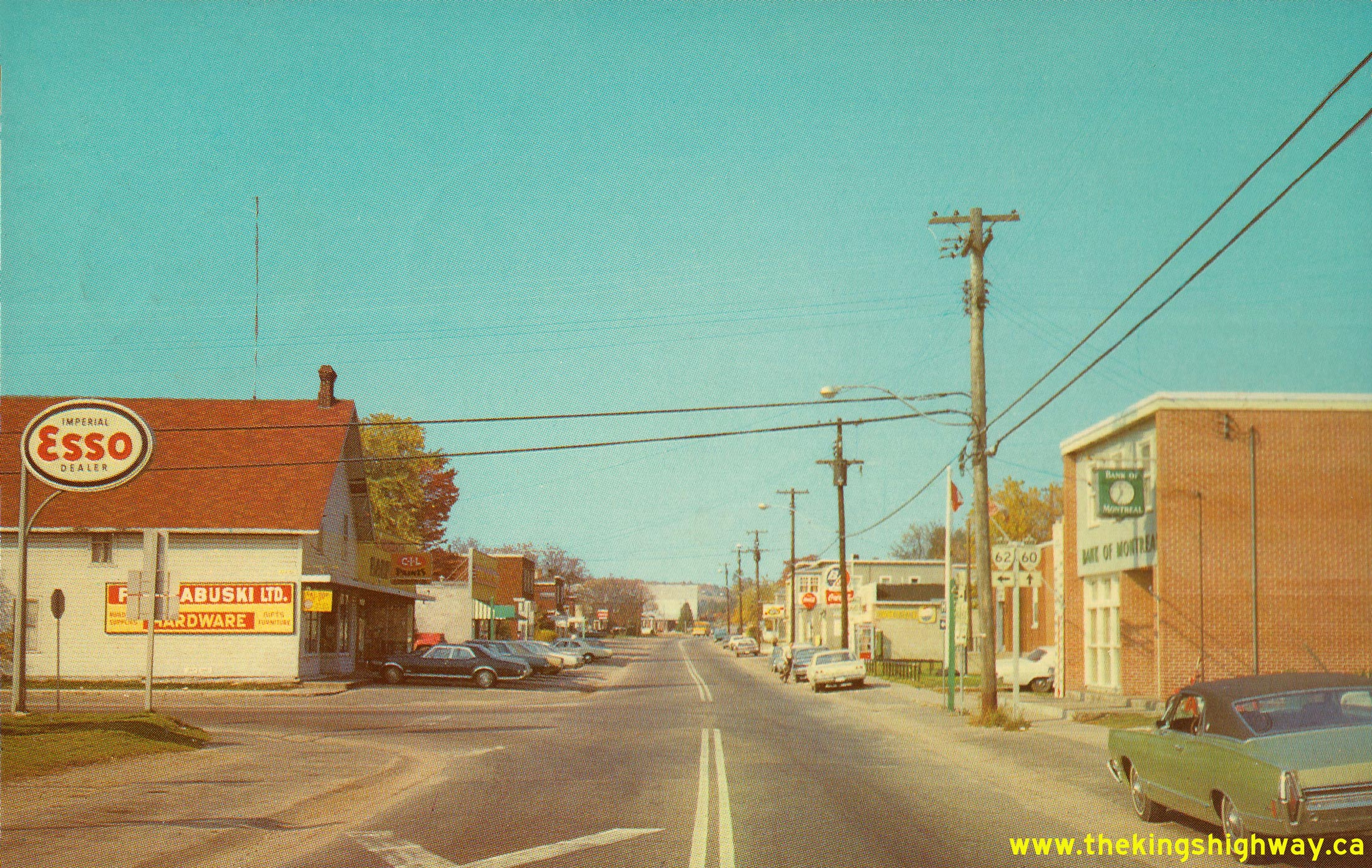
Above - Postcard view of the Hwy 60 & Hwy 62 Junction in Barry's Bay. See an
Enlarged Photo Here. Photo taken circa 1970. (Photo courtesy of Len Leiffer) 
Above - Resurfaced section of Hwy 62 north of Bannockburn (1972) (Photo courtesy of Ontario Ministry of Transportation - © King's Printer for Ontario, 1972) 

Left - Widening a rock cut on Hwy 62 south of Bancroft (1974) (Photo courtesy of Ontario Ministry of Transportation - © King's Printer for Ontario, 1974) Right - Completed reconstruction of Hwy 62, facing south from the Hwy 28 Junction in Bancroft (1975) (Photo courtesy of Ontario Ministry of Transportation - © King's Printer for Ontario, 1975)
Continue on to King's Highway 62 Present Day Photos: Bloomfield to Belleville
|
|---|
Links to Adjacent King's Highway Photograph Pages:
Back to King's Highway 61 Photos /
King's Highway 62 History /
On to King's Highway 63 Photos
Ontario Highway History - Main Menu / Back to List of Highways Website contents, photos & text © 2002-2026, Cameron
Bevers (Webmaster) - All Rights Reserved / Contact Me
|
|---|