
| 
|  |
|
|
This page contains present day photos (Year 2000 to date) of Ontario's King's Highway 62, arranged by location from Bloomfield
northerly to Belleville. All photographs displayed on this page were taken by the Webmaster (Cameron Bevers), unless specifically noted otherwise. Click on any
thumbnail to see a larger image!
Please note that all photographs displayed on this
website are protected by copyright. These photographs must not be reproduced, published,
electronically stored or copied, distributed, or posted onto other websites without
my written permission. If you want to use photos from this website, please
email me first for permission. Thank-you!
|
|---|
|
Page 2: Present Day King's Highway 62 Photographs (Bloomfield to Belleville)
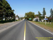
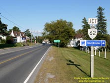
Left - Approaching the Hwy 62 Junction on Hwy 33 in Bloomfield, facing east. See an
Enlarged Photo here. (Photograph taken on September 17, 2009 - © Cameron Bevers) Right - A "JCT" Hwy 62 Junction sign on eastbound Hwy 33 approaching Bloomfield. See an Enlarged Photo here. (Photograph taken on September 17, 2009 - © Cameron Bevers) 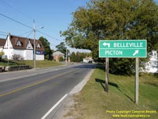

Left - Destination guide signs on eastbound Hwy 33 at the Hwy 62 Junction in Bloomfield. From this highway junction, Hwy 33 turns right and continues east
towards Picton and Kingston. Belleville is accessible via Hwy 62, at left. See an
Enlarged Photo here. (Photograph taken on September 17, 2009 - © Cameron Bevers) Right - Facing east at the Hwy 33 & Hwy 62 Junction in Bloomfield. Motorists who turn left here can follow Hwy 62 north to Belleville. Hwy 33 turns right at this junction and continues east towards Picton. This stop-controlled intersection has an unusual configuration with separated left and right turn lanes. This lane arrangement is typically only used at signalized or all-way stop controlled intersections. See an Enlarged Photo here. (Photograph taken on September 17, 2009 - © Cameron Bevers) 

Left - Southern terminus of Hwy 62 at the Hwy 33 Junction in Bloomfield. Hwy 33 continues straight ahead via Main Street. See an
Enlarged Photo here. (Photograph taken on September 17, 2009 - © Cameron Bevers) Right - Junction assembly at the Hwy 33 & Hwy 62 Junction in Bloomfield. Although the section of Hwy 33 lying west of Bloomfield was transferred to Prince Edward County in the 1990s, the route of Hwy 33 lying to the east of Bloomfield was retained in the provincial highway system. The highway from Belleville to Picton has been a provincial highway since 1921. Originally, the route was known as Hwy 14, although in later years the eastern and northern parts of the route were renumbered as Hwy 33 and Hwy 62, respectively. See an Enlarged Photo here. (Photograph taken on September 17, 2009 - © Cameron Bevers) 

Left - Facing north along Hwy 62 towards Belleville from the Hwy 33 Junction in Bloomfield. See an
Enlarged Photo here. (Photograph taken on September 17, 2009 - © Cameron Bevers) Right - Approaching the Hwy 62 Junction on westbound Hwy 33 (Main Street) in Bloomfield. See an Enlarged Photo here. (Photograph taken on September 17, 2009 - © Cameron Bevers) 

Left - Destination guide signs at the Hwy 33 & Hwy 62 Junction in Bloomfield, facing west. See an
Enlarged Photo here. (Photograph taken on September 17, 2009 - © Cameron Bevers) Right - Facing east along Hwy 33 towards Picton from the Hwy 62 Junction in Bloomfield. See an Enlarged Photo here. (Photograph taken on September 17, 2009 - © Cameron Bevers) 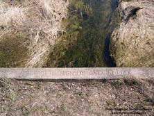
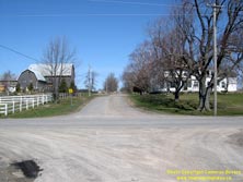
Left - Inscription on an old concrete culvert on a former alignment of Hwy 14 (Pierce Road) north of Bloomfield - "PROVINCIAL HIGHWAY ONTARIO 1924". See an
Enlarged Photo here. (Photograph taken on April 9, 2004 - © Cameron Bevers) Right - This township road (Pierce Road) north of Bloomfield was once part of Hwy 14. In 1961-1962, a diversion was constructed for Hwy 14 well to the east in order to bypass a sharp horizontal curve on the original highway's route. The section of Hwy 14 from Bloomfield to Foxboro was renumbered as Hwy 62 during the 1980s. See an Enlarged Photo here. (Photograph taken on April 9, 2004 - © Cameron Bevers) 
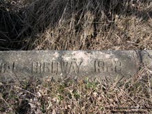
Left - Facing south along Old Hwy 14 (Pierce Road) from Gilead Road. Today's route of Hwy 62 bypasses this area entirely. See an
Enlarged Photo here. (Photograph taken on April 9, 2004 - © Cameron Bevers) Right - Date stamp on an old concrete culvert beside Hwy 62 north of Bloomfield - "ONTARIO PROVINCIAL HIGHWAY 1922". See an Enlarged Photo here. (Photograph taken on April 9, 2004 - © Cameron Bevers) 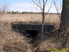

Left - An overgrown concrete culvert lying in a field indicates a former highway alignment north of Bloomfield. The entire route of Hwy 14 was reconstructed
through Prince Edward County in the early 1960s, in an effort to improve the highway's geometry. As a result, there are several abandoned and bypassed sections of the
highway in this area. See an Enlarged Photo here. (Photograph taken on April 9, 2004 - © Cameron Bevers) Right - Pearsall Creek Culvert on Hwy 62, located about 7 km north of Bloomfield. This culvert is rather unique, because the highway was actually realigned and the road's vertical profile raised directly on top of the old culvert. The culvert was extended and reconstructed as part of a highway improvement project carried out in 1962. See an Enlarged Photo here. (Photograph taken on April 9, 2004 - © Cameron Bevers) 

Left - The Pearsall Creek Culvert was extended in 1962 on the western side to allow for the construction of a revised alignment of Hwy 14 (later Hwy 62). The
bridge has only one steel handrail on the newer western side. The eastern side of the culvert is protected by steel beam guide rail. The structure definitely looks
very odd from the roadway level! See an Enlarged Photo here. (Photograph taken on April 9, 2004 - © Cameron Bevers) Right - Inscription on the older eastern side of the Pearsall Creek Culvert - "ONTARIO PROVINCIAL HIGHWAY 1923". See an Enlarged Photo here. (Photograph taken on April 9, 2004 - © Cameron Bevers) 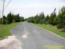
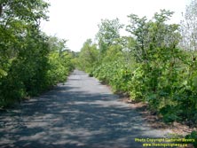
Left - Southern approach to the former Hwy 14 alignment at the community of Mountain View. A fairly substantial relocation of Hwy 14 took place here in 1960.
This section of the former highway is now a private driveway. Some parts of the old highway through the community of Mountain View are still open to public travel.
See an Enlarged Photo here. (Photograph taken on July 26, 2003 - © Cameron Bevers) Right - Facing north along an abandoned section of the former Hwy 14 alignment at Mountain View. Roughly 1 km of Old Hwy 14 through Mountain View was bypassed. See an Enlarged Photo here. (Photograph taken on July 26, 2003 - © Cameron Bevers) 

Left - The old alignment of Hwy 14 at Mountain View had a steep grade, which was bypassed by an much-improved highway alignment in 1960. See an
Enlarged Photo here. (Photograph taken on July 26, 2003 - © Cameron Bevers) Right - Facing south along the abandoned highway alignment at Mountain View. The forest is slowly reclaiming the old highway's route. See an Enlarged Photo here. (Photograph taken on July 26, 2003 - © Cameron Bevers) 

Left - Abandoned alignment of Hwy 14 approaching Mountain View. On the western side of Hwy 62, parts of the old highway's route are still public roadways
through the community of Mountain View (Cannery Road and Union Road). However, the old curve diversion seen here serves as a private driveway. See an
Enlarged Photo here. (Photograph taken on July 26, 2003 - © Cameron Bevers) Right - Worn date stamp (1922) on a concrete culvert on a former alignment of Hwy 14 (Reddick Street) in Rossmore. See an Enlarged Photo here. (Photograph taken on April 9, 2004 - © Cameron Bevers) 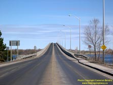
Left - View of the Norris Whitney Bridge on Hwy 62, facing north towards Belleville from the southern end of the bridge. This new high-level structure was
completed in 1982. The Norris Whitney Bridge replaced an opening bridge located on a causeway between Rossmore and Belleville. See an
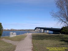
Enlarged Photo here. (Photograph taken on April 9, 2004 - © Cameron Bevers) Right - The old Belleville Bay Bridge was constructed by the Department of Public Highways of Ontario (DPHO) between 1927 and 1931. The crossing consisted of multiple steel truss spans and a long causeway, the remnants of which can be seen in the background. The bridge and causeway structure replaced an 18-span truss bridge that was built in 1890. See an Enlarged Photo here. (Photograph taken on April 9, 2004 - © Cameron Bevers) 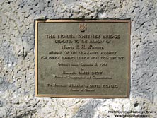

Left - Plaque commemorating the official opening of the Norris Whitney Bridge on December 4, 1982. See an
Enlarged Photo here. (Photograph taken on April 9, 2004 - © Cameron Bevers) Right - Stone monument commemorating the completion of the original Bay of Quinte Bridge in 1890. See an Enlarged Photo here. (Photograph taken on April 9, 2004 - © Cameron Bevers) 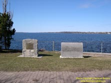

Left - Both bridge monuments have been thoughtfully preserved in a small roadside park beside Hwy 62 in Rossmore. See an
Enlarged Photo here. (Photograph taken on April 9, 2004 - © Cameron Bevers) Right - Western side of the Norris Whitney Bridge on Hwy 62, facing north towards Belleville. Construction of the new bridge began in 1980, and took almost 3 years to complete. The high-level bridge is 881 metres (2,890 feet) in length, and has a vertical clearance over the marine navigation channel of 23 metres (75 feet). See an Enlarged Photo here. (Photograph taken on April 9, 2004 - © Cameron Bevers) 

Left - Looking south from Belleville across the now-abandoned causeway and former site of the old Belleville Bay Bridge. Note the old highway pavement in the
background. The old Belleville Bay Bridge was dismantled in 1983-1984, following the completion of the new Norris Whitney Bridge at left. See an
Enlarged Photo here. (Photograph taken on April 9, 2004 - © Cameron Bevers) Right - A symmetrical centreline view underneath the Norris Whitney Bridge on Hwy 62 in Belleville. See an Enlarged Photo here. (Photograph taken on April 9, 2004 - © Cameron Bevers) 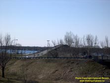
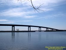
Left - North approach to the Norris Whitney Bridge over the Bay of Quinte on Hwy 62 in Belleville, facing south towards Bloomfield. See an
Enlarged Photo here. (Photograph taken on April 9, 2004 - © Cameron Bevers) Right - Western side of the Norris Whitney Bridge, facing south from Belleville. Note the abandoned causeway of the former Belleville Bay Bridge beside the new skyway. See an Enlarged Photo here. (Photograph taken on April 9, 2004 - © Cameron Bevers) 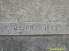
Left - Date stamp (1982) and structure identification number on the Norris Whitney Bridge on Hwy 62 in Belleville. See an
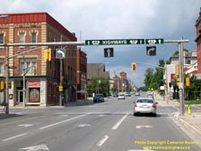
Enlarged Photo here. (Photograph taken on April 9, 2004 - © Cameron Bevers) Right - This interesting internally-illuminated overhead sign on northbound Pinnacle Street (Hwy 62) guides traffic north towards highways leading out of Belleville. This sign was a municipal installation, as the Ministry of Transportation of Ontario (MTO) does not use internally-illuminated signs such as this to mark provincial highways. See an Enlarged Photo here. (Photograph taken on August 17, 2008 - © Cameron Bevers) 
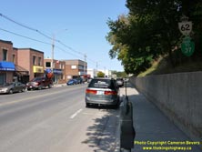
Left - Facing south along Pinnacle Street (Hwy 62) from Victoria Avenue in Downtown Belleville. See an
Enlarged Photo here. (Photograph taken on September 10, 2017 - © Cameron Bevers) Right - Dual Hwy 62 and "TO 37" route markers on northbound Pinnacle Street in Downtown Belleville. See an Enlarged Photo here. (Photograph taken on September 10, 2017 - © Cameron Bevers) 
Above - Hwy 62 and "TO 2" route markers along southbound Pinnacle Street in Downtown Belleville. The Hwy 2 trailblazer marker likely dates from the
1960s. See an Enlarged Photo here. (Photograph taken on September 10, 2017 - © Cameron Bevers) 
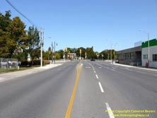
Left - Facing south along Pinnacle Street (Hwy 62) from Station Street (Hwy 37) in Downtown Belleville. See an
Enlarged Photo here. (Photograph taken on September 10, 2017 - © Cameron Bevers) Right - Approaching the Hwy 37 Junction on Hwy 62 in Belleville, facing north. See an Enlarged Photo here. (Photograph taken on September 10, 2017 - © Cameron Bevers) 

Left - Facing north along Station Street (Hwy 37) from Pinnacle Street (Hwy 62). The route of Hwy 37 extends north from Belleville and connects with Hwy 7 near
Actinolite. In 1932, Hwy 37 was established as a new King's Highway which connected Belleville to the new Perth-Madoc Highway (Hwy 7), which was nearing completion
at the time. Provincial jurisdiction over Hwy 37 begins at the Hwy 401 Interchange, located about 3 km to the north. The balance of Hwy 37 lying between the Hwy 62
Junction and the Hwy 401 Interchange is under the jurisdiction of the City of Belleville. See an
Enlarged Photo here. (Photograph taken on September 10, 2017 - © Cameron Bevers) Right - Junction sign assembly at the Hwy 37 & Hwy 62 Junction in Downtown Belleville. See an Enlarged Photo here. (Photograph taken on September 10, 2017 - © Cameron Bevers) 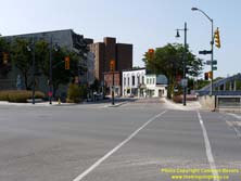

Left - Southern terminus of Hwy 37 at Pinnacle Street (Hwy 62) in Downtown Belleville. When Hwy 37 was first established in 1932, the highway continued south
for one more block to connect with Hwy 14 (the historical predecessor of Hwy 62) at Front Street. The route of Hwy 14 (now Hwy 62) was rerouted several times through
Downtown Belleville over the years. See an Enlarged Photo here. (Photograph taken on September 10, 2017 - © Cameron Bevers) Right - Eastern side of the Sagonaska Bridge over the Moira River on Pinnacle Street (Hwy 62) in Downtown Belleville. See an Enlarged Photo here. (Photograph taken on September 10, 2017 - © Cameron Bevers) 
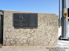
Left - View of the Sagonaska Bridge over the Moira River on Pinnacle Street (Hwy 62), facing north from Station Street (Hwy 37). See an
Enlarged Photo here. (Photograph taken on September 10, 2017 - © Cameron Bevers) Right - Date stamp (1978) and commemorative plaque marking the opening of the Sagonaska Bridge on Pinnacle Street (Hwy 62). See an Enlarged Photo here. (Photograph taken on September 10, 2017 - © Cameron Bevers) 

Left - Western side of the Sagonaska Bridge over the Moira River on Pinnacle Street (Hwy 62) in Downtown Belleville. See an
Enlarged Photo here. (Photograph taken on September 10, 2017 - © Cameron Bevers) Right - Junction sign assembly on southbound Pinnacle Street (Hwy 62) approaching the Hwy 37 Junction at Station Street. See an Enlarged Photo here. (Photograph taken on September 10, 2017 - © Cameron Bevers) 

Left - Facing south across the Sagonaska Bridge over the Moira River on Pinnacle Street (Hwy 62). See an
Enlarged Photo here. (Photograph taken on September 10, 2017 - © Cameron Bevers) Right - Facing north along Pinnacle Street (Hwy 62) from the Sagonaska Bridge. See an Enlarged Photo here. (Photograph taken on September 10, 2017 - © Cameron Bevers) 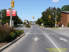
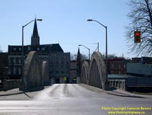
Left - Facing north along Pinnacle Street (Hwy 62) at Moira Street in Downtown Belleville. This revised route of Hwy 62 (Formerly Hwy 14) provided a four-lane
street into Downtown Belleville. The previous route of Hwy 14 followed North Front Street, which was only two lanes. See an
Enlarged Photo here. (Photograph taken on September 10, 2017 - © Cameron Bevers) Right - Moira River Bridge on a former alignment of Hwy 14 (North Front Street), facing south towards Downtown Belleville. See an Enlarged Photo here. (Photograph taken on April 9, 2004 - © Cameron Bevers) 

Left - Facing north across the Moira River Bridge on a former alignment of Hwy 14 (North Front Street) in Downtown Belleville. See an
Enlarged Photo here. (Photograph taken on April 9, 2004 - © Cameron Bevers) Right - Eastern side of the Moira River Bridge on North Front Street (Formerly Hwy 14). This two-span concrete bowstring arch bridge was completed in 1930. See an Enlarged Photo here. (Photograph taken on April 9, 2004 - © Cameron Bevers) 
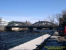
Left - Commemorative plaque marking the opening of the Moira River Bridge on the former route of Hwy 14 (North Front Street) in 1930. See an
Enlarged Photo here. (Photograph taken on April 9, 2004 - © Cameron Bevers) Right - Western side of the Moira River Bridge on North Front Street (Formerly Hwy 14) in Downtown Belleville. See an Enlarged Photo here. (Photograph taken on April 9, 2004 - © Cameron Bevers)
Continue on to King's Highway 62 Photos: Belleville to Bancroft
|
|---|
Links to Adjacent King's Highway Photograph Pages:
Back to Hwy 62 - Historical Photos (1910-1999)
Hwy 62 Photo Index
On to Hwy 62 - Belleville to Bancroft
Back to King's Highway 61 Photos /
King's Highway 62 History /
On to King's Highway 63 Photos
Ontario Highway History - Main Menu / Back to List of Highways Website contents, photos & text © 2002-2025, Cameron
Bevers (Webmaster) - All Rights Reserved / Contact Me |
|---|