
| 
| |
|
|
This page contains present day photos (Year 2000 to date) of Ontario's King's Highway 62, arranged by location from
Belleville northerly to Bancroft. All photographs displayed on this page were taken by the Webmaster (Cameron Bevers), unless specifically noted otherwise. Click on
any thumbnail to see a larger image!
Please note that all photographs displayed on this
website are protected by copyright. These photographs must not be reproduced, published,
electronically stored or copied, distributed, or posted onto other websites without
my written permission. If you want to use photos from this website, please
email me first for permission. Thank-you!
|
|---|
|
Page 3: Present Day King's Highway 62 Photographs (Belleville to Bancroft)


Left - Blue guide sign on Eastbound Hwy 401 indicating the route to Downtown Belleville via Hwy 62 South. (Photograph taken on May 29, 2010 - © Cameron Bevers) Right - Advance guide sign marking the Hwy 62 Interchange on Eastbound Hwy 401 in Belleville. (Photograph taken on May 29, 2010 - © Cameron Bevers) 

Left - Older "angled" exit sign for Hwy 62 South on Eastbound Hwy 401. These angled turn-off signs were used extensively on Ontario freeways during
the 1970s. The angled freeway signs were gradually phased out and replaced with rectangular signs beginning in the 1980s. In my opinion, these angled
turn-off signs were an excellent idea. Their unique shape helped drivers to immediately differentiate turn-off signs from all other rectangular-shaped
ground-mounted guide signs on the freeway, even at a considerable distance. These angled signs were particularly useful at "Parclo-B" and full cloverleaf
interchanges, where there is more than one exit ramp off of the freeway. See an
Enlarged Photo here. (Photograph taken on May 29, 2010 - © Cameron Bevers) Right - Cloverleaf ramp configuration in the southeast quadrant of the Hwy 401 & Hwy 62 Interchange in Belleville. (Photograph taken on May 29, 2010 - © Cameron Bevers) 

Left - The Belleville Cloverleaf at Hwy 401 & Hwy 62 is one of only two full eight-ramp cloverleaf interchanges left on Ontario's 400-Series
Highways. This once-common interchange design has been almost completely supplanted by partial cloverleaf interchanges of various configurations over the
past 30 years. Cloverleaf interchanges tend to operate poorly at highly congested interchanges, due to the short weaving space between the opposing loop
ramps. However, the Hwy 62 Cloverleaf operates surprisingly well since the traffic volumes here are relatively light. See an
Enlarged Photo here. (Photograph taken on May 29, 2010 - © Cameron Bevers) Right - Facing east along Hwy 401 from the Hwy 62 Overpass in Belleville. Almost immediately adjacent to the Hwy 62 Interchange is an interchange for Hwy 37. When the Belleville Bypass was built in the 1950s, both the Hwy 62 and Hwy 37 Interchanges were full eight-ramp cloverleaf interchanges. This led to problems in traffic operations and signing, since the two cloverleaf interchanges were only 700 metres apart. In the early 1990s, the adjacent Hwy 37 Interchange was reconfigured so that the cloverleaf ramps on the western side of the interchange were removed. This ramp reconfiguration increased the space between the two interchanges on Hwy 401. See an Enlarged Photo here. (Photograph taken on May 29, 2010 - © Cameron Bevers) 

Left - Belleville Cloverleaf at Hwy 401 & Hwy 62, facing east towards the Moira River. See an
Enlarged Photo here. (Photograph taken on May 29, 2010 - © Cameron Bevers) Right - Facing north along Hwy 62 towards Madoc from the Hwy 401 Interchange. See an Enlarged Photo here. (Photograph taken on May 29, 2010 - © Cameron Bevers) 

Left - Hwy 62 Overpass on Hwy 401 in Belleville. Structure completed in 1956. (Photograph taken on May 29, 2010 - © Cameron Bevers) Right - Bridge-mounted exit sign for the Hwy 62 South ramp on Westbound Hwy 401. (Photograph taken on May 29, 2010 - © Cameron Bevers) 

Left - Facing south across the Hwy 62 Overpass on Hwy 401 in Belleville. (Photograph taken on May 29, 2010 - © Cameron Bevers) Right - Western side of the Hwy 62 Overpass on Hwy 401 in Belleville. (Photograph taken on May 29, 2010 - © Cameron Bevers) 

Left - Facing west along Hwy 401 towards Trenton from the Hwy 62 Overpass in Belleville. See an
Enlarged Photo here. (Photograph taken on May 29, 2010 - © Cameron Bevers) Right - Bridge-mounted exit sign for the Hwy 62 North ramp on Eastbound Hwy 401. Note that the route of Former Hwy 14 is trailblazed from this interchange via Hwy 62 North. Until the early 1980s, the section of Hwy 62 through Belleville was known as Hwy 14. In an effort to simplify route numbering in the area, the Belleville section of Hwy 14 was renumbered as Hwy 62 in 1984. Since Hwy 14 no longer connected to Hwy 401 directly, the route of Hwy 14 was trailblazed along Hwy 62 to guide motorists to the beginning of the highway in Foxboro, located 8 km to the north. After Hwy 14 was downloaded in 1996, the old King's Highway crown was overlayed with a County Road 14 flowerpot marker. (Photograph taken on May 29, 2010 - © Cameron Bevers) 

Left - Facing south along Hwy 62 at the Hwy 401 Interchange in Belleville. The cloverleaf ramp at right carries traffic from Southbound Hwy 62 to
Eastbound Hwy 401. (Photograph taken on May 29, 2010 - © Cameron Bevers) Right - Facing south along Hwy 62 at the Hwy 401 Interchange in Belleville. The cloverleaf ramp at left carries traffic from Eastbound Hwy 401 to Northbound Hwy 62. See an Enlarged Photo here. (Photograph taken on May 29, 2010 - © Cameron Bevers) 

Left - Bi-directional freeway ramp at the Hwy 401 & Hwy 62 Interchange in Belleville. This ramp carries two-way traffic from both Eastbound
Hwy 401 to Northbound Hwy 62 and from Northbound Hwy 62 to Eastbound Hwy 401. Bi-directional ramps such as this were actually quite common when Hwy 401
was first built, but they are slowly disappearing as interchanges are reconstructed. (Photograph taken on May 29, 2010 - © Cameron Bevers) Right - Exit sign for Hwy 62 North on Westbound Hwy 401 in Belleville. Note the trailblazed route to Former Hwy 14. (Photograph taken on May 29, 2010 - © Cameron Bevers) 

Left - Facing north along the Foxboro Bypass (Hwy 62) approaching the Hwy 14 Junction. See an
Enlarged Photo Here. (Photograph taken on August 16, 2008 - © Cameron Bevers) Right - Approaching the Hwy 62 & Hwy 14 Junction near Foxboro, facing north. The two highways intersect about 8 km north of the Hwy 401 Interchange. See an Enlarged Photo Here. (Photograph taken on September 10, 2017 - © Cameron Bevers) 
Above - Junction assembly on northbound Hwy 62 approaching the Hwy 14 Junction near Foxboro. Up until the 1990s, Hwy 14 was a King's Highway which connected
Foxboro to Marmora, via Stirling. Jurisdiction over the highway was transferred from the province to the County of Hastings in 1996, who subsequently delegated
highway maintenance responsibilities to its various townships. See an Enlarged Photo Here. (Photograph taken on August 16, 2008 - © Cameron Bevers) 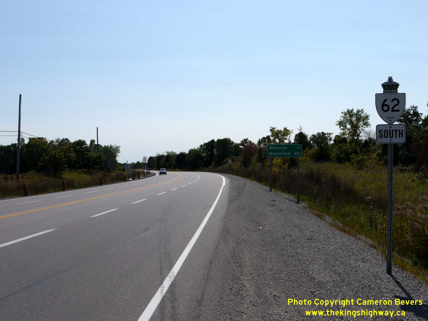

Left - Facing south towards Belleville along the Foxboro Bypass (Hwy 62) from the Hwy 14 Junction. The Foxboro Bypass was opened to traffic on November 1,
1963. The new bypass allowed through traffic on Hwy 14 to bypass the community of Foxboro altogether. The bypass also provided more direct access to the well-traveled
Foxboro-Madoc Road, a development road which was ultimately assumed by the province as an extension of Hwy 62 in 1966. See an
Enlarged Photo Here. (Photograph taken on September 10, 2017 - © Cameron Bevers) Right - Facing north along Hwy 62 at the Hwy 14 Junction near Foxboro. From this junction, Hwy 14 heads northwesterly towards Stirling and Marmora via the Foxboro-Stirling Road, while Hwy 62 continues straight ahead (north) towards Madoc and Bancroft. Prior to the completion of the Foxboro Bypass in 1963, the route of Hwy 14 continued east from this intersection into Foxboro via Ducette Road. The channelized right turn ramp at left which carries southbound Hwy 14 traffic to southbound Hwy 62 was completed during an intersection improvement project carried out in 1970. See an Enlarged Photo Here. (Photograph taken on September 10, 2017 - © Cameron Bevers) 

Left - View of Ducette Road (Old Hwy 14) facing east from the Foxboro Bypass (Hwy 62). As originally established in the 1920s, Hwy 14 continued east into
Foxboro and turned right at Ashley Street where the highway continued south towards Belleville. See an
Enlarged Photo Here. (Photograph taken on September 10, 2017 - © Cameron Bevers) Right - Approaching the Foxboro Bypass (Hwy 62) on Ducette Road (Old Hwy 14) departing from Foxboro. Beyond the intersection, Hwy 14 follows the Foxboro-Stirling Road northwesterly towards Stirling. See an Enlarged Photo Here. (Photograph taken on September 10, 2017 - © Cameron Bevers) 

Left - Southern terminus of Hwy 14 at the Hwy 62 Junction near Foxboro. Until 1963, Hwy 14 continued straight ahead via Ducette Road into Foxboro. See an
Enlarged Photo Here. (Photograph taken on September 10, 2017 - © Cameron Bevers) Right - Green guide sign marking the Hwy 62 Junction at the southern terminus of Hwy 14 near Foxboro. Following the completion of the Foxboro Bypass in 1963, Hwy 14 turned right at this intersection and proceeded directly towards Belleville. In an effort to simplify route numbering in the area, Hwy 14 was truncated at this junction in 1984. In turn, Hwy 62 was extended south along the existing route of Hwy 14 between Foxboro and Bloomfield, via Belleville. See an Enlarged Photo Here. (Photograph taken on September 10, 2017 - © Cameron Bevers) 

Left - Facing south along Hwy 62 approaching the Hwy 14 Junction near Foxboro. Prior to 1984, Hwy 62 reached its southern terminus at this highway junction.
The through road continued south towards Belleville as Hwy 14. In an effort to simplify route numbering in the Belleville area, the southern leg of Hwy 14 between
Foxboro and Bloomfield was renumbered as Hwy 62 in 1984. See an Enlarged Photo Here. (Photograph taken on September 10, 2017 - © Cameron Bevers) Right - Facing north along Hwy 62 towards Madoc from the Hwy 14 Junction near Foxboro. See an Enlarged Photo Here. (Photograph taken on September 10, 2017 - © Cameron Bevers) 

Left - Old fingerboard guide signs at the Hwy 14 & Hwy 62 Junction on the Foxboro Bypass. See an
Enlarged Photo Here. (Photograph taken on September 10, 2017 - © Cameron Bevers) Right - Facing north along Hwy 14 from the Foxboro Bypass (Hwy 62). Note that the Hastings County name has been covered over on this flowerpot route marker, as this road is now maintained by the City of Quinte West. See an Enlarged Photo Here. (Photograph taken on September 10, 2017 - © Cameron Bevers) 

Left - Deer Creek Bridge on Old Hwy 7 (now Hwy 62) in Madoc. Structure completed in 1949. (Photograph taken on July 24, 2005 - © Cameron Bevers) Right - Junction of Old Hwy 7 and Hwy 62 at St. Lawrence Street and Durham Street in Downtown Madoc, facing east. Originally, Hwy 7 continued straight through at this intersection on its route towards Ottawa. After the Madoc Bypass was completed in 1967, the old route of Hwy 7 became Hwy 7B. Although Hwy 7B was decommissioned many years ago, this intersection still serves a King's Highway. At this intersection, Hwy 62 turns right and proceeds south towards Belleville. See an Enlarged Photo here. (Photograph taken on July 24, 2005 - © Cameron Bevers) 

Left - Facing north along Hwy 62 (Durham Street) towards the Old Hwy 7 Junction (St. Lawrence Street) in Downtown Madoc. To continue north on Hwy 62,
northbound traffic must turn left at this intersection. For a brief period during the 1960s, Hwy 7 and Hwy 62 shared a short concurrent route through Madoc,
but it was discontinued after the Madoc Bypass was completed and opened to traffic in 1967. St. Lawrence Street was briefly signed as Hwy 7B, until the
business route was decommissioned in 1969. (Photograph taken on July 24, 2005 - © Cameron Bevers) Right - This overhead flashing beacon at Old Hwy 7 and Hwy 62 in Downtown Madoc likely dates from the 1950s. (Photograph taken on July 24, 2005 - © Cameron Bevers) 

Left - Facing south along Hwy 62 from St. Lawrence Street (Old Hwy 7) in Downtown Madoc. See an
Enlarged Photo here. (Photograph taken on August 17, 2008 - © Cameron Bevers) Right - Guide sign marking the Hwy 62 Junction on the Madoc Bypass (Hwy 7). At this junction, motorists can follow Hwy 62 North to Bancroft or Hwy 62 South to Belleville. Continuing straight through on Hwy 7 leads to Peterborough. (Photograph taken on July 10, 2011 - © Cameron Bevers) 
Above - Beaver Creek Bridge south of Bancroft (built in 1938), showing original timber pilings (Photograph taken on October, 2002 - © Cameron Bevers)
Continue on to King's Highway 62 Photos: Bancroft to Maynooth
|
|---|
Links to Adjacent King's Highway Photograph Pages:
Back to King's Highway 61 Photos /
King's Highway 62 History /
On to King's Highway 63 Photos
Ontario Highway History - Main Menu / Back to List of Highways Website contents, photos & text © 2002-2026, Cameron
Bevers (Webmaster) - All Rights Reserved / Contact Me
|
|---|