
| 
| |
|
|
This page contains present day photos (Year 2000 to date) of Ontario's King's Highway 62, arranged by location from Maynooth
northerly to Killaloe. All photographs displayed on this page were taken by the Webmaster (Cameron Bevers), unless specifically noted otherwise. Click on any
thumbnail to see a larger image!
Please note that all photographs displayed on this
website are protected by copyright. These photographs must not be reproduced, published,
electronically stored or copied, distributed, or posted onto other websites without
my written permission. If you want to use photos from this website, please
email me first for permission. Thank-you!
|
|---|
|
Page 5: Present Day King's Highway 62 Photographs (Maynooth to Killaloe)
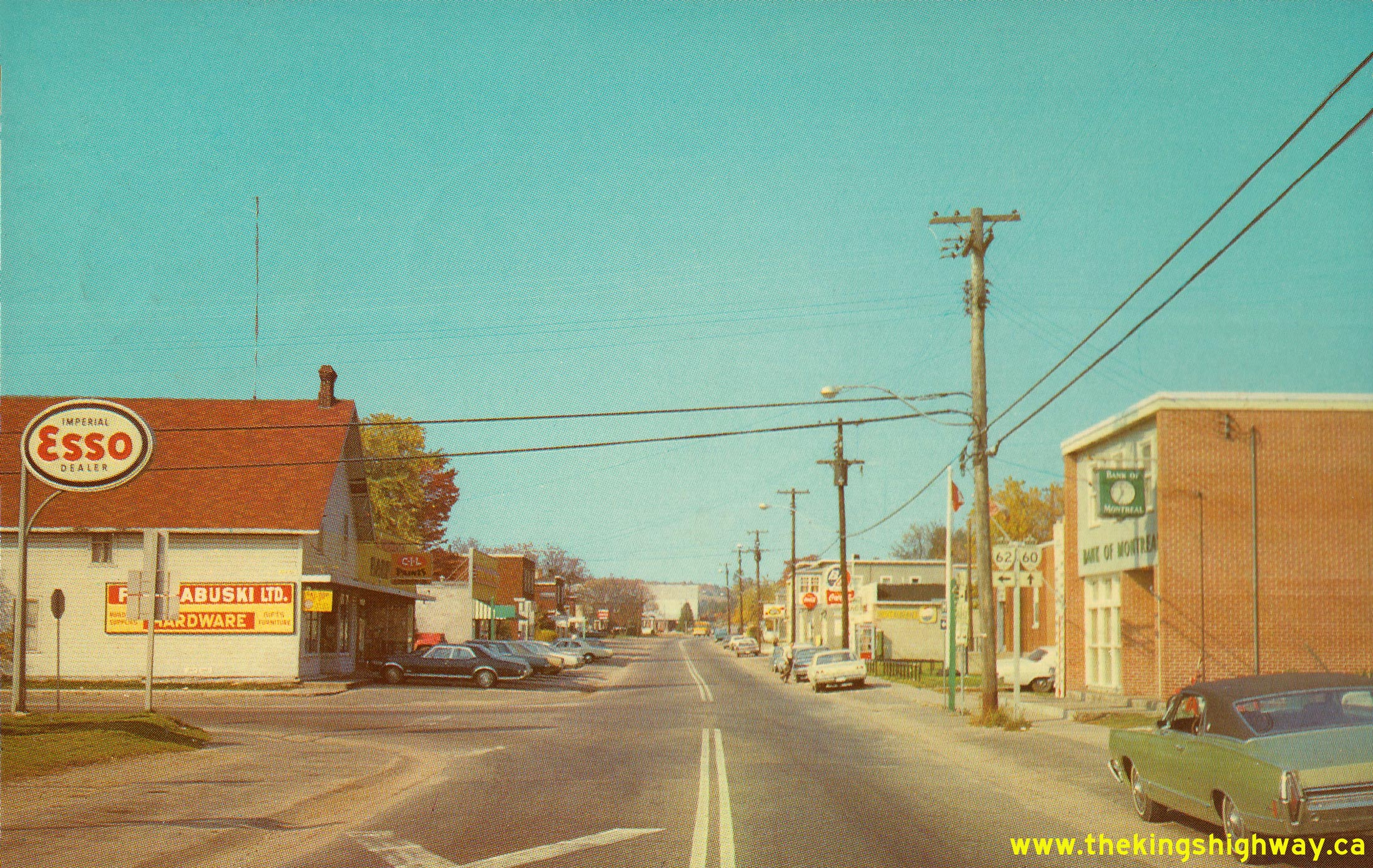
Left - Facing north along Hwy 62 towards Barry's Bay from Maynooth. See an
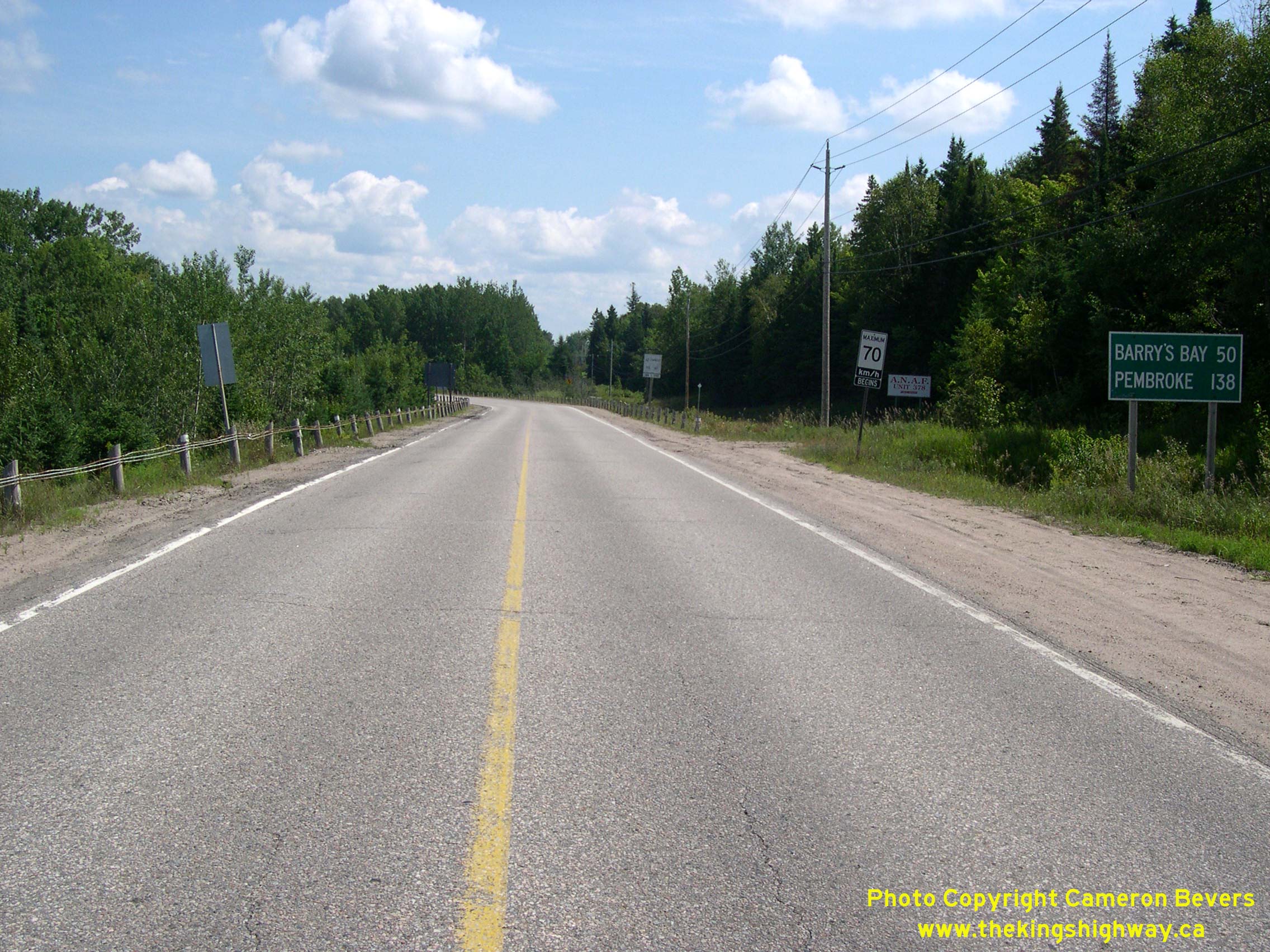
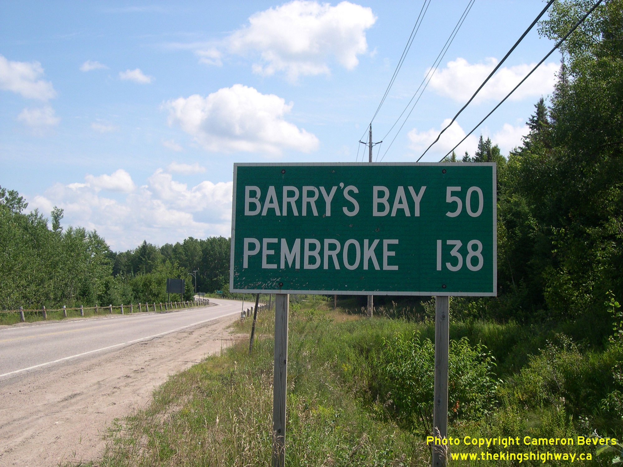
Enlarged Photo Here. (Photograph taken on August 5, 2008 - © Cameron Bevers) Right - Distance guide sign facing northbound traffic on Hwy 62, just north of the Hwy 127 Junction at Maynooth. The entire route of Hwy 62 from Madoc to Barry's Bay was assumed by the Department of Highways of Ontario (DHO) as a new King's Highway, effective August 11, 1937. This route became the very first King's Highway to reach the vast, remote region lying southeast of Algonquin Park. Even today, Hwy 62 is one of this area's only major through routes - the others being Hwy 28 to the south and Hwy 60 to the north. See an Enlarged Photo Here. (Photograph taken on August 5, 2008 - © Cameron Bevers) 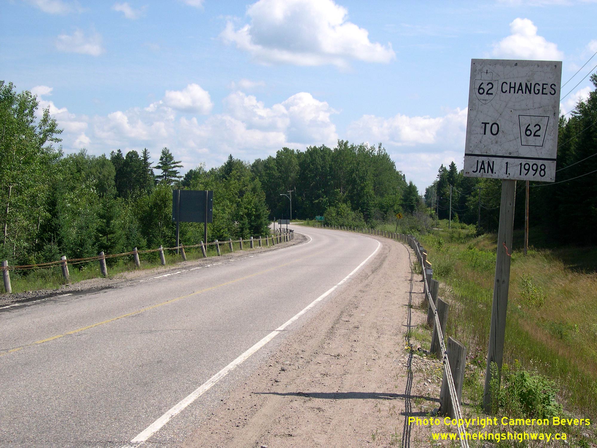
Left - Highway transfer notification sign on Hwy 62 north of Maynooth. These white signs were placed on many downloaded King's Highways in the late 1990s
to advise motorists that they were no longer travelling on a provincially-maintained highway. Jurisdiction over the 50 km section of Hwy 62 from Maynooth to Barry's
Bay was transferred from the province to Hastings County and Renfrew County, effective January 1, 1998. Although the Maynooth-Barry's Bay Road is still commonly
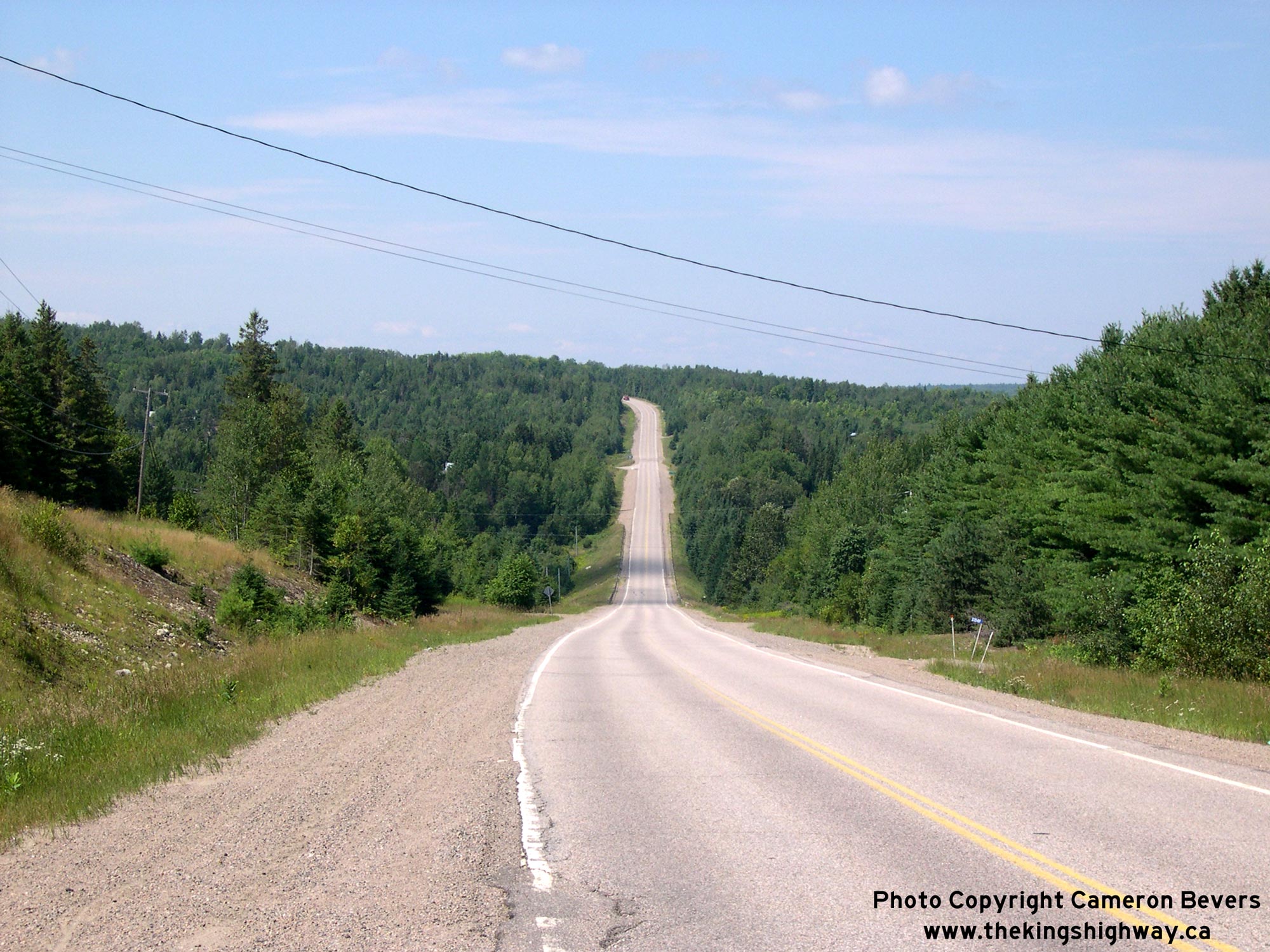
referred to as a "highway", it is now a municipal road. See an Enlarged Photo Here. (Photograph taken on August 5, 2008 - © Cameron Bevers) Right - Facing south along Hwy 62 towards Bancroft, about 2 km north of Maynooth. See an Enlarged Photo Here. (Photograph taken on August 5, 2008 - © Cameron Bevers) 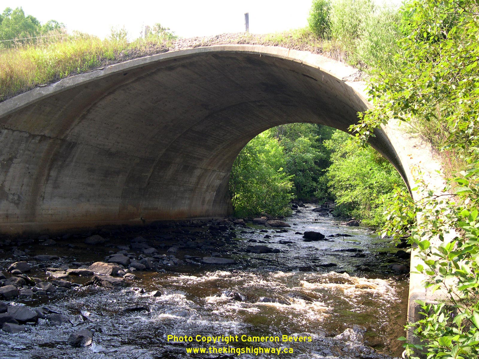
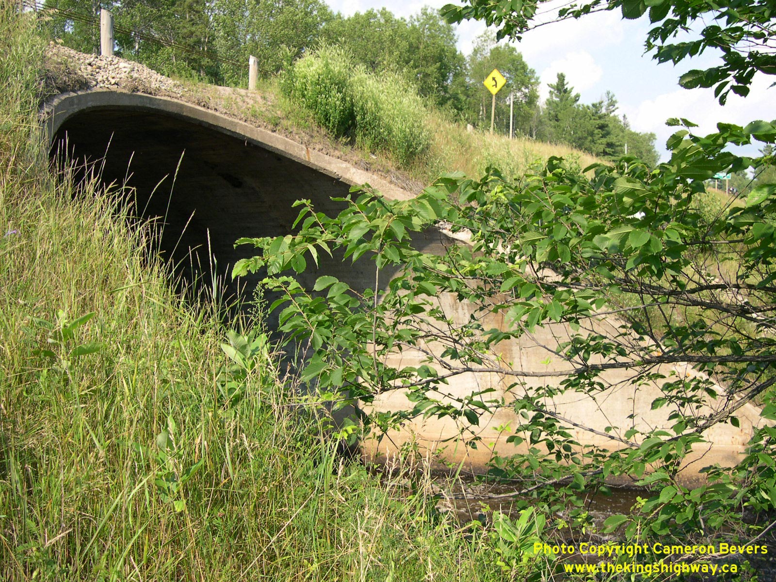
Left - Papineau Creek Culvert (Site #11-16) on Hwy 62 between Maynooth and Maple Leaf. This massive concrete barrel arch structure was completed in 1938. See
an Enlarged Photo Here. (Photograph taken on August 2, 2004 - © Cameron Bevers) Right - The Papineau Creek Culvert is rather inconspicuous from the highway, since it is located at the bottom of a deep fill. Unless you are really looking for this historic structure, it is very easy to miss even though it has a span length (diameter) of 40 feet. This culvert was built under Contract #1937-95 as part of the grading of a roughly 4-mile highway diversion situated between Maynooth and Combermere, known as the Maple Leaf Diversion. See an Enlarged Photo Here. (Photograph taken on August 2, 2004 - © Cameron Bevers) 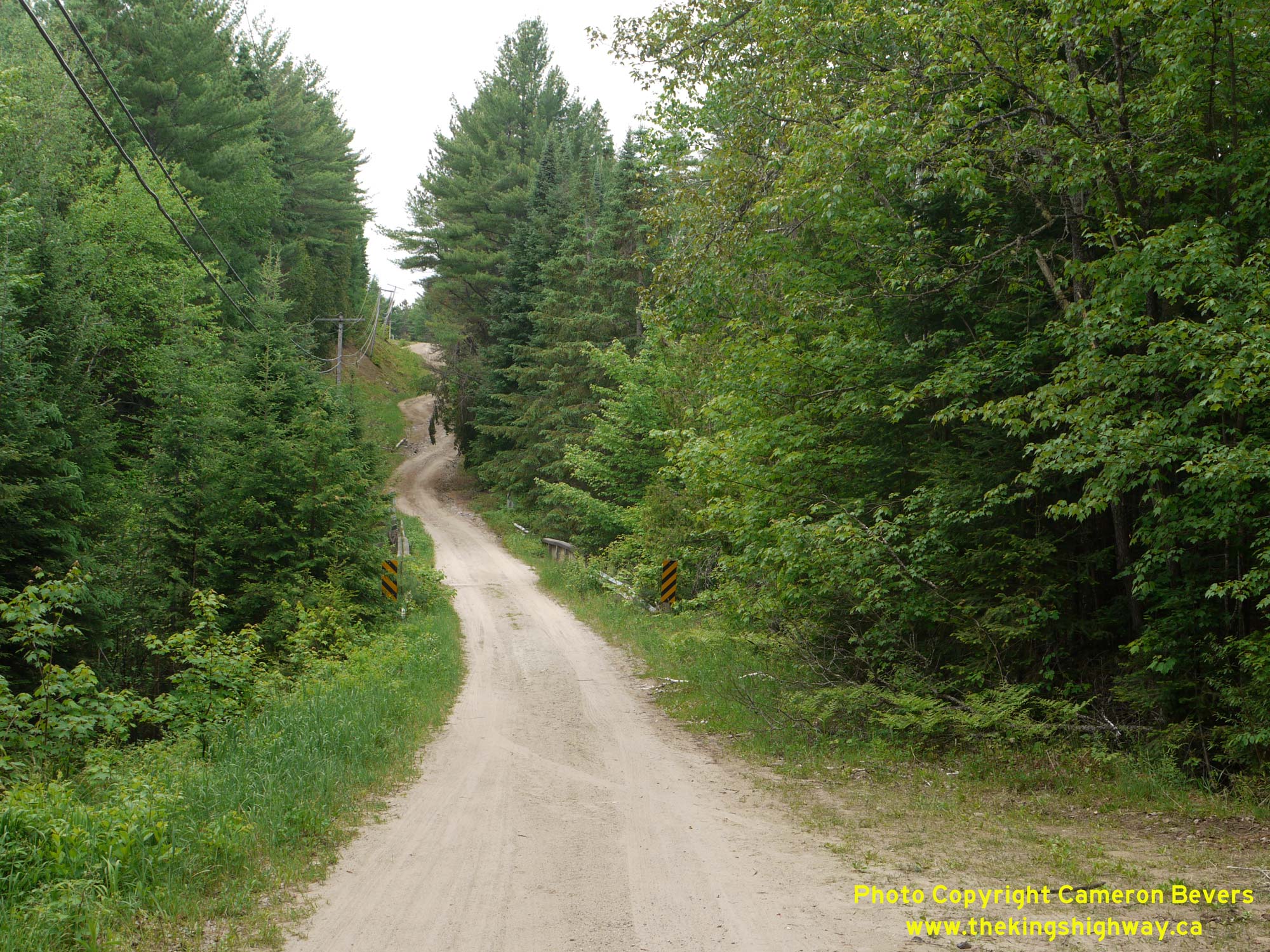
  Left - View of Old Hwy 62 (Church Road) approaching the Papineau Creek Bridge near Maple Leaf. The original alignment of Hwy 62 in this area was very poor,
with steep, winding grades. In 1937, construction got underway on the Maple Leaf Diversion, which bypassed about 4 miles of the original route of Hwy 62. Conditions
were so poor during the highway's early days that Official Ontario Road Bulletins issued during the 1940s specifically warned motorists to drive carefully along the
highway north of Bancroft. Provincial jurisdiction over Old Hwy 62 ultimately came to an end in June 1973, when the former highway's alignment seen here was
transferred back to municipal control. See an Enlarged Photo Here. Left - View of Old Hwy 62 (Church Road) approaching the Papineau Creek Bridge near Maple Leaf. The original alignment of Hwy 62 in this area was very poor,
with steep, winding grades. In 1937, construction got underway on the Maple Leaf Diversion, which bypassed about 4 miles of the original route of Hwy 62. Conditions
were so poor during the highway's early days that Official Ontario Road Bulletins issued during the 1940s specifically warned motorists to drive carefully along the
highway north of Bancroft. Provincial jurisdiction over Old Hwy 62 ultimately came to an end in June 1973, when the former highway's alignment seen here was
transferred back to municipal control. See an Enlarged Photo Here.(Photograph taken on May 30, 2010 - © Cameron Bevers) Right - Facing north along Old Hwy 62 (Church Road) at the Papineau Creek Bridge. This narrow single-lane bridge was bypassed when Hwy 62 was relocated onto a
improved alignment (the Maple Leaf Diversion) in 1938. Through traffic began to use the new route of Hwy 62. This old section of Hwy 62 was left behind, but was kept
open for local traffic only. See an Enlarged Photo Here.(Photograph taken on May 30, 2010 - © Cameron Bevers) 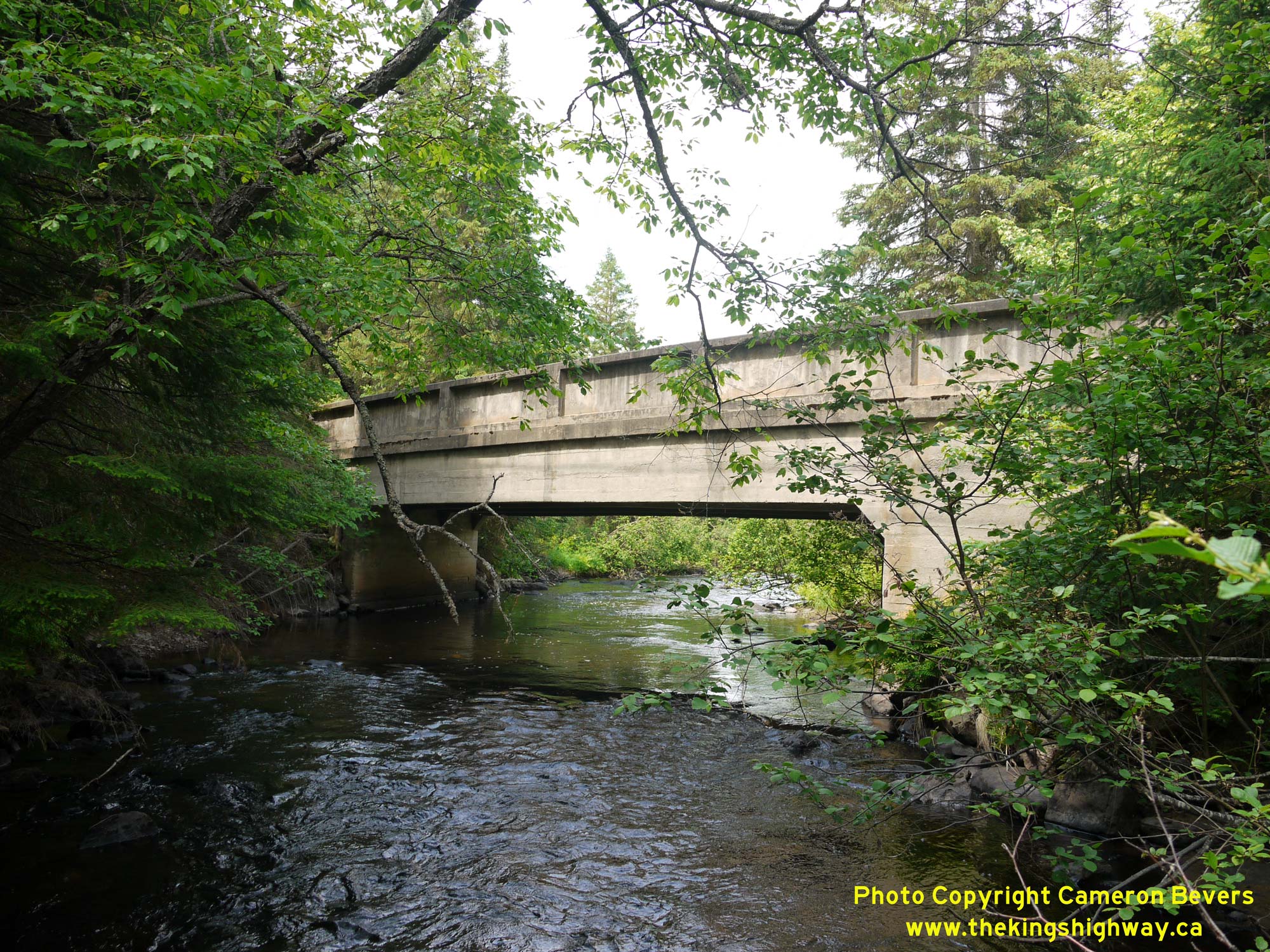
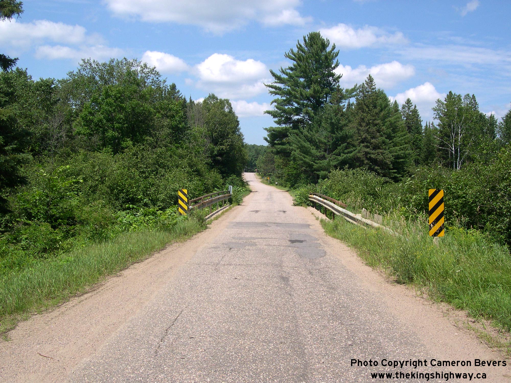
 Left - Papineau Creek Bridge on Old Hwy 62 (Church Road) between Maynooth and Maple Leaf. This single-span concrete T-girder structure was likely constructed
in the early 1930s. This bridge was bypassed by the Maple Leaf Diversion (Hwy 62 New) in 1938. Accordingly, this narrow bridge has only carried local traffic since
the late 1930s. See an Enlarged Photo Here. Left - Papineau Creek Bridge on Old Hwy 62 (Church Road) between Maynooth and Maple Leaf. This single-span concrete T-girder structure was likely constructed
in the early 1930s. This bridge was bypassed by the Maple Leaf Diversion (Hwy 62 New) in 1938. Accordingly, this narrow bridge has only carried local traffic since
the late 1930s. See an Enlarged Photo Here.(Photograph taken on May 30, 2010 - © Cameron Bevers) Right - Facing south along Old Hwy 62 (Church Road) at the Papineau Creek Bridge. See an
Enlarged Photo Here.(Photograph taken on May 30, 2010 - © Cameron Bevers) 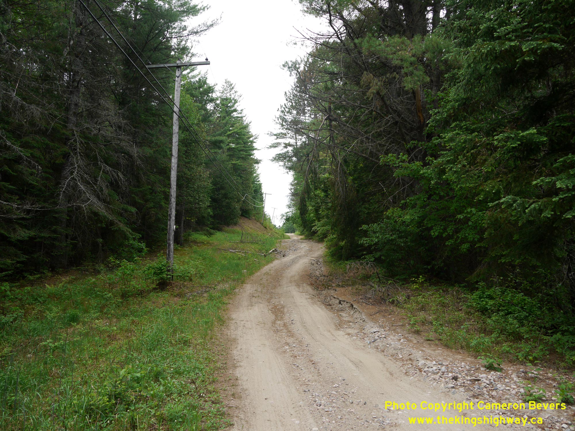
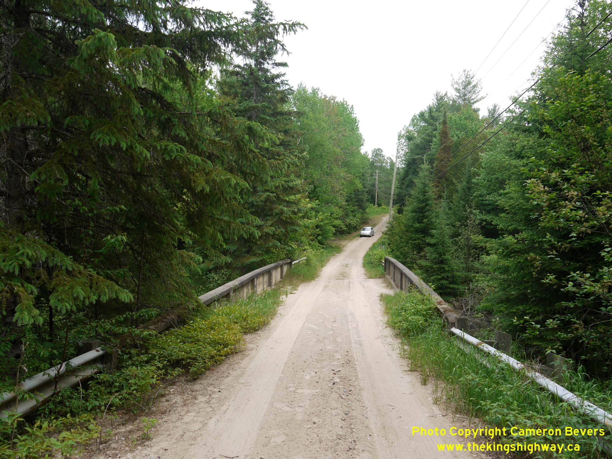
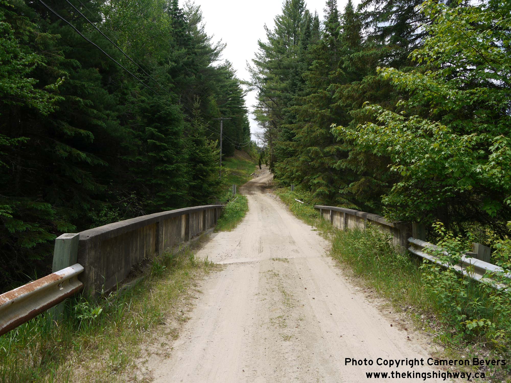
 Left - The narrow and winding route of Old Hwy 62 has changed very little in the decades since it was bypassed in 1938. In fact, it still very much resembles
the tortuous route that early motorists using Hwy 62 would have endured. While this appalling road condition may come of surprise to many website readers for a King's
Highway, this scene was actually representative of what many parts of Hwy 62 looked like in this area until the 1950s. Post-war reconstruction of Hwy 62 from Bancroft
to Combermere has greatly improved the highway's alignment. See an Enlarged Photo Here. Left - The narrow and winding route of Old Hwy 62 has changed very little in the decades since it was bypassed in 1938. In fact, it still very much resembles
the tortuous route that early motorists using Hwy 62 would have endured. While this appalling road condition may come of surprise to many website readers for a King's
Highway, this scene was actually representative of what many parts of Hwy 62 looked like in this area until the 1950s. Post-war reconstruction of Hwy 62 from Bancroft
to Combermere has greatly improved the highway's alignment. See an Enlarged Photo Here.(Photograph taken on May 30, 2010 - © Cameron Bevers) Right - Facing south along Hwy 62 (Maple Leaf Diversion) from the intersection of Nieman Road (Old Hwy 62). The Papineau Creek Culvert passes below Hwy 62 a
short distance ahead. After the Maple Leaf Diversion was completed and opened to traffic in 1938, it drastically improved the highway's alignment from a narrow
winding bush road into a modern highway facility. However, this was the exception rather than the rule. Due to the outbreak of World War II in 1939, reconstruction of
other sections of Hwy 62 in this area had to be deferred. In fact, some sections of Hwy 62 in this part of Ontario did not get reconstructed until well into the
1950s. See an Enlarged Photo Here.(Photograph taken on May 30, 2010 - © Cameron Bevers) 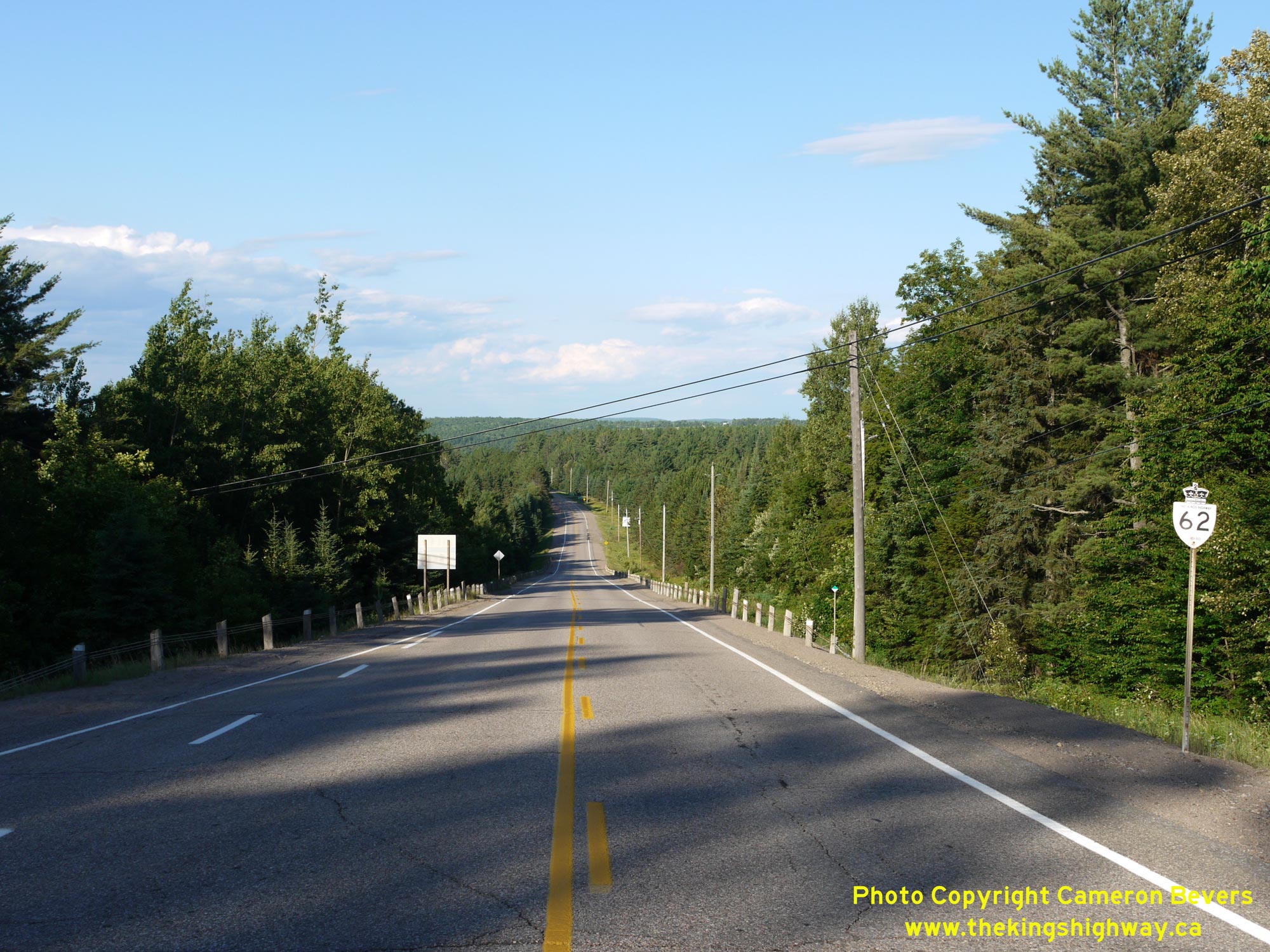
 Left - Facing north along Hwy 62 towards Barry's Bay from McAlpine Road near Maple Leaf. An old King's Highway 62 sign can be seen beside the highway at right
- a remnant from when this route used to be a provincial highway prior to 1998. See an
Enlarged Photo Here. Left - Facing north along Hwy 62 towards Barry's Bay from McAlpine Road near Maple Leaf. An old King's Highway 62 sign can be seen beside the highway at right
- a remnant from when this route used to be a provincial highway prior to 1998. See an
Enlarged Photo Here.(Photograph taken on June 30, 2012 - © Cameron Bevers) Right - View of Hwy 62 approaching Maple Leaf, facing north towards Barry's Bay. This small community is one of the few settlements along Hwy 62 in this area. This community is situated about 9 km north of Maynooth and 22 km south of Combermere. See an Enlarged Photo Here. (Photograph taken on August 5, 2008 - © Cameron Bevers) 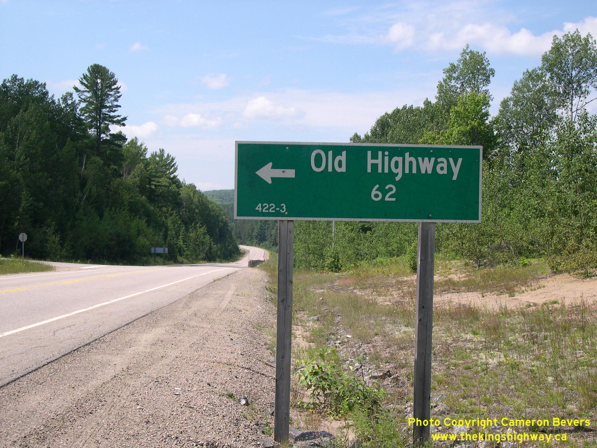
Left - Green guide sign marking an old alignment of Hwy 62 between Maple Leaf and Combermere. This is just one of several abandoned and bypassed alignments of
Hwy 62 in this area. The route of Hwy 62 was extensively reconstructed in the 1950s and 1960s, so many pieces of the old highway can still be found abandoned in the
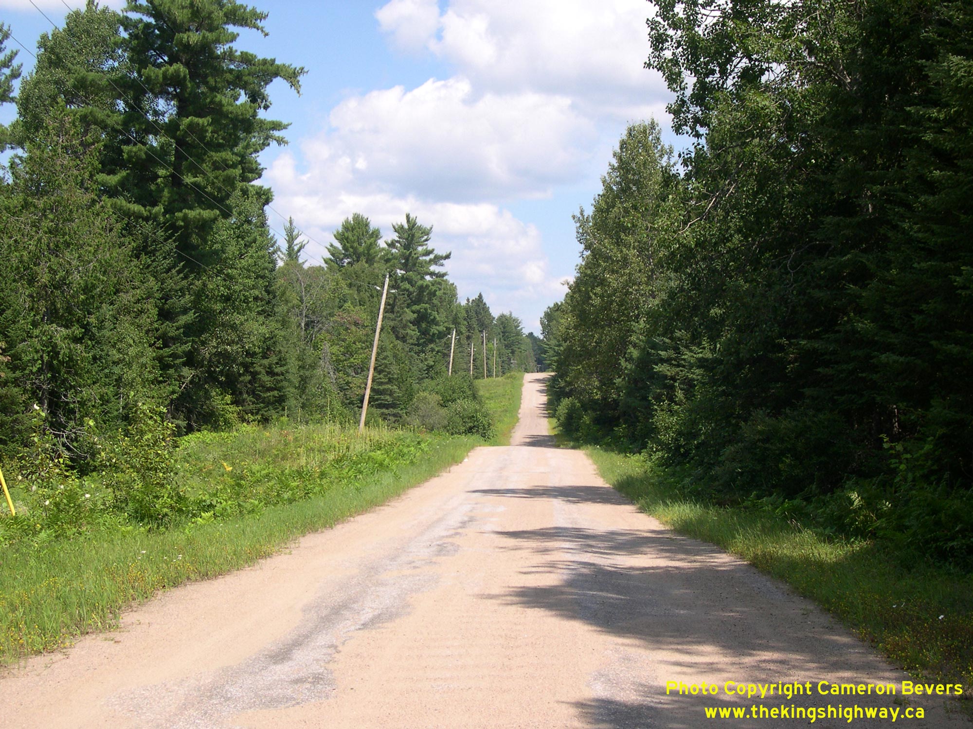
forest. See an Enlarged Photo Here. (Photograph taken on August 5, 2008 - © Cameron Bevers) Right - Former alignment of Hwy 62 near Maple Leaf. This is one of the only old Hwy 62 alignments that is still open to local traffic. Many are now fenced off. See an Enlarged Photo Here. (Photograph taken on August 5, 2008 - © Cameron Bevers) 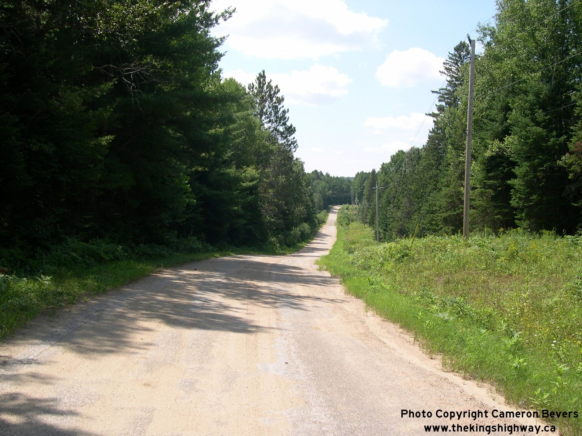
Left - View of the former alignment of Hwy 62 near Maple Leaf. Note the superelevated curve in the foreground, which looks strangely out-of-place on a quiet
rural road like this. Although it doesn't look like much of a highway anymore, it is very obvious that this road was originally designed to move fast traffic in its
day. Jurisdiction over Old Hwy 62 was transferred from the province to the Township of Wicklow, effective April 1, 1964. See an
Enlarged Photo Here. (Photograph taken on August 5, 2008 - © Cameron Bevers) Right - A section of the Boulter Road near Maple Leaf was also a former alignment of Hwy 62. Here, the former highway crosses Little Papineau Creek before re-joining the current route of Hwy 62 just north of Maple Leaf. This section of the old highway was bypassed in 1962. See an Enlarged Photo Here. (Photograph taken on August 5, 2008 - © Cameron Bevers) 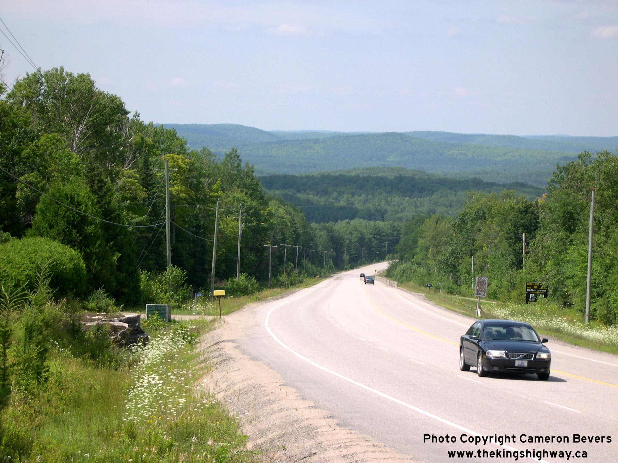
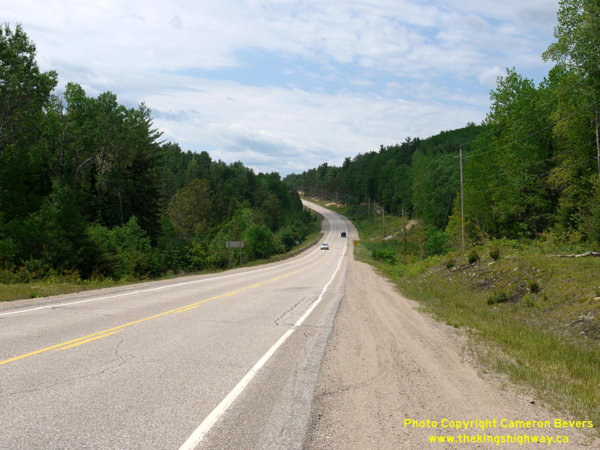
Left - Facing south along Hwy 62 between Maple Leaf and Combermere. The highway climbs several significant grades through the Hastings Highlands. This section
of Hwy 62 is located about 13 km south of Combermere and features a northbound passing lane. See an
Enlarged Photo Here. (Photograph taken on August 5, 2008 - © Cameron Bevers) Right - View of Hwy 62 facing north towards Barry's Bay at the White Duck Lake Roadside Park. This small 1 acre park was developed by the DHO as an overnight
campground in the early 1940s. Note the historical log guide rail beside Hwy 62 at right. While once a common sight along highways in Ontario's hinterlands, this
roadside barrier system was largely retired from service in the 1950s and replaced with newer barrier system designs. This example along Hwy 62 at the White Duck Lake
Roadside Park is the only surviving installation of a log guide rail that I am aware of along any of our highways. See an
Enlarged Photo Here.(Photograph taken on May 30, 2010 - © Cameron Bevers) 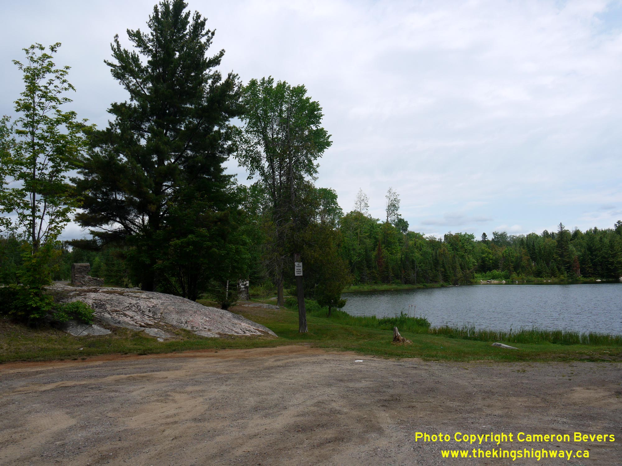
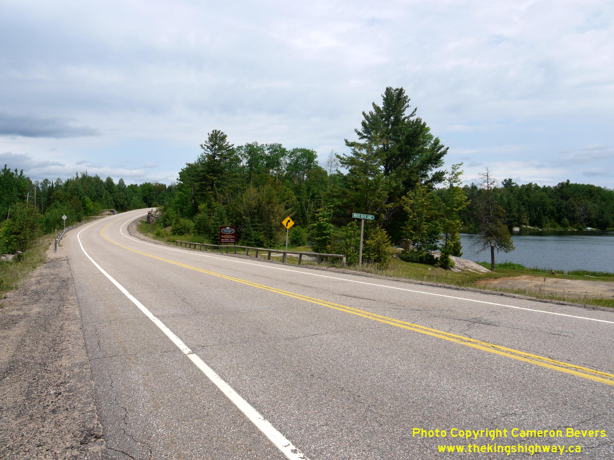
 Left - View of the White Duck Lake Roadside Park on Hwy 62, located about 7 km south of Combermere. The DHO acquired the property for this lakeside park site
in 1941. For a number of years, the site was operated as a rustic roadside campsite and picnic area for the convenience of motorists travelling along Hwy 62. It is
still in service today, but as a day-use area only. See an Enlarged Photo Here. Left - View of the White Duck Lake Roadside Park on Hwy 62, located about 7 km south of Combermere. The DHO acquired the property for this lakeside park site
in 1941. For a number of years, the site was operated as a rustic roadside campsite and picnic area for the convenience of motorists travelling along Hwy 62. It is
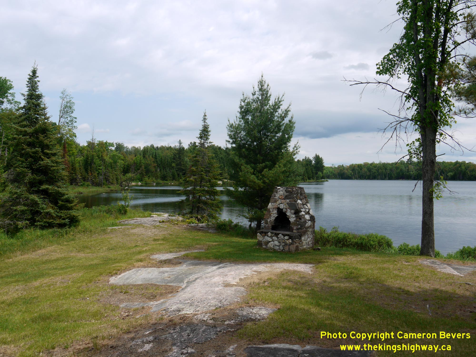
still in service today, but as a day-use area only. See an Enlarged Photo Here.(Photograph taken on May 30, 2010 - © Cameron Bevers) Right - Stone fireplace at the White Duck Lake Roadside Park on Hwy 62 south of Combermere. Two fireplaces were added to the park's amenities during 1951.
Growing popularity of these roadside parks for camping throughout the 1950s led to overcrowding and excessive use of these parks. Like many of the DHO's roadside
parks, overnight camping was prohibited at this location by the end of the 1950s. The park subsequently operated as a day-use picnic area only. See an
Enlarged Photo Here.(Photograph taken on May 30, 2010 - © Cameron Bevers) 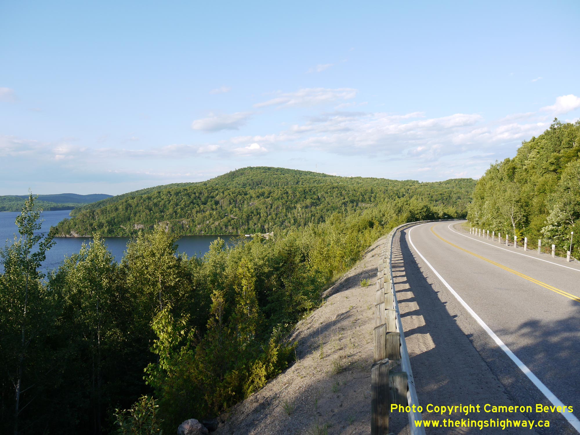
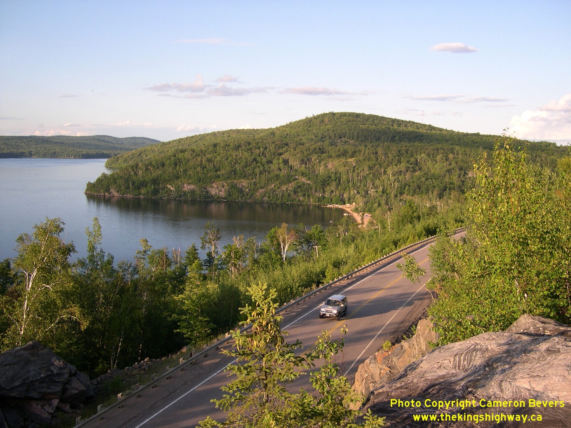 Left - Diversion of Hwy 62 near the Kamaniskeg Lake Scenic Lookout south of Combermere. About 1 mile of Hwy 62 was reconstructed on an improved grade
approaching Kamaniskeg Lake during the late 1960s. The reconstruction of Hwy 62 took place under Contract #1966-173 and was completed in 1968. As a result of the
highway's reconstruction, a portion of Hwy 62 was closed to traffic and abandoned. However, a short section of Old Hwy 62 was kept open to provide access to the
scenic lookout nearby. See an Enlarged Photo Here. Left - Diversion of Hwy 62 near the Kamaniskeg Lake Scenic Lookout south of Combermere. About 1 mile of Hwy 62 was reconstructed on an improved grade
approaching Kamaniskeg Lake during the late 1960s. The reconstruction of Hwy 62 took place under Contract #1966-173 and was completed in 1968. As a result of the
highway's reconstruction, a portion of Hwy 62 was closed to traffic and abandoned. However, a short section of Old Hwy 62 was kept open to provide access to the
scenic lookout nearby. See an Enlarged Photo Here.(Photograph taken on June 30, 2012 - © Cameron Bevers) Right - View of Hwy 62 and Kamaniskeg Lake from the scenic lookout, located just south of Combermere. Perched on a high bluff overlooking Hwy 62 and Kamaniskeg Lake, this lookout offers motorists with a nice spot to take a break and enjoy the view. The lookout is one of many hidden gems in this scenic part of Ontario. See an Enlarged Photo Here. (Photograph taken on August 4, 2008 - © Cameron Bevers) 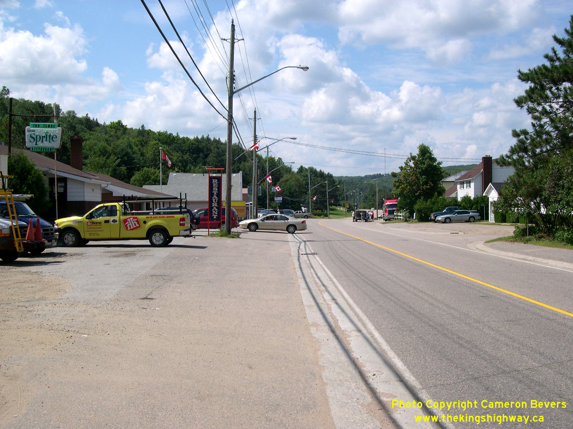
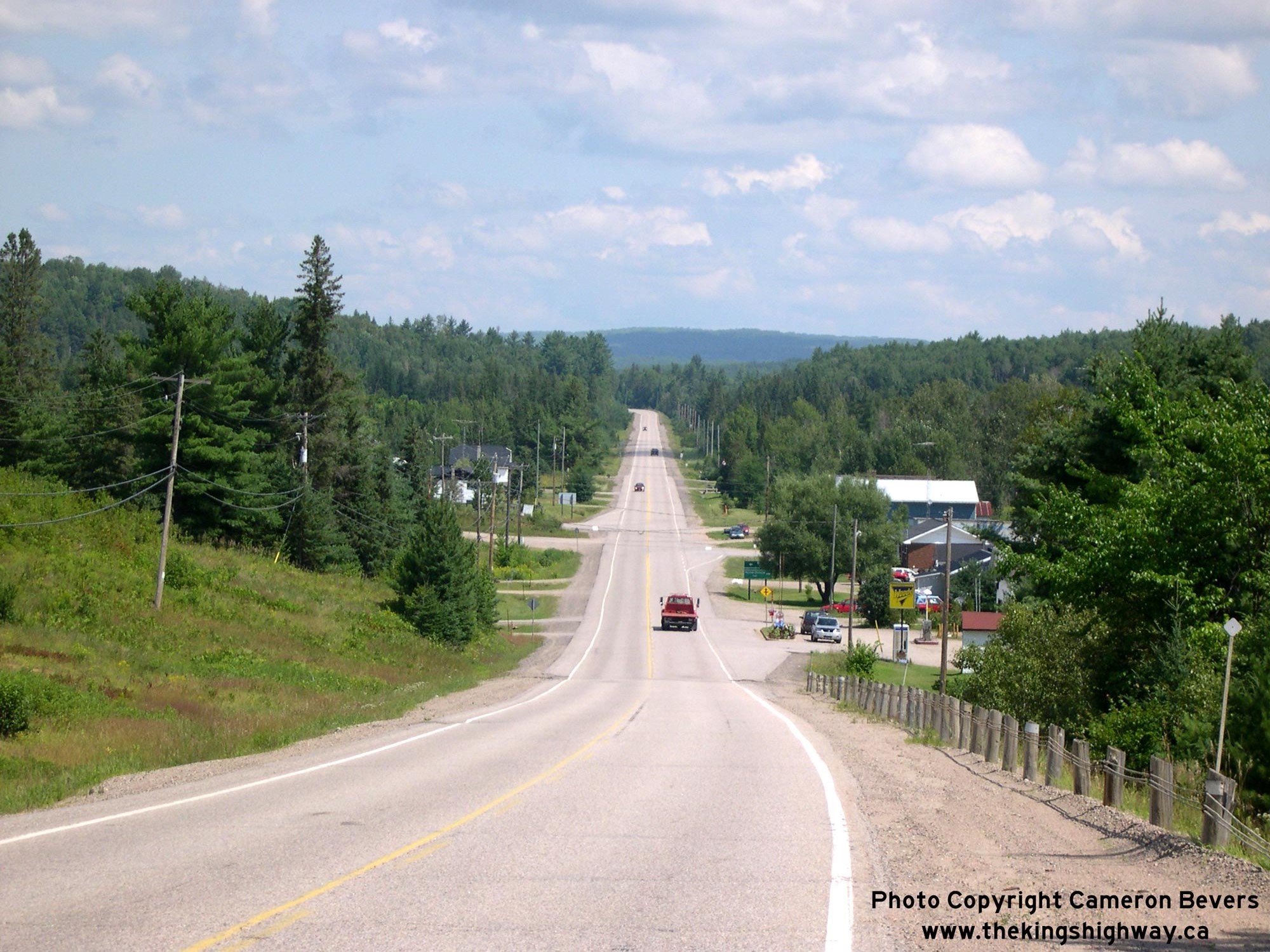
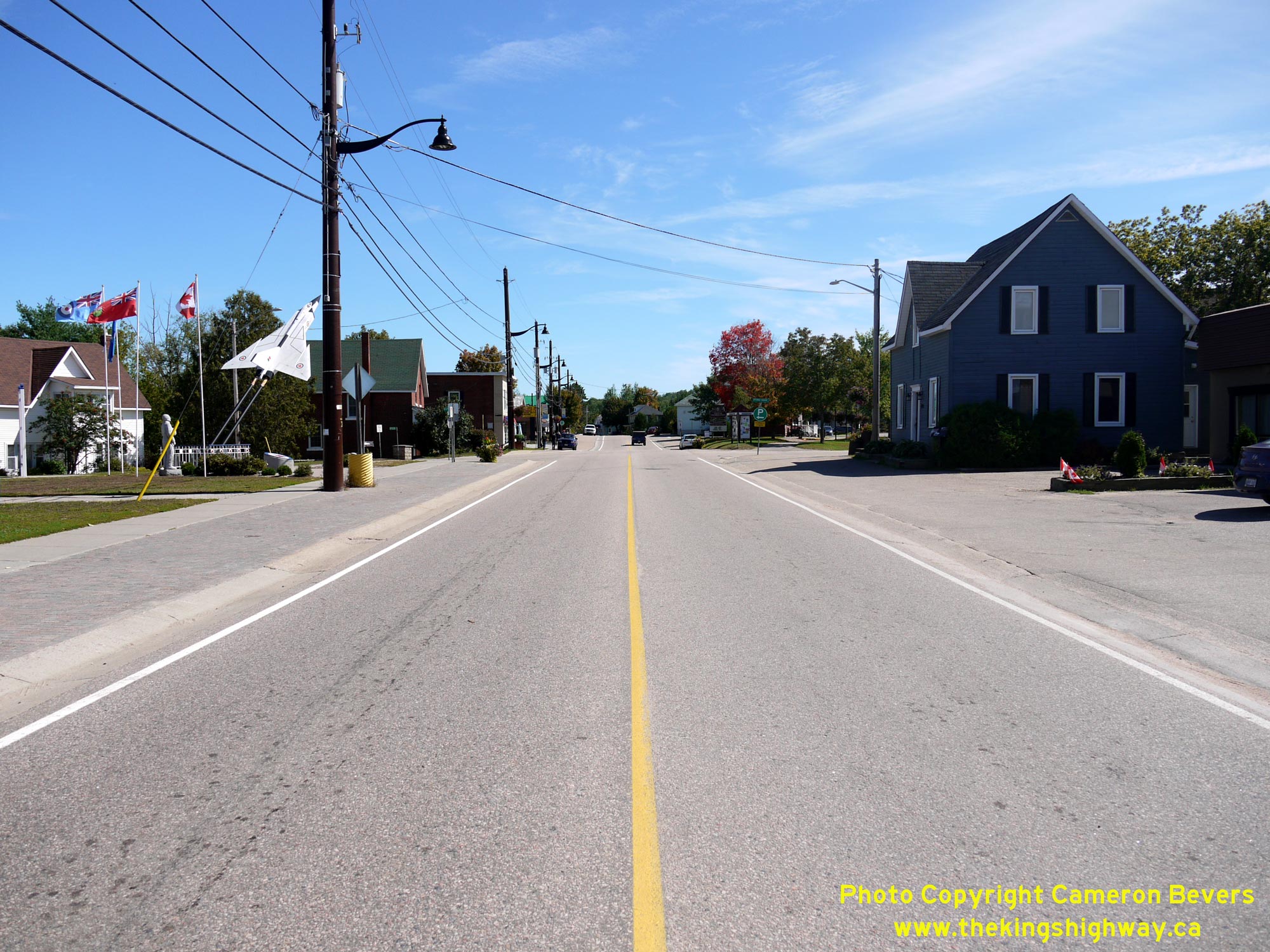
Left - View of Hwy 62 in Combermere, facing south towards Maynooth and Bancroft. See an
Enlarged Photo Here. (Photograph taken on August 5, 2008 - © Cameron Bevers) Right - Facing north along Hwy 62 in Combermere, approaching the Hwy 517 Junction. See an Enlarged Photo Here. (Photograph taken on August 5, 2008 - © Cameron Bevers) 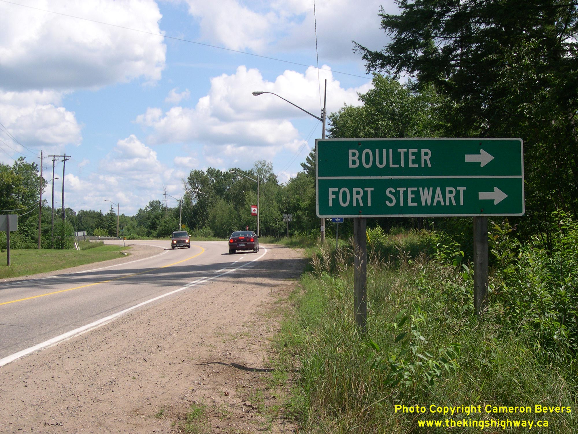
Left - Green guide sign on northbound Hwy 62 marking the destinations accessible via Hwy 517. This former Secondary Highway meanders through a particularly
empty region of western Renfrew County before terminating abruptly at the Boulter Road in adjacent Hastings County. It is interesting to note that neither Boulter
nor Fort Stewart are situated directly on Hwy 517. However, these are listed as the destination "control cities" on signs at the Hwy 62 Junction, since Hwy 517 has no
destinations to sign to along its entire route. See an Enlarged Photo Here. (Photograph taken on August 5, 2008 - © Cameron Bevers) Right - Facing south along Hwy 62 towards Maynooth from the Hwy 517 Junction at Combermere. See an Enlarged Photo Here. (Photograph taken on August 5, 2008 - © Cameron Bevers) 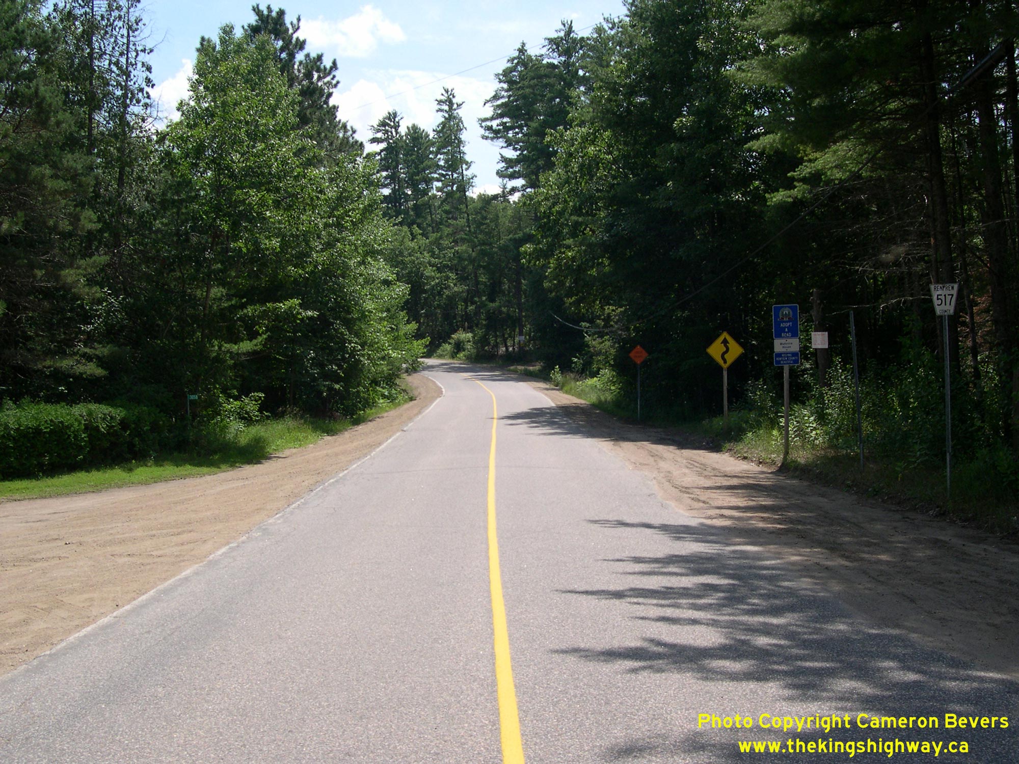
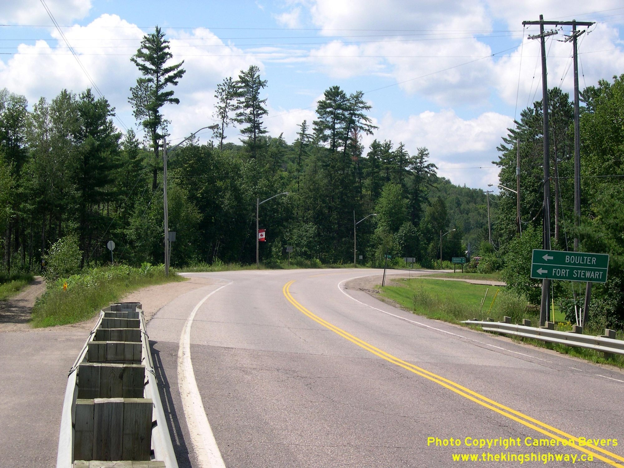
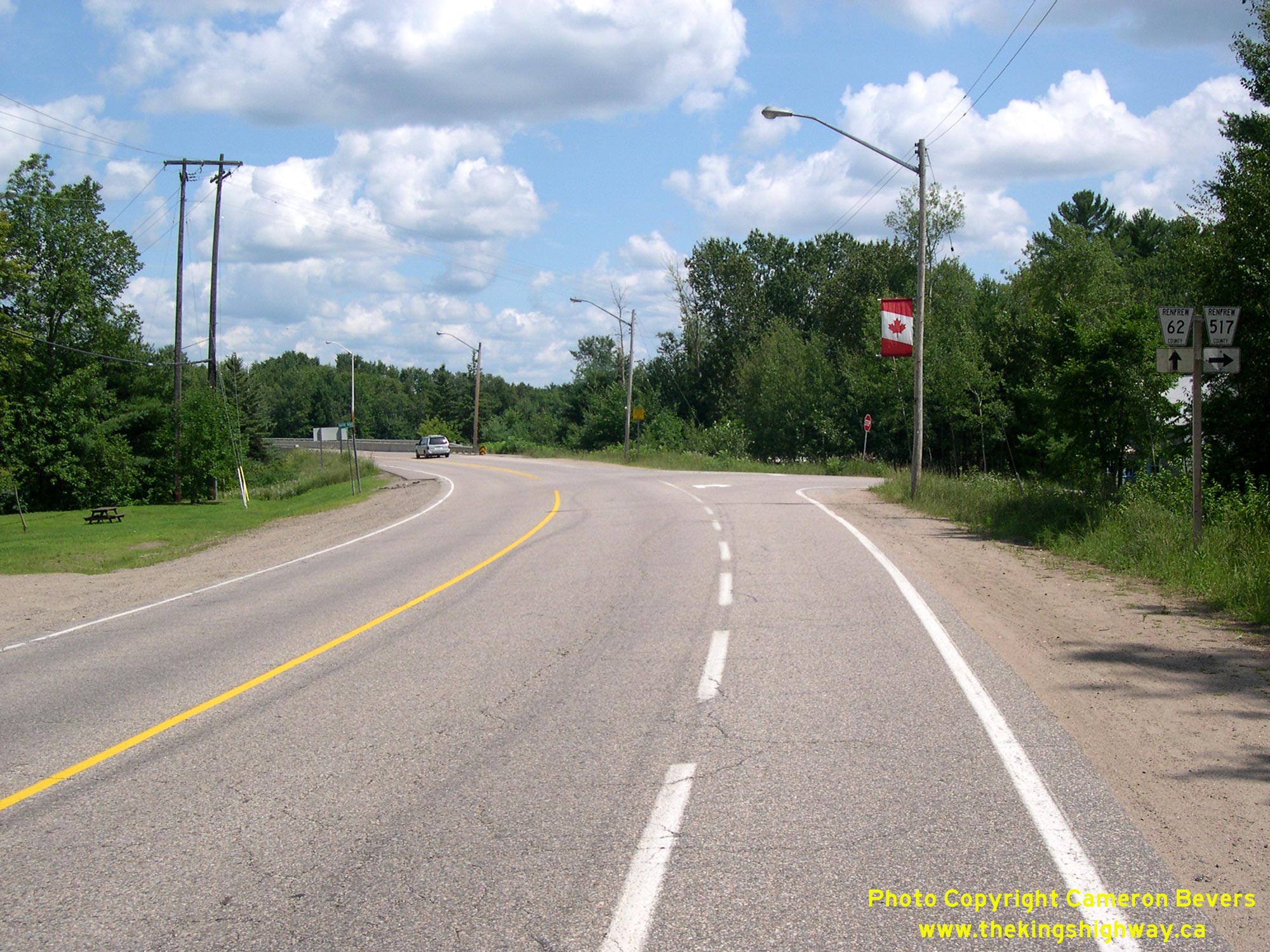
Left - Facing south along Hwy 517 from the Hwy 62 Junction at Combermere. After following the Madawaska River briefly south of Combermere, Hwy 517 turns
southwesterly and meanders its way across the remote highlands, where it comes to an end at the Boulter Road. Jurisdiction over numerous Ontario Secondary Highways
were transferred from the province to Renfrew County in the late 1990s. Officially, Hwy 517 is known today as Renfrew County Road 517. See an
Enlarged Photo Here. (Photograph taken on August 5, 2008 - © Cameron Bevers) Right - Facing south along Hwy 62 in Combermere, approaching the Hwy 517 Junction. See an Enlarged Photo Here. (Photograph taken on August 5, 2008 - © Cameron Bevers) 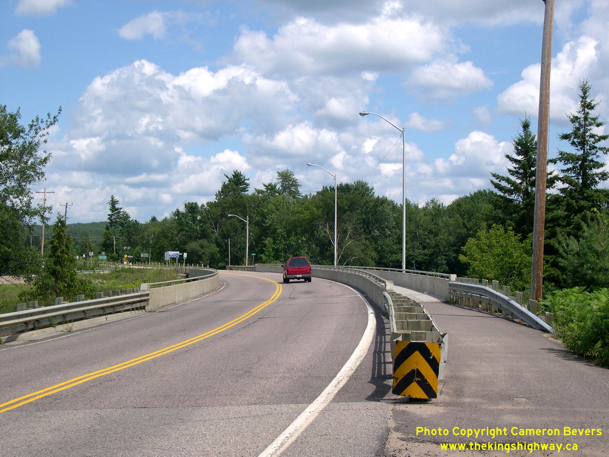
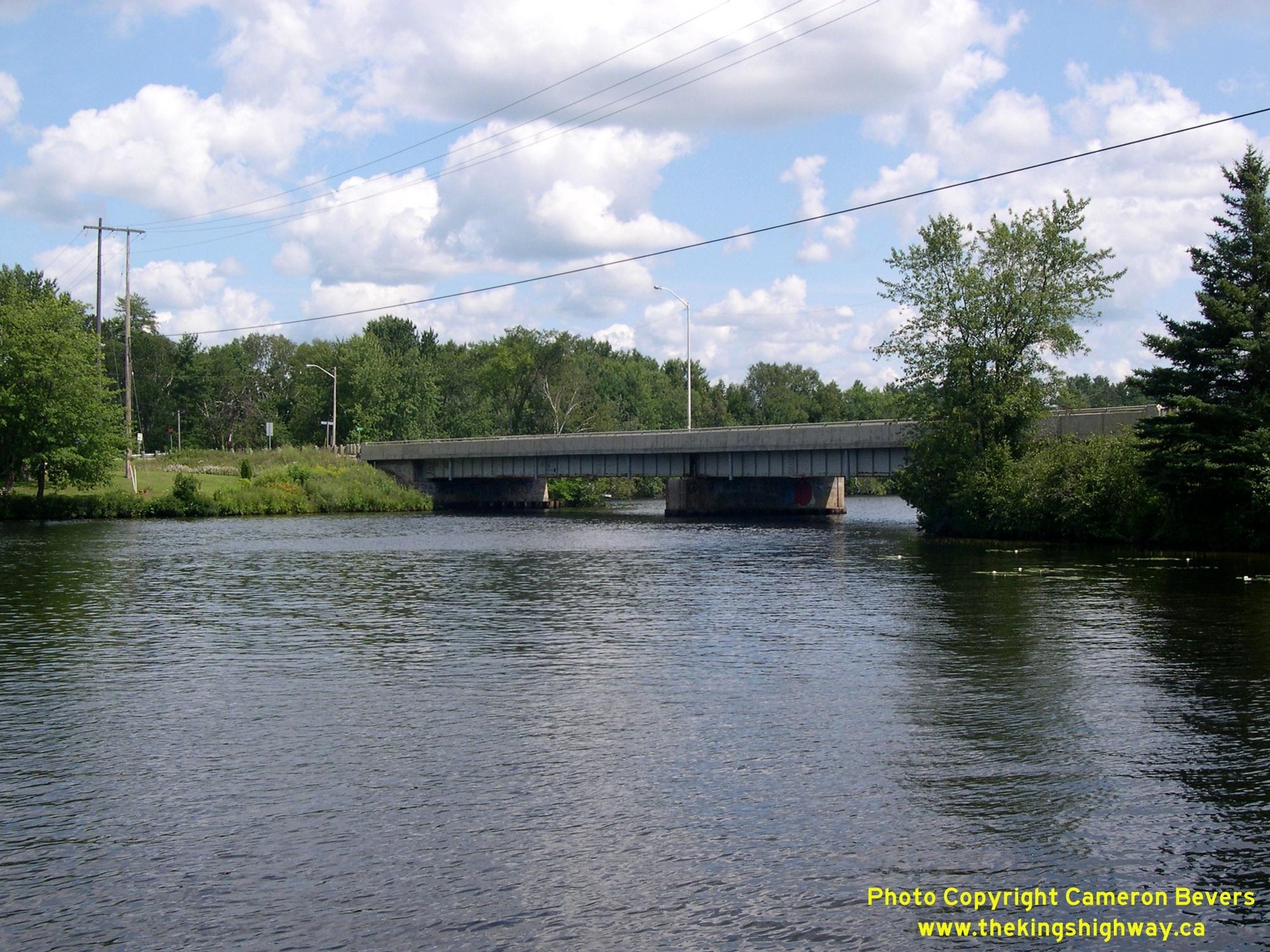
Left - Facing north along Hwy 62 approaching the Madawaska River Bridge at Combermere. See an
Enlarged Photo Here. (Photograph taken on August 5, 2008 - © Cameron Bevers) Right - Madawaska River Bridge (Site #29-76) on Hwy 62 at Combermere. This two-span steel plate girder structure was built under Contracts #1958-188 (structural steel) and #1958-240 (concrete substructure and approaches) and was completed and opened to traffic in 1960. The bridge was constructed at an approximate cost of $320,000 in 1960 Dollars, the equivalent of about $3.4 Million in 2025 Dollars. See an Enlarged Photo Here. (Photograph taken on August 5, 2008 - © Cameron Bevers) 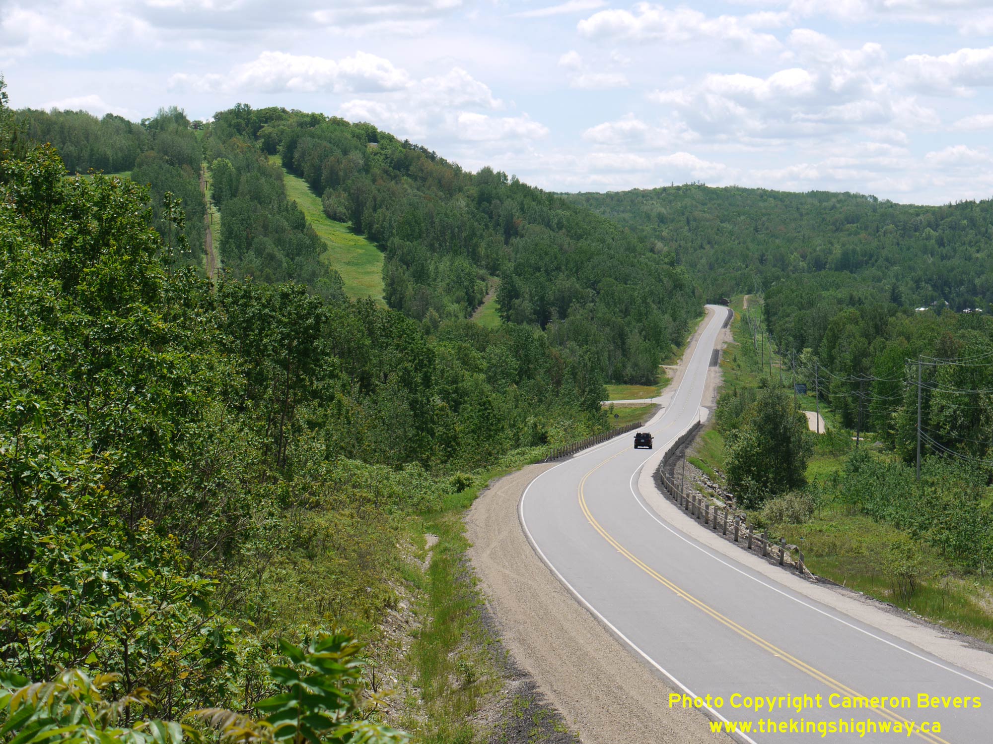
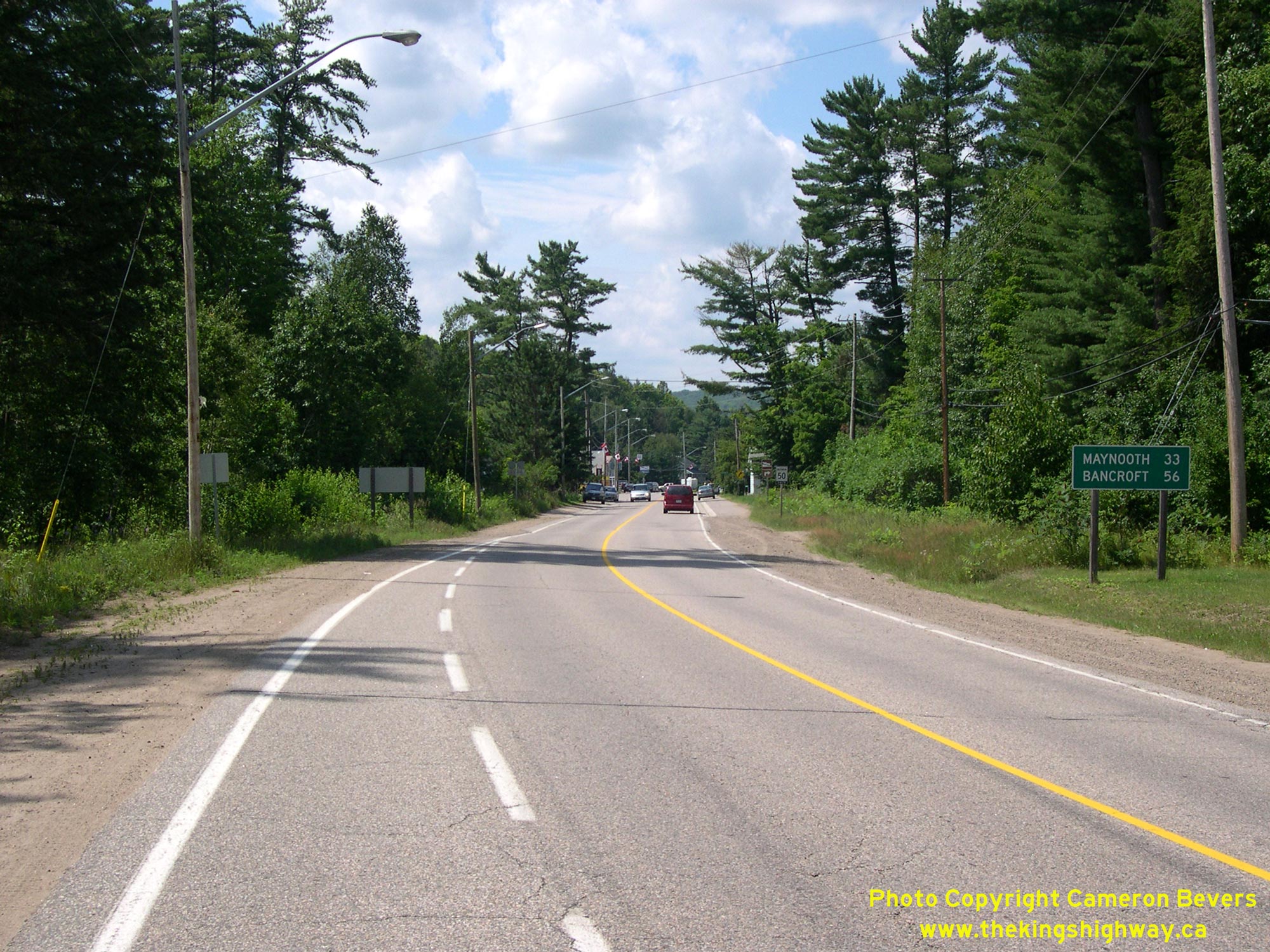
 Left - Scenic view of Hwy 62 about 6 km south of Barry's Bay, facing south towards Combermere. This section of Hwy 62 passes through a highlands area with some
surprisingly large hills. Originally, traffic between Combermere and Barry's Bay had to follow Old Barry's Bay Road. The section of Hwy 62 seen here was actually a
diversion of the original road between Combermere and Barry's Bay. Construction of this 10-mile diversion was initiated by Ontario's Department of Northern
Development in the first half of the 1930s. In 1936, it was announced that the Department of Northern Development's road construction functions would be amalgamated
with those of the DHO. The new highway was ultimately completed by the DHO under Contract #1936-90. See an
Enlarged Photo Here. Left - Scenic view of Hwy 62 about 6 km south of Barry's Bay, facing south towards Combermere. This section of Hwy 62 passes through a highlands area with some
surprisingly large hills. Originally, traffic between Combermere and Barry's Bay had to follow Old Barry's Bay Road. The section of Hwy 62 seen here was actually a
diversion of the original road between Combermere and Barry's Bay. Construction of this 10-mile diversion was initiated by Ontario's Department of Northern
Development in the first half of the 1930s. In 1936, it was announced that the Department of Northern Development's road construction functions would be amalgamated
with those of the DHO. The new highway was ultimately completed by the DHO under Contract #1936-90. See an
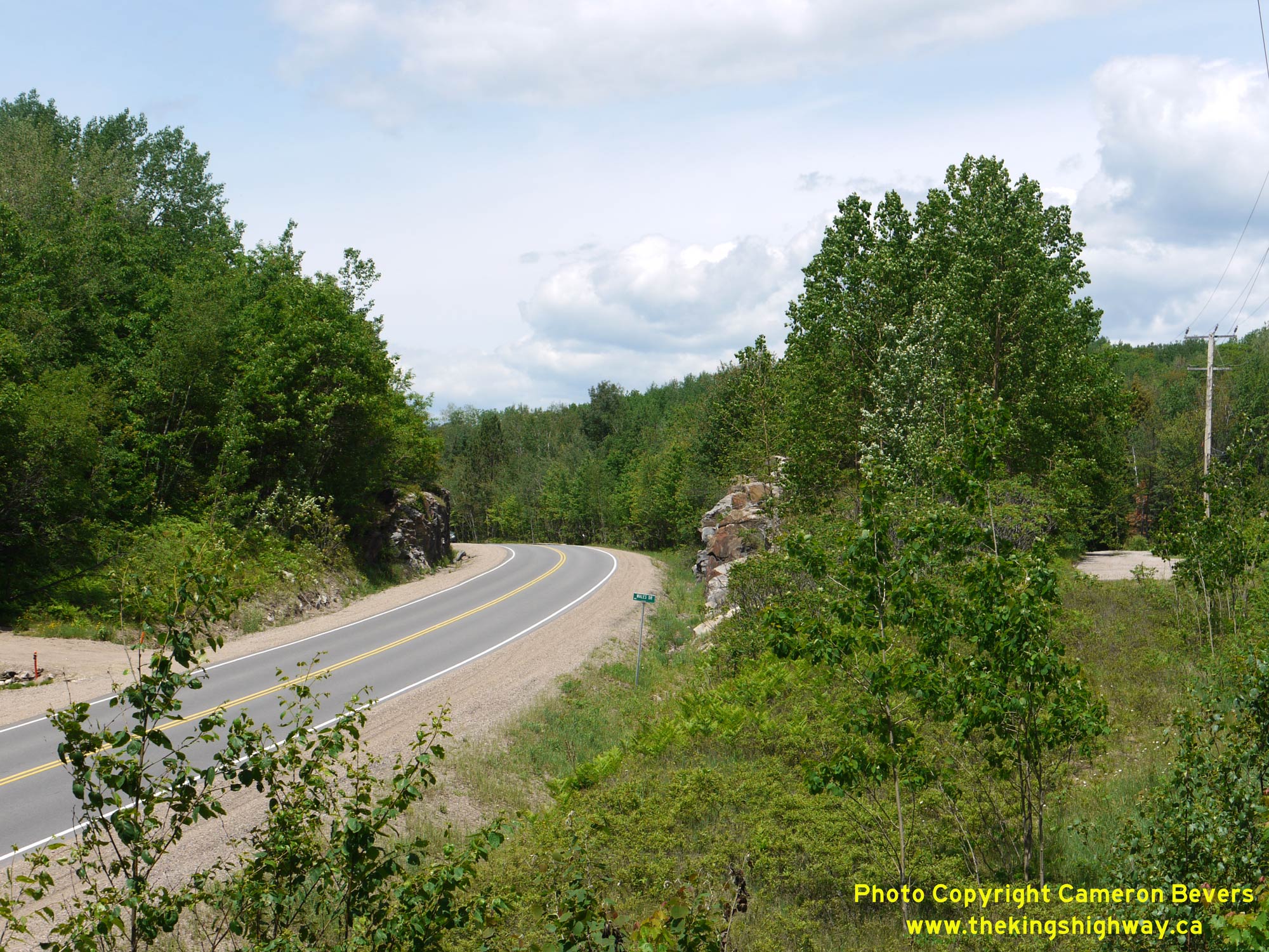
Enlarged Photo Here.(Photograph taken on June 4, 2010 - © Cameron Bevers) Right - Realigned curve on Hwy 62 near the intersection of Wales Drive, located about 6 km south of Barry's Bay. This curve relocation took place under
Contract #1959-84, when the highway's vertical profile was lowered in elevation to improve the grade. The opportunity was also taken at the same time to improve the
curve's horizontal radius. See an Enlarged Photo Here.(Photograph taken on June 4, 2010 - © Cameron Bevers) 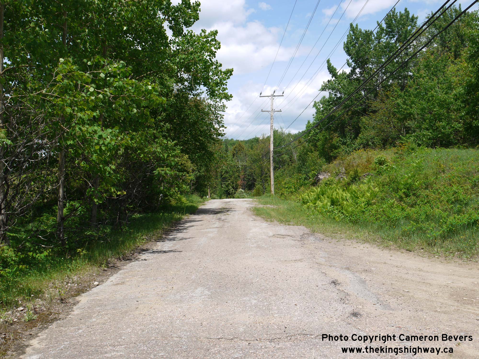
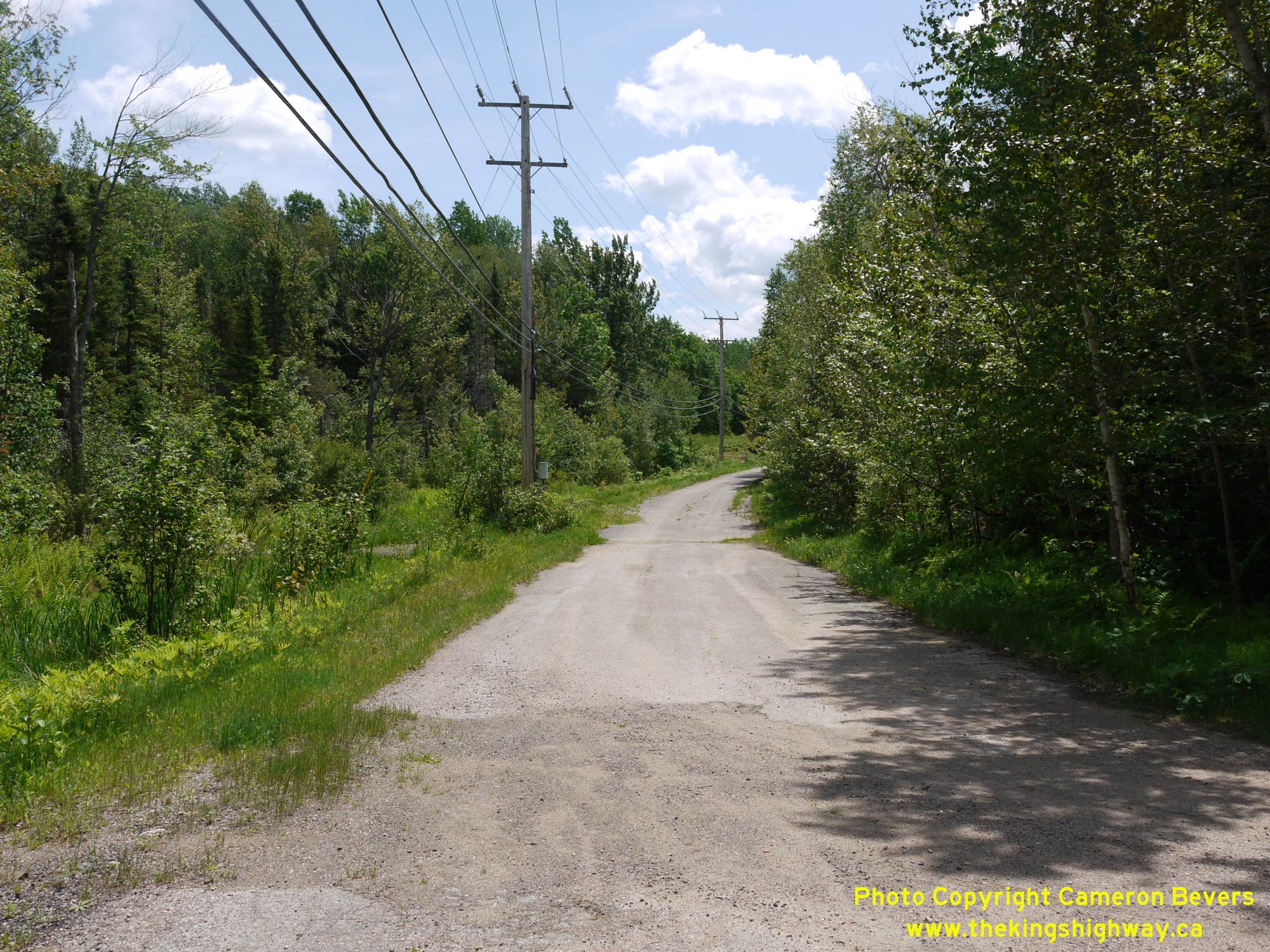 Left - Facing north along Old Hwy 62 (Dixie Lake Lane) south of Barry's Bay. This bypassed highway curve now serves as a local access road to adjacent
properties. This section of pavement was constructed during the original surfacing of Hwy 62 in 1945. The old pavement has fared remarkably well, given its age. See
an Enlarged Photo Here. Left - Facing north along Old Hwy 62 (Dixie Lake Lane) south of Barry's Bay. This bypassed highway curve now serves as a local access road to adjacent
properties. This section of pavement was constructed during the original surfacing of Hwy 62 in 1945. The old pavement has fared remarkably well, given its age. See
an Enlarged Photo Here.(Photograph taken on June 4, 2010 - © Cameron Bevers) Right - Bypassed curve along Hwy 62 about 6 km south of Barry's Bay. This curve was bypassed during reconstruction of Hwy 62 in 1959-1960. See an
Enlarged Photo Here.(Photograph taken on June 4, 2010 - © Cameron Bevers) 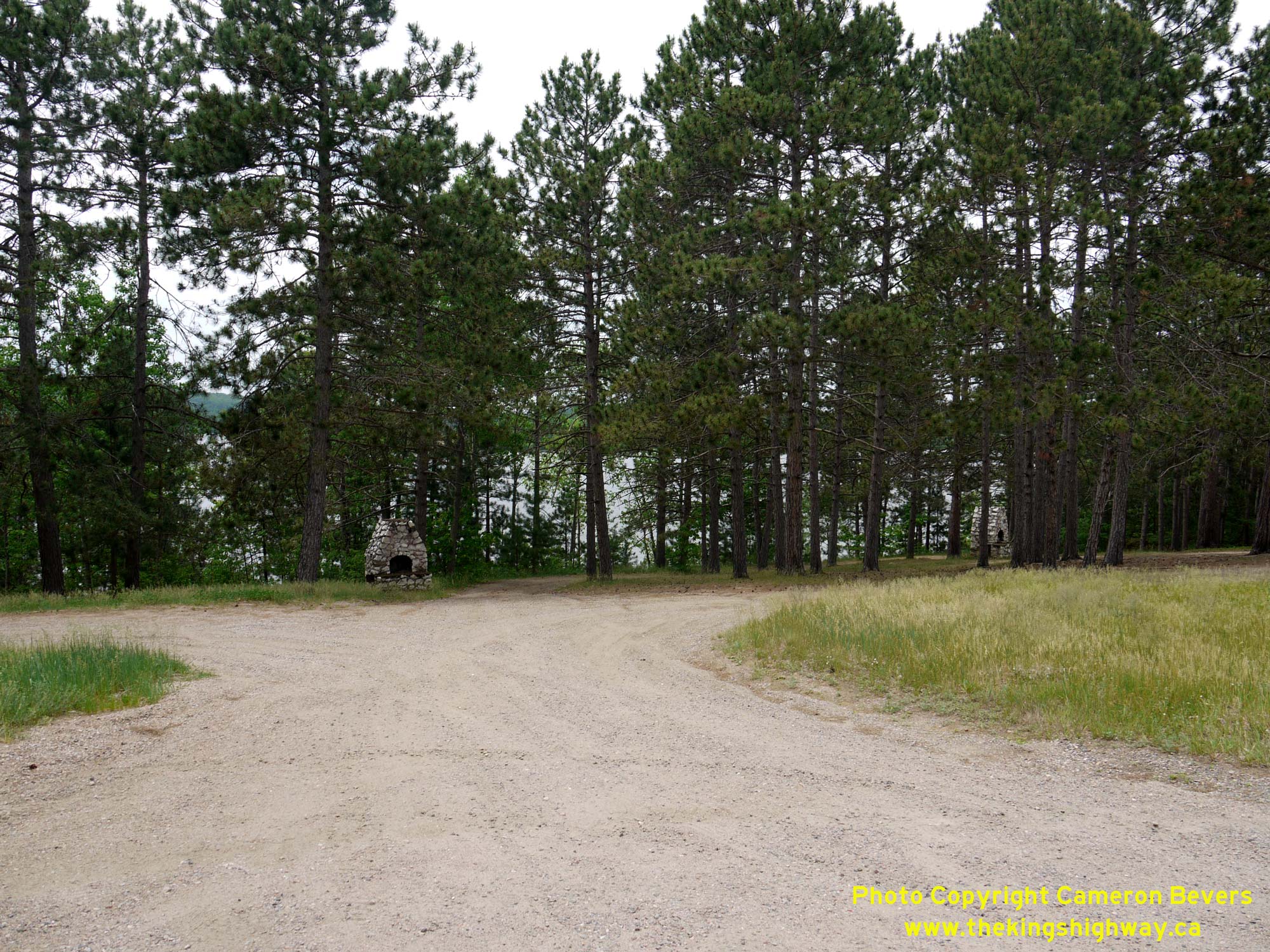
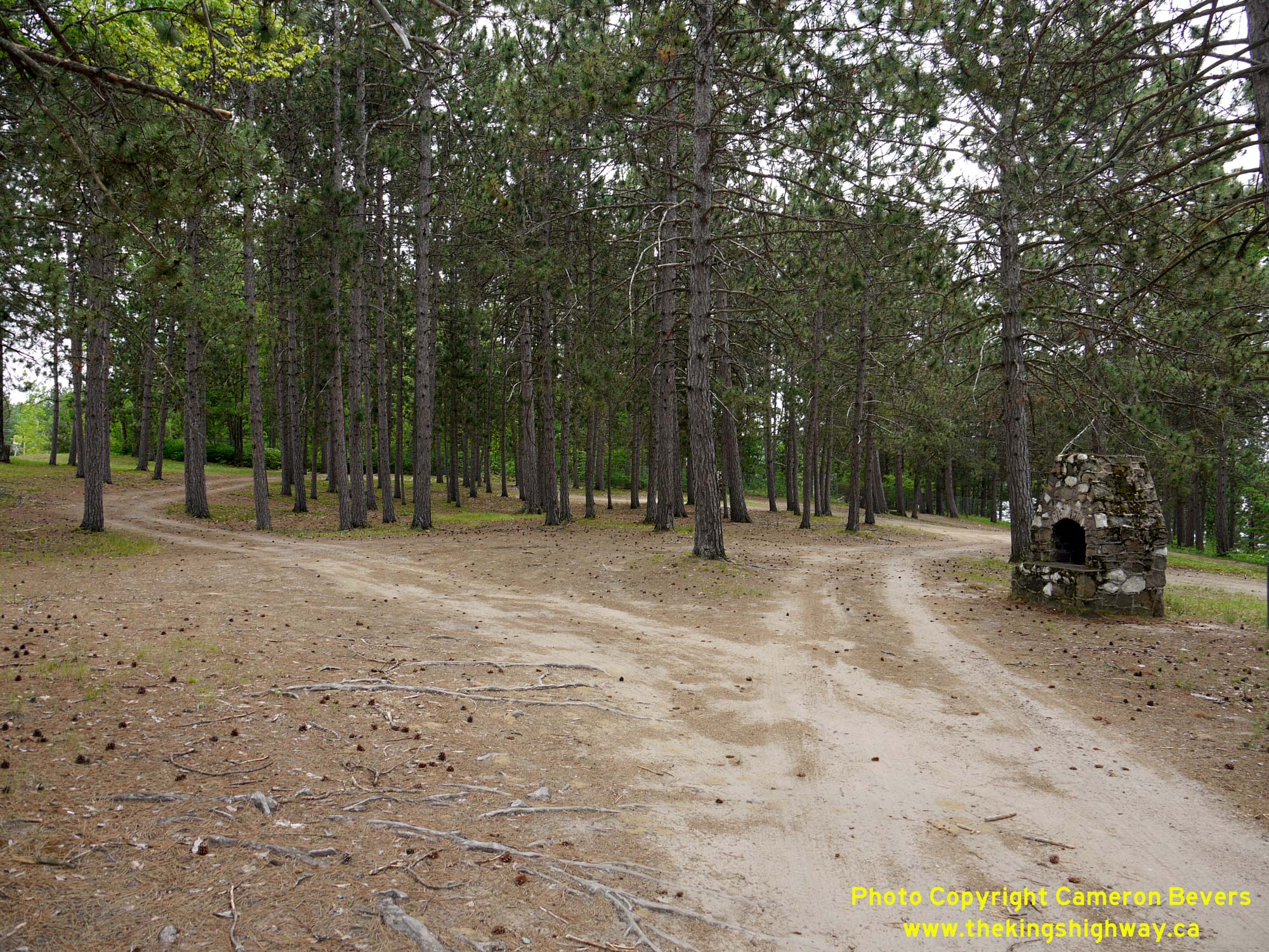 Left - Entrance to the Kamaniskeg Lake Roadside Park on Hwy 62, located about 1 km south of Barry's Bay. Compare this 2010 photo to this
Historical 1954 Photo taken of the park only a few years after its opening in 1951. See an
Enlarged Photo Here. Left - Entrance to the Kamaniskeg Lake Roadside Park on Hwy 62, located about 1 km south of Barry's Bay. Compare this 2010 photo to this
Historical 1954 Photo taken of the park only a few years after its opening in 1951. See an
Enlarged Photo Here.(Photograph taken on May 30, 2010 - © Cameron Bevers) Right - View of the Kamaniskeg Lake Roadside Park on Hwy 62. This 3.3 acre roadside park was established in 1951. Camping was permitted in this park for the
first few years of operation, but it had to be suspended by the end of the 1950s due to overcrowding. The park subsequently operated as a day-use picnic area only.
See an Enlarged Photo Here.(Photograph taken on May 30, 2010 - © Cameron Bevers) 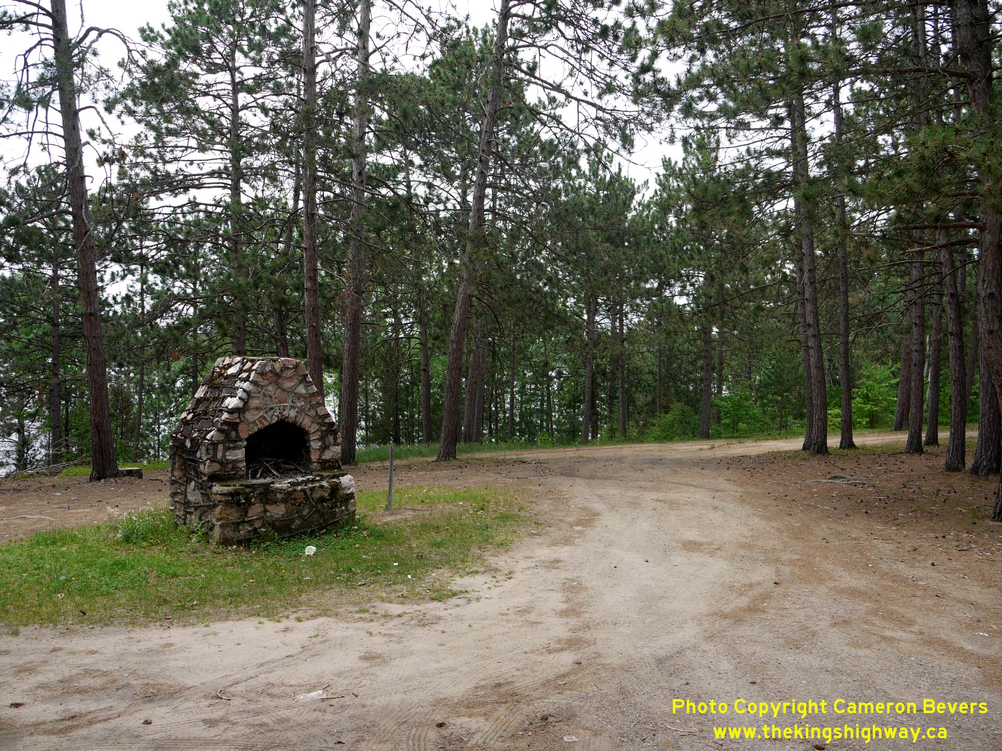
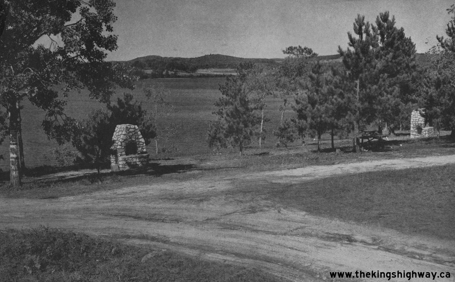
 Left - As was typical for DHO's Roadside Parks in Bancroft District (District #10), stone fireplaces were placed throughout the Kamaniskeg Lake Roadside Park
to allow for cooking. By the 1950s, these roadside parks became a destination in their own right, where motorists could enjoy a pleasant summer day by the lake - or
even stay overnight, if they wished to camp. The DHO did not collect any fees for the use of these campgrounds - even the firewood was supplied to park users at no
charge! See an Enlarged Photo Here. Left - As was typical for DHO's Roadside Parks in Bancroft District (District #10), stone fireplaces were placed throughout the Kamaniskeg Lake Roadside Park
to allow for cooking. By the 1950s, these roadside parks became a destination in their own right, where motorists could enjoy a pleasant summer day by the lake - or
even stay overnight, if they wished to camp. The DHO did not collect any fees for the use of these campgrounds - even the firewood was supplied to park users at no
charge! See an Enlarged Photo Here.(Photograph taken on May 30, 2010 - © Cameron Bevers) Right - Facing north along Hwy 62 (Bay Street) approaching the Hwy 60 Junction in Barry's Bay. Up until the 1990s, motorists who wished to continue north along
Hwy 62 to Pembroke would have had to turn right just ahead at the Hwy 60 Junction. From there, Hwy 60 & Hwy 62 continued easterly towards Killaloe via an
overlapped, concurrent route. See an Enlarged Photo Here.(Photograph taken on September 12, 2020 - © Cameron Bevers) 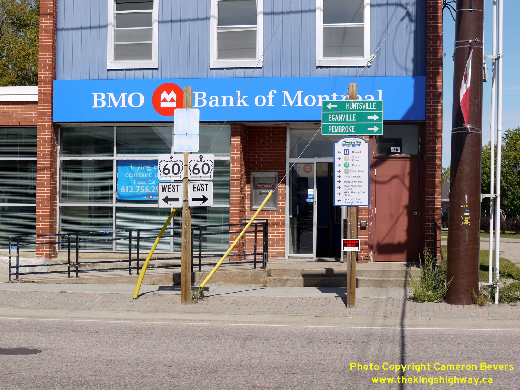
 Left - Junction sign assembly at the Hwy 60 & Hwy 62 Junction in Barry's Bay. During the late 1990s, many changes were made to the provincial highway
network in this part of Ontario. Provincial jurisdiction over Hwy 62 ceased between Maynooth and Barry's Bay, along with a second section of Hwy 62 between Killaloe
and Pembroke. Prior to the 1990s, Hwy 62 turned right and headed east towards Killaloe, concurrently with Hwy 60. After provincial jurisdiction over Hwy 62 ended in
this area in 1997-1998, the highway from the Combermere area northerly to Barry's Bay was transferred over to the County of Renfrew, who renamed the road Renfrew
County Road 62. Rather than continue the route of Renfrew County Road 62 northeasterly from the Barry's Bay area to the Pembroke area, Renfrew County instead decided
to terminate Renfrew County Road 62 at Barry's Bay. The northeastern leg of Hwy 62 from Killaloe to Pembroke via Round Lake was renamed as Renfrew County Road 58.
Accordingly, the overlapped route of Hwy 60 & Hwy 62 between Barry's Bay and Killaloe was discontinued. Today, the highway from Barry's Bay to Killaloe is known
as Hwy 60 only, with all references to Hwy 62 removed. See an Enlarged Photo Here. Left - Junction sign assembly at the Hwy 60 & Hwy 62 Junction in Barry's Bay. During the late 1990s, many changes were made to the provincial highway
network in this part of Ontario. Provincial jurisdiction over Hwy 62 ceased between Maynooth and Barry's Bay, along with a second section of Hwy 62 between Killaloe
and Pembroke. Prior to the 1990s, Hwy 62 turned right and headed east towards Killaloe, concurrently with Hwy 60. After provincial jurisdiction over Hwy 62 ended in
this area in 1997-1998, the highway from the Combermere area northerly to Barry's Bay was transferred over to the County of Renfrew, who renamed the road Renfrew
County Road 62. Rather than continue the route of Renfrew County Road 62 northeasterly from the Barry's Bay area to the Pembroke area, Renfrew County instead decided
to terminate Renfrew County Road 62 at Barry's Bay. The northeastern leg of Hwy 62 from Killaloe to Pembroke via Round Lake was renamed as Renfrew County Road 58.
Accordingly, the overlapped route of Hwy 60 & Hwy 62 between Barry's Bay and Killaloe was discontinued. Today, the highway from Barry's Bay to Killaloe is known
as Hwy 60 only, with all references to Hwy 62 removed. See an Enlarged Photo Here.(Photograph taken on September 12, 2020 - © Cameron Bevers) Right - Facing south along Hwy 62 (Bay Street) towards Combermere from the Hwy 60 Junction in Barry's Bay. See an
Enlarged Photo Here.(Photograph taken on September 12, 2020 - © Cameron Bevers) 
 Left - Facing east along Hwy 60 (Opeongo Line) towards the Hwy 62 Junction at Bay Street in Barry's Bay. Ever since the initial establishment of King's
Highways in this part of Ontario in 1937, Barry's Bay has formed a key link in the provincial highway system. No matter where you travel in this part of Ontario,
chances are you will have to drive through Barry's Bay! See an Enlarged Photo Here. Left - Facing east along Hwy 60 (Opeongo Line) towards the Hwy 62 Junction at Bay Street in Barry's Bay. Ever since the initial establishment of King's
Highways in this part of Ontario in 1937, Barry's Bay has formed a key link in the provincial highway system. No matter where you travel in this part of Ontario,
chances are you will have to drive through Barry's Bay! See an Enlarged Photo Here.(Photograph taken on September 12, 2020 - © Cameron Bevers) Right - View of Hwy 60 (Opeongo Line) facing west towards Madawaska from the Hwy 62 Junction in Barry's Bay. See an
Enlarged Photo Here.(Photograph taken on September 12, 2020 - © Cameron Bevers) 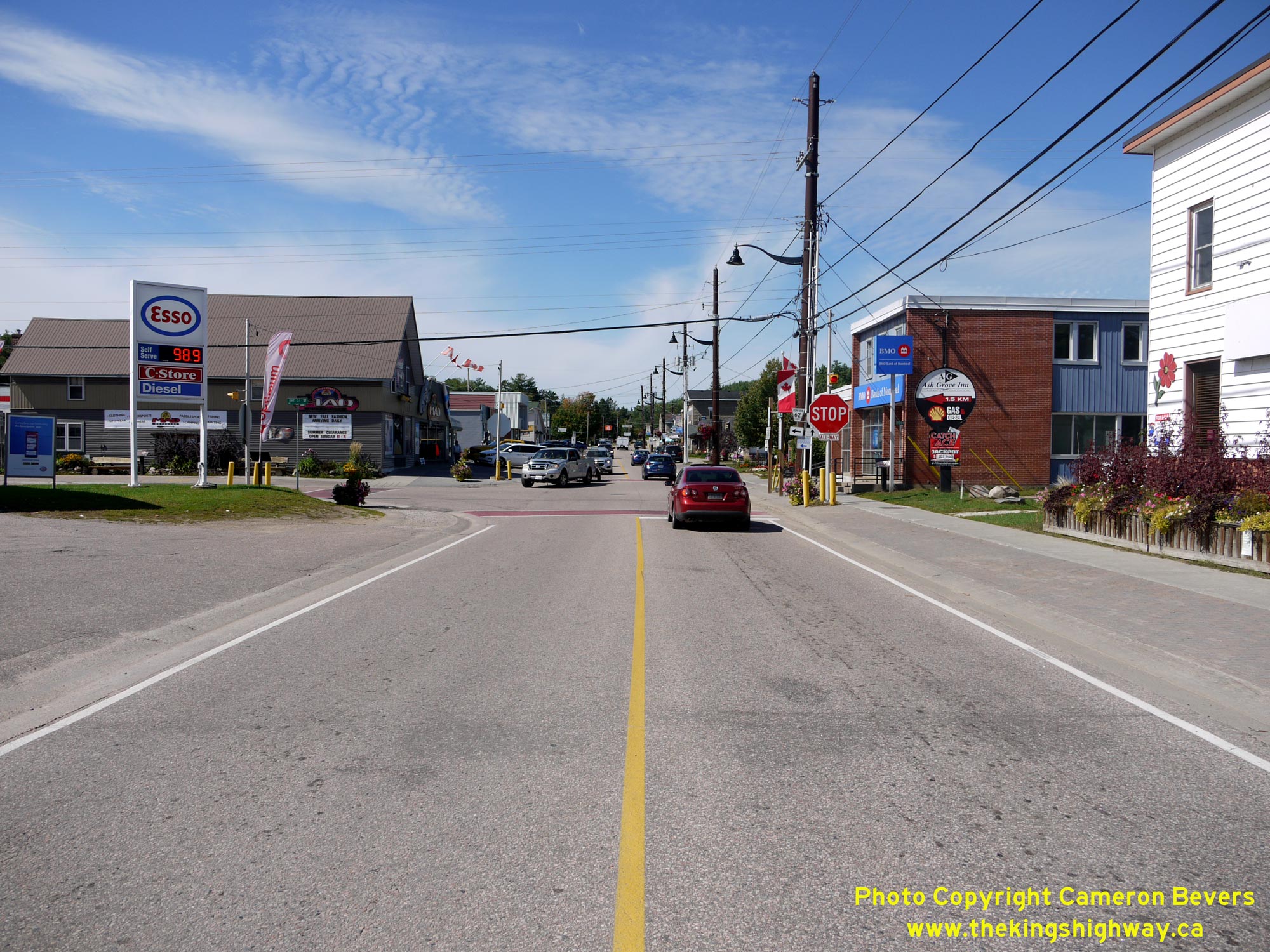
 Left - View of the Hwy 60 & Hwy 62 Junction at the intersection of Opeongo Line and Bay Street in Barry's Bay, facing west. Prior to the 1990s, Hwy 62
turned left at this junction and headed south towards Combermere, Maynooth and Bancroft. By continuing west via Hwy 60, motorists can reach Madawaska, Algonquin Park
and Huntsville. For an interesting historical comparison, have a look at this Circa 1970 Photo
of this highway junction taken from roughly the same location about 50 years later. See an
Enlarged Photo Here. Left - View of the Hwy 60 & Hwy 62 Junction at the intersection of Opeongo Line and Bay Street in Barry's Bay, facing west. Prior to the 1990s, Hwy 62
turned left at this junction and headed south towards Combermere, Maynooth and Bancroft. By continuing west via Hwy 60, motorists can reach Madawaska, Algonquin Park
and Huntsville. For an interesting historical comparison, have a look at this Circa 1970 Photo
of this highway junction taken from roughly the same location about 50 years later. See an
Enlarged Photo Here.(Photograph taken on September 12, 2020 - © Cameron Bevers) Right - Facing east along Hwy 60 (Opeongo Line) from the Hwy 62 Junction at Bay Street in Barry's Bay. See an
Enlarged Photo Here.(Photograph taken on September 12, 2020 - © Cameron Bevers) 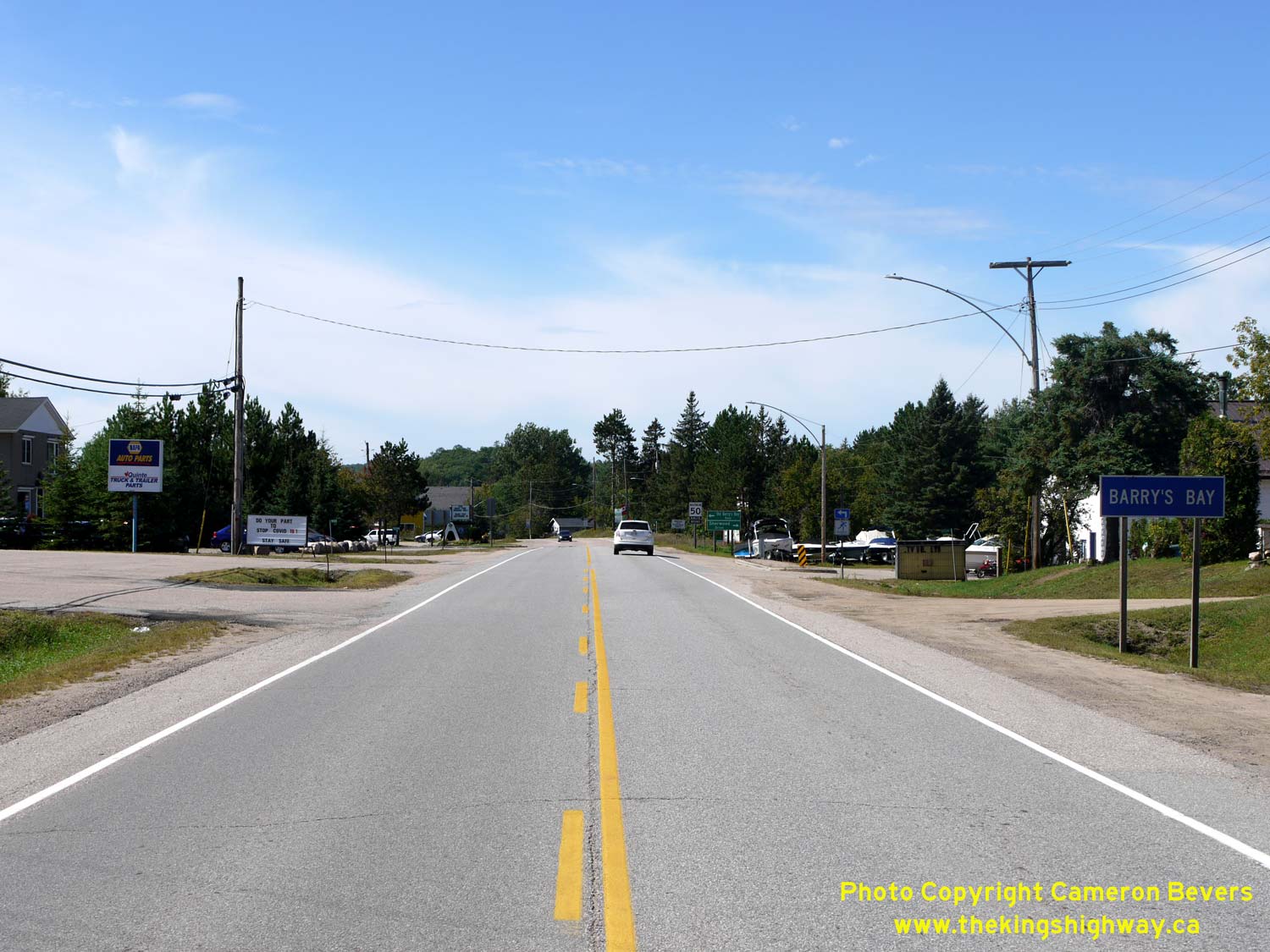
Left - Eastern entrance to Barry's Bay on Hwy 60, facing west at Old Barry's Bay Road. As the name implies, motorists once had to use the Old Barry's Bay Road
prior to the completion of the new Combermere-Barry's Bay Road (now Hwy 62) along the eastern shores of Kamaniskeg Lake during the 1930s. See an
Enlarged Photo Here. (Photograph taken on September 12, 2020 - © Cameron Bevers) Right - Facing east along Hwy 60 towards Killaloe, departing from Barry's Bay. The Department of Highways of Ontario (DHO) took over responsibility of the Barry's Bay-Golden Lake Road when it was assumed as a new King's Highway in September 1937. Initially, the new highway was signed as Hwy 60 only. However, Hwy 60 was signed as an overlapped route (Hwy 60 & Hwy 62) between Barry's Bay and Killaloe from 1960 up until 1998. See an Enlarged Photo Here. (Photograph taken on September 12, 2020 - © Cameron Bevers) 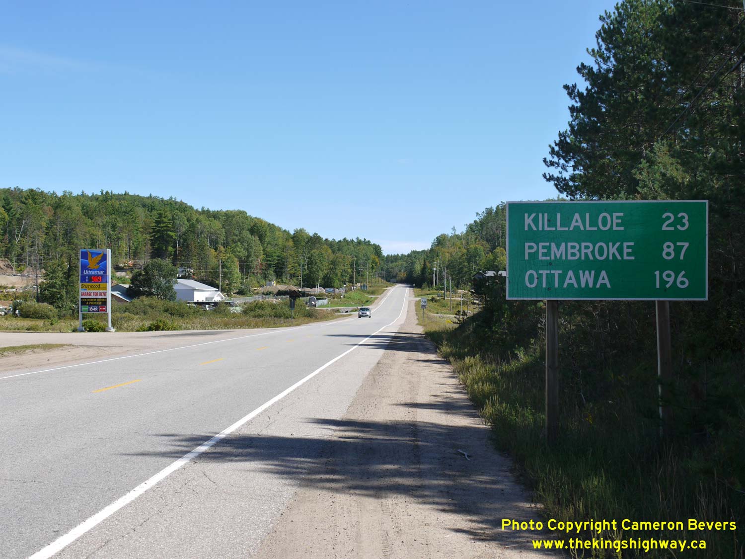
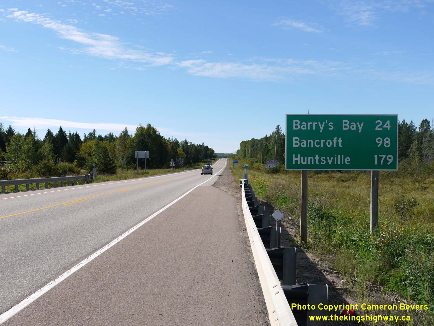
Left - Distance guide sign on eastbound Hwy 60 departing Barry's Bay. Although Hwy 60 does not reach Ottawa, it is a far more logical control city than
the highway's actual eastern terminus in Renfrew. In fact, Ottawa is signed as the destination control city for Hwy 60 even at the highway's western terminus in
Huntsville. Eastbound highway distances are also signed to Pembroke at Barry's Bay, as this route was signed as Hwy 60 & Hwy 62 up until the late 1990s. See an
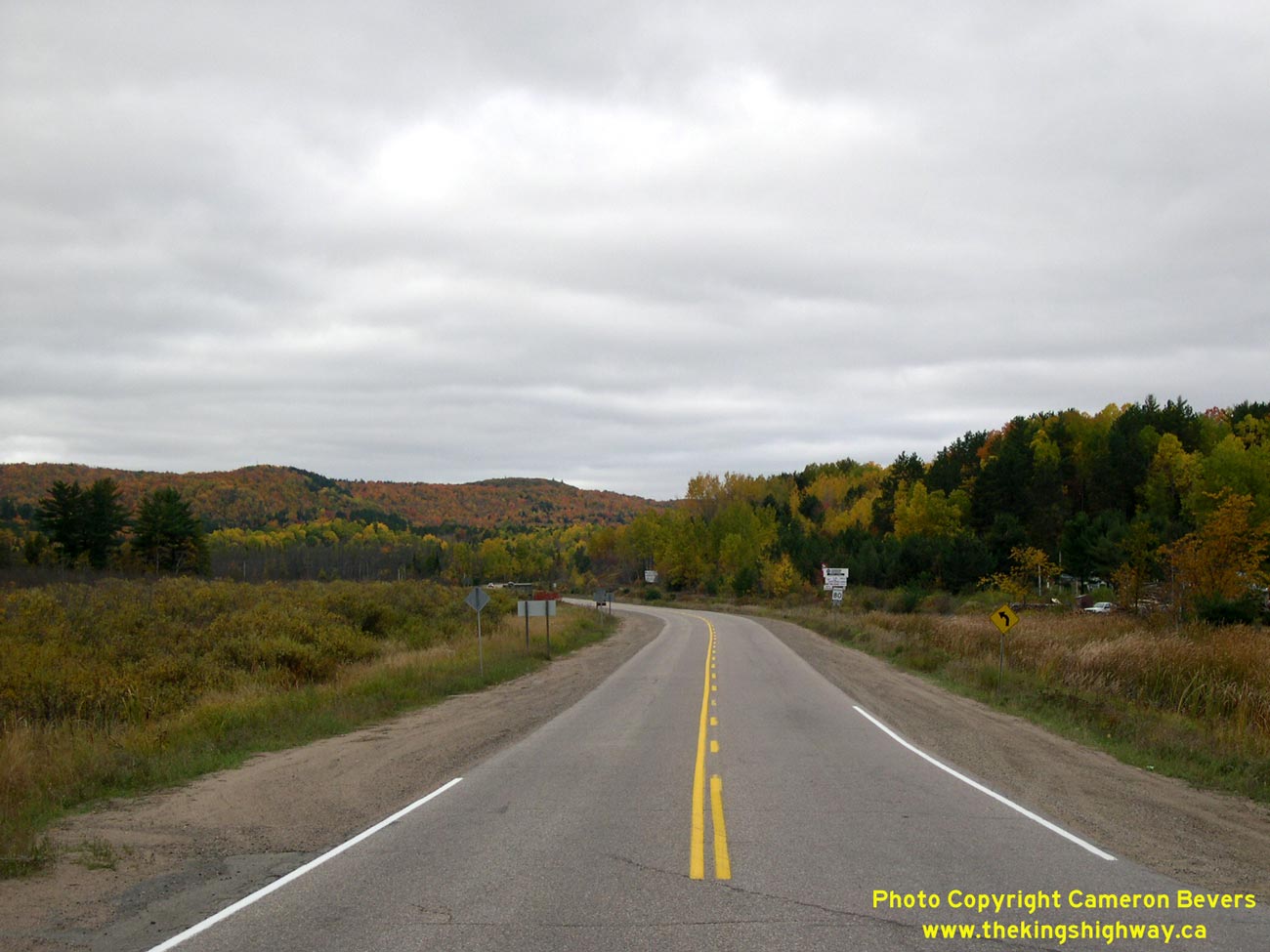
Enlarged Photo Here. (Photograph taken on September 12, 2020 - © Cameron Bevers) Right - Autumn colours on Hwy 60, facing west towards Barry's Bay from Wilno. See an Enlarged Photo Here. (Photograph taken on October 9, 2004 - © Cameron Bevers) 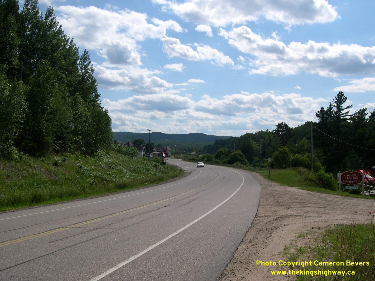
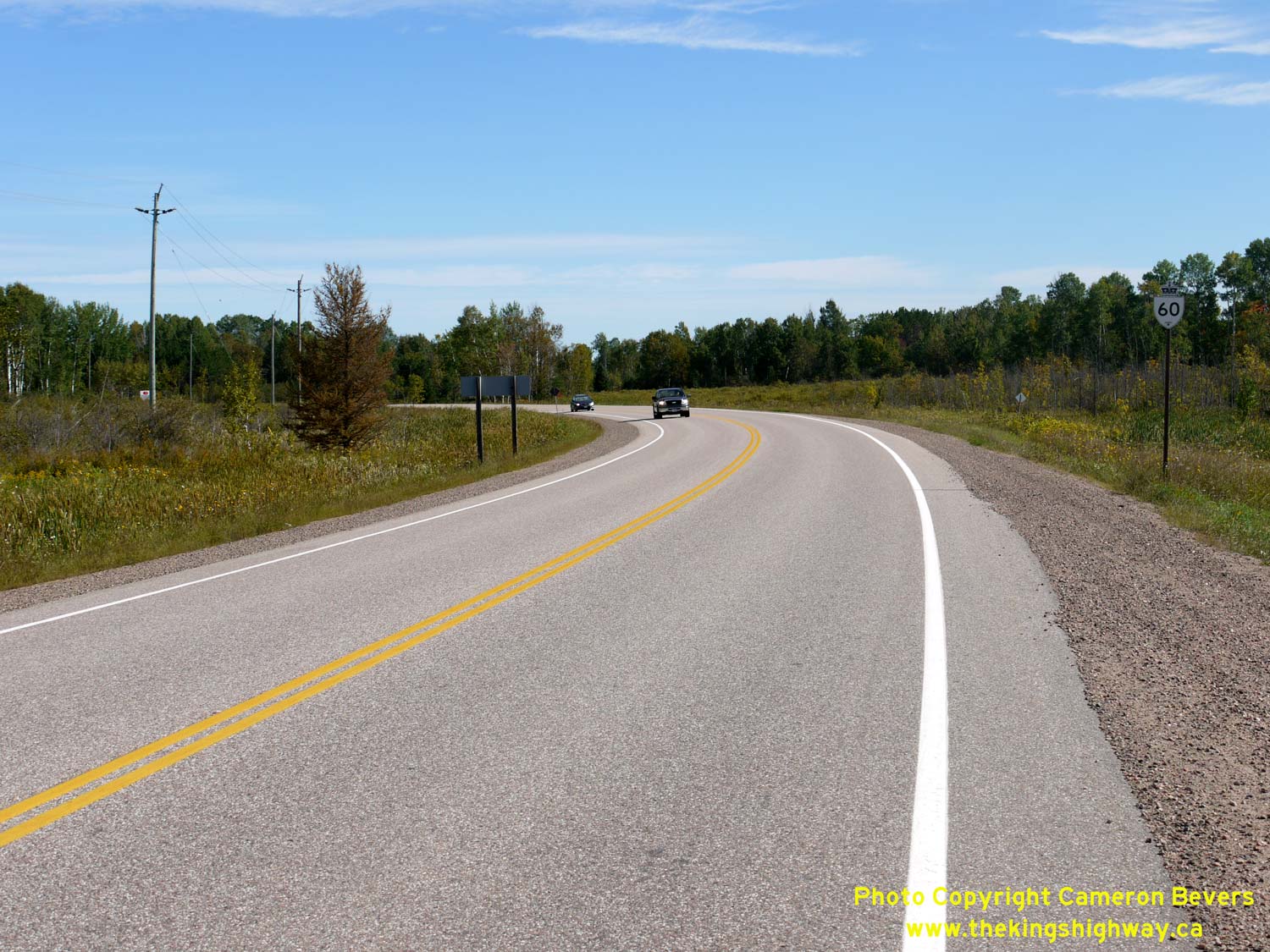
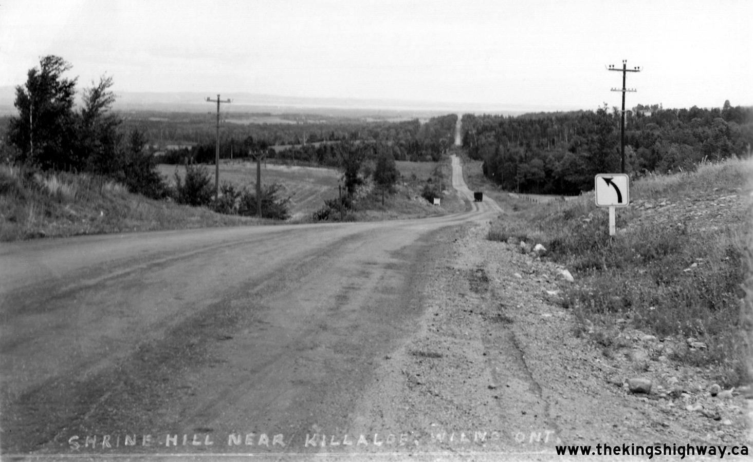
Left - View of Hwy 60 at Wilno, facing west towards Barry's Bay. See an
Enlarged Photo Here. (Photograph taken on August 1, 2004 - © Cameron Bevers) Right - Facing east along Hwy 60 from Wilno towards Shrine Hill. This photo clearly illustrates the start of the Shrine Hill Diversion, which was built in the early 1960s to carry an improved grade of Hwy 60 across this sharp pinnacle. The original 1937 route of Hwy 60 crests over the top of Shrine Hill straight ahead. See an Enlarged Photo Here. (Photograph taken on October 9, 2004 - © Cameron Bevers) 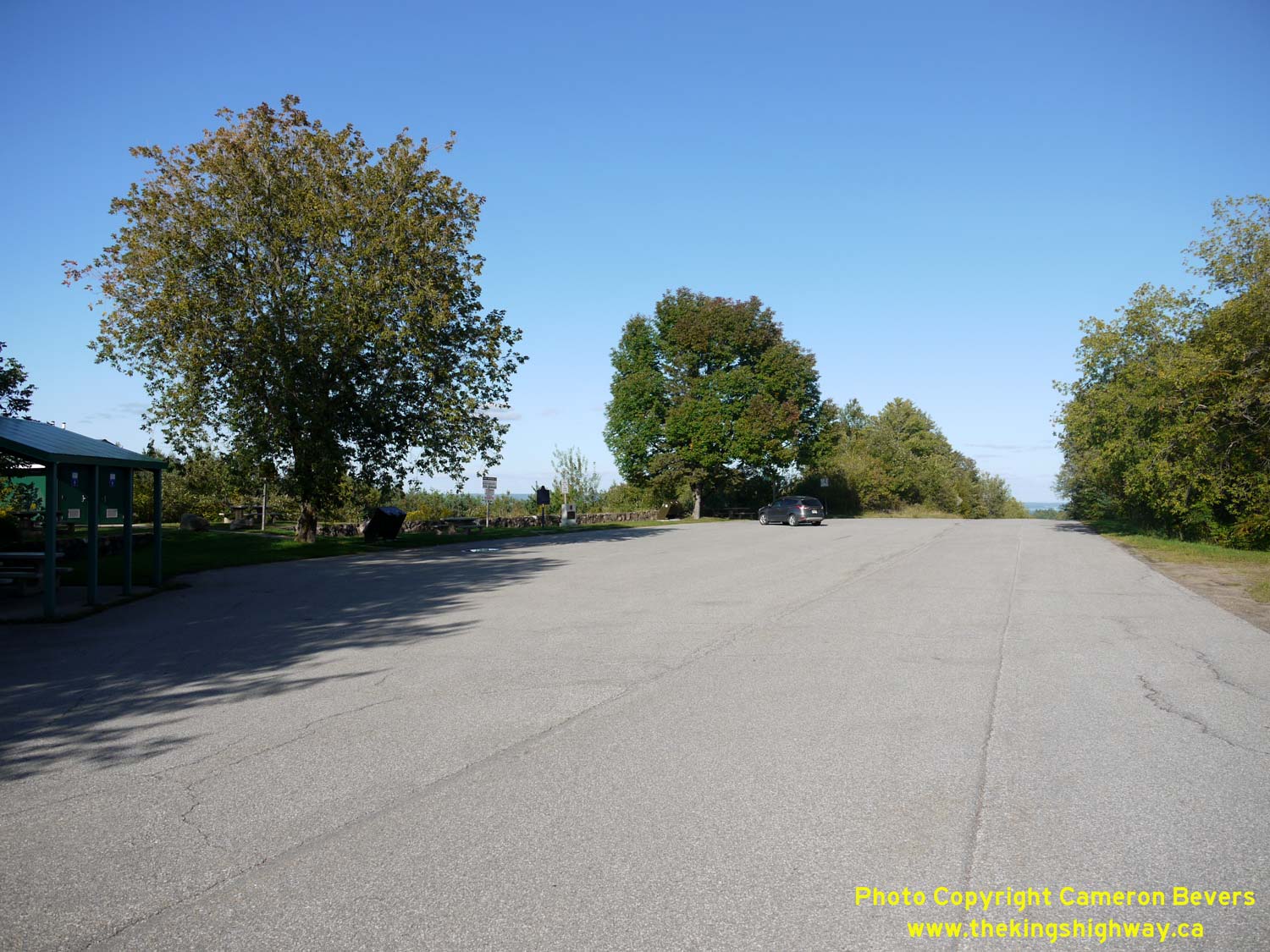
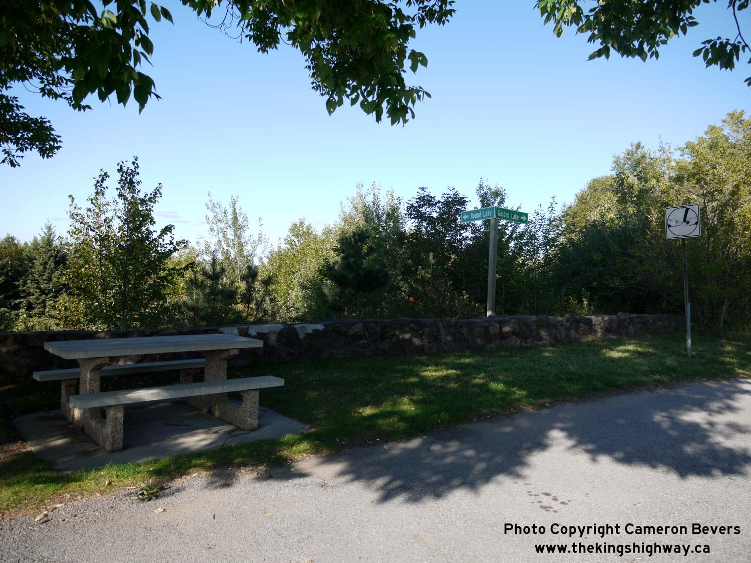
Left - View of the Shrine Hill Lookout on Hwy 60 east of Wilno. This small roadside park was established in the early 1940s so that motorists on Hwy 60 could
pull safely off of the highway to enjoy the spectacular views of Round Lake and Golden Lake. This small park offers parking, a picnic shelter, toilets and a number of
picnic tables. The lookout was bypassed in 1963-1964 by a new route of Hwy 60 on an improved alignment. See an
Enlarged Photo Here. (Photograph taken on September 11, 2020 - © Cameron Bevers) Right - A pair of fingerboard guide signs identify the two lakes visible from the Shrine Hill Lookout. The stone retaining wall which can be seen behind the picnic table runs along the northern side of the lookout's parking area. It is believed that this stone retaining wall was constructed when the DHO first established the roadside park at Shrine Hill in 1940. See an Enlarged Photo Here. (Photograph taken on September 11, 2020 - © Cameron Bevers) 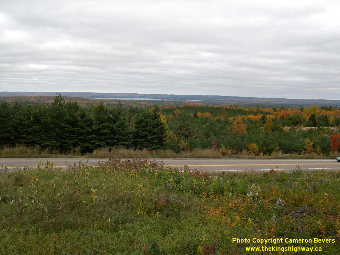
Left - View of Round Lake from the Shrine Hill Lookout on Hwy 60. Sadly, the views from the Shrine Hill Lookout are no longer the sweeping panoramic vistas
they once were, due to decades of tree growth in the valley. Since the time I took this photo in the Fall of 2004, the row of trees beside the highway has obscured
the view of Round Lake. The grade revision to Hwy 60 (the Shrine Hill Diversion) can be seen in the foreground. See an
Enlarged Photo Here. (Photograph taken on October 9, 2004 - © Cameron Bevers) Right - Autumn colours along Old Hwy 60 (Shrine Hill Drive), facing east from the Shrine Hill Roadside Park. Compare this 2004 photo to this historic 1940s postcard view of Hwy 60, which (by sheer coincidence) was taken from exactly the same location decades earlier. I actually acquired the historic photo of Hwy 60 at an antique sale many years after my photo above was taken. Understandably, I was rather intrigued at the similarity of the vantage point that the historical photographer chose to capture their view of Hwy 60. Note the amount of tree growth on Shrine Hill since the 1940s. See an Enlarged Photo Here. (Photograph taken on October 9, 2004 - © Cameron Bevers) 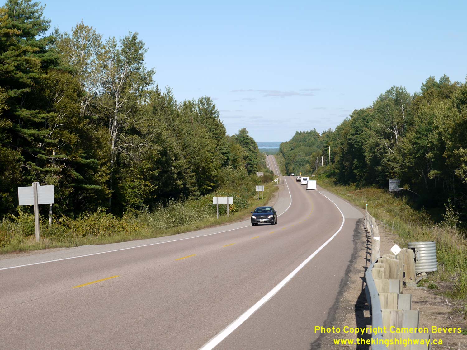
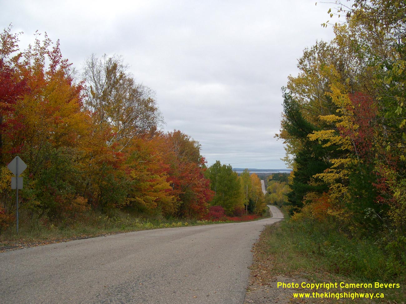
Left - Facing east along Hwy 60 towards Killaloe from Shrine Hill Drive. This point marks the eastern end of the Shrine Hill Diversion, where the revised
route of Hwy 60 built in the early 1960s ties back into the original 1937 route of Hwy 60 east of Wilno. Golden Lake can be seen in the far distance. See an
Enlarged Photo Here. (Photograph taken on September 11, 2020 - © Cameron Bevers) Right - Facing west along Hwy 60 from Mill Street (Old Hwy 60) in Killaloe. In the mid-1950s, a substantial highway diversion was built to carry a revised route of Hwy 60 through Killaloe (formerly known as Killaloe Station). The diversion resulted in a shorter and vastly-improved alignment for Hwy 60. The original 1937 highway route crossed the current highway diagonally across the top of the rock cut. It then ran through the present-day site of Killaloe's Ontario Provincial Police Detachment, whose entrance is visible beside the highway at right. See an Enlarged Photo Here. (Photograph taken on September 12, 2020 - © Cameron Bevers) 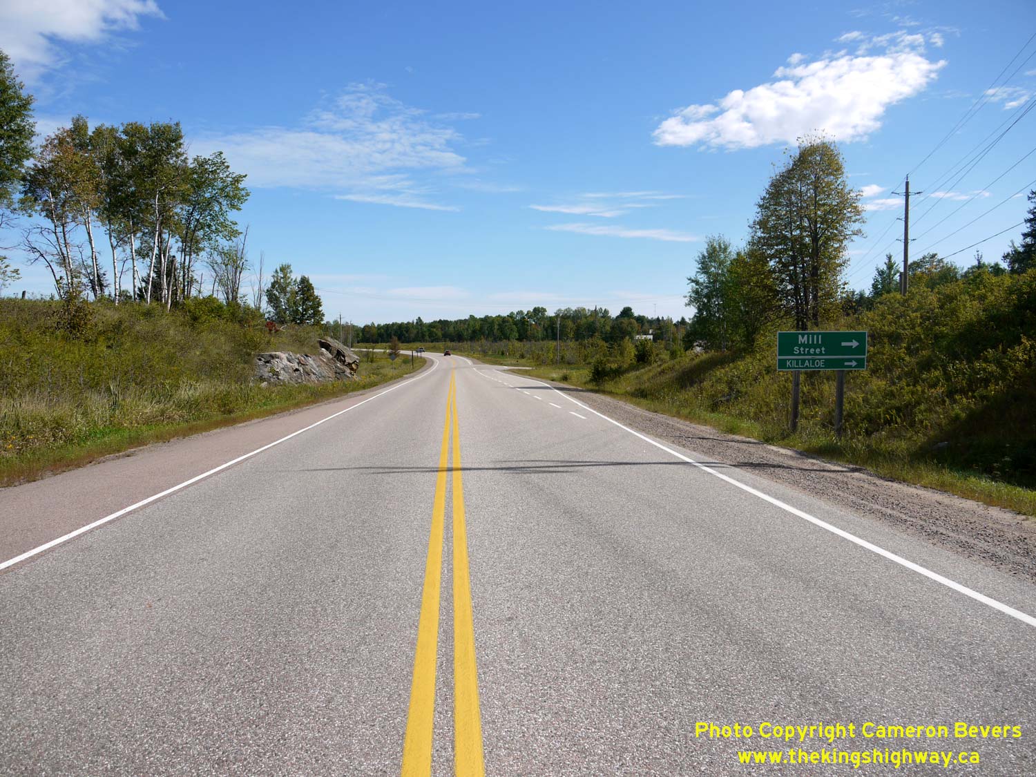
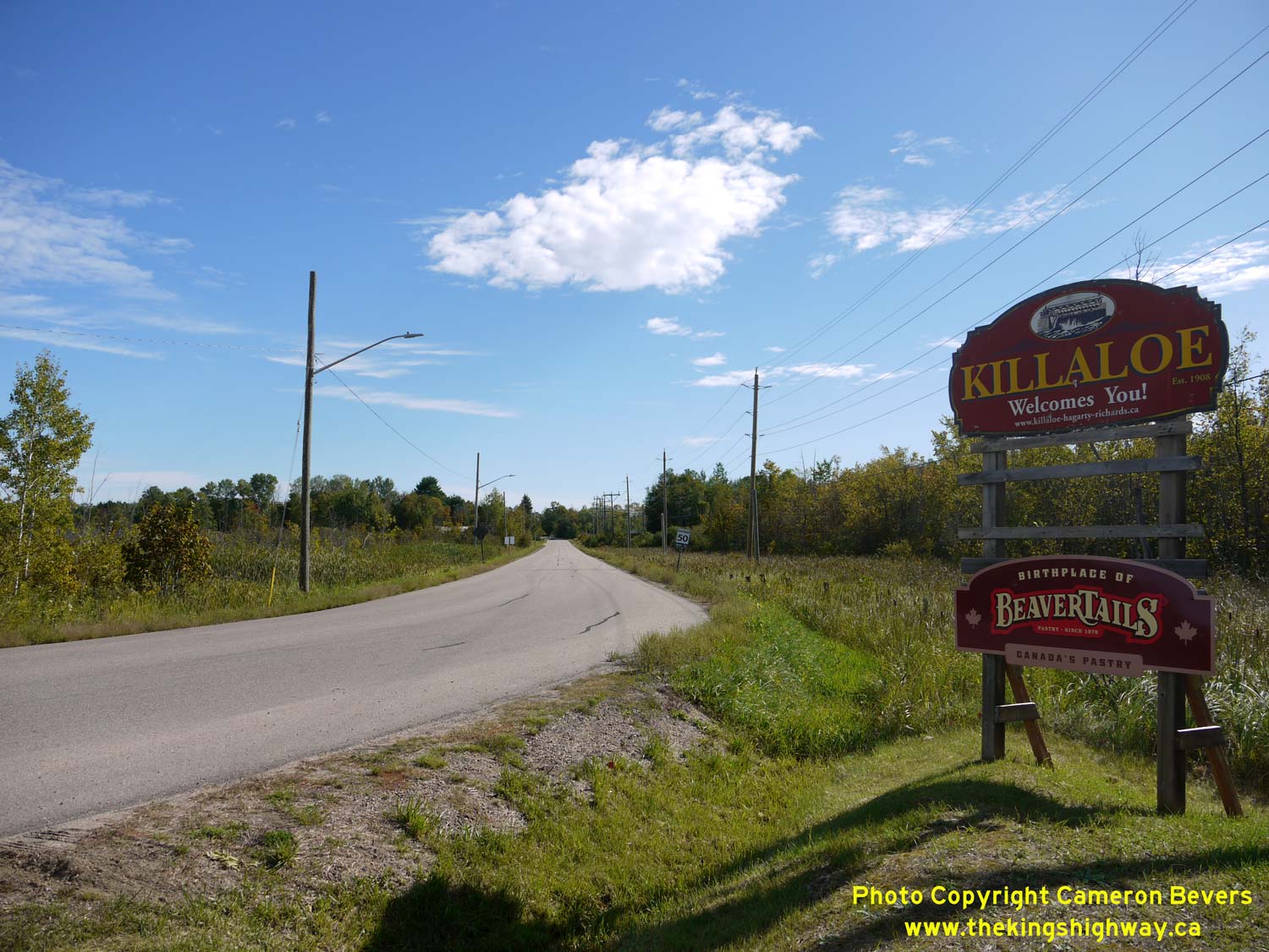
Left - Approaching Mill Street (Old Hwy 60) on the Killaloe Diversion. From the time Hwy 60 was first established as a King's Highway in 1937 up until the
completion of the Killaloe Diversion in 1955, Hwy 60 passed right through Killaloe Station's village centre. See an
Enlarged Photo Here. (Photograph taken on September 12, 2020 - © Cameron Bevers) Right - Western entrance to Killaloe on Mill Street (Old Hwy 60), facing east from the Hwy 60 Junction. The DHO briefly retained ownership of Old Hwy 60 approaching Killaloe, even after the completion of the new bypass in 1955. Jurisdiction over this former route of Hwy 60 was eventually transferred from the province to the Village of Killaloe Station and the Township of Hagarty in March, 1957. See an Enlarged Photo Here. (Photograph taken on September 12, 2020 - © Cameron Bevers) 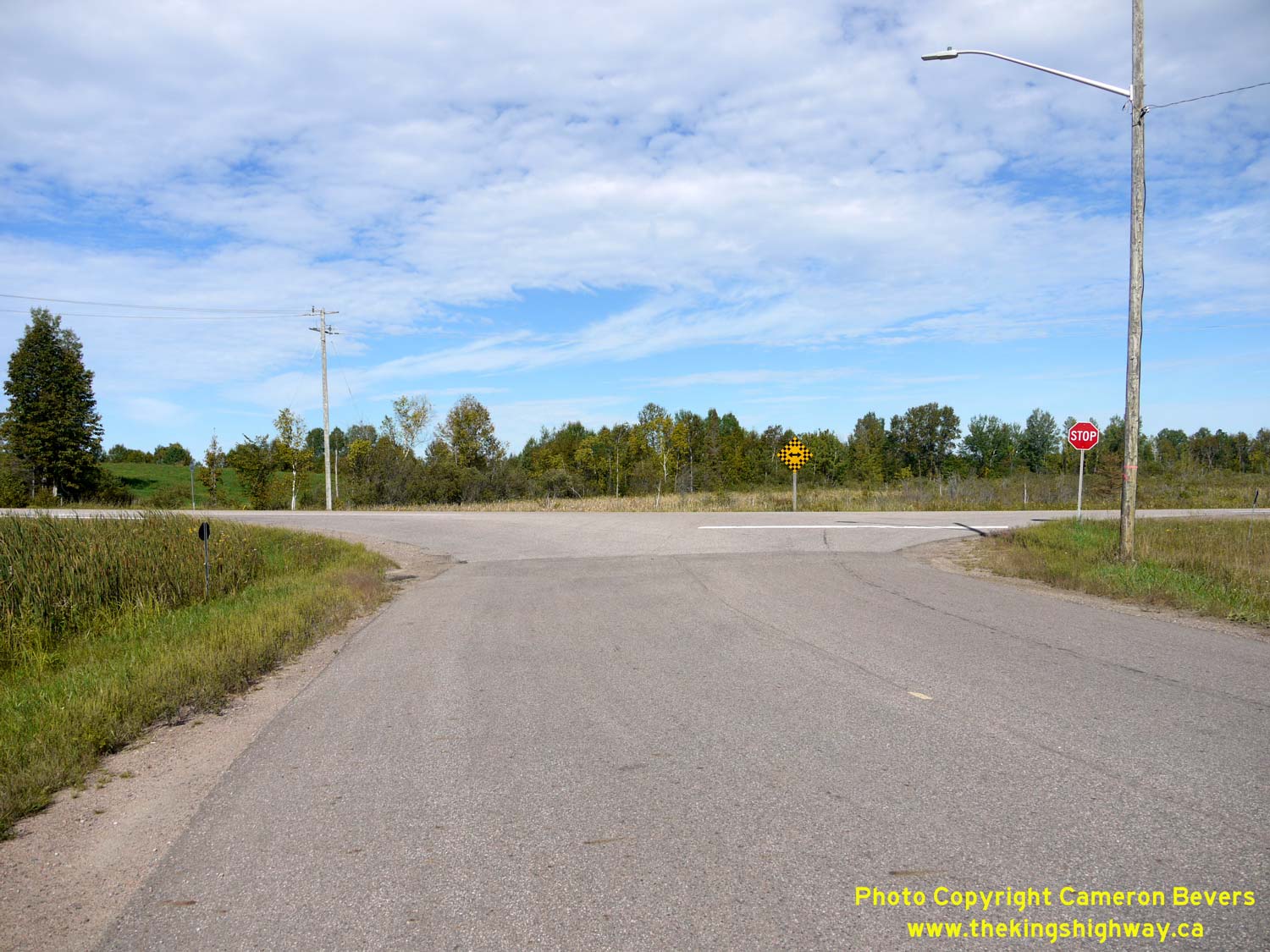
Left - Old meets new: The former route of Hwy 60 connects to the Killaloe Diversion (current Hwy 60) west of Killaloe. In a notable departure from a common DHO
practice of the 1950s, the old route of Hwy 60 through Killaloe was apparently never signed as a Hwy 60B Business Route. This is likely due to the fact that
Killaloe's Main Street was designated as a Secondary Highway (Hwy 521) in 1956, which meant that Killaloe was still served by a provincial highway despite being
bypassed. See an Enlarged Photo Here. (Photograph taken on September 12, 2020 - © Cameron Bevers) Right - Facing east along the Killaloe Diversion (Hwy 60) from Mill Street. This long, gentle curve on the Killaloe Diversion was a significant improvement over the old, winding route of Hwy 60 through Killaloe Station's village centre. See an Enlarged Photo Here. (Photograph taken on September 12, 2020 - © Cameron Bevers) 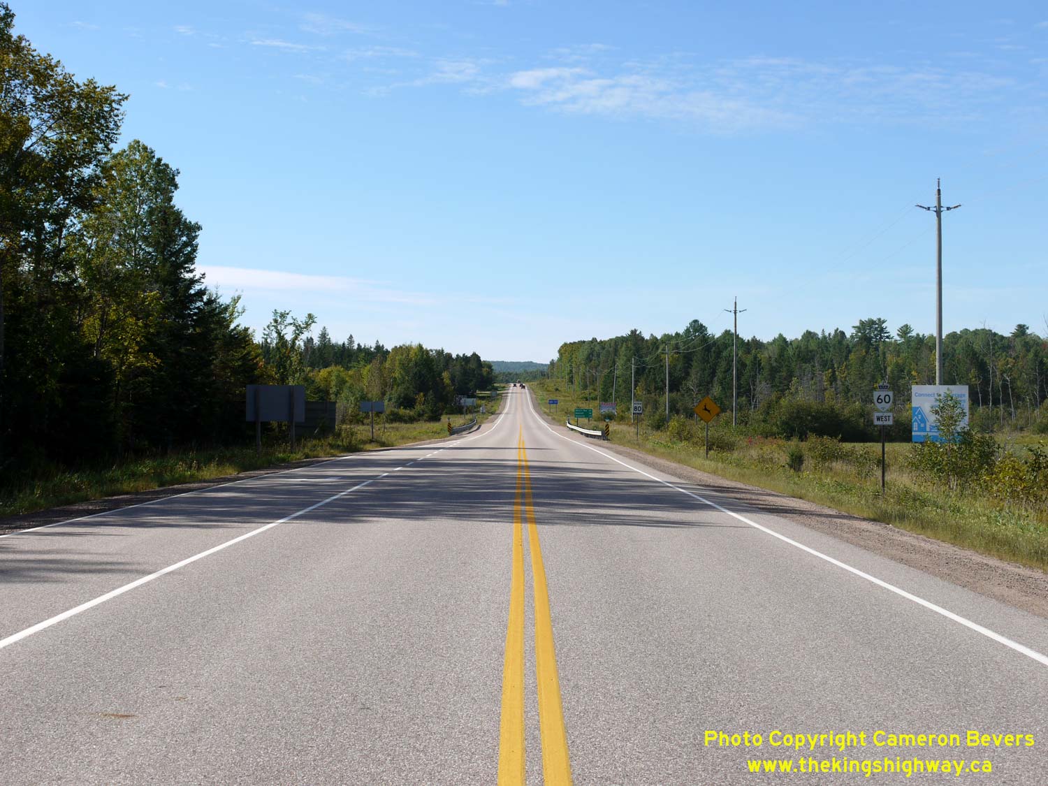
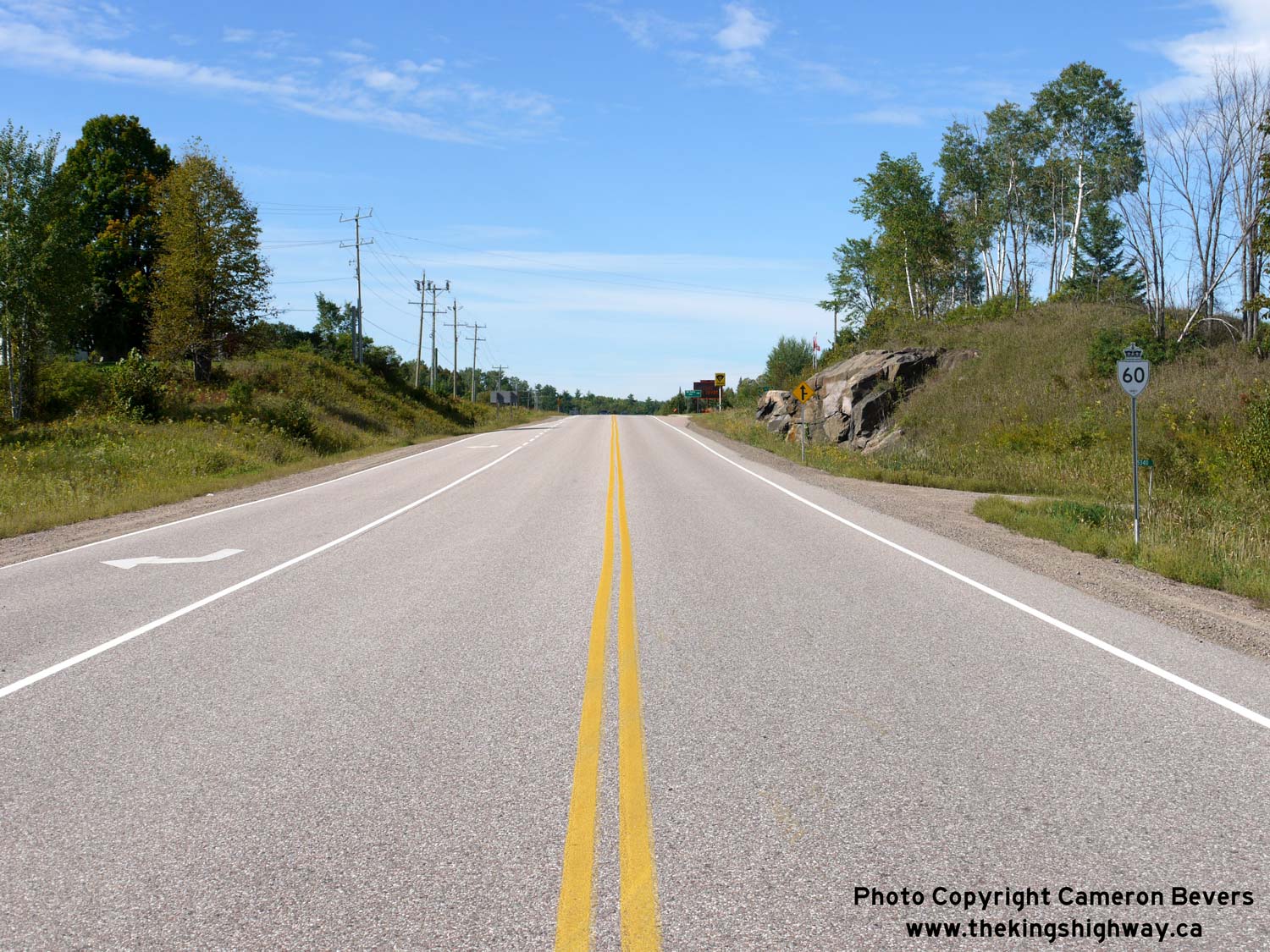
Left - Facing west along Hwy 60 towards Wilno from the Former Hwy 62 North & Hwy 512 Junction at Killaloe. Apart from the two horizontal curves at either
end of the Killaloe Diversion, the revised alignment of Hwy 60 around Killaloe is arrow-straight. The Killaloe Diversion was constructed under Contract #1954-77. See
an Enlarged Photo Here. (Photograph taken on September 12, 2020 - © Cameron Bevers) Right - Distance guide sign on westbound Hwy 60 departing Killaloe. Westbound highway distances are also signed to Bancroft. Although Bancroft is actually situated on Hwy 62, it should be noted that this portion of Hwy 60 was overlapped with Hwy 62 for many years. The overlapped route of Hwy 60 & Hwy 62 was discontinued once Hwy 62 was decommissioned as a King's Highway north of Maynooth during the mass Ontario highway downloading spree of 1997 and 1998. See an Enlarged Photo Here. (Photograph taken on September 12, 2020 - © Cameron Bevers)
Continue on to King's Highway 62 Photos: Killaloe to Pembroke
|
|---|
Links to Adjacent King's Highway Photograph Pages:
Back to King's Highway 61 Photos /
King's Highway 62 History /
On to King's Highway 63 Photos
Ontario Highway History - Main Menu / Back to List of Highways Website contents, photos & text © 2002-2026, Cameron
Bevers (Webmaster) - All Rights Reserved / Contact Me
|
|---|