
| 
| |
|
|
This page contains present day photos (Year 2000 to date) of Ontario's King's Highway 62, arranged by location from Killaloe
northerly to Pembroke. All photographs displayed on this page were taken by the Webmaster (Cameron Bevers), unless specifically noted otherwise. Click on any
thumbnail to see a larger image!
Please note that all photographs displayed on this
website are protected by copyright. These photographs must not be reproduced, published,
electronically stored or copied, distributed, or posted onto other websites without
my written permission. If you want to use photos from this website, please
email me first for permission. Thank-you!
|
|---|
|
Page 6: Present Day King's Highway 62 Photographs (Killaloe to Pembroke)
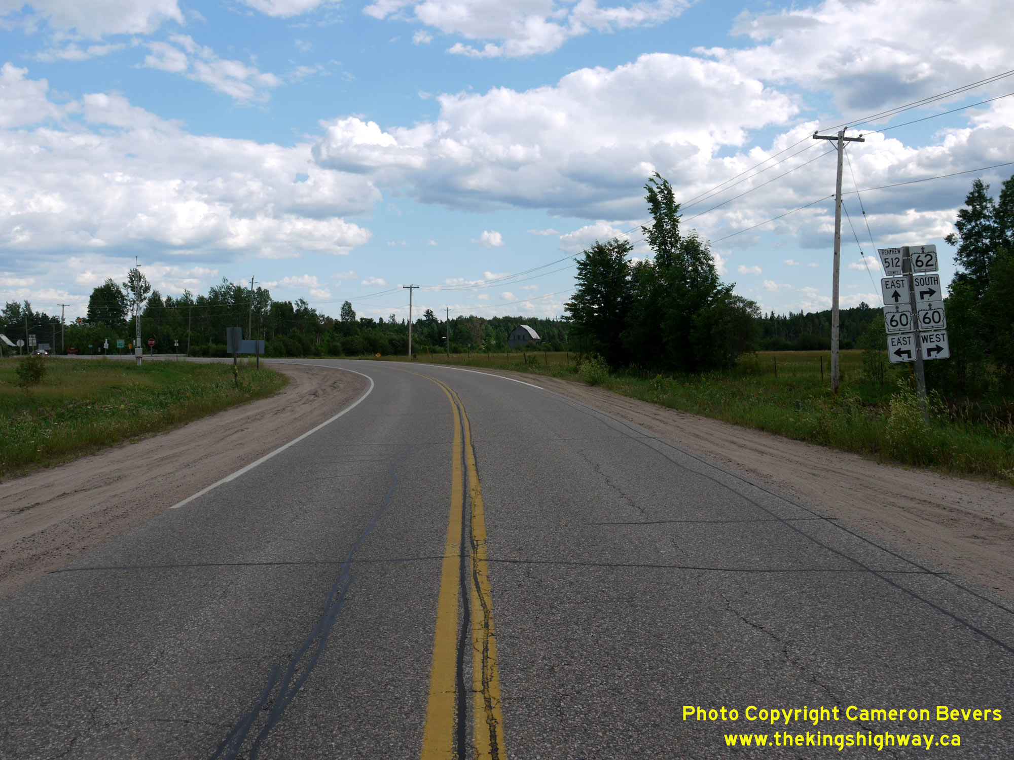
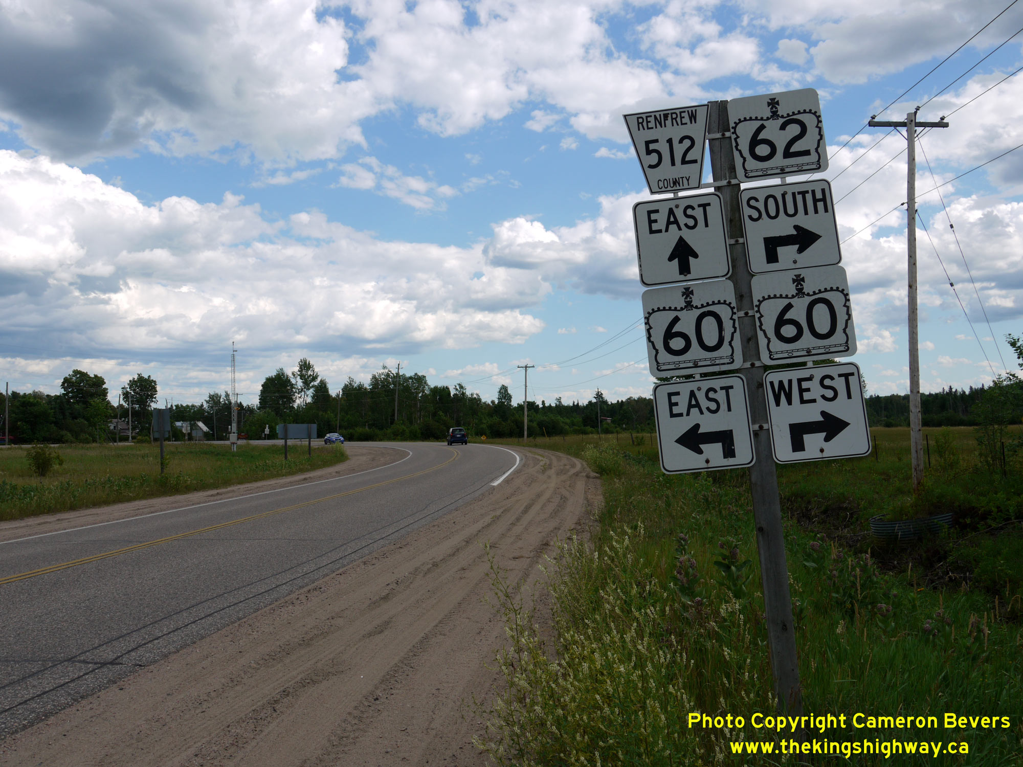
Left - Facing south along Hwy 62 approaching the Hwy 60 & Hwy 512 Junction in Killaloe. See an
Enlarged Photo Here. (Photograph taken on June 30, 2012 - © Cameron Bevers) Right - Junction assembly on southbound Hwy 62 approaching the Hwy 60 & Hwy 512 Junction near Killaloe. Until recently, a single Hwy 62 South marker remained at this junction - a historical reminder that a provincially-maintained Hwy 62 once extended this far north. Today, the province only maintains Hwy 62 south of Maynooth. Jurisdiction over Hwy 62 from Maynooth to Barry's Bay and from Killaloe to Pembroke was transferred from the province to the municipal tier in 1997-1998. As the sign indicates, Hwy 60 & Hwy 62 once shared a concurrent route between Barry's Bay and Killaloe. The overlapped route of Hwy 60 & Hwy 62 was discontinued in 1998. The downloaded north leg of Hwy 62 from Killaloe to Pembroke is now officially known as Renfrew County Road 58. See an Enlarged Photo Here. (Photograph taken on June 30, 2012 - © Cameron Bevers) 

Left - Facing south along Hwy 62 at the Byers Creek Bridge, located about 12 km north of Killaloe. See an
Enlarged Photo here. (Photograph taken on June 30, 2012 - © Cameron Bevers) Right - Western side of the Byers Creek Bridge on Hwy 62 north of Killaloe. This single-span concrete girder structure was completed in 1981. See an Enlarged Photo here. (Photograph taken on June 30, 2012 - © Cameron Bevers) 

Left - View of Round Lake from the Byers Creek Bridge on Hwy 62. The route of Hwy 62 nearly orbits the entire lake. In the 1960s, a proposal was considered to
build a much shorter cut-off route for Hwy 62 to Killaloe around the eastern side of Round Lake. Those plans were eventually abandoned, so the route of Hwy 62
remained more or less unchanged from the 1960s up until the 1990s when Hwy 62 was decommissioned as a King's Highway. Had the Hwy 62 cut-off been built, it would have
shortened the highway distance between Killaloe and Pembroke by about 10 km. See an
Enlarged Photo here. (Photograph taken on June 30, 2012 - © Cameron Bevers) Right - Eastern side of the Byers Creek Bridge on Hwy 62 north of Killaloe. See an Enlarged Photo here. (Photograph taken on June 30, 2012 - © Cameron Bevers) 

Left - Structure identification number and date stamp (1981) on the Byers Creek Bridge on Hwy 62. See an
Enlarged Photo here. (Photograph taken on June 30, 2012 - © Cameron Bevers) Right - Facing south along Hwy 62 towards Killaloe from the Byers Creek Bridge. See an Enlarged Photo here. (Photograph taken on June 30, 2012 - © Cameron Bevers) 

Left - Facing north along Hwy 62 towards Pembroke at the Byers Creek Bridge. See an
Enlarged Photo here. (Photograph taken on June 30, 2012 - © Cameron Bevers) Right - An abandoned Hwy 62 alignment lies in the woods near the Byers Creek Bridge. Originally, the highway crossed Byers Creek on a small steel truss bridge located a short distance upstream from the current highway bridge. See an Enlarged Photo here. (Photograph taken on June 30, 2012 - © Cameron Bevers) 

Left - Former Hwy 62 alignment (Lakeview Drive) at Round Lake Centre, about 16 km north of Killaloe. The highway was realigned here in the late 1960s,
bypassing this old section of road. Today, this old section of Hwy 62 provides local access to the cottages along the western shores of Round Lake. See an
Enlarged Photo here. (Photograph taken on August 2, 2004 - © Cameron Bevers) Right - Originally, Hwy 62 ran right along the lakeshore at Round Lake Centre, before the highway was relocated further inland in the 1960s. Beyond the end of the old road, a small section of Hwy 62 pavement still survives as a private driveway, complete with its original painted centreline. Most of the old highway's asphalt beyond this point was removed by adjacent landowners. See an Enlarged Photo here. (Photograph taken on August 2, 2004 - © Cameron Bevers) 

Left - Facing south along Hwy 62 towards Killaloe at the Sherwood River Bridge, located about 4 km north of Round Lake Centre. See an
Enlarged Photo here. (Photograph taken on June 4, 2010 - © Cameron Bevers) Right - Close-up view of the concrete and steel handrail of the Sherwood River Bridge on Hwy 62. See an Enlarged Photo here. (Photograph taken on June 4, 2010 - © Cameron Bevers) 

Left - Western side of the Sherwood River Bridge on Hwy 62 north of Round Lake Centre. This single-span concrete girder structure was completed in 1967. See an
Enlarged Photo here. (Photograph taken on June 4, 2010 - © Cameron Bevers) Right - Structure identification number and date stamp (1967) on the Sherwood River Bridge on Hwy 62. See an Enlarged Photo here. (Photograph taken on June 4, 2010 - © Cameron Bevers) 

Left - Eastern side of the Sherwood River Bridge on Hwy 62, located about 4 km north of Round Lake Centre. See an
Enlarged Photo here. (Photograph taken on June 4, 2010 - © Cameron Bevers) Right - Facing north along Hwy 62 towards Pembroke at the Sherwood River Bridge on Hwy 62. See an Enlarged Photo here. (Photograph taken on June 4, 2010 - © Cameron Bevers) 

Left - Facing south along Hwy 62 towards Killaloe at the Bonnechere River Bridge, located about 8 km north of Round Lake Centre. See an
Enlarged Photo here. (Photograph taken on June 4, 2010 - © Cameron Bevers) Right - Western side of the Bonnechere River Bridge on Hwy 62 north of Round Lake Centre. This three-span concrete girder structure was completed in 1967. See an Enlarged Photo here. (Photograph taken on June 4, 2010 - © Cameron Bevers) 

Left - Facing south along Hwy 62 towards Killaloe at the Bonnechere River Bridge near Round Lake Centre. See an
Enlarged Photo here. (Photograph taken on June 4, 2010 - © Cameron Bevers) Right - Eastern side of the Bonnechere River Bridge on Hwy 62 north of Round Lake Centre. See an Enlarged Photo here. (Photograph taken on June 4, 2010 - © Cameron Bevers) 

Left - Structure identification number and date stamp (1967) on the Bonnechere River Bridge on Hwy 62. See an
Enlarged Photo here. (Photograph taken on June 4, 2010 - © Cameron Bevers) Right - Jack's Lake Roadside Park on Hwy 62, located about 14 km north of Round Lake Centre. For a number of years after the province transferred ownership of Hwy 62 over to the County of Renfrew, the county continued to operate the roadside park at Jack's Lake. The park's facilities were closed down at the end of 2009, leaving only the parking area seen here. See an Enlarged Photo here. (Photograph taken on August 1, 2004 - © Cameron Bevers) 

Left - View of Jack's Lake from Hwy 62 north of Round Lake Centre. See an
Enlarged Photo here. (Photograph taken on June 4, 2010 - © Cameron Bevers) Right - Site of the former roadside park along Hwy 62 at Jack's Lake in 2010, shortly after all park facilities were removed. See an Enlarged Photo here. (Photograph taken on June 4, 2010 - © Cameron Bevers) 

Left - Fall colours on Hwy 62 between Round Lake Centre and Pembroke. See an
Enlarged Photo here. (Photograph taken on October 9, 2004 - © Cameron Bevers) Right - Facing north along Hwy 62 between Round Lake Centre and Pembroke. See an Enlarged Photo here. (Photograph taken on October 9, 2004 - © Cameron Bevers) 

Left - Facing south along Hwy 62 towards the South Indian River Bridge between Alice and Round Lake Centre. See an
Enlarged Photo here. (Photograph taken on August 1, 2004 - © Cameron Bevers) Right - Facing north along Hwy 62 approaching the South Indian River Bridge near Alice. See an Enlarged Photo here. (Photograph taken on August 1, 2004 - © Cameron Bevers) 

Left - South Indian River Bridge on Hwy 62 between Alice and Round Lake Centre. This single-span concrete rigid frame structure was completed in 1937. See an
Enlarged Photo here. (Photograph taken on August 1, 2004 - © Cameron Bevers) Right - Eastern side of the South Indian River Bridge on Hwy 62, located about 22 km south of Pembroke. The original steel handrail was replaced on this bridge after it was struck and badly damaged during a vehicle collision in 2003. This bridge used to look identical to the North Indian River Bridge, which is situated a little further to the north along Hwy 62. See an Enlarged Photo here. (Photograph taken on August 1, 2004 - © Cameron Bevers) 

Left - North Indian River Bridge on Hwy 62 between Alice and Round Lake Centre. This single-span concrete rigid frame structure was completed in 1937. See an
Enlarged Photo here. (Photograph taken on August 1, 2004 - © Cameron Bevers) Right - Date stamp (1937) on the curb of the North Indian River Bridge on Hwy 62, located about 21 km south of Pembroke. See an Enlarged Photo here. (Photograph taken on August 1, 2004 - © Cameron Bevers) 

Left - The embossed concrete design elements and steel handrails of the North Indian River Bridge are typical of Ontario highway bridges built during the late
1930s. See an Enlarged Photo here. (Photograph taken on August 1, 2004 - © Cameron Bevers) Right - Western side of the North Indian River Bridge on Hwy 62 near Alice. See an Enlarged Photo here. (Photograph taken on August 1, 2004 - © Cameron Bevers) 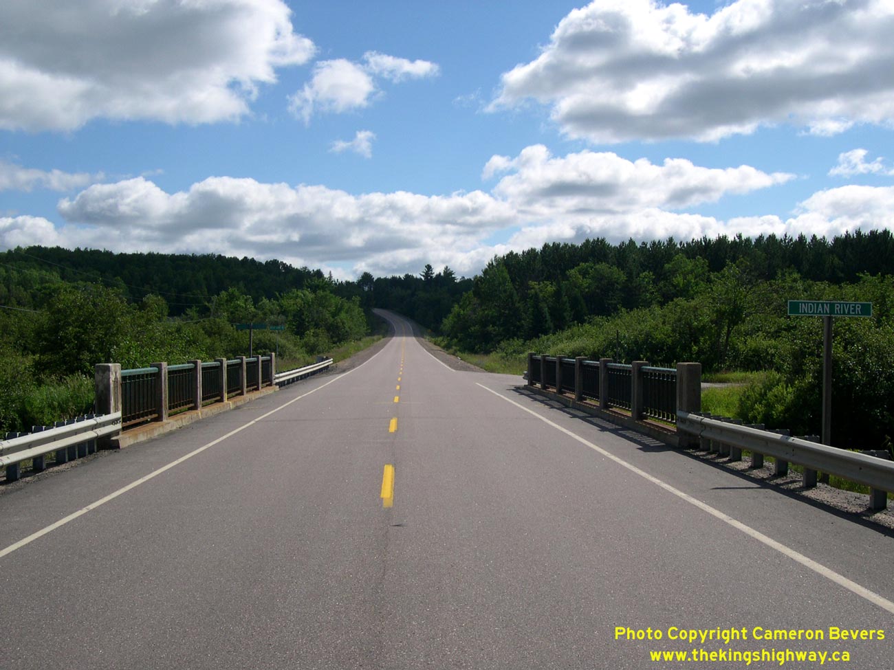

Left - Facing north along Hwy 62 towards Pembroke at the North Indian River Bridge near Alice. See an
Enlarged Photo here. (Photograph taken on August 1, 2004 - © Cameron Bevers) Right - Facing south along Hwy 62 towards Round Lake at the North Indian River Bridge near Alice. See an Enlarged Photo here. (Photograph taken on August 1, 2004 - © Cameron Bevers) 

Left - A second 1937 date stamp exists at the top of the arch of the North Indian River Bridge on Hwy 62. See an
Enlarged Photo here. (Photograph taken on August 1, 2004 - © Cameron Bevers) Right - Former Hwy 62 alignment (Borne Road) and bridge over the Indian River near Alice, south of Pembroke. This narrow and winding former section of Hwy 62 was bypassed by the new Alice Diversion in the mid-1960s, in an effort to improve the highway's alignment in the area. See an Enlarged Photo here. (Photograph taken on August 1, 2004 - © Cameron Bevers) 

Left - Side view of the Indian River Bridge on Old Hwy 62 (Borne Road) north of Alice. This single-span steel beam structure was built before the Department of
Highways of Ontario (DHO) took over the Round Lake Road as Hwy 62 in 1937. This bridge likely dates from about 1925. See an
Enlarged Photo here. (Photograph taken on June 4, 2010 - © Cameron Bevers) Right - Old Hwy 62 at the Indian River Bridge north of Alice. This old section of Hwy 62 was bypassed by the new Alice Diversion in 1964. The narrow bridge near Alice had a roadway width of only 17 feet, and could only accommodate one direction of traffic at a time. See an Enlarged Photo here. (Photograph taken on June 4, 2010 - © Cameron Bevers) 

Left - Facing south along the Alice Diversion on Hwy 62, about 7 km south of the Hwy 17 Junction in Pembroke. See an
Enlarged Photo here. (Photograph taken on June 4, 2010 - © Cameron Bevers) Right - Old Provincial Park reassurance marker on southbound Hwy 62 south of Pembroke. See an Enlarged Photo here. (Photograph taken on June 4, 2010 - © Cameron Bevers) 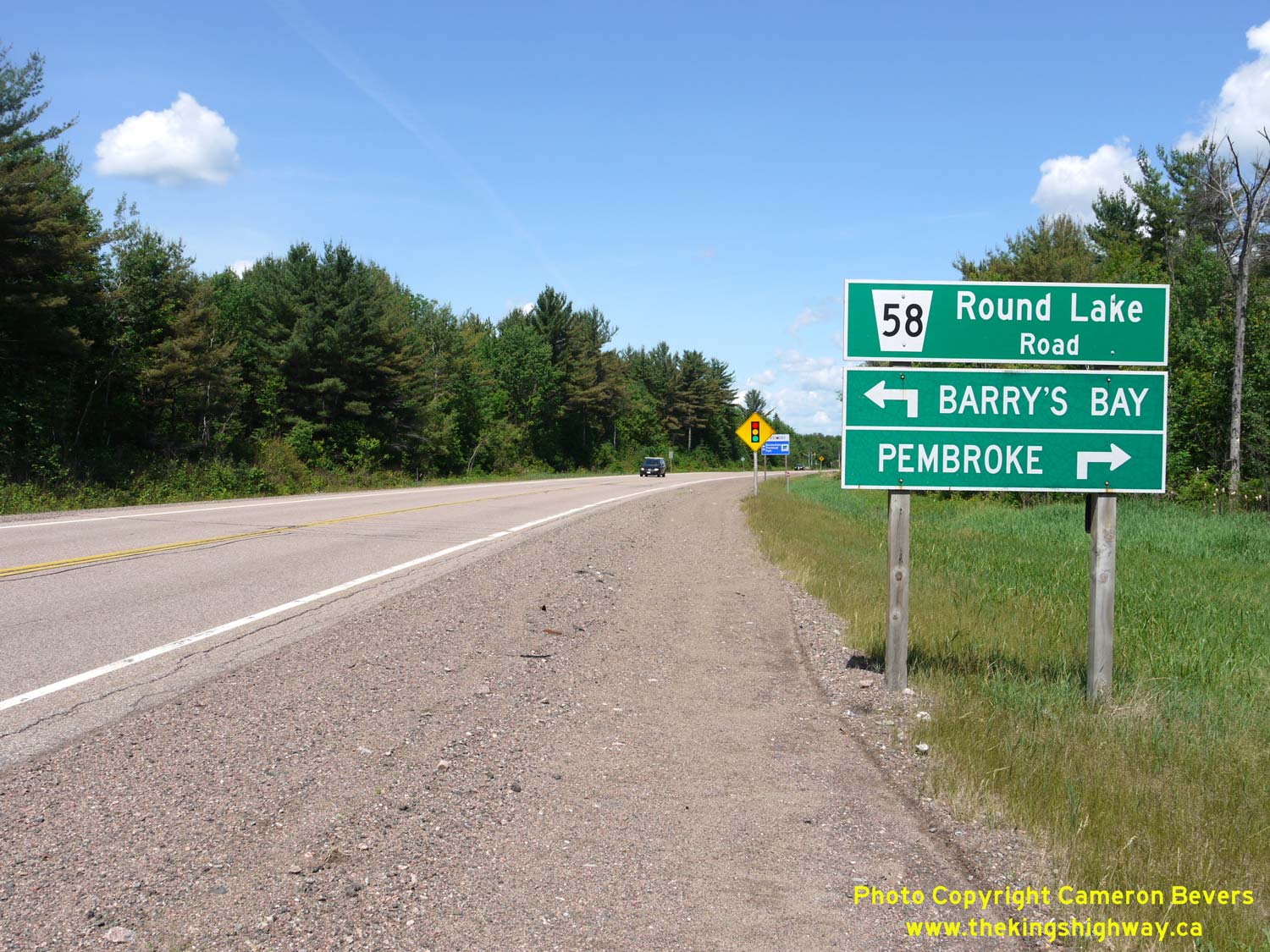
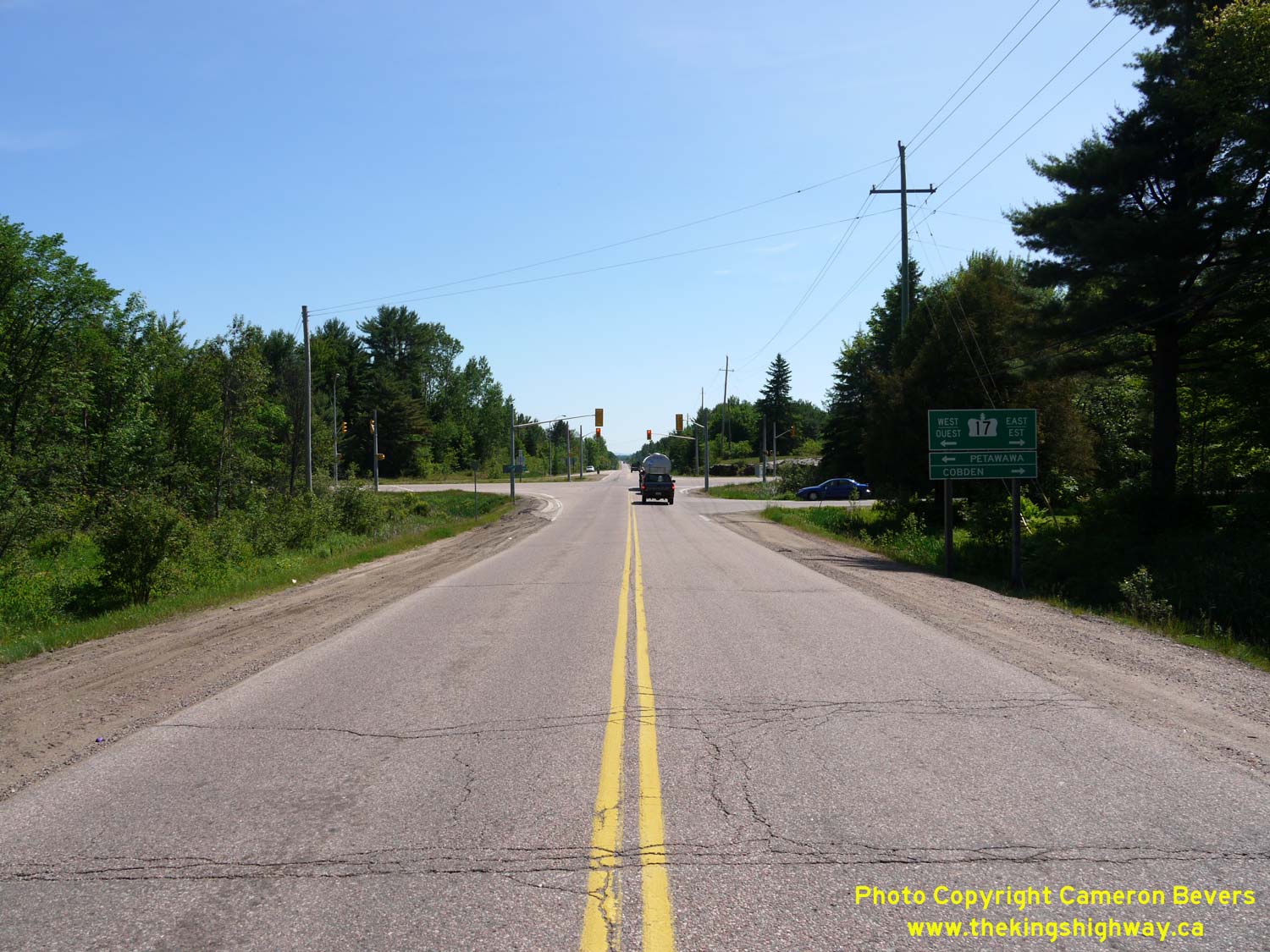
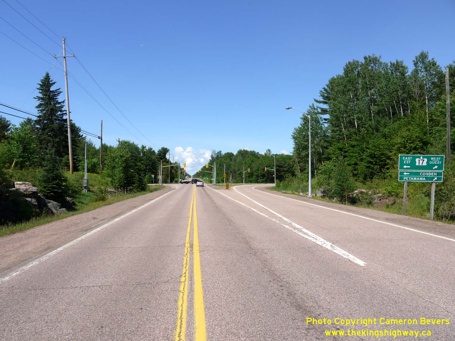
Left - Facing west along Hwy 17 towards Petawawa approaching Round Lake Road (Hwy 62 & Hwy 148) near Pembroke. Up until 1997, Round Lake Road south of the
Hwy 17 Junction was part of King's Highway 62, while north of the Hwy 17 Junction, Round Lake Road was known as King's Highway 148. Both of these provincial highways
were transferred to the County of Renfrew in 1997. Renfrew County renamed the two former highways collectively as Renfrew County Road 58. See an
Enlarged Photo here. (Photograph taken on June 4, 2010 - © Cameron Bevers) Right - Facing north along Round Lake Road (Hwy 62) towards the Hwy 17 Junction near Pembroke. Prior to 1997, Hwy 62 reached its northern terminus at the Hwy 17 Junction. As a result of highway transfers and government service realignment in the 1990s, provincial ownership of Hwy 62 now ends in Maynooth, located about 130 km to the south. See an Enlarged Photo here. (Photograph taken on June 4, 2010 - © Cameron Bevers) 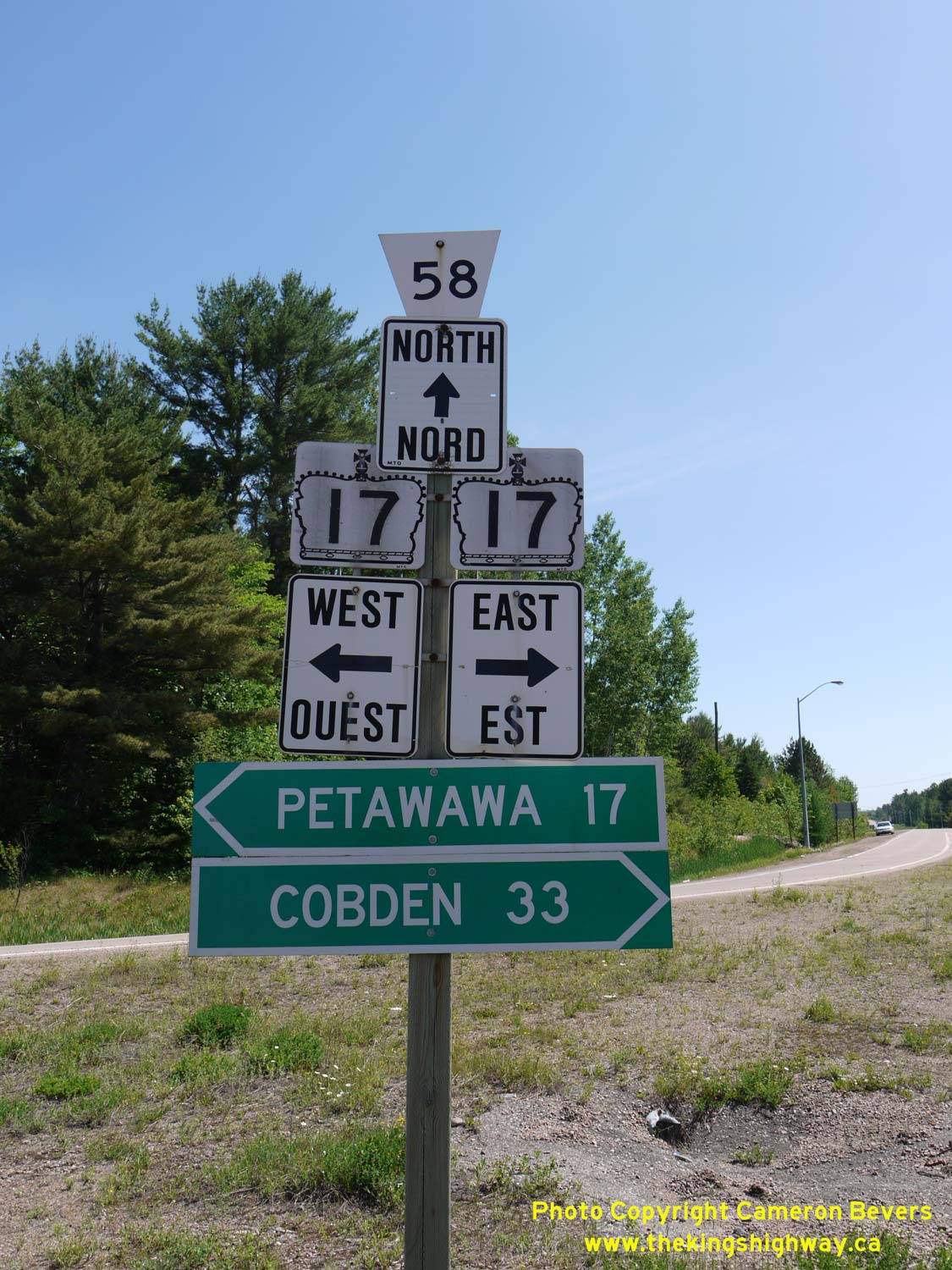
Above - Junction sign assembly at the Hwy 17 and Former Hwy 62 & Hwy 148 Junction near Pembroke. Prior to 1997, the County Road 58 flowerpot route marker
would have been a Hwy 148 provincial crown sign. Jurisdiction over both Hwy 62 & Hwy 148 in this area was transferred from the province to the County of Renfrew,
effective March 31, 1997. See an Enlarged Photo here. (Photograph taken on June 4, 2010 - © Cameron Bevers) 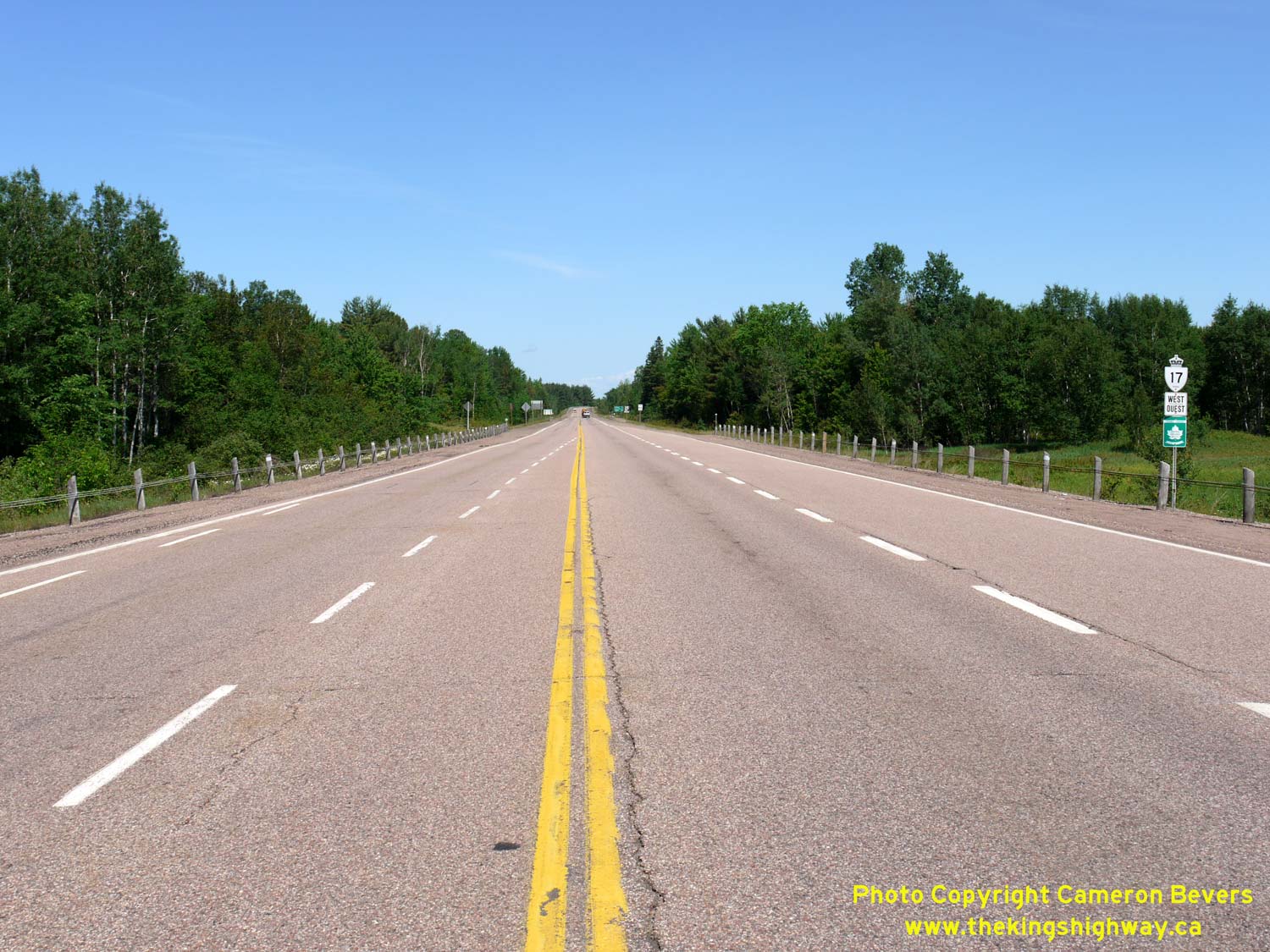
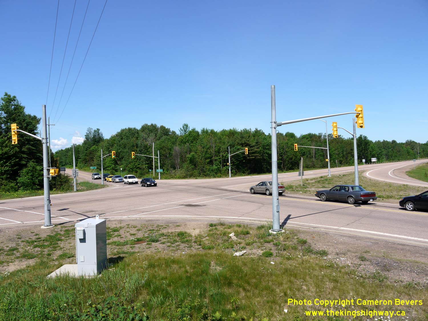
Left - Facing west along Hwy 17 towards Petawawa from the Round Lake Road (Hwy 62 & Hwy 148) Junction. See an
Enlarged Photo here. (Photograph taken on June 4, 2010 - © Cameron Bevers) Right - Approaching the Round Lake Road (Hwy 62 & Hwy 148) Junction on Hwy 17, facing east towards Renfrew. See an Enlarged Photo here. (Photograph taken on June 4, 2010 - © Cameron Bevers) 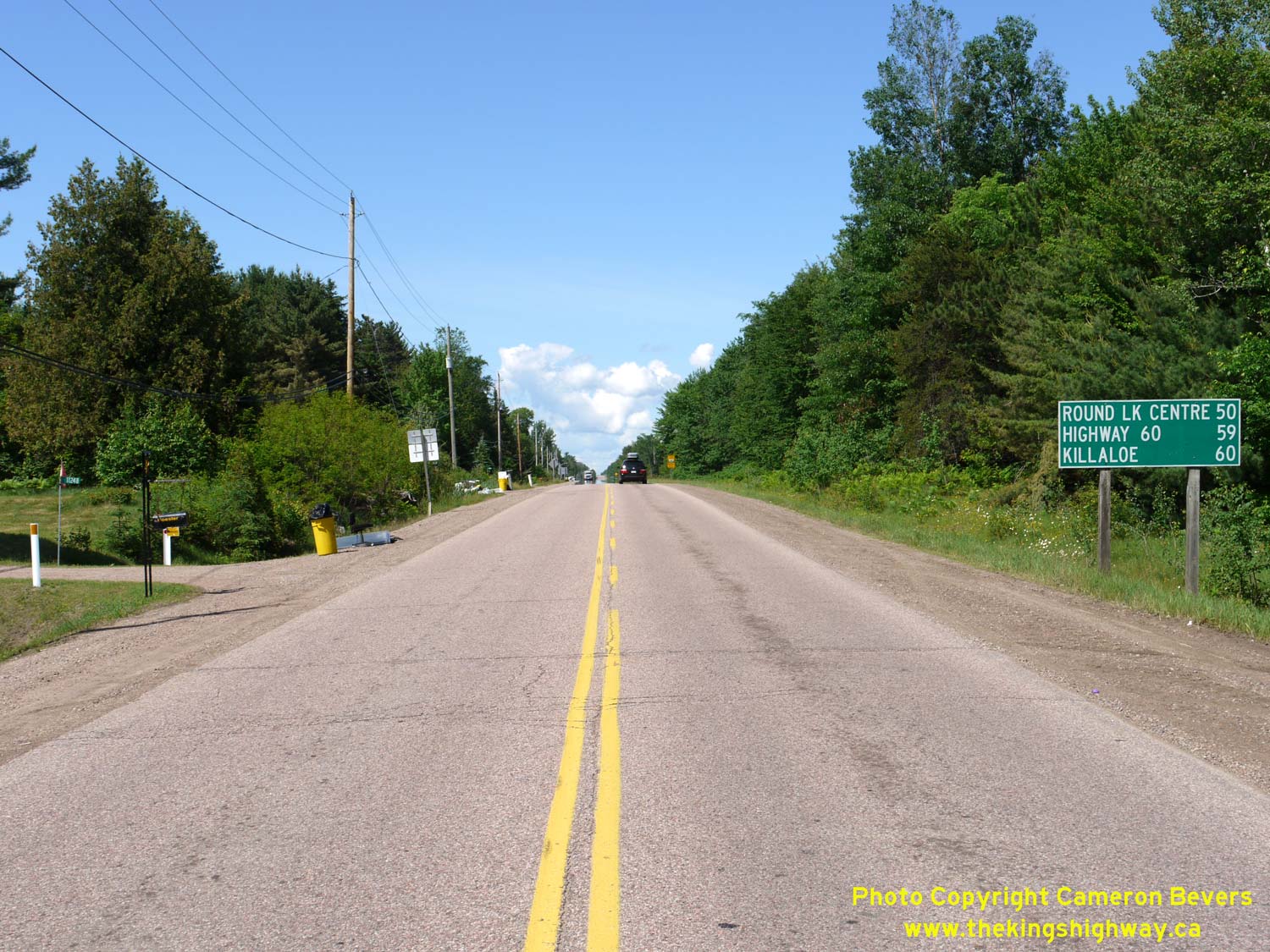
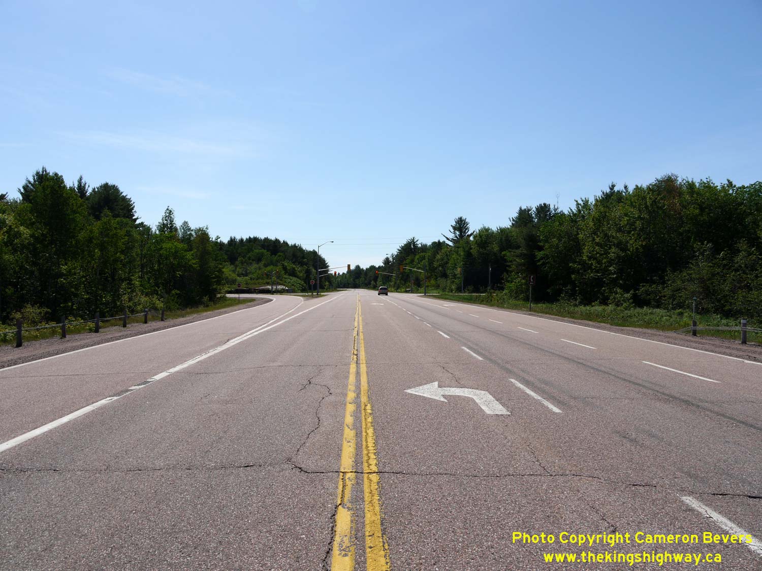
Left - Facing south along Round Lake Road (Hwy 62) from the Hwy 17 Junction. It is interesting to note that the distance guide sign at right lists Hwy 60 as a
destination. This is actually the next highway junction beyond Hwy 17, when heading south out of Pembroke. See an
Enlarged Photo here. (Photograph taken on June 4, 2010 - © Cameron Bevers) Right - Facing west along Hwy 17 at the Round Lake Road (Hwy 62 & Hwy 148) Junction. See an Enlarged Photo here. (Photograph taken on June 4, 2010 - © Cameron Bevers) 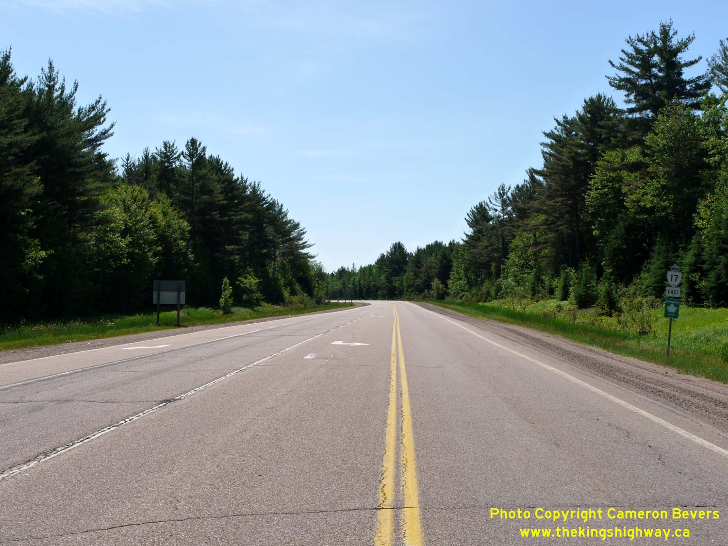
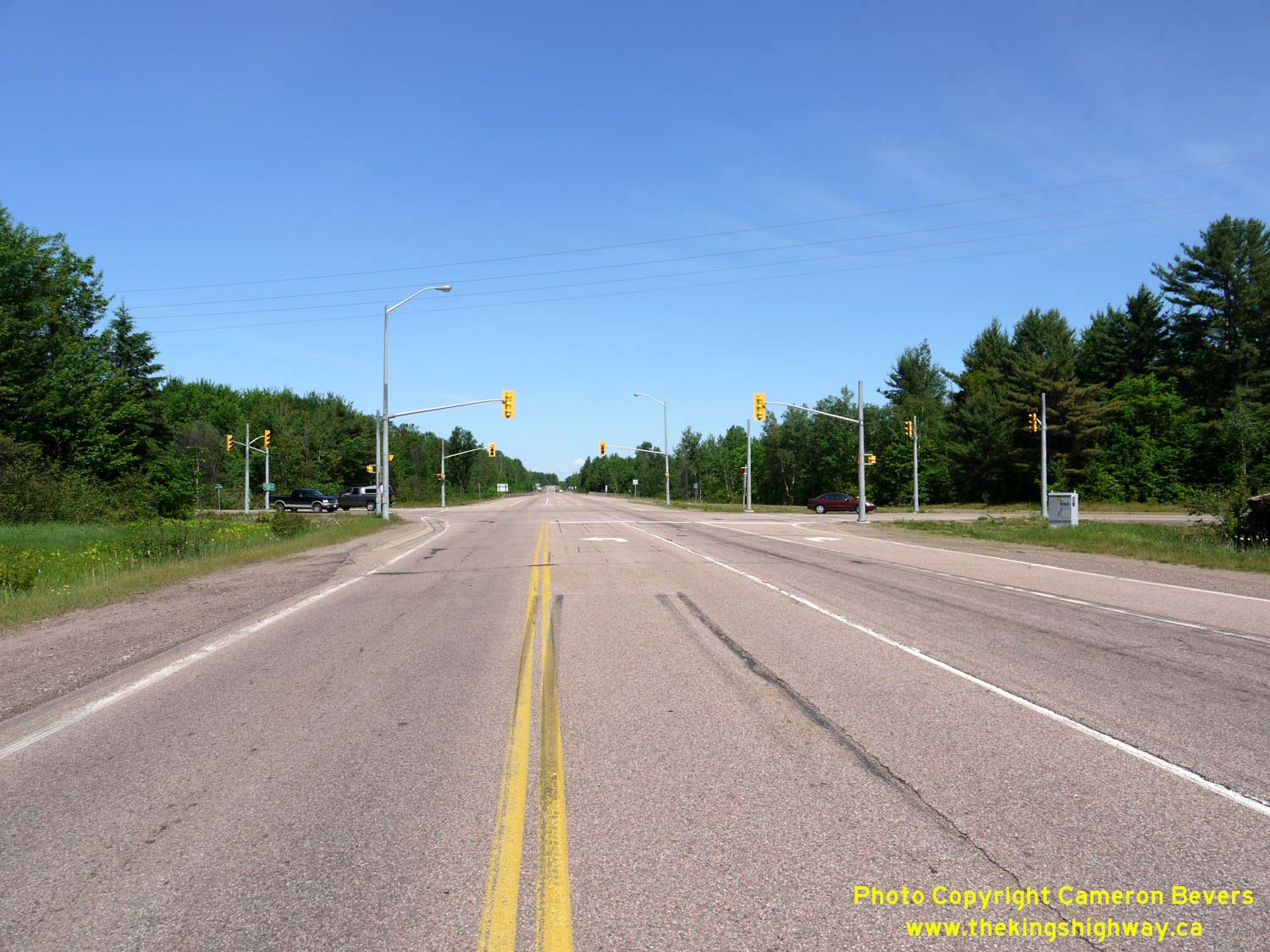
Left - Facing east along Hwy 17 from the Round Lake Road (Hwy 62 & Hwy 148) Junction near Pembroke. See an
Enlarged Photo here. (Photograph taken on June 4, 2010 - © Cameron Bevers) Right - View of the traffic signals at Hwy 17 and Round Lake Road (Hwy 62 & Hwy 148). See an Enlarged Photo here. (Photograph taken on June 4, 2010 - © Cameron Bevers) 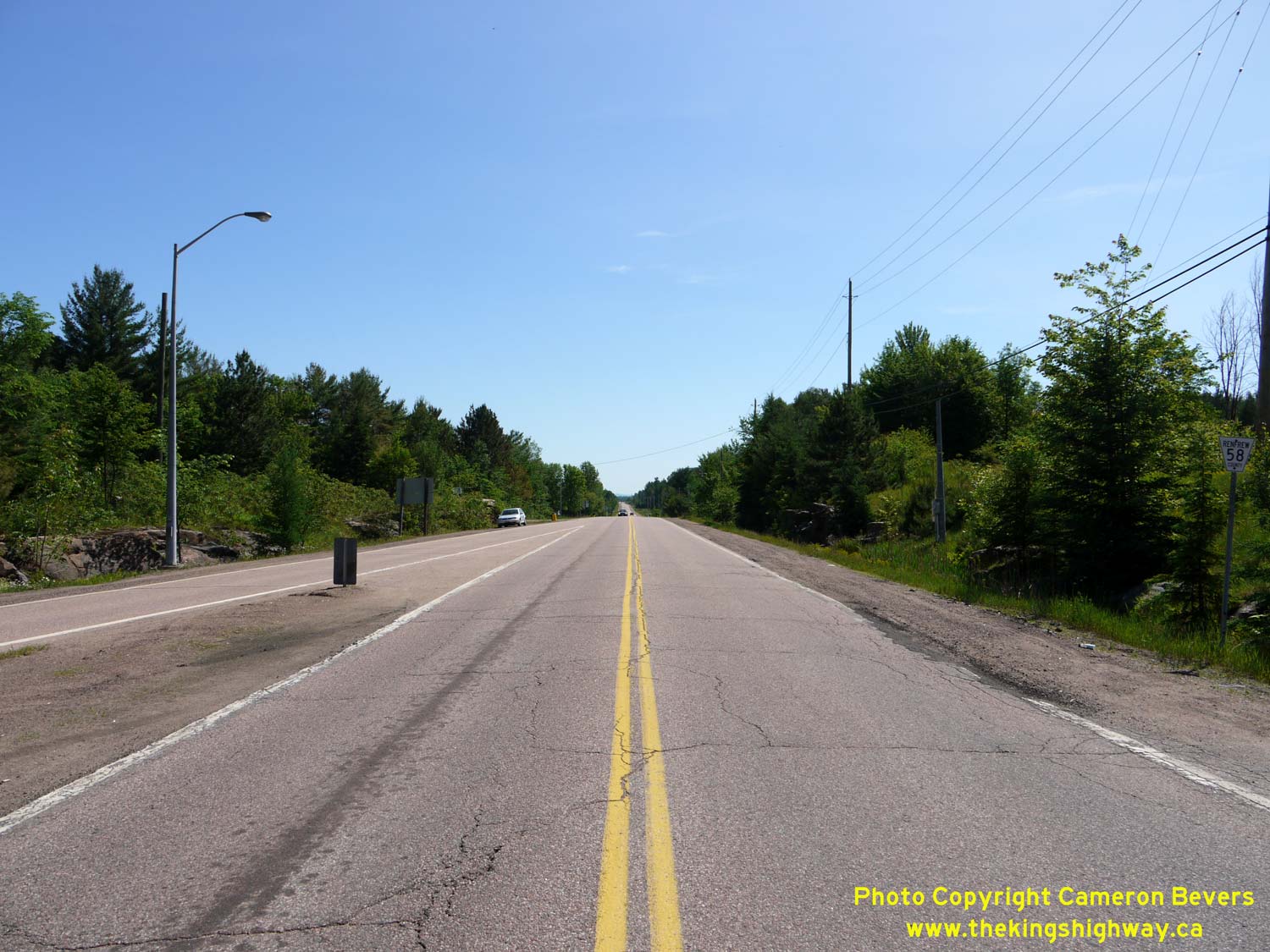
Left - Facing north along Round Lake Road (Hwy 148) from the Hwy 17 & Hwy 62 Junction near Pembroke. Downtown Pembroke lies about 7 km ahead. See an
Enlarged Photo here. (Photograph taken on June 4, 2010 - © Cameron Bevers) Right - Approaching the Hwy 17 & Hwy 62 Junction on Round Lake Road (Hwy 148) near Pembroke. See an Enlarged Photo here. (Photograph taken on June 4, 2010 - © Cameron Bevers)
More King's Highway 62 Photographs Coming Soon!
|
|---|
Links to Adjacent King's Highway Photograph Pages:
Back to King's Highway 61 Photos /
King's Highway 62 History /
On to King's Highway 63 Photos
Ontario Highway History - Main Menu / Back to List of Highways Website contents, photos & text © 2002-2026, Cameron
Bevers (Webmaster) - All Rights Reserved / Contact Me
|
|---|