
| 
|  |
|
|
This page contains historical and present day photos of Ontario's King's Highway 64. All photographs displayed on this page
were taken by the Webmaster (Cameron Bevers), unless specifically noted otherwise. Historical photographs are arranged in approximate chronological order, while
present day photographs (Year 2000 to date) are arranged by location from south to north. Click on any thumbnail to see a larger image!
Please note that all photographs displayed on this
website are protected by copyright. These photographs must not be reproduced, published,
electronically stored or copied, distributed, or posted onto other websites without
my written permission. If you want to use photos from this website, please
email me first for permission. Thank-you!
|
|---|
|
Present Day King's Highway 64 Photographs


Left - Green destination guide sign on Hwy 69 approaching the Hwy 64 Junction near Rutter. Hwy 64 provides an important cut-off route from Hwy 69 to
Hwy 17 at Sturgeon Falls, in addition to servicing the numerous communities to the west of Lake Nipissing. (Photograph taken on August 27, 2011 - © Cameron Bevers) Right - Approaching the Hwy 64 Junction on Hwy 69, facing north towards Sudbury. (Photograph taken on August 27, 2011 - © Cameron Bevers) 

Left - Facing north along Hwy 69 approaching the Hwy 64 Junction near Rutter. (Photograph taken on August 27, 2011 - © Cameron Bevers) Right - Junction assembly on Northbound Hwy 69 marking the upcoming Hwy 64 Junction. Considering that Hwy 64 is a relatively important highway junction along Hwy 69, it is rather surprising that it is only marked with regular-sized crown junction signs. (Photograph taken on August 27, 2011 - © Cameron Bevers) 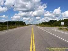

Left - Hwy 64 Junction on Hwy 69, facing north towards Sudbury. (Photograph taken on August 27, 2011 - © Cameron Bevers) Right - Facing south along Hwy 69 towards Parry Sound from the Hwy 64 Junction near Rutter. (Photograph taken on August 27, 2011 - © Cameron Bevers) 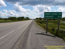
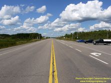
Left - Distance sign on Southbound Hwy 69 at the Hwy 64 Junction. (Photograph taken on August 27, 2011 - © Cameron Bevers) Right - Facing north along Hwy 69 approaching the Hwy 64 Junction. (Photograph taken on August 27, 2011 - © Cameron Bevers) 
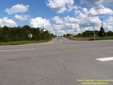
Left - Turn-off signs marking the Hwy 64 Junction on Northbound Hwy 69 near Rutter. (Photograph taken on August 27, 2011 - © Cameron Bevers) Right - Southern terminus of Hwy 64 at the Hwy 69 Junction, facing north towards Sturgeon Falls. (Photograph taken on August 27, 2011 - © Cameron Bevers) 
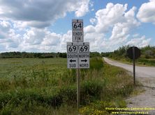
Left - Fingerboard direction signs at the Hwy 64 & Hwy 69 Junction. (Photograph taken on August 27, 2011 - © Cameron Bevers) Right - Junction assembly at the southern terminus of Hwy 64 at the Hwy 69 Junction. (Photograph taken on August 27, 2011 - © Cameron Bevers) 

Left - Facing north along Hwy 64 towards Sturgeon Falls from the Hwy 69 Junction near Rutter. (Photograph taken on August 27, 2011 - © Cameron Bevers) Right - Distance sign on Northbound Hwy 64 at the Hwy 69 Junction near Rutter. (Photograph taken on August 27, 2011 - © Cameron Bevers) 

Left - Southern terminus of Hwy 64 at the Hwy 69 Junction near Rutter. This intersection has been the southern terminus for Hwy 64 since 1956. (Photograph taken on August 27, 2011 - © Cameron Bevers) Right - View of the Hwy 64 & Hwy 69 Junction near Rutter, facing west. Over the next decade, a new interchange will be built at Hwy 64 and the new four-lane Hwy 69, as highway widening work progresses south from Sudbury. (Photograph taken on August 27, 2011 - © Cameron Bevers) 
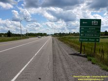
Left - Facing south along Hwy 69 approaching the Hwy 64 Junction near Rutter. (Photograph taken on August 27, 2011 - © Cameron Bevers) Right - Green guide sign marking the Hwy 64 turn-off on Southbound Hwy 69. (Photograph taken on August 27, 2011 - © Cameron Bevers) 

Left - Facing south along Hwy 69 at the Hwy 64 Junction near Rutter. (Photograph taken on August 27, 2011 - © Cameron Bevers) Right - Facing north along Hwy 69 towards Sudbury from the Hwy 64 Junction. (Photograph taken on August 27, 2011 - © Cameron Bevers) 
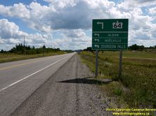
Left - Facing south along Hwy 69 towards Parry Sound, approaching the Hwy 64 Junction near Rutter. (Photograph taken on August 27, 2011 - © Cameron Bevers) Right - Advance guide sign marking the Hwy 64 Junction on Southbound Hwy 69. (Photograph taken on August 27, 2011 - © Cameron Bevers) 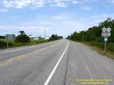

Left - Dual Hwy 17 & Hwy 64 route markers near Sturgeon Falls. These two highways share a concurrent route for approximately 16 km between Verner and
Sturgeon Falls. The overlapped route was created in 1956, when Hwy 64 was extended south from its original 1937 southern terminus in Sturgeon Falls to the Hwy 69
Junction near Alban. See an Enlarged Photo Here. (Photograph taken on July 21, 2012 - © Cameron Bevers) Right - Facing west along Hwy 17 & Hwy 64 about 4 km east of Verner. This area of Northern Ontario is unusual, in that it has comparatively good soil which supports a fairly extensive agricultural industry. See an Enlarged Photo Here. (Photograph taken on July 21, 2012 - © Cameron Bevers) 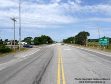
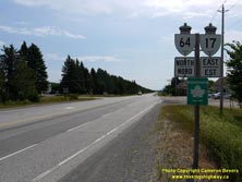
Left - Approaching the Hwy 64 South Junction on Hwy 17 in Verner, facing west towards Sudbury. See an
Enlarged Photo Here. (Photograph taken on July 21, 2012 - © Cameron Bevers) Right - Dual Hwy 17 & Hwy 64 route markers facing eastbound traffic in Verner. See an Enlarged Photo Here. (Photograph taken on July 21, 2012 - © Cameron Bevers) 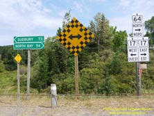

Left - Junction sign assembly and distance guide signs at the Hwy 64 South Junction on Hwy 17 in Verner. At this junction, Hwy 64 turns right and heads east
towards Sturgeon Falls concurrently with Hwy 17. At Sturgeon Falls, Hwy 64 turns left from Hwy 17 and continues its route north towards Marten River. See an
Enlarged Photo Here. (Photograph taken on July 21, 2012 - © Cameron Bevers) Right - Facing east along Hwy 17 & Hwy 64 towards Sturgeon Falls from the Hwy 64 South Junction in Verner. See an Enlarged Photo Here. (Photograph taken on July 21, 2012 - © Cameron Bevers) 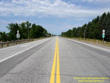

Left - Facing west along Hwy 17 towards Sudbury from the Hwy 64 South Junction. See an
Enlarged Photo Here. (Photograph taken on July 21, 2012 - © Cameron Bevers) Right - Facing south along Hwy 64 towards Lavigne from the Hwy 17 Junction in Verner. Hwy 64 resumes its journey south towards the French River area, after a brief journey west between Verner and Sturgeon Falls alongside Hwy 17. See an Enlarged Photo Here. (Photograph taken on July 21, 2012 - © Cameron Bevers) 

Left - Approaching the Hwy 17 Junction in Verner on Hwy 64, facing north. See an
Enlarged Photo Here. (Photograph taken on July 21, 2012 - © Cameron Bevers) Right - Facing east along Hwy 17 approaching the Hwy 64 South Junction in Verner. See an Enlarged Photo Here. (Photograph taken on July 21, 2012 - © Cameron Bevers) 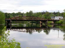

Left - Eastern side of the Sturgeon River Bridge on Hwy 64 in Field. Structure completed in 1947. See an
Enlarged Photo Here. (Photograph taken on June 28, 2003 - © Cameron Bevers) Right - Looking south along Hwy 64 towards the Sturgeon River Bridge in Field. See an Enlarged Photo Here. (Photograph taken on June 28, 2003 - © Cameron Bevers) 
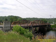
Left - Facing south along Hwy 64 at the Sturgeon River Bridge at Field showing truss details. See an
Enlarged Photo Here. (Photograph taken on July 1, 2006 - © Cameron Bevers) Right - Western side of the Sturgeon River Bridge on Hwy 64 in Field. See an Enlarged Photo Here. (Photograph taken on July 1, 2006 - © Cameron Bevers) 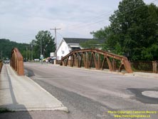
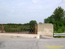
Left - Facing south along Hwy 64 at the Sturgeon River Bridge in Field, showing the western side of the truss. See an
Enlarged Photo Here. (Photograph taken on July 1, 2006 - © Cameron Bevers) Right - Close-up of the latticed steel handrail design of the Sturgeon River Bridge in Field. See an Enlarged Photo Here. (Photograph taken on July 1, 2006 - © Cameron Bevers) 
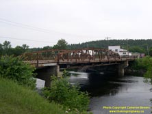
Left - The Sturgeon River Bridge has a sidewalk on both sides of the truss. This design feature was uncommon on truss bridges located in smaller communities.
Most truss bridges in rural Ontario had a sidewalk on one side only due to limited pedestrian traffic. See an
Enlarged Photo Here. (Photograph taken on July 1, 2006 - © Cameron Bevers) Right - The Sturgeon River Bridge on Hwy 64 was replaced with a new structure in 2007. See an Enlarged Photo Here. (Photograph taken on July 1, 2006 - © Cameron Bevers) 

Left - Facing north along Hwy 64 from the Hwy 575 Junction in Field. See an
Enlarged Photo Here. (Photograph taken on July 1, 2006 - © Cameron Bevers) Right - Facing north along Hwy 64 from the Hwy 539 Junction north of Field. See an Enlarged Photo Here. (Photograph taken on July 1, 2006 - © Cameron Bevers) 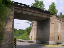

Left - Northern side of the Field Subway on Hwy 64. Structure completed in 1937. See an
Enlarged Photo Here. (Photograph taken on July 1, 2006 - © Cameron Bevers) Right - Facing north along Hwy 64 from the Field Subway. The railway that once crossed this bridge is now abandoned, but the right-of-way is still used as a public recreational trail. See an Enlarged Photo Here. (Photograph taken on July 1, 2006 - © Cameron Bevers) 

Left - Facing south along Hwy 64 towards Field from the railway subway near the Hwy 539 Junction. See an
Enlarged Photo Here. (Photograph taken on July 1, 2006 - © Cameron Bevers) Right - Close-up of the 1937 date stamp on the Field Subway on Hwy 64. See an Enlarged Photo Here. (Photograph taken on July 1, 2006 - © Cameron Bevers) 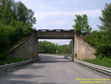
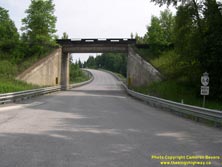
Left - Facing south along Hwy 64 towards the Field Subway. See an
Enlarged Photo Here. (Photograph taken on July 1, 2006 - © Cameron Bevers) Right - Facing north along Hwy 64 towards the Field Subway. See an Enlarged Photo Here. (Photograph taken on July 1, 2006 - © Cameron Bevers) 

Left - The Marten River Road near Hwy 64 was a former alignment of the Ferguson Highway which was originally constructed in the 1920s. See an
Enlarged Photo Here. (Photograph taken on August 6, 2011 - © Cameron Bevers) Right - Another view of Marten River Road approaching Hwy 64. For a few years in the late 1920s and early 1930s, the Ferguson Highway followed this route. A highway improvement project during the 1930s resulted in a relocation of a short section of the Ferguson Highway at the Marten River Bridge. The relocated route of the Ferguson Highway was bypassed yet again in 1940, when a new steel truss bridge was constructed on Hwy 11 across Marten River about 2 km to the east. This new route of Hwy 11 was part of a major diversion project, which bypassed about 15 km of the old Ferguson Highway. Most of the old Ferguson Highway between Marten River and Tilden Lake was abandoned entirely, but a 3 km section of the route at Marten River became part of Hwy 64 in 1940. See an Enlarged Photo Here. (Photograph taken on August 6, 2011 - © Cameron Bevers) 

Left - The old Ferguson Highway passes through a portion of Marten River Provincial Park. The old highway is gated off at Hwy 64, just south of the Marten
River Bridge. The road hasn't been used by through traffic since the 1930s, when a new diversion was constructed at Marten River. The project resulted in the
construction of a new creosoted timber truss bridge on an improved highway alignment. In 1940, Hwy 11 was relocated onto a new alignment and the bypassed section of
the Ferguson Highway built in the 1930s became part of Hwy 64. See an Enlarged Photo Here. (Photograph taken on August 6, 2011 - © Cameron Bevers) Right - View of the Marten River from the current Hwy 64 Bridge. See an Enlarged Photo Here. (Photograph taken on August 6, 2011 - © Cameron Bevers) 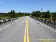

Left - Facing north along Hwy 64 at the Marten River Bridge. See an
Enlarged Photo Here. (Photograph taken on August 6, 2011 - © Cameron Bevers) Right - Eastern side of the Marten River Bridge on Hwy 64. This single-span steel girder structure was completed in 1977. It replaced an aging creosoted timber truss bridge that had been built in the 1930s. This is the same bridge shown under construction in the 1977 photo above. See an Enlarged Photo Here. (Photograph taken on August 6, 2011 - © Cameron Bevers) 

Left - Facing south along Hwy 64 towards Field at the Marten River Bridge. See an
Enlarged Photo Here. (Photograph taken on August 6, 2011 - © Cameron Bevers) Right - Structure identification number and date stamp (1977) on the Marten River Bridge. See an Enlarged Photo Here. (Photograph taken on August 6, 2011 - © Cameron Bevers) 
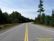
Left - Western side of the Marten River Bridge on Hwy 64. See an
Enlarged Photo Here. (Photograph taken on August 6, 2011 - © Cameron Bevers) Right - Distance guide sign on Hwy 64 facing south at the Hwy 11 Junction. See an Enlarged Photo Here. (Photograph taken on August 6, 2011 - © Cameron Bevers) 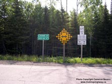
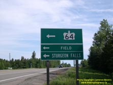
Left - Junction signs at Hwy 64 and Hwy 11 at Marten River (Photograph taken on July 1, 2006 - © Cameron Bevers) Right - Directional sign for Hwy 64 at the Hwy 11 Junction at Marten River (Photograph taken on July 1, 2006 - © Cameron Bevers) 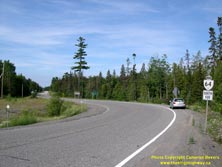
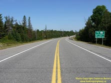
Left - Facing south along Hwy 64 from the Hwy 11 Junction at Marten River. (Photograph taken on July 1, 2006 - © Cameron Bevers) Right - Approaching the Hwy 64 Junction on Hwy 11 at Marten River, facing north. (Photograph taken on August 6, 2011 - © Cameron Bevers) 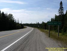
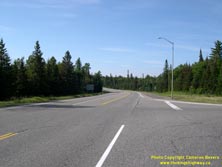
Left - Distance sign on Southbound Hwy 11 at the Hwy 64 Junction. (Photograph taken on August 6, 2011 - © Cameron Bevers) Right - Facing south along Hwy 11 from the Hwy 64 Junction at Marten River. (Photograph taken on July 1, 2006 - © Cameron Bevers) 
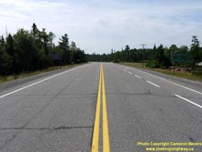
Left - Distance sign on Northbound Hwy 11 at the Hwy 64 Junction. (Photograph taken on August 6, 2011 - © Cameron Bevers) Right - Approaching the Hwy 64 Junction on Hwy 11 at Marten River, facing south. (Photograph taken on August 6, 2011 - © Cameron Bevers) 
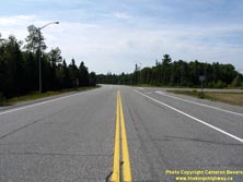
Left - Facing north along Hwy 11 at the Hwy 64 Junction at Marten River. (Photograph taken on August 6, 2011 - © Cameron Bevers) Right - Facing south along Hwy 11 at the Hwy 64 Junction at Marten River. (Photograph taken on August 6, 2011 - © Cameron Bevers) 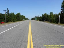
Above - Facing north along Hwy 11 from the Hwy 64 Junction at Marten River. (Photograph taken on August 6, 2011 - © Cameron Bevers)
More King's Highway 64 Photographs Coming Soon!
|
|---|
Links to Adjacent King's Highway Photograph Pages:
Back to King's Highway 63 Photos /
King's Highway 64 History /
On to King's Highway 65 Photos
Ontario Highway History - Main Menu / Back to List of Highways Website contents, photos & text © 2002-2025, Cameron
Bevers (Webmaster) - All Rights Reserved / Contact Me |
|---|