
| 
| |
|
|
This page contains present day photos (Year 2000 to date) of Ontario's King's Highway 69, arranged by location from the
Highway 169 Junction at Foot's Bay northerly to the Highway 400 Interchange at Horseshoe Lake. All photographs displayed on this page were taken by the Webmaster
(Cameron Bevers), unless specifically noted otherwise. Click on any thumbnail to see a larger image!
Please note that all photographs displayed on this
website are protected by copyright. These photographs must not be reproduced, published,
electronically stored or copied, distributed, or posted onto other websites without
my written permission. If you want to use photos from this website, please
email me first for permission. Thank-you!
|
|---|
|
Page 5: Present Day King's Highway 69 Photographs (Hwy 169 to Horseshoe Lake)


Left - Approaching the Hwy 169 Junction on Hwy 69 (Lake Joseph Road) at Foot's Bay, facing north towards Parry Sound. See an
Enlarged Photo here. (Photograph taken on April 12, 2012 - © Cameron Bevers) Right - Junction sign assembly marking the upcoming Hwy 169 Junction on northbound Hwy 69 at Foot's Bay. Hwy 169 was one of many Ontario King's Highways which was transferred from the province to municipalities during provincial service restructuring in the late 1990s. Officially, Hwy 169 through Muskoka is now known as Muskoka District Road 169. Hwy 169 ceased to be a provincial highway in 1998. See an Enlarged Photo here. (Photograph taken on April 12, 2012 - © Cameron Bevers) 

Left - Facing north along Hwy 69 towards the Foot's Bay Railway Subway near MacTier. The subway is situated immediately to the south of the Hwy 169 Junction.
See an Enlarged Photo here. (Photograph taken on June 10, 2007 - © Cameron Bevers) Right - Facing south along Hwy 69 towards the Foot's Bay Railway Subway. This single span steel plate girder structure was completed in 1957. See an Enlarged Photo here. (Photograph taken on June 10, 2007 - © Cameron Bevers) 

Left - Close-up of the date stamp (1957) on the Foot's Bay Railway Subway on Hwy 69 (Lake Joseph Road). See an
Enlarged Photo here. (Photograph taken on June 10, 2007 - © Cameron Bevers) Right - Facing north along Hwy 69 at the Hwy 169 Junction at Foot's Bay. From here, Hwy 169 heads southeasterly towards Bala and Gravenhurst, while Hwy 69 continues north towards Parry Sound and Sudbury. Hwy 169 connects to Hwy 118 east of Foot's Bay, which provides access to Port Carling and Bracebridge. See an Enlarged Photo here. (Photograph taken on June 10, 2007 - © Cameron Bevers) 

Left - Junction assembly and fingerboard destination guide signs at the Hwy 69 & Hwy 169 Junction at Foot's Bay. See an
Enlarged Photo here. (Photograph taken on April 12, 2012 - © Cameron Bevers) Right - Facing south along Hwy 69 towards MacTier from the Hwy 169 Junction at Foot's Bay. See an Enlarged Photo here. (Photograph taken on April 12, 2012 - © Cameron Bevers) 

Left - Facing north along Hwy 69 towards Parry Sound from the Hwy 169 Junction at Foot's Bay. See an
Enlarged Photo here. (Photograph taken on April 12, 2012 - © Cameron Bevers) Right - Northern terminus of Hwy 169 at the Hwy 69 Junction at Foot's Bay. From here, traffic can either turn left and follow Hwy 69 south to Barrie (via Hwy 400) or turn right and follow Hwy 69 north to Parry Sound and Sudbury. Both right turn lanes at the Hwy 69 & Hwy 169 Junction are channelized. See an Enlarged Photo here. (Photograph taken on April 12, 2012 - © Cameron Bevers) 

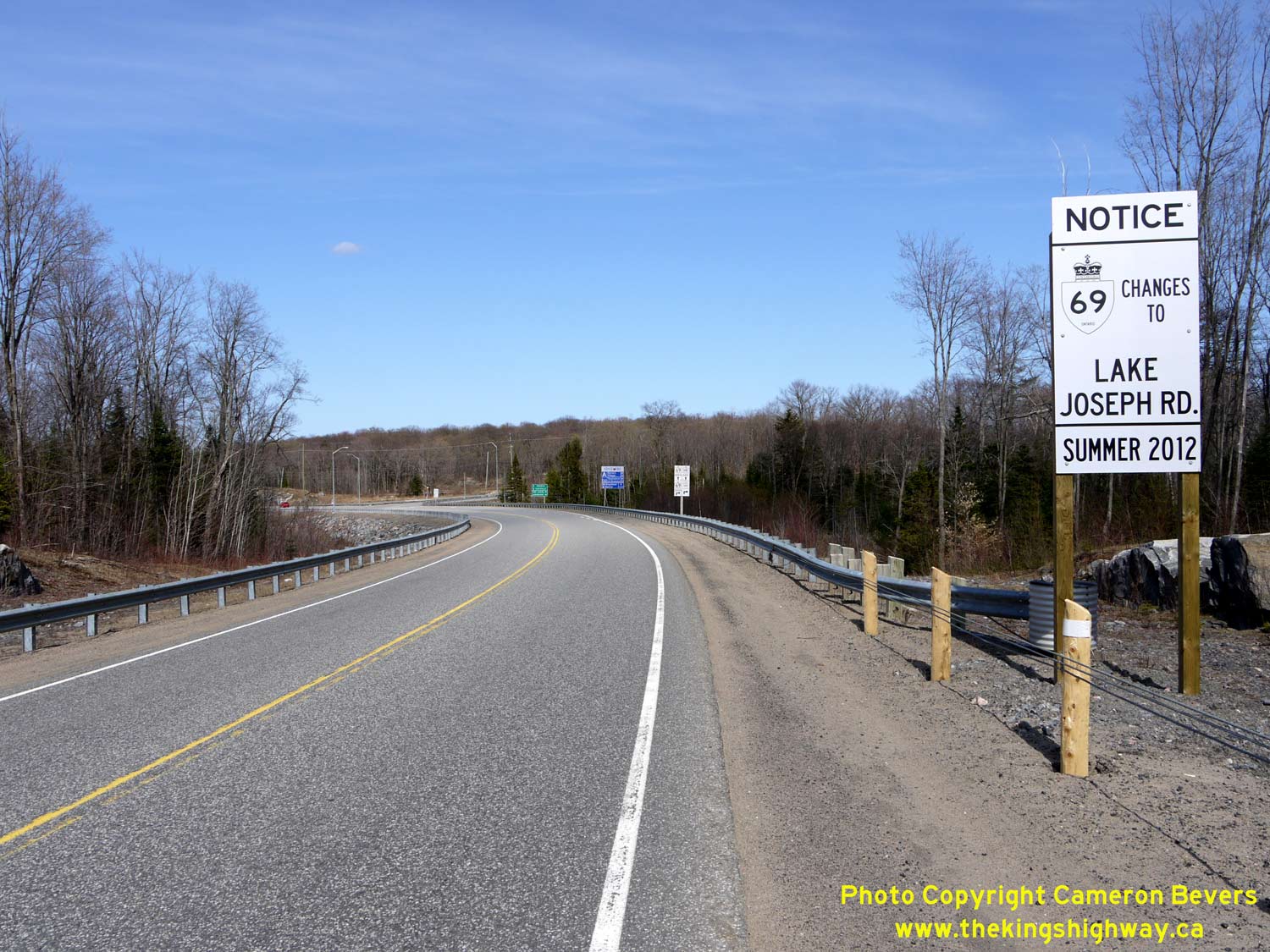
Left - Highway guide signs at the northern terminus of Hwy 169 at the Hwy 69 Junction at Foot's Bay. The bypassed route of Hwy 69 via MacTier, Foot's Bay and
Horseshoe Lake was renamed Lake Joseph Road in September, 2012. Although Lake Joseph Road is still maintained by the province, it is no longer officially known as
Hwy 69. The route of Hwy 69 now begins where Hwy 400 ends north of Nobel. See an
Enlarged Photo here. (Photograph taken on April 12, 2012 - © Cameron Bevers) Right - Approaching the northern terminus of Hwy 169 at the Hwy 69 Junction at Foot's Bay. The route of Hwy 169 once extended southeasterly for over 90 km via Gravenhurst and Washago, where it connected with Hwy 12 just outside of Brechin. When Hwy 169 was still a provincial highway prior to 1998, it was signed concurrently with Hwy 11 between Gravenhurst and Washago. Once this overlapped route of Hwy 11 & Hwy 169 was removed between Gravenhurst and Washago in 1998, Hwy 169 was broken into distinct northern and southern sections, maintained by the District Municipality of Muskoka and the County of Simcoe, respectively. See an Enlarged Photo here. (Photograph taken on April 12, 2012 - © Cameron Bevers) 

Left - Highway guide signs approaching the northern terminus of Hwy 169 at the Hwy 69 Junction at Foot's Bay. Since September, 2012, the bypassed route of
Hwy 69 has been known as Lake Joseph Road. Accordingly, there are no longer any references to Hwy 69 at this junction anymore. See an
Enlarged Photo here. (Photograph taken on April 12, 2012 - © Cameron Bevers) Right - Junction assembly on northbound Hwy 169 approaching the Hwy 69 Junction at Foot's Bay. The route of Hwy 400 is trailblazed with green signs at this highway junction. The new route of Hwy 400 opened to traffic in October, 2003, bypassing about 28 km of Hwy 69 via MacTier, Foot's Bay and Horseshoe Lake. See an Enlarged Photo here. (Photograph taken on April 12, 2012 - © Cameron Bevers) 

Left - Facing south along Hwy 69 towards the Hwy 169 Junction at Foot's Bay. Historically, Hwy 69 used to turn left at this highway junction and follow the
route of what is now Hwy 169 to Gravenhurst. The through highway at this junction used to be known as Hwy 103, which connected the Port Severn area to MacTier. At the
time this highway junction was built in the 1950s, little thought was given to the logic of the route numbers departing from this junction. In recent decades, Human
Factors research has demonstrated that it is generally a better highway design practice to ensure that the through highway maintains its route name or number at a
junction, as this is what motorists would typically expect. The sudden departure of Hwy 69 onto another roadway at this junction likely confused many southbound
motorists. In an effort to simplify the highway numbering in the area, the through highway at this junction was renumbered from Hwy 103 to Hwy 69 in 1976. The
existing route of Hwy 69 via Gravenhurst and Washago was renumbered as Hwy 169. See an
Enlarged Photo here. (Photograph taken on April 12, 2012 - © Cameron Bevers) Right - Junction assembly on southbound Hwy 69 approaching the Hwy 169 Junction at Foot's Bay. At one time, a large freeway-style overhead sign structure used to mark this junction. The overhead sign structure was installed long before the route renumbering of 1976, to advise southbound motorists who wished to stay on Hwy 69 that they had to turn left onto a different roadway in order to continue along Hwy 69. Following the 1976 route renumbering, Hwy 69 became the through highway at this junction, which would have been more in line with drivers' expectations. The change in highway numbers also complemented the predominant north-south traffic movement between Port Severn and Parry Sound. The overhead sign structure was left in place at this junction for more than two decades after the highway renumbering, even though the new route numbering introduced in 1976 was far more logical. Once the new Hwy 400 opened to traffic in 2003, the existing route of Hwy 69 began to serve a more local traffic function. The overhead sign structure was subsequently removed. See an Enlarged Photo here. (Photograph taken on April 12, 2012 - © Cameron Bevers) 

Left - Facing north along Hwy 69 (MacTier Diversion) towards Parry Sound, about 1 km north of Foot's Bay. Preliminary clearing and grading work began on the
Hwy 69 diversion around MacTier during the winter of 1938-1939 as a Depression-era unemployment relief project. Work was halted due to the outbreak of World War II
and the ensuing shift in highway construction priorities. Ultimately, the MacTier Diversion was completed as part of the improvements for the Georgian Bay Route of
the Trans-Canada Highway. Construction resumed on the new 9 km highway diversion between Foot's Bay and Gordon Bay in 1953. The new Hwy 69 route was completed three
years later. The original 1937 route of Hwy 69 via MacTier subsequently became Hwy 612, which runs more or less parallel to Hwy 69. See an
Enlarged Photo here. (Photograph taken on June 10, 2011 - © Cameron Bevers) Right - Unusual warning sign on northbound Hwy 69 near Foot's Bay, advising motorists to watch for disabled vehicles, cyclists and pedestrians on the paved shoulder. While this sign may seem very odd today, it was placed there for a specific reason. During the 1980s, the shoulders along Hwy 69 were paved between Port Severn and Parry Sound. Slower vehicles were encouraged to pull out onto the paved shoulder to allow faster traffic to pass. For many years, this type of traffic operation allowed for a fairly efficient use of the highway without the need for constructing expensive passing lanes. However, it did create potential conflicts between moving traffic on the shoulder and other road users - hence these warning signs. As traffic volumes on Hwy 69 continued to grow into the 1990s, even the use of the paved shoulder by slow vehicles was not adequate enough to ensure efficient traffic operations. Slow vehicles who pulled out onto the shoulder often had trouble getting back into the through lane, and by the late 1990s, long traffic queues became a common sight on Hwy 69 on summer weekends. Ultimately, Hwy 69 was widened to four lanes between Waubaushene and Parry Sound, which has greatly improved summer traffic conditions in recent years. The four-lane sections of Hwy 69 from Waubaushene to Nobel were subsequently renumbered as Hwy 400 as they were rebuilt, starting with the southernmost section of the highway in 1997. See an Enlarged Photo here. (Photograph taken on June 10, 2011 - © Cameron Bevers) 

Left - Facing north along Hwy 69 about 3 km north of Foot's Bay. Note the abandoned commercial entrance at right. The bypassed route of Hwy 69 is now littered
with the remnants of closed and abandoned roadside businesses. Most through traffic now uses Hwy 400, which was built on an entirely new alignment in this area. See
an Enlarged Photo here. (Photograph taken on October 9, 2011 - © Cameron Bevers) Right - Facing north along Hwy 69 approaching the Hwy 612 Junction, about 1 km south of Gordon Bay. See an Enlarged Photo here. (Photograph taken on April 12, 2012 - © Cameron Bevers) 

Left - Junction sign assembly on northbound Hwy 69 approaching the Hwy 612 Junction near Gordon Bay. See an
Enlarged Photo here. (Photograph taken on April 12, 2012 - © Cameron Bevers) Right - Approaching the northern terminus of Hwy 612 at the Hwy 69 Junction south of Gordon Bay. Historically, Hwy 612 used to be part of Hwy 69. From the time the highway was first established in 1937 up until 1956, Hwy 69 used to pass right through MacTier. As part of the Trans-Canada Highway construction in the 1950s, Hwy 69 was relocated onto a brand-new and much-improved alignment between the Gordon Bay area and Foot's Bay. See an Enlarged Photo here. (Photograph taken on April 12, 2012 - © Cameron Bevers) 

Left - Junction assembly and fingerboard destination signs at the Hwy 69 & Hwy 612 Junction near Gordon Bay. See an
Enlarged Photo here. (Photograph taken on April 12, 2012 - © Cameron Bevers) Right - Facing north along Hwy 69 towards Parry Sound at the Hwy 612 Junction. This highway junction marks the northern end of the 9 km MacTier Diversion. When this diversion of Hwy 69 was completed and opened to traffic in 1956, it shortened the highway distance between Foot's Bay and Parry Sound by about 3 km. See an Enlarged Photo here. (Photograph taken on April 12, 2012 - © Cameron Bevers) 

Left - Junction sign assembly on northbound Hwy 69 at the Hwy 612 Junction near Gordon Bay. See an
Enlarged Photo here. (Photograph taken on April 12, 2012 - © Cameron Bevers) Right - Facing south along Hwy 69 towards Foot's Bay at the Hwy 612 Junction. From this vantage point, it is very obvious that Hwy 69 at one time continued straight ahead towards MacTier. In addition to shortening the highway distance between Foot's Bay and Parry Sound, the MacTier Diversion also bypassed four at-grade railway crossings on the original Hwy 69 route. Had it not been for the outbreak of World War II, the MacTier Diversion between here and Foot's Bay likely would have been completed by the early 1940s. See an Enlarged Photo here. (Photograph taken on April 12, 2012 - © Cameron Bevers) 

Left - Distance guide sign on northbound Hwy 69 at the Hwy 612 Junction near Gordon Bay. See an
Enlarged Photo here. (Photograph taken on April 12, 2012 - © Cameron Bevers) Right - Facing south along Hwy 69 towards Foot's Bay at the Portage Creek Bridge at Gordon Bay. See an Enlarged Photo here. (Photograph taken on August 7, 2006 - © Cameron Bevers) 

Left - Western side of the Portage Creek Bridge on Hwy 69 at Gordon Bay. This eight-span steel beam and timber trestle structure was completed in 1954. See an
Enlarged Photo here. (Photograph taken on August 7, 2006 - © Cameron Bevers) Right - Eastern side of the Portage Creek Bridge on Hwy 69. This bridge is a steel beam structure supported on a creosoted timber trestle. See an Enlarged Photo here. (Photograph taken on August 7, 2006 - © Cameron Bevers) 

Left - A series of partially submerged timber bents marks the location of the former Portage Creek Bridge on Hwy 69. The ruins of the old bridge lie just a few
metres to the east of the current Hwy 69 structure. The old bridge was a creosoted timber beam and trestle structure, which was built prior to the assumption of
Hwy 69 as a King's Highway in 1937. See an Enlarged Photo here. (Photograph taken on August 7, 2006 - © Cameron Bevers) Right - Facing north along Hwy 69 towards Parry Sound at the Portage Creek Bridge. See an Enlarged Photo here. (Photograph taken on August 7, 2006 - © Cameron Bevers) 
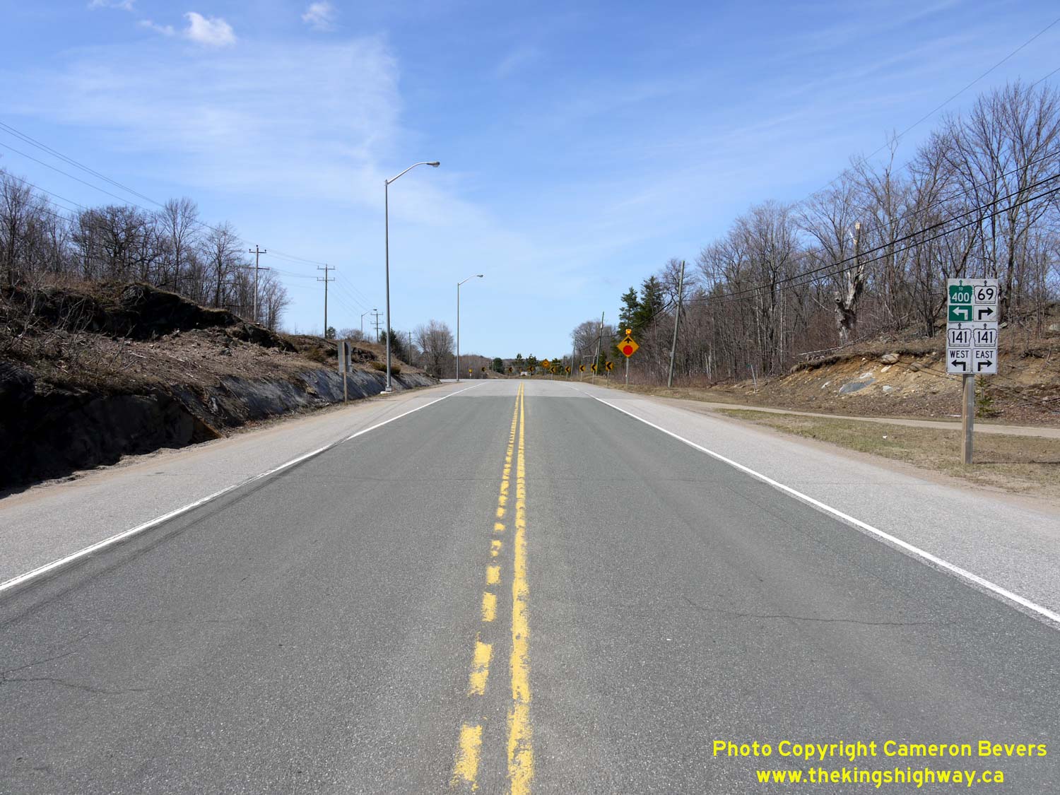
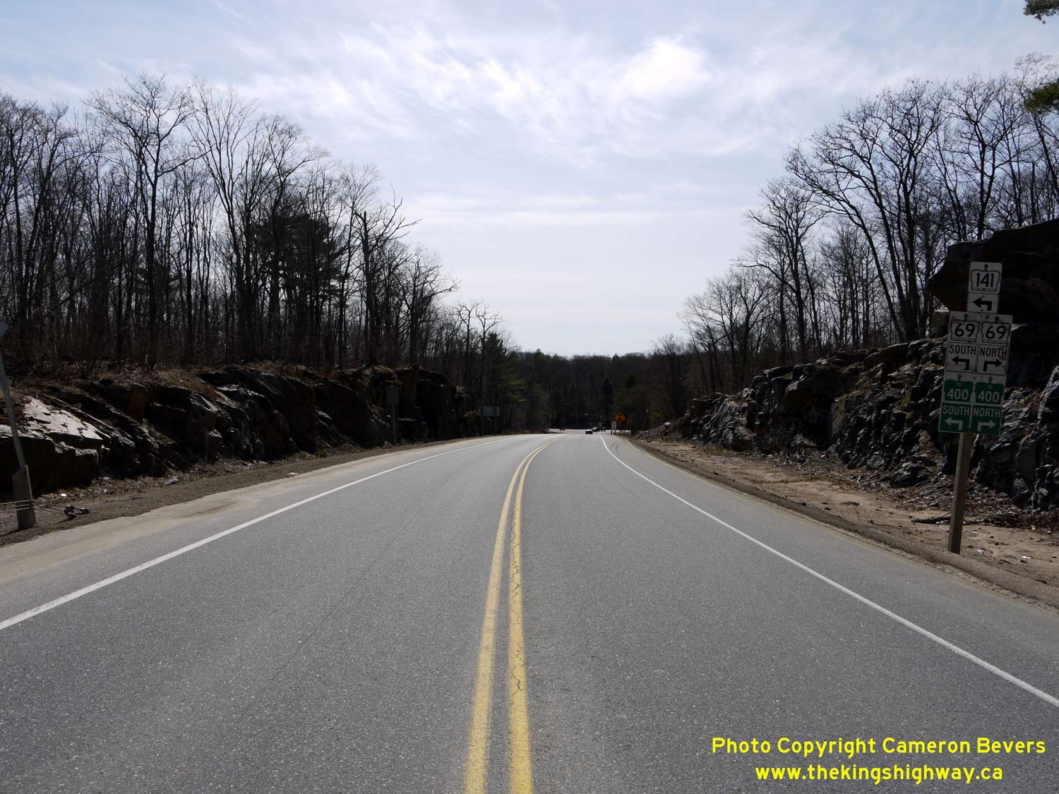
Left - Facing north along Hwy 69 towards Parry Sound at Silver Lake, about 1 km north of Gordon Bay. See an
Enlarged Photo here. (Photograph taken on October 9, 2011 - © Cameron Bevers) Right - Facing north along Hwy 69 approaching the Hwy 141 West Junction between Gordon Bay and Hayes Corners. This was a new highway junction completed in 2003, as part of the adjacent Hwy 400 Extension. Hwy 141 was extended west from Hwy 69 at Hayes Corners to join with the new route of Hwy 400. See an Enlarged Photo here. (Photograph taken on April 12, 2012 - © Cameron Bevers) 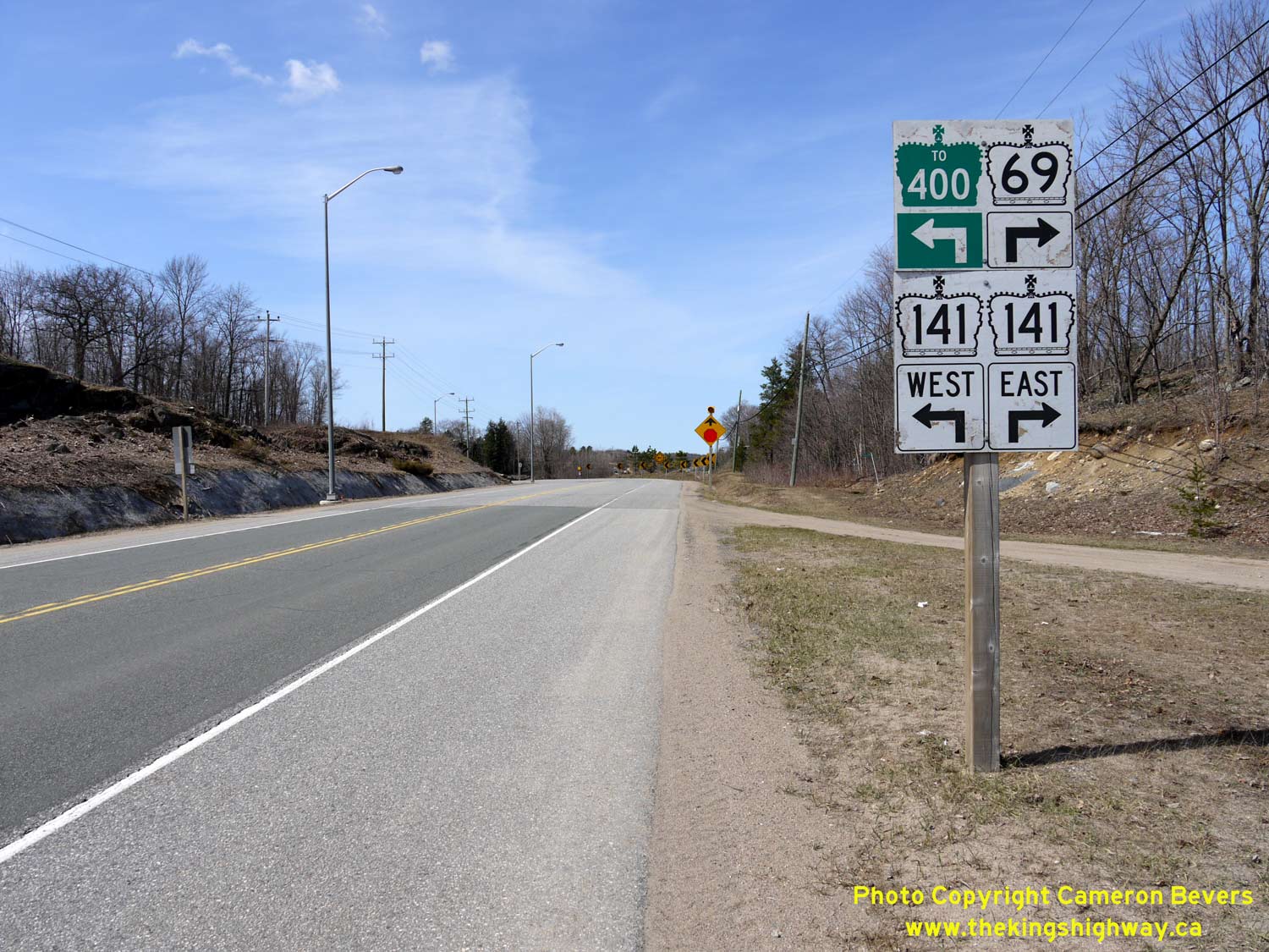
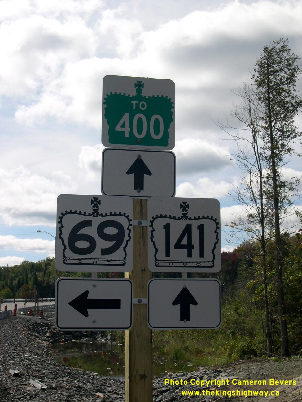
Left - Junction assembly on northbound Hwy 69 approaching the Hwy 141 West Junction between Gordon Bay and Hayes Corners. The route of Hwy 400 is trailblazed
using green "To 400" route markers via westbound Hwy 141. The Hwy 141 Interchange is the first access point along Hwy 400 since the Hwy 69 Interchange south of
MacTier. See an Enlarged Photo here. (Photograph taken on April 12, 2012 - © Cameron Bevers) Right - Cul-de-sac on the former Hwy 69 alignment at the Hwy 141 West Junction between Gordon Bay and Hayes Corners. In 2003, Hwy 69 was realigned so that it intersected with the relocated route of Hwy 141. The realignment left behind a short bypassed section of Hwy 69, which terminated at this point. In the background, the concurrent route of Hwy 69 & Hwy 141 can be seen continuing north towards Parry Sound. See an Enlarged Photo here. (Photograph taken on June 10, 2007 - © Cameron Bevers) 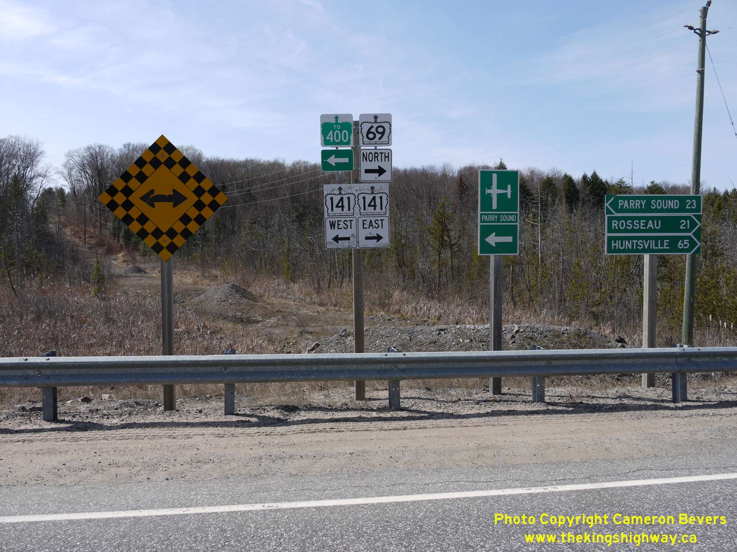
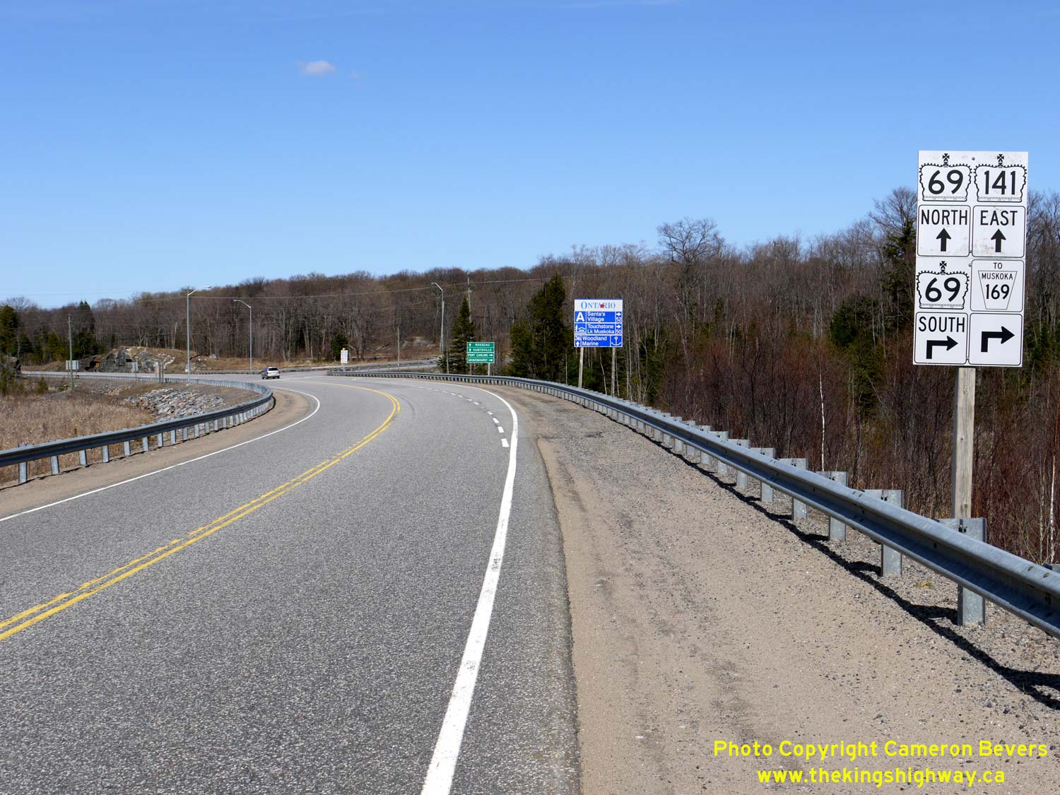
Left - Junction assembly and fingerboard destination signs at the Hwy 69 & Hwy 141 West Junction between Gordon Bay and Hayes Corners. Interestingly,
traffic bound for Parry Sound is directed to follow Hwy 141 West to Hwy 400. Although it may seem somewhat counter-intuitive to turn west at this junction, motorists
will find that travel times between using Hwy 400 and Hwy 69 to reach Parry Sound from this highway junction are more or less comparable. See an
Enlarged Photo here. (Photograph taken on April 12, 2012 - © Cameron Bevers) Right - Advisory sign on Hwy 141 indicating the pending removal of the Hwy 69 designation. In September 2012, Hwy 69 route markers were removed along the highway between MacTier and the Nobel area. As the sign indicates, the former route of Hwy 69 between MacTier and Horseshoe Lake is now known as Lake Joseph Road. The old highway was assigned unposted 7000-series highway numbers. From MacTier to Hwy 141, Old Hwy 69 is referred to internally by MTO as Hwy 7289 and from Hwy 141 to Horseshoe Lake, Old Hwy 69 is known as Hwy 7290. See an Enlarged Photo here. (Photograph taken on April 12, 2012 - © Cameron Bevers) 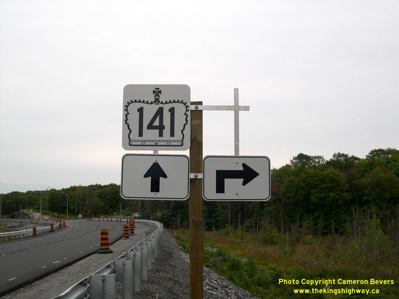
Left - Partially-installed junction assembly at the realigned Hwy 141 & Hwy 69 Junction between Gordon Bay and Hayes Corners just prior to opening in 2003,
facing east. Post-construction, the junction sign assembly was modified to include a trailblazer marker for Muskoka Road 169. See an
Enlarged Photo here. (Photograph taken on August 31, 2003 - © Cameron Bevers) Right - Revised route marker assembly on eastbound Hwy 141 approaching the Hwy 69 South Junction between Gordon Bay and Hayes Corners. See an Enlarged Photo here. (Photograph taken on April 12, 2012 - © Cameron Bevers) 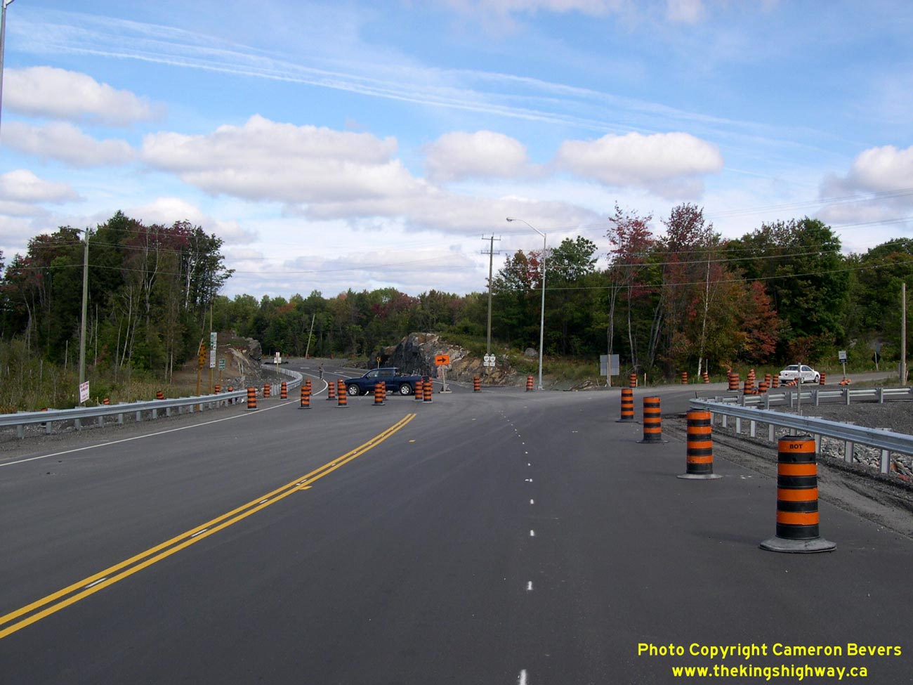

Left - Realigned junction of Hwy 69 and Hwy 141, just prior to opening in 2003. Due to construction staging, part of the new route of Hwy 141 was already open
to local traffic heading to and from the Parry Sound Area Municipal Airport and the nearby cottage community of Roberts Lake. See an
Enlarged Photo here. (Photograph taken on September 20, 2003 - © Cameron Bevers) Right - Facing north at the Hwy 69 & Hwy 141 West Junction between Gordon Bay and Hayes Corners. This photo shows the completed diversion of Hwy 141 and new junction with Hwy 69 South, which is seen partially-constructed in the 2003 photo at left. See an Enlarged Photo here. (Photograph taken on April 12, 2012 - © Cameron Bevers) 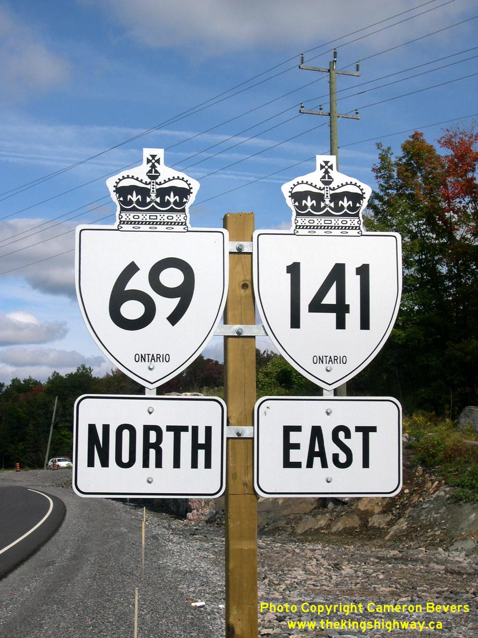
Left - Dual Hwy 69 & Hwy 141 route markers south of Hayes Corners. See an
Enlarged Photo here. (Photograph taken on September 20, 2003 - © Cameron Bevers) Right - Junction assembly at the realigned Hwy 69 and Hwy 141 West Junction. See an Enlarged Photo here. (Photograph taken on September 20, 2003 - © Cameron Bevers) 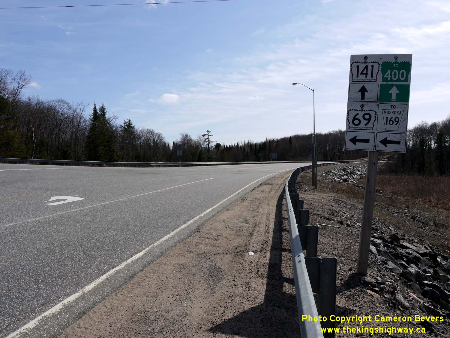
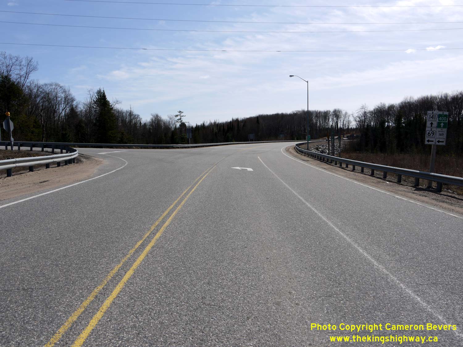
Left - Revised route marker assembly on westbound Hwy 141 approaching the Hwy 69 South Junction between Gordon Bay and Hayes Corners. Like the eastbound
Hwy 141 junction assembly, the westbound assembly was modified post-construction to include a trailblazer marker for Muskoka Road 169. See an
Enlarged Photo here. (Photograph taken on April 12, 2012 - © Cameron Bevers) Right - Facing west along Hwy 141 at the Hwy 69 South Junction between Gordon Bay and Hayes Corners. The route of Hwy 141 continues west beyond Hwy 69 for about 1 km, where it terminates at the Hwy 400 Interchange. See an Enlarged Photo here. (Photograph taken on April 12, 2012 - © Cameron Bevers) 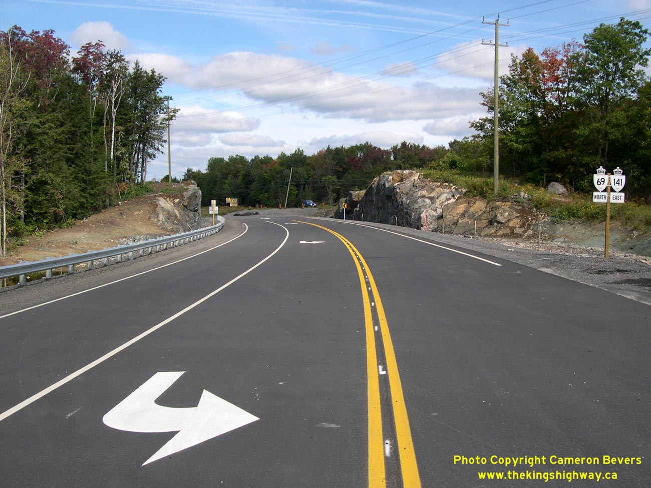
Left - Facing north along Hwy 69 & Hwy 141 towards Parry Sound from the new Hwy 141 West Junction, just prior to the highway's opening in 2003. See an
Enlarged Photo here. (Photograph taken on September 20, 2003 - © Cameron Bevers) Right - Facing north along Hwy 69 & Hwy 141 approaching Hayes Corners. See an Enlarged Photo here. (Photograph taken on April 12, 2012 - © Cameron Bevers) 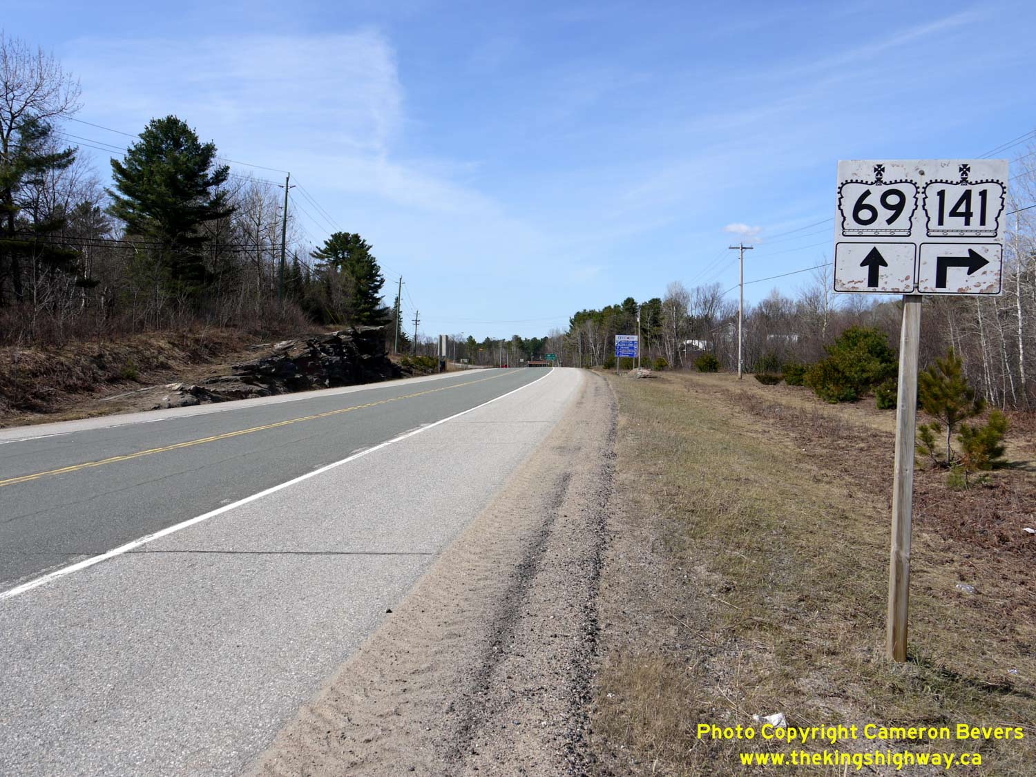
Left - Junction sign assembly on northbound Hwy 69 approaching the Hwy 141 East Junction at Hayes Corners. From Hayes Corners, Hwy 141 continues east via
Humphrey, Rosseau and Utterson, where it connects with Hwy 11 south of Huntsville. Historically, Hwy 141 was an Ontario Secondary Highway known as Hwy 532. See an
Enlarged Photo here. (Photograph taken on April 12, 2012 - © Cameron Bevers) Right - Approaching Hayes Corners on westbound Hwy 141. Up until 2003, Hwy 141 reached its western terminus at the Hwy 69 Junction at Hayes Corners. See an Enlarged Photo here. (Photograph taken on April 12, 2012 - © Cameron Bevers) 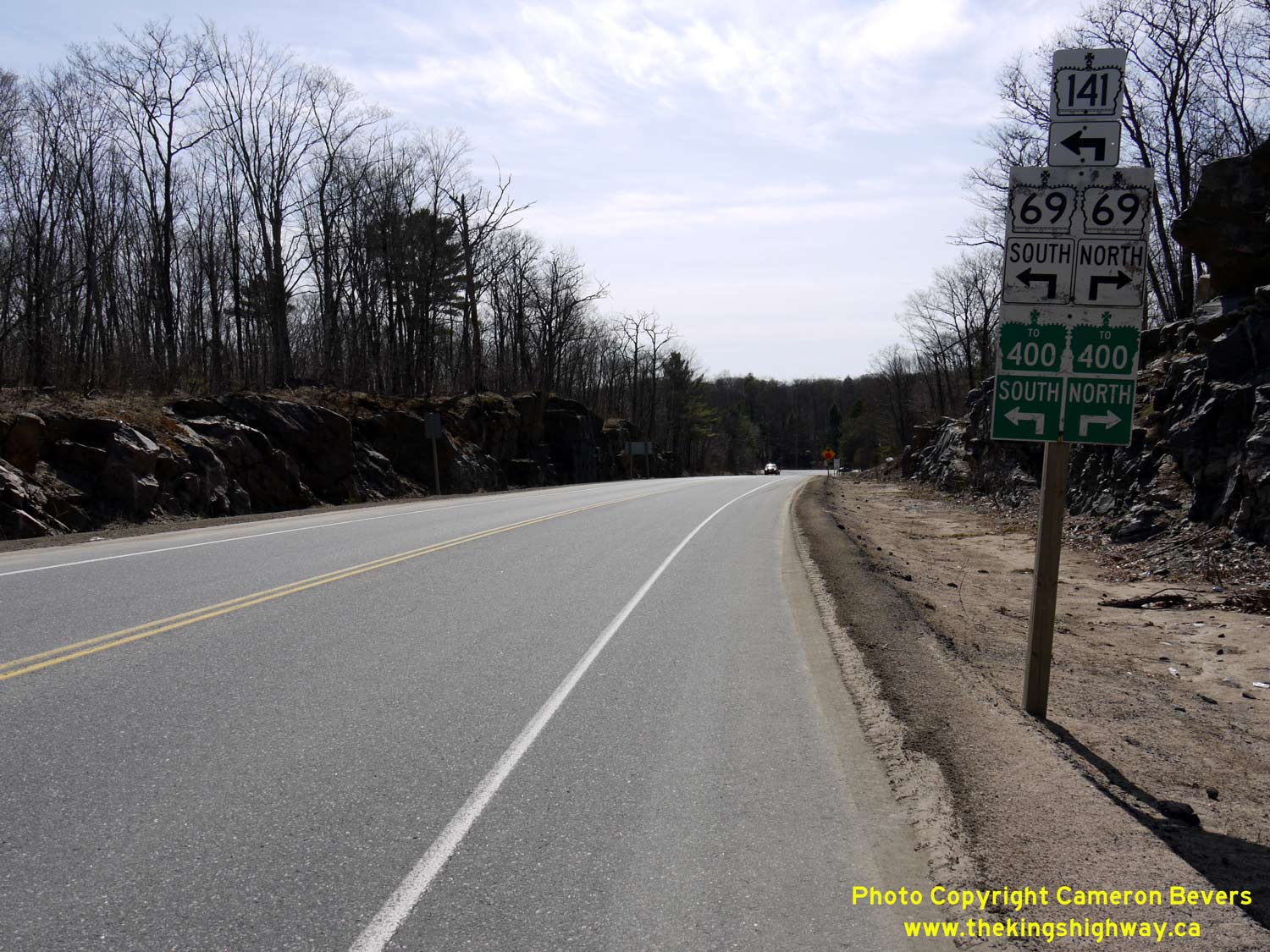
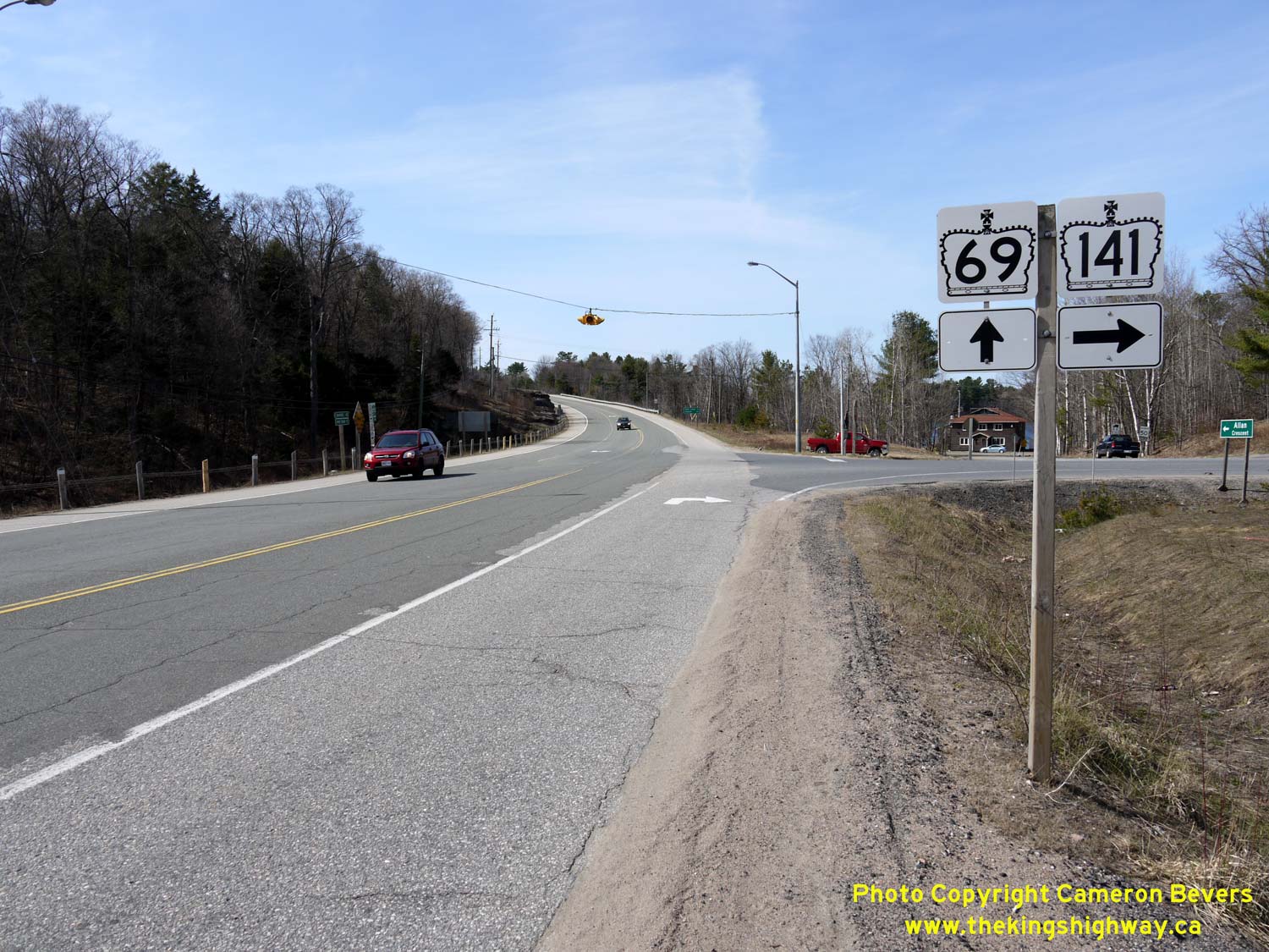
Left - Junction sign assembly on westbound Hwy 141 approaching the Hwy 69 North Junction at Hayes Corners. See an
Enlarged Photo here. (Photograph taken on April 12, 2012 - © Cameron Bevers) Right - Junction sign assembly and fingerboard destination signs at the Hwy 69 & Hwy 141 East Junction at Hayes Corners. From Hayes Corners, Hwy 141 now continues south concurrently with Hwy 69, where it connects with Hwy 400 near the Parry Sound Area Municipal Airport. The 4 km extension of Hwy 141 came into effect in October, 2003, in conjunction with the Hwy 400 Extension to Horseshoe Lake. See an Enlarged Photo here. (Photograph taken on April 12, 2012 - © Cameron Bevers) 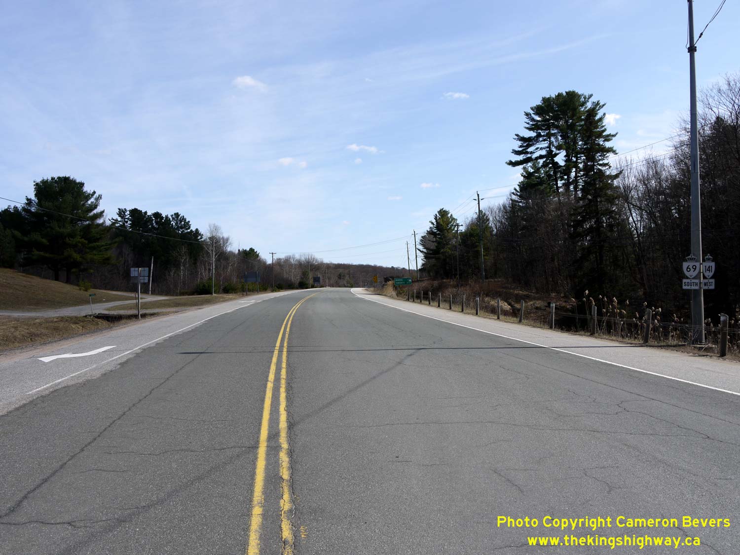
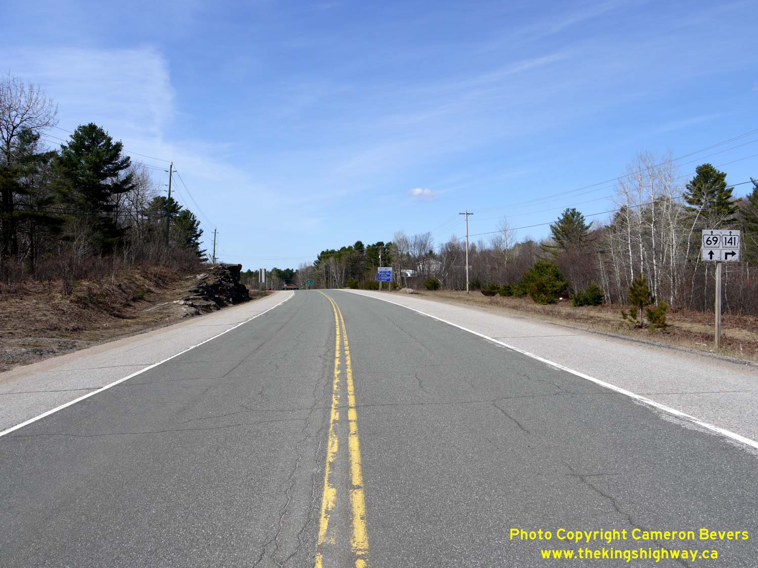
Left - Facing south along Hwy 69 & Hwy 141 towards MacTier from Hayes Corners. See an
Enlarged Photo here. (Photograph taken on April 12, 2012 - © Cameron Bevers) Right - Dual King's Highway route markers on southbound Hwy 69 & Hwy 141 at Hayes Corners. See an Enlarged Photo here. (Photograph taken on April 12, 2012 - © Cameron Bevers) 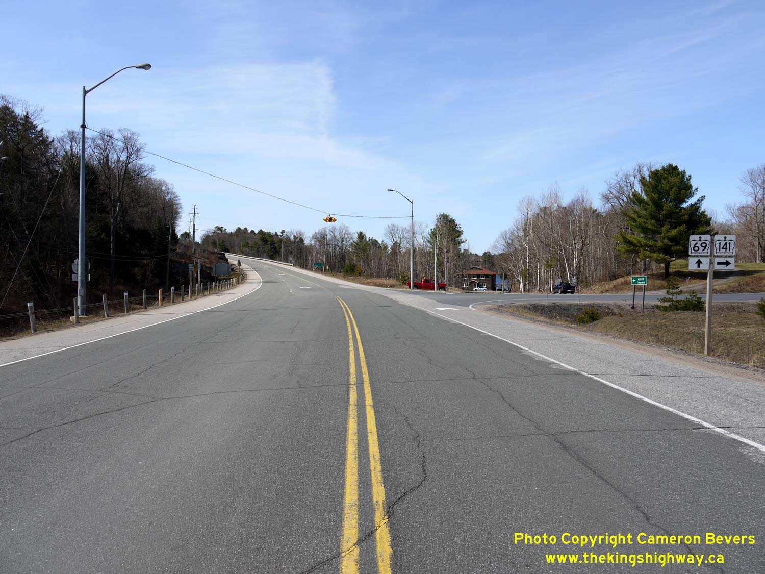
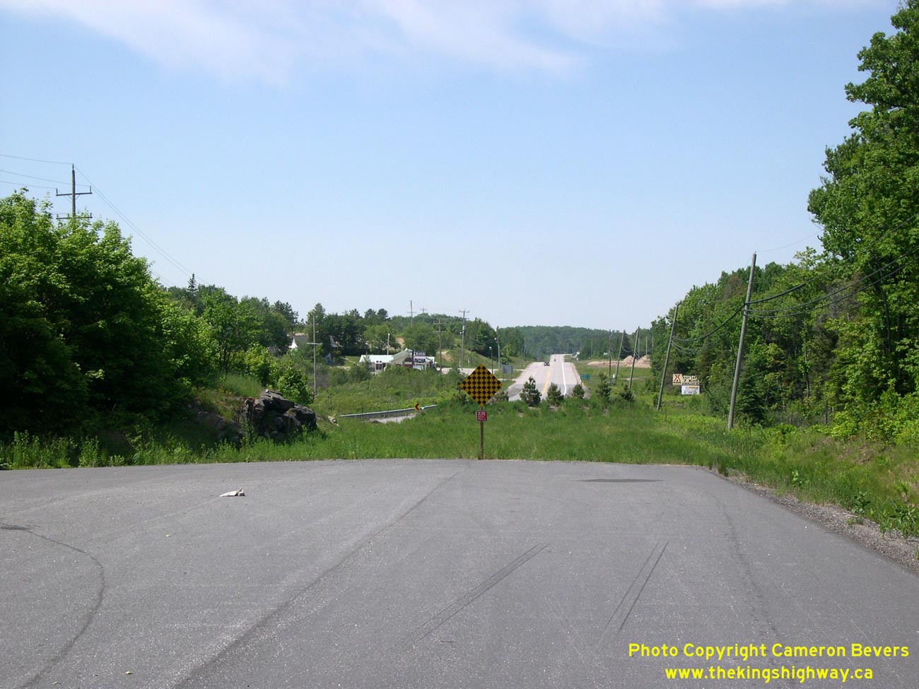
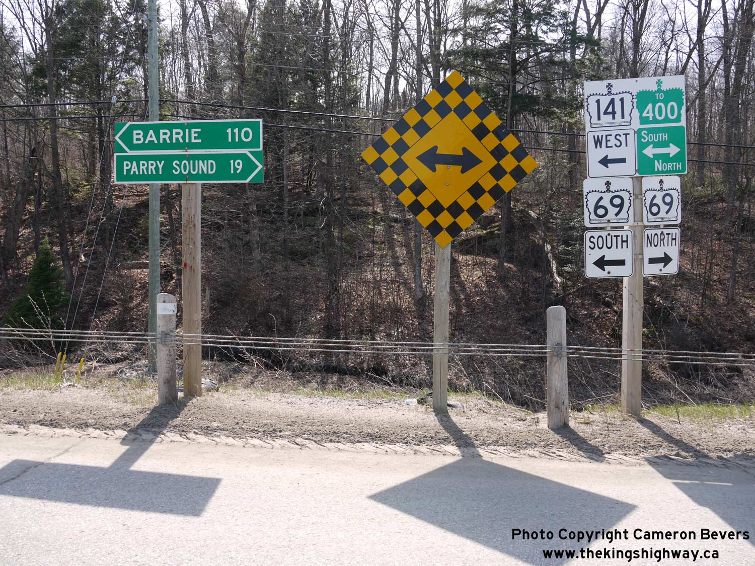
Left - Facing north along Hwy 69 towards Parry Sound at the Hwy 141 East Junction at Hayes Corners. The intersection at Hayes Corners is located on a long
horizontal curve. A flashing overhead intersection warning beacon exists at this highway junction. See an
Enlarged Photo here. (Photograph taken on April 12, 2012 - © Cameron Bevers) Right - Hwy 69 & Hwy 141 route markers at Hayes Corners, facing north. These two highways have intersected at Hayes Corners ever since Hwy 141 was first established as a King's Highway in 1974. It wasn't until 2003 that Hwy 69 & Hwy 141 shared a brief concurrent route south of Hayes Corners. As a result of the Hwy 400 Extension's completion to Horseshoe Lake in 2003, Hwy 141 was extended west from Hayes Corners by about 4 km to reach the new freeway. See an Enlarged Photo here. (Photograph taken on April 12, 2012 - © Cameron Bevers) 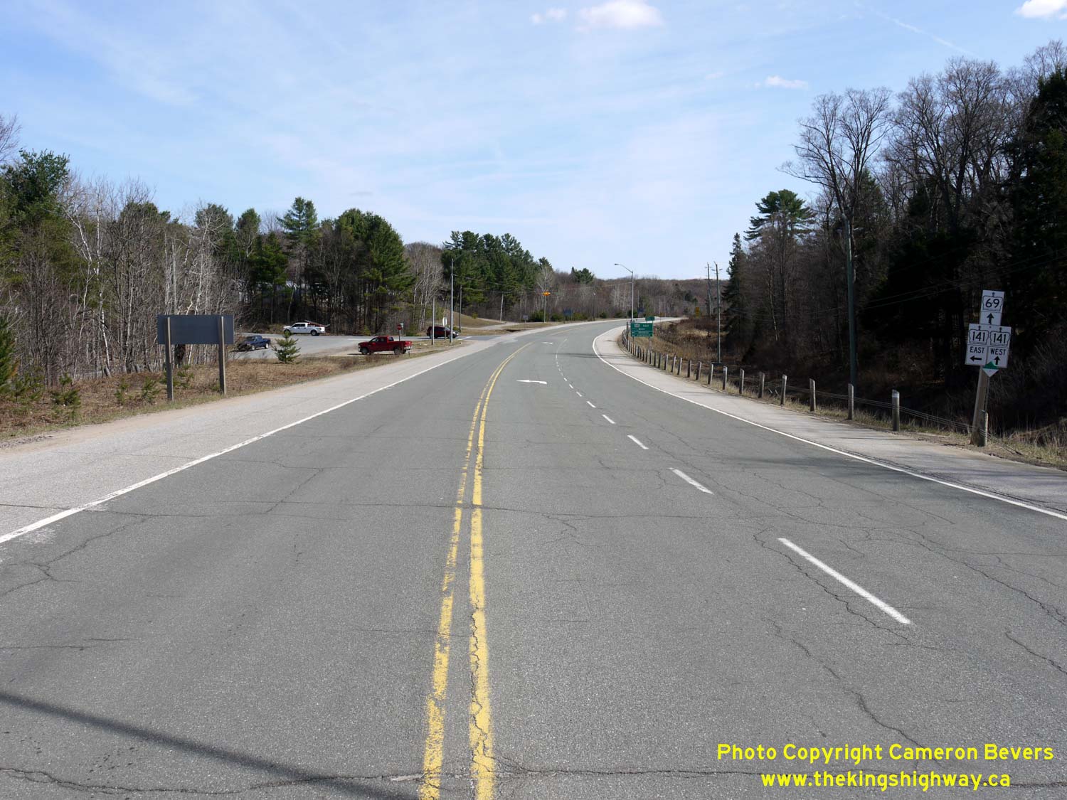
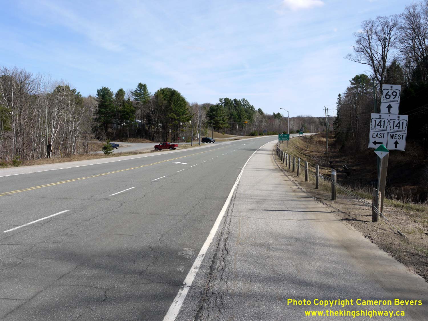
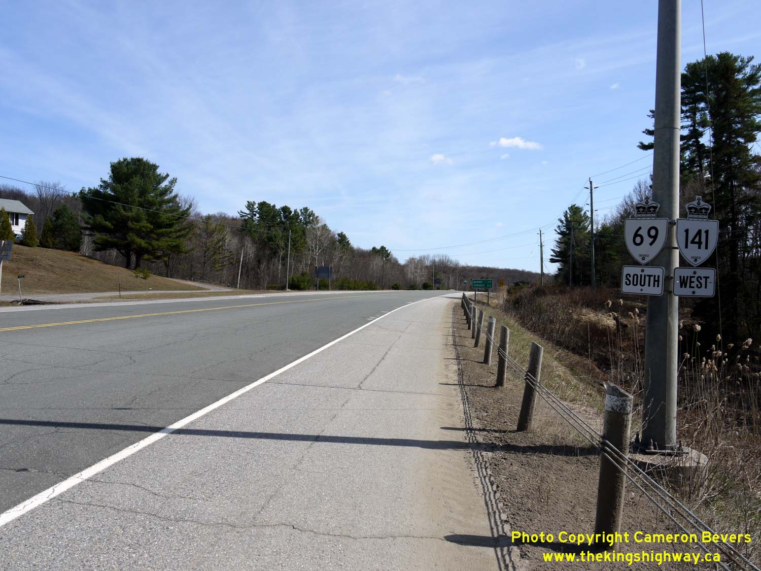
Left - Facing south along Hwy 69 towards MacTier at the Hwy 141 East Junction at Hayes Corners. See an
Enlarged Photo here. (Photograph taken on April 12, 2012 - © Cameron Bevers) Right - Junction sign assembly on southbound Hwy 69 approaching the Hwy 141 East Junction at Hayes Corners. See an Enlarged Photo here. (Photograph taken on April 12, 2012 - © Cameron Bevers) 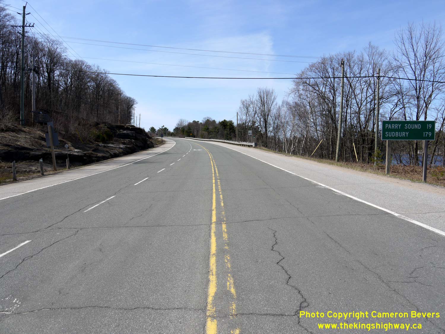

Left - Distance guide sign on northbound Hwy 69 near the Hwy 141 East Junction at Hayes Corners. See an
Enlarged Photo here. (Photograph taken on April 12, 2012 - © Cameron Bevers) Right - Former Hwy 69 alignment (Reptile Museum Road) near the Hwy 141 East Junction at Hayes Corners. This diversion was built in 1939 as part of an early highway improvement project on Hwy 69. As originally assumed in 1937, Hwy 69 passed through the small community of Rosseau Road via today's Jacklin Crescent. The new highway had more gentle curves and grades which were less steep than those on the original 1937 highway. In the early 1960s, yet another series of Hwy 69 diversions were completed between Hayes Corners and the Rankin Lake area, which is largely the route that Hwy 69 follows today. Reptile Museum Road (Old Hwy 69) was one of several highway loops bypassed by the new Hwy 69 in 1961. See an Enlarged Photo here. (Photograph taken on September 20, 2003 - © Cameron Bevers) 

Left - This old concrete culvert under a former Hwy 69 alignment (McKaig Road) at Horseshoe Lake was built as part of an early highway improvement project in
1938. See an Enlarged Photo here. (Photograph taken on June 5, 2004 - © Cameron Bevers) Right - Horseshoe Lake Road is the original 1937 alignment of Hwy 69. About 4 km of the original route of Hwy 69 was bypassed by the current highway in 1961. Jurisdiction over the old route of Hwy 69 (Horseshoe Lake Road) was transferred from the province to the Township of Foley in 1966. See an Enlarged Photo here. (Photograph taken on June 5, 2004 - © Cameron Bevers) 

Left - This well-designed horizontal curve on Old Hwy 69 (Horseshoe Lake Road) was built during a highway improvement project in 1939. See an
Enlarged Photo here. (Photograph taken on June 10, 2007 - © Cameron Bevers) Right - Facing south along Horseshoe Lake Road (Old Hwy 69) at Mud Lake Road. The geometry of this road has the unmistakable characteristics of an older King's Highway. Considering the quality of most highways in the northern parts of Ontario at the time, this section of Hwy 69 was designed to very high standards when it was reconstructed in 1939. This part of Hwy 69 was originally gravel-surfaced, but was paved immediately following World War II in 1946. These early improvements made to Hwy 69 quickly affirmed the Parry Sound area as one of Ontario's major summer vacation destinations. See an Enlarged Photo here. (Photograph taken on June 10, 2007 - © Cameron Bevers)
Continue on to King's Highway 69 Photos: Horseshoe Lake to Parry Sound
|
|---|
Links to Adjacent King's Highway Photograph Pages:
Back to Hwy 69 - Waubaushene to Hwy 169
Hwy 69 Photo Index
On to Hwy 69 - Horseshoe Lake to Parry Sound
Back to King's Highway 68 Photos /
King's Highway 69 History /
On to King's Highway 70 Photos
Ontario Highway History - Main Menu / Back to List of Highways Website contents, photos & text © 2002-2026, Cameron
Bevers (Webmaster) - All Rights Reserved / Contact Me
|
|---|