
| 
| |
|
|
This page contains present day photos (Year 2000 to date) of Ontario's King's Highway 69, arranged by location from Horseshoe
Lake northerly to the Highway 124 Interchange in Parry Sound. All photographs displayed on this page were taken by the Webmaster (Cameron Bevers), unless specifically
noted otherwise. Click on any thumbnail to see a larger image!
Please note that all photographs displayed on this
website are protected by copyright. These photographs must not be reproduced, published,
electronically stored or copied, distributed, or posted onto other websites without
my written permission. If you want to use photos from this website, please
email me first for permission. Thank-you!
|
|---|
|
Page 6: Present Day King's Highway 69 Photographs (Horseshoe Lake to Parry Sound)


Left - Facing south along Hwy 69 towards MacTier from the Hwy 400 Interchange at Horseshoe Lake. See an
Enlarged Photo here. (Photograph taken on April 12, 2012 - © Cameron Bevers) Right - Route markers on southbound Hwy 69 at the Hwy 400 Interchange at Horseshoe Lake. Hwy 141 is marked using a green trailblazer route marker from this interchange. See an Enlarged Photo here. (Photograph taken on April 12, 2012 - © Cameron Bevers) 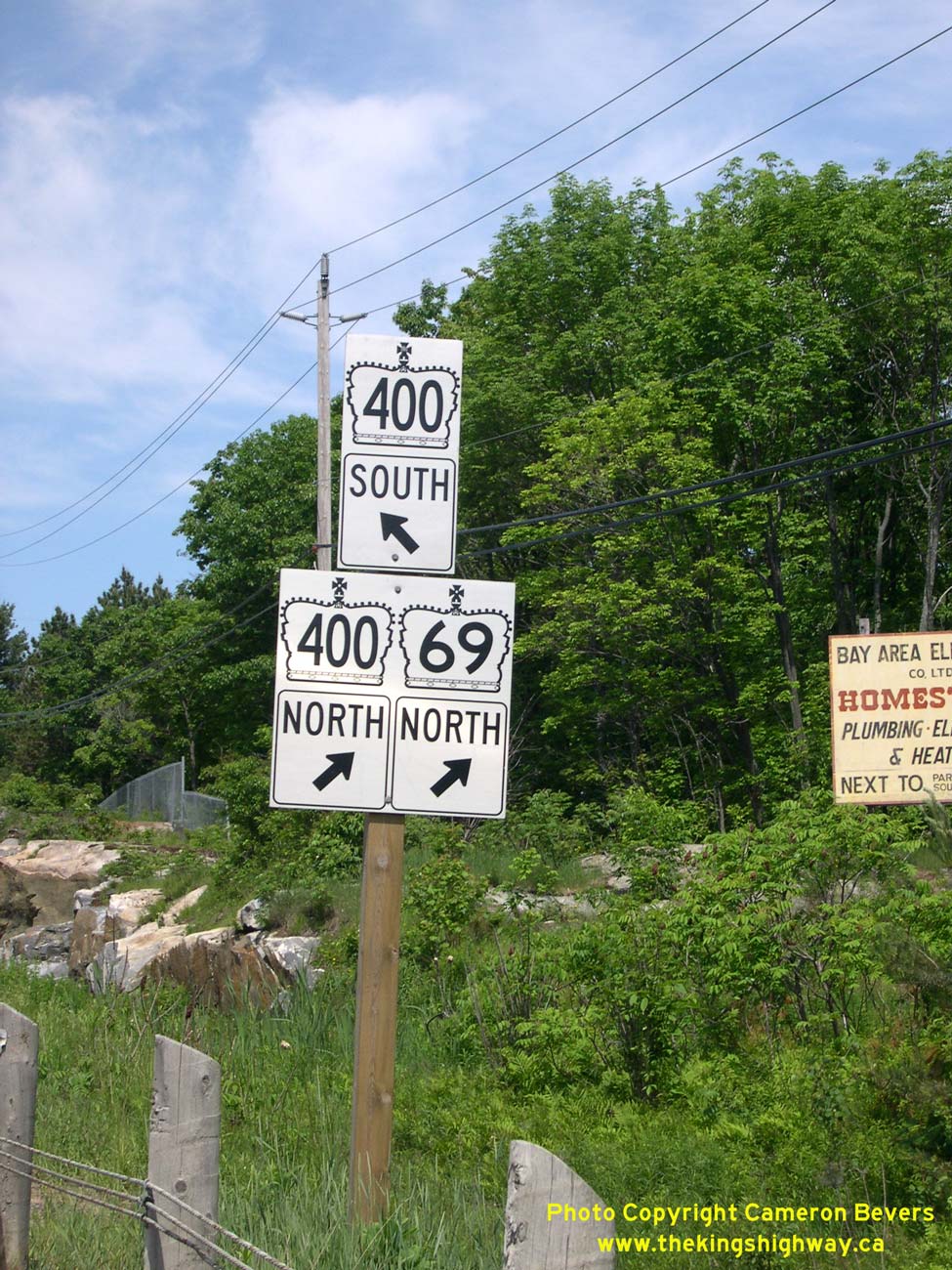

Left - Junction sign assembly at the Hwy 69 & Hwy 400 Interchange at Horseshoe Lake. Hwy 69 & Hwy 400 shared a concurrent routing south of Parry Sound
for the better part of a decade, between 2003 and 2012. In September 2012, all references to Hwy 69 south of the Hwy 559 Interchange near Nobel were removed. See an
Enlarged Photo here. (Photograph taken on June 10, 2007 - © Cameron Bevers) Right - This Hwy 69 route marker at Horseshoe Lake was made using an older sign font, which hasn't been used since the 1970s. Although it was installed fairly recently, this sign may have been part of some forgotten "old stock" held in storage somewhere. It's deliciously retro! See an Enlarged Photo here. (Photograph taken on June 10, 2007 - © Cameron Bevers) 

Left - Advisory sign on southbound Hwy 69 at the Hwy 400 Interchange at Horseshoe Lake, indicating the pending removal of the Hwy 69 designation. In September
2012, Hwy 69 route markers were removed along the highway between MacTier and the Nobel area. As the sign indicates, the former route of Hwy 69 between MacTier and
Horseshoe Lake is now known as Lake Joseph Road. The old highway was assigned unposted 7000-series highway numbers. From MacTier to Hwy 141, Old Hwy 69 is referred to
internally by MTO as Hwy 7289 and from Hwy 141 to Horseshoe Lake, Old Hwy 69 is known as Hwy 7290. See an
Enlarged Photo here. (Photograph taken on April 12, 2012 - © Cameron Bevers) Right - Green guide sign on northbound Hwy 400 for the Hwy 69 South Interchange at Horseshoe Lake. The cardinal direction "SOUTH" was implemented on this sign to aid in wayfinding, because motorists heading northbound on Hwy 400 are most likely looking for Hwy 69 North, which they can reach without exiting the freeway. See an Enlarged Photo here. (Photograph taken on June 10, 2007 - © Cameron Bevers) 

Left - New Hwy 400 & Hwy 69 Interchange at Horseshoe Lake in 2003, facing south. The new Hwy 400 Extension had not yet opened to traffic when this photo
was taken. All traffic was still using the old alignment of Hwy 69, which can be seen at left. Note the unusual sign in the foreground, advising motorists that Hwy 69
can be used as an alternate route to reach Barrie and Toronto. See an Enlarged Photo here. (Photograph taken on September 20, 2003 - © Cameron Bevers) Right - Facing north at the Hwy 400 & Hwy 69 Interchange at Horseshoe Lake, just prior to new Hwy 400 Extension opening in 2003. See an Enlarged Photo here. (Photograph taken on September 20, 2003 - © Cameron Bevers) 

Left - Facing south along the unopened Hwy 400 Extension from the Hwy 69 Overpass, about two weeks prior to opening. The new Hwy 400 Extension was officially
opened to traffic between MacTier and Horseshoe Lake on October 7, 2003. The new Hwy 400 Extension shortened the highway distance between MacTier and Parry Sound by
about 5 km and significantly reduced traffic congestion on neighbouring Hwy 69. See an
Enlarged Photo here. (Photograph taken on September 20, 2003 - © Cameron Bevers) Right - Green guide sign on southbound Hwy 400 for the Hwy 69 South Interchange at Horseshoe Lake. Unlike the corresponding sign on northbound Hwy 400, the southbound exit sign for Hwy 69 doesn't indicate the cardinal direction "SOUTH", since the highway only goes in one direction from this interchange. See an Enlarged Photo here. (Photograph taken on April 12, 2012 - © Cameron Bevers) 

Left - Dual green Hwy 69 & Hwy 400 trailblazer route markers on Horseshoe Lake Road at Black Road. The conversion of Hwy 69 into a controlled-access
freeway south of Parry Sound in the early 2000s resulted in the construction of several service roads to divert local traffic to the new highway access points.
Coincidentally, Horseshoe Lake Road itself was a former alignment of Hwy 69. This bypassed loop carried through traffic on Hwy 69 from 1937 up until 1961, when it was
bypassed by an improved Hwy 69 alignment. See an Enlarged Photo here. (Photograph taken on June 10, 2007 - © Cameron Bevers) Right - Dual green Hwy 69 & Hwy 400 trailblazer junction signs on Horseshoe Lake Road at Seguin Trail. See an Enlarged Photo here. (Photograph taken on June 10, 2007 - © Cameron Bevers) 

Left - Overhead guide sign on the Black Road Overpass for the upcoming Seguin Trail & Horseshoe Lake Interchange. See an
Enlarged Photo here. (Photograph taken on June 10, 2011 - © Cameron Bevers) Right - Green guide sign marking the entrance ramp to northbound Hwy 69 & Hwy 400 at the Seguin Trail & Horseshoe Lake Interchange south of Parry Sound. See an Enlarged Photo here. (Photograph taken on April 12, 2012 - © Cameron Bevers) 

Left - Abandoned Boyne River Bridge on a former Hwy 69 alignment south of Parry Sound. This single-span concrete slab structure was completed in 1938. See an
Enlarged Photo here. (Photograph taken on September 20, 2003 - © Cameron Bevers) Right - Abandoned Hwy 69 alignment at the Boyne River Bridge south of Parry Sound near Oastler Lake. See an Enlarged Photo here. (Photograph taken on September 20, 2003 - © Cameron Bevers) 

Left - View of the old and current Boyne River Bridges on Old Hwy 69 (Oastler Park Drive), located about 4 km south of Parry Sound. See an
Enlarged Photo here. (Photograph taken on August 5, 2006 - © Cameron Bevers) Right - Facing south along Old Hwy 69 (Oastler Park Drive) at the Boyne River Bridge. See an Enlarged Photo here. (Photograph taken on August 5, 2006 - © Cameron Bevers) 

Left - Eastern side of the Boyne River Bridge on Old Hwy 69 (Oastler Park Drive). This single-span concrete rigid frame structure was completed in 1960. See an
Enlarged Photo here. (Photograph taken on August 5, 2006 - © Cameron Bevers) Right - Facing north along Old Hwy 69 (Oastler Park Drive) towards Parry Sound at the Boyne River Bridge. See an Enlarged Photo here. (Photograph taken on August 5, 2006 - © Cameron Bevers) 

Left - Close-up view of the concrete and steel handrail on the Boyne River Bridge on Old Hwy 69 (Oastler Park Drive). See an
Enlarged Photo here. (Photograph taken on August 5, 2006 - © Cameron Bevers) Right - Facing south along Old Hwy 69 (Oastler Park Drive) from South Parry Drive. See an Enlarged Photo here. (Photograph taken on September 16, 2017 - © Cameron Bevers) 

Left - Approaching the Hwy 518 (Hunter Drive) Junction on Old Hwy 69 (Oastler Park Drive), about 2 km south of Parry Sound. See an
Enlarged Photo here. (Photograph taken on September 16, 2017 - © Cameron Bevers) Right - Facing west towards Orrville along Hwy 518 (Hunter Drive) from Old Hwy 69 (Oastler Park Drive) south of Parry Sound. See an Enlarged Photo here. (Photograph taken on September 16, 2017 - © Cameron Bevers) 

Left - Approaching the old western terminus of Hwy 518 at Oastler Park Drive (Old Hwy 69). When the new four-lane Hwy 69 was completed and opened to traffic
south of Parry Sound in 2001, it bypassed an existing section of Hwy 69 between Oastler Lake and Parry Sound. This relocation of Hwy 69 also bypassed a section of
Hwy 518 between the old and new routes of Hwy 69. This section of Hwy 518 was deemed to be a redundant link in the provincial highway system, so in 2002, jurisdiction
was transferred from the province to the Township of Seguin. Since that time, this section of Hwy 518 has been known as Hunter Drive. See an
Enlarged Photo here. (Photograph taken on September 16, 2017 - © Cameron Bevers) Right - Facing north along Oastler Park Drive (Old Hwy 69) towards Parry Sound from Hunter Drive (Old Hwy 518). See an Enlarged Photo here. (Photograph taken on September 16, 2017 - © Cameron Bevers) 

Left - Approaching the Old Hwy 518 (Hunter Drive) Junction on Oastler Park Drive (Old Hwy 69), facing south. Prior to the opening of the new four-lane Hwy 69
south of Parry Sound in 2001, the old two-lane section of Hwy 69 was severely overburdened by traffic. Today, the old highway's route is virtually empty. See an
Enlarged Photo here. (Photograph taken on September 16, 2017 - © Cameron Bevers) Right - Facing south along Oastler Park Drive (Old Hwy 69) from the south limits of Parry Sound. See an Enlarged Photo here. (Photograph taken on June 19, 2013 - © Cameron Bevers) 

Left - Unusual warning sign on southbound Oastler Park Drive (Old Hwy 69) in Parry Sound, advising motorists to watch for disabled vehicles, cyclists and
pedestrians on the paved shoulder. See an Enlarged Photo here. (Photograph taken on June 19, 2013 - © Cameron Bevers) Right - Facing north along Oastler Park Drive (Old Hwy 69) towards Bowes Street (Old Hwy 69B) in Parry Sound. Up until the late 1990s, this intersection was marked with an overhead flashing warning beacon, with a STOP sign facing Bowes Street. In 1998, modifications were made at this junction to install traffic signals and to construct a northbound bypass lane. This interesting bypass lane allowed through traffic on northbound Hwy 69 to bypass the traffic signals entirely, and greatly aided traffic flow. The northbound bypass lane proved to be a temporary measure only. Once the new four-lane Hwy 69 was opened to traffic in 2001, Bowes Street was extended to the east to connect to the relocated route of Hwy 69. This former T-intersection was thus converted into a four-leg intersection, and the old bypass lane had to be removed. Traces of the grading for the bypass lane can still be seen at right. At this diverge point, motorists would have to choose whether to keep left for Parry Sound via Bowes Street, or enter the bypass lane at right and continue north along Hwy 69 towards Sudbury. See an Enlarged Photo here. (Photograph taken on June 19, 2013 - © Cameron Bevers) 

Left - Overhead guide sign on northbound Hwy 69 & Hwy 400 for the upcoming Bowes Street & McDougall Road Interchange in Parry Sound. Bowes Street is
the main access route into Downtown Parry Sound, and at one time, carried Hwy 69 traffic through town. Once the Parry Sound Bypass was completed and opened to traffic
in 1961, the old highway route through the town centre was renumbered as Hwy 69B. See an
Enlarged Photo here. (Photograph taken on August 27, 2011 - © Cameron Bevers) Right - A bridge-mounted "pull-through" sign for Hwy 69 was installed on the Bowes Street Overpass in Parry Sound. This sign was changed to read Hwy 400 in 2012. See an Enlarged Photo here. (Photograph taken on June 10, 2007 - © Cameron Bevers) 
Above - Dual Hwy 69 & Hwy 400 route markers at the Bowes Street Interchange in Parry Sound. See an
Enlarged Photo here. (Photograph taken on August 5, 2006 - © Cameron Bevers) 

Left - Start of the four-lane Hwy 69 & Hwy 400 just south of Mill Lake Narrows in 2004. Following the completion of the MacTier-Horseshoe Lake Diversion
in 2003, the route of Hwy 400 was extended north from its former terminus at the Musquash River south of MacTier to Mill Lake Narrows in Parry Sound. For a number of
years, Hwy 400 ended at Mill Lake Narrows. The Hwy 400 designation has subsequently replaced the Hwy 69 designation to a point north of Nobel. Note the traces of the
old route of Hwy 69 off to the right, which was closed off to through traffic in 2001. The old route of Hwy 69 through Parry Sound is now known as Oastler Park Drive
as well as a portion of Louisa Street. See an Enlarged Photo here. (Photograph taken on June 5, 2004 - © Cameron Bevers) Right - Facing south along Hwy 69 & Hwy 400 from Mill Lake Narrows in 2011, following reconstruction. The old median crossover and convergence of the northbound and southbound lanes seen in the 2004 photo above has been replaced with a continuous four-lane divided highway across Mill Lake Narrows. See an Enlarged Photo here. (Photograph taken on June 10, 2011 - © Cameron Bevers) 

Left - View of the overhead sign marking the start of the two-lane Hwy 69 on the approach to Mill Lake Narrows in 2004. This sign was removed altogether after
the completion of the four-lane highway in 2010. Compare this 2004 photo with the 2011 photo at right, showing the completed four-lane Hwy 69 & Hwy 400 on the
approach to Mill Lake Narrows. See an Enlarged Photo here. (Photograph taken on June 5, 2004 - © Cameron Bevers) Right - Completed four-lane Hwy 69 & Hwy 400 across Mill Lake Narrows in 2011, facing north towards Nobel. See an Enlarged Photo here. (Photograph taken on June 10, 2011 - © Cameron Bevers) 

Left - Old Mill Lake Narrows Bridge on Hwy 69 in Parry Sound in 2004, facing north towards Nobel. See an
Enlarged Photo here. (Photograph taken on June 5, 2004 - © Cameron Bevers) Right - Close-up view of the completed twin structures on Hwy 69 & Hwy 400 across Mill Lake Narrows in 2011, facing north towards Nobel. See an Enlarged Photo here. (Photograph taken on June 10, 2011 - © Cameron Bevers) 

Left - Facing west across Mill Lake towards Hwy 69 in Parry Sound in 2004, prior to the construction of the new four-lane highway across Mill Lake Narrows.
See an Enlarged Photo here. (Photograph taken on June 5, 2004 - © Cameron Bevers) Right - Facing south across the Old Mill Lake Narrows Bridge on Hwy 69 in Parry Sound in 2006. In the background, grading work had begun on the new twinned highway. See an Enlarged Photo here. (Photograph taken on August 5, 2006 - © Cameron Bevers) 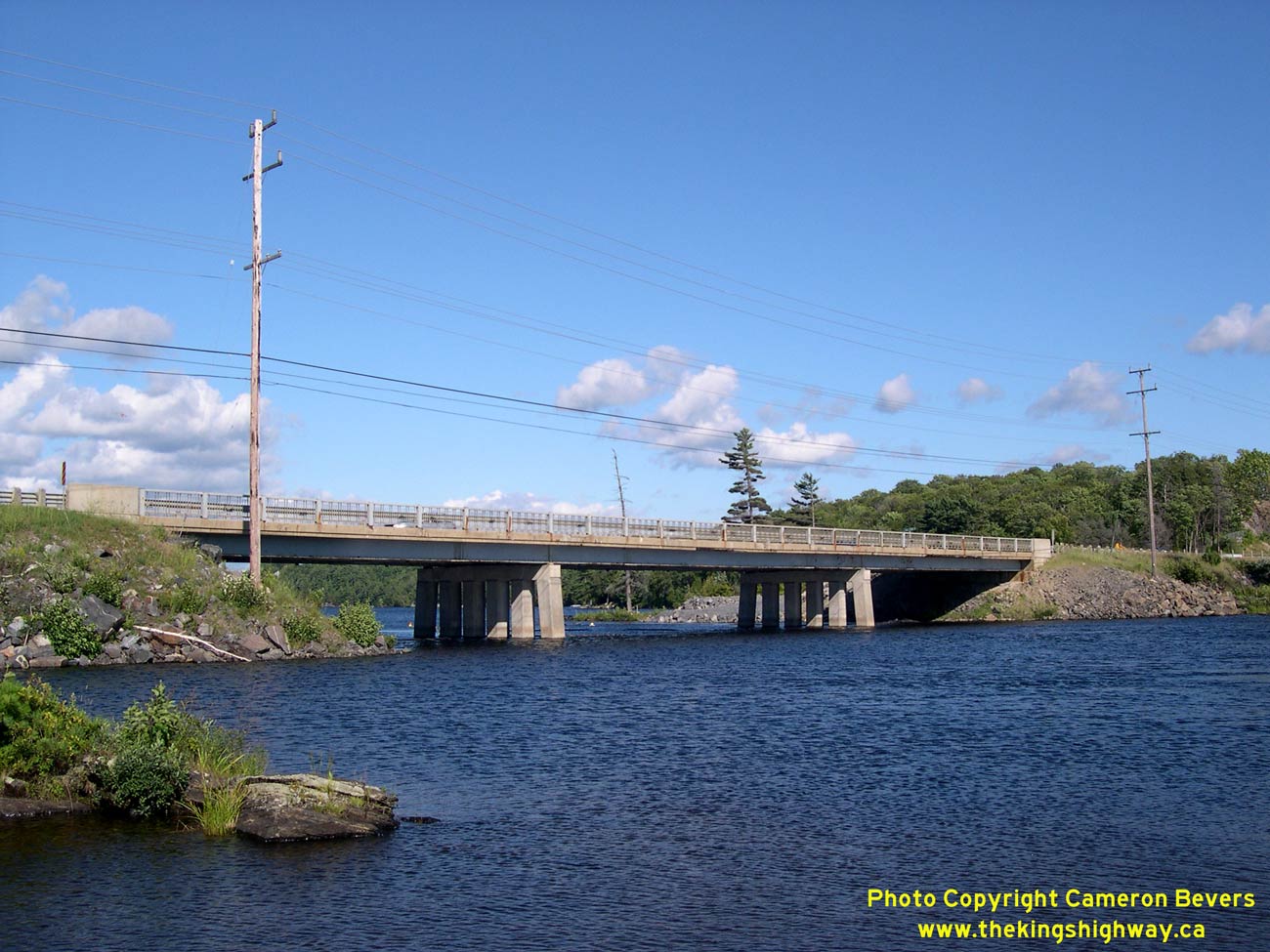

Left - Western side of the Old Mill Lake Narrows Bridge on Hwy 69 in Parry Sound. This three-span steel girder structure was completed in 1961. See an
Enlarged Photo here. (Photograph taken on August 5, 2006 - © Cameron Bevers) Right - Grading for the new twin Mill Lake Narrows crossing on Hwy 69 in Parry Sound in 2006. See an Enlarged Photo here. (Photograph taken on August 5, 2006 - © Cameron Bevers) 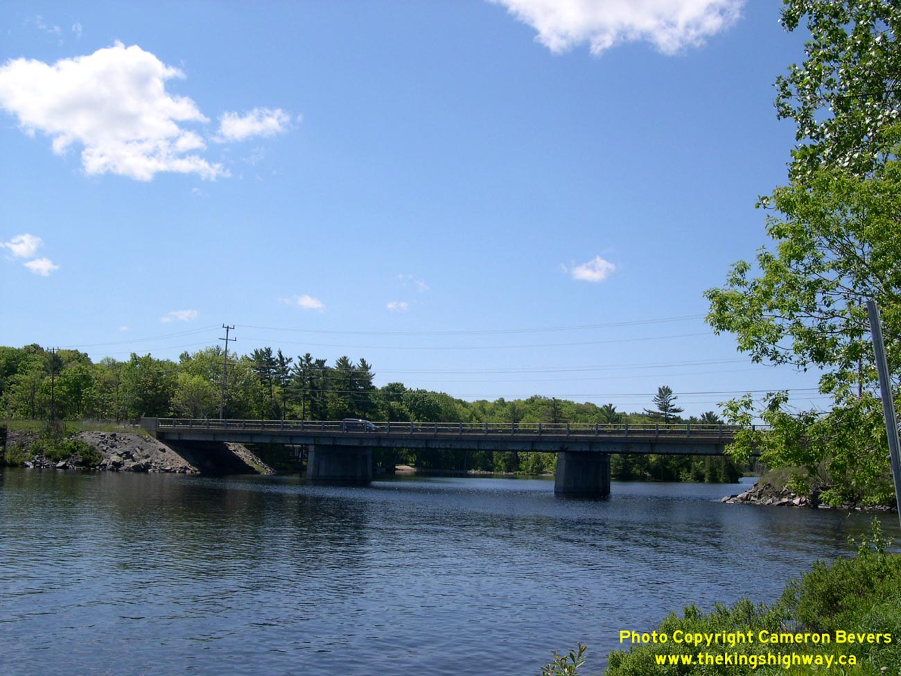

Left - Old Mill Lake Narrows Bridge on Hwy 69 in Parry Sound in 2004. The single two-lane bridge was replaced with a new twin structure during a multi-year
project which started in 2005. See an Enlarged Photo here. (Photograph taken on June 5, 2004 - © Cameron Bevers) Right - Completed Mill Lake Narrows Bridges on Hwy 69 & Hwy 400 in Parry Sound in 2011. See an Enlarged Photo here. (Photograph taken on June 10, 2011 - © Cameron Bevers) 

Left - Facing south along Hwy 69 at Mill Lake Narrows from Hall's Road in Parry Sound in 2004. See an
Enlarged Photo here. (Photograph taken on June 5, 2004 - © Cameron Bevers) Right - View of Mill Lake Narrows on Hwy 69 from Hall's Road in 2006, just as construction was getting underway. The Hall's Road intersection in the foreground was closed off permanently during the construction of the new four-lane highway. Traffic can now access Hall's Road from the Parry Sound Drive Interchange. See an Enlarged Photo here. (Photograph taken on August 5, 2006 - © Cameron Bevers) 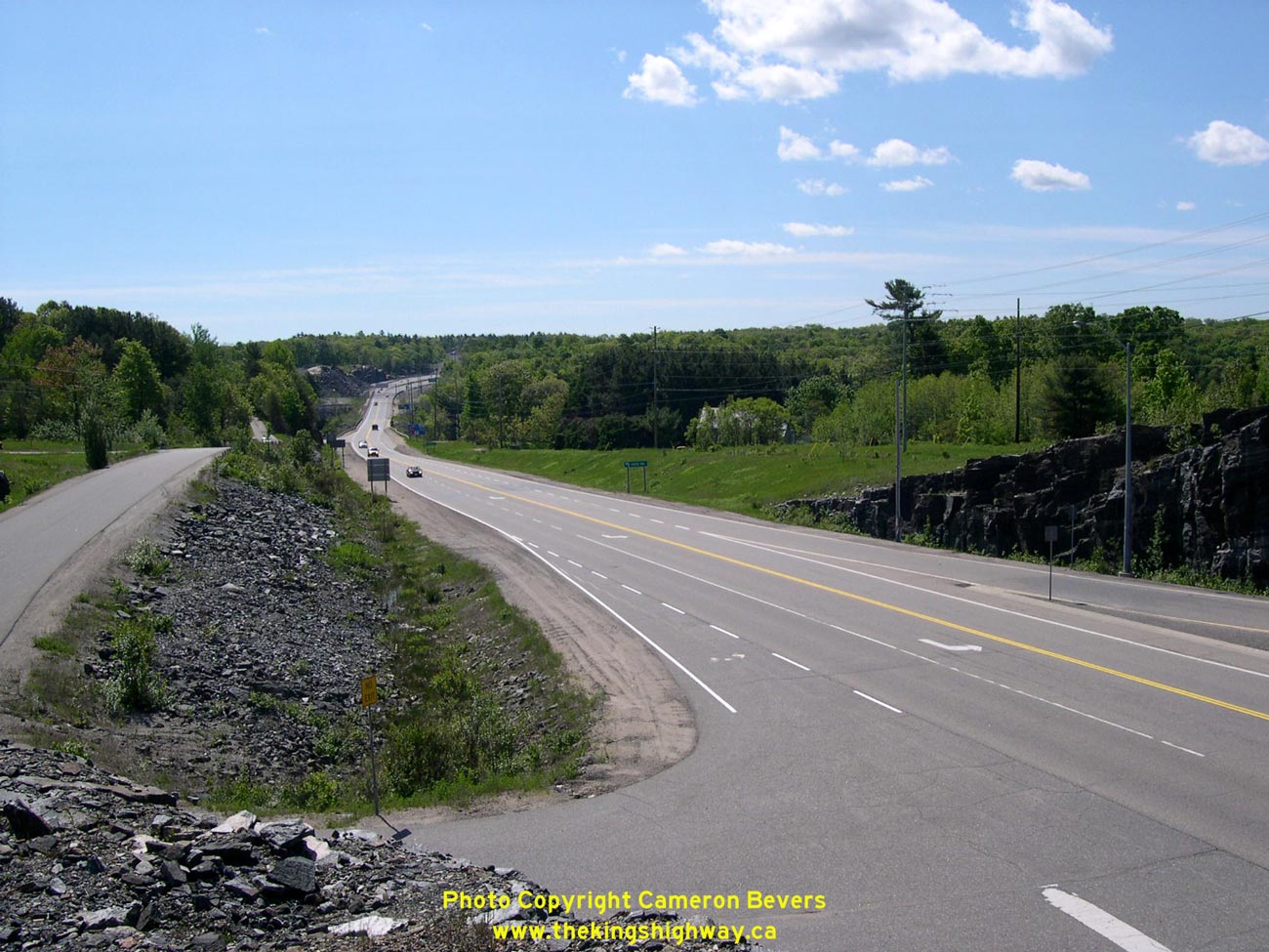

Left - Facing south along Hwy 69 towards Mill Lake Narrows from Parry Sound Drive prior to the start of construction. At the time this photo was taken in 2004,
Parry Sound Drive met Hwy 69 at an at-grade intersection. The intersection was closed and replaced with a grade-separated interchange during the construction of the
new four-lane highway. See an Enlarged Photo here. (Photograph taken on June 5, 2004 - © Cameron Bevers) Right - View of the twin Mill Lake Narrows Bridges on Hwy 69 & Hwy 400 following construction in 2011. A new service road (Hall's Quarry Road) was built along the eastern side of the freeway to provide access to the properties on the north side of Mill Lake along former Hall's Road. See an Enlarged Photo here. (Photograph taken on June 10, 2011 - © Cameron Bevers) 

Left - View of the Hwy 69 and Parry Sound Drive Intersection before construction in 2004, facing south towards Mill Lake Narrows. A new grade-separated
interchange was constructed immediately to the north of this intersection as part of the four-laning of Hwy 69. Until the early 1990s, Parry Sound Drive was actually
the route of Hwy 69. The North Parry Sound Bypass (Hwy 69 New) replaced the former highway's route between Parry Sound and the south entrance to the community of
Nobel in 1992. See an Enlarged Photo here. (Photograph taken on June 5, 2004 - © Cameron Bevers) Right - New Parry Sound Drive Overpass under construction on Hwy 69 in 2006. The new Parry Sound Drive Overpass is a post-tensioned concrete structure. Bridges of this design are built using cast-in-place concrete which requires the assembly of an intricate system of falsework to support the concrete during curing. This makes post-tensioned bridges rather interesting to observe while they are being built. Post-tensioned structures tend to be aesthetically pleasing, when compared to plain girder-type bridges. See an Enlarged Photo here. (Photograph taken on August 5, 2006 - © Cameron Bevers) 

Left - Facing south along the future northbound lanes of Hwy 69 from the new Parry Sound Drive Overpass in 2007. See an
Enlarged Photo here. (Photograph taken on June 10, 2007 - © Cameron Bevers) Right - View of existing Hwy 69 in 2007, facing south from the Parry Sound Drive Overpass towards Mill Lake Narrows. The at-grade intersection at Hwy 69 and Parry Sound Drive was still in use at the time this photo was taken. Once the future northbound lanes of Hwy 69 were completed at left, all traffic was diverted onto the new road while existing Hwy 69 was subsequently reconstructed. Ultimately, the existing Hwy 69 seen here will become the southbound lanes of the new four-lane highway. See an Enlarged Photo here. (Photograph taken on June 10, 2007 - © Cameron Bevers) 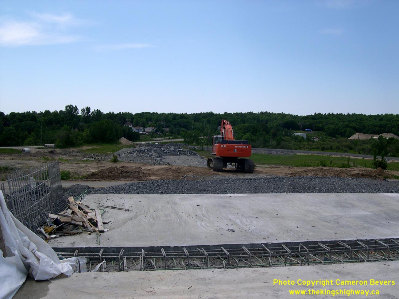

Left - Facing west along future Parry Sound Drive from the new overpass at Hwy 69 in 2007. Parry Sound Drive had to be relocated a fair distance to the north
in order to provide enough space for an on-ramp to the southbound lanes of the new four-lane highway in the southwest interchange quadrant. At the time this photo was
taken, only rough grading had commenced on the diversion of Parry Sound Drive. The existing route of Parry Sound Drive (Old Hwy 69) can be seen in the distance. See
an Enlarged Photo here. (Photograph taken on June 10, 2007 - © Cameron Bevers) Right - Facing north along Hwy 69 towards Nobel from the site of the future Parry Sound Drive Overpass during construction in 2006. Note the rock cut and grading underway for the future northbound lanes at right and the North Road Overpass spanning existing Hwy 69 in the distance. See an Enlarged Photo here. (Photograph taken on August 5, 2006 - © Cameron Bevers) 

Left - View of existing Hwy 69 at the Parry Sound Drive Overpass in 2007, facing north towards Nobel. See an
Enlarged Photo here. (Photograph taken on June 10, 2007 - © Cameron Bevers) Right - Facing north along the future northbound lanes of Hwy 69 from the new Parry Sound Drive Overpass in 2007. See an Enlarged Photo here. (Photograph taken on June 10, 2007 - © Cameron Bevers) 

Left - View of Hwy 69 near Parry Sound Drive in 2007, facing north towards Nobel. Note the new North Road Overpass under construction in the background. See an
Enlarged Photo here. (Photograph taken on June 10, 2007 - © Cameron Bevers) Right - Facing south along Hwy 69 between North Road and Parry Sound Drive in 2006. The rock clearing at left is for the future northbound lanes of the highway. See an Enlarged Photo here. (Photograph taken on August 5, 2006 - © Cameron Bevers) 

Left - View of the North Parry Sound Bypass (Hwy 69) in 2004, facing south towards Mill Lake Narrows near North Road. Initial construction began on this
two-lane bypass in 1988, in order to relieve traffic congestion along existing Hwy 69 (now Parry Sound Drive). The North Parry Sound Bypass was built with a full
grade-separated interchange at Hwy 124, and a grade-separated crossing at North Road. The North Parry Sound Bypass opened to traffic in 1992, after four years of
construction. See an Enlarged Photo here. (Photograph taken on June 5, 2004 - © Cameron Bevers) Right - Facing south along Hwy 69 from the North Road Overpass. The adjacent Parry Sound Drive Interchange was starting to take form at the time this photo was taken in 2007. A temporary median crossover was designed to allow staged traffic on the future northbound lanes to access the exit while the southbound lanes (existing Hwy 69) were rebuilt. See an Enlarged Photo here. (Photograph taken on June 10, 2007 - © Cameron Bevers) 

Left - Facing south along the two-lane North Parry Sound Bypass (Hwy 69) from the North Road Overpass in 2004, before the start of construction. A new
four-lane highway was completed and opened to traffic through this area in 2010. Compare this 2004 photo to the 2011 photo at right, showing the new four-lane
highway. See an Enlarged Photo here. (Photograph taken on June 5, 2004 - © Cameron Bevers) Right - Facing south along the completed four-lane Hwy 69 & Hwy 400 from the North Road Overpass in Parry Sound in 2011. See an Enlarged Photo here. (Photograph taken on June 10, 2011 - © Cameron Bevers) 

Left - View of the old North Road Overpass on Hwy 69 in 2006, shortly before being demolished. This single-span steel beam structure was built over the
two-lane North Parry Sound Bypass (Hwy 69 New) in 1990. The old structure was demolished and reconstructed in 2006-2007 to make way for the new four-lane highway,
along with speed-change lanes for the adjacent Parry Sound Drive Interchange. See an
Enlarged Photo here. (Photograph taken on August 5, 2006 - © Cameron Bevers) Right - Permanent North Road Overpass on Hwy 69 under construction in 2007. The new bridge is a two-span post-tensioned concrete structure. See an Enlarged Photo here. (Photograph taken on June 10, 2007 - © Cameron Bevers) 

Left - Temporary North Road Overpass on Hwy 69 in 2007. The temporary structure was a three-span Bailey Bridge. It is very unusual to see a Bailey Bridge used
to span a freeway construction site. Typically, Bailey Bridge installations are used for temporary roadside diversions during reconstruction of a bridge over a small
creek or river. The use of the Bailey Bridge allowed the North Road Overpass to be reconstructed on its original alignment, without the need to permanently divert the road
approaches on either side. See an Enlarged Photo here. (Photograph taken on June 10, 2007 - © Cameron Bevers) Right - Approach to the temporary North Road Overpass on Hwy 69 in 2007. Temporary traffic signals alternated one-way traffic across the single lane Bailey Bridge. See an Enlarged Photo here. (Photograph taken on June 10, 2007 - © Cameron Bevers) 

Left - Facing north along Hwy 69 towards Nobel from the North Road Overpass in 2004, prior to construction start. See an
Enlarged Photo here. (Photograph taken on June 5, 2004 - © Cameron Bevers) Right - Widening of Hwy 69 at North Road in Parry Sound during construction in 2006. Note the removal of the rock face at right to make way for the northbound lanes of the new four-lane highway. Upon project completion, existing Hwy 69 will become the southbound lanes of the four-lane highway. The amount of rock removed from this cut was quite remarkable! See an Enlarged Photo here. (Photograph taken on August 5, 2006 - © Cameron Bevers) 

Left - Completed four-lane Hwy 69 & Hwy 400 in 2011, facing north from North Road in Parry Sound. See an
Enlarged Photo here. (Photograph taken on June 10, 2011 - © Cameron Bevers) Right - View of the temporary and permanent North Road Bridges on Hwy 69 in Parry Sound in 2007, facing south. See an Enlarged Photo here. (Photograph taken on June 10, 2007 - © Cameron Bevers) 

Left - Another view of the widened rock cut on Hwy 69 between North Road and the Hwy 124 Interchange in 2006. The rock removed from this cut was likely
transported to other areas within the highway project, where fill was required to build up the new highway to the appropriate grade. When designing new highways,
finding the optimal balance between cut and fill can be quite challenging, and requires a great deal of thought. Even the sequence of construction activities will
dictate how much surplus or deficit there is with respect to available fill material. See an
Enlarged Photo here. (Photograph taken on August 5, 2006 - © Cameron Bevers) Right - View of the completed four-lane Hwy 69 & Hwy 400 in 2011, facing north from the North Road Overpass towards the Hwy 124 Interchange. See an Enlarged Photo here. (Photograph taken on June 10, 2011 - © Cameron Bevers)
Continue on to King's Highway 69 Photos: Parry Sound to Britt
|
|---|
Links to Adjacent King's Highway Photograph Pages:
Back to King's Highway 68 Photos /
King's Highway 69 History /
On to King's Highway 70 Photos
Ontario Highway History - Main Menu / Back to List of Highways Website contents, photos & text © 2002-2026, Cameron
Bevers (Webmaster) - All Rights Reserved / Contact Me
|
|---|