
| 
| |
|
|
This page contains present day photos (Year 2000 to date) of Ontario's King's Highway 71, arranged by location from Emo
northerly to Sioux Narrows. All photographs displayed on this page were taken by the Webmaster (Cameron Bevers), unless specifically noted otherwise. Click on any
thumbnail to see a larger image!
Please note that all photographs displayed on this
website are protected by copyright. These photographs must not be reproduced, published,
electronically stored or copied, distributed, or posted onto other websites without
my written permission. If you want to use photos from this website, please
email me first for permission. Thank-you!
|
|---|
|
Page 3: Present Day King's Highway 71 Photographs (Emo to Sioux Narrows)


Left - Facing north along Hwy 71 towards Nestor Falls at Mather Creek (#2) Bridge, located 7 km north of the Hwy 11 Junction. See an
Enlarged Photo here. (Photograph taken on August 27, 2003 - © Cameron Bevers) Right - Western side of the Mather Creek (#2) Bridge on Hwy 71, located 7 km north of the Hwy 11 Junction. Structure completed in 1951. Note the timber beam curbs on the structure. See an Enlarged Photo here. (Photograph taken on August 27, 2003 - © Cameron Bevers) 

Left - Eastern side of the Sturgeon Creek Bridge on Hwy 71. This creosoted timber beam structure was completed in 1951. See an
Enlarged Photo here. (Photograph taken on August 27, 2003 - © Cameron Bevers) Right - Facing north along Hwy 71 towards Nestor Falls at the Sturgeon Creek Bridge, located 9 km north of the Hwy 11 Junction. See an Enlarged Photo here. (Photograph taken on August 27, 2003 - © Cameron Bevers) 

Left - Facing north along Hwy 71 towards Nestor Falls at the Mather Creek (#1) Bridge, located 4 km south of the Hwy 600 & Hwy 615 Junction. See an
Enlarged Photo here. (Photograph taken on August 27, 2003 - © Cameron Bevers) Right - Western side of the Mather Creek (#1) Bridge on Hwy 71, south of the Hwy 600 & Hwy 615 Junction. See an Enlarged Photo here. (Photograph taken on August 27, 2003 - © Cameron Bevers) 
Left - Eastern side of the Mather Creek (#1) Bridge on Hwy 71. This creosoted timber beam structure was completed in 1951. It was one of three nearly
identical timber beam bridges built on the Finland-Emo Diversion in the early 1950s. See an
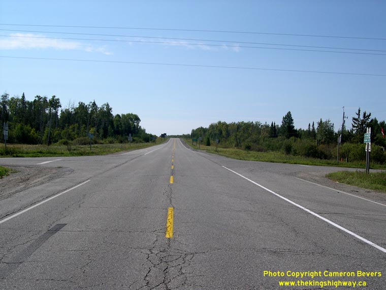
Enlarged Photo here. (Photograph taken on August 27, 2003 - © Cameron Bevers) Right - Facing south along Hwy 71 towards Emo at the Hwy 600 & Hwy 615 Junction near Finland. See an Enlarged Photo here. (Photograph taken on September 3, 2006 - © Cameron Bevers) 

Left - Junction assembly at the Hwy 600 & Hwy 615 Junction on Hwy 71 between Finland and Emo. See an
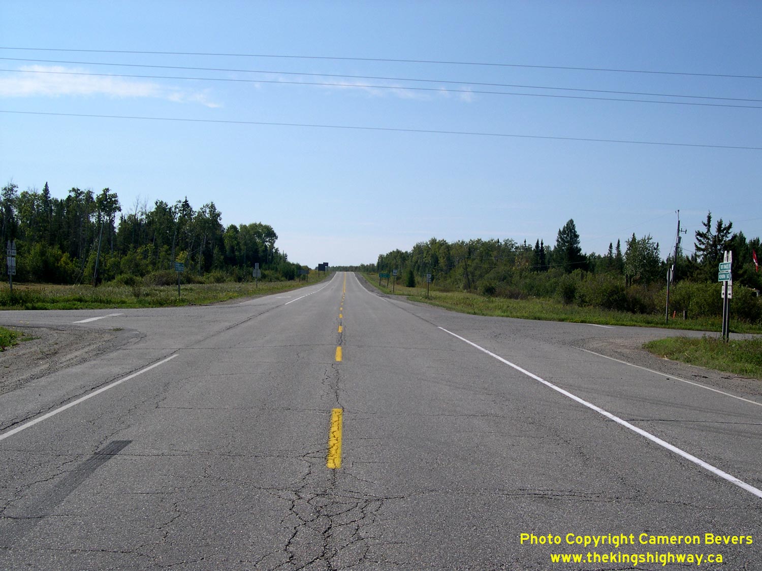
Enlarged Photo here. (Photograph taken on September 3, 2006 - © Cameron Bevers) Right - Facing north along Hwy 71 towards Finland from the Hwy 600 & Hwy 615 Junction. See an Enlarged Photo here. (Photograph taken on September 3, 2006 - © Cameron Bevers) 

Left - Junction assembly at the Hwy 600 & Hwy 615 Junction on Hwy 71 between Finland and Emo. Both Hwy 600 and Hwy 615 reach a common terminus at
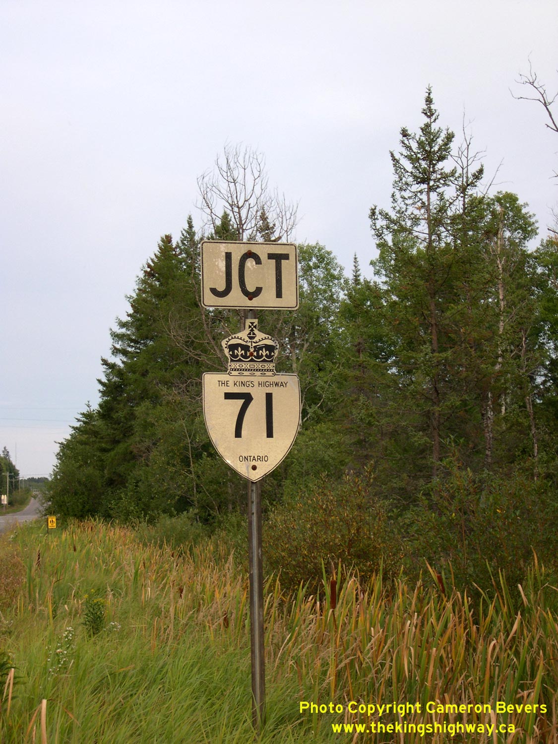
Hwy 71. See an Enlarged Photo here. (Photograph taken on September 2, 2006 - © Cameron Bevers) Right - Junction sign on Hwy 600 approaching the Hwy 71 Junction south of Finland. See an Enlarged Photo here. (Photograph taken on September 2, 2006 - © Cameron Bevers) 

Left - Approaching Off Lake Corners on Hwy 615 (Old Hwy 71), facing east. This rural junction on the original route of the Kenora-Fort Frances Highway was
bypassed in the early 1950s by the Finland-Emo Diversion. Up until 1951, Hwy 71 (previously known as Hwy 70) turned right at this junction and headed south towards
Emo. Today, Hwy 615 turns left and heads north while the old route of Hwy 71 to the right is now a township road called Off Lake Road. See an
Enlarged Photo here. (Photograph taken on September 3, 2006 - © Cameron Bevers) Right - Facing south towards Emo along Off Lake Road (Old Hwy 71) from Off Lake Corners. This road was originally part of the Kenora-Fort Frances Highway. The old highway route was decommissioned following the completion of the Finland-Emo Diversion. See an Enlarged Photo here. (Photograph taken on September 3, 2006 - © Cameron Bevers) 

Left - A piece of historical oil company memorabilia still stands at Off Lake Corners, at the junction of Old Hwy 71 and Hwy 615 north of Emo. This former
Gulf Oil gas station now operates independently, but the old orange gas station sign still remains. Off Lake Corners was a much busier place until the 1950s, when a
new route for Hwy 71 (previously known as Hwy 70) was built between Finland and Emo, which bypassed Off Lake Corners entirely. See an
Enlarged Photo here. (Photograph taken on August 27, 2003 - © Cameron Bevers) Right - Facing north along Hwy 71 towards Nestor Falls, 11 km south of Caliper Lake. See an Enlarged Photo here. (Photograph taken on September 3, 2006 - © Cameron Bevers) 

Left - The Log River Bridge stands mid-way through this beautiful reverse curve on Hwy 71 south of Nestor Falls. See an
Enlarged Photo here. (Photograph taken on September 3, 2006 - © Cameron Bevers) Right - Eastern side of the Log River Bridge on Hwy 71 between Nestor Falls and Finland. Structure completed in 1939. See an Enlarged Photo here. (Photograph taken on September 3, 2006 - © Cameron Bevers) 

Left - Western side of the Log River Bridge on Hwy 71 between Nestor Falls and Finland. See an
Enlarged Photo here. (Photograph taken on September 3, 2006 - © Cameron Bevers) Right - Curb inscription on the Log River Bridge on Hwy 71 - "THE KING'S HIGHWAY 1939". See an Enlarged Photo here. (Photograph taken on September 3, 2006 - © Cameron Bevers) 

Left - Facing north along Hwy 71 towards Nestor Falls at the Log River Bridge. See an
Enlarged Photo here. (Photograph taken on September 3, 2006 - © Cameron Bevers) Right - Close-up of the concrete and steel handrail design on the western side of Log River Bridge south of Nestor Falls. See an Enlarged Photo here. (Photograph taken on September 3, 2006 - © Cameron Bevers) 

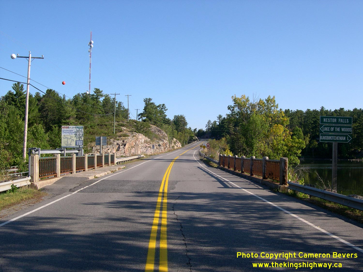
Left - Facing north along Hwy 71 towards Nestor Falls at Kakibikitchiwan Lake. The section of Hwy 71 through the Nestor Falls area is among the most beautiful
sections of highway in Northwestern Ontario. See an Enlarged Photo here. (Photograph taken on September 3, 2006 - © Cameron Bevers) Right - Hwy 71 at Nestor Falls, facing south. At Nestor Falls, Kakibikitchiwan Lake (at left) drains into Lake of the Woods (at right) through a small waterfall. See an Enlarged Photo here. (Photograph taken on September 3, 2006 - © Cameron Bevers) 

Left - Eastern side of the Nestor Falls Bridge on Hwy 71. This single-span concrete rigid frame bridge was completed in 1939. See an
Enlarged Photo here. (Photograph taken on September 3, 2006 - © Cameron Bevers) Right - Nestor Falls Bridge on Hwy 71, facing south towards Finland. See an Enlarged Photo here. (Photograph taken on September 3, 2006 - © Cameron Bevers) 

Left - Nestor Falls Bridge on Hwy 71, facing north towards Sioux Narrows. See an
Enlarged Photo here. (Photograph taken on September 3, 2006 - © Cameron Bevers) Right - Close-up of the concrete and steel handrail design on the western side of Nestor Falls Bridge. See an Enlarged Photo here. (Photograph taken on August 26, 2003 - © Cameron Bevers) 

Left - Facing north along Hwy 71 towards Sioux Narrows from the northern entrance to Nestor Falls. See an
Enlarged Photo here. (Photograph taken on September 3, 2006 - © Cameron Bevers) Right - Approaching Nestor Falls on Hwy 71, facing south near Lake of the Woods. See an Enlarged Photo here. (Photograph taken on September 3, 2006 - © Cameron Bevers) 
Above - Abandoned alignment of Hwy 71 about 16 km north of Nestor Falls. Note the new highway at right. (Photograph taken in August 2001 - © Cameron Bevers) 

Left - Heenan Highway historical plaque at the Muskie Bay Picnic Area on Hwy 71 north of Crow Lake. The plaque commemorates the dedication of the
Kenora-Fort Frances Highway as the Heenan Highway in 1936. The route was named after Peter Heenan, Minister of Lands and Forests, who had been a
long-standing proponent of highway construction in Northern Ontario in Mitch Hepburn's Government. The Heenan Highway was officially designated as King's Highway 70
in 1937, when the Department of Highways assumed responsibility for Trunk Roads in Northern Ontario. In 1960, Hwy 70 was renumbered as Hwy 71. See an
Enlarged Photo here. (Photograph taken on August 26, 2003 - © Cameron Bevers) Right - Abandoned Hwy 71 alignment at Yukon Lake, south of Sioux Narrows. This lengthy former alignment of Hwy 71 was bypassed during a massive highway reconstruction project south of Sioux Narrows in the early 1970s. The former highway alignment at Yukon Lake has been closed to traffic since 1972. See an Enlarged Photo here. (Photograph taken on August 26, 2003 - © Cameron Bevers) 

Left - The old Hwy 71 alignment at Yukon Lake continues through the bush for almost 7 km, before reemerging back at the current highway. See an
Enlarged Photo here. (Photograph taken on August 26, 2003 - © Cameron Bevers) Right - The old Yukon Lake portion of Hwy 71 passes six small lakes along its route. See an Enlarged Photo here. (Photograph taken on August 26, 2003 - © Cameron Bevers) 
Above - Parts of the old white centre line are still visible through this sharp "S" bend on the abandoned portion of Hwy 71 near Yukon Lake, south
of Sioux Narrows. See an Enlarged Photo here. (Photograph taken on August 26, 2003 - © Cameron Bevers)
Continue on to King's Highway 71 Photos: Sioux Narrows to Kenora
|
|---|
Links to Adjacent King's Highway Photograph Pages:
Back to King's Highway 70 Photos /
King's Highway 71 History /
On to King's Highway 72 Photos
Ontario Highway History - Main Menu / Back to List of Highways Website contents, photos & text © 2002-2026, Cameron
Bevers (Webmaster) - All Rights Reserved / Contact Me
|
|---|