
| 
| |
|
|
This page contains present day photos (Year 2000 to date) of Ontario's King's Highway 71, arranged by location from Fort
Frances westerly to Emo. All photographs displayed on this page were taken by the Webmaster (Cameron Bevers), unless specifically noted otherwise. Click on any
thumbnail to see a larger image!
Please note that all photographs displayed on this
website are protected by copyright. These photographs must not be reproduced, published,
electronically stored or copied, distributed, or posted onto other websites without
my written permission. If you want to use photos from this website, please
email me first for permission. Thank-you!
|
|---|
|
Page 2: Present Day King's Highway 71 Photographs (Fort Frances to Emo)


Left - Ground-mounted guide signs for Hwy 11 & Hwy 71 at the exit from the International Bridge in Fort Frances. See an
Enlarged Photo here. (Photograph taken on September 3, 2006 - © Cameron Bevers) Right - Great River Road tourism sign on Hwy 11 & Hwy 71 near the Fort Frances International Bridge. See an Enlarged Photo here. (Photograph taken on September 3, 2006 - © Cameron Bevers) 

Left - Overhead guide signs for Hwy 11 & Hwy 71 at the exit from the International Bridge in Fort Frances. See an
Enlarged Photo here. (Photograph taken on September 3, 2006 - © Cameron Bevers) Right - Overhead guide sign on Hwy 11 & Hwy 71 at the Fort Frances International Bridge Entrance. See an Enlarged Photo here. (Photograph taken on September 3, 2006 - © Cameron Bevers) 

Left - Junction signs for Hwy 11 & Hwy 71 in Downtown Fort Frances. See an
Enlarged Photo here. (Photograph taken on September 3, 2006 - © Cameron Bevers) Right - Hwy 11 & Hwy 71 King's Highway route markers in Fort Frances. See an Enlarged Photo here. (Photograph taken on September 3, 2006 - © Cameron Bevers) 

Left - A portion of Hwy 11 & Hwy 71 in Fort Frances is appropriately named "King's Highway". See an
Enlarged Photo here. (Photograph taken on August 22, 2003 - © Cameron Bevers) Right - Facing west along Hwy 11 & Hwy 71 in Fort Frances. See an Enlarged Photo here. (Photograph taken on September 3, 2006 - © Cameron Bevers) 

Left - Facing east along Hwy 11 & Hwy 71 in Fort Frances. See an
Enlarged Photo here. (Photograph taken on September 3, 2006 - © Cameron Bevers) Right - Facing west towards Emo along Hwy 11 & Hwy 71 in Fort Frances. See an Enlarged Photo here. (Photograph taken on September 3, 2006 - © Cameron Bevers) 

Left - Facing east along Hwy 11 & Hwy 71, about 1 km west of Fort Frances. See an
Enlarged Photo here. (Photograph taken on September 3, 2006 - © Cameron Bevers) Right - Tree-lined section of Hwy 11 & Hwy 71, about 2 km west of Fort Frances. This wonderful stretch of highway extends for about 4 km west of Downtown Fort Frances. It is very rare to see trees lining a King's Highway today. Most roadside trees were cut down in the 1950s and 1960s, as part of highway "improvement" projects. While the trees are a potential collision hazard, they greatly enhance the aesthetics of the road environment. The placement of a steel beam guide rail along the road would prevent the possibility of tree collisions, while still preserving the pleasant atmosphere of this stretch of highway. It is very unfortunate that this strategy was not employed decades earlier on other Ontario highways, before millions of roadside trees were stripped and extirpated from the landscape in a hasty approach to improving highway safety. See an Enlarged Photo here. (Photograph taken on September 3, 2006 - © Cameron Bevers) 

Left - Facing east along Hwy 11 & Hwy 71, about 3 km west of Fort Frances. See an
Enlarged Photo here. (Photograph taken on September 3, 2006 - © Cameron Bevers) Right - Hwy 11 & Hwy 71 at the Western Town Limits of Fort Frances, facing east. See an Enlarged Photo here. (Photograph taken on September 3, 2006 - © Cameron Bevers) 

Left - Facing east towards Fort Frances at the La Vallee River Bridge on Hwy 11 & Hwy 71. See an
Enlarged Photo here. (Photograph taken on August 28, 2003 - © Cameron Bevers) Right - Facing west towards Emo at the La Vallee River Bridge on Hwy 11 & Hwy 71. See an Enlarged Photo here. (Photograph taken on August 28, 2003 - © Cameron Bevers) 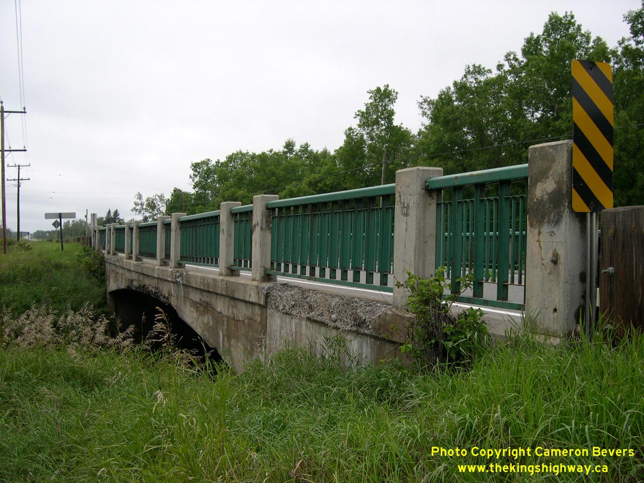

Left - Southern side of the La Vallee River Bridge on Hwy 11 & Hwy 71 east of Emo. See an
Enlarged Photo here. (Photograph taken on August 28, 2003 - © Cameron Bevers) Right - Date stamp on the La Vallee River Bridge on Hwy 11 & Hwy 71 - "THE KING'S HIGHWAY 1938". See an Enlarged Photo here. (Photograph taken on August 28, 2003 - © Cameron Bevers) 

Left - Northern side of the La Vallee River Bridge. This single span concrete rigid frame structure was completed in 1938. See an
Enlarged Photo here. (Photograph taken on August 28, 2003 - © Cameron Bevers) Right - Facing west along Hwy 11 & Hwy 71 at the Hwy 611 South Junction at Crozier. See an Enlarged Photo here. (Photograph taken on September 3, 2006 - © Cameron Bevers) 

Left - Junction signs at the Hwy 611 and Hwy 11 & Hwy 71 Junction at Crozier. See an
Enlarged Photo here. (Photograph taken on September 3, 2006 - © Cameron Bevers) Right - Facing west along Hwy 11 & Hwy 71 from the Hwy 611 South Junction at Crozier. See an Enlarged Photo here. (Photograph taken on September 3, 2006 - © Cameron Bevers) 

Left - Facing east along Hwy 11 & Hwy 71 from the Hwy 611 South Junction at Crozier. See an
Enlarged Photo here. (Photograph taken on September 3, 2006 - © Cameron Bevers) Right - Facing north along Hwy 613 towards the Hwy 11 & Hwy 71 Junction at Devlin. See an Enlarged Photo here. (Photograph taken on September 3, 2006 - © Cameron Bevers) 

Left - A very rare instance: Three Ontario highways following the same route (Hwy 11, Hwy 71 & Hwy 611). See an
Enlarged Photo here. (Photograph taken on September 3, 2006 - © Cameron Bevers) Right - Junction signs at Hwy 613 and Hwy 11 & Hwy 71 at Devlin. See an Enlarged Photo here. (Photograph taken on September 3, 2006 - © Cameron Bevers) 
Above - Blue municipality sign for Emo on Hwy 11 & Hwy 71. Emo is the only sizeable town between Fort Frances and Rainy River. See an
Enlarged Photo here. (Photograph taken on September 3, 2006 - © Cameron Bevers)
Continue on to King's Highway 71 Photos: Emo to Sioux Narrows
|
|---|
Links to Adjacent King's Highway Photograph Pages:
Back to Hwy 71 - Historical Photos (1936 to 1999)
Hwy 71 Photo Index
On to Hwy 71 - Emo to Sioux Narrows
Back to King's Highway 70 Photos /
King's Highway 71 History /
On to King's Highway 72 Photos
Ontario Highway History - Main Menu / Back to List of Highways Website contents, photos & text © 2002-2026, Cameron
Bevers (Webmaster) - All Rights Reserved / Contact Me
|
|---|