
| 
|  |
|
|
This page contains historical and present day photos of Ontario's King's Highway 93. All photographs displayed on
this page were taken by the Webmaster (Cameron Bevers), unless specifically noted otherwise. Historical photographs are arranged in approximate chronological order,
while present day photographs (Year 2000 to date) are arranged by location from south to north. Click on any thumbnail to see a larger image!
Please note that all photographs displayed on this
website are protected by copyright. These photographs must not be reproduced, published,
electronically stored or copied, distributed, or posted onto other websites without
my written permission. If you want to use photos from this website, please
email me first for permission. Thank-you!
|
|---|
|
Historical King's Highway 93 Photographs

Above - Facing north along Main Street (Hwy 93, formerly known as Hwy 27) approaching Robert Street in Downtown Penetanguishene in 1941. The Hotel Brule beside
the highway at left operated until recent decades, although the building itself still stands today. Historically, the route of Hwy 27 ended at the Penetanguishene
Harbour Wharf at the bottom of the hill in the background. See an Enlarged Photo Here. Photo
taken in 1941. (Photo from Cameron Bevers' historical photograph collection - Original photographer unknown) 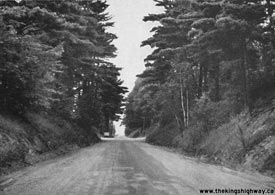

Left - View of Hwy 93 north of Orr Lake, facing north towards Waverley in 1953. See an
Enlarged Photo here. (Photo courtesy of Ontario Ministry of Transportation - © King's Printer for Ontario, 1953) Right - Facing south towards Hillsdale on Hwy 93 just south of Orr Lake in 1953. See an Enlarged Photo here. (Photo courtesy of Ontario Ministry of Transportation - © King's Printer for Ontario, 1953) 
Above - Crown Hill Overpass on Hwy 400 approaching the Hwy 11 & Hwy 93 Interchange north of Barrie in 1968. At this major fork, the Hwy 400 Extension exits
from the freeway and continues north across the overpass towards Coldwater, while the unposted route of Hwy 400A continues straight ahead to Crown Hill, where it
connects with Hwy 11 to Orillia. Note the incredibly retro guide sign at right, marking the upcoming Hwy 93 Exit at Crown Hill. See an
Enlarged Photo Here. Photo taken on August 12, 1968. (Photo courtesy of Ontario Ministry of Transportation - © King's Printer for Ontario, 2019) 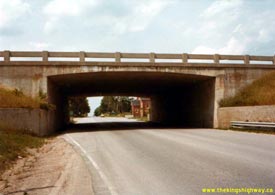
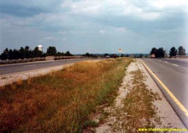
Left - Hwy 93 Underpass on Hwy 11 at the Crown Hill Interchange, facing north towards Midland. See an
Enlarged Photo Here. Photo taken on August 2, 1978. (Photo courtesy of Ontario Ministry of Transportation - © King's Printer for Ontario, 2020) Right - Facing north along Hwy 11 towards Orillia from the Crown Hill Interchange at Hwy 93. See an Enlarged Photo Here. Photo taken on August 2, 1978. (Photo courtesy of Ontario Ministry of Transportation - © King's Printer for Ontario, 2020) 
Above - Facing south along Hwy 400 towards the new Hwy 93 Interchange near Hillsdale (April 29, 1981) (Photo courtesy of Ontario Ministry of Transportation - © King's Printer for Ontario, 2010) 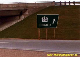
Above - Close-up view of the "angled" turn-off sign marking the exit to Hwy 93 from Hwy 400 South. These signs were used
extensively on Ontario freeways during the 1970s. The angled freeway signs were gradually phased out and replaced with rectangular signs beginning in the
1980s. In my opinion, these angled turn-off signs were an excellent idea. Their unique shape helped drivers to immediately differentiate turn-off signs
from all other rectangular-shaped ground-mounted guide signs on the freeway, even at a considerable distance. These angled signs were particularly useful at
"Parclo-B" interchanges such as the Hwy 93 Interchange, where the exit ramp is hidden on the far side of the grade separation and would therefore be less
apparent to a driver. Photo taken on April 29, 1981. (Photo courtesy of Ontario Ministry of Transportation - © King's Printer for Ontario, 2010) 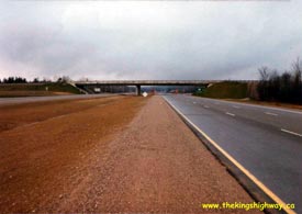
Above - Facing north along Hwy 400 towards the new Hwy 93 Interchange near Hillsdale (April 29, 1981) (Photo courtesy of Ontario Ministry of Transportation - © King's Printer for Ontario, 2010) 
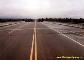
Left - Facing south along Hwy 93 at the Hwy 400 Interchange. Until 1980, these two highways met at an at-grade intersection. Photo taken on April 29, 1981. (Photo courtesy of Ontario Ministry of Transportation - © King's Printer for Ontario, 2010) Right - Facing south across the newly-completed Hwy 93 Overpass on Hwy 400 (April 29, 1981) (Photo courtesy of Ontario Ministry of Transportation - © King's Printer for Ontario, 2010) 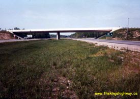
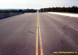
Left - Facing south along Hwy 400 towards the Hwy 93 Interchange near Hillsdale (July, 1983) (Photo courtesy of Ontario Ministry of Transportation - © King's Printer for Ontario, 2010) Right - Facing south across the Hwy 93 Overpass on Hwy 400 near Hillsdale (July, 1983) (Photo courtesy of Ontario Ministry of Transportation - © King's Printer for Ontario, 2010) 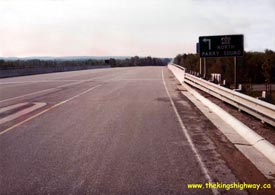
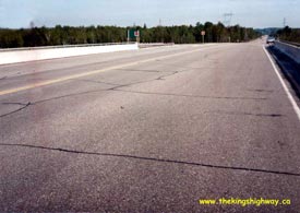
Left - Green guide sign on Hwy 93 marking the ramp to Hwy 400 North (July, 1983) (Photo courtesy of Ontario Ministry of Transportation - © King's Printer for Ontario, 2010) Right - Facing north across the Hwy 93 Overpass on Hwy 400 near Hillsdale (July, 1983) (Photo courtesy of Ontario Ministry of Transportation - © King's Printer for Ontario, 2010) 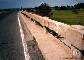
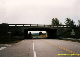
Left - Concrete bar and post railing on the Hwy 93 Underpass on Hwy 11 at Crown Hill (June 24, 1987) (Photo courtesy of Ontario Ministry of Transportation - © King's Printer for Ontario, 2010) Right - Northern side of the Hwy 93 Underpass on Hwy 11 at Crown Hill, facing south towards Barrie (September 15, 1987) (Photo courtesy of Ontario Ministry of Transportation - © King's Printer for Ontario, 2010) 
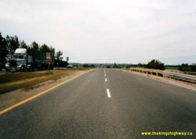
Left - Southern side of the Hwy 93 Underpass on Hwy 11 at Crown Hill, facing north towards Midland (September 15, 1987) (Photo courtesy of Ontario Ministry of Transportation - © King's Printer for Ontario, 2010) Right - Facing south along the southbound lanes of Hwy 11 from the Hwy 93 Interchange at Crown Hill (September 15, 1987) (Photo courtesy of Ontario Ministry of Transportation - © King's Printer for Ontario, 2010) 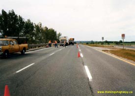

Left - Facing south along the northbound lanes of Hwy 11 from the Hwy 93 Interchange at Crown Hill (September 15, 1987) (Photo courtesy of Ontario Ministry of Transportation - © King's Printer for Ontario, 2010) Right - Facing north along Hwy 400 from the Hwy 93 Overpass near Hillsdale (August 18, 1992) (Photo courtesy of Ontario Ministry of Transportation - © King's Printer for Ontario, 2010) |
|---|
|
Present Day King's Highway 93 Photographs
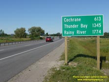
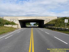
Left - Newly-installed distance guide sign on northbound Hwy 11 near the Crown Hill Interchange, marking the distance to the end of Hwy 11 in Rainy River
along with distances to Cochrane and Thunder Bay. Although it is fairly common to see "end-of-highway" destinations listed on Ontario distance guide signs, this sign
is particularly noteworthy due to the high distances shown on the sign. Hwy 11 is Ontario's second-longest provincial highway, second only to Hwy 17, so the high
distances shown on the sign are entirely attributable to the extreme length of this highway. To the best of my knowledge, this is the highest-mileage distance sign in
Canada, with the furthest destination being almost 1,775 km away. It easily beats out
this sign in Northern British Columbia, showing the distance to Fairbanks, Alaska
(a mere distance of 1,005 km) on the northbound Haines Highway. Personally, I really appreciate this new distance sign on Hwy 11 near Barrie. It serves as a reminder
to Ontario residents of the vast size of this province, and draws some attention to the seldom-explored northern regions of the province. Hopefully, this sign will
prove to be more than just a local curiosity, and encourage passer-bys to consider exploring Ontario's vast north in their future travels. See an
Enlarged Photo Here. (Photograph taken on July 17, 2014 - © Cameron Bevers) Right - Crown Hill Underpass at the Hwy 11 & Hwy 93 Interchange near Barrie, facing north. This single span concrete rigid frame structure was completed in 1951. See an Enlarged Photo Here. (Photograph taken on August 25, 2011 - © Cameron Bevers) 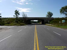
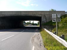
Left - Northern side of the Crown Hill Underpass at the Hwy 11 & Hwy 93 Interchange. This interchange marked the northern terminus of the Toronto-Barrie
Highway (Hwy 400) for several years, before the Coldwater Extension was completed in 1959. Today, the Crown Hill Interchange ensures a seamless transition between
Hwy 400 and the expressway portion of Hwy 11. See an Enlarged Photo Here. (Photograph taken on August 25, 2011 - © Cameron Bevers) Right - Historically, the highway numbering at the Crown Hill Interchange was rather confusing. Up until 1997, the route of Hwy 11 exited from the expressway and passed through the Crown Hill Underpass. From there, Hwy 11 followed Penetanguishene Road south into Downtown Barrie. However, traffic on the expressway above the structure continued south towards Toronto by accessing Hwy 400. Although it was never a posted route number, the short section of highway connecting the Crown Hill Interchange to the Hwy 400 Extension Interchange is known as Hwy 400A. The route of Hwy 400A is signed as Hwy 11 heading northbound and Hwy 400 heading southbound. Between 1938 and 1997, Hwy 93 also terminated at this junction. See an Enlarged Photo Here. (Photograph taken on August 25, 2011 - © Cameron Bevers) 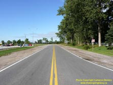

Left - Bi-directional freeway ramp at the Hwy 11 & Hwy 93 Interchange at Crown Hill near Barrie. This ramp also provides access to the Crown Hill MTO
Carpool Lot. See an Enlarged Photo Here. (Photograph taken on August 25, 2011 - © Cameron Bevers) Right - The Crown Hill Interchange ramps on the southbound side of Hwy 11 are in a "Parclo B-4" configuration, with the loop ramp situated on the far side of the grade separation. As a result, there are two exit ramps from Southbound Hwy 11 at this interchange. The directional ramp before the grade separation carries traffic to northbound Hwy 93 only, while the loop ramp on the south side of the grade separation carries traffic bound for Barrie via Penetanguishene Road (Former Hwy 11 South). See an Enlarged Photo Here. (Photograph taken on August 25, 2011 - © Cameron Bevers) 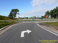
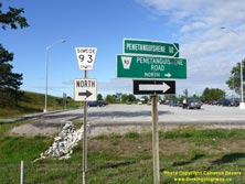
Left - Extra pavement markings and signs have been put in place to discourage drivers from turning left towards Barrie from the first southbound Hwy 11 exit
ramp at Crown Hill. To reach Barrie, drivers are supposed to take the second southbound exit ramp on the south side of the Crown Hill Underpass. These two exits were
a bit more distinctive prior to 1997, when the first exit was signed as Hwy 93 and the second exit was signed as Hwy 11. See an
Enlarged Photo Here. (Photograph taken on August 25, 2011 - © Cameron Bevers) Right - Guide signs marking Simcoe County Road 93 North (Former Hwy 93) at the Crown Hill Interchange on Hwy 11 near Barrie. Simcoe County has maintained Hwy 93 between Crown Hill and the Hwy 400 Interchange near Craighurst since the province transferred its jurisdiction over the highway in 1997. See an Enlarged Photo Here. (Photograph taken on August 25, 2011 - © Cameron Bevers) 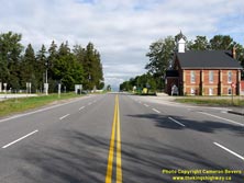
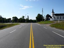
Left - Facing north along Hwy 93 towards Midland from the Crown Hill Interchange on Hwy 11. See an
Enlarged Photo Here. (Photograph taken on August 25, 2011 - © Cameron Bevers) Right - Southern terminus of Hwy 93 at the Crown Hill Interchange on Hwy 11, facing south towards Barrie. See an Enlarged Photo Here. (Photograph taken on August 25, 2011 - © Cameron Bevers) 
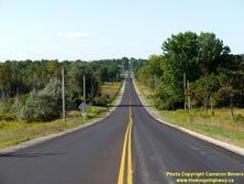
Left - County Road 93 route marker at Crown Hill. Prior to 1997, this route marker indicated Hwy 11 South. After Hwy 11 was downloaded to Simcoe County between
Barrie and Crown Hill, Simcoe County decided to renumber Former Hwy 11 as County Road 93. See an
Enlarged Photo Here. (Photograph taken on August 25, 2011 - © Cameron Bevers) Right - Facing south along Penetanguishene Road (Former Hwy 11) between Barrie and Crown Hill. The highway descends into a steep-sided valley approaching Willow Creek. See an Enlarged Photo Here. (Photograph taken on August 25, 2011 - © Cameron Bevers) 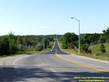

Left - Facing south along Penetanguishene Road (Former Hwy 11) from Crown Hill towards Downtown Barrie. See an
Enlarged Photo Here. (Photograph taken on August 25, 2011 - © Cameron Bevers) Right - Facing north along Penetanguishene Road (Former Hwy 11) approaching the Crown Hill Interchange. Up until 1997, Hwy 11 turned right at this ramp to join the expressway portion of Hwy 11 leading north to Orillia. Penetanguishene Road continues north towards Midland and Penetanguishene as Hwy 93 beyond this interchange. As a result of the 1997-1998 highway downloading, the Crown Hill Interchange now marks the southern terminus of Hwy 11. At one time, Hwy 11 extended south to Toronto. See an Enlarged Photo Here. (Photograph taken on August 25, 2011 - © Cameron Bevers) 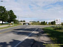
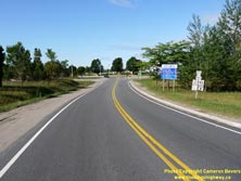
Left - Northbound guide signs on Penetanguishene Road (Former Hwy 11) approaching the Crown Hill Interchange, marking the on-ramps to Hwy 11 North and Hwy 400
South. See an Enlarged Photo Here. (Photograph taken on August 25, 2011 - © Cameron Bevers) Right - Bi-directional freeway ramp at the Hwy 11 & Hwy 93 Interchange at Crown Hill near Barrie. Bi-directional ramps such as this were actually quite common when Hwy 400 was first built, but they are slowly disappearing as interchanges are reconstructed. The Crown Hill Interchange marked the original northern terminus of Hwy 400 before the Coldwater Extension was completed in 1959. See an Enlarged Photo Here. (Photograph taken on August 25, 2011 - © Cameron Bevers) 
Above - Signs marking the former Hwy 11 & Hwy 93 Junction at the Crown Hill Interchange. This is a rare instance where highway downloading actually
improved the route numbering logic. After the province relinquished ownership of Hwy 11 between Barrie and Crown Hill, Simcoe County chose to rename the downloaded
section of Hwy 11 as County Road 93. See an Enlarged Photo Here. (Photograph taken on August 25, 2011 - © Cameron Bevers) 
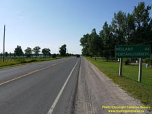
Left - The Crown Hill Interchange ramps on the northbound side of Hwy 11 are in a "Parclo B-2" configuration, with the loop ramp situated on the far side of
the grade separation. The interchange was designed this way in order to avoid disturbing a church in the southeast quadrant of the interchange. See an
Enlarged Photo Here. (Photograph taken on August 25, 2011 - © Cameron Bevers) Right - Distance guide sign on northbound Hwy 93 just north of Hwy 11 at the Crown Hill Interchange. See an Enlarged Photo Here. (Photograph taken on July 17, 2014 - © Cameron Bevers) 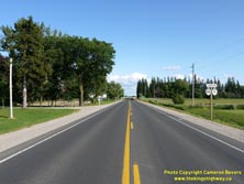

Left - Facing south along Hwy 93 towards the Crown Hill Interchange. Note the junction sign at right, indicating the upcoming highway interchange.
See an Enlarged Photo Here. (Photograph taken on July 17, 2014 - © Cameron Bevers) Right - Junction sign assembly on southbound Hwy 93 approaching the Hwy 11 Interchange at Crown Hill. This recently-installed sign assembly makes use of a full "Junction" sign tab, which has been a relatively uncommon signing practice on provincial highways in recent years. See an Enlarged Photo Here. (Photograph taken on July 17, 2014 - © Cameron Bevers) 

Left - Facing north along Hwy 93 between Hillsdale and Orr Lake. See an
Enlarged Photo here. (Photograph taken on August 2, 2007 - © Cameron Bevers) Right - Hwy 93 at Orr Lake, facing north towards Waverley. See an Enlarged Photo here. (Photograph taken on August 2, 2007 - © Cameron Bevers) 

Left - Facing north along Hwy 93 approaching the Hwy 27 Junction at Waverley. Traffic bound for Midland must continue through this junction via Hwy 93. See an
Enlarged Photo here. (Photograph taken on August 2, 2007 - © Cameron Bevers) Right - Approaching the Hwy 93 Junction at the end of Hwy 27 at Waverley. The through road at this intersection is Simcoe Road 23, which goes to Coldwater. See an Enlarged Photo here. (Photograph taken on August 2, 2007 - © Cameron Bevers) 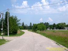
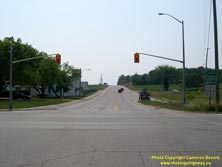
Left - Old alignment of Hwy 27 at the Hwy 93 Junction at Waverley. See an
Enlarged Photo here. (Photograph taken on July 17, 2004 - © Cameron Bevers) Right - Facing south along Hwy 27 from the Hwy 93 Junction at Waverley. See an Enlarged Photo here. (Photograph taken on August 2, 2007 - © Cameron Bevers) 

Left - Facing south along Hwy 93 towards the Hwy 27 Junction in Waverley. From this point, traffic heading south to Barrie can either follow Hwy 93
via Hillsdale and Orr Lake to reach Hwy 400, or follow Hwy 27 via Elmvale and Midhurst. Both routes are about the same distance to Barrie. See an
Enlarged Photo here. (Photograph taken on August 2, 2007 - © Cameron Bevers) Right - Facing north along Hwy 93 between Waverley and Wyebridge. There are several passing lanes along this section of Hwy 93. See an Enlarged Photo here. (Photograph taken on August 2, 2007 - © Cameron Bevers) 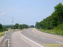

Left - Facing north along Hwy 93 towards Wyebridge. This section of Hwy 93 was completely rebuilt in 2003. See an
Enlarged Photo here. (Photograph taken on August 2, 2007 - © Cameron Bevers) Right - Facing south along Hwy 93 towards Wyebridge, between Midland and Waverley. See an Enlarged Photo here. (Photograph taken on August 2, 2007 - © Cameron Bevers) 

Left - Abandoned curve on Hwy 93 (Old Hwy 27) leading into Midland. This old highway alignment is now a private driveway. See an
Enlarged Photo here. (Photograph taken on July 17, 2004 - © Cameron Bevers) Right - Facing south along Hwy 93 from Midland. On the other side of this valley, Hwy 93 joins Hwy 12 which goes to Orillia. See an Enlarged Photo here. (Photograph taken on August 2, 2007 - © Cameron Bevers) 
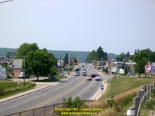
Left - Hwy 93 between Midland and Penetanguishene, facing south. See an
Enlarged Photo here. (Photograph taken on August 2, 2007 - © Cameron Bevers) Right - Facing north along Hwy 93 at the entrance to Penetanguishene. See an Enlarged Photo here. (Photograph taken on August 2, 2007 - © Cameron Bevers)
More King's Highway 93 Photographs Coming Soon!
|
|---|
Links to Adjacent King's Highway Photograph Pages:
Back to King's Highway 92 Photos /
King's Highway 93 History /
On to King's Highway 94 Photos
Ontario Highway History - Main Menu / Back to List of Highways Website contents, photos & text © 2002-2025, Cameron
Bevers (Webmaster) - All Rights Reserved / Contact Me |
|---|