
| 
|  |
|
|
This page contains historical and present day photos of Ontario's King's Highway 92. All photographs displayed on
this page were taken by the Webmaster (Cameron Bevers), unless specifically noted otherwise. Historical photographs are arranged in approximate chronological order,
while present day photographs (Year 2000 to date) are arranged by location from east to west. Click on any thumbnail to see a larger image!
Please note that all photographs displayed on this
website are protected by copyright. These photographs must not be reproduced, published,
electronically stored or copied, distributed, or posted onto other websites without
my written permission. If you want to use photos from this website, please
email me first for permission. Thank-you!
|
|---|
|
Historical King's Highway 92 Photographs

Above - Old Nottawasaga River Bridge at the entrance to Wasaga Beach (ca. 1924). See an
Enlarged Photo here. (Photo from Cameron Bevers' Historical Photograph Collection - Original Photographer Unknown) 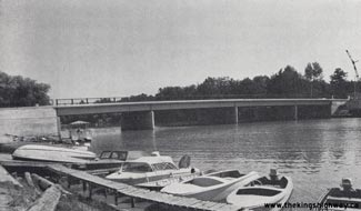
Above - New Nottawasaga River Bridge on Main Street (Hwy 92) in Wasaga Beach in 1961. This new four-span steel girder bridge was completed in the Fall of
1961. It replaced a narrow steel truss bridge with a timber deck on Main Street that dated from the 1920s. Photo taken in 1961. (Photo courtesy of Ontario Ministry of Transportation - © Queen's Printer for Ontario, 1961) 
Above - Circa 1963 postcard view of Main Street (Hwy 92) in Wasaga Beach, facing north from the Nottawasaga River Bridge and Mosley Street. Up until 1964, Hwy 92 reached its
western terminus at this intersection. Main Street continued north from Mosley Street for one block to end at the Wasaga Beach waterfront at Wasaga Avenue (today's
Beach Drive). Beginning in 1964, various different routes of Hwy 92 were established through the village centre and beach area under Municipal Connecting Link
agreements between the Village of Wasaga Beach and the Department of Highways of Ontario (DHO), including the section of Main Street seen here. It wasn't until 1979
that the downtown beach area was bypassed altogether by a new route of Hwy 92, via River Road and the Schoonertown Bridge. In the early morning hours of November 30,
2007, a fire broke out on Main Street. Fanned by howling autumn winds, the flames quickly engulfed Main Street. The devastating 2007 Wasaga Beach Fire destroyed most
of the historic buildings seen in this 1960s-era photo, leaving behind only memories of summer fun browsing those curious Main Street beach shops. See an
Enlarged Photo here. (Photo courtesy of the Canadian Postcard Company Ltd. Toronto) 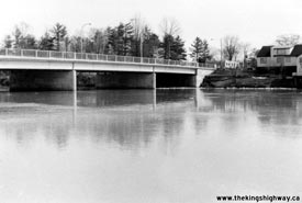
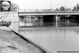
Left - Southern end of the Nottawasaga River Bridge on Main Street (Hwy 92) in Wasaga Beach. Photo taken on March 23, 1976. See an
Enlarged Photo here. (Photo courtesy of Ontario Ministry of Transportation - © Queen's Printer for Ontario, 2018) Right - Northern end of the Nottawasaga River Bridge on Main Street (Hwy 92) in Wasaga Beach. Photo taken on March 23, 1976. See an Enlarged Photo here. (Photo courtesy of Ontario Ministry of Transportation - © Queen's Printer for Ontario, 2018) 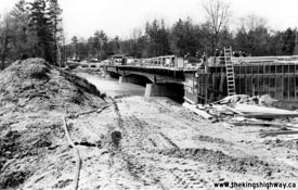

Left - Construction of the Schoonertown Bridge over the Nottawasaga River on proposed Hwy 92 New (River Road) in Wasaga Beach. Photo taken on March 23, 1976. See an
Enlarged Photo here. (Photo courtesy of Ontario Ministry of Transportation - © Queen's Printer for Ontario, 2018) Right - New Schoonertown Bridge under construction over the Nottawasaga River on Hwy 92 New (River Road) in Wasaga Beach. Photo taken on March 23, 1976. See an Enlarged Photo here. (Photo courtesy of Ontario Ministry of Transportation - © Queen's Printer for Ontario, 2018) 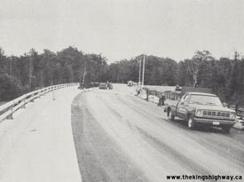
Above - Schoonertown Bridge nearing completion on Hwy 92 New (River Road) in Wasaga Beach, Contract #1975-413 (1976) (Photo courtesy of Ontario Ministry of Transportation - © Queen's Printer for Ontario, 1976) |
|---|
|
Present Day King's Highway 92 Photographs
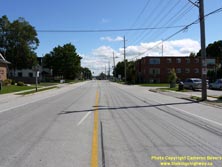

Left - Facing south along Hwy 27 towards Barrie from the Hwy 92 Junction in Elmvale. See an
Enlarged Photo here. (Photograph taken on August 25, 2011 - © Cameron Bevers) Right - Destination guide sign on northbound Hwy 27 approaching the Hwy 92 Junction in Elmvale. It is interesting to note that the destination control city on this sign for Hwy 27 is Penetanguishene, reflecting the highway's historical northern terminus. In 1982, the northern leg of Hwy 27 from Waverley to Penetanguishene was renumbered as Hwy 93. The route of Hwy 27 was then truncated at the Hwy 93 Junction in Waverley. See an Enlarged Photo here. (Photograph taken on August 25, 2011 - © Cameron Bevers) 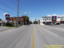
Left - Facing north along Hwy 27 towards the Hwy 92 Junction in Elmvale. See an
Enlarged Photo here. (Photograph taken on August 25, 2011 - © Cameron Bevers) Right - Beginning of Hwy 92 at the Hwy 27 Junction in Elmvale, facing west towards Wasaga Beach. The route of Hwy 92 was first established in 1936, in an effort to improve provincial highway access to the popular summer resort town of Wasaga Beach. The route of Hwy 92 extends from Elmvale westerly to Wasaga Beach, where it connects with Hwy 26. See an Enlarged Photo here. (Photograph taken on August 25, 2011 - © Cameron Bevers) 
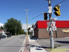
Left - Facing south along Hwy 27 towards the Hwy 92 Junction in Elmvale. See an
Enlarged Photo here. (Photograph taken on August 25, 2011 - © Cameron Bevers) Right - Junction assembly at the intersection of Hwy 27 & Hwy 92 in Elmvale. Both of these highways were transferred to Simcoe County during the mass provincial highway downloading spree which took place in 1997-1998. During that time, thousands of kilometres of provincial highways which were deemed to serve primarily "local purposes" were handed over to municipalities as a provincial cost-cutting measure. See an Enlarged Photo here. (Photograph taken on August 25, 2011 - © Cameron Bevers) 

Left - Eastern terminus of Hwy 92 at the Hwy 27 Junction in Elmvale. These two highways have met at this intersection ever since Hwy 92 was first established
in 1936. As a result of the provincial highway downloading of the 1990s, Simcoe County now maintains jurisdiction over both Hwy 27 and Hwy 92. See an
Enlarged Photo here. (Photograph taken on August 25, 2011 - © Cameron Bevers) Right - Facing north along Hwy 27 towards Waverley from the Hwy 92 Junction in Elmvale. See an Enlarged Photo here. (Photograph taken on August 25, 2011 - © Cameron Bevers) 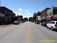

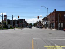
Left - Queen Street (Hwy 92) in Downtown Elmvale, facing west towards Wasaga Beach. See an
Enlarged Photo here. (Photograph taken on August 25, 2011 - © Cameron Bevers) Right - Approaching the eastern terminus of Hwy 92 at the Hwy 27 Junction in Downtown Elmvale. Hwy 92 ends at the traffic signals in the background. See an Enlarged Photo here. (Photograph taken on August 25, 2011 - © Cameron Bevers) 

Left - Facing east across the Wye River Bridge on Hwy 92 in Elmvale. See an
Enlarged Photo here. (Photograph taken on August 25, 2011 - © Cameron Bevers) Right - Wye River Bridge on Hwy 92 in Elmvale, facing west towards Wasaga Beach. See an Enlarged Photo here. (Photograph taken on August 25, 2011 - © Cameron Bevers) 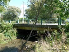

Left - The Wye River Bridge is a single-span steel beam structure, which was completed in 1957. See an
Enlarged Photo here. (Photograph taken on August 25, 2011 - © Cameron Bevers) Right - Facing west along Hwy 92 towards Wasaga Beach from the western entrance to Elmvale. See an Enlarged Photo here. (Photograph taken on August 25, 2011 - © Cameron Bevers) 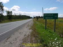

Left - Distance guide sign on westbound Hwy 92, showing the distance to Wasaga Beach. See an
Enlarged Photo here. (Photograph taken on August 25, 2011 - © Cameron Bevers) Right - Facing east along Hwy 92, about 2 km west of the Hwy 27 Junction in Elmvale. See an Enlarged Photo here. (Photograph taken on August 25, 2011 - © Cameron Bevers) 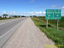
Left - An older green guide sign for Simcoe County Road 29 on eastbound Hwy 92 between Wasaga Beach and Elmvale. See an
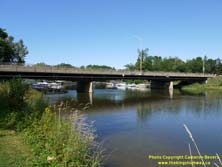
Enlarged Photo here. (Photograph taken on August 25, 2011 - © Cameron Bevers) Right - Southern side of the Schoonertown Bridge on River Road West (Hwy 92) in Wasaga Beach. This three-span steel girder structure was completed in 1976. See an Enlarged Photo here. (Photograph taken on August 25, 2011 - © Cameron Bevers) 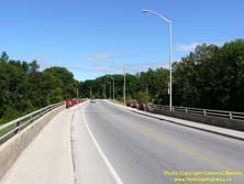
Left - Facing east along River Road West (Hwy 92) towards Elmvale from the Schoonertown Bridge in Wasaga Beach. This section of Hwy 92 was established fairly
recently, as part of a 1979 Municipal Connecting Link agreement between the Ministry of Transportation and Communications (MTC) and the Town of Wasaga Beach. From
1936 up until 1979, Hwy 92 ended in Downtown Wasaga Beach and did not connect to Hwy 26 west of Wasaga Beach. See an
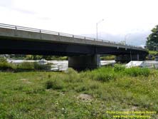
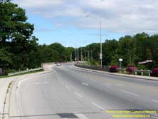
Enlarged Photo here. (Photograph taken on August 25, 2011 - © Cameron Bevers) Right - Northern side of the Schoonertown Bridge on Hwy 92 in Wasaga Beach. This bridge is located on a horizontal curve and thus has a superelevated bridge deck with a transverse crossfall of approximately 4 percent. River Road West was expanded from two lanes to four lanes across the Schoonertown Bridge by the Town of Wasaga Beach in 2015. Fortunately, when the Schoonertown Bridge was first designed back in 1973, engineers had the foresight to design the bridge in such a way that it could be expanded to an ultimate four-lane cross section fairly easily. On the original construction drawings, this bridge is identified as the "Schoonertown Bridge", not the "Schooner Town Bridge" as indicated on the blue mid-span identification sign. See an Enlarged Photo here. (Photograph taken on August 25, 2011 - © Cameron Bevers) 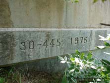
Left - Structure identification number and date stamp (1976) on the Schoonertown Bridge on Hwy 92. See an
Enlarged Photo here. (Photograph taken on August 25, 2011 - © Cameron Bevers) Right - Facing east along River Road West (Hwy 92) towards the Schoonertown Bridge from Mosley Street in Wasaga Beach. The extension of River Road West through Wasaga Beach during the 1970s and early 1980s appears to have been a joint project between the province and the municipality. The MTC constructed the Schoonertown Bridge in 1976, which allowed for through traffic to bypass the congested downtown beach area and provided an improved municipal road connection between Hwy 92 and Hwy 26. Ultimately, River Road West was officially designated as a Municipal Connecting Link portion of Hwy 92 in 1979. See an Enlarged Photo here. (Photograph taken on August 25, 2011 - © Cameron Bevers) 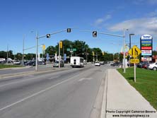

Left - Junction of River Road West (Hwy 92) and Mosley Street, facing east. Prior to the construction of the Schoonertown Bridge in the mid-1970s, Mosley
Street simply curved to the left and headed east into Downtown Wasaga Beach. See an Enlarged Photo here. (Photograph taken on August 25, 2011 - © Cameron Bevers) Right - This "butterfly" overhead sign structure at Mosley Street and River Road West guides through traffic to Hwy 92. This sign structure likely dates from the late 1970s. See an Enlarged Photo here. (Photograph taken on August 25, 2011 - © Cameron Bevers) 

Left - Sign on Hwy 26 marking the junction of Mosley Street (Hwy 92) in Wasaga Beach. See an
Enlarged Photo here. (Photograph taken on October 16, 2009 - © Cameron Bevers) Right - Facing west along Hwy 26 towards Collingwood from the Hwy 92 Junction in Wasaga Beach. See an Enlarged Photo here. (Photograph taken on October 16, 2009 - © Cameron Bevers) 
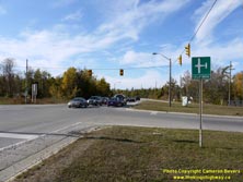
Left - Junction of Hwy 26 and Hwy 92 in Wasaga Beach, facing west towards Collingwood. See an
Enlarged Photo here. (Photograph taken on October 16, 2009 - © Cameron Bevers) Right - The traffic signal heads at the junction of Hwy 26 and Hwy 92 were affixed to overhead cables. Cable-mounted signals are relatively uncommon on provincial highways, except for temporary conditions such as a bridge reconstruction or other roadway improvements where permanent mast-mounted signal heads would be impractical. These traffic signals were removed once a roundabout was built at this junction. See an Enlarged Photo here. (Photograph taken on October 16, 2009 - © Cameron Bevers) 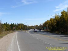
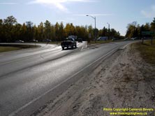
Left - Facing east along Hwy 26 approaching the Hwy 92 Junction in Wasaga Beach. See an
Enlarged Photo here. (Photograph taken on October 16, 2009 - © Cameron Bevers) Right - Facing west along Hwy 92 approaching the Hwy 26 Junction in Wasaga Beach. See an Enlarged Photo here. (Photograph taken on October 16, 2009 - © Cameron Bevers) 

Left - Facing east along Collingwood Airport Road towards the Hwy 26 and Hwy 92 Junction in Wasaga Beach. As part of the adjacent Hwy 26 New construction,
major changes were made to this intersection. Collingwood Airport Road was realigned further to the south, where it intersects Hwy 26 New at a roundabout. The
existing signalized intersection of Hwy 26 and Hwy 92 shown here was also converted into a roundabout. See an
Enlarged Photo here. (Photograph taken on October 16, 2009 - © Cameron Bevers) Right - Hwy 92 (Mosley Street) approaching Wasaga Beach, facing east from the Hwy 26 Junction. See an Enlarged Photo here. (Photograph taken on October 16, 2009 - © Cameron Bevers)
More King's Highway 92 Photographs Coming Soon!
|
|---|
Links to Adjacent King's Highway Photograph Pages:
Back to King's Highway 91 Photos /
King's Highway 92 History /
On to King's Highway 93 Photos
Ontario Highway History - Main Menu / Back to List of Highways Website contents, photos & text © 2002-2025, Cameron
Bevers (Webmaster) - All Rights Reserved / Contact Me |
|---|