
| 
| |
|
|
This page contains historical photos of Ontario's King's Highway 9 dating from 1920 to 1999. All photographs displayed on
this page were taken by the Ontario Ministry of Transportation, unless specifically noted otherwise. Historical photographs are arranged in approximate chronological
order. Click on any thumbnail to see a larger image!
Please note that all photographs displayed on this
website are protected by copyright. These photographs must not be reproduced, published,
electronically stored or copied, distributed, or posted onto other websites without
my written permission. If you want to use photos from this website, please
email me first for permission. Thank-you!
|
|---|
|
Page 1: Historical King's Highway 9 Photographs

Above - Newly reconstructed intersection of Hwy 4 and Hwy 9 facing east, nine miles west of Walkerton in 1952. Note the new channelized right-turn
ramps and left turn lane from Westbound Hwy 9 onto Southbound Hwy 4. Photo taken on October 30, 1952. See an
Enlarged Photo Here. (Photo courtesy of Ontario Ministry of Transportation - © King's Printer for Ontario, 1952) 
Above - Junction of Hwy 4 and Hwy 9 west of Walkerton in 1952, showing new channelized right turn ramps and zone painting. Photo taken on October 30, 1952. See an
Enlarged Photo Here. (Photo courtesy of Ontario Ministry of Transportation - © King's Printer for Ontario, 1952) 
Above - Hwy 400 in 1953, looking north towards Holland Marsh from the King Township Side Road 35 Overpass (now Hwy 9). Photo taken on November 5, 1953. See an
Enlarged Photo Here. (Photo courtesy of Ontario Ministry of Transportation - © King's Printer for Ontario, 1954) 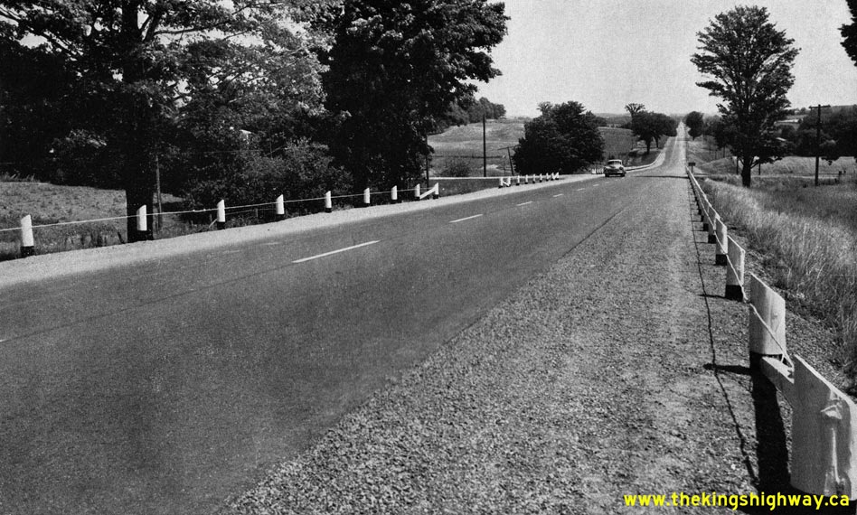
Above - Facing east along Hwy 9, one mile east of Mono Mills in 1955. See an
Enlarged Photo Here. (Photo courtesy of Ontario Ministry of Transportation - © King's Printer for Ontario, 1955) 

Left - King Township Side Road 35 Overpass on Hwy 400 near Newmarket in 1962. Several years after this photo was taken, this township road was assumed by the
province as a new King's Highway. In the late 1960s, this road was incorporated into an extension of Hwy 9 from Schomberg to Newmarket. The Hwy 9 extension to
Newmarket was completed and opened to traffic in 1969, along with a new interchange at Hwy 400. See
an Enlarged Photo Here. Photo taken on May 31, 1962. (Photo courtesy of Ontario Ministry of Transportation - © King's Printer for Ontario, 2012) Right - Facing east towards Newmarket at the King Township Side Road 35 Overpass on Hwy 400 in 1962. This road ultimately became Hwy 9 in the late 1960s, when a new King's Highway was built connecting Schomberg and Newmarket. It may seem hard to believe, but this tiny road is now a busy four-lane arterial highway! Compare this 1962 photo to this Present Day Photo of the same location. See an Enlarged Photo Here. Photo taken on May 31, 1962. (Photo courtesy of Ontario Ministry of Transportation - © King's Printer for Ontario, 2012) 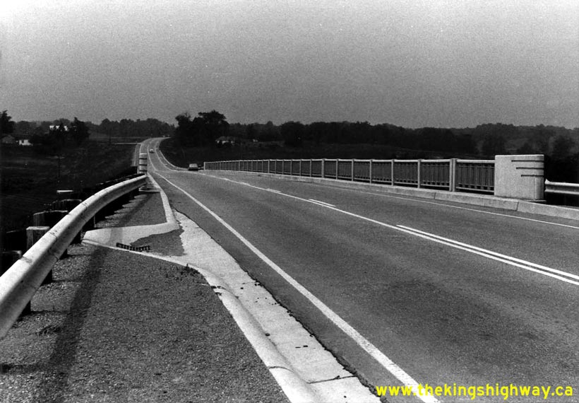

Left - Facing west along Hwy 9 towards Orangeville at the newly-completed Black Horse Railway Overhead near Tottenham (June, 1967) (Photo courtesy of Ontario Ministry of Transportation - © King's Printer for Ontario, 2012) Right - Black Horse Railway Overhead on Hwy 9 near Tottenham, shortly after completion (June, 1967) (Photo courtesy of Ontario Ministry of Transportation - © King's Printer for Ontario, 2012) 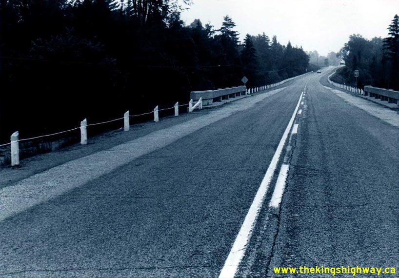
Left - Facing west along Hwy 9 towards Orangeville at the Humber River Bridge at Ballycroy (July, 1967) (Photo courtesy of Ontario Ministry of Transportation - © King's Printer for Ontario, 2012) Right - Humber River Bridge on Hwy 9 at Ballycroy. This small concrete rigid frame bridge was completed in 1950. This was one of the only provincial highway bridges spanning the Humber River that wasn't badly damaged or destroyed by the Hurricane Hazel Flood in October, 1954. Photo taken in July, 1967. (Photo courtesy of Ontario Ministry of Transportation - © King's Printer for Ontario, 2012) 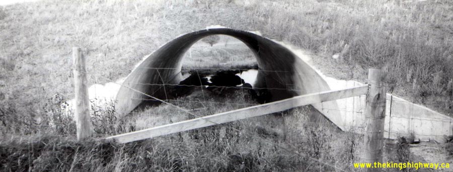
Above - Schomberg Creek Arch Culvert on Hwy 9, west of the Hwy 27 Junction (October 13, 1971) (Photo courtesy of Ontario Ministry of Transportation - © King's Printer for Ontario, 2012) 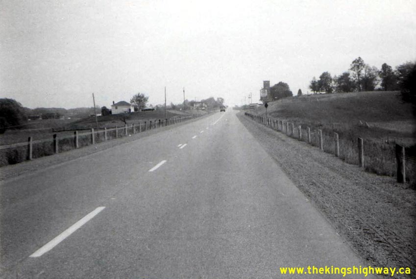
Left - Facing east along Hwy 9 towards Schomberg from the Schomberg Creek Arch Culvert (October 13, 1971) (Photo courtesy of Ontario Ministry of Transportation - © King's Printer for Ontario, 2012) Right - Facing east along Hwy 9 at the West Holland Canal Bridge on Hwy 9 between Schomberg and the Hwy 400 Interchange (October 13, 1971) (Photo courtesy of Ontario Ministry of Transportation - © King's Printer for Ontario, 2012) 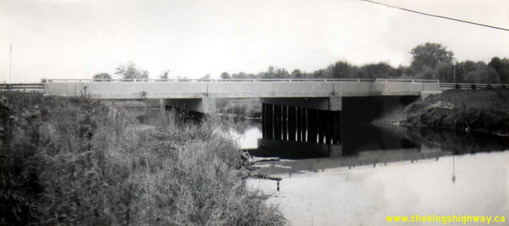
Above - West Holland Canal Bridge on Hwy 9 between Schomberg and the Hwy 400 Interchange (October 13, 1971) (Photo courtesy of Ontario Ministry of Transportation - © King's Printer for Ontario, 2012) 
Left - Facing east along Hwy 9 towards the Hwy 400 Interchange at the Schomberg River Bridge (October 13, 1971) (Photo courtesy of Ontario Ministry of Transportation - © King's Printer for Ontario, 2012) Right - Facing east along Hwy 9 towards the Hwy 400 Interchange at the East Holland Canal Bridge (October 13, 1971) (Photo courtesy of Ontario Ministry of Transportation - © King's Printer for Ontario, 2012) 
Above - East Holland Canal Bridge on Hwy 9 between Schomberg and the Hwy 400 Interchange (October 13, 1971) (Photo courtesy of Ontario Ministry of Transportation - © King's Printer for Ontario, 2012) 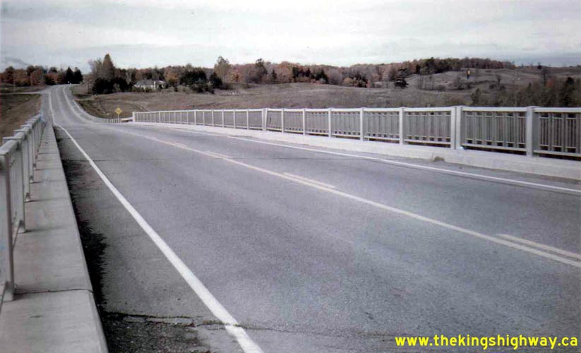
Above - Facing west along Hwy 9 towards Orangeville from the Black Horse Railway Overhead near Tottenham (October 17, 1973) (Photo courtesy of Ontario Ministry of Transportation - © King's Printer for Ontario, 2012) 
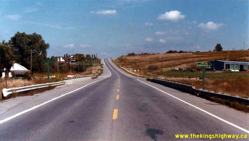
Above - Approaching the Hwy 10 & Hwy 24 Junction on Hwy 9 in Orangeville in 1977. Note the green guide sign at right, showing the concurrent routes of
Hwy 9, Hwy 10 and Hwy 24. Until the Orangeville sections of Hwy 9 and Hwy 24 were downloaded in 1998, this highway junction represented a rare situation where three
King's Highways shared a concurrent route. See an Enlarged Photo Here. Photo taken in November,
1977. (Photo courtesy of Ontario Ministry of Transportation - © King's Printer for Ontario, 2012) 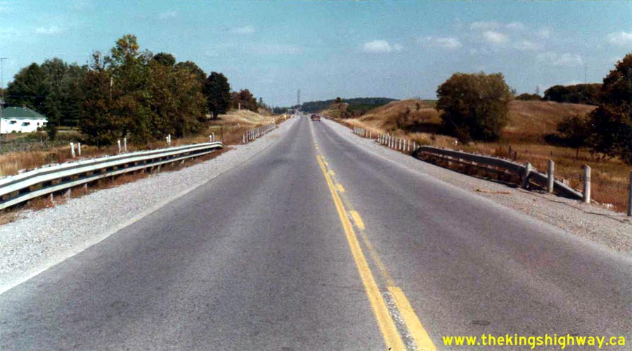
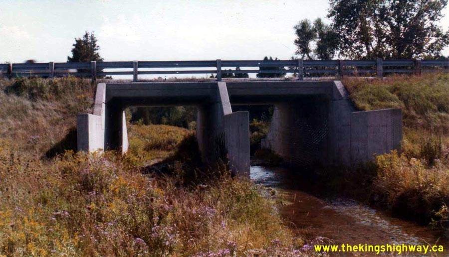
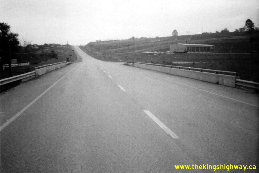
Left - Facing east along Hwy 9 towards Newmarket from Kettleby Creek near the Hwy 400 Interchange (September 26, 1978) (Photo courtesy of Ontario Ministry of Transportation - © King's Printer for Ontario, 2012) Right - Kettleby Creek Culvert on Hwy 9 between the Hwy 400 Interchange and Newmarket (September 26, 1978) (Photo courtesy of Ontario Ministry of Transportation - © King's Printer for Ontario, 2012) 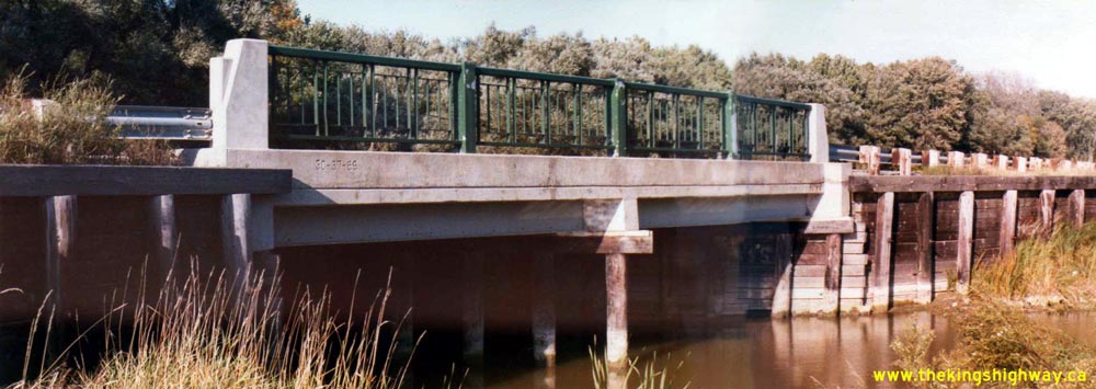
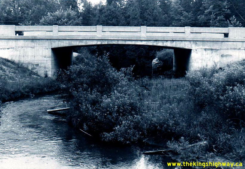
Above - Schomberg River Bridge on Hwy 9 east of Schomberg (September 26, 1978) (Photo courtesy of Ontario Ministry of Transportation - © King's Printer for Ontario, 2012) 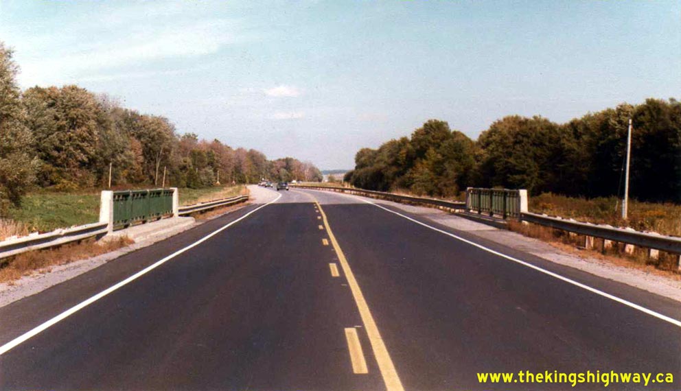
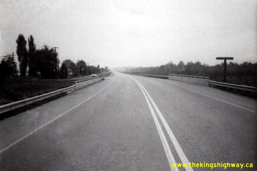
Left - Facing east along Hwy 9 towards the Hwy 400 Interchange at the Schomberg River Bridge (September 26, 1978) (Photo courtesy of Ontario Ministry of Transportation - © King's Printer for Ontario, 2012) Right - Facing east along Hwy 9 towards the Hwy 400 Interchange at the East Holland Canal Bridge (September 26, 1978) (Photo courtesy of Ontario Ministry of Transportation - © King's Printer for Ontario, 2012) 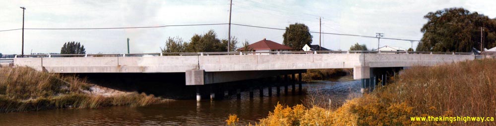
Above - East Holland Canal Bridge on Hwy 9 between Schomberg and the Hwy 400 Interchange (September 26, 1978) (Photo courtesy of Ontario Ministry of Transportation - © King's Printer for Ontario, 2012) 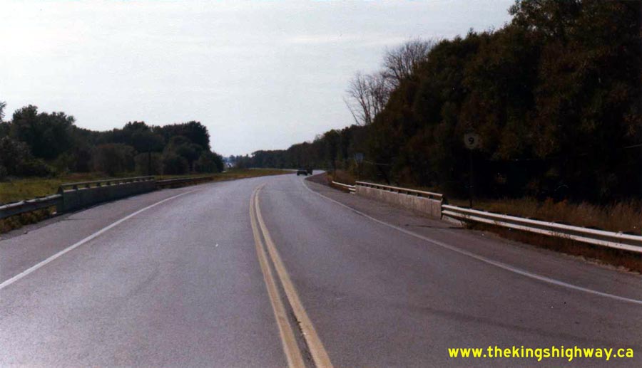
Above - Facing west along Hwy 9 towards Schomberg at the West Holland Canal Bridge (September 26, 1978) (Photo courtesy of Ontario Ministry of Transportation - © King's Printer for Ontario, 2012) 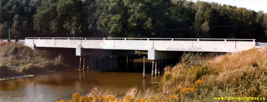
Above - West Holland Canal Bridge on Hwy 9 between Schomberg and the Hwy 400 Interchange (September 26, 1978) (Photo courtesy of Ontario Ministry of Transportation - © King's Printer for Ontario, 2012) 
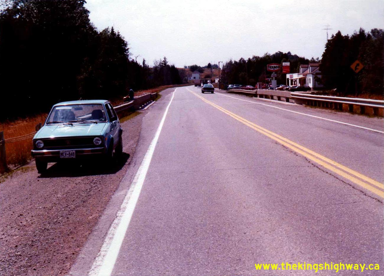
Above - Facing west along Hwy 9 towards the Humber River Bridge, near the Hwy 50 Junction at Ballycroy in 1978. Although it isn't obvious in this photo,
gasoline was selling at 29 cents per litre at the Texaco gas station in the background. See an
Enlarged Photo Here. Photo taken on September 26, 1978. (Photo courtesy of Ontario Ministry of Transportation - © King's Printer for Ontario, 2012) 
Above - Circa 1980 postcard view of the Hwy 87 & Hwy 89 Junction on Elora Street (Hwy 9) in Harriston. See an
Enlarged Photo Here. (Photograph courtesy of Barry Schneider)
Continue on to King's Highway 9 Present Day Photos: Newmarket to Orangeville
|
|---|
Links to Adjacent King's Highway Photograph Pages:
Back to King's Highway 8 Photos /
King's Highway 9 History /
On to King's Highway 10 Photos
Ontario Highway History - Main Menu / Back to List of Highways Website contents, photos & text © 2002-2026, Cameron
Bevers (Webmaster) - All Rights Reserved / Contact Me
|
|---|