
| 
| |
|
|
This page contains present day photos (Year 2000 to date) of Ontario's King's Highway 9, arranged by location from Newmarket
westerly to Orangeville. All photographs displayed on this page were taken by the Webmaster (Cameron Bevers), unless specifically noted otherwise. Click on any
thumbnail to see a larger image!
Please note that all photographs displayed on this
website are protected by copyright. These photographs must not be reproduced, published,
electronically stored or copied, distributed, or posted onto other websites without
my written permission. If you want to use photos from this website, please
email me first for permission. Thank-you!
|
|---|
|
Page 2: Present Day King's Highway 9 Photographs (Newmarket to Orangeville)


Left - Facing east along Hwy 9 towards Newmarket at the Hwy 400 Overpass. Compare this present-day view to this
Historic 1962 Photograph taken from the same location, before Hwy 9 was extended from Schomberg
to Newmarket. See an Enlarged Photo here. (Photograph taken on October 17, 2010 - © Cameron Bevers) Right - Westbound Hwy 9 Overpass across Hwy 400. Structure completed in 1999. The original 1947 structure carrying eastbound Hwy 9 traffic is visible in the background. See an Enlarged Photo here. (Photograph taken on October 10, 2008 - © Cameron Bevers) 

Left - View of the Hwy 400 & Hwy 9 Interchange and Overpass facing northeast. Note the grading for a former directional on-ramp from Hwy 9 to Hwy 400 in
the foreground, which was relocated a few years ago to permit the construction of an MTO carpool parking lot. See an
Enlarged Photo here. (Photograph taken on October 10, 2008 - © Cameron Bevers) Right - Close-up view of the Hwy 9 Overpass across Hwy 400. The older eastbound Hwy 9 structure is shown here, which was completed in 1947. A new bridge was constructed to carry westbound Hwy 9 traffic across Hwy 400 in 1999. See an Enlarged Photo here. (Photograph taken on October 10, 2008 - © Cameron Bevers) 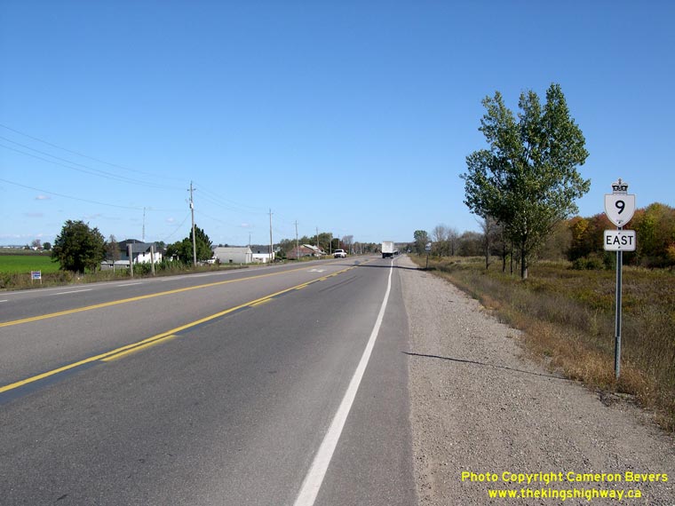
Left - Facing east along Hwy 9 towards the Hwy 400 Interchange at Holland Marsh. The section of Hwy 9 across the Holland Marsh was the last section of the
highway to be completed and opened to traffic. Until 1969, it was not possible to proceed east across the Holland Marsh on Hwy 9 between the Hwy 27 Junction at
Schomberg and Hwy 400. Interchange ramps were constructed at Hwy 400 and Hwy 9 in the 1960s, as part of the Hwy 9 Extension project from Schomberg to Newmarket.
Previously, the Newmarket Side Road (Hwy 9) merely crossed over Hwy 400 on an overpass, with no access to the freeway. See an
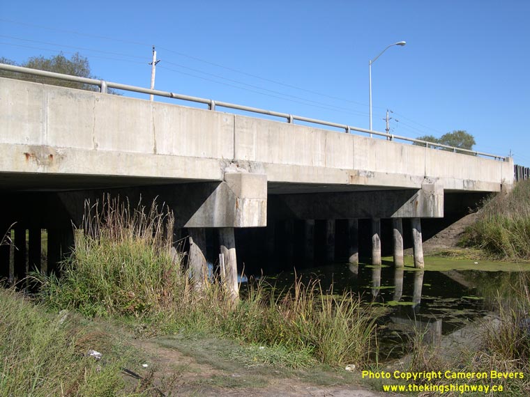
Enlarged Photo here. (Photograph taken on October 10, 2008 - © Cameron Bevers) Right - Holland Canal Bridge on Hwy 9 east of Schomberg. Structure completed in 1969. See an Enlarged Photo here. (Photograph taken on October 10, 2008 - © Cameron Bevers) 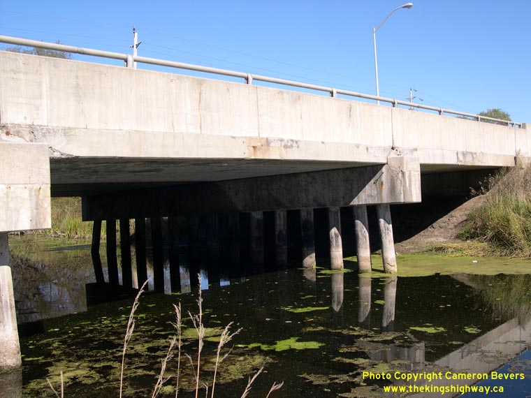

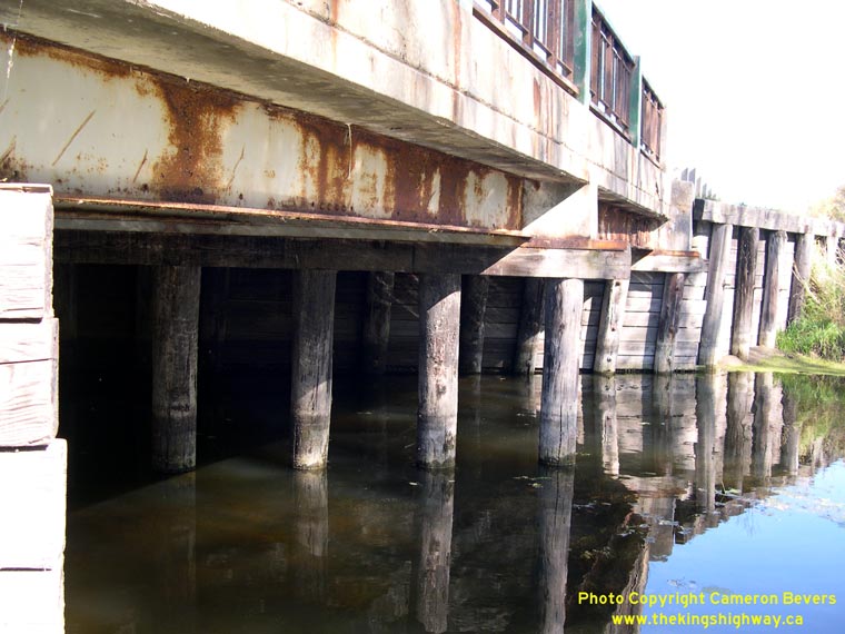
Left - The Holland Canal Bridge on Hwy 9 is a continuous concrete slab structure supported on timber bents. The bridge was rehabilitated in 2000. See an
Enlarged Photo here. (Photograph taken on October 10, 2008 - © Cameron Bevers) Right - Facing west towards Schomberg across the Holland Canal Bridge on Hwy 9. See an Enlarged Photo here. (Photograph taken on October 10, 2008 - © Cameron Bevers) 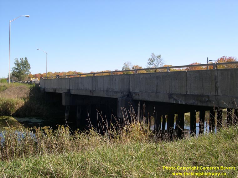
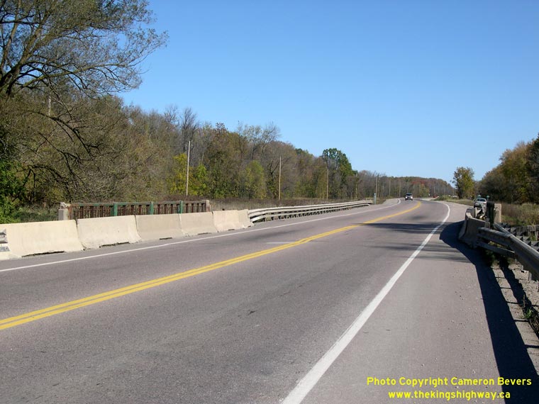
Left - Northern side of the Holland Canal Bridge on Hwy 9 east of Schomberg. See an
Enlarged Photo here. (Photograph taken on October 10, 2008 - © Cameron Bevers) Right - Facing west along Hwy 9 at the Schomberg River Bridge, east of the Hwy 27 Junction. See an Enlarged Photo here. (Photograph taken on October 10, 2008 - © Cameron Bevers) 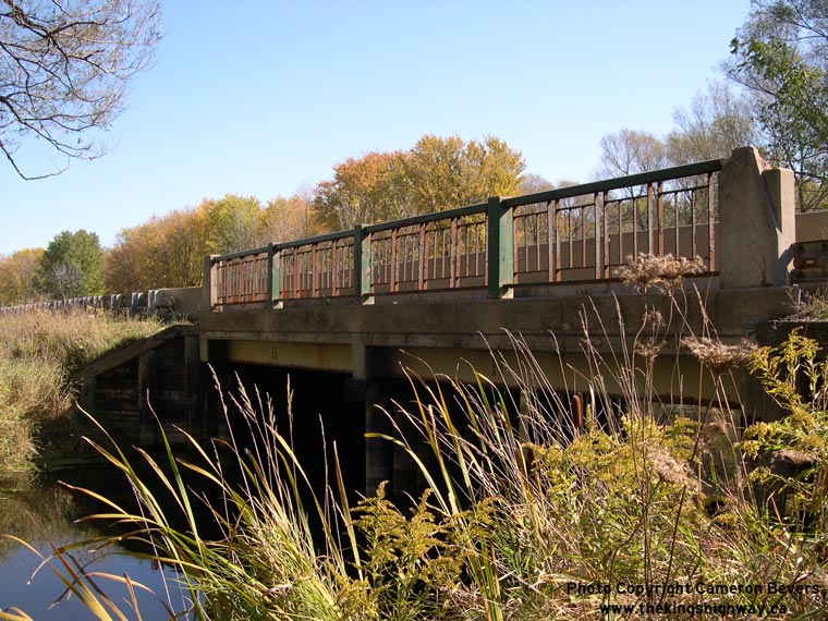
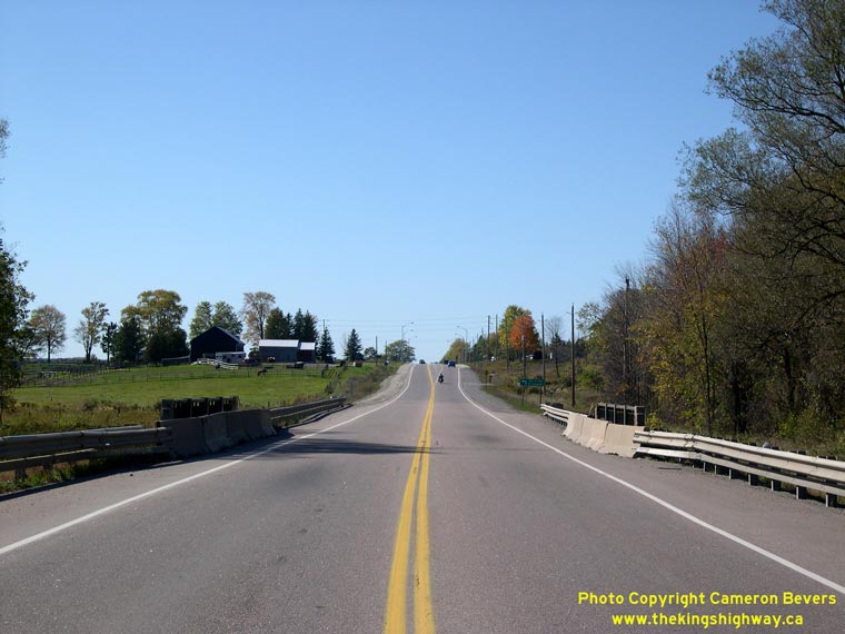
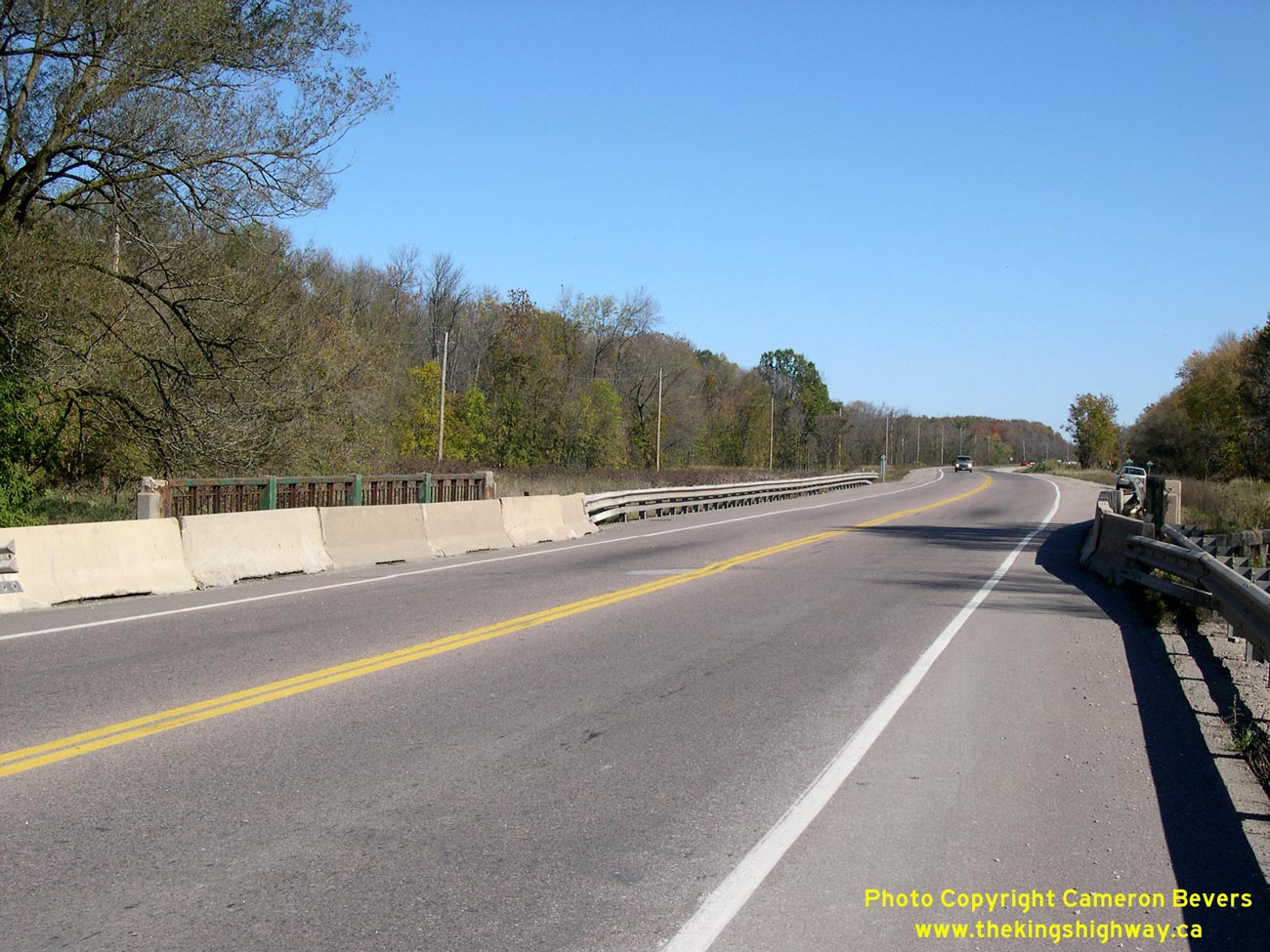
Left - Northern side of the Schomberg River Bridge on Hwy 9, east of the Hwy 27 Junction. Structure completed in 1957. See an
Enlarged Photo here. (Photograph taken on October 10, 2008 - © Cameron Bevers) Right - Facing east along Hwy 9 towards the Hwy 400 Interchange at the Schomberg River Bridge. See an Enlarged Photo here. (Photograph taken on October 10, 2008 - © Cameron Bevers) 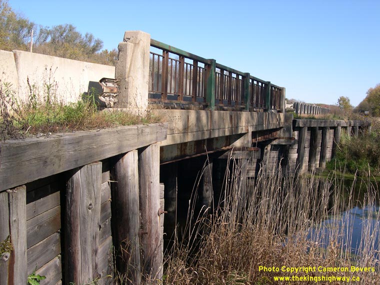
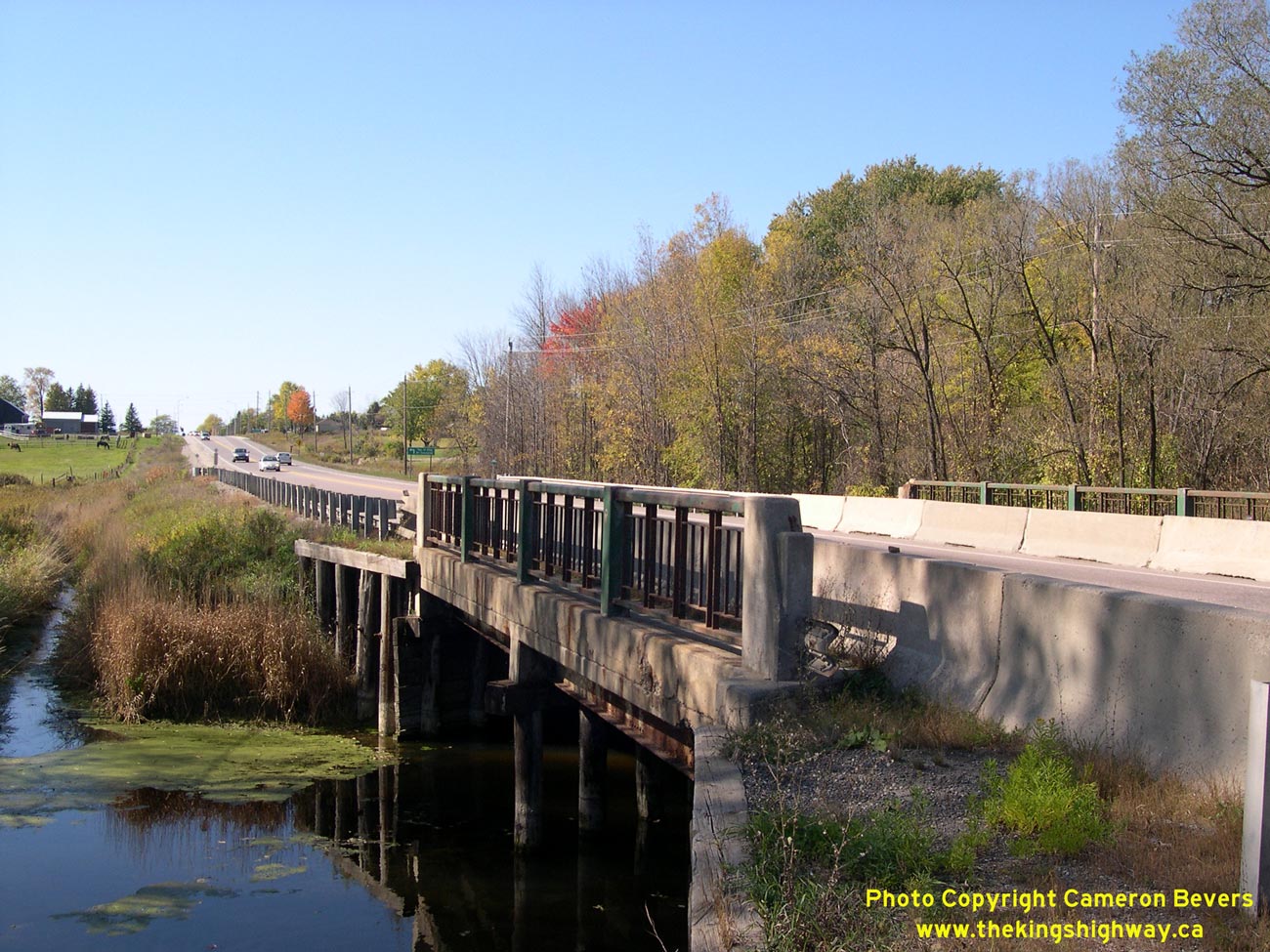
Left - Southern side of the Schomberg River Bridge on Hwy 9, east of the Hwy 27 Junction. The wing walls of this structure are made from creosoted timber
planks. See an Enlarged Photo here. (Photograph taken on October 10, 2008 - © Cameron Bevers) Right - The Schomberg River Bridge on Hwy 9 is a steel beam structure supported on timber bents. The structure was originally built by York County in 1957 as part of the Schomberg-Bradford County Road. The bridge was widened to its current width by the Department of Highways in 1969, shortly after this road was designated as Hwy 9. See an Enlarged Photo here. (Photograph taken on October 10, 2008 - © Cameron Bevers) 

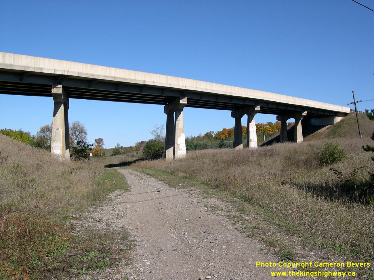
Left - Schomberg River Bridge on Hwy 9 east of the Hwy 27 Junction. Timber bent structures such as this are rather uncommon in Southern Ontario. See an
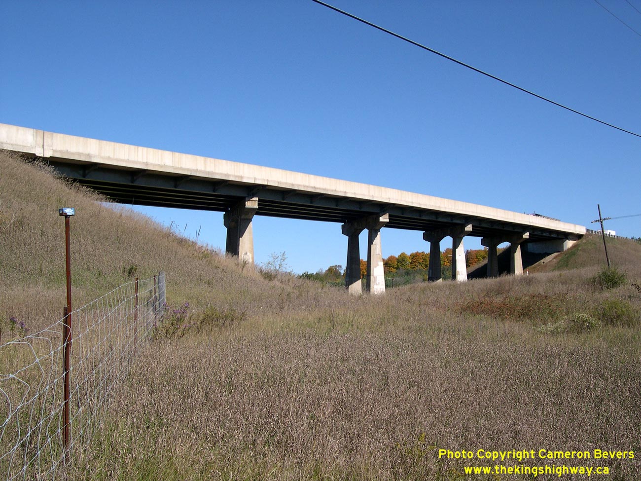
Enlarged Photo here. (Photograph taken on October 10, 2008 - © Cameron Bevers) Right - Black Horse CPR Overhead on Hwy 9 near Tottenham. Structure completed in 1965. See an Enlarged Photo here. (Photograph taken on October 10, 2008 - © Cameron Bevers) 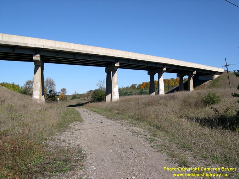

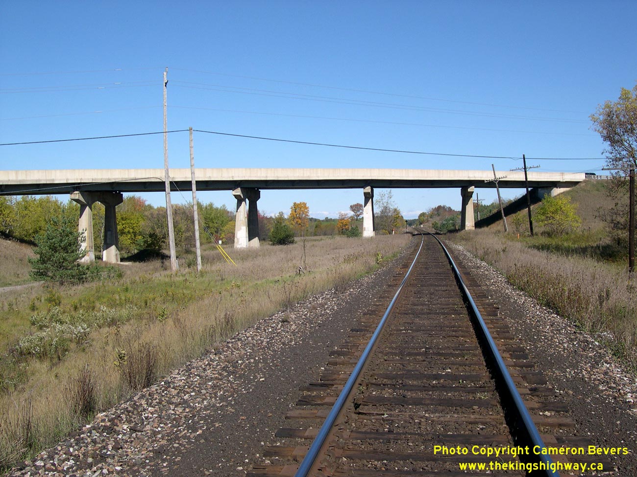
Left - The Black Horse CPR Overhead on Hwy 9 near Tottenham also spanned the former CNR line. See an
Enlarged Photo here. (Photograph taken on October 10, 2008 - © Cameron Bevers) Right - The Black Horse CPR Overhead on Hwy 9 is a five-span steel plate-girder structure. See an Enlarged Photo here. (Photograph taken on October 10, 2008 - © Cameron Bevers) 

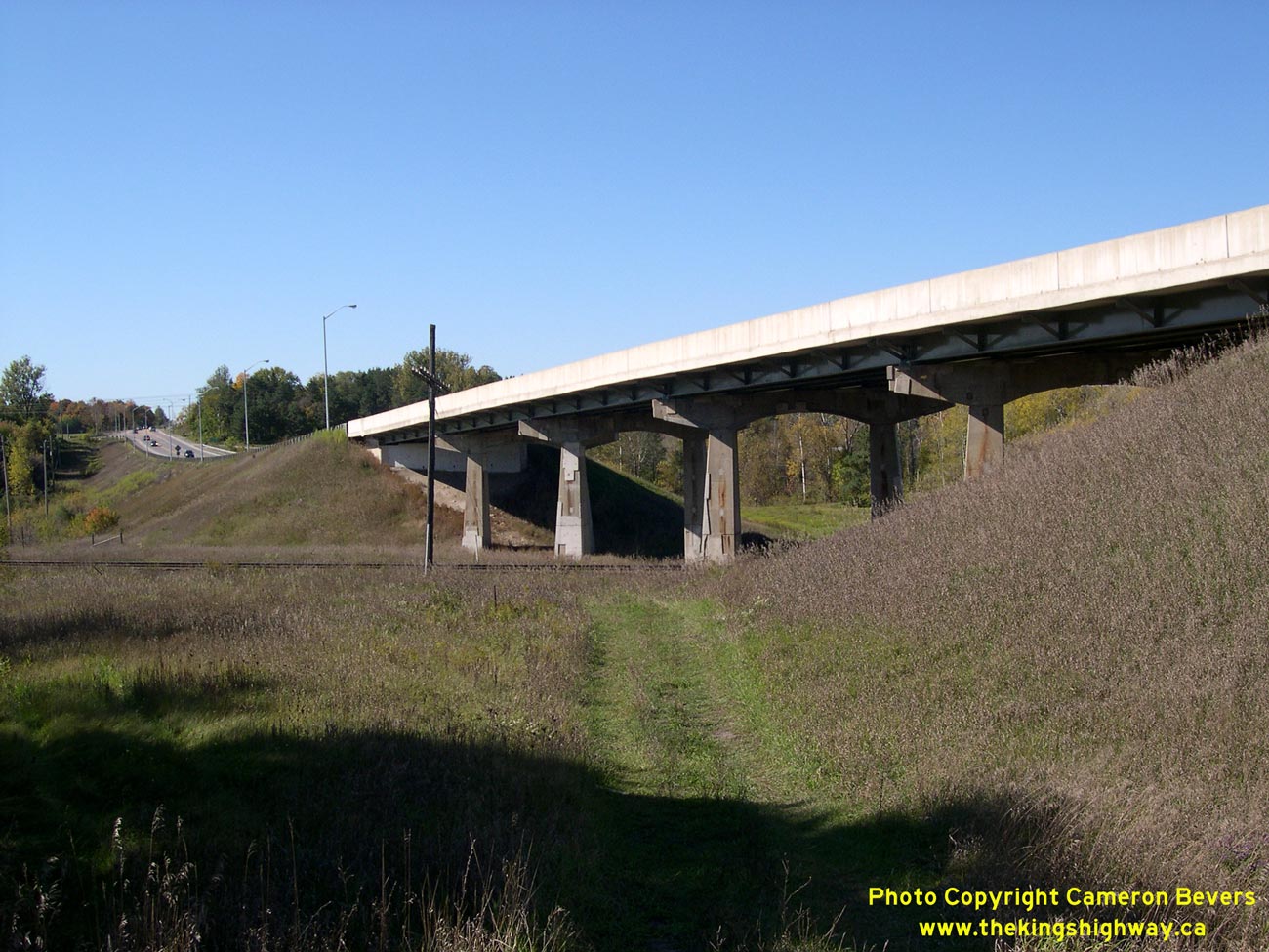
Left - When the Black Horse CPR Overhead was completed in the 1960s, a section of Hwy 9 leading to an at-grade railway crossing was bypassed. See an
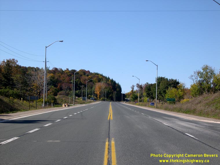
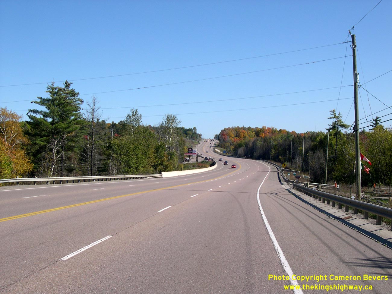
Enlarged Photo here. (Photograph taken on October 10, 2008 - © Cameron Bevers) Right - Facing west along Hwy 9 towards the Hwy 50 Junction between Schomberg and Orangeville. The Mono Mills Grade can be seen in the distance. See an Enlarged Photo here. (Photograph taken on October 10, 2008 - © Cameron Bevers) 

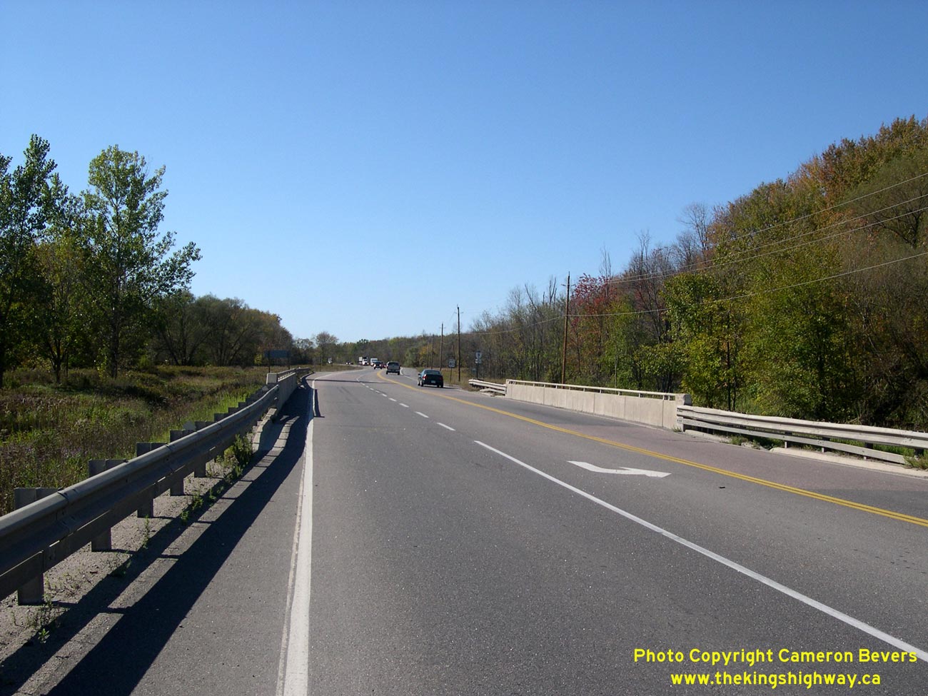
Left - Facing west along Hwy 9 from the Hwy 50 Junction between Schomberg and Orangeville. See an
Enlarged Photo here. (Photograph taken on October 10, 2008 - © Cameron Bevers) Right - Facing east along Hwy 9 towards the Humber River Bridge near the Hwy 50 Junction. See an Enlarged Photo here. (Photograph taken on October 10, 2008 - © Cameron Bevers) 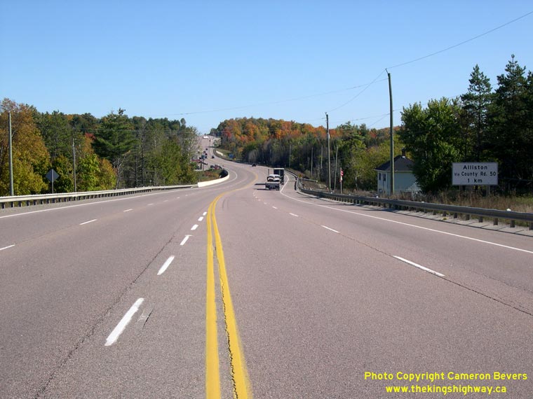

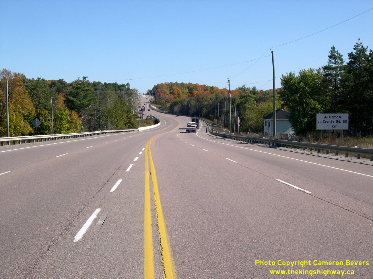
Left - Facing west on Hwy 9 approaching the Hwy 50 Junction near Tottenham. Note the sign at right directing traffic to use this road to access Alliston. See
an Enlarged Photo here. (Photograph taken on October 10, 2008 - © Cameron Bevers) Right - Approaching Mono Mills on Hwy 9, facing west towards Orangeville. This section of Hwy 9 was rebuilt in the 1990s with four lanes to allow faster vehicles to overtake slower vehicles on the long Mono Mills Grade leading up to the top of the Niagara Escarpment. See an Enlarged Photo here. (Photograph taken on October 10, 2008 - © Cameron Bevers) 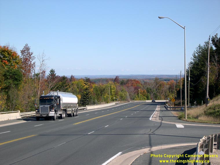

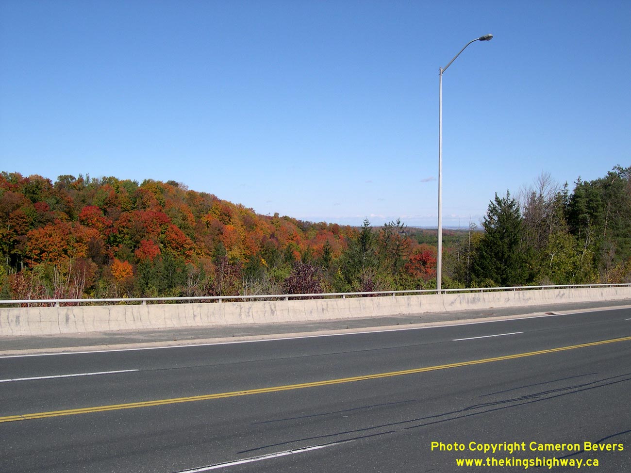
Left - Hwy 9 descends the Niagara Escarpment just east of Mono Mills. This section of Hwy 9 is rather scenic, with expansive vistas looking east. See an
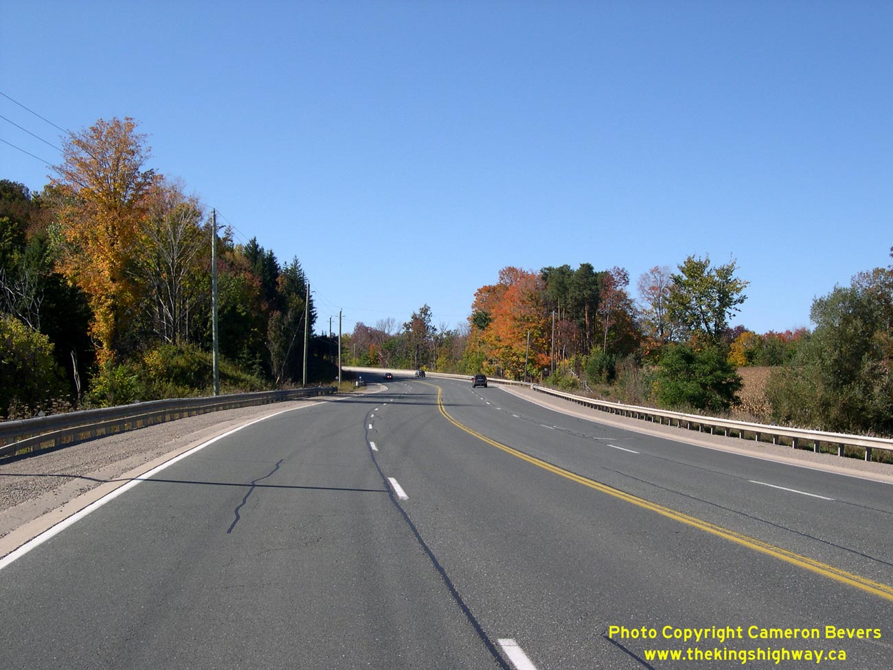
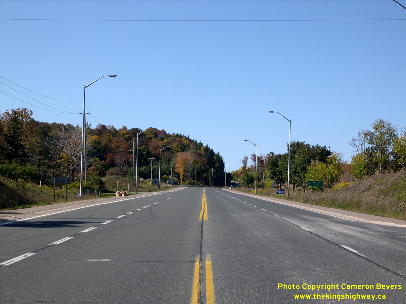
Enlarged Photo here. (Photograph taken on October 10, 2008 - © Cameron Bevers) Right - Autumn colours on Hwy 9 near Mono Mills. The drive between Orangeville and Newmarket on Hwy 9 is especially nice in the fall. See an Enlarged Photo here. (Photograph taken on October 10, 2008 - © Cameron Bevers) 
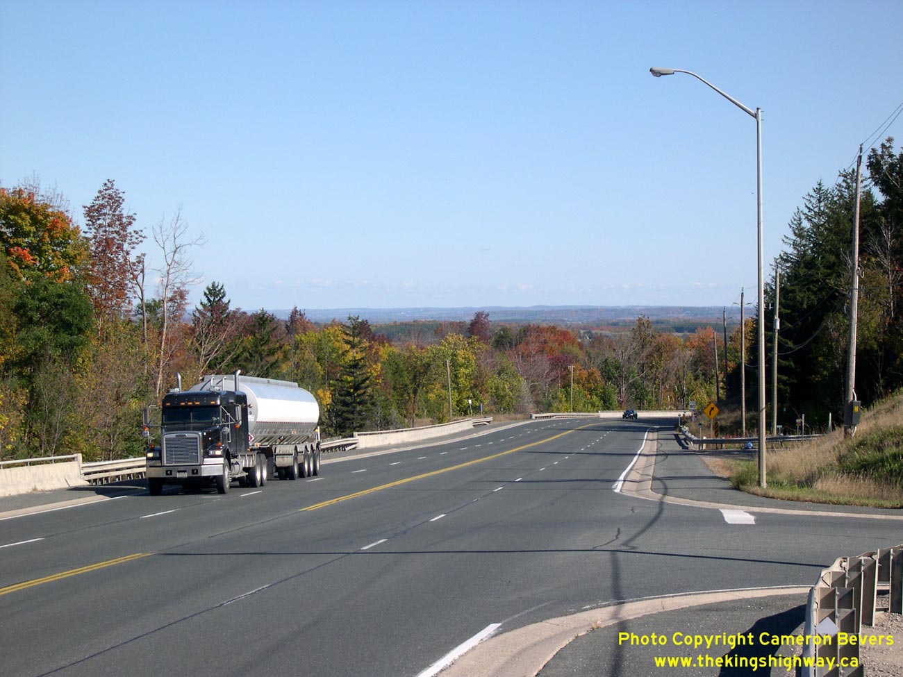
Left - Beginning of the Mono Mills Grade on Hwy 9, facing east towards Schomberg. This grade passes across the Niagara Escarpment and is nearly 3 km in length.
See an Enlarged Photo here. (Photograph taken on October 10, 2008 - © Cameron Bevers) Right - Facing west along Hwy 9 up the Mono Mills Grade. Although the Niagara Escarpment is subtle in this area, the highway's overall ascent is still considerable. See an Enlarged Photo here. (Photograph taken on October 10, 2008 - © Cameron Bevers) 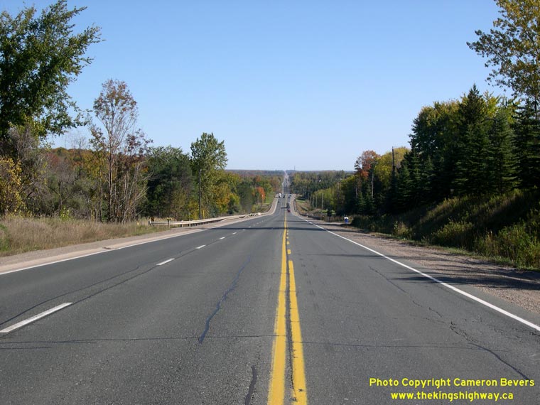
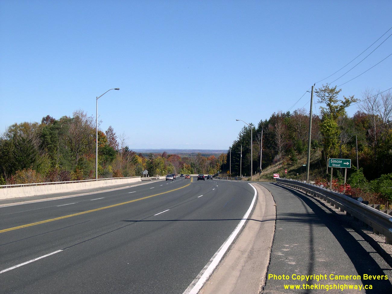
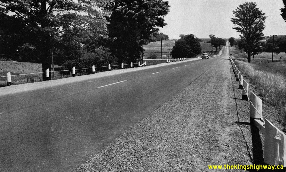
Left - Facing east along Hwy 9 down the Mono Mills Grade. Compare this present-day photo to this
1955 photo, taken from approximately the same location. See an
Enlarged Photo here. (Photograph taken on October 10, 2008 - © Cameron Bevers) Right - Facing east along Hwy 9 towards Mono Mills from Orangeville. East of the Hwy 10 Junction, Hwy 9 is two lanes with a two-way centre left turn lane. See an Enlarged Photo here. (Photograph taken on October 10, 2008 - © Cameron Bevers) 

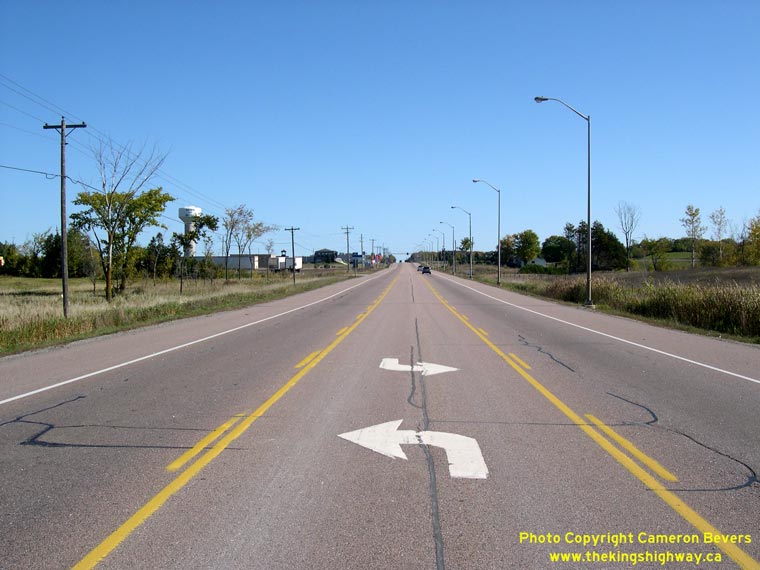
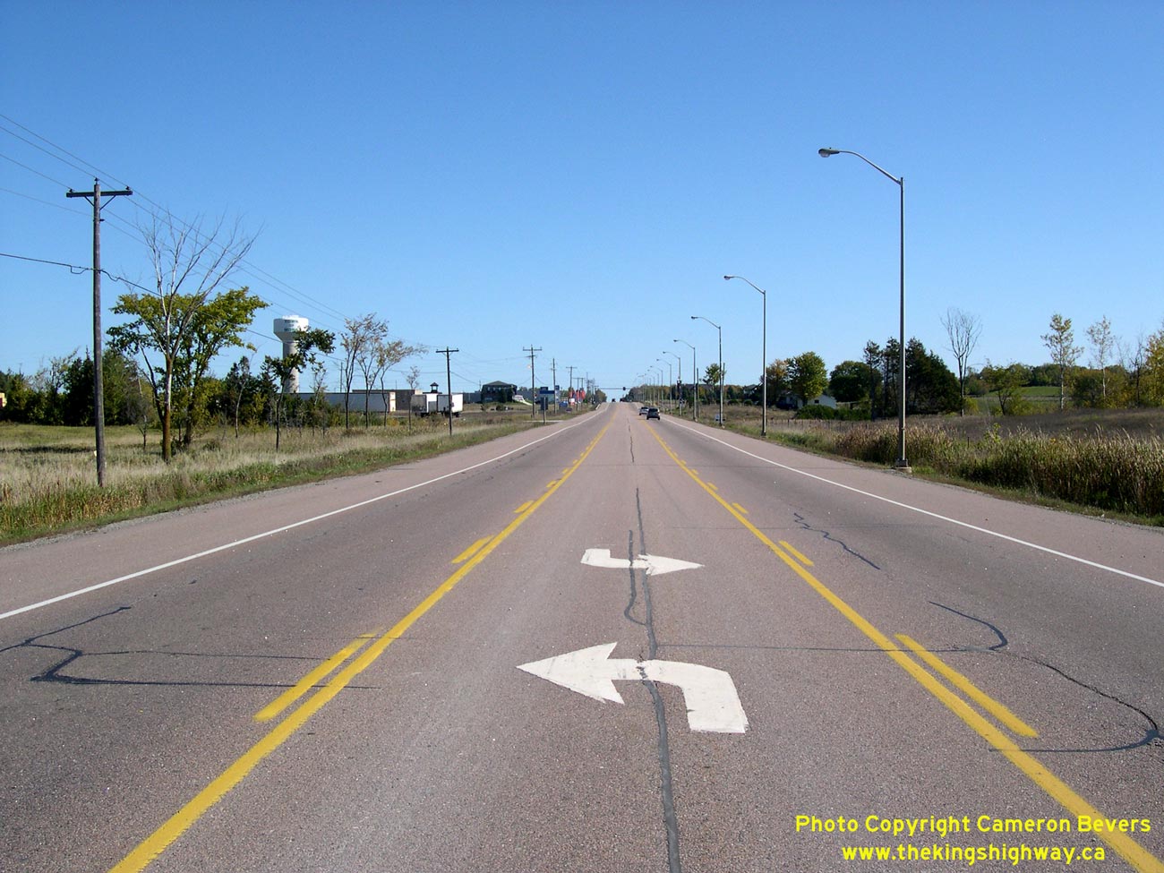
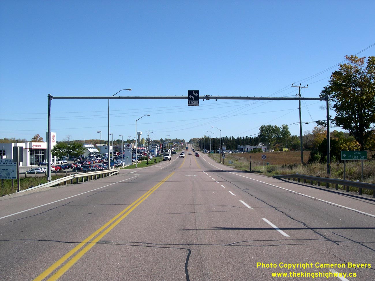
Left - Approaching Orangeville on Hwy 9, facing west towards the Hwy 10 Junction. Although it is not a built-up or urbanized area, there are several businesses
and other private entrances along this section of Hwy 9 which necessitated the installation of this continuous centre left-turn lane. See an
Enlarged Photo here. (Photograph taken on October 10, 2008 - © Cameron Bevers) Right - Facing east along Hwy 9 towards the start of the two-way centre left turn lane east of Orangeville. See an Enlarged Photo here. (Photograph taken on October 10, 2008 - © Cameron Bevers) 

Left - Approaching the end of Hwy 9 at the Hwy 10 Junction in Orangeville. Prior to the 1990s, Hwy 9 turned right at this junction and briefly joined Hwy 10
& Hwy 24 in a concurrent routing through Orangeville. However, in 1998, a 68 km section of Hwy 9 between Orangeville and Harriston was downloaded to the Counties
of Dufferin and Wellington. The downloaded section of Hwy 9 in the middle is now known as County Road 109. There are no signs at this junction indicating that one has
to follow County Road 109 to access the western leg of Hwy 9 to Kincardine. See an
Enlarged Photo here. (Photograph taken on October 10, 2008 - © Cameron Bevers) Right - Start of the eastern leg of Hwy 9, facing east from the Hwy 10 Junction in Orangeville. See an Enlarged Photo here. (Photograph taken on October 10, 2008 - © Cameron Bevers) 

Left - Green guide sign on Northbound Hwy 10 marking the ramp to Hwy 9 East in Orangeville. See an
Enlarged Photo here. (Photograph taken on October 10, 2008 - © Cameron Bevers) Right - Facing north along the former concurrent route of Hwy 9, Hwy 10, & Hwy 24 in Orangeville. Due to the provincial highway downloading that took place in 1997-1998, this route is now known simply as Hwy 10. The other two routes were downloaded in this area, making the concurrent designation unnecessary for route continuity. See an Enlarged Photo here. (Photograph taken on October 10, 2008 - © Cameron Bevers) 

Left - Approaching the Old Hwy 9 Junction (Broadway) on Hwy 10 & Hwy 24 in Orangeville. Prior to 1998, Hwy 9 departed from Hwy 10 & Hwy 24 at this
intersection, and continued west through Downtown Orangeville towards Harriston and Kincardine. See an
Enlarged Photo here. (Photograph taken on October 10, 2008 - © Cameron Bevers) Right - Old Hwy 9 Junction (Broadway) on Hwy 10 & Hwy 24 in Orangeville. From this vantage point, the former route of Hwy 9 can be seen departing from Hwy 10 & Hwy 24 and heading up the hill into Downtown Orangeville. Until the completion of the Orangeville Bypass in the early 1970s, Hwy 10 & Hwy 24 also followed this route along Broadway through Downtown Orangeville. See an Enlarged Photo here. (Photograph taken on October 10, 2008 - © Cameron Bevers) 

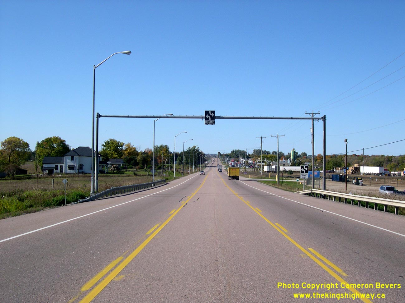
Left - The former concurrent route of Hwy 9, Hwy 10, & Hwy 24 in Orangeville briefly has a seven-lane cross section, with two through lanes in each
direction, dual northbound left-turn lanes and a channelized eastbound right turn ramp. The recent completion of Orangeville's South Arterial Road (Riddell Road) has
greatly relieved congestion at this intersection by allowing through traffic to bypass Orangeville's busy main street, Broadway (Old Hwy 9) entirely. See an
Enlarged Photo here. (Photograph taken on October 10, 2008 - © Cameron Bevers) Right - Facing west along Old Hwy 9 (Broadway) from the Hwy 10 & Hwy 24 Junction in Orangeville. See an Enlarged Photo here. (Photograph taken on October 10, 2008 - © Cameron Bevers) 

Left - Approaching the South Arterial Road on Southbound Hwy 10 & Hwy 24 in Orangeville. This new bypass allows long distance through traffic to access
Dufferin County Road 109 (Formerly Hwy 9) without having to negotiate Orangeville's busy main street (Broadway). Although it is signed as Dufferin County Road 109,
much of the road lies within the Regional Municipality of Peel. See an Enlarged Photo here. (Photograph taken on October 10, 2008 - © Cameron Bevers) Right - Facing west along the South Arterial Road from the Hwy 10 Junction in Orangeville. The construction of the Dufferin County Road 109 Bypass created a jurisdictional problem which would have been avoided if Hwy 9 beyond Orangeville was still a provincial highway. The road was built to divert long distance through traffic heading towards Arthur and points to the west away from Downtown Orangeville, but there was insufficient right-of-way to construct this bypass route entirely within the Town of Orangeville's limits. As a result, the bypass route was partially built within the Regional Municipality of Peel, which did not stand to benefit much from the road's construction. This bypass route was situated at the extreme northwestern corner of Peel and was primarily built to resolve a traffic issue in neighbouring Dufferin County. While the South Arterial Road has greatly relieved traffic congestion in Orangeville, the planning and construction of this bypass would have been simplified if it was built and operated as a provincial highway, in my opinion. The overall transportation needs of the province would have likely taken precedence over any local municipal issues. See an Enlarged Photo here. (Photograph taken on October 10, 2008 - © Cameron Bevers)
Continue on to King's Highway 9 Photos: Orangeville to Arthur
|
|---|
Links to Adjacent King's Highway Photograph Pages:
Back to Hwy 9 - Historical Photos (1920 to 1999)
Hwy 9 Photo Index
On to Hwy 9 - Orangeville to Arthur
Back to King's Highway 8 Photos /
King's Highway 9 History /
On to King's Highway 10 Photos
Ontario Highway History - Main Menu / Back to List of Highways Website contents, photos & text © 2002-2026, Cameron
Bevers (Webmaster) - All Rights Reserved / Contact Me
|
|---|