
| 
| |
|
|
This page contains historical photos of Ontario's Queen Elizabeth Way dating from 1980 to 1984. All photographs displayed on
this page were taken by the Ontario Ministry of Transportation, unless specifically noted otherwise. Historical photographs are arranged in approximate chronological
order. Click on any thumbnail to see a larger image!
Please note that all photographs displayed on this
website are protected by copyright. These photographs must not be reproduced, published,
electronically stored or copied, distributed, or posted onto other websites without
my written permission. If you want to use photos from this website, please
email me first for permission. Thank-you!
|
|---|
|
Page 8: Historical Queen Elizabeth Way Photographs (1980 to 1984)


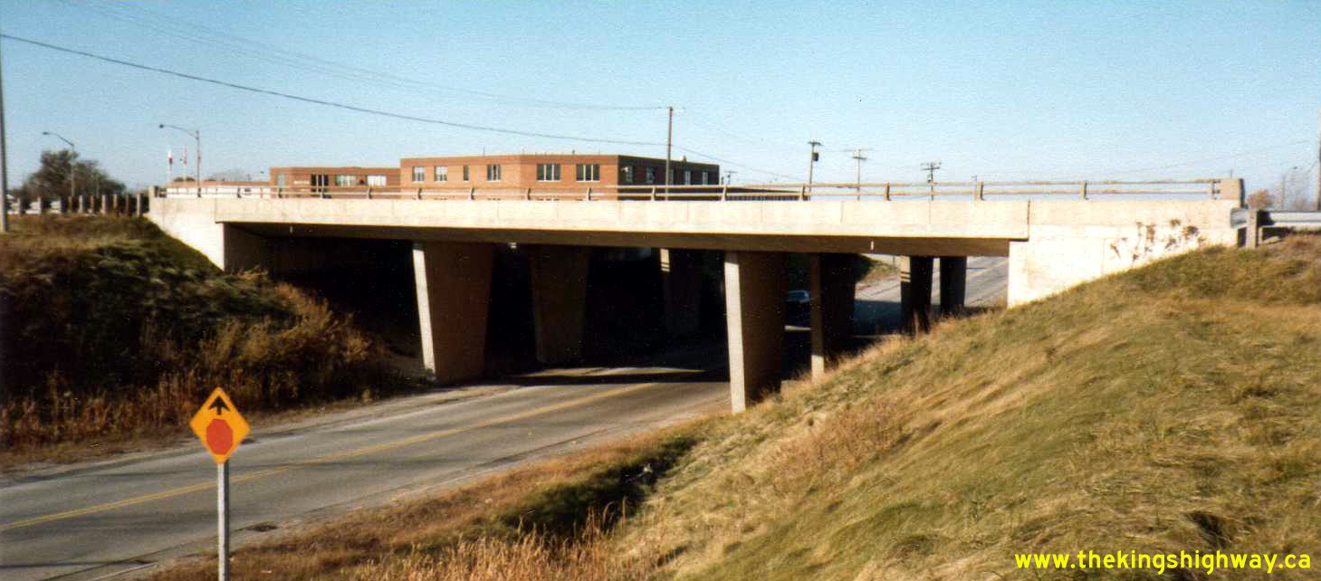
Left - Facing west along the Queen Elizabeth Way towards the Burlington Skyway at the Woodward Avenue Underpass in Hamilton in 1980. This section of the Queen
Elizabeth Way was rebuilt and widened in the mid-1980s, as part of the Burlington Skyway Twinning Project. See an
Enlarged Photo Here. Photo taken on August 20, 1980. (Photo courtesy of Ontario Ministry of Transportation - © King's Printer for Ontario, 2012) Right - Woodward Avenue Underpass on the Queen Elizabeth Way in Hamilton prior to reconstruction, facing north towards Lake Ontario. Photo taken on August 20, 1980. (Photo courtesy of Ontario Ministry of Transportation - © King's Printer for Ontario, 2012) 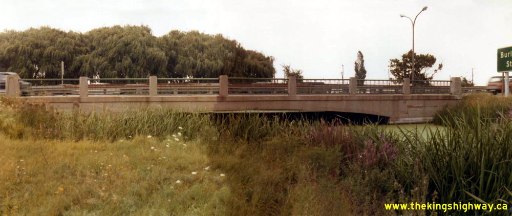
Above - Red Hill Creek Bridge #2 on the Queen Elizabeth Way in Hamilton in 1980. This structure was located between the Woodward Avenue Underpass and the
Burlington Street Interchange. This bridge was built over Red Hill Creek in 1938, during construction of the New Niagara Falls Highway between Hamilton and
St. Catharines. A short distance to the north, another nearly identical bridge was built over Red Hill Creek, but it was demolished in the 1950s to make way for the
new Burlington Skyway Approach. The southern structure depicted here lasted until 2008, when it was removed and replaced with a concrete box culvert. Photo taken
on August 22, 1980. (Photo courtesy of Ontario Ministry of Transportation - © King's Printer for Ontario, 2012) 

Left - Approaching the Burlington Street Interchange on the Queen Elizabeth Way in Hamilton in 1980. The Queen Elizabeth Way looks dramatically different
today, as a result of the new Burlington Street and Red Hill Valley Parkway Interchange. The unique Hamilton Waterworks Building at left is about the only
distinguishing landmark visible in this photo that still remains today. See an Enlarged Photo Here.
Photo taken on August 22, 1980. (Photo courtesy of Ontario Ministry of Transportation - © King's Printer for Ontario, 2012) Right - Gray's Road Overpass on the Queen Elizabeth Way in Stoney Creek, facing north towards Lake Ontario. Photo taken on September 22, 1980. (Photo courtesy of Ontario Ministry of Transportation - © King's Printer for Ontario, 2012) 

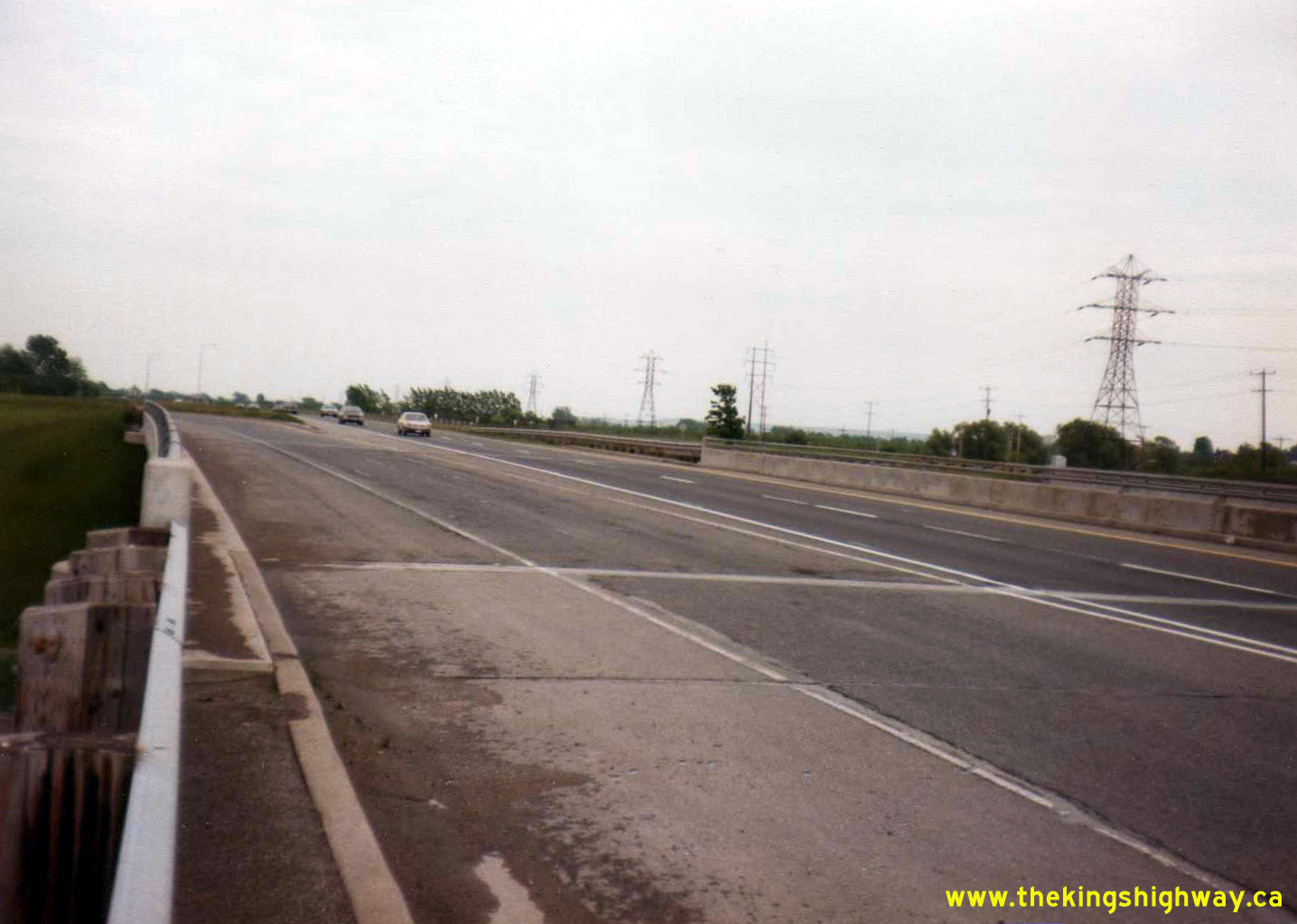
Left - Facing south along the Queen Elizabeth Way from the Plains Road Interchange in Burlington in 1980, prior to reconstruction. In 1983, a construction
contract was called to rebuild the interchange at Plains Road, along with the realignment and extension of Fairview Street so that it joined the Queen Elizabeth Way
as well. This view has changed quite dramatically over the past few decades, as the city has grown up around the highway on all sides. See
an Enlarged Photo Here. Photo taken on October 1, 1980. (Photo courtesy of Ontario Ministry of Transportation - © King's Printer for Ontario, 2017) Right - Close-up of the median of the Plains Road Overpass on the Queen Elizabeth Way in Burlington in 1980, showing the retrofitted three-cable guide rail installation. Many sections of the Queen Elizabeth Way between Burlington and Fort Erie had three-cable guide rail installed during the 1970s to provide some protection of the narrow median. The field in the background on the far side of the highway is the present-day site of the Mapleview Shopping Centre. A narrow two-lane Maple Avenue can be seen approaching Plains Road in the distance, in the upper left corner of the photo. See an Enlarged Photo Here. Photo taken on October 1, 1980. (Photo courtesy of Ontario Ministry of Transportation - © King's Printer for Ontario, 2017) 

Left - Facing east along Plains Road at the Queen Elizabeth Way Interchange in Burlington. The structure seen here was built in 1956, as part of the
construction of a new approach to the Burlington Skyway. Both this bridge and the original 1936 Burlington Interchange Overpass lying a short distance to the west
were demolished in 1983-1984 to make way for the new Plains Road & Fairview Street Interchange. See an
Enlarged Photo Here. Photo taken on October 1, 1980. (Photo courtesy of Ontario Ministry of Transportation - © King's Printer for Ontario, 2017) Right - North Service Road-Plains Road Connector under the Niagara-bound lanes of the Queen Elizabeth Way in Burlington in 1980. This one way street provided westbound access only between the North Service Road at Guelph Line and Plains Road. This connector road was ultimately closed during reconstruction of the Queen Elizabeth Way west of Guelph Line. See an Enlarged Photo Here. Photo taken on October 1, 1980. (Photo courtesy of Ontario Ministry of Transportation - © King's Printer for Ontario, 2017) 

Left - Niagara-bound lanes of the Queen Elizabeth Way at the Hwy 2 (North Shore Boulevard) Interchange in Burlington, facing southeast. The original underpass
structure at Hwy 2 was constructed in 1956 under Contract #1956-38 with two freeway lanes in each direction plus speed change lanes from the cloverleaf ramps. During
reconstruction of the Hwy 2 Interchange in the early 1980s, the two speed change lanes were converted to through lanes so that the Queen Elizabeth Way had three
through lanes in each direction through the Hwy 2 Interchange. The double-sided steel beam guide rail median barrier in the centre of the highway was actually a
retrofit. When the Hwy 2 Interchange was first built in 1956, the median merely consisted of a curbed traffic island with no physical barrier separating the
Niagara-bound and Toronto-bound lanes. See an Enlarged Photo Here. Photo taken on October 1,
1980. (Photo courtesy of Ontario Ministry of Transportation - © King's Printer for Ontario, 2022) Right - Facing west along Hwy 2 (North Shore Boulevard) at the Queen Elizabeth Way Interchange in Burlington in 1980. This interesting photo shows the Queen Elizabeth Way with its late 1950s lane configuration, with only a single structure spanning Hwy 2. In 1982, construction began on the widening of the Queen Elizabeth Way through this interchange in order to provide separate Collector Lane structures. The Hwy 2 Interchange was fully reconstructed as part of this work, which resulted in the present-day interchange configuration that we see today. See an Enlarged Photo Here. Photo taken on October 1, 1980. (Photo courtesy of Ontario Ministry of Transportation - © King's Printer for Ontario, 2022) 

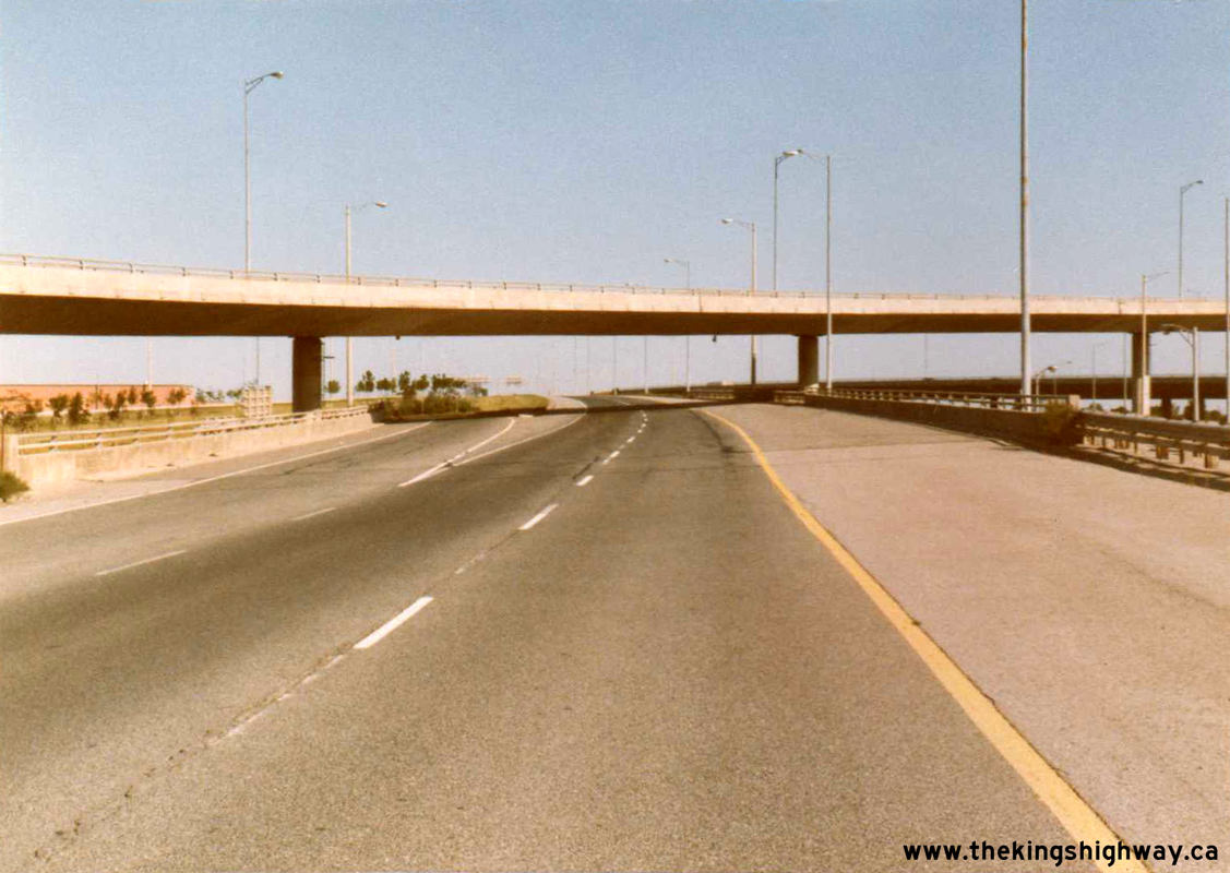
Left - Niagara-bound lanes of the Queen Elizabeth Way through the Freeman Interchange at Hwy 403 in Burlington. See an
Enlarged Photo Here. Photo taken on October 1, 1980. (Photo courtesy of Ontario Ministry of Transportation - © King's Printer for Ontario, 2022) Right - Approaching the Freeman Interchange on the Toronto-bound Queen Elizabeth Way in Burlington in 1980. Note the overhead diagrammatic sign, showing the old left-hand exit ramp to Hwy 403. This unusual left-hand exit configuration proved to be confusing for motorists who were unfamiliar with this interchange. This situation existed up until 1993, when the left-hand exit was closed off and replaced with a more conventional right-hand exit ramp during the Freeman Interchange reconstruction. See an Enlarged Photo Here. Photo taken in December 1980. (Photo courtesy of Ontario Ministry of Transportation - © King's Printer for Ontario, 2012) 
Above - Southern side of the westbound Hwy 420 Flyover to the Fort Erie-bound Queen Elizabeth Way (Bridge #4) in Niagara Falls. See an
Enlarged Photo Here. Photo taken in June 2, 1981. (Photo courtesy of Ontario Ministry of Transportation - © King's Printer for Ontario, 2022) 

Left - Deck view of the westbound Hwy 420 Flyover to the Fort Erie-bound Queen Elizabeth Way (Bridge #4) in Niagara Falls. This complicated freeway ramp
structure features an alignment with a reverse curve. This reverse curve is rather evident in this photo. See an
Enlarged Photo Here. Photo taken in June 2,
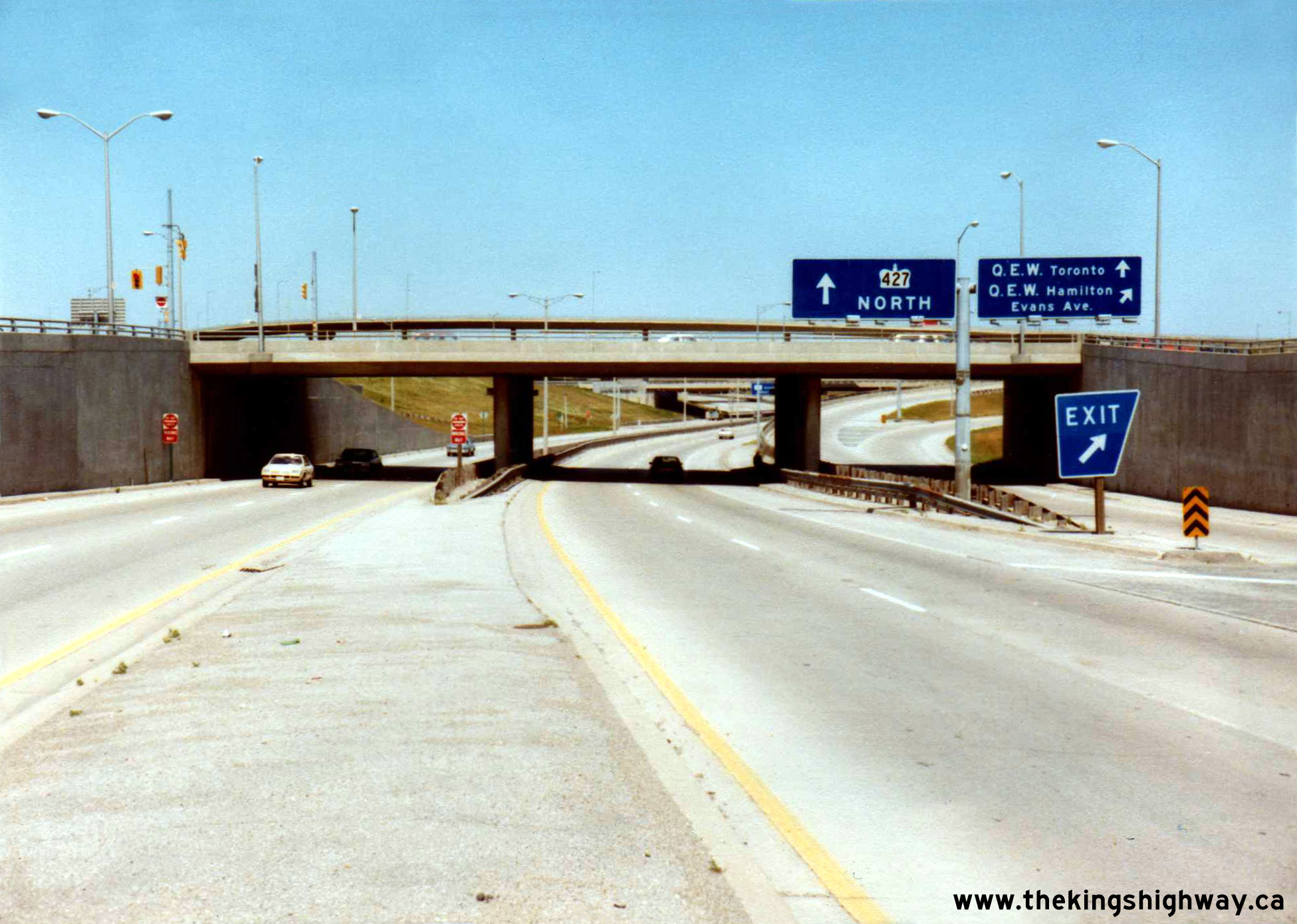
1981. (Photo courtesy of Ontario Ministry of Transportation - © King's Printer for Ontario, 2022) Right - Facing north along Hwy 427 at the Queen Elizabeth Way and Evans Avenue Interchange in Toronto. See an Enlarged Photo Here. Photo taken on July 30, 1981. (Photo courtesy of Ontario Ministry of Transportation - © King's Printer for Ontario, 2012) 

Left - Facing west along the Niagara-bound lanes of the Queen Elizabeth Way at Concession Street in Fort Erie. Note that at the time this photo was taken in
1981, the on-ramp to the USA-bound Queen Elizabeth Way was striped as a two-lane ramp. It is a single lane ramp today. See an
Enlarged Photo Here. Photo taken on September 16, 1981. (Photo courtesy of Ontario Ministry of Transportation - © King's Printer for Ontario, 2017) Right - Overhead signs on the Toronto-bound Queen Elizabeth Way at the Concession Street Interchange in Fort Erie. See an Enlarged Photo Here. Photo taken on September 16, 1981. (Photo courtesy of Ontario Ministry of Transportation - © King's Printer for Ontario, 2017) 

Left - Facing east along Lundy's Lane towards Niagara Falls at the Queen Elizabeth Way Underpass. Photo taken on September 16, 1981. (Photo courtesy of Ontario Ministry of Transportation - © King's Printer for Ontario, 2011) Right - Overhead guide sign for the Hwy 420 and Hwy 20 Interchange on the Queen Elizabeth Way in Niagara Falls. Photo taken on September 16, 1981. (Photo courtesy of Ontario Ministry of Transportation - © King's Printer for Ontario, 2011) 

Left - Northern side of the Lundy's Lane Overpass on the Queen Elizabeth Way in Niagara Falls. Photo taken on September 16, 1981. (Photo courtesy of Ontario Ministry of Transportation - © King's Printer for Ontario, 2011) Right - Bowen Road Overpass on the Queen Elizabeth Way, facing east towards Fort Erie. Photo taken on September 16, 1981. (Photo courtesy of Ontario Ministry of Transportation - © King's Printer for Ontario, 2012) 

Left - Facing east across the McLeod Road Overpass on the Queen Elizabeth Way in Niagara Falls. See an
Enlarged Photo Here. Photo taken on September 16, 1981. (Photo courtesy of Ontario Ministry of Transportation - © King's Printer for Ontario, 2022) Right - Flyover from the Toronto-bound Queen Elizabeth Way to eastbound Hwy 420 (Bridge #8) in Niagara Falls. See an Enlarged Photo Here. Photo taken on September 24, 1981. (Photo courtesy of Ontario Ministry of Transportation - © King's Printer for Ontario, 2022) 
Left - Facing towards Toronto across the Hwy 420 Flyover (Bridge #2) across the Queen Elizabeth Way in Niagara Falls. See an
Enlarged Photo Here. Photo taken on September 24, 1981. (Photo courtesy of Ontario Ministry of Transportation - © King's Printer for Ontario, 2022) Right - Fort Erie-bound lanes of the Queen Elizabeth Way at the Hwy 420 Underpass (Bridge #3) in Niagara Falls, facing towards Toronto. The westbound Hwy 420 Flyover to the Fort Erie-bound Queen Elizabeth Way (Bridge #4) can be seen crossing over the highway. See an Enlarged Photo Here. Photo taken on September 24, 1981. (Photo courtesy of Ontario Ministry of Transportation - © King's Printer for Ontario, 2022) 

Left - Eastern side of the Fort Erie-bound Queen Elizabeth Way structure over Hwy 420 (Bridge #3) in Niagara Falls. This complex four-level interchange
replaced a traffic circle on the Queen Elizabeth Way in the early 1970s. See an
Enlarged Photo Here. Photo taken on September 24, 1981. (Photo courtesy of Ontario Ministry of Transportation - © King's Printer for Ontario, 2022) Right - Facing towards Toronto at the flyover between the Queen Elizabeth Way and Hwy 420 across the westbound lanes of Hwy 420 (Bridge #7) in Niagara Falls. See an Enlarged Photo Here. Photo taken on September 24, 1981. (Photo courtesy of Ontario Ministry of Transportation - © King's Printer for Ontario, 2022) 
Left - Eastern side of the Toronto-bound Queen Elizabeth Way structure over Hwy 420 (Bridge #6) in Niagara Falls. An overhead bridge-mounted guide sign
directed westbound Hwy 420 traffic to "Hwy 20 Lundy's Lane". See an Enlarged Photo Here. Photo
taken on September 24, 1981. (Photo courtesy of Ontario Ministry of Transportation - © King's Printer for Ontario, 2022) Right - Toronto-bound lanes of the Queen Elizabeth Way at the Hwy 420 Underpass (Bridge #6) in Niagara Falls, facing towards Toronto. See an Enlarged Photo Here. Photo taken on September 24, 1981. (Photo courtesy of Ontario Ministry of Transportation - © King's Printer for Ontario, 2022) 

Left - Mississauga Road Cloverleaf on the Queen Elizabeth Way in Mississauga, facing north. See an
Enlarged Photo Here. Photo taken on October 29, 1981. (Photo courtesy of Ontario Ministry of Transportation - © King's Printer for Ontario, 2012) Right - Facing west along the Queen Elizabeth Way towards Hamilton at the Mississauga Road Cloverleaf. The fact that the photographer was able to take this photo from the highway's median in the middle of Mississauga speaks to the comparatively low traffic volumes on the QEW at that time. It would be impossible to take a photo from this vantage point today. See an Enlarged Photo Here. Photo taken on October 29, 1981. (Photo courtesy of Ontario Ministry of Transportation - © King's Printer for Ontario, 2012) 
Above - Glendale Avenue Interchange on Old Hwy 8 (Niagara Road 81) and the Queen Elizabeth Way, facing west towards St. Catharines. Photo taken on November 3,
1981. (Photo courtesy of Ontario Ministry of Transportation - © King's Printer for Ontario, 2012) 
Left - Facing north along Glendale Avenue from the Queen Elizabeth Way towards the Old Hwy 8 (Niagara Road 81) Interchange near St. Catharines. Photo taken on
November 3, 1981. (Photo courtesy of Ontario Ministry of Transportation - © King's Printer for Ontario, 2012) Right - Facing east along the Toronto-bound lanes of the Queen Elizabeth Way at the Jordan Road Interchange. See an Enlarged Photo Here. Photo taken on November 3, 1981. (Photo courtesy of Ontario Ministry of Transportation - © King's Printer for Ontario, 2022) 
Above - Facing east along the Niagara-bound lanes of the Queen Elizabeth Way at the Jordan Road Interchange. See an
Enlarged Photo Here. Photo taken on November 3, 1981. (Photo courtesy of Ontario Ministry of Transportation - © King's Printer for Ontario, 2022) 
Above - Southern side of the Jordan Road Underpass on the Queen Elizabeth Way near Beamsville. See an
Enlarged Photo Here. Photo taken on November 3, 1981. (Photo courtesy of Ontario Ministry of Transportation - © King's Printer for Ontario, 2022) 

Left - Facing east along the Queen Elizabeth Way towards the Burlington Street Interchange from the Woodward Avenue Underpass. Note that the exit ramp to
Woodward Avenue had not yet been constructed. See an Enlarged Photo Here. Photo taken on May 11,
1982. (Photo courtesy of Ontario Ministry of Transportation - © King's Printer for Ontario, 2012) Right - Facing west along the Queen Elizabeth Way towards Woodward Avenue from the Burlington Street Interchange in Hamilton in 1982. This photo shows the original four-lane highway before it was widened in the mid-1980s as part of the Burlington Skyway Twinning Project. See an Enlarged Photo Here. Photo taken on May 20, 1982. (Photo courtesy of Ontario Ministry of Transportation - © King's Printer for Ontario, 2012) 
Above - Dual concrete rigid frame structures on the Queen Elizabeth Way over 40 Mile Creek in Grimsby in 1982. Both structures were completed in 1938. When
this section of the Queen Elizabeth Way was widened to six lanes in the 1990s, the twin structures over 40 Mile Creek were demolished and replaced with a new bridge.
Photo taken on May 27, 1982. (Photo courtesy of Ontario Ministry of Transportation - © King's Printer for Ontario, 2012) 
Above - Toronto-bound Queen Elizabeth Way structure over 40 Mile Creek in Grimsby in 1982. Note the section of yellow-coloured guide rail in the foreground.
Until about 1970, the Ontario Department of Highways painted guide rails along the Queen Elizabeth Way a bright yellow. Most sections of painted guide rail such as
this example are now long-gone, replaced during various highway reconstruction projects. Photo taken on May 27, 1982. (Photo courtesy of Ontario Ministry of Transportation - © King's Printer for Ontario, 2012) 

Left - Several trees existed in the median of the Queen Elizabeth Way at 40 Mile Creek. Photo taken on May 27, 1982. (Photo courtesy of Ontario Ministry of Transportation - © King's Printer for Ontario, 2012) Right - Looking upstream towards the twin Queen Elizabeth Way structures over 40 Mile Creek in Grimsby. Photo taken on May 27, 1982. (Photo courtesy of Ontario Ministry of Transportation - © King's Printer for Ontario, 2012) 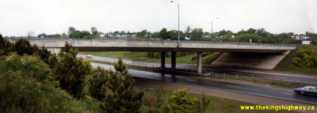
Above - Maple Avenue Overpass on the Queen Elizabeth Way in Grimsby. Photo taken on May 27, 1982. (Photo courtesy of Ontario Ministry of Transportation - © King's Printer for Ontario, 2012) 
Above - Christie Street Overpass on the Queen Elizabeth Way in Grimsby. Photo taken on May 27, 1982. (Photo courtesy of Ontario Ministry of Transportation - © King's Printer for Ontario, 2012) 

Left - Christie Street Overpass on the Queen Elizabeth Way in Grimsby, facing north. Photo taken on May 27, 1982. (Photo courtesy of Ontario Ministry of Transportation - © King's Printer for Ontario, 2012) Right - Facing west along the Queen Elizabeth Way towards the Ontario Street Overpass in Grimsby in 1982. The highway has changed quite dramatically since the time this photo was taken. In the mid-1990s, the highway was widened to six lanes and the cedar post and cable median barrier was replaced with a concrete tall wall barrier. Note the chain-link fence, which was installed to prevent pedestrians from walking across the highway. While crossing the highway on foot may seem like a very foolish idea today, it should be pointed out that pedestrians were legally allowed to walk along this section of the Queen Elizabeth Way right up until the 1970s when the current Grimsby Interchange was built. See an Enlarged Photo Here. Photo taken on June 1, 1982. (Photo courtesy of Ontario Ministry of Transportation - © King's Printer for Ontario, 2012) 

Left - An older Queen Elizabeth Way route marker on Ontario Street in Grimsby. Photo taken on June 1, 1982. (Photo courtesy of Ontario Ministry of Transportation - © King's Printer for Ontario, 2012) Right - Facing south across the Casablanca Boulevard Overpass on the Queen Elizabeth Way in Grimsby. See an Enlarged Photo Here. Photo taken on August 18, 1982. (Photo courtesy of Ontario Ministry of Transportation - © King's Printer for Ontario, 2022) 

Left - Casablanca Boulevard Overpass on the Queen Elizabeth Way in Grimsby. See an
Enlarged Photo Here. Photo taken on August 18, 1982. (Photo courtesy of Ontario Ministry of Transportation - © King's Printer for Ontario, 2022) Right - Facing west along the Queen Elizabeth Way approaching the Ontario Street Interchange in Beamsville. See an Enlarged Photo Here. Photo taken on August 18, 1982. (Photo courtesy of Ontario Ministry of Transportation - © King's Printer for Ontario, 2022) 

Left - Ontario Street Overpass on the Queen Elizabeth Way in Beamsville. See an
Enlarged Photo Here. Photo taken on August 18, 1982. (Photo courtesy of Ontario Ministry of Transportation - © King's Printer for Ontario, 2022) Right - Toronto-bound Queen Elizabeth Way structure over Bartlett Avenue in Grimsby. See an Enlarged Photo Here. Photo taken on August 18, 1982. (Photo courtesy of Ontario Ministry of Transportation - © King's Printer for Ontario, 2022) 

Left - Toronto-bound lanes of the Queen Elizabeth Way at the Bartlett Avenue Interchange in Grimsby. See an
Enlarged Photo Here. Photo taken on August 18, 1982. (Photo courtesy of Ontario Ministry of Transportation - © King's Printer for Ontario, 2022) Right - Seventh Street Overpass and Interchange on the Queen Elizabeth Way west of St. Catharines. See an Enlarged Photo Here. Photo taken on September 1, 1982. (Photo courtesy of Ontario Ministry of Transportation - © King's Printer for Ontario, 2022) 
Above - View of the Seventh Street Overpass on the Queen Elizabeth Way west of St. Catharines, facing south. See an
Enlarged Photo Here. Photo taken on September 1, 1982. (Photo courtesy of Ontario Ministry of Transportation - © King's Printer for Ontario, 2022) 

Left - View of the Seventh Street Overpass on the Queen Elizabeth Way west of St. Catharines, facing north. See an
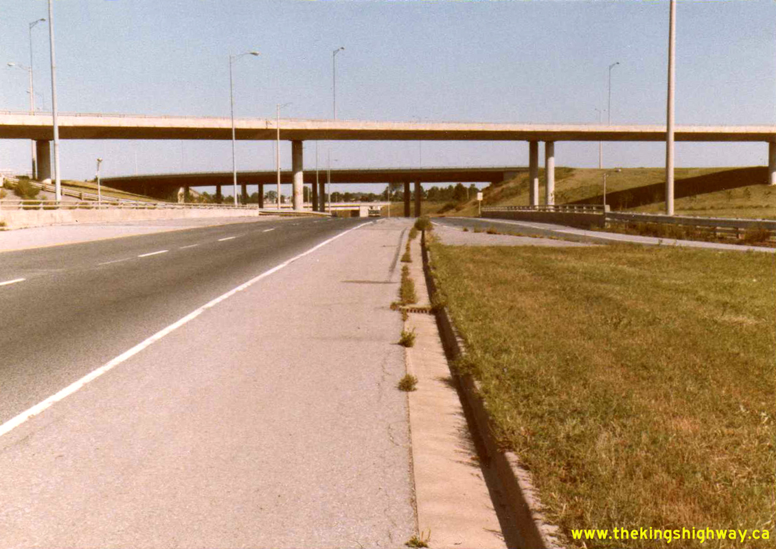
Enlarged Photo Here. Photo taken on September 1, 1982. (Photo courtesy of Ontario Ministry of Transportation - © King's Printer for Ontario, 2022) Right - Freeman Railway Overhead on the Queen Elizabeth Way in Burlington. Photo taken in September 1982. (Photo courtesy of Ontario Ministry of Transportation - © King's Printer for Ontario, 2012) 

Left - Facing west along Plains Road towards the Queen Elizabeth Way Underpass in 1982. Note the old 1936 Burlington Interchange Overpass structure in the
background, which at that time only carried traffic from westbound Plains Road onto the Niagara-bound Queen Elizabeth Way. The entire interchange at Plains Road was
rebuilt in 1983-1984. See an Enlarged Photo Here. Photo taken in September 1982. (Photo courtesy of Ontario Ministry of Transportation - © King's Printer for Ontario, 2017) Right - Passing through the Freeman Interchange on the Queen Elizabeth Way in Burlington in 1982. This ramp carries traffic from the Toronto-bound Queen Elizabeth Way to westbound Hwy 403 across the Niagara-bound lanes of the Queen Elizabeth Way. See an Enlarged Photo Here. Photo taken in September 1982. (Photo courtesy of Ontario Ministry of Transportation - © King's Printer for Ontario, 2017) 

Left - Facing south across the Freeman Railway Overhead on the Queen Elizabeth Way in Burlington. Photo taken in September 1982. (Photo courtesy of Ontario Ministry of Transportation - © King's Printer for Ontario, 2012) Right - Facing south across the new Trafalgar Road Overpass on the Queen Elizabeth Way in Oakville. Photo taken in October 1982. (Photo courtesy of Ontario Ministry of Transportation - © King's Printer for Ontario, 2012) 

Left - The new Trafalgar Road Overpass and reconfigured interchange was completed in 1979-1980, replacing the original interchange that was constructed in
1955. The new Trafalgar Road structure was considerably wider than the original 1955 structure, and provided an improved north-south arterial road connection between the
northern and southern sections of Oakville. Photo taken in October 1982. (Photo courtesy of Ontario Ministry of Transportation - © King's Printer for Ontario, 2012) Right - Facing north across the Glendale Avenue Overpass on the Queen Elizabeth Way near St. Catharines. Photo taken on October 14, 1982. (Photo courtesy of Ontario Ministry of Transportation - © King's Printer for Ontario, 2012) 

Left - Facing south across the Glendale Avenue Overpass on the Queen Elizabeth Way near St. Catharines. Photo taken on October 14, 1982. (Photo courtesy of Ontario Ministry of Transportation - © King's Printer for Ontario, 2012) Right - King's Highway 405 route marker at the Hwy 405 & Queen Elizabeth Way Interchange. Photo taken on October 14, 1982. (Photo courtesy of Ontario Ministry of Transportation - © King's Printer for Ontario, 2012) 

Left - Hwy 405 Flyover at the Queen Elizabeth Way Interchange. Photo taken on October 14, 1982. (Photo courtesy of Ontario Ministry of Transportation - © King's Printer for Ontario, 2012) Right - Lake Street Overpass on the Queen Elizabeth Way in St. Catharines. See an Enlarged Photo Here. Photo taken on November 2, 1982. (Photo courtesy of Ontario Ministry of Transportation - © King's Printer for Ontario, 2012) 

Left - Overhead bridge-mounted guide signs on the Ontario Street Overpass on the Queen Elizabeth Way in St. Catharines. Photo taken on November 2, 1982. (Photo courtesy of Ontario Ministry of Transportation - © King's Printer for Ontario, 2012) Right - Facing north across the Niagara Street Overpass on the Queen Elizabeth Way in St. Catharines. Photo taken on November 2, 1982. (Photo courtesy of Ontario Ministry of Transportation - © King's Printer for Ontario, 2012) 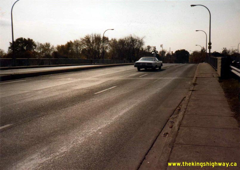

Left - Facing south across the Niagara Street Overpass on the Queen Elizabeth Way in St. Catharines. Photo taken on November 2, 1982. (Photo courtesy of Ontario Ministry of Transportation - © King's Printer for Ontario, 2012) Right - Niagara Street Overpass on the Queen Elizabeth Way in St. Catharines. Photo taken on November 2, 1982. (Photo courtesy of Ontario Ministry of Transportation - © King's Printer for Ontario, 2012) 

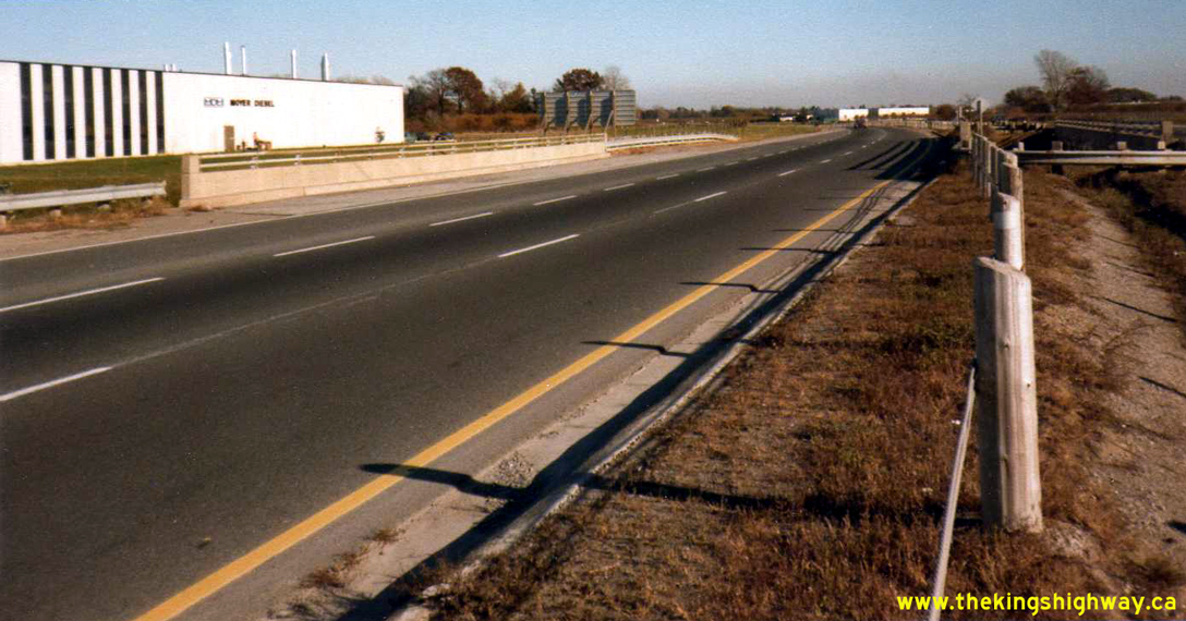
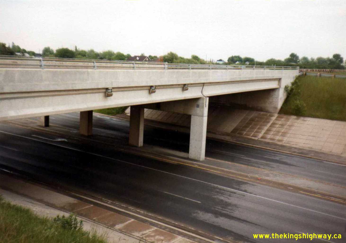
Left - New Appleby Line Overpass on the Queen Elizabeth Way in Burlington. Photo taken on May 5, 1983. (Photo courtesy of Ontario Ministry of Transportation - © King's Printer for Ontario, 2012) Right - The new Appleby Line Overpass on the Queen Elizabeth Way was completed in 1980, replacing the original two-lane 1959 structure seen in this 1977 Photo. The widened Appleby Line Overpass greatly improved north-south traffic flow through Burlington. Photo taken on May 5, 1983. (Photo courtesy of Ontario Ministry of Transportation - © King's Printer for Ontario, 2012) 

Left - Northern side of the Sixteen Mile Creek Bridge on the Queen Elizabeth Way in Oakville, facing west. Photo taken on May 5, 1983. (Photo courtesy of Ontario Ministry of Transportation - © King's Printer for Ontario, 2012) Right - Facing west along the Hamilton-bound lanes of the Queen Elizabeth Way at the Sixteen Mile Creek Bridge in Oakville. See an Enlarged Photo Here. Photo taken on May 5, 1983. (Photo courtesy of Ontario Ministry of Transportation - © King's Printer for Ontario, 2012) 

Left - Facing west along the Toronto-bound lanes of the Queen Elizabeth Way at the Sixteen Mile Creek Bridge in Oakville. See an
Enlarged Photo Here. Photo taken on May 5, 1983. (Photo courtesy of Ontario Ministry of Transportation - © King's Printer for Ontario, 2012) Right - Southern side of the Sixteen Mile Creek Bridge on the Queen Elizabeth Way in Oakville, facing west. Photo taken on May 5, 1983. (Photo courtesy of Ontario Ministry of Transportation - © King's Printer for Ontario, 2012) 

Left - Facing north across the Guelph Line Overpass on the Queen Elizabeth Way in Burlington. Photo taken on May 5, 1983. (Photo courtesy of Ontario Ministry of Transportation - © King's Printer for Ontario, 2012) Right - Eastern side of the Guelph Line Overpass on the Queen Elizabeth Way in Burlington. Photo taken on May 5, 1983. (Photo courtesy of Ontario Ministry of Transportation - © King's Printer for Ontario, 2012) 

Left - Facing south across the Walkers Line Overpass on the Queen Elizabeth Way in Burlington in 1983, shortly before the interchange was rebuilt. Growing
traffic volumes on Walkers Line forced a redesign of the old diamond interchange at this location. In 1987, a new six-lane structure and partial cloverleaf
interchange was built to replace the outdated 1959 diamond interchange and the two-lane overpass shown here. Photo taken on May 5, 1983. (Photo courtesy of Ontario Ministry of Transportation - © King's Printer for Ontario, 2012) Right - Western side of the Walkers Line Overpass on the Queen Elizabeth Way in Burlington in 1983. The bridge was demolished four years later. Photo taken on May 5, 1983. (Photo courtesy of Ontario Ministry of Transportation - © King's Printer for Ontario, 2012) 

Left - Facing east across the McLeod Road Overpass on the Queen Elizabeth Way in Niagara Falls. See an
Enlarged Photo Here. Photo taken on May 13, 1983. (Photo courtesy of Ontario Ministry of Transportation - © King's Printer for Ontario, 2022) Right - Facing east along Lundy's Lane towards Niagara Falls at the Queen Elizabeth Way Underpass. Photo taken on May 13, 1983. (Photo courtesy of Ontario Ministry of Transportation - © King's Printer for Ontario, 2011) 

Left - Southern side of the flyover from westbound Hwy 420 to the Fort Erie-bound Queen Elizabeth Way (Bridge #4) in Niagara Falls, crossing the Fort
Erie-bound lanes of the Queen Elizabeth Way. The Hwy 420 Underpass (Bridge #3) can be seen in the foreground. See an
Enlarged Photo Here. Photo taken on May 18, 1983. (Photo courtesy of Ontario Ministry of Transportation - © King's Printer for Ontario, 2022) Right - Flyover between the Toronto-bound Queen Elizabeth Way and eastbound Hwy 420 across the eastbound lanes of Hwy 420 (Bridge #8), facing towards Downtown Niagara Falls. See an Enlarged Photo Here. Photo taken on May 18, 1983. (Photo courtesy of Ontario Ministry of Transportation - © King's Printer for Ontario, 2022) 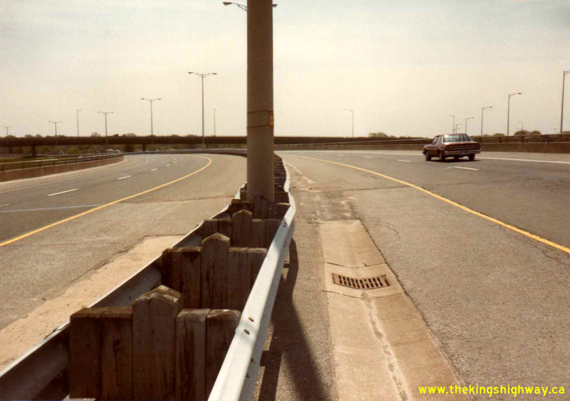

Left - Facing towards Downtown Niagara Falls across the Hwy 420 Flyover (Bridge #2) across the Queen Elizabeth Way. See an
Enlarged Photo Here. Photo taken on May 18, 1983. (Photo courtesy of Ontario Ministry of Transportation - © King's Printer for Ontario, 2022) Right - Flyover between the Queen Elizabeth Way and Hwy 420 across the westbound lanes of Hwy 420 (Bridge #7), facing towards Downtown Niagara Falls. See an Enlarged Photo Here. Photo taken on May 18, 1983. (Photo courtesy of Ontario Ministry of Transportation - © King's Printer for Ontario, 2022) 

Left - Facing towards Toronto across the Hwy 420 Underpass (Bridge #6) on the Queen Elizabeth Way. See an
Enlarged Photo Here. Photo taken on May 18, 1983. (Photo courtesy of Ontario Ministry of Transportation - © King's Printer for Ontario, 2022) Right - Hamilton-bound lanes of the Queen Elizabeth Way, facing west from the Mississauga Road Cloverleaf. See an Enlarged Photo Here. Photo taken on May 27, 1983. (Photo courtesy of Ontario Ministry of Transportation - © King's Printer for Ontario, 2012) 

Left - Toronto-bound lanes of the Queen Elizabeth Way, facing west from the Mississauga Road Cloverleaf. See an
Enlarged Photo Here. Photo taken on May 27, 1983. (Photo courtesy of Ontario Ministry of Transportation - © King's Printer for Ontario, 2012) Right - Suspended pin-and-hanger connection on the Freeman Railway Overhead on the Queen Elizabeth Way in Burlington in 1983. This unusual bridge design never saw widespread use in the province, so this example is actually quite rare. The small number of bridges built in Ontario with a suspended pin-and-hanger connection have now been retrofitted with a new connection system. The Freeman Railway Overhead was demolished shortly after this photo was taken to make way for the widened Burlington Skyway Approach. Photo taken on August 4, 1983. (Photo courtesy of Ontario Ministry of Transportation - © King's Printer for Ontario, 2012) 

Left - Facing north along Glendale Avenue from the Queen Elizabeth Way at the Old Hwy 8 (Niagara Road 81) Interchange near St. Catharines. Photo taken on
October 18, 1983. (Photo courtesy of Ontario Ministry of Transportation - © King's Printer for Ontario, 2012) Right - View of the Hwy 2 (North Shore Boulevard) Interchange in Burlington in 1983, facing west. This photo was taken part-way through this interchange's multi-year reconstruction under Contract #1982-85. In this view, the newly-built Collector Lane structures can be seen flanking the original 1956 structure. See an Enlarged Photo Here. Photo taken on November 17, 1983. (Photo courtesy of Ontario Ministry of Transportation - © King's Printer for Ontario, 2022) 

Left - Facing south along the future Toronto-bound Collector Lanes on the Queen Elizabeth Way at the Hwy 2 (North Shore Boulevard) Interchange in 1983, prior
to deck waterproofing and final paving. Unfortunately, a temporary construction sign beside the highway at right masks the fact that there was only one Burlington Bay
Skyway in service at the time this photo was taken. The twin Burlington Bay Skyway, which now carries all of the Niagara-bound lanes of the Queen Elizabeth Way,
wasn't completed until 1985. See an Enlarged Photo Here. Photo taken on November 17, 1983. (Photo courtesy of Ontario Ministry of Transportation - © King's Printer for Ontario, 2022) Right - Future Niagara-bound Collector Lanes on the Queen Elizabeth Way at the Hwy 2 (North Shore Boulevard) Interchange in Burlington 1983. Once the new Collector Lanes were opened to traffic, the original 1956 structure at left was closed for rehabilitation. The old concrete bar-and-post handrail was removed along with the double-sided steel beam guide rail median barrier and replaced with solid concrete barriers. This photo also shows the old 1950s-era median illumination system along the Queen Elizabeth Way, which had been installed along the approaches to the Burlington Bay Skyway. This illumination system was removed through the Hwy 2 Interchange in 1984. See an Enlarged Photo Here. Photo taken on November 17, 1983. (Photo courtesy of Ontario Ministry of Transportation - © King's Printer for Ontario, 2022) 

Left - New Hwy 406 structures over the Queen Elizabeth Way in St. Catharines, facing south. See
an Enlarged Photo Here. Photo taken on December 14, 1983. (Photo courtesy of Ontario Ministry of Transportation - © King's Printer for Ontario, 2017) Right - New ramp from the future northbound lanes of Hwy 406 to the Niagara-bound Queen Elizabeth Way in 1983. Construction of the new Hwy 406 Interchange began in 1981. The interchange opened to traffic in 1984 after three years of construction. See an Enlarged Photo Here. Photo taken on December 14, 1983. (Photo courtesy of Ontario Ministry of Transportation - © King's Printer for Ontario, 2017) 

Left - General view of the new Hwy 406 Interchange on the Queen Elizabeth Way facing west, as it nears completion in late 1983. The four overhead structures
span across the South Service Road. See an Enlarged Photo Here. Photo taken on December 14, 1983. (Photo courtesy of Ontario Ministry of Transportation - © King's Printer for Ontario, 2017) Right - New post-tensioned concrete ramp structure from northbound Hwy 406 to the Niagara-bound Queen Elizabeth Way. See an Enlarged Photo Here. Photo taken on December 14, 1983. (Photo courtesy of Ontario Ministry of Transportation - © King's Printer for Ontario, 2017) 

Left - New ramp from northbound Hwy 406 to the Niagara-bound Queen Elizabeth Way, prior to deck waterproofing. See an
Enlarged Photo Here. Photo taken on December 14, 1983. (Photo courtesy of Ontario Ministry of Transportation - © King's Printer for Ontario, 2017) Right - General view of the new Hwy 406 Interchange on the Queen Elizabeth Way, facing east along the South Service Road. See an Enlarged Photo Here. Photo taken on December 14, 1983. (Photo courtesy of Ontario Ministry of Transportation - © King's Printer for Ontario, 2017) 

Left - New ramp from the Niagara-bound Queen Elizabeth Way to southbound Hwy 406, prior to deck waterproofing. See an
Enlarged Photo Here. Photo taken on December 14, 1983. (Photo courtesy of Ontario Ministry of Transportation - © King's Printer for Ontario, 2017) Right - Facing south along the future southbound lanes of Hwy 406 at the Queen Elizabeth Way. See an Enlarged Photo Here. Photo taken on December 14, 1983. (Photo courtesy of Ontario Ministry of Transportation - © King's Printer for Ontario, 2017) 

Left - New Hwy 406 structures over the Queen Elizabeth Way in St. Catharines, facing north. See an
Enlarged Photo Here. Photo taken on December 14, 1983. (Photo courtesy of Ontario Ministry of Transportation - © King's Printer for Ontario, 2017) Right - Facing north along the future northbound lanes of Hwy 406 at the Queen Elizabeth Way. See an Enlarged Photo Here. Photo taken on December 14, 1983. (Photo courtesy of Ontario Ministry of Transportation - © King's Printer for Ontario, 2017) 

Left - Facing east along the Toronto-bound lanes of the Queen Elizabeth Way at the Woodward Avenue Underpass in Hamilton. See an
Enlarged Photo Here. Photo taken on July 20, 1984. (Photo courtesy of Ontario Ministry of Transportation - © King's Printer for Ontario, 2012) Right - During construction of the adjacent Woodward Avenue Ramp in 1983, the original concrete bar-and-post handrail of the Woodward Avenue Underpass was replaced. Photo taken on July 20, 1984. (Photo courtesy of Ontario Ministry of Transportation - © King's Printer for Ontario, 2012) 

Left - Facing east along the Niagara-bound lanes of the Queen Elizabeth Way towards the new Woodward Avenue Ramp in Hamilton. Photo taken on July 20, 1984. (Photo courtesy of Ontario Ministry of Transportation - © King's Printer for Ontario, 2012) Right - Rehabilitation of the Old Hwy 8 Overpass on the Queen Elizabeth Way near St. Catharines. Photo taken on September 7, 1984. (Photo courtesy of Ontario Ministry of Transportation - © King's Printer for Ontario, 2012) 

Left - Facing west across the Hwy 405 Flyover at the Queen Elizabeth Way Interchange. Photo taken on September 7, 1984. (Photo courtesy of Ontario Ministry of Transportation - © King's Printer for Ontario, 2012) Right - Glendale Avenue Overpass on the Queen Elizabeth Way near St. Catharines, facing south. Photo taken on September 17, 1984. (Photo courtesy of Ontario Ministry of Transportation - © King's Printer for Ontario, 2012) 

Left - Facing north across the Seventh Street Overpass near St. Catharines. See an
Enlarged Photo Here. Photo taken in October 1984. (Photo courtesy of Ontario Ministry of Transportation - © King's Printer for Ontario, 2022) Right - Trafalgar Road Overpass on the Queen Elizabeth Way in Oakville, facing north. Photo taken in October 1984. (Photo courtesy of Ontario Ministry of Transportation - © King's Printer for Ontario, 2012) 

Left - Sidewalk on the Toronto-bound 40 Mile Creek Bridge on the Queen Elizabeth Way in Grimsby in 1984. While it may seem strange to see a sidewalk on a
freeway structure, it is important to note that pedestrians were permitted to walk along this section of the Queen Elizabeth Way right up until the 1970s. It was not
until that time that all sideroad and driveway access points were completely removed and the highway was converted into a fully controlled-access freeway facility.
Photo taken on November 8, 1984. (Photo courtesy of Ontario Ministry of Transportation - © King's Printer for Ontario, 2012) Right - Niagara-bound 40 Mile Creek Bridge on the Queen Elizabeth Way in Grimsby, facing east. Photo taken on November 8, 1984. (Photo courtesy of Ontario Ministry of Transportation - © King's Printer for Ontario, 2012)
Continue on to Queen Elizabeth Way Historical Photos from 1985-1989
|
|---|
Links to Adjacent King's Highway Photograph Pages:
Back to King's Highway 427 Photos /
Queen Elizabeth Way History /
On to Secondary Highway 500 Photos
Ontario Highway History - Main Menu / Back to List of Highways Website contents, photos & text © 2002-2026, Cameron
Bevers (Webmaster) - All Rights Reserved / Contact Me
|
|---|