
| 
| |
|
|
All photographs displayed on this page were taken by the
Webmaster (Cameron Bevers). Photographs of Alaska Highway 1 are arranged by location from north
to south, heading outbound from Anchorage. To view
photos of other Alaska Highways, please select a highway number listed on the
Alaska Photograph Index Page.
Click on any thumbnail to see a larger image!
Please note that all photographs displayed on this
website are protected by copyright. These photographs must not be reproduced, published,
electronically stored or copied, distributed, or posted onto other websites without
my written permission. If you want to use photos from this website, please
email me first for permission. Thank-you!
|
|---|
|
Page 4S - Alaska Highway 1 (Seward Highway) Photographs: Turnagain Pass to Tern Lake

Left - Turnagain Pass on the Seward Highway (Hwy 1), facing north towards Anchorage. Although the summit is only 988 feet above sea level, Turnagain Pass gets
a healthy snowfall each winter. Even in late May, a significant amount of snow still envelops the nearby Kenai Mountains. See an
Enlarged Photo Here. (Photograph taken on May 27, 2012 - © Cameron Bevers) Right - Sign marking Turnagain Pass along the Northbound Seward Highway (Hwy 1). Turnagain Pass lies at Milepost 68, which is located about 60 miles south of Anchorage. (Photograph taken on May 27, 2012 - © Cameron Bevers) 

Left - Two roadside parks exist at the summit of Turnagain Pass. The Seward Highway (Hwy 1) widens into a divided highway across the summit. See an
Enlarged Photo Here. (Photograph taken on May 27, 2012 - © Cameron Bevers) Right - Facing south along the Seward Highway (Hwy 1) from the summit of Turnagain Pass. See an Enlarged Photo Here. (Photograph taken on May 27, 2012 - © Cameron Bevers) 

Left - Facing north along the Seward Highway (Hwy 1) towards the summit of Turnagain Pass. See an
Enlarged Photo Here. (Photograph taken on May 27, 2012 - © Cameron Bevers) Right - Concurrent passing lanes on the Seward Highway (Hwy 1), ascending Turnagain Pass from the south. (Photograph taken on June 11, 2012 - © Cameron Bevers) 

Left - The spectacular Kenai Mountains surround the Seward Highway (Hwy 1). This view is about 4 miles south of Turnagain Pass near
Granite Creek. See an Enlarged Photo Here. (Photograph taken on June 11, 2012 - © Cameron Bevers) Right - Facing north along the Seward Highway (Hwy 1), about 6 miles south of Turnagain Pass. This is the second of two four-lane sections on the Seward Highway between Turnagain Pass and the Hope Highway Junction at Canyon Creek. The other concurrent passing lane section lies a few miles to the north near Granite Creek. See an Enlarged Photo Here. (Photograph taken on June 11, 2012 - © Cameron Bevers) 

Left - Facing south along the Seward Highway (Hwy 1) between the Granite Creek Bridge and the Six Mile Creek Bridge. See an
Enlarged Photo Here. (Photograph taken on June 11, 2012 - © Cameron Bevers) Right - Guide sign marking the upcoming Hope Highway Turn-Off on the Southbound Seward Highway (Hwy 1). See an Enlarged Photo Here. (Photograph taken on June 11, 2012 - © Cameron Bevers) 

Left - The Hope Highway Turn-Off lies 1 mile ahead, just beyond the Canyon Creek Bridge on the Seward Highway (Hwy 1). (Photograph taken on June 11, 2012 - © Cameron Bevers) Right - Distance guide sign on the Northbound Seward Highway (Hwy 1) near the Hope Highway Junction. (Photograph taken on June 11, 2012 - © Cameron Bevers) 

Left - Facing south along the Seward Highway (Hwy 1) at the Canyon Creek Bridge. See an
Enlarged Photo Here. (Photograph taken on June 11, 2012 - © Cameron Bevers) Right - Western side of the Canyon Creek Bridge on the Seward Highway (Hwy 1). (Photograph taken on June 11, 2012 - © Cameron Bevers) 

Left - Eastern side of the Canyon Creek Bridge on the Seward Highway (Hwy 1). The Canyon Creek Bridge is the longest structure on the Seward Highway. See an
Enlarged Photo Here. (Photograph taken on June 11, 2012 - © Cameron Bevers) Right - The Seward Highway is carried high above Canyon Creek, south of Hope. The new Canyon Creek Bridge was completed in 1997. The construction project also included a substantial relocation of the Seward Highway in an effort to remove several successive sharp curves in the original highway's alignment. About 1 mile of the Seward Highway was relocated. In addition, the junction with the Hope Highway was also improved. See an Enlarged Photo Here. (Photograph taken on June 11, 2012 - © Cameron Bevers) 

Left - Old Canyon Creek Bridge on a former alignment of the Seward Highway (Hwy 1), facing south. This narrow bridge was built in 1950, and is located on a
sharp horizontal curve. It carried Seward Highway traffic up until the late 1990s, when a new bridge was constructed a short distance to the west. (Photograph taken on June 11, 2012 - © Cameron Bevers) Right - Facing north across the Old Canyon Creek Bridge. After the Seward Highway (Hwy 1) was relocated onto the new structure in 1997, the old highway alignment was converted into a pedestrian path. The horizontal geometry of this structure is rather interesting. The road alignment is so constrained at this location that a substantial curve superelevation had to be incorporated into the design of the bridge deck. (Photograph taken on June 11, 2012 - © Cameron Bevers) 

Left - Old Canyon Creek Bridge as seen from the Seward Highway (Hwy 1). This structure carried the Seward Highway from the time the bridge was completed in
1950, up until the completion of the current Canyon Creek Bridge in 1997. The old Seward Highway structure is now a pedestrian bridge. See an
Enlarged Photo Here. (Photograph taken on June 11, 2012 - © Cameron Bevers) Right - Former alignment of the Seward Highway (Hwy 1) at the Canyon Creek Bridge. This would have been a very sharp turn for vehicles to negotiate. (Photograph taken on June 11, 2012 - © Cameron Bevers) 

Left - Facing north along the Seward Highway (Hwy 1) towards Anchorage at the Canyon Creek Bridge. See an
Enlarged Photo Here. (Photograph taken on June 11, 2012 - © Cameron Bevers) Right - Canyon Creek Bridge on the Seward Highway (Hwy 1), facing north. See an Enlarged Photo Here. (Photograph taken on June 11, 2012 - © Cameron Bevers) 

Left - Hope Highway Turn-Off on the Seward Highway (Hwy 1), facing south. The small community of Hope lies about 16 miles to the north on Turnagain Arm. (Photograph taken on June 11, 2012 - © Cameron Bevers) Right - Approaching the Hope Highway Turn-Off on the Seward Highway (Hwy 1), facing north towards Anchorage. The Hope Highway does not have a posted highway route number. Only destination signs are present at the Hope Highway Junction. See an Enlarged Photo Here. (Photograph taken on June 11, 2012 - © Cameron Bevers) 

Left - Facing south from the Hope Highway Junction along the Seward Highway (Hwy 1). (Photograph taken on June 11, 2012 - © Cameron Bevers) Right - Distance guide sign on the Southbound Seward Highway (Hwy 1) near the Hope Highway Junction. (Photograph taken on June 11, 2012 - © Cameron Bevers) 

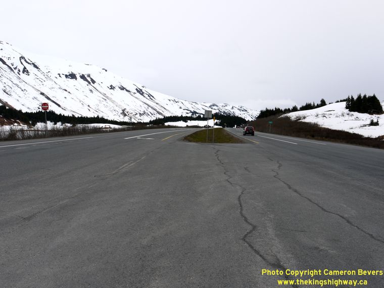
Left - Facing south along the Seward Highway (Hwy 1), about 1 mile south of the Hope Highway Junction. See an
Enlarged Photo Here. (Photograph taken on June 11, 2012 - © Cameron Bevers) Right - Elevation makes a huge difference at this latitude. While spring has definitely arrived in the valley, the mountains are still gripped in an icy winter. The difference between the two seasons is quite striking while traveling along the Seward Highway south of Hope. See an Enlarged Photo Here. (Photograph taken on June 11, 2012 - © Cameron Bevers) 

Left - Seward Highway (Hwy 1), facing south about 3 miles south of the Hope Highway Junction. (Photograph taken on June 11, 2012 - © Cameron Bevers) Right - This spectacular view of the Seward Highway (Hwy 1) emerges at Milepost 52, located 75 miles south of Anchorage. See an Enlarged Photo Here. (Photograph taken on June 11, 2012 - © Cameron Bevers) 

Left - Facing south along the Seward Highway (Hwy 1) near Milepost 50, 13 miles north of Tern Lake. (Photograph taken on June 11, 2012 - © Cameron Bevers) Right - Facing north along the Seward Highway (Hwy 1) near Lower Summit Lake. See an Enlarged Photo Here. (Photograph taken on June 11, 2012 - © Cameron Bevers) 

Left - Facing south along the Seward Highway (Hwy 1) at Summit Lake. The Seward Highway runs along the western shore of Summit Lake, as it cuts south across
the Kenai Mountains towards Seward. See an Enlarged Photo Here. (Photograph taken on June 11, 2012 - © Cameron Bevers) Right - This scenic view of Summit Lake is visible to motorists who stop at the roadside turnout on the Seward Highway (Hwy 1). See an Enlarged Photo Here. (Photograph taken on June 11, 2012 - © Cameron Bevers) 

Left - Facing north along the Seward Highway (Hwy 1) at Summit Lake. See an
Enlarged Photo Here. (Photograph taken on June 11, 2012 - © Cameron Bevers) Right - Distance sign on the Northbound Seward Highway (Hwy 1) leaving Tern Lake. (Photograph taken on June 11, 2012 - © Cameron Bevers)
NOTE: At Tern Lake Junction, Hwy 1 splits off from the Seward Highway and follows the Sterling Highway to Homer. The Seward Highway continues south to Seward as Hwy 9. Continue south along the Seward Highway via Alaska Highway 9 Continue south along the Sterling Highway via Alaska Highway 1 |
|---|
Links to Other Ontario Highway History Website Sections:
Back to Alaska Highway 1 Photos /
Alaska Highways Photo Index /
On to Alaska Highway 2 Photos
Vacation Highway Photos - Main Menu / Ontario Highway History - Main Menu Website contents, photos & text © 2002-2026, Cameron
Bevers (Webmaster) - All Rights Reserved / Contact Me
|
|---|