
| 
| |
|
|
This page contains historical photos of Ontario's King's Highway 144 dating from 1950 to 1999. All photographs displayed on
this page were taken by the Ontario Ministry of Transportation, unless specifically noted otherwise. Historical photographs are arranged in approximate chronological
order. Click on any thumbnail to see a larger image!
Please note that all photographs displayed on this
website are protected by copyright. These photographs must not be reproduced, published,
electronically stored or copied, distributed, or posted onto other websites without
my written permission. If you want to use photos from this website, please
email me first for permission. Thank-you!
|
|---|
|
Page 1: Historical King's Highway 144 Photographs (1950-1999)

Above - Entrance to the Windy Lake Roadside Park on the Sudbury-Cartier Road (Hwy 544, later Hwy 144) between Onaping and Cartier. Windy Lake Park was one of
several roadside parks established by the Department of Highways of Ontario (DHO) in 1939 for the convenience of motorists using Sudbury-area highways. With a
total area of approximately 315 acres, Windy Lake Park was the second-largest park in the DHO's system of roadside parks. The park included a beach, campground,
washrooms, cooking stoves and a fishing wharf. Administration of the roadside park was eventually transferred from the DHO to the Department of Lands and Forests in
1958. It was subsequently designated as Windy Lake Provincial Park in 1959 and is still in operation today. See an
Enlarged Photo Here. Photo taken on September 4, 1950. (Photo courtesy of Ontario Ministry of Transportation - © King's Printer for Ontario, 1950) 
Above - Muskeg removal and preparation for rock blasting on a new diversion of Hwy 544 (later Hwy 144) between Sudbury and Azilda. Photo taken on October 15, 1956. (Photo courtesy of Ontario Ministry of Transportation - © King's Printer for Ontario, 1956) 
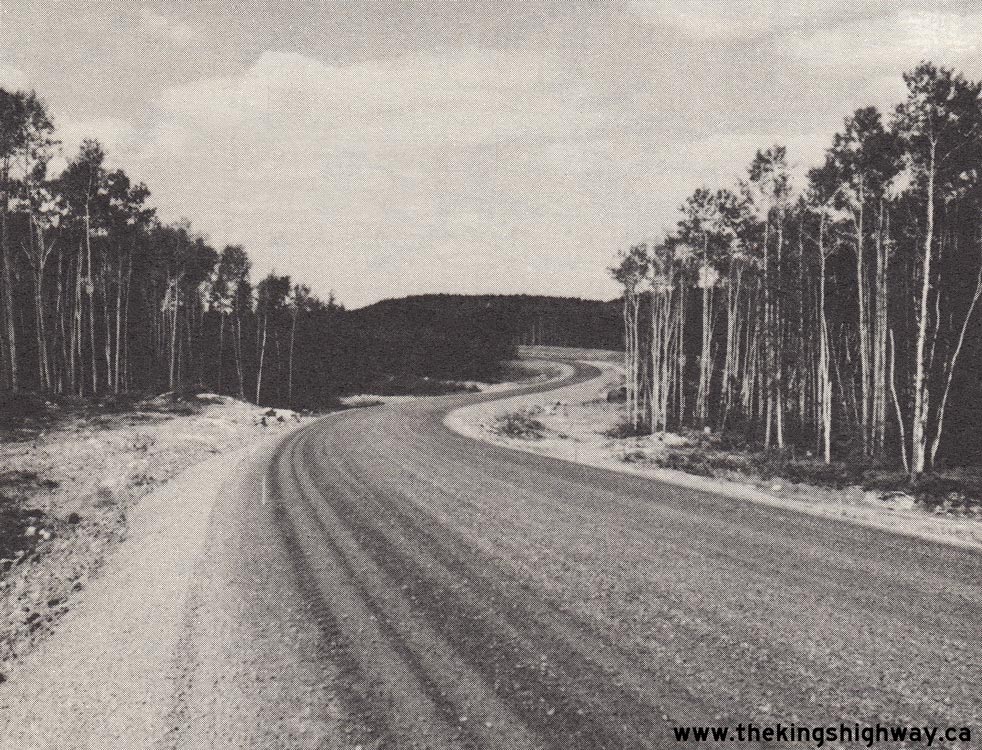
Above - Completed grading work on Hwy 544 (later Hwy 144) about 3 miles north of Larchwood (1957) (Photo courtesy of Ontario Ministry of Transportation - © King's Printer for Ontario, 1957) 

Left - Existing forestry road bridge over the Tatachikapika River on the proposed route of the Sudbury-Timmins Highway (Hwy 144), about 4 miles south of the
Hwy 101 Junction. This rather precarious one-lane timber structure was one of several old bridges which had to be replaced during construction of the Hwy 144 link
between Sudbury and Timmins. Photo taken in 1964. (Photo courtesy of Ontario Ministry of Transportation - © King's Printer for Ontario, 1964) Right - Grading for the new Sudbury-Timmins Highway (Hwy 144) in 1965 (Photo courtesy of Ontario Ministry of Transportation - © King's Printer for Ontario, 1965) 

Left - Paving operations on the Windy Lake-Cartier Diversion (Hwy 144) south of Cartier (1965) (Photo courtesy of Ontario Ministry of Transportation - © King's Printer for Ontario, 1965) Right - Rock cut excavation for the new route of Hwy 144, about 55 miles north of Benny (1968) (Photo courtesy of Ontario Ministry of Transportation - © King's Printer for Ontario, 1968) 

Left - Reconstruction of a section of Hwy 144 west of Azilda (1968) (Photo courtesy of Ontario Ministry of Transportation - © King's Printer for Ontario, 1968) Right - Paving a new section of Hwy 144 north of Gogama, Contract #1970-60 (1970) (Photo courtesy of Ontario Ministry of Transportation - © King's Printer for Ontario, 1970) 

Left - Paving operations along Hwy 144 north of Gogama (1970) (Photo courtesy of Ontario Ministry of Transportation - © King's Printer for Ontario, 1970) Right - Official opening of Hwy 144 between Sudbury and Timmins on September 25, 1970. A car bearing former Ontario Premier John Robarts and former Minister of Highways George Gomme, breaks through a paper sign, officially opening Hwy 144 to traffic. The new highway shortened the distance between the two cities by over 100 km. Photo taken on September 25, 1970. (Photo courtesy of Ontario Ministry of Transportation - © King's Printer for Ontario, 1970) 
Left - Construction of a new diversion for Hwy 144 south of Gogama (1970) (Photo courtesy of Ontario Ministry of Transportation - © King's Printer for Ontario, 1970) Right - Completed section of Hwy 144 before paving, about 24 miles north of Benny (1970) (Photo courtesy of Ontario Ministry of Transportation - © King's Printer for Ontario, 1970) 

Left - Newly-paved section of Hwy 144 near Onaping Lake (1971) (Photo courtesy of Ontario Ministry of Transportation - © King's Printer for Ontario, 1971) Right - Rock cuts on a new diversion for Hwy 144 south of Gogama (1972) (Photo courtesy of Ontario Ministry of Transportation - © King's Printer for Ontario, 1972) 

Left - Resurfaced section of Hwy 144 south of the Hwy 101 Junction (1978) (Photo courtesy of Ontario Ministry of Transportation - © King's Printer for Ontario, 1978) Right - Resurfaced section of Hwy 144 south of Gogama (1980) (Photo courtesy of Ontario Ministry of Transportation - © King's Printer for Ontario, 1980) 
Above - Arctic Watershed sign on Hwy 144 near the Hwy 560 Junction. See an
Enlarged Photo Here. (Photograph taken in August 1999 - © Cameron Bevers) 
Above - Facing south along Hwy 144 from Hwy 101 Junction west of Timmins. Note the advisory sign ahead stating that there are no service stations for 85 km.
See an Enlarged Photo Here. (Photograph taken in August 1999 - © Cameron Bevers)
Continue on to King's Highway 144 Present Day Photos: Hwy 17 to Cartier
|
|---|
Links to Adjacent King's Highway Photograph Pages:
Back to King's Highway 141 Photos /
King's Highway 144 History /
On to King's Highway 148 Photos
Ontario Highway History - Main Menu / Back to List of Highways Website contents, photos & text © 2002-2026, Cameron
Bevers (Webmaster) - All Rights Reserved / Contact Me
|
|---|