
| 
| |
|
|
This page contains historical photos of Ontario's King's Highway 15 dating from 1920 to 1999. All photographs displayed on
this page were taken by the Ontario Ministry of Transportation, unless specifically noted otherwise. Historical photographs are arranged in approximate chronological
order. Click on any thumbnail to see a larger image!
Please note that all photographs displayed on this
website are protected by copyright. These photographs must not be reproduced, published,
electronically stored or copied, distributed, or posted onto other websites without
my written permission. If you want to use photos from this website, please
email me first for permission. Thank-you!
|
|---|
|
Historical King's Highway 15 Photographs (1920-1999)


Left - Henninger Construction Company crew laying hot-mix asphalt pavement on Hwy 29 (now Hwy 15) between Smiths Falls and Franktown. Photo taken on September 25, 1946. (Photo courtesy of Ontario Ministry of Transportation - © King's Printer for Ontario, 1946) Right - Widening a rock cut on Hwy 29 (now Hwy 15) 3 miles north of Smiths Falls by Henninger Construction Company. Photo taken on September 25, 1946. (Photo courtesy of Ontario Ministry of Transportation - © King's Printer for Ontario, 1946) 

Left - Rolling hot-mix asphalt pavement on Hwy 29 (now Hwy 15) between Smiths Falls and Franktown. Photo taken on September 25, 1946. (Photo courtesy of Ontario Ministry of Transportation - © King's Printer for Ontario, 1946) Right - Completed hot-mix asphalt surface on Hwy 29 (now Hwy 15) between Smiths Falls and Franktown. Photo taken on September 25, 1946. (Photo courtesy of Ontario Ministry of Transportation - © King's Printer for Ontario, 1946) 

Left - Junction of Hwy 15 & Hwy 29 near Carleton Place, facing south towards Smiths Falls. Ottawa-bound traffic forked to the left via Hwy 15 (now
Hwy 7), while Kingston-bound traffic continued straight ahead via Hwy 29 (now Hwy 15). Click here to see a
Present Day Photo of this highway junction. Photo taken on September 28, 1946. (Photo courtesy of Ontario Ministry of Transportation - © King's Printer for Ontario, 1946) Right - Entrance to the Department of Highways' Roadside Park at the Hwy 44 & Hwy 29 Junction (later Hwy 15) in Almonte in 1948. The Almonte DHO Roadside Park had a 10-acre wooded campground, cooking stoves and washrooms for the convenience of motorists using area highways. Administration of the roadside park was eventually transferred from the DHO to the Town of Almonte (now part of the Municipality of Mississippi Mills). The former Almonte DHO Roadside Park was situated immediately adjacent to the Hwy 44 Junction in the northwest corner of the present-day Gemmill Park. Photo taken on September 11, 1948. (Photo courtesy of Ontario Ministry of Transportation - © King's Printer for Ontario, 1948) 

Left - Looking west along Hwy 15, one mile east of Bell's Corners in 1948. This historic photo shows the area where Richmond Road (Old Hwy 7 & Hwy 15)
crosses over Hwy 416 today, between Bell's Corners and Ottawa. See an Enlarged Photo Here. Photo
taken on July 15, 1948. (Photo courtesy of Ontario Ministry of Transportation - © King's Printer for Ontario, 1948) Right - Department of Highways' Roadside Park on Hwy 15 (today's Hwy 7) at Innisville in 1950. This small roadside park was established in 1948 for the convenience of motorists traveling to and from Ottawa. The park was built between the original highway alignment which ran behind the park to the left and the relocated highway at right. Although the stone fireplaces were removed many years ago, this roadside park and picnic area is still in operation today on Hwy 7 north of Innisville. See an Enlarged Photo Here. Photo taken on July 22, 1950. (Photo courtesy of Ontario Ministry of Transportation - © King's Printer for Ontario, 1951) 
Above - Trans-Canada Highway Sign at the junction of Hwy 15 & Hwy 17 in Ottawa. Photo taken on July 19, 1950. (Photo courtesy of Ontario Ministry of Transportation - © King's Printer for Ontario, 1950) 

Left - A scenic view of the Rideau Canal in Ottawa in 1950, approaching the Wellington Street Bridge near Parliament Hill. Although they are not particularly
obvious in this photo, note the four King's Highway route markers mounted onto a single post on Rideau Canal Drive at left. For many years, the routes of Hwy 15,
Hwy 16, Hwy 17 and Hwy 31 all followed Rideau Canal Drive along a city-signed scenic loop through Downtown Ottawa. See an
Enlarged Photo Here. Photo taken in 1950. (Photo courtesy of Ontario Ministry of Transportation - © King's Printer for Ontario, 1950) Right - Facing south along Rideau Canal Drive (Hwy 15, Hwy 16, Hwy 17 & Hwy 31) in Ottawa in 1951. See an Enlarged Photo Here. Photo taken in 1951. (Photo courtesy of Ontario Ministry of Transportation - © King's Printer for Ontario, 1951) 
Above - New pavement and zone markings on a new Hwy 15 alignment east of Crosby. Photo taken on June 8, 1951. (Photo courtesy of Ontario Ministry of Transportation - © King's Printer for Ontario, 1951) 
Above - Craig Street Bridge over the Tay River on Hwy 15 (later Hwy 43) in Perth (1954) (Photo courtesy of Ontario Ministry of Transportation - © King's Printer for Ontario, 1954) 
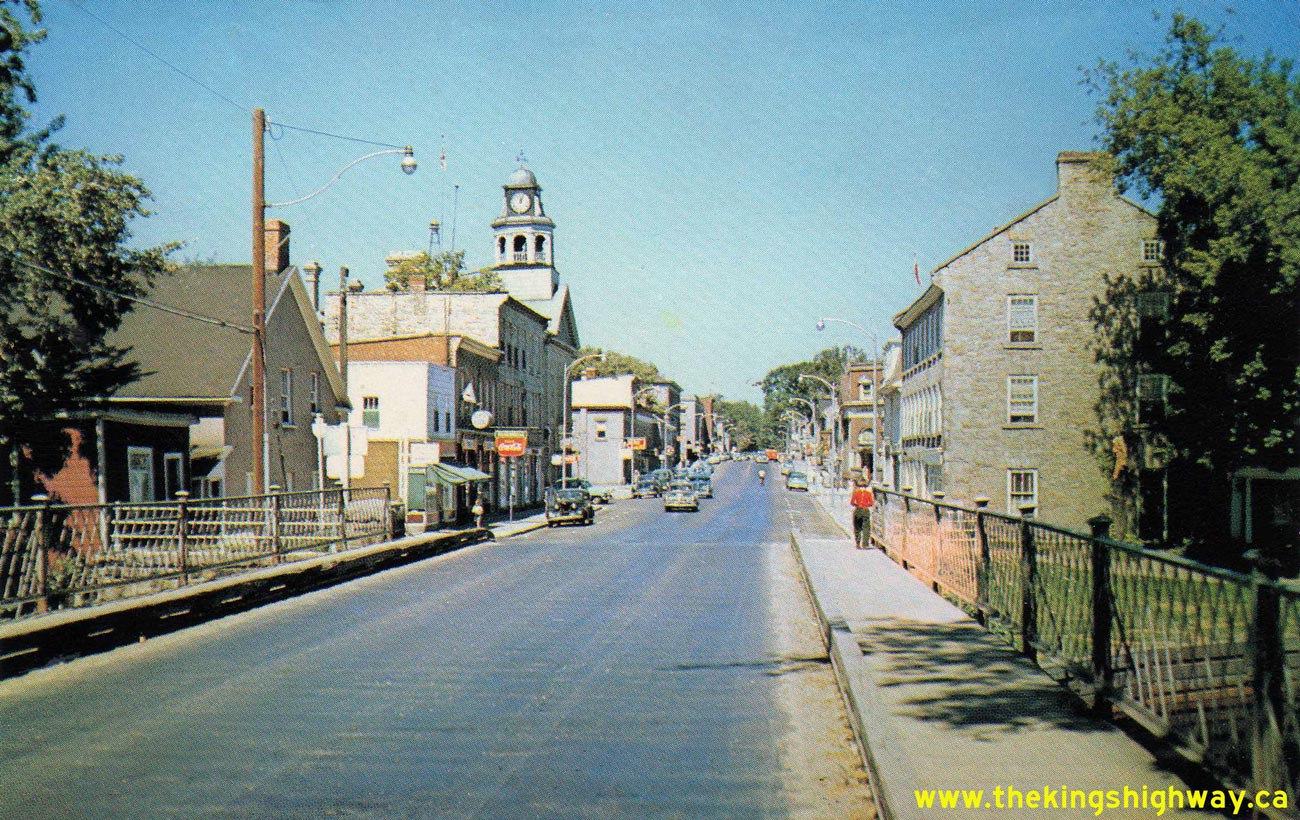
Above - Circa 1955 postcard view of Gore Street (Hwy 15, later Hwy 43) in Downtown Perth, facing north from the Tay River Bridge. See an
Enlarged Photo Here. (Photo courtesy of L. F. Charter) 

Left - Broken concrete pavement on Hwy 15 near Smiths Falls. Photo taken in 1958. See an
Enlarged Photo Here. (Photo courtesy of Ontario Ministry of Transportation - © King's Printer for Ontario, 1958) Right - Bell's Corners Subway on Hwy 15 west of Ottawa. Photo taken in 1958. See an Enlarged Photo Here. (Photo courtesy of Ontario Ministry of Transportation - © King's Printer for Ontario, 1958) 
Above - Outdated railway subway on Hwy 29 (later Hwy 15) in Smiths Falls in 1958. Narrow, low clearance railway subways such as this one were quite common on
Ontario's highways until the 1960s. See an Enlarged Photo Here. (Photo courtesy of Ontario Ministry of Transportation - © King's Printer for Ontario, 1958) 
Above - New entrance to Fort Henry on Hwy 2 & Hwy 15 east of Kingston, Contract #1960-221. See an
Enlarged Photo Here. Photo taken in 1961. (Photo courtesy of Ontario Ministry of Transportation - © King's Printer for Ontario, 1961) 
Above - Resurfacing operations on Hwy 15 & Hwy 29 south of Carleton Place (1963) (Photo courtesy of Ontario Ministry of Transportation - © King's Printer for Ontario, 1963) 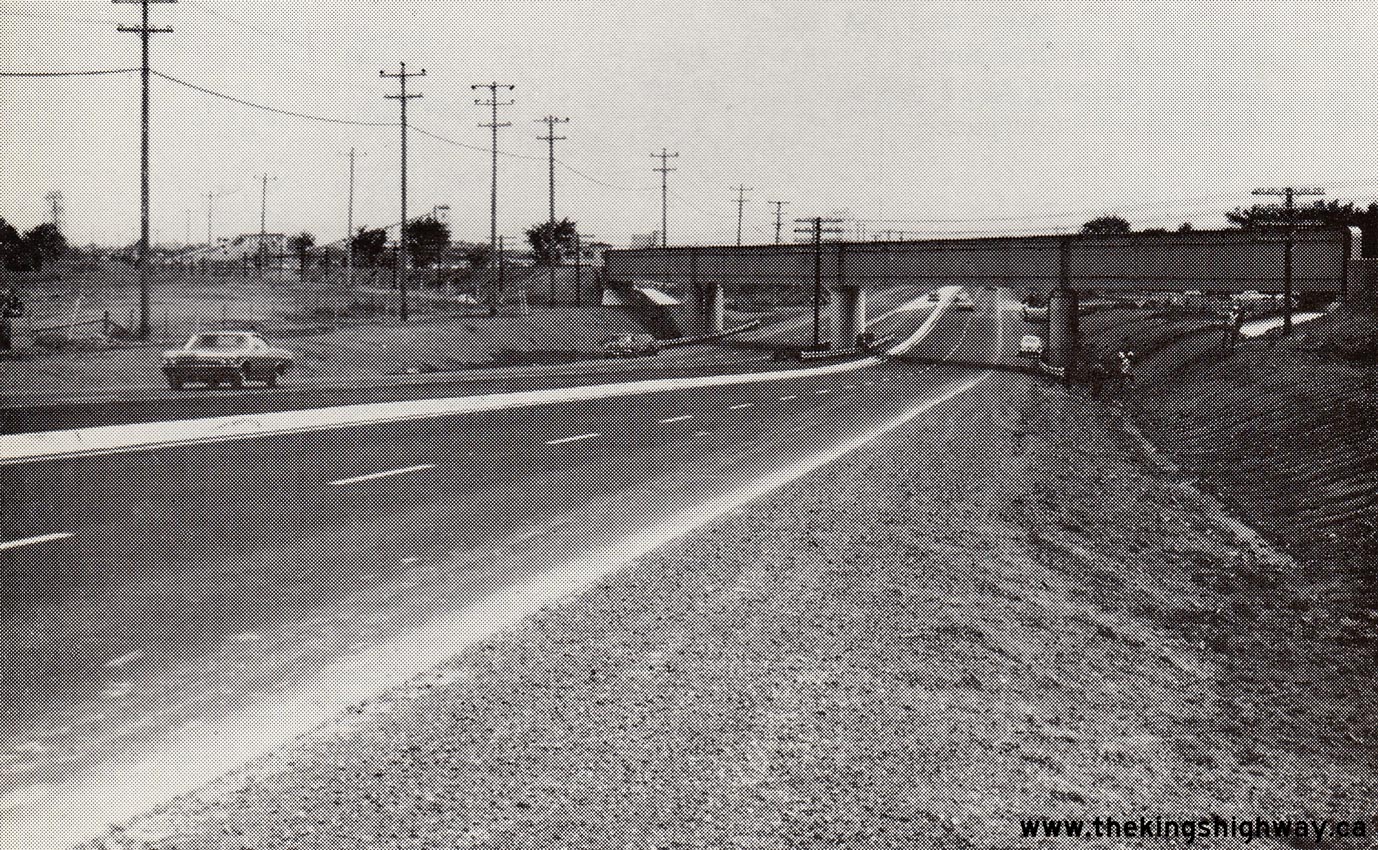
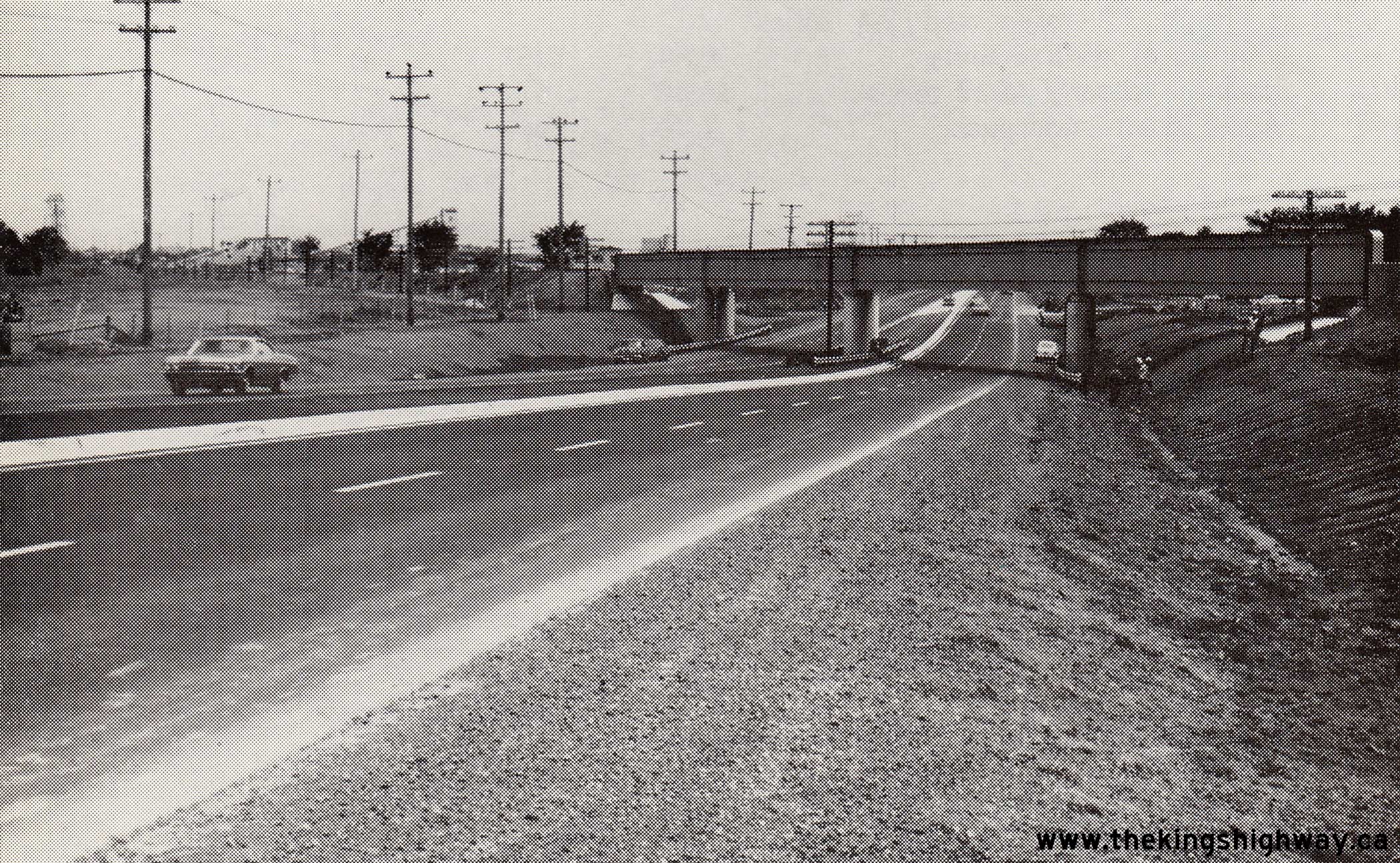
Left - Completed Bells Corners Canadian Pacific Railway (CPR) Subway on Hwy 7 & Hwy 15 (today's Robertson Road) southwest of Ottawa in 1967. Built under
Contract #1965-168, this impressive new railway subway accommodated a four-lane divided highway on a vastly-improved alignment. The previous CPR Subway on Hwy 7 &
Hwy 15 at Bells Corners was on a crooked alignment, as seen in this 1958 Photo. By the early
1960s, the subway's already limited vertical clearance was reduced further to only 13 feet, 3 inches (just over 4.0 metres), due to asphalt pavement overlays. Until
the new four-lane Bells Corners Subway was completed in 1966, the limited vertical clearance of the old subway prevented larger transport trucks from using Hwy 7
& Hwy 15 through this area. See an Enlarged Photo Here. Photo taken in 1967. (Photo courtesy of Ontario Ministry of Transportation - © King's Printer for Ontario, 1967) 

Left - Circa 1968 postcard view of Bridge Street (Hwy 7B & Hwy 29, later known as Hwy 15) in Downtown Carleton Place. See an
Enlarged Photo Here. (Photograph courtesy of Len Leiffer) Right - Circa 1968 postcard view of the Mississippi River in Carleton Place, as seen from Bridge Street (Hwy 7B & Hwy 29, later known as Hwy 15). See an Enlarged Photo Here. (Photograph courtesy of Len Leiffer)
Continue on to King's Highway 15 Present Day Photos: Kingston to Smiths Falls
|
|---|
Links to Adjacent King's Highway Photograph Pages:
Back to King's Highway 14 Photos /
King's Highway 15 History /
On to King's Highway 16 Photos
Ontario Highway History - Main Menu / Back to List of Highways Website contents, photos & text © 2002-2026, Cameron
Bevers (Webmaster) - All Rights Reserved / Contact Me
|
|---|