
| 
| |
|
|
This page contains present day photos (Year 2000 to date) of Ontario's King's Highway 15, arranged by location from Kingston
northerly to Smiths Falls. All photographs displayed on this page were taken by the Webmaster (Cameron Bevers), unless specifically noted otherwise. Click on any
thumbnail to see a larger image!
Please note that all photographs displayed on this
website are protected by copyright. These photographs must not be reproduced, published,
electronically stored or copied, distributed, or posted onto other websites without
my written permission. If you want to use photos from this website, please
email me first for permission. Thank-you!
|
|---|
|
Page 2: Present Day King's Highway 15 Photographs (Kingston to Smiths Falls)

Above - King's Highway 15 route marker facing northbound traffic near the Hwy 2 Junction at Barriefield. See an
Enlarged Photo Here. (Photograph taken on April 9, 2004 - © Cameron Bevers) 

Left - Facing east along Hwy 401 from the Hwy 15 Overpass east of Kingston. The rocky topography of this area prompted the highway's designers to use a
"diamond" interchange at Hwy 401 & Hwy 15. The diamond interchange design is quite uncommon in Ontario, despite its widespread use in many other North American
jurisdictions. See an Enlarged Photo Here. (Photograph taken on April 9, 2004 - © Cameron Bevers) Right - Facing west along Hwy 401 towards Kingston from the Hwy 15 Overpass. See an Enlarged Photo Here. (Photograph taken on April 9, 2004 - © Cameron Bevers) 
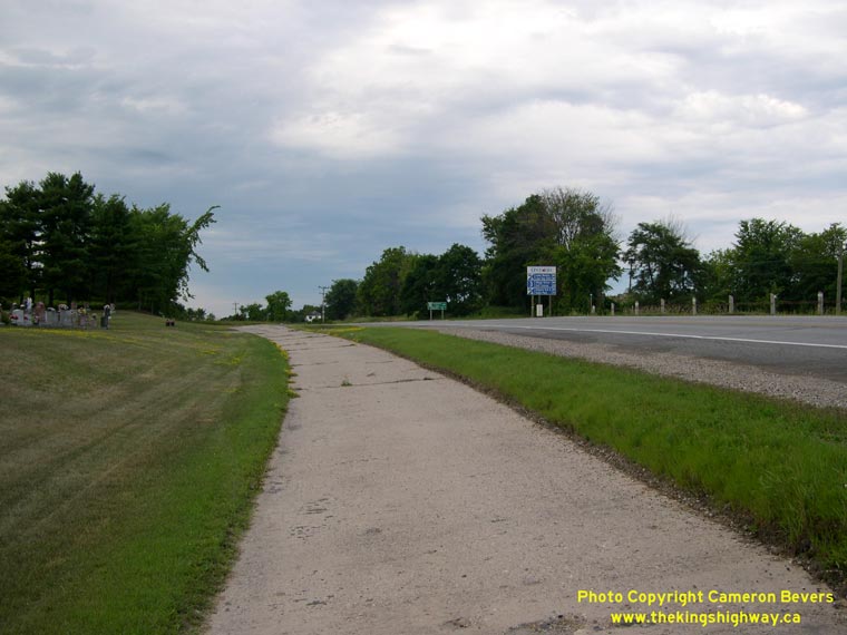
Left - Abandoned Hwy 15 alignment north of the Hwy 32 Junction near Seeley's Bay. This superelevated curve was abandoned when the highway's alignment was
improved in the 1950s. The revised highway at left features a curve with a lower superelevation rate and more gradual horizontal curvature. See an
Enlarged Photo Here. (Photograph taken on July 31, 2005 - © Cameron Bevers) Right - Another view of the abandoned Hwy 15 alignment north of the Hwy 32 Junction. Originally, this was a twin-slab concrete highway. In order to construct the new highway alignment at right, the former northbound concrete lane was broken up and removed. The former southbound lane was left in place to serve as an access road to a nearby cemetery. See an Enlarged Photo Here. (Photograph taken on July 31, 2005 - © Cameron Bevers) 

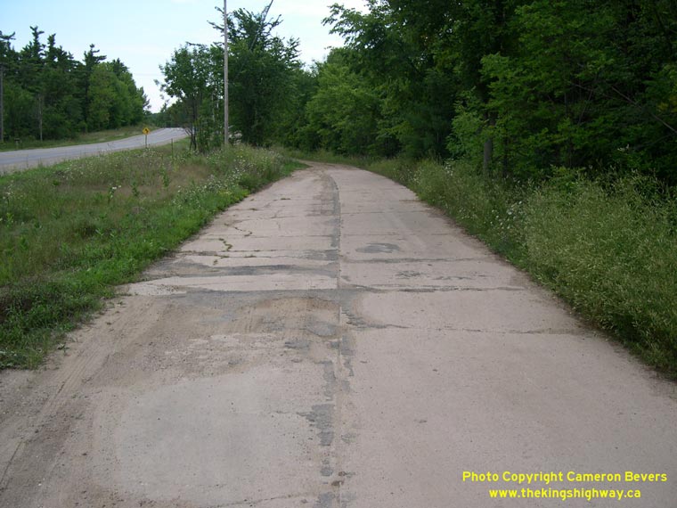
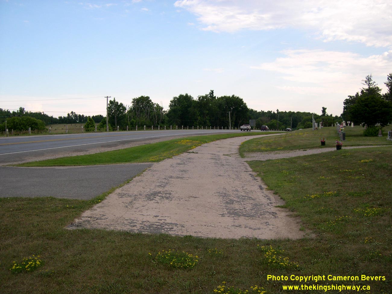
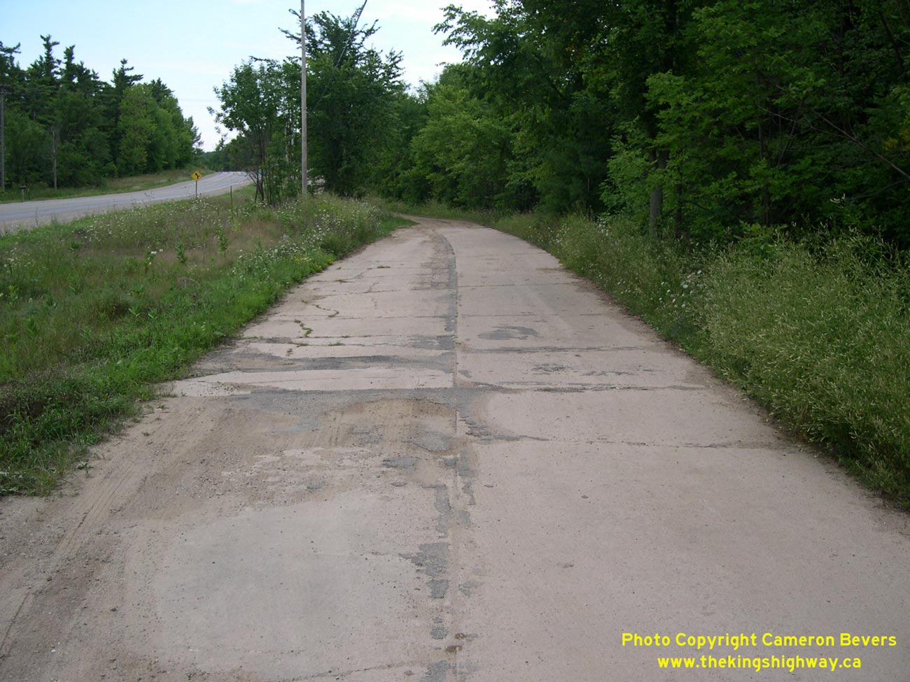
Left - Another abandoned Hwy 15 alignment between the Hwy 32 Junction and Morton. This twin-slab concrete pavement was constructed in 1934, when Hwy 15 was
paved between Seeley's Bay and Elgin. This particular section was bypassed during a highway improvement project in the 1950s, in order to remove a steep grade on
the original highway. The old concrete highway now serves as a private residential driveway. See an
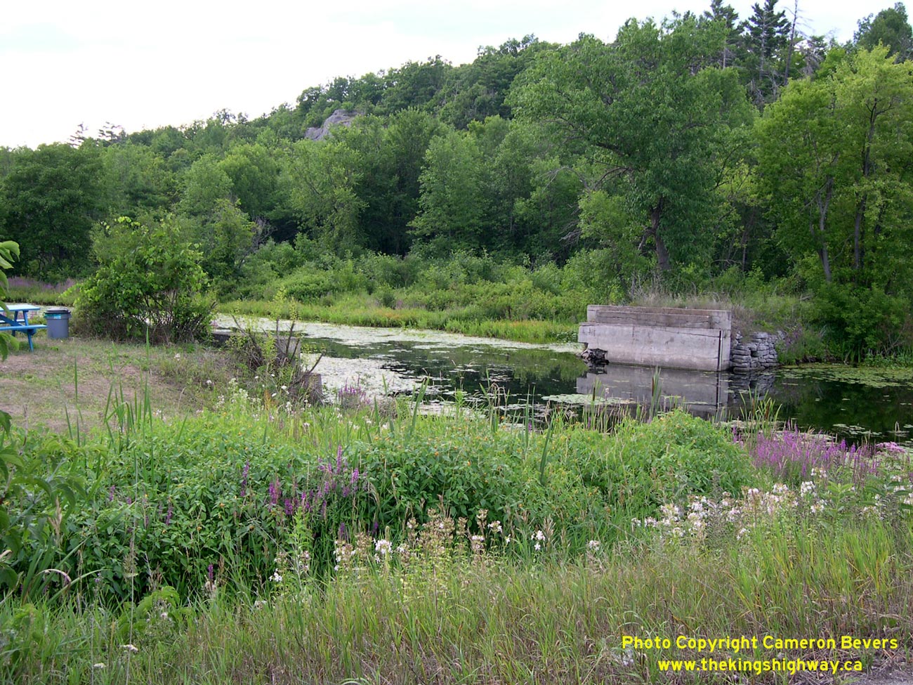
Enlarged Photo Here. (Photograph taken on July 31, 2005 - © Cameron Bevers) Right - Site of the Old Morton Creek Bridge on a former alignment of Hwy 15 at Morton. The old bridge was removed in 1934, when a new highway alignment was constructed north of Morton on an improved grade. Only the old concrete bridge abutments remain today. See an Enlarged Photo Here. (Photograph taken on July 31, 2005 - © Cameron Bevers) 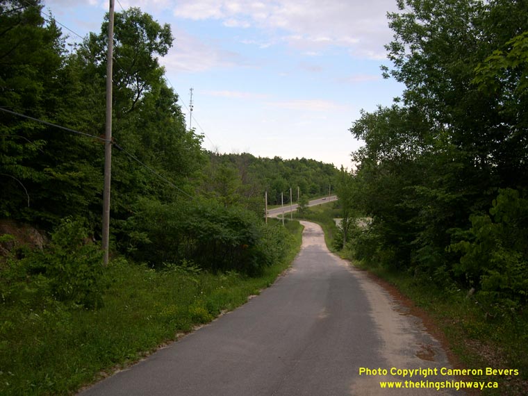
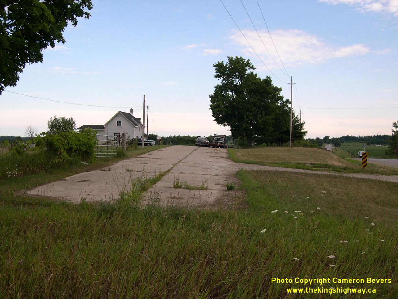
Left - Former Hwy 15 alignment north of Morton, facing south towards Seeley's Bay. This steep grade and narrow roadway was bypassed by a new Hwy 15 diversion
in 1934. See an Enlarged Photo Here. (Photograph taken on July 31, 2005 - © Cameron Bevers) Right - Abandoned curve on a former alignment of Hwy 15 about 3 km north of Morton, showing an old section of twin-slab concrete pavement. See an Enlarged Photo Here. (Photograph taken on July 31, 2005 - © Cameron Bevers) 
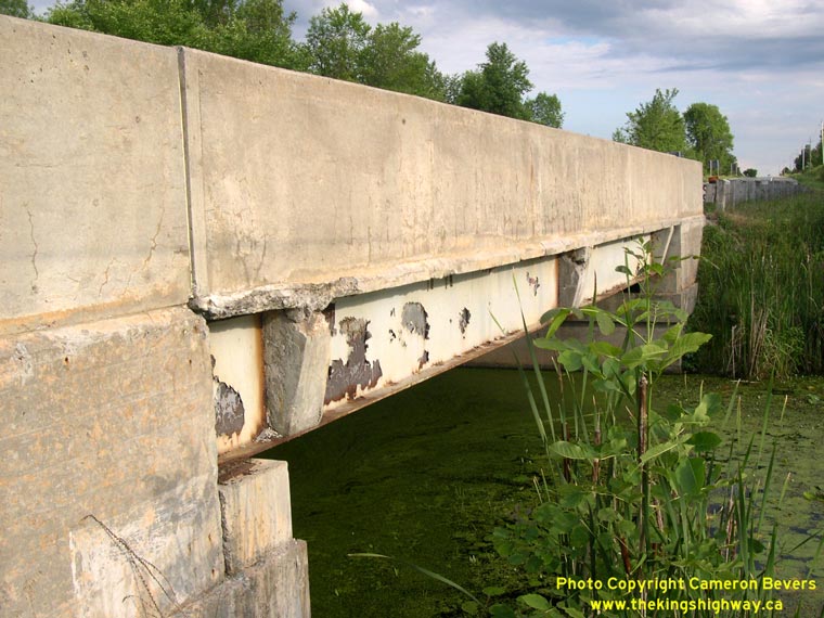
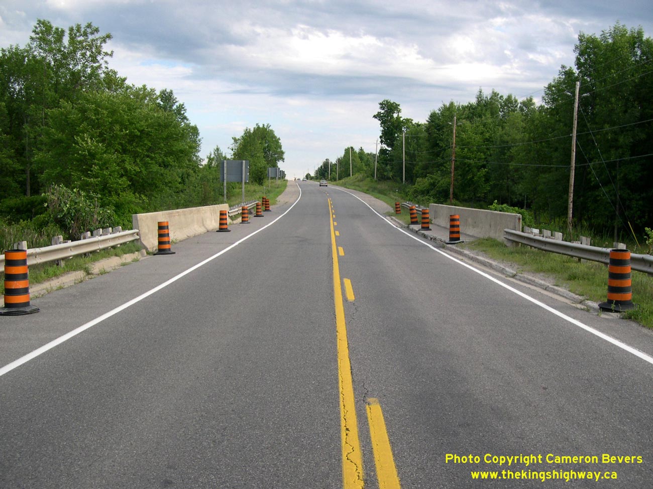
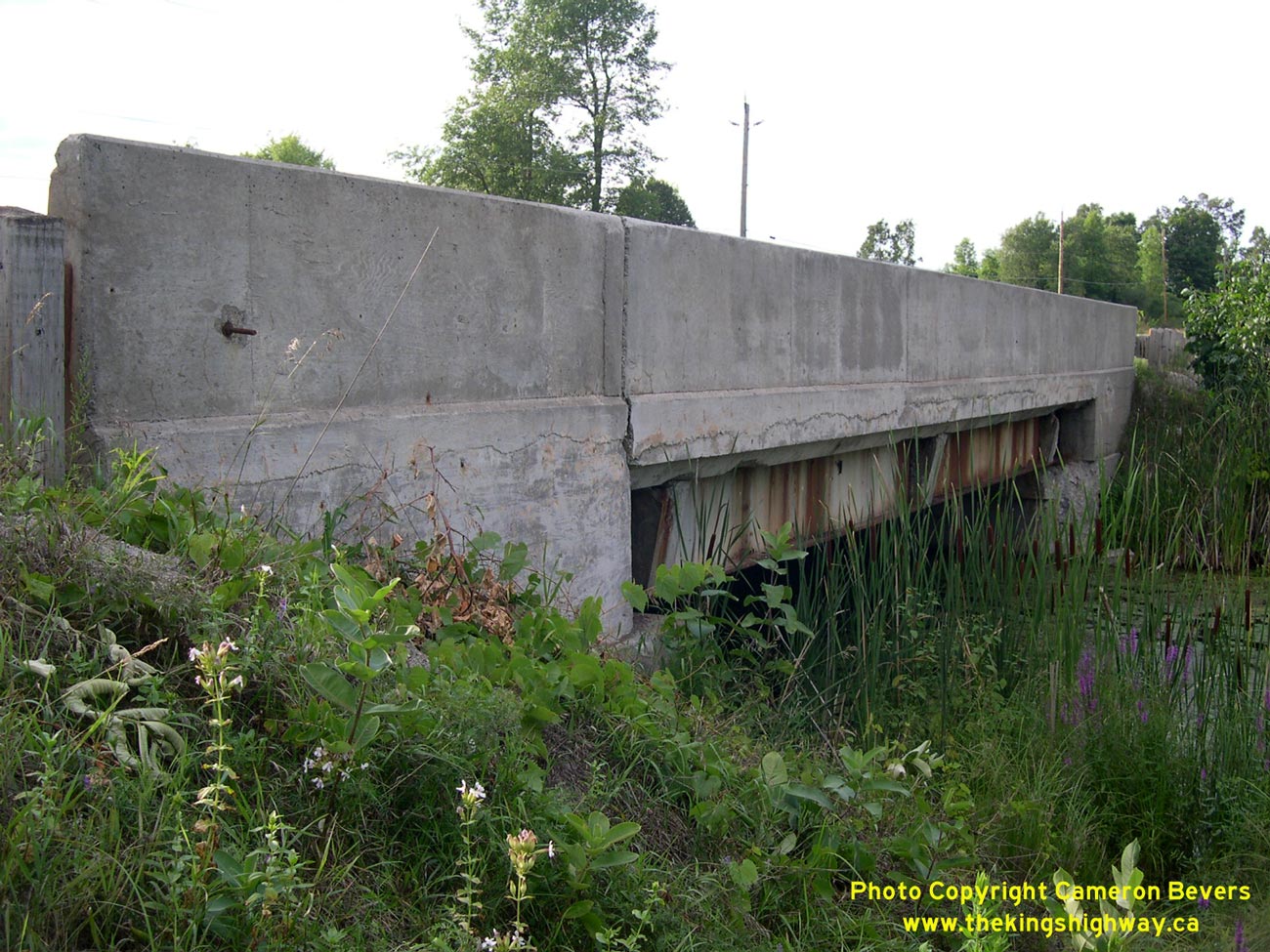
Left - Facing south along Hwy 15 towards Elgin at the Crosby Creek Bridge south of Crosby. See an
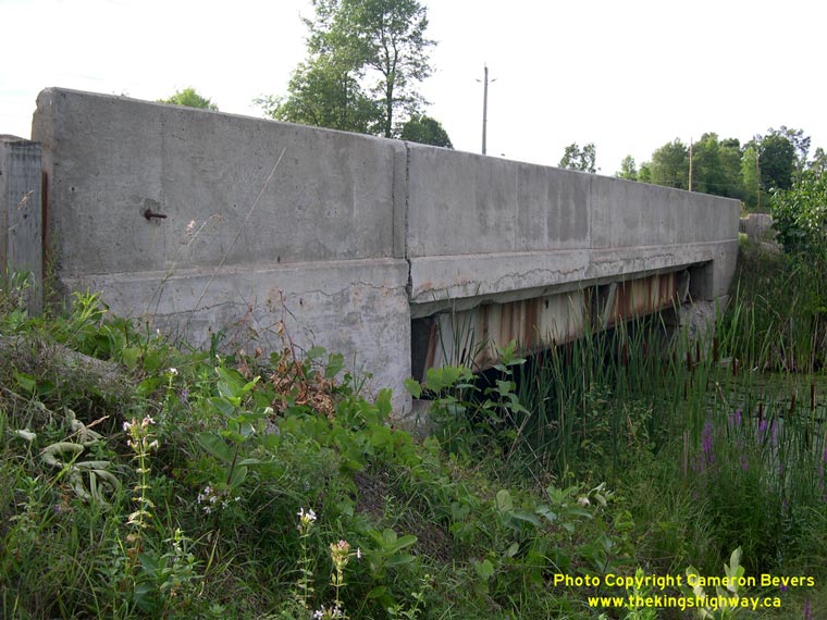
Enlarged Photo Here. (Photograph taken on July 31, 2005 - © Cameron Bevers) Right - Western side of the Crosby Creek Bridge on Hwy 15 south of Crosby. This single-span steel girder structure was completed in 1931. See an Enlarged Photo Here. (Photograph taken on July 31, 2005 - © Cameron Bevers) 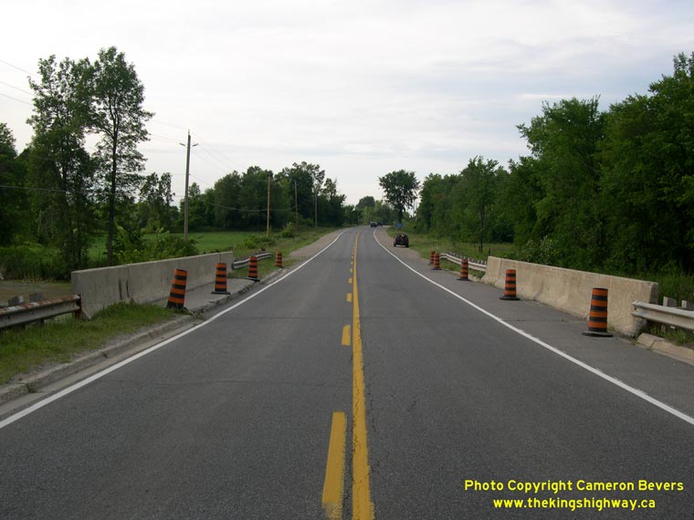
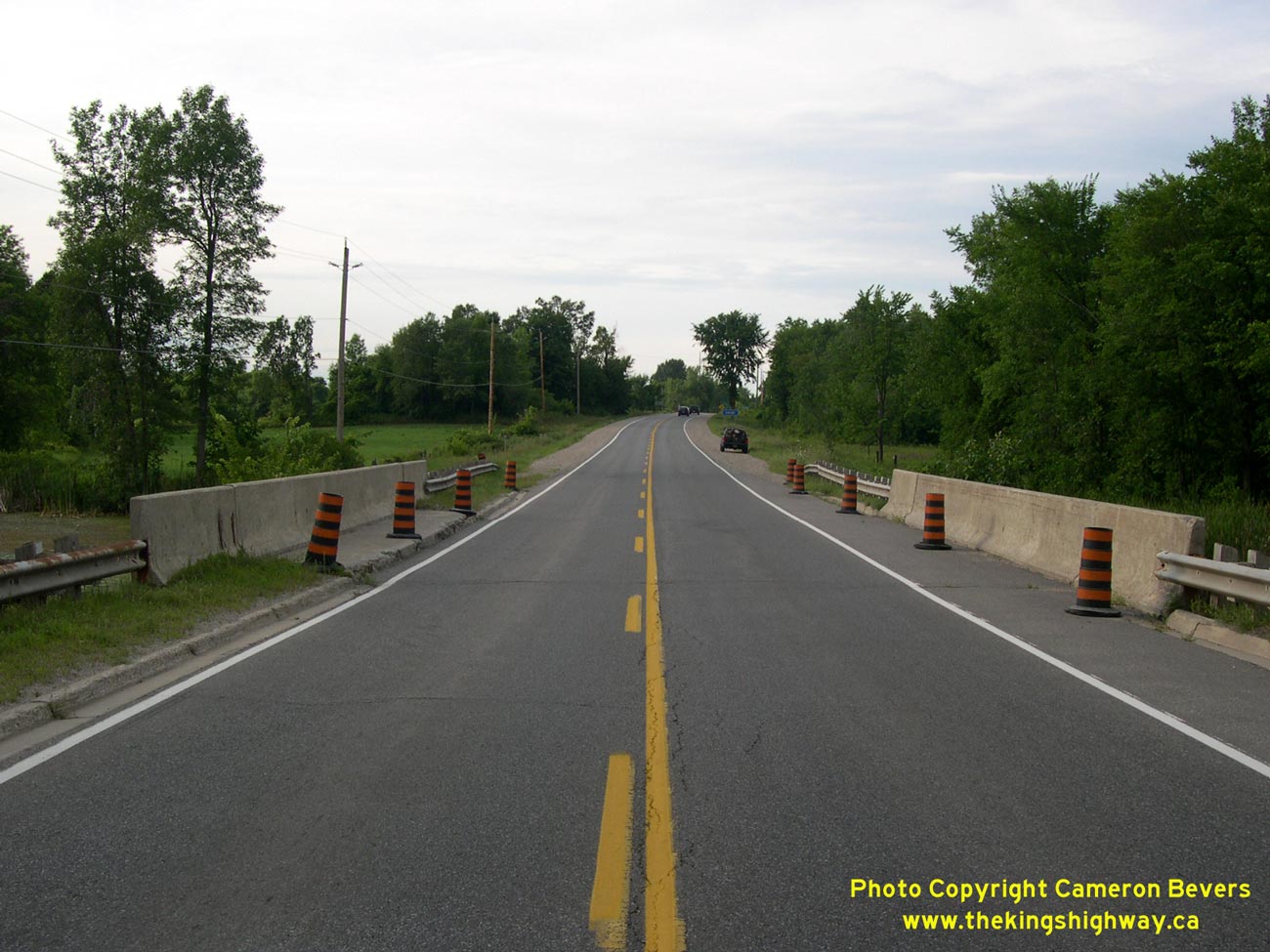
Left - Facing north along Hwy 15 towards Crosby at the Crosby Creek Bridge. See an
Enlarged Photo Here. (Photograph taken on July 31, 2005 - © Cameron Bevers) Right - Eastern side of the Crosby Creek Bridge on Hwy 15 south of Crosby. See an Enlarged Photo Here. (Photograph taken on July 31, 2005 - © Cameron Bevers) 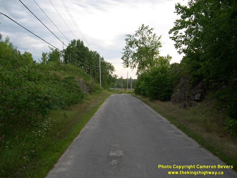
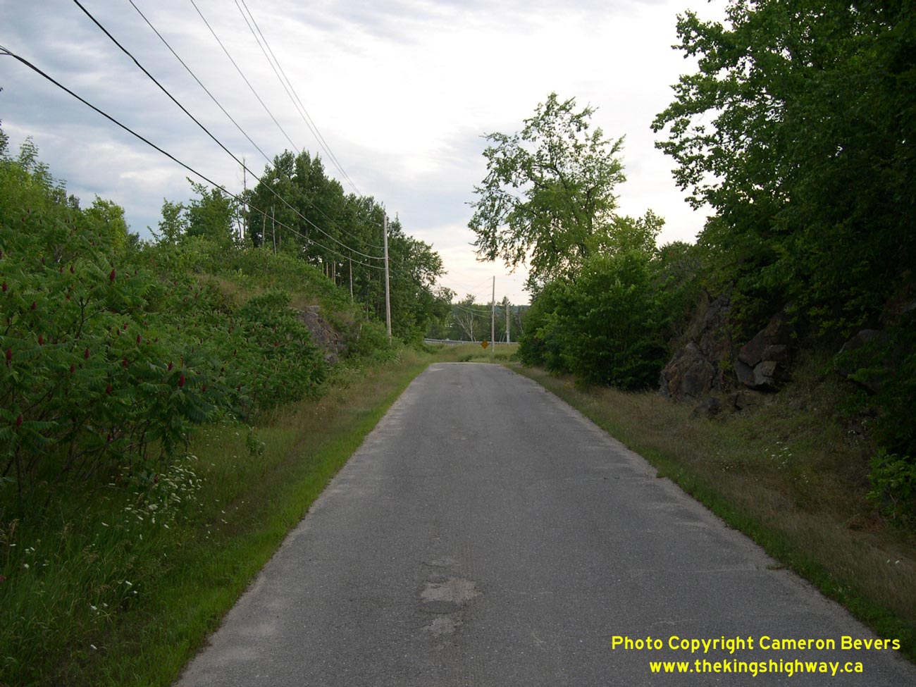
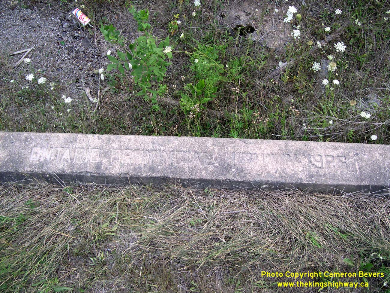
Left - Old Hwy 15 alignment at Blanchards Hill, facing south towards Crosby. See an
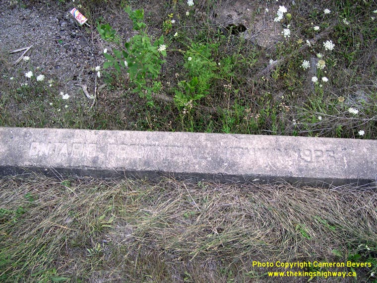
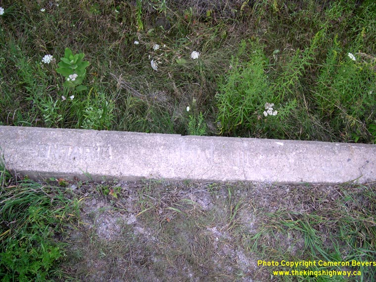
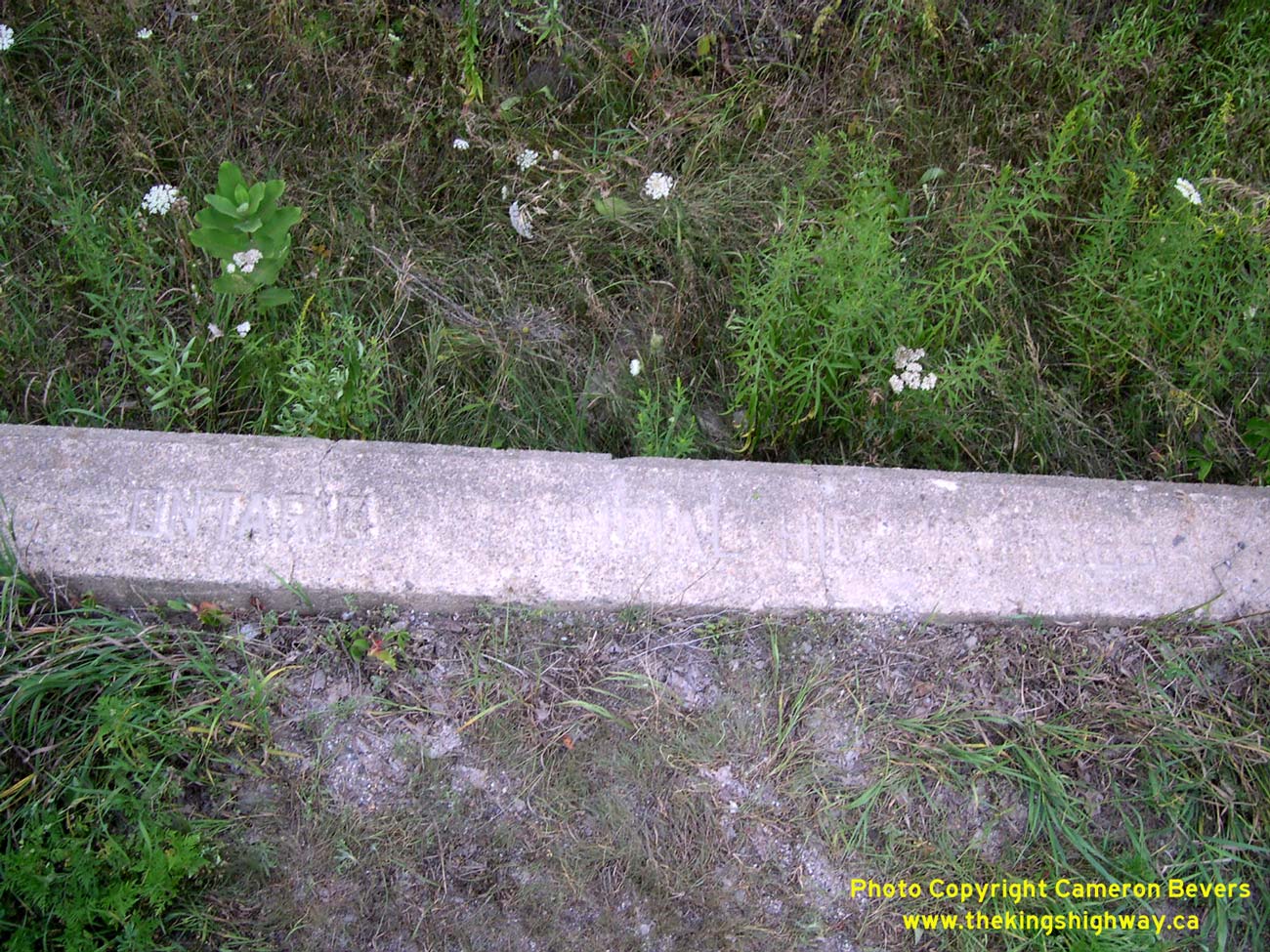
Enlarged Photo Here. (Photograph taken on July 31, 2005 - © Cameron Bevers) Right - Old culvert on Old Hwy 15 at Blanchards Hill - "ONTARIO PROVINCIAL HIGHWAY 1926". See an Enlarged Photo Here. (Photograph taken on July 31, 2005 - © Cameron Bevers) 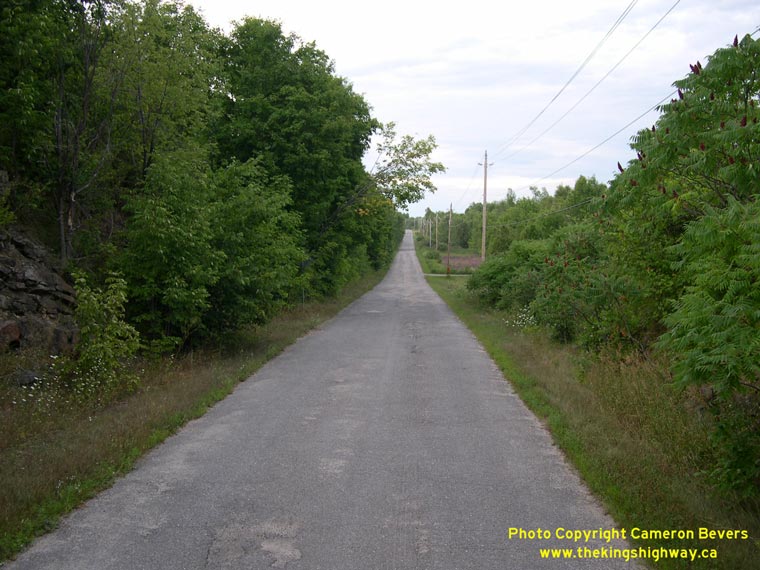
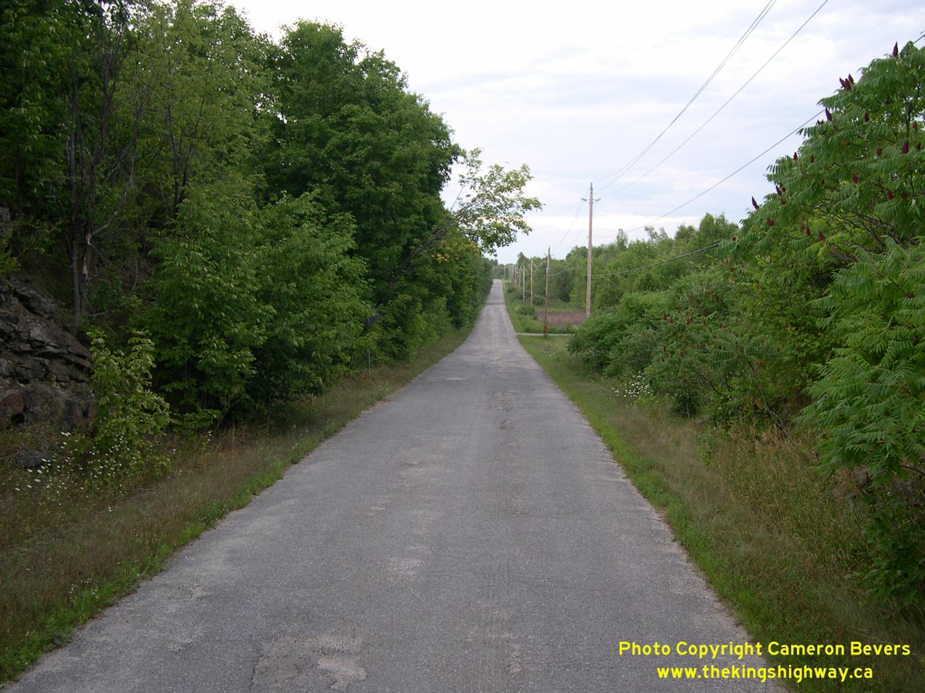
Left - Facing north towards Smiths Falls on Old Hwy 15 at Blanchards Hill. See an
Enlarged Photo Here. (Photograph taken on July 31, 2005 - © Cameron Bevers) Right - Old culvert on a former Hwy 15 alignment near Lombardy - "ONTARIO PROVINCIAL HIGHWAY 1925". See an Enlarged Photo Here. (Photograph taken on July 31, 2005 - © Cameron Bevers)
Continue on to King's Highway 15 Photos: Smiths Falls to Carleton Place
|
|---|
Links to Adjacent King's Highway Photograph Pages:
Back to Hwy 15 - Historical Photos (1920-1999)
Hwy 15 Photo Index
On to Hwy 15 - Smiths Falls to Carleton Place
Back to King's Highway 14 Photos /
King's Highway 15 History /
On to King's Highway 16 Photos
Ontario Highway History - Main Menu / Back to List of Highways Website contents, photos & text © 2002-2026, Cameron
Bevers (Webmaster) - All Rights Reserved / Contact Me
|
|---|