
| 
| |
|
|
This page contains present day photos (Year 2000 to date) of Ontario's King's Highway 15, arranged by location from Smiths
Falls northerly to Carleton Place. All photographs displayed on this page were taken by the Webmaster (Cameron Bevers), unless specifically noted otherwise. Click on
any thumbnail to see a larger image!
Please note that all photographs displayed on this
website are protected by copyright. These photographs must not be reproduced, published,
electronically stored or copied, distributed, or posted onto other websites without
my written permission. If you want to use photos from this website, please
email me first for permission. Thank-you!
|
|---|
|
Page 3: Present Day King's Highway 15 Photographs (Smiths Falls to Carleton Place)
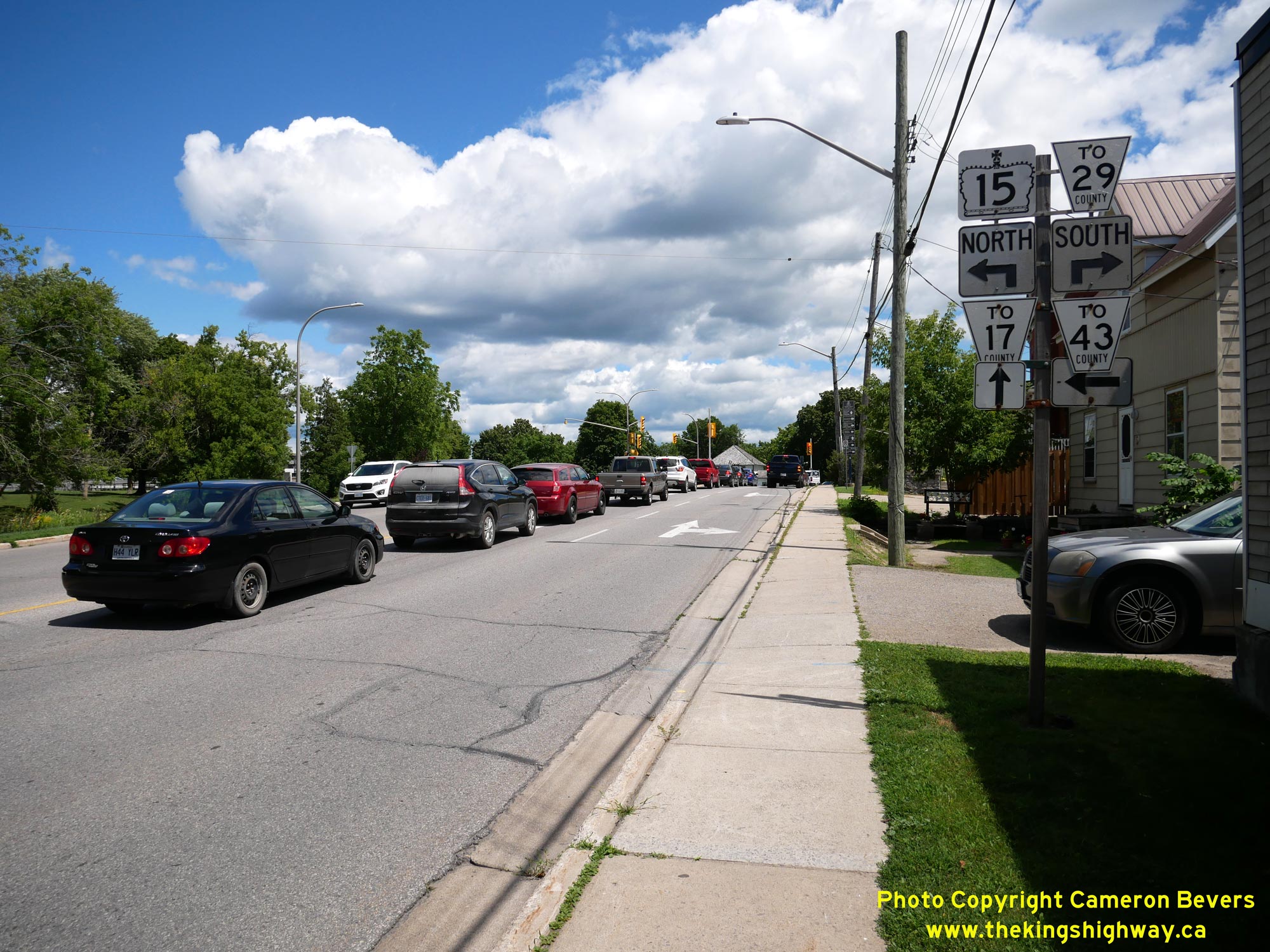
  Left - Facing north along Hwy 15 (Lombard Street) towards Hwy 29 (Brockville Street) in Smiths Falls. At this junction, the route of Hwy 15 turns left and
heads north through Smiths Falls' Town Centre via Beckwith Street. From this intersection, Hwy 29 heads southerly towards Brockville via Brockville Street. Both
Hwy 15 and Hwy 29 were established as provincial highways during the 1920s as part of Ontario's growing highway network. While Hwy 15 is still mostly a
provincially-maintained highway today, jurisdiction over Hwy 29 was transferred from the province to the municipal tier in the late 1990s. See an
Enlarged Photo Here. Left - Facing north along Hwy 15 (Lombard Street) towards Hwy 29 (Brockville Street) in Smiths Falls. At this junction, the route of Hwy 15 turns left and
heads north through Smiths Falls' Town Centre via Beckwith Street. From this intersection, Hwy 29 heads southerly towards Brockville via Brockville Street. Both
Hwy 15 and Hwy 29 were established as provincial highways during the 1920s as part of Ontario's growing highway network. While Hwy 15 is still mostly a
provincially-maintained highway today, jurisdiction over Hwy 29 was transferred from the province to the municipal tier in the late 1990s. See an
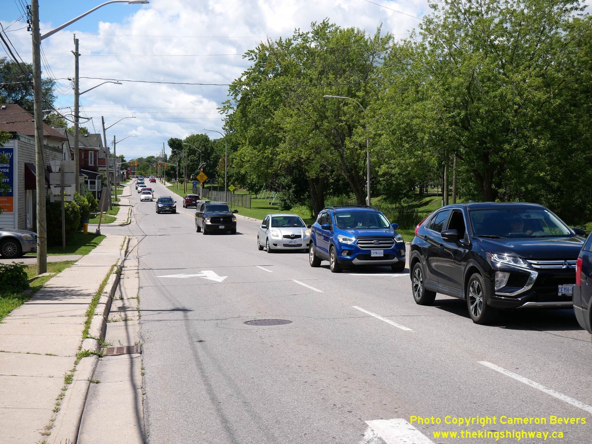
Enlarged Photo Here.(Photograph taken on July 29, 2022 - © Cameron Bevers) Right - View of Hwy 15 (Lombard Street) from the Hwy 29 Junction in Smiths Falls. The route of Hwy 15 generally heads in a southwesterly direction from Smiths
Falls towards Kingston. As is typical within urbanized areas, this urban section of Hwy 15 is part of a Municipal Connecting Link which is actually owned and
maintained by the Town of Smiths Falls. See an Enlarged Photo Here.(Photograph taken on July 29, 2022 - © Cameron Bevers) 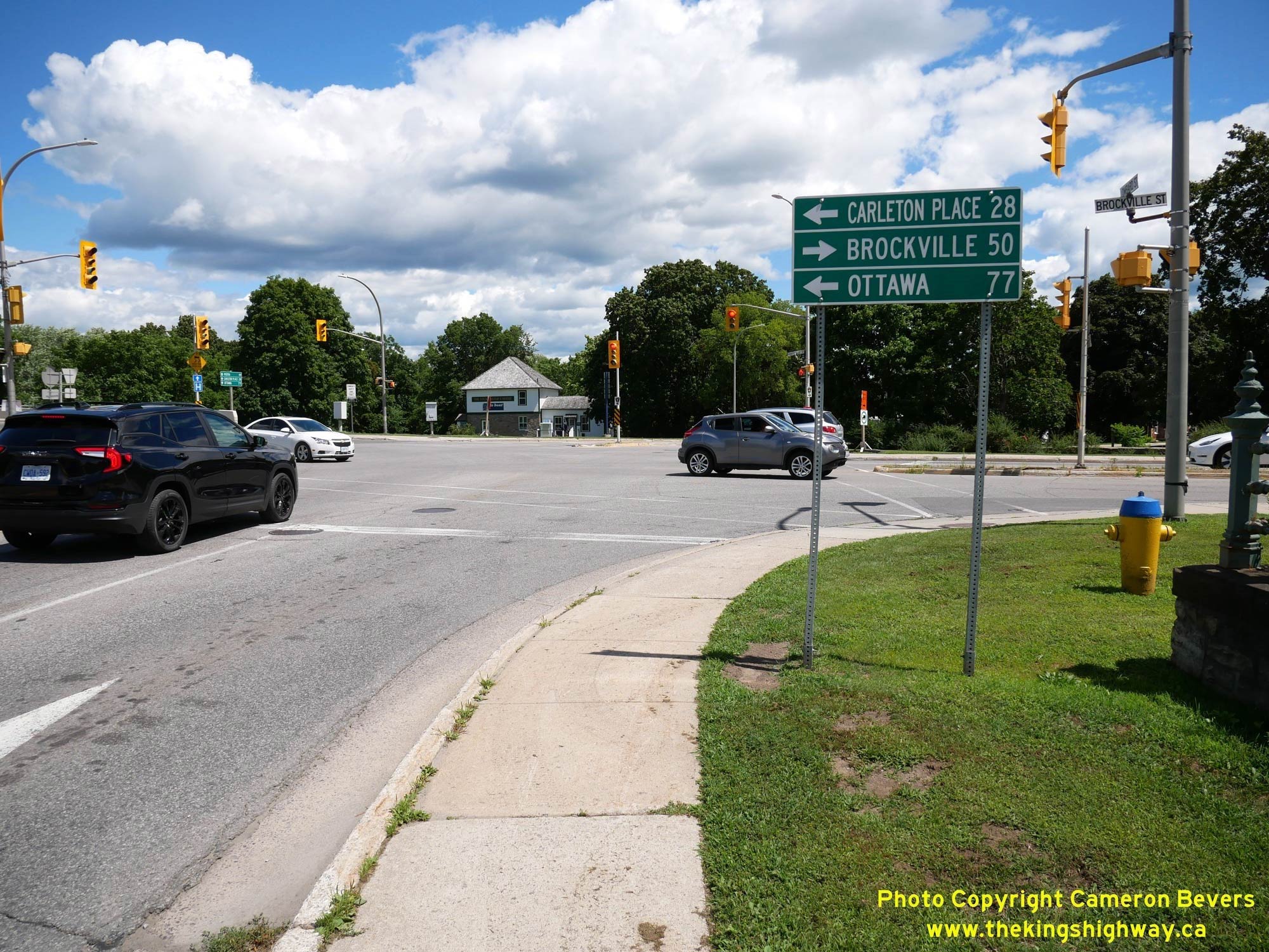
 Left - Destination guide sign on Hwy 15 (Lombard Street) at the Hwy 29 Junction in Smiths Falls. See an
Enlarged Photo Here. Left - Destination guide sign on Hwy 15 (Lombard Street) at the Hwy 29 Junction in Smiths Falls. See an
Enlarged Photo Here.(Photograph taken on July 29, 2022 - © Cameron Bevers) Right - Facing south along Hwy 29 (Brockville Street) from the Hwy 15 Junction in Smiths Falls. Up until the late 1990s, Hwy 29 between Smiths Falls and
Brockville was a King's Highway under provincial jurisdiction. Today, Hwy 29 is a Leeds & Grenville County Road. Since the Town of Smiths Falls is not part of the
County of Leeds & Grenville, County Road 29 is merely trailblazed from Hwy 15 with "TO 29" markers along Brockville Street. See an
Enlarged Photo Here.(Photograph taken on July 29, 2022 - © Cameron Bevers) 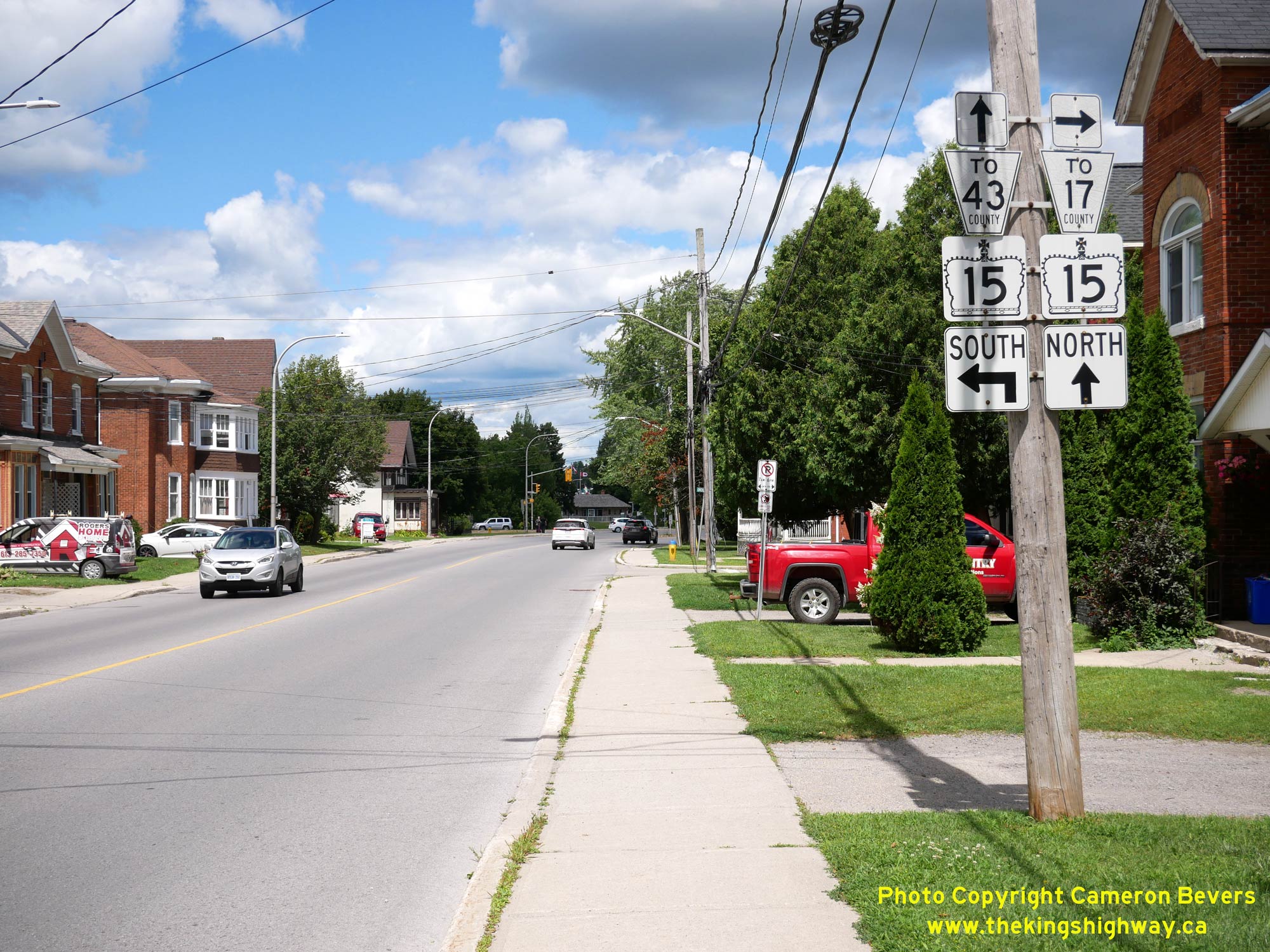
 Left - Junction sign assembly on northbound Hwy 29 approaching the Hwy 15 Junction in Smiths Falls. See an
Enlarged Photo Here. Left - Junction sign assembly on northbound Hwy 29 approaching the Hwy 15 Junction in Smiths Falls. See an
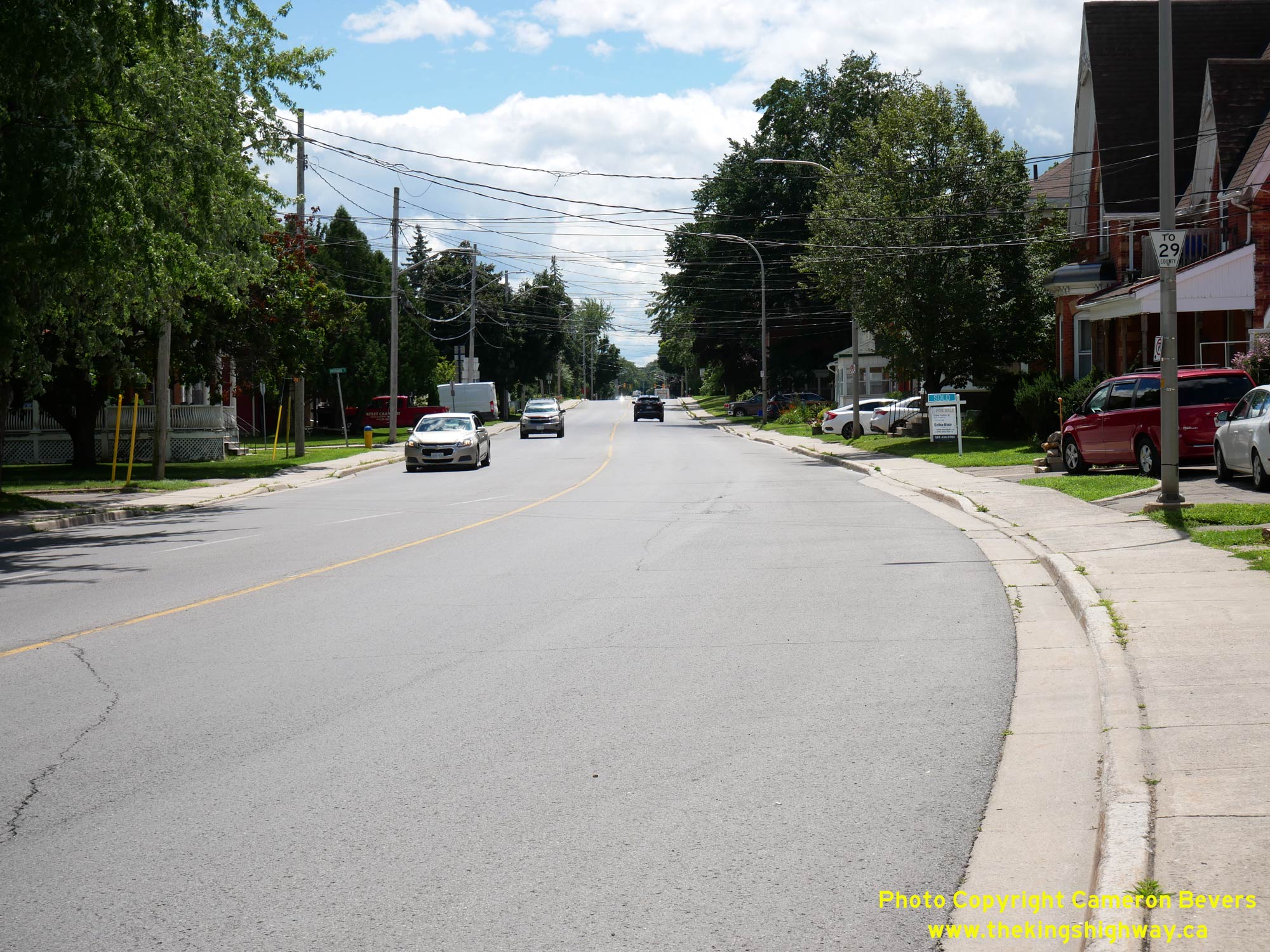
Enlarged Photo Here.(Photograph taken on July 29, 2022 - © Cameron Bevers) Right - Facing north along Hwy 29 (Brockville Street) towards the Hwy 15 Junction at Lombard Street in Smiths Falls. Prior to the downloading of Hwy 29 to the
municipal tier in the 1990s, Hwy 29 came to an end at this intersection. However, Hwy 29 historically continued north from Smiths Falls to Arnprior. In an effort to
simplify highway route numbering in this part of Ontario, Hwy 29 was truncated at this intersection in 1984. The overlapped route of Hwy 15 & Hwy 29 from Smiths
Falls to Carleton Place was discontinued. Additionally, Hwy 15 was extended north from Carleton Place to Arnprior via the former route of Hwy 29 at that time. See an
Enlarged Photo Here.(Photograph taken on July 29, 2022 - © Cameron Bevers) 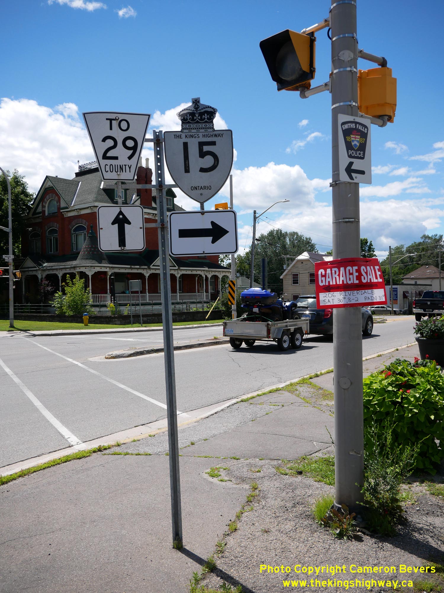 Above - Southbound junction sign assembly at the Hwy 15 & Hwy 29 Junction in Smiths Falls. See an
Enlarged Photo Here. Above - Southbound junction sign assembly at the Hwy 15 & Hwy 29 Junction in Smiths Falls. See an
Enlarged Photo Here.(Photograph taken on July 29, 2022 - © Cameron Bevers) 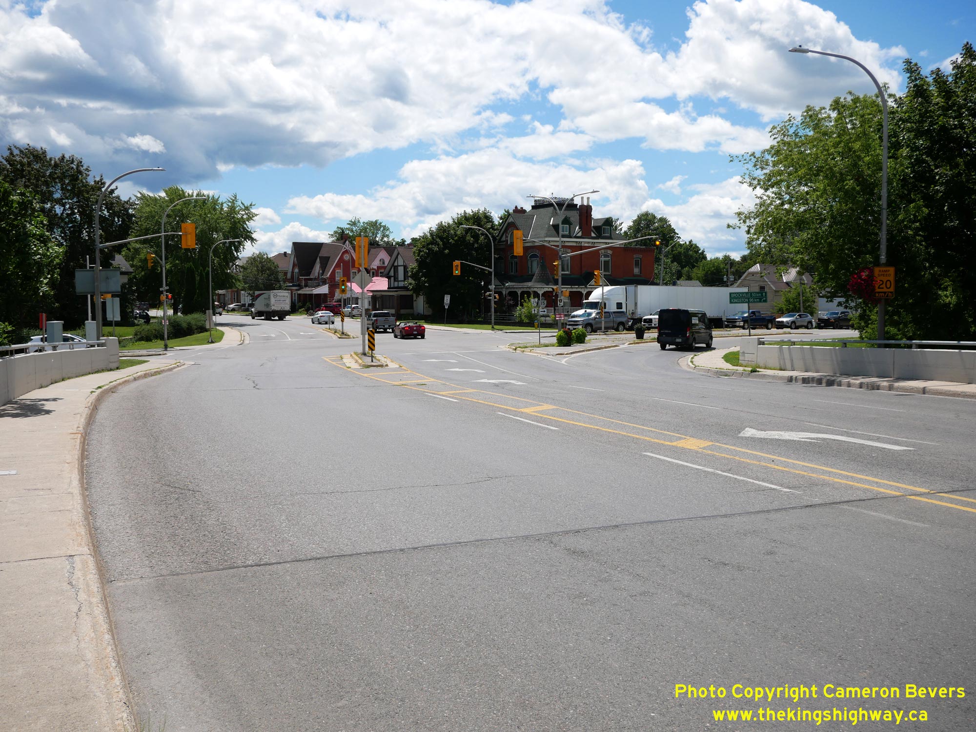
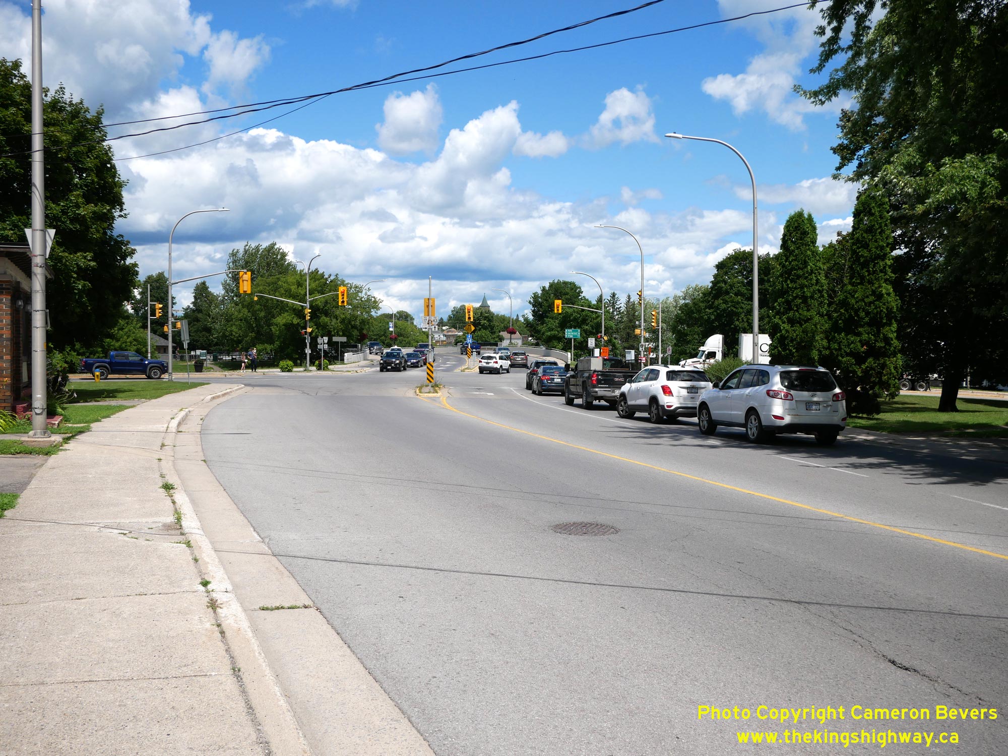
 Left - View of the Hwy 15 & Hwy 29 Junction in Smiths Falls, facing south. At this intersection, Beckwith Street comes to an end and becomes Brockville
Street south of the traffic signals. Motorists wishing to continue south on Hwy 15 towards Kingston must turn right and follow Lombard Street out of town. By
continuing straight ahead at this intersection, motorists will find themselves on Hwy 29 heading for Brockville. See an
Enlarged Photo Here. Left - View of the Hwy 15 & Hwy 29 Junction in Smiths Falls, facing south. At this intersection, Beckwith Street comes to an end and becomes Brockville
Street south of the traffic signals. Motorists wishing to continue south on Hwy 15 towards Kingston must turn right and follow Lombard Street out of town. By
continuing straight ahead at this intersection, motorists will find themselves on Hwy 29 heading for Brockville. See an
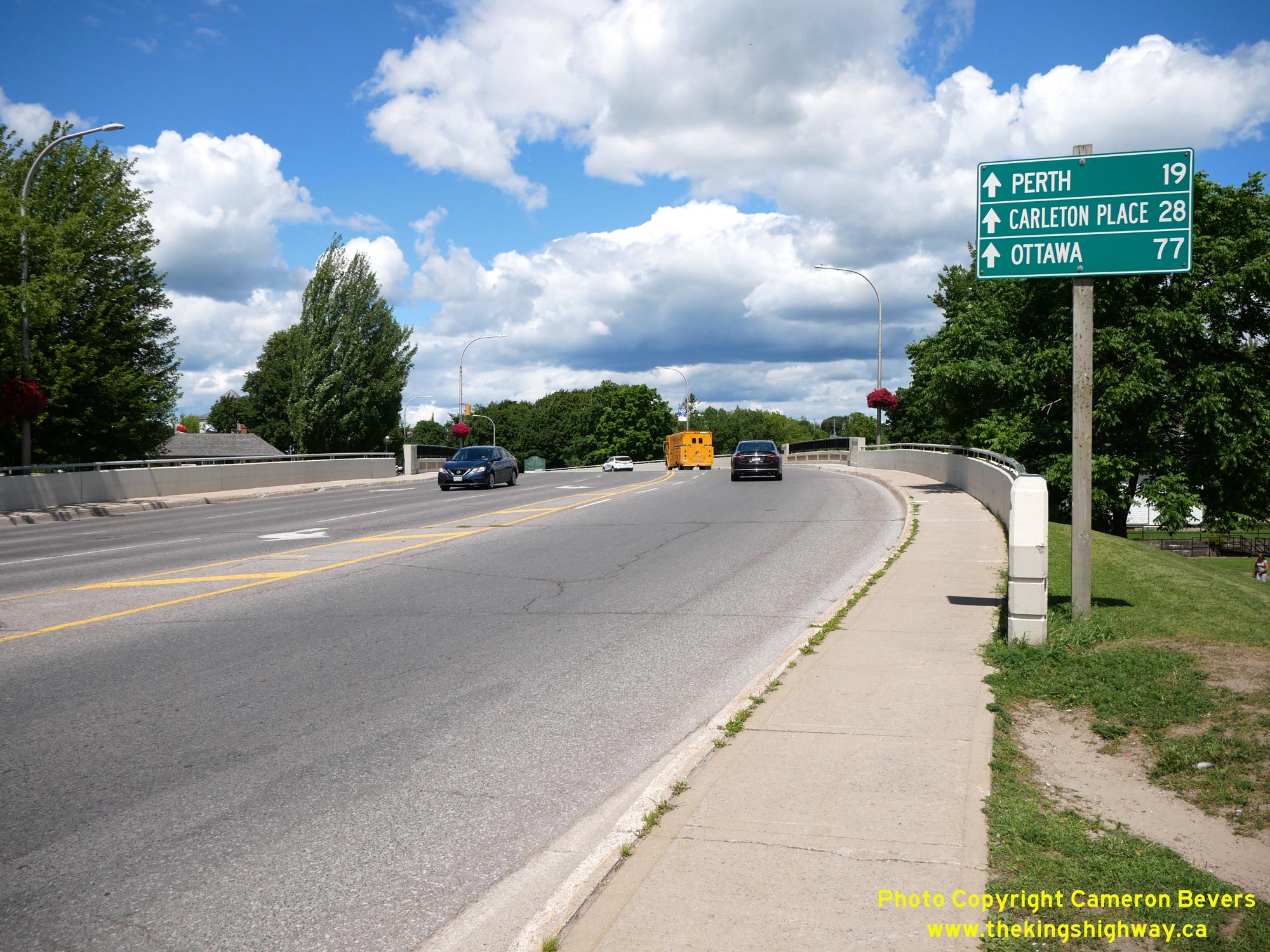
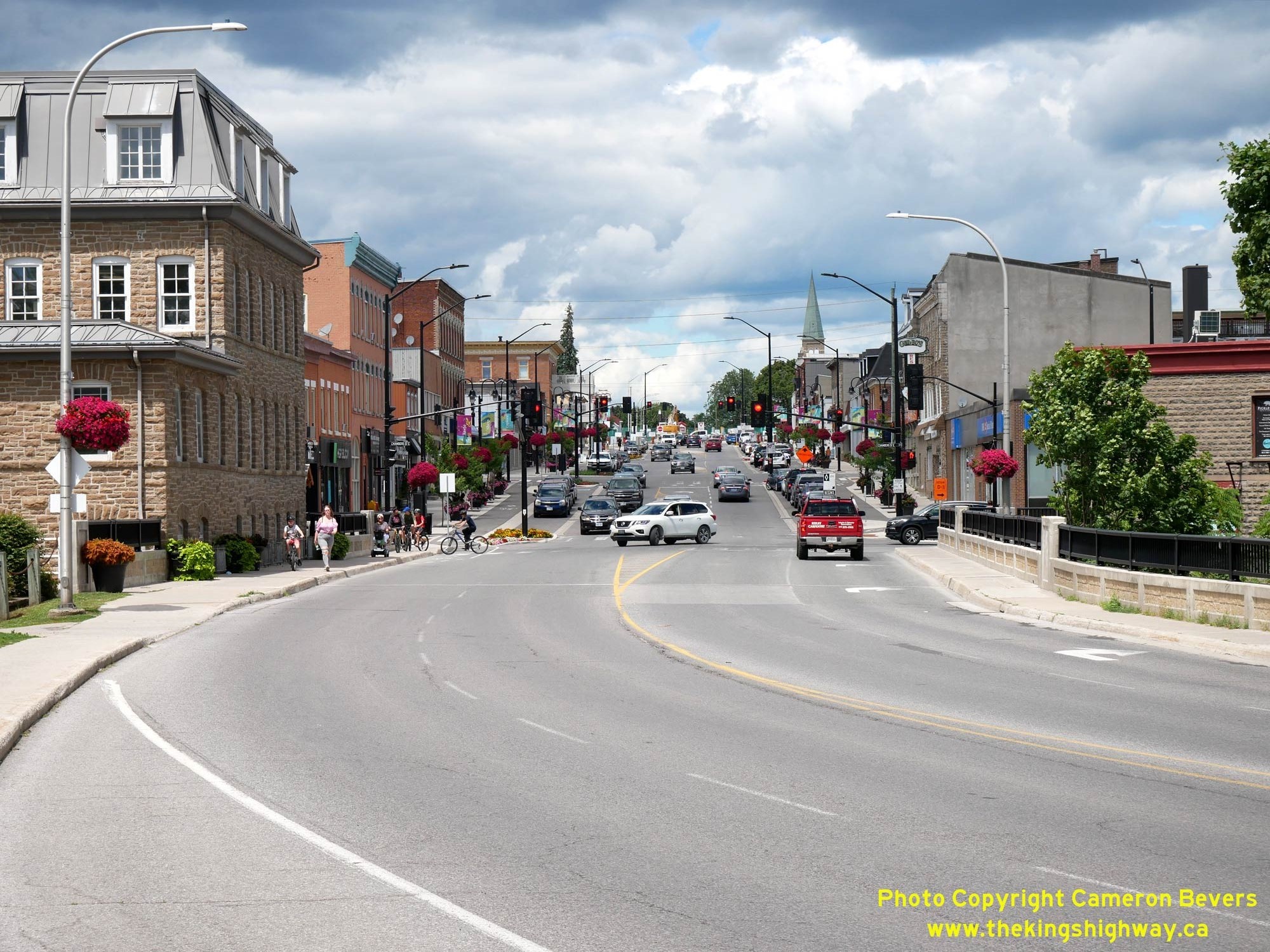
Enlarged Photo Here.(Photograph taken on July 29, 2022 - © Cameron Bevers) Right - Facing north along Hwy 15 (Beckwith Street) from the Hwy 29 Junction in Smiths Falls. Immediately north of the junction, the highway spans the Rideau
Canal, which passes through the heart of Smiths Falls. If motorists perceive that roads from most other major towns in this area all seem to converge on Smiths Falls,
they are not mistaken. It is actually quite difficult to get around this part of Ontario without passing through Smiths Falls, due to the configuration of the area's
road network. Not surprisingly, the major streets through Smiths Falls carry considerable traffic. See an
Enlarged Photo Here.(Photograph taken on July 29, 2022 - © Cameron Bevers) 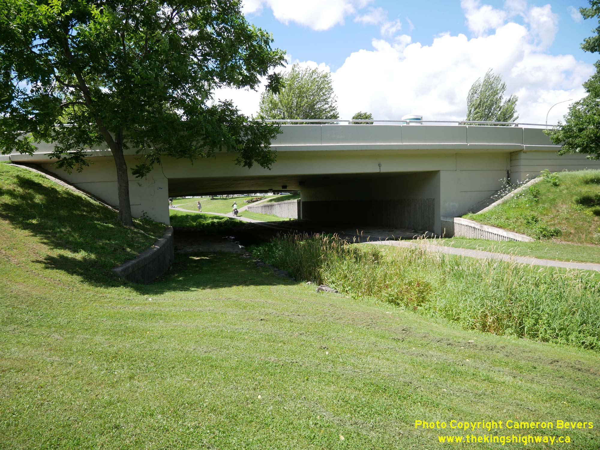
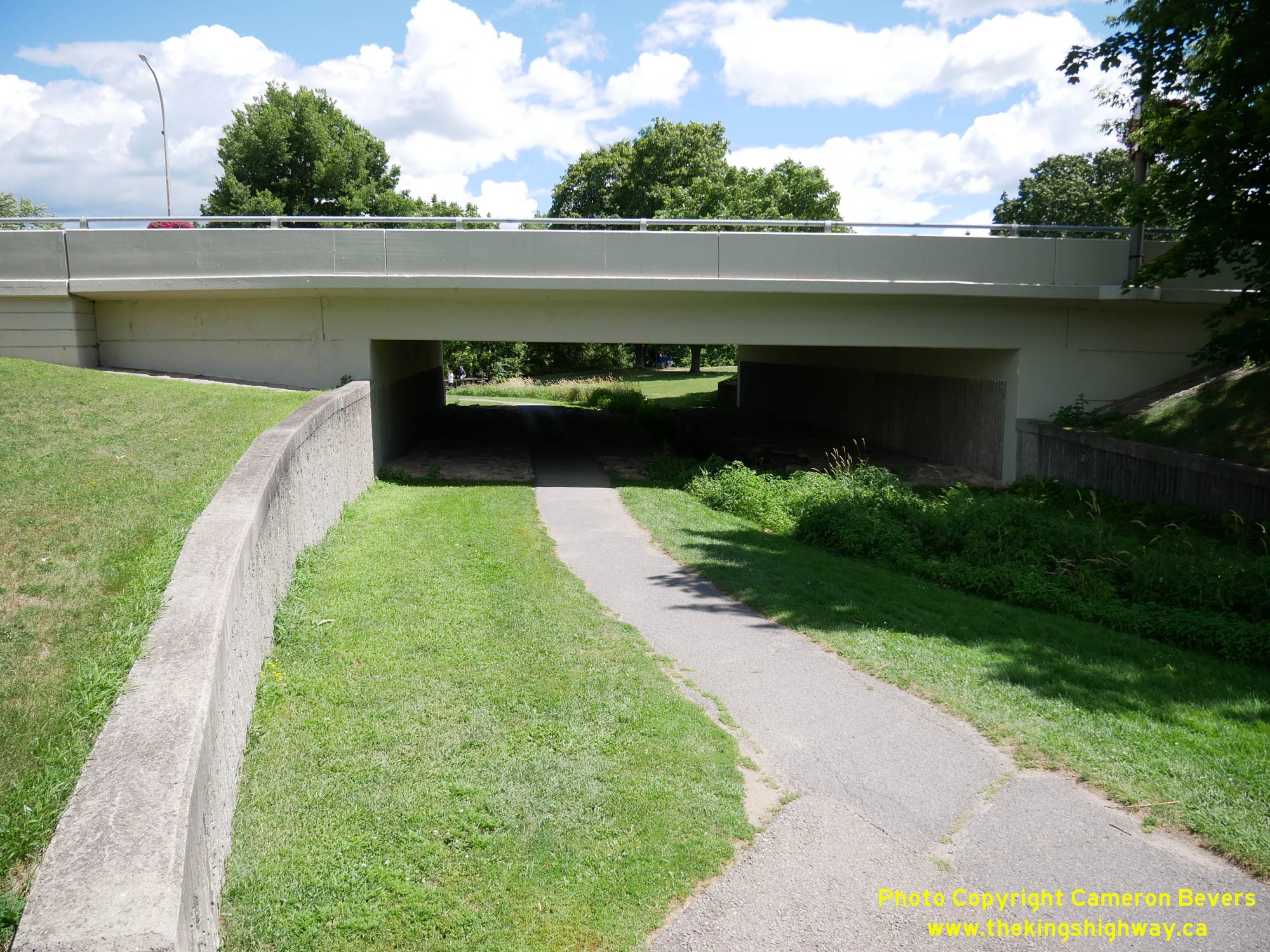 Left - Eastern side of the Rideau Overflow Channel Bridge on Hwy 15 in Smiths Falls. This is one of three bridges which carries Hwy 15 across the canal lands.
See an Enlarged Photo Here. Left - Eastern side of the Rideau Overflow Channel Bridge on Hwy 15 in Smiths Falls. This is one of three bridges which carries Hwy 15 across the canal lands.
See an Enlarged Photo Here.(Photograph taken on July 29, 2022 - © Cameron Bevers) Right - View of the western side of the Rideau Overflow Channel Bridge on Hwy 15 in Smiths Falls. This bridge primarily serves as a pedestrian trail underpass,
but it also carries a small watercourse. This single-span concrete bridge was completed in 1974 as part of general improvements to the Rideau Canal. See an
Enlarged Photo Here.(Photograph taken on July 29, 2022 - © Cameron Bevers) 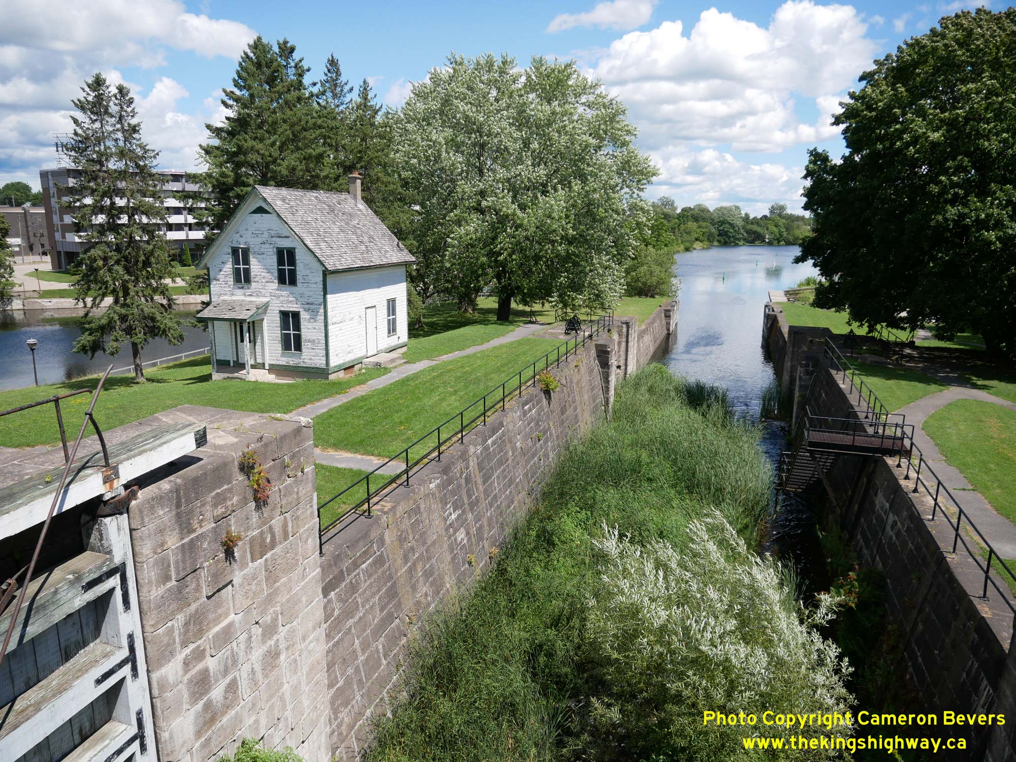
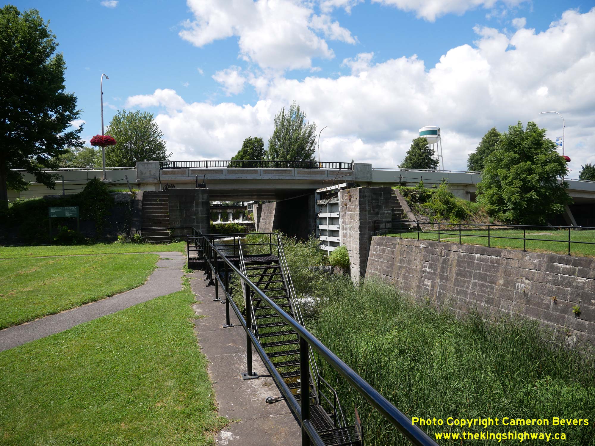 Left - View of the Old Smiths Falls Combined Locks from Hwy 15 (Beckwith Street). This section of the Rideau Canal and its three historical flight locks (Locks
#28, 29 & 30) were bypassed by a new combined lock (Lock #29A) in the 1970s. This historic canal lock system has stood here for approximately 200 years, having
been constructed in 1829. The Rideau Canal system provides transportation enthusiasts with some interesting insight into Ontario's earliest "highways", when travel by
the province's waterways was often far more efficient than overland travel. The development of the Rideau Canal triggered an industrial boom in Upper Canada, which
later became the Province of Ontario. See an Enlarged Photo Here. Left - View of the Old Smiths Falls Combined Locks from Hwy 15 (Beckwith Street). This section of the Rideau Canal and its three historical flight locks (Locks
#28, 29 & 30) were bypassed by a new combined lock (Lock #29A) in the 1970s. This historic canal lock system has stood here for approximately 200 years, having
been constructed in 1829. The Rideau Canal system provides transportation enthusiasts with some interesting insight into Ontario's earliest "highways", when travel by
the province's waterways was often far more efficient than overland travel. The development of the Rideau Canal triggered an industrial boom in Upper Canada, which
later became the Province of Ontario. See an Enlarged Photo Here.(Photograph taken on July 29, 2022 - © Cameron Bevers) Right - Eastern side of the Old Rideau Canal Bridge on Hwy 15 (Beckwith Street). Historically, there were once three locks on the Rideau Canal at this location.
As part of a series of canal improvements carried out by the Government of Canada in the 1970s, this section of the old canal was bypassed by a new canal with a
single combined lock. The location of the new lock allowed a fixed high-level bridge to be built across the canal for Hwy 15 (Beckwith Street). See an
Enlarged Photo Here.(Photograph taken on July 29, 2022 - © Cameron Bevers) 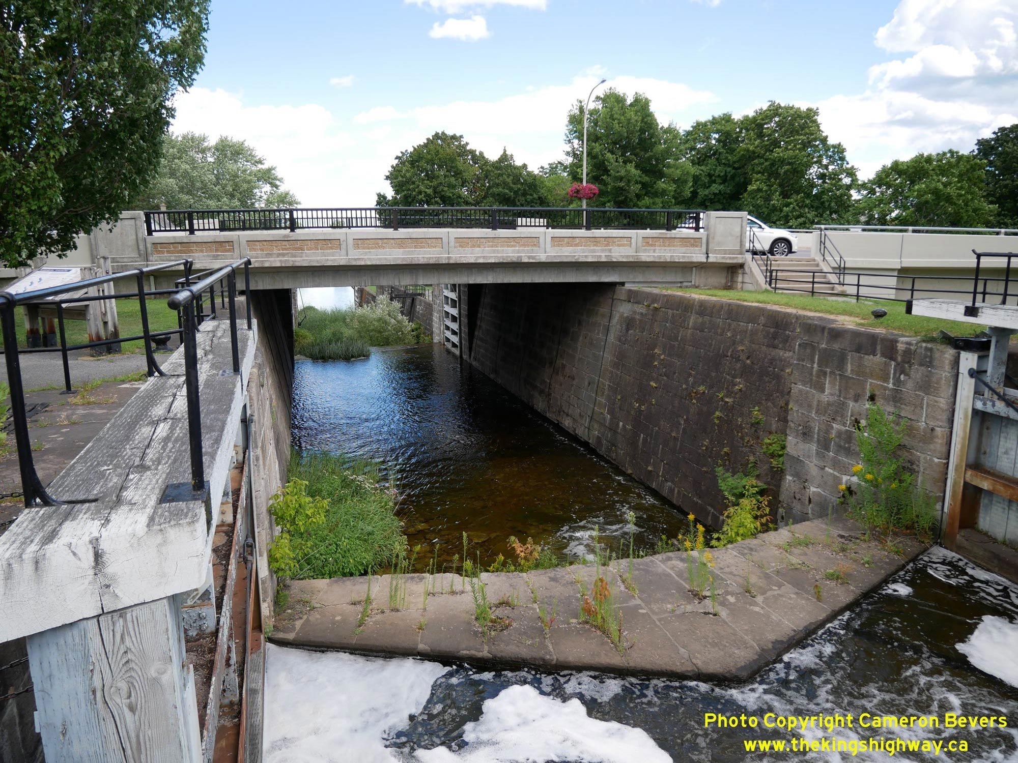
 Left - View of the Old Rideau Canal at the Beckwith Street Bridge on Hwy 15. This simply-supported single-span concrete slab structure was built as part of the
reconstruction of the Smiths Falls Locks in 1973-1974. The previous structure at this location was a steel plate girder swing bridge, which was completed in 1923. The
old swing bridge had very narrow traffic lanes across it, with a curb-to-curb roadway width of only 19 feet (5.8 metres). The resulting traffic lanes across the swing
bridge were only 9 feet, 6 inches (or 2.9 metres), which meant that larger trucks had to take turns and cross the bridge one at a time. By the 1960s, the old swing
bridge had became a serious traffic bottleneck. Not only was the aging bridge periodically swung open for marine traffic, but the bridge's poor roadway geometrics and
painfully slow turning speed ultimately doomed the old bridge. The reconstruction of the Smiths Falls Locks in the 1970s provided an opportunity to replace the
outdated swing bridge once and for all. A new high-level fixed bridge crossing was built for Hwy 15 across the relocated Rideau Canal just to the north, which no
longer had to be opened to accommodate marine traffic on the canal below. See an
Enlarged Photo Here. Left - View of the Old Rideau Canal at the Beckwith Street Bridge on Hwy 15. This simply-supported single-span concrete slab structure was built as part of the
reconstruction of the Smiths Falls Locks in 1973-1974. The previous structure at this location was a steel plate girder swing bridge, which was completed in 1923. The
old swing bridge had very narrow traffic lanes across it, with a curb-to-curb roadway width of only 19 feet (5.8 metres). The resulting traffic lanes across the swing
bridge were only 9 feet, 6 inches (or 2.9 metres), which meant that larger trucks had to take turns and cross the bridge one at a time. By the 1960s, the old swing
bridge had became a serious traffic bottleneck. Not only was the aging bridge periodically swung open for marine traffic, but the bridge's poor roadway geometrics and
painfully slow turning speed ultimately doomed the old bridge. The reconstruction of the Smiths Falls Locks in the 1970s provided an opportunity to replace the
outdated swing bridge once and for all. A new high-level fixed bridge crossing was built for Hwy 15 across the relocated Rideau Canal just to the north, which no
longer had to be opened to accommodate marine traffic on the canal below. See an
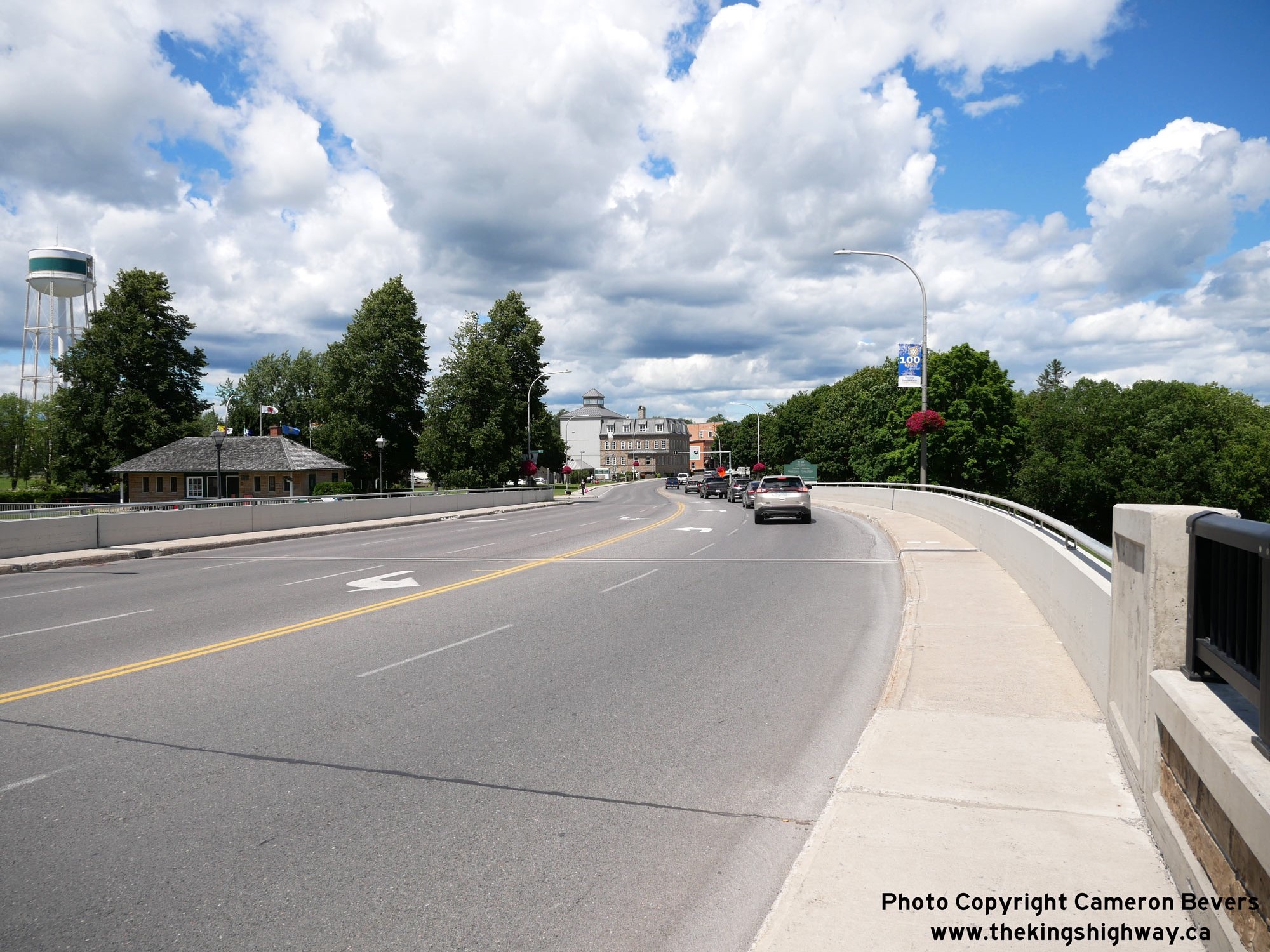
Enlarged Photo Here.(Photograph taken on July 29, 2022 - © Cameron Bevers) Right - Facing north along Hwy 15 (Beckwith Street) towards Downtown Smiths Falls at the Old and New Rideau Canal Bridges. As a result of the reconstruction of
the Smiths Falls Locks in 1973-1974, a short section of the highway was realigned through the canal lands, with the new alignment being curved to allow Hwy 15 traffic
to pass around the site of the lock construction area and removal of the old swing bridge. Previously, the alignment of Hwy 15 through the canal lands was essentially
tangential. See an Enlarged Photo Here.(Photograph taken on July 29, 2022 - © Cameron Bevers) 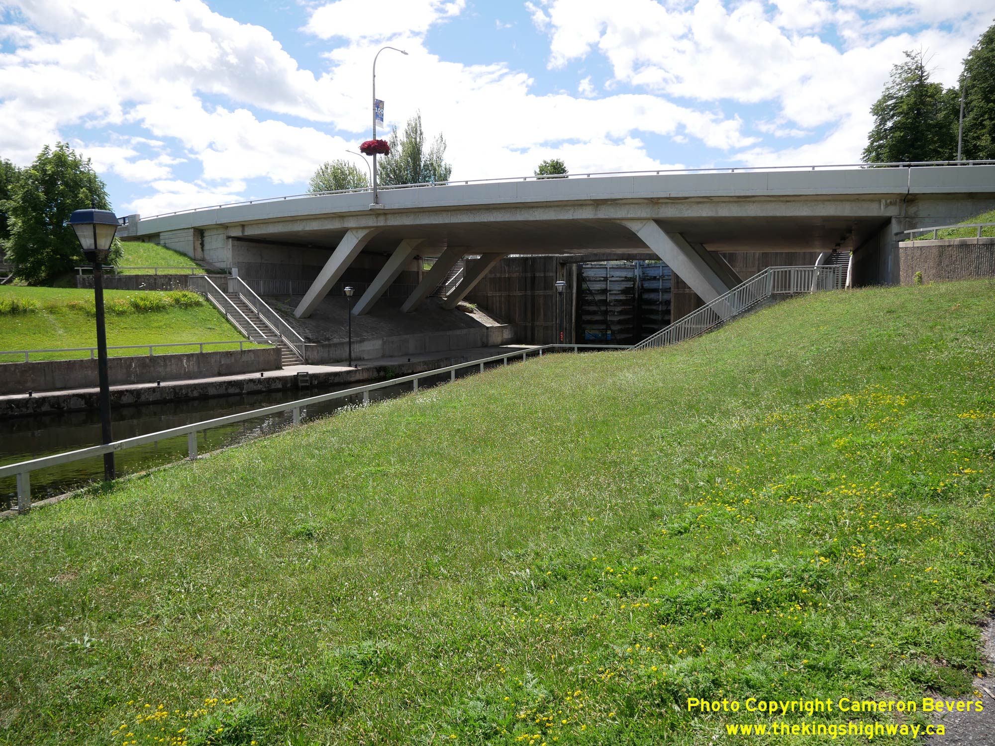
 Left - Eastern side of the New Rideau Canal Bridge on Hwy 15 (Beckwith Street) in Smiths Falls. The relocated canal and single combined lock greatly expedited
the passage of marine traffic through Smiths Falls. Since the single lock was located entirely on the western side of Hwy 15, the new high-level bridge across the
lock no longer had to be an opening span. Accordingly, traffic conditions on Hwy 15 were immediately improved as a result of this Rideau Canal project. See an
Enlarged Photo Here. Left - Eastern side of the New Rideau Canal Bridge on Hwy 15 (Beckwith Street) in Smiths Falls. The relocated canal and single combined lock greatly expedited
the passage of marine traffic through Smiths Falls. Since the single lock was located entirely on the western side of Hwy 15, the new high-level bridge across the
lock no longer had to be an opening span. Accordingly, traffic conditions on Hwy 15 were immediately improved as a result of this Rideau Canal project. See an
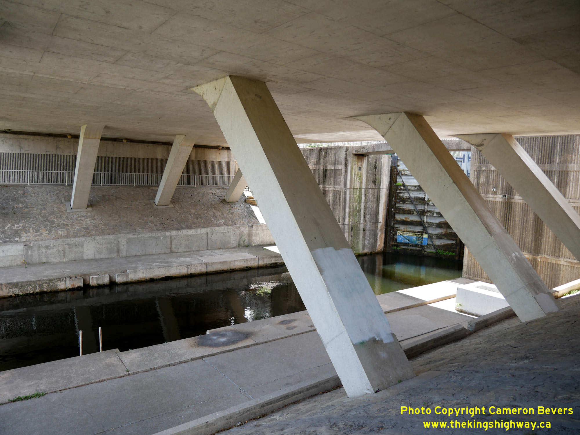
Enlarged Photo Here.(Photograph taken on July 29, 2022 - © Cameron Bevers) Right - The New Rideau Canal Bridge on Hwy 15 is a three-span concrete slab bridge, with the centre span being a concrete rigid frame with inclined legs along
with a cantilevered approach span at each end. This interesting high-level fixed bridge replaced an old swing bridge just to the south which routinely snarled highway
traffic through Smiths Falls each time the bridge had to be opened to allow marine traffic to pass through. See an
Enlarged Photo Here.(Photograph taken on July 29, 2022 - © Cameron Bevers) 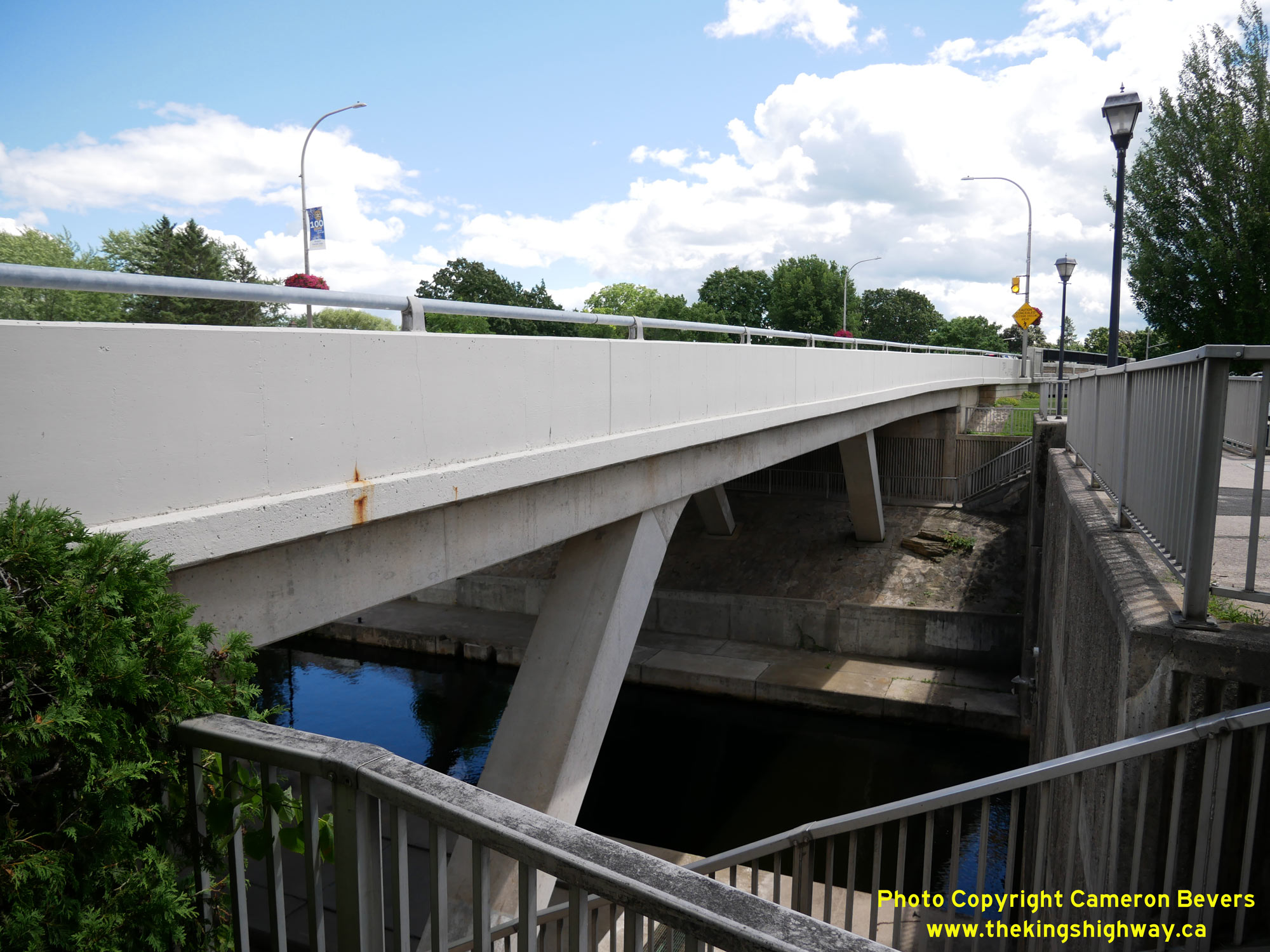
 Left - Western side of the New Rideau Canal Bridge on Hwy 15. The new Smiths Falls Lock (Lock #29A) lies immediately to the west of the Hwy 15 Bridge.
Lock 29A is the highest single lock along the Rideau Canal, with a vertical elevation difference of 26 feet (7.9 metres) from the upstream end of the lock to the
downstream end of the lock. See an Enlarged Photo Here. Left - Western side of the New Rideau Canal Bridge on Hwy 15. The new Smiths Falls Lock (Lock #29A) lies immediately to the west of the Hwy 15 Bridge.
Lock 29A is the highest single lock along the Rideau Canal, with a vertical elevation difference of 26 feet (7.9 metres) from the upstream end of the lock to the
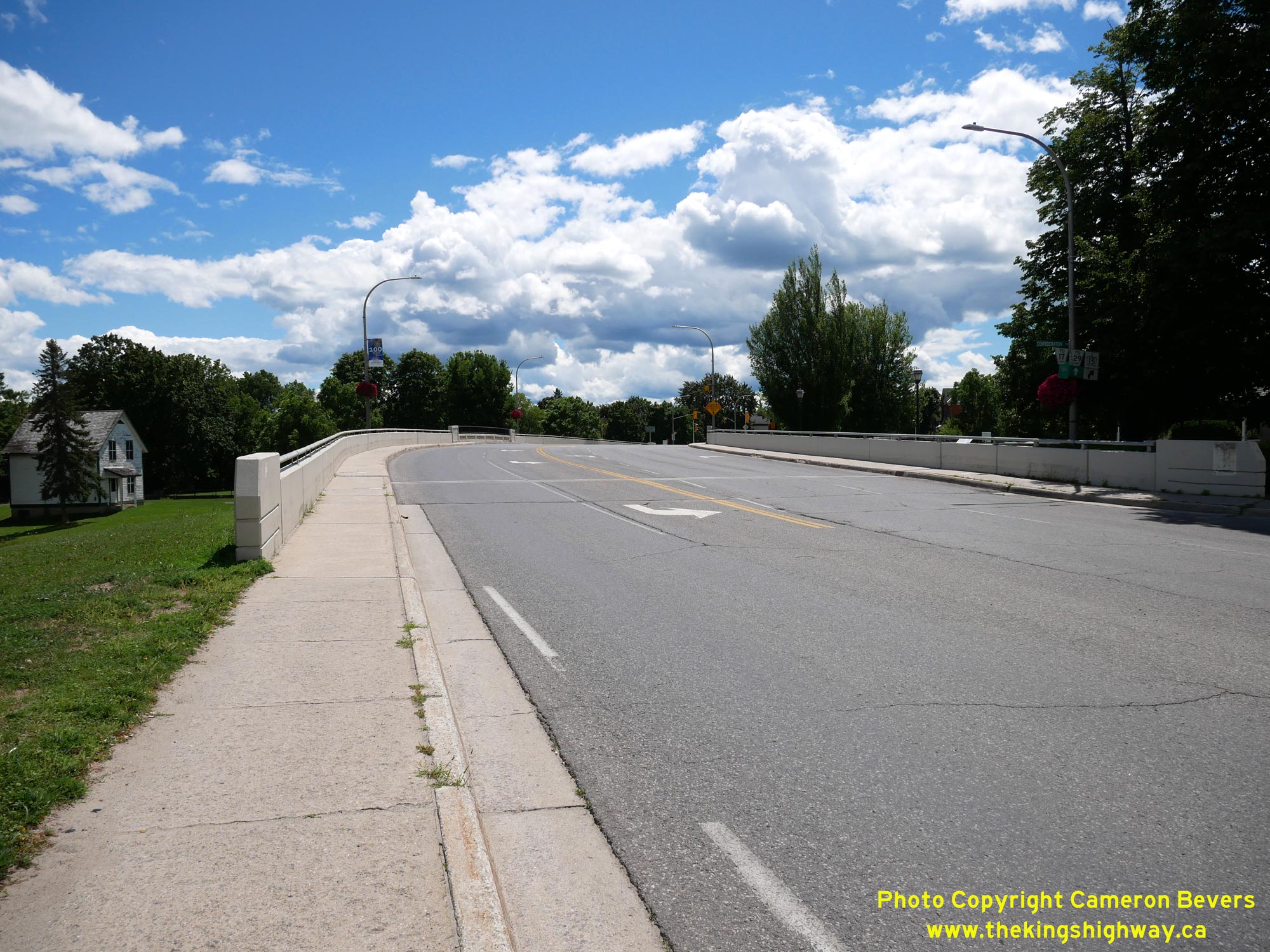
downstream end of the lock. See an Enlarged Photo Here.(Photograph taken on July 29, 2022 - © Cameron Bevers) Right - Facing south along Hwy 15 (Beckwith Street) at the Old and New Rideau Canal Bridges in Smiths Falls. A trio of bridges carry Hwy 15 traffic across the
canal lands. These new bridges were constructed on an improved alignment for Hwy 15 during the 1970s and were built with traffic lanes of adequate width for modern
vehicles. The previous swing bridge at Smiths Falls had dreadfully narrow lanes and became a major traffic bottleneck as the highway became busier. See an
Enlarged Photo Here.(Photograph taken on July 29, 2022 - © Cameron Bevers) 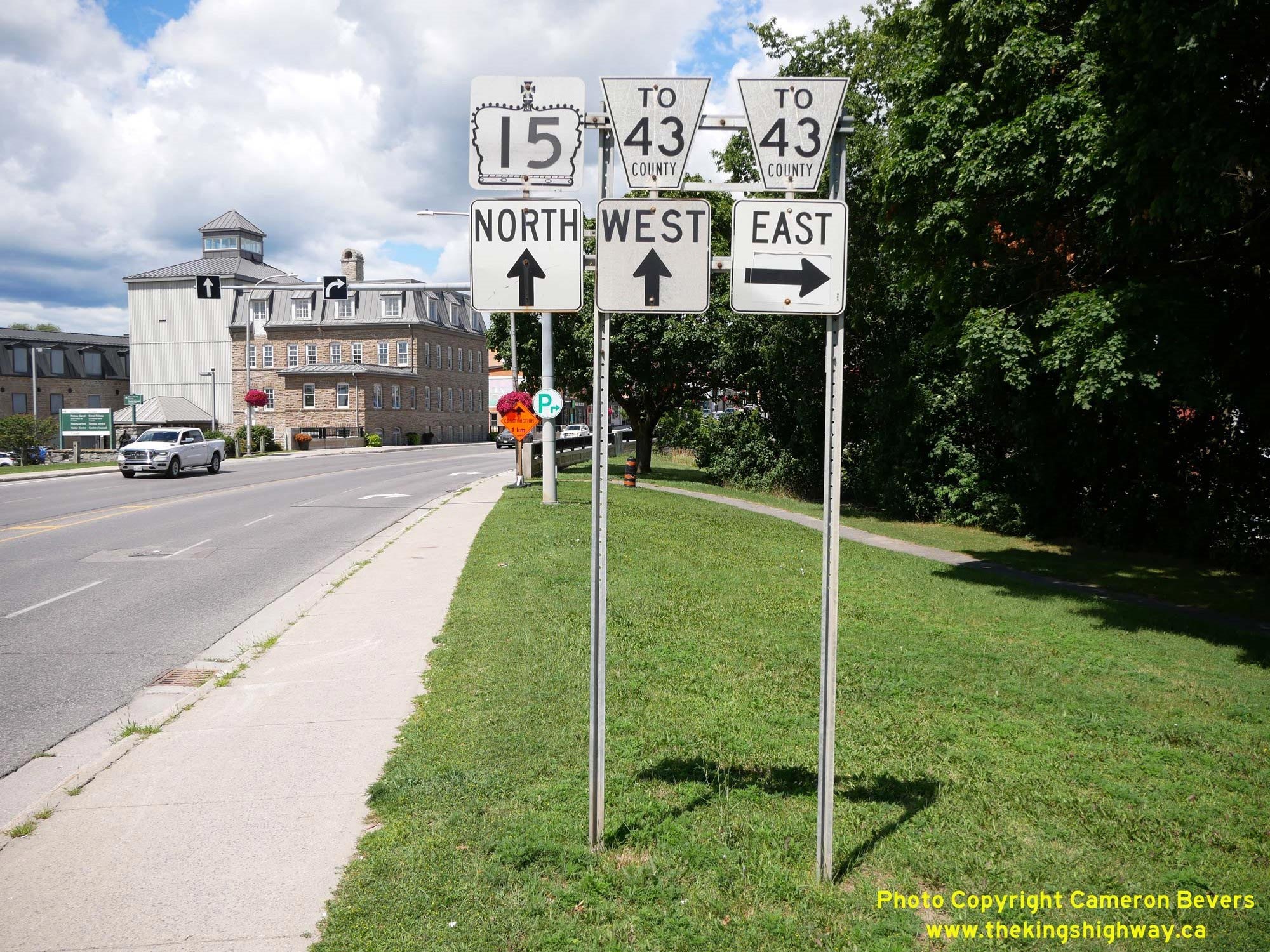
 Left - Junction sign assembly on northbound Beckwith Street for the upcoming junction of Hwy 15 & Hwy 43 in Downtown Smiths Falls. Although these two
highways didn't actually meet until the intersection of Beckwith Street and Elmsley Street at the north end of the town centre, a short cut-off route to Hwy 43 East
was signed via Chambers Street. This alternate route connects to Hwy 43 (Elmsley Street) three blocks to the east. See an
Enlarged Photo Here. Left - Junction sign assembly on northbound Beckwith Street for the upcoming junction of Hwy 15 & Hwy 43 in Downtown Smiths Falls. Although these two
highways didn't actually meet until the intersection of Beckwith Street and Elmsley Street at the north end of the town centre, a short cut-off route to Hwy 43 East
was signed via Chambers Street. This alternate route connects to Hwy 43 (Elmsley Street) three blocks to the east. See an
Enlarged Photo Here.(Photograph taken on July 29, 2022 - © Cameron Bevers) Right - View of Hwy 15 (Beckwith Street) approaching the Rideau River Bridge and Downtown Smiths Falls. This historic town has many interesting heritage
buildings along its Main Street, the largest of which is the historic grist mill (known as Wood's Mill) located beside Hwy 15 at left. This impressive stone building
was constructed in 1887. The building now houses a Parks Canada Office along with the Rideau Canal Visitor Information Centre. See an
Enlarged Photo Here.(Photograph taken on July 29, 2022 - © Cameron Bevers) 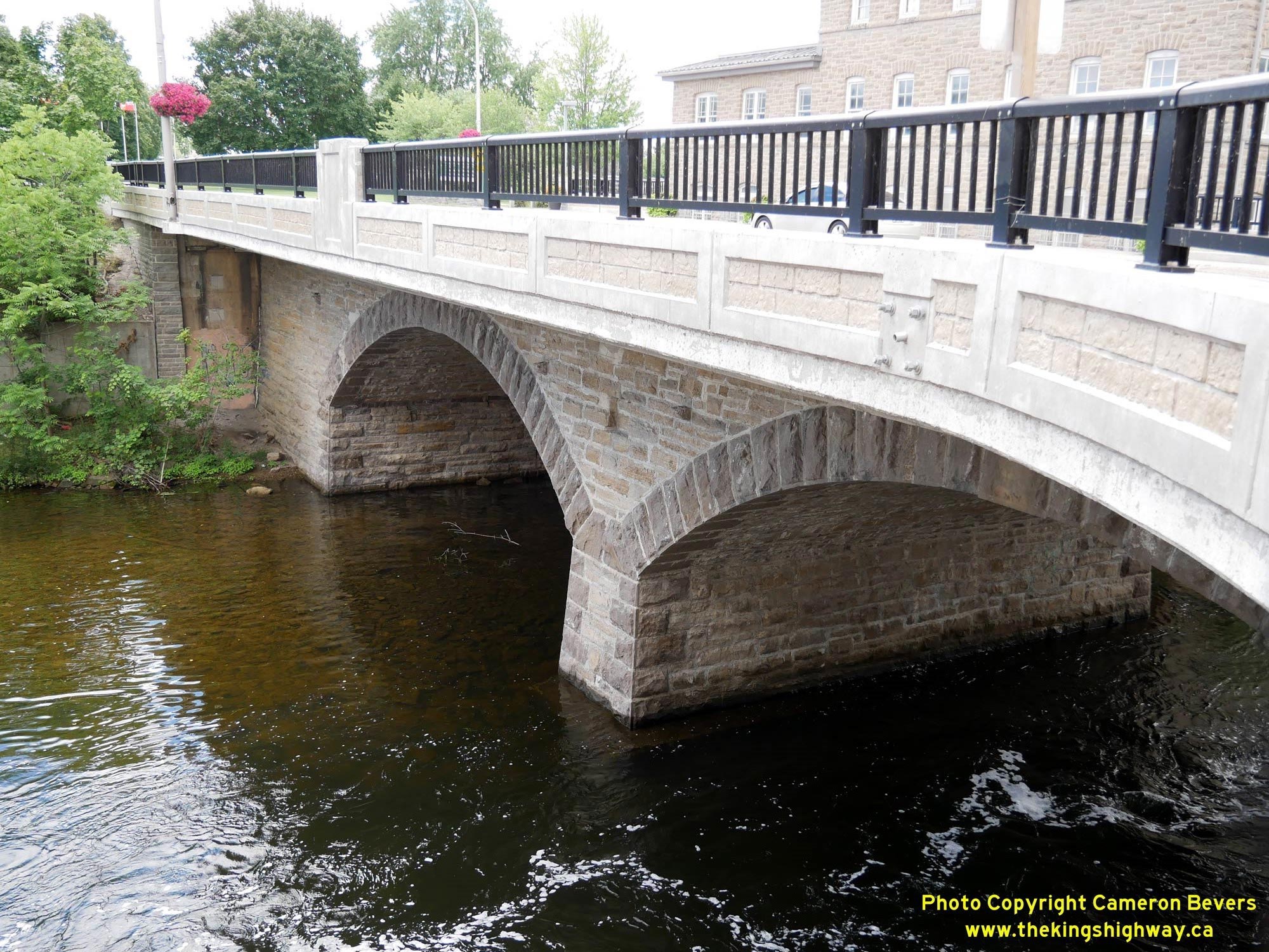
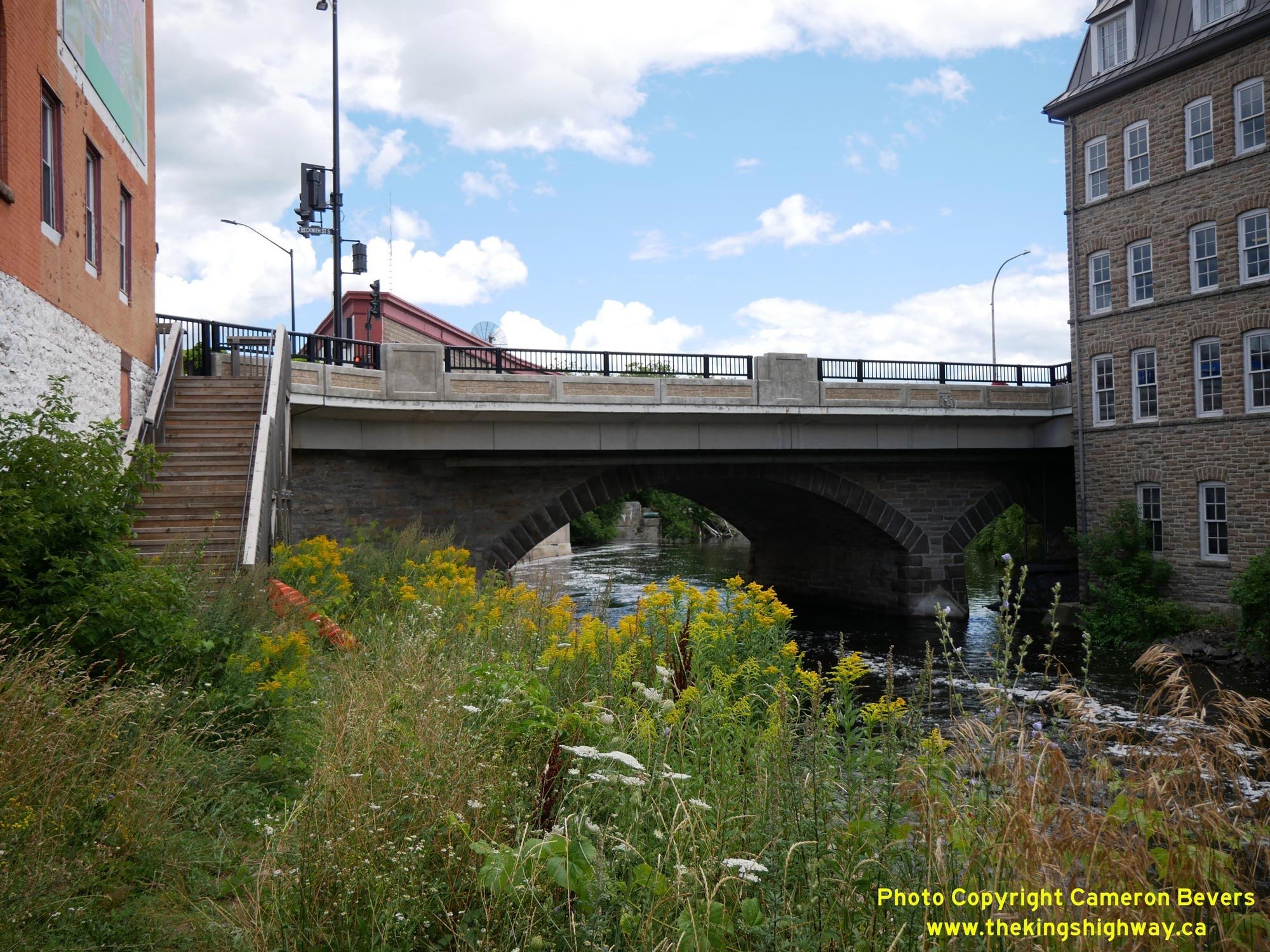 Left - Rideau River Bridge on Hwy 15 (Beckwith Street) in Downtown Smiths Falls. This historic stone arch bridge is almost completely hidden from view below
Hwy 15 and is not an easy structure to appreciate due to the lack of public vantage points. According to a historical structure inventory completed by the Ministry of
Transportation and Communications in 1972, this stone arch bridge on Beckwith Street was reportedly constructed in 1875. This bridge has no visible indication of a
year of construction, so I do not know how that construction date was ascertained by the Ministry at the time the inventory was prepared. While I personally believe
that this bridge is about 15 years newer than its purported 1875 construction date based on my own historical research, it is nevertheless a very old and interesting
historic structure. It is one of only a few surviving 19th Century bridges left on the provincial highway system and its various Municipal Connecting Links. See an
Enlarged Photo Here. Left - Rideau River Bridge on Hwy 15 (Beckwith Street) in Downtown Smiths Falls. This historic stone arch bridge is almost completely hidden from view below
Hwy 15 and is not an easy structure to appreciate due to the lack of public vantage points. According to a historical structure inventory completed by the Ministry of
Transportation and Communications in 1972, this stone arch bridge on Beckwith Street was reportedly constructed in 1875. This bridge has no visible indication of a
year of construction, so I do not know how that construction date was ascertained by the Ministry at the time the inventory was prepared. While I personally believe
that this bridge is about 15 years newer than its purported 1875 construction date based on my own historical research, it is nevertheless a very old and interesting
historic structure. It is one of only a few surviving 19th Century bridges left on the provincial highway system and its various Municipal Connecting Links. See an
Enlarged Photo Here.(Photograph taken on July 29, 2022 - © Cameron Bevers) Right - Western side of the Rideau River Bridge on Hwy 15 (Beckwith Street) in Downtown Smiths Falls. The historic Wood's Mill can be seen just to the right of
the bridge. The arrival of the Rideau Canal in the early 1800s led to the establishment of various industries along the canal, due to the ease of canal transportation
for industrial wares and an abundant supply of water power. See an Enlarged Photo Here.(Photograph taken on July 29, 2022 - © Cameron Bevers) 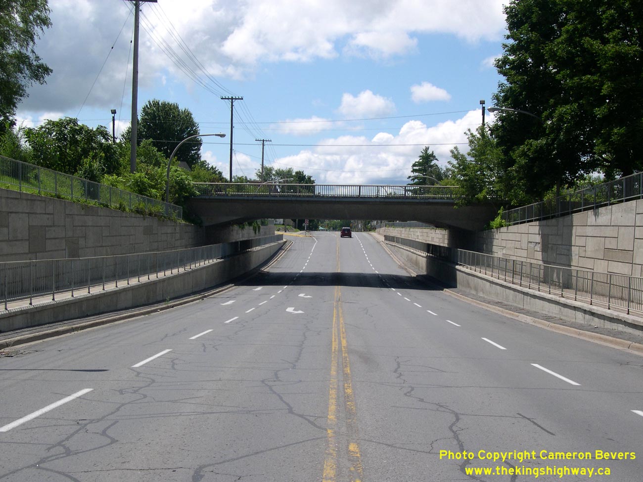
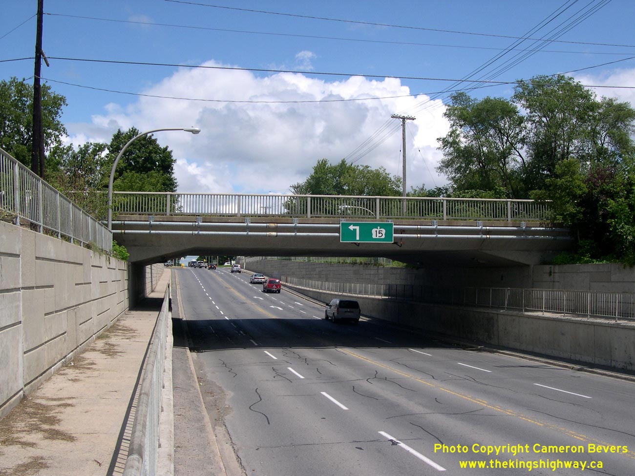
Left - Facing south along Hwy 15 through the Canadian Pacific Railway Subway on Cornelia Street in Smiths Falls. See an
Enlarged Photo Here. (Photograph taken on August 3, 2008 - © Cameron Bevers) Right - The Smiths Falls Subway on Hwy 15 was completed in 1969, under a connecting link agreement between the Town of Smiths Falls and the Department of Highways. This new four-lane subway replaced a very narrow old two-lane subway with a limited overhead clearance of 11 feet, 8 inches (3.55 metres). The new subway also has sidewalks for pedestrians on both sides of the road. The old Smiths Falls Subway only had one sidewalk on the eastern side of Hwy 15. See an Enlarged Photo Here. (Photograph taken on August 3, 2008 - © Cameron Bevers) 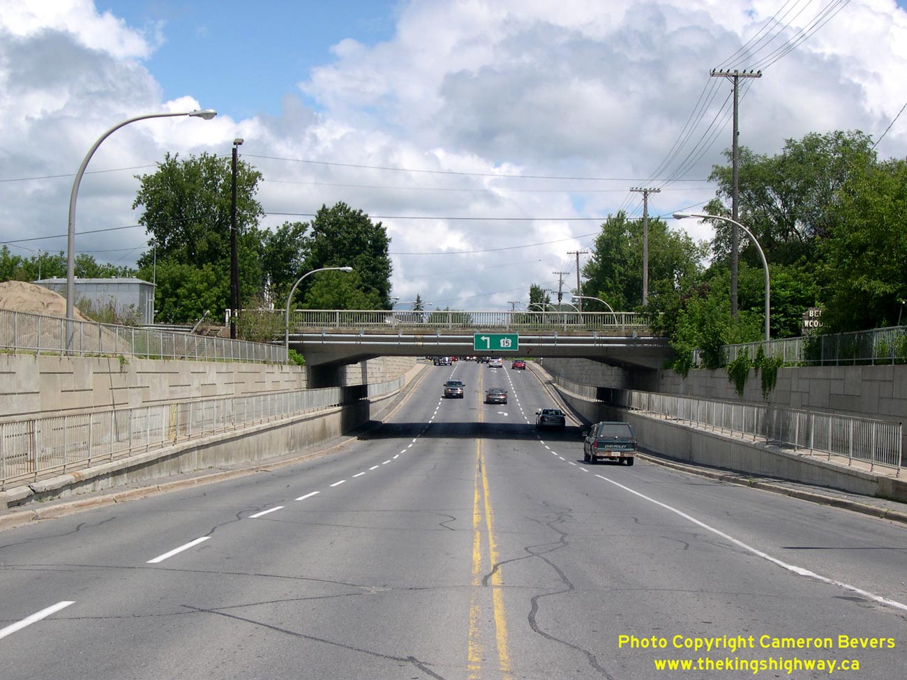
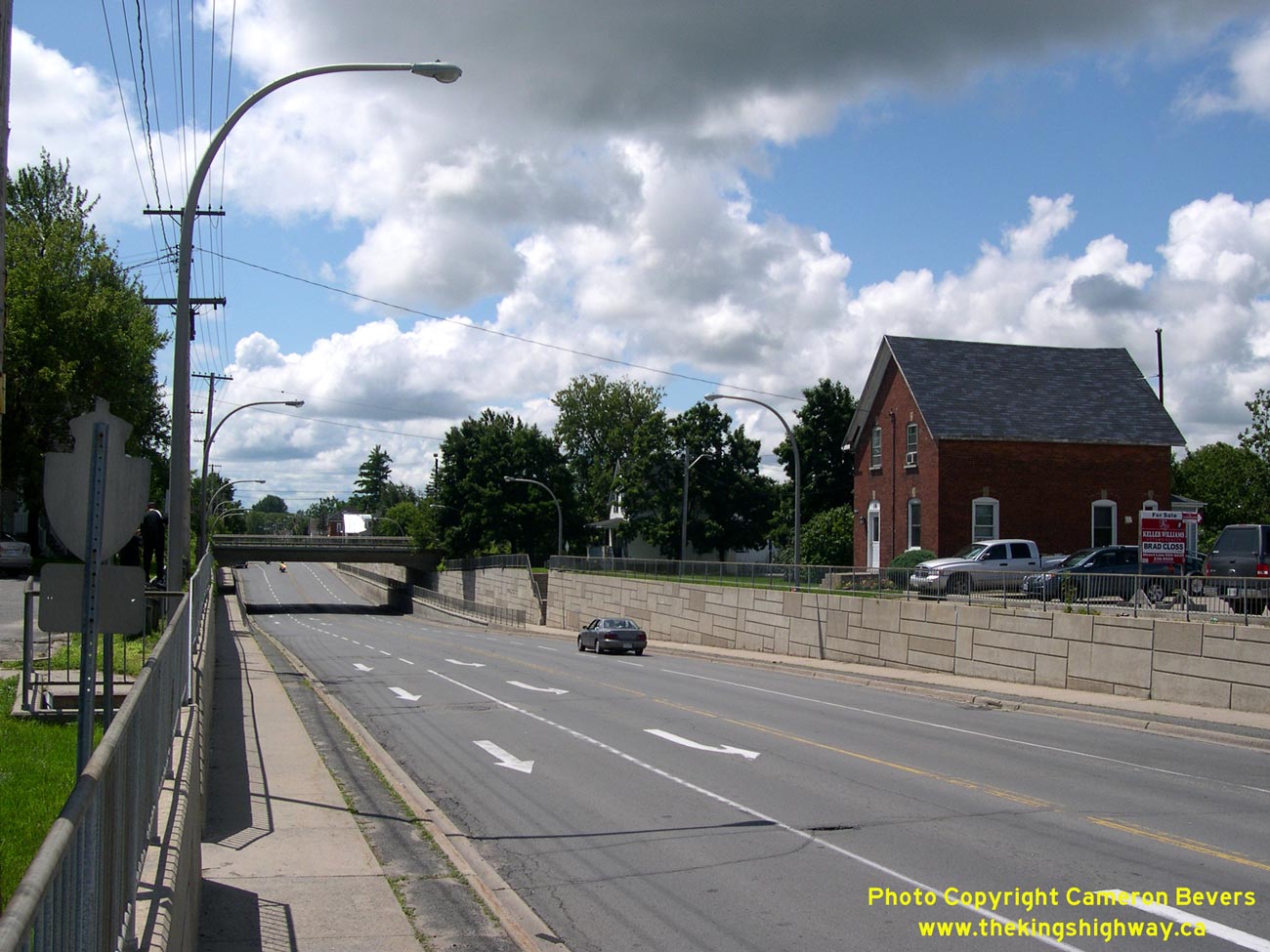
Left - Facing north along Hwy 15 towards the Smiths Falls Subway on Cornelia Street. Compare this present-day photo of the Smiths Falls Subway to
this 1958 Photo of the old Smiths Falls Subway on Hwy 15 (Formerly Hwy 29). See an
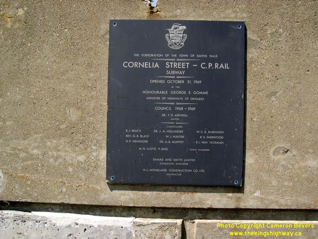
Enlarged Photo Here. (Photograph taken on August 3, 2008 - © Cameron Bevers) Right - Plaque commemorating the completion of the new Smiths Falls Subway on Cornelia Street (Hwy 15) on October 31, 1969. See an Enlarged Photo Here. (Photograph taken on August 3, 2008 - © Cameron Bevers) 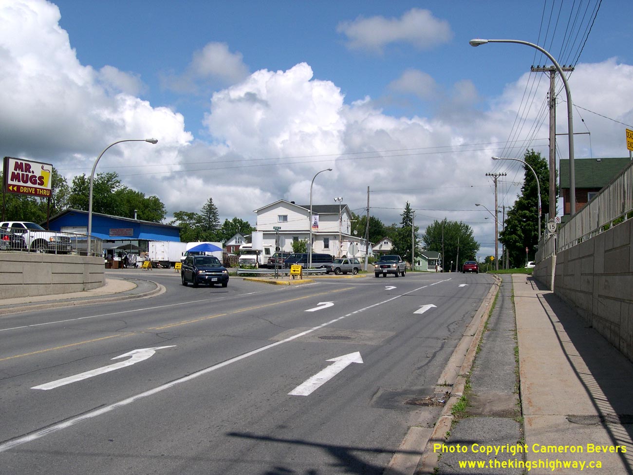
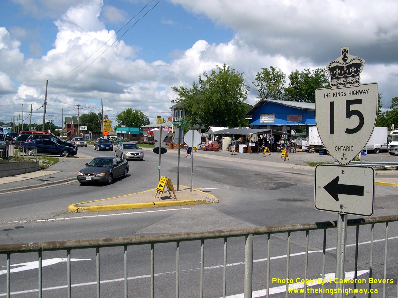
Left - Immediately north of the Smiths Falls Subway, northbound Hwy 15 traffic turns left from Cornelia Street onto Union Street. See an
Enlarged Photo Here. (Photograph taken on August 3, 2008 - © Cameron Bevers) Right - Intersection of Cornelia Street and Union Street in Smiths Falls. From this intersection, Hwy 15 quickly leaves Smiths Falls on its route north to Carleton Place. Southbound traffic on Hwy 15 enters town via a channelized right-turn lane. See an Enlarged Photo Here. (Photograph taken on August 3, 2008 - © Cameron Bevers) 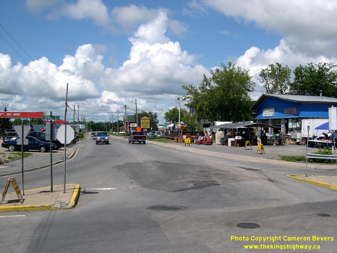
Left - Facing north along Hwy 15 towards Carleton Place from the intersection of Cornelia Street and Union Street in Smiths Falls. See an
Enlarged Photo Here. (Photograph taken on August 3, 2008 - © Cameron Bevers) Right - Facing south along Hwy 15 towards the Smiths Falls Subway from the intersection of Cornelia Street and Union Street. See an Enlarged Photo Here. (Photograph taken on August 3, 2008 - © Cameron Bevers) 

Left - Facing west towards Perth along the Carleton Place Bypass (Hwy 7) near Napoleon Street. The Carleton Place Bypass was completed and opened to traffic
in December, 1959. The new bypass was built to relieve recurring traffic congestion on Bridge Street through Downtown Carleton Place, which once carried the former
routes of Hwy 15 & Hwy 29. See an Enlarged Photo Here. (Photograph taken on July 1, 2012 - © Cameron Bevers) Right - Green guide sign on eastbound Hwy 7 indicating the upcoming Hwy 15 Junction in Carleton Place. As a result of the mass highway downloading spree of 1997-1998, the Hwy 7 & Hwy 15 Junction is the only non-freeway junction of two provincial highways in the Ottawa area. Up until the mid-1990s, Hwy 15 followed Franktown Road north from Hwy 7 through Downtown Carleton Place, where the route then continued north towards Arnprior. As a result of the highway downloading of 1997-1998, Hwy 15 no longer continues north from Carleton Place. See an Enlarged Photo Here. (Photograph taken on July 1, 2012 - © Cameron Bevers) 

Left - Green guide sign for Franktown Road in Carleton Place. Up until the mid-1990s, Hwy 15 followed Franktown Road north from Hwy 7 through Downtown Carleton
Place, where the route then continued north towards Arnprior. As a result of the highway downloading of 1997-1998, Hwy 15 no longer continues north from Carleton
Place. A new truck bypass for Hwy 15 (McNeely Avenue) was constructed in the 1990s along the eastern side of Carleton Place, in order to divert through traffic away
from Bridge Street (Old Hwy 15). See an Enlarged Photo Here. (Photograph taken on July 1, 2012 - © Cameron Bevers) Right - Facing east along Hwy 7 towards the Hwy 15 Junction in Carleton Place. From here, motorists can either turn left and follow Franktown Road north into Downtown Carleton Place or turn right and head south along Hwy 15 towards Smiths Falls and Kingston. Ottawa lies 38 km straight ahead via Hwy 7. See an Enlarged Photo Here. (Photograph taken on July 1, 2012 - © Cameron Bevers) 

Left - Facing west along Hwy 7 towards the Hwy 15 Junction in Carleton Place. Prior to 1998, Hwy 15 was one of several highways leading south from Hwy 7 to
Hwy 401 between Ottawa and Peterborough. As a result of the mass highway downloading of 1997-1998, Hwy 15, along with Hwy 37 and Hwy 62, form the only north-south
provincial highway links between Hwy 7 and Hwy 401 between here and Peterborough. Prior to 1998, motorists could take their pick from five other King's Highways
(Hwy 38, Hwy 41, Hwy 30, Hwy 45 and Hwy 28) to reach Hwy 401 from Hwy 7. However, all five of these highways were transferred to municipalities and are therefore no
longer provincial highways today. See an Enlarged Photo Here. (Photograph taken on July 1, 2012 - © Cameron Bevers) Right - Guide sign marking the Hwy 15 Junction on westbound Hwy 7 in Carleton Place. The route of Hwy 15 extends south from Carleton Place to Smiths Falls and ultimately, Kingston. Prior to 1998, Hwy 15 shared a brief concurrent route with Hwy 7 between Franktown Road and McNeely Avenue (East Carleton Place Bypass). However, this concurrent routing was very short-lived and was discontinued when the section of Hwy 15 from Carleton Place to Arnprior was downloaded to Lanark County and the former Regional Municipality of Ottawa-Carleton. See an Enlarged Photo Here. (Photograph taken on July 1, 2012 - © Cameron Bevers) 

Left - Facing north along Franktown Road (Formerly Hwy 15) towards Downtown Carleton Place from the Hwy 7 Junction. Up until the 1990s, Hwy 15 extended north
from Carleton Place to Arnprior. The northern section of Hwy 15 from Carleton Place to Arnprior fell victim to the mass highway downloading spree of 1997-1998. As a
result, Hwy 15 now reaches its northern terminus at the Hwy 7 Junction in Carleton Place. See an
Enlarged Photo Here. (Photograph taken on July 1, 2012 - © Cameron Bevers) Right - Junction assembly on southbound Franktown Road, indicating the start of Hwy 15 at the Hwy 7 Junction in Carleton Place. See an Enlarged Photo Here. (Photograph taken on July 1, 2012 - © Cameron Bevers) 

Left - Facing south along Franktown Road (Hwy 15) towards the Hwy 7 Junction in Carleton Place. This intersection has been an important provincial highway
junction ever since the Franktown Road was assumed as a new provincial highway in 1936. See
an Enlarged Photo Here. (Photograph taken on July 1, 2012 - © Cameron Bevers) Right - Facing west along Hwy 7 towards Perth from the Hwy 15 Junction in Carleton Place. Up until the completion of the Carleton Place Bypass in 1959, there was no through road here. Traffic heading west to Perth had to turn right and follow Franktown Road and Bridge Street through Downtown Carleton Place in order to continue west to Perth. See an Enlarged Photo Here. (Photograph taken on July 1, 2012 - © Cameron Bevers) 

Left - Guide sign marking the Hwy 15 Junction on eastbound Hwy 7 in Carleton Place. Heading eastbound, Hwy 15 is the last provincial highway junction along
Hwy 7 before Hwy 417 in Ottawa. Following the completion of the East Carleton Place Bypass (McNeely Avenue) in the mid-1990s, Hwy 15 was briefly routed along Hwy 7
from this intersection easterly to McNeely Avenue. See an Enlarged Photo Here. (Photograph taken on July 1, 2012 - © Cameron Bevers) Right - Approaching the northern terminus of Hwy 15 at the Hwy 7 Junction in Carleton Place. See an Enlarged Photo Here. (Photograph taken on July 1, 2012 - © Cameron Bevers) 

Left - Green guide sign marking the Hwy 7 Junction on northbound Hwy 15 in Carleton Place. Motorists arriving at this junction can either continue straight
ahead on Franktown Road into Downtown Carleton Place, turn left and head west towards Perth or turn right and head east towards Ottawa. See an
Enlarged Photo Here. (Photograph taken on July 1, 2012 - © Cameron Bevers) Right - Facing south along Hwy 15 towards Smiths Falls from the Hwy 7 Junction in Carleton Place. See an Enlarged Photo Here. (Photograph taken on July 1, 2012 - © Cameron Bevers) 
Above - Hwy 15 Ends sign at the Hwy 7 Junction in Carleton Place.
See an Enlarged Photo Here. (Photograph taken on July 1, 2012 - © Cameron Bevers) 

Left - Trans-Canada Highway route marker assembly on Hwy 7 at the Hwy 15 Junction in Carleton Place. The Central Ontario Route of the Trans-Canada Highway
follows Hwy 7 between Ottawa and Sunderland, northeast of Toronto. See an Enlarged Photo Here. (Photograph taken on July 1, 2012 - © Cameron Bevers) Right - Junction assembly at McNeely Avenue (Hwy 15 Bypass) and Hwy 7 in Carleton Place. Note the bilingual green "TO/VERS 15" trailblazer, which directs traffic to Hwy 15 South. For a couple of years in the mid-1990s, Hwy 7 & Hwy 15 shared a short concurrent route for about 600 metres between McNeely Avenue and Franktown Road. See an Enlarged Photo Here. (Photograph taken on July 1, 2012 - © Cameron Bevers)
Continue on to King's Highway 15 Photos: Carleton Place to Arnprior
|
|---|
Links to Adjacent King's Highway Photograph Pages:
Back to Hwy 15 - Kingston to Smiths Falls
Hwy 15 Photo Index
On to Hwy 15 - Carleton Place to Arnprior
Back to King's Highway 14 Photos /
King's Highway 15 History /
On to King's Highway 16 Photos
Ontario Highway History - Main Menu / Back to List of Highways Website contents, photos & text © 2002-2026, Cameron
Bevers (Webmaster) - All Rights Reserved / Contact Me
|
|---|