
| 
|  |
|
|
This page contains present day photos (Year 2000 to date) of Ontario's King's Highway 169, arranged by location from the
Highway 12 Junction near Brechin northerly to the Highway 11 Interchange at Washago. Please note that Highway 169 was known as Highway 69 prior to 1976. All
photographs displayed on this page were taken by the Webmaster (Cameron Bevers), unless specifically noted otherwise. Click on any thumbnail to see a larger
image!
Please note that all photographs displayed on this
website are protected by copyright. These photographs must not be reproduced, published,
electronically stored or copied, distributed, or posted onto other websites without
my written permission. If you want to use photos from this website, please
email me first for permission. Thank-you!
|
|---|
|
Page 2: Present Day King's Highway 169 Photographs (Hwy 12 to Washago)

Left - Facing south along Hwy 12 towards Brechin near the Hwy 169 Junction. See an
Enlarged Photo Here. (Photograph taken on July 23, 2016 - © Cameron Bevers) Right - Green guide sign for Hwy 169 on northbound Hwy 12 near Brechin. Until the late 1990s, Hwy 169 was a King's Highway which extended from Hwy 12 north of Brechin to MacTier, via Washago and Gravenhurst. Jurisdiction over the southern leg of Hwy 169 from Brechin to Washago was transferred to the County of Simcoe in 1998. This section of Hwy 169 is now officially known as Simcoe Road 169. The northern leg of Hwy 169 from Gravenhurst to MacTier is now officially known as Muskoka Road 169. See an Enlarged Photo Here. (Photograph taken on July 23, 2016 - © Cameron Bevers) 

Left - Distance guide sign on southbound Hwy 12 at the Hwy 169 Junction near Brechin. See an
Enlarged Photo Here. (Photograph taken on July 23, 2016 - © Cameron Bevers) Right - Junction assembly and fingerboard destination signs at the Hwy 12 & Hwy 169 Junction between Brechin and Orillia. See an Enlarged Photo Here. (Photograph taken on July 23, 2016 - © Cameron Bevers) 

Left - Facing south along Hwy 12 from the Hwy 169 Junction near Brechin. The community of Brechin lies about 3 km to the south of the Hwy 169 Junction. See an
Enlarged Photo Here. (Photograph taken on July 23, 2016 - © Cameron Bevers) Right - A channelized right turn lane carries traffic from northbound Hwy 12 to northbound Hwy 169. See an Enlarged Photo Here. (Photograph taken on July 23, 2016 - © Cameron Bevers) 

Left - Southern terminus of Hwy 169 at the Hwy 12 Junction north of Brechin. These two highways have met at this rural highway junction ever since the new
Brechin-Washago route of Hwy 69 (later known as Hwy 169) was first established in 1952. Prior to 1952, Hwy 12 & Hwy 69 joined together immediately east of the
Atherley Narrows Bridge near Orillia. See an Enlarged Photo Here. (Photograph taken on July 23, 2016 - © Cameron Bevers) Right - Facing north along Hwy 169 towards Washago from the Hwy 12 Junction. See an Enlarged Photo Here. (Photograph taken on July 23, 2016 - © Cameron Bevers) 

Left - Facing north along Hwy 12 from the Hwy 169 Junction north of Brechin. See an
Enlarged Photo Here. (Photograph taken on July 23, 2016 - © Cameron Bevers) Right - Approaching the Hwy 169 Junction on Hwy 12, facing south towards Brechin. The Ministry of Transportation of Ontario (MTO) plans to convert this stop-controlled intersection to a roundabout in the coming years, in order to more effectively deal with both existing and future traffic demand at this highway junction. See an Enlarged Photo Here. (Photograph taken on July 23, 2016 - © Cameron Bevers) 

Left - Distance guide sign on northbound Hwy 12 at the Hwy 169 Junction near Brechin. See an
Enlarged Photo Here. (Photograph taken on July 23, 2016 - © Cameron Bevers) Right - Green guide sign marking the upcoming Hwy 169 Junction on southbound Hwy 12. See an Enlarged Photo Here. (Photograph taken on July 23, 2016 - © Cameron Bevers) 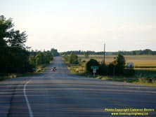
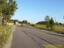
Left - Facing north along Hwy 169 towards Washago, about 1 km north of the Hwy 12 Junction. See an
Enlarged Photo Here. (Photograph taken on August 6, 2016 - © Cameron Bevers) Right - View of Hwy 169 facing south near Ramara Sideroad 10. The highway seen here was actually a diversion that was completed in 1953. As originally assumed by the Department of Highways of Ontario (DHO) in 1952, Hwy 69 followed the narrow and winding Ramara Sideroad 10 through the grove of trees to the right. The newer highway diversion seen here was a vast improvement over the original route, which is scarcely even passable by motor traffic today. The DHO relinquished its jurisdiction over Old Hwy 69 (Ramara Sideroad 10) in May 1954. See an Enlarged Photo Here. (Photograph taken on August 6, 2016 - © Cameron Bevers) 
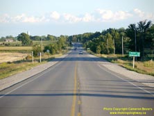
Left - Facing south along Hwy 169 towards Brechin from the small rural community of Udney. See an
Enlarged Photo Here. (Photograph taken on August 6, 2016 - © Cameron Bevers) Right - Approaching Udney on Hwy 169, facing north towards Washago. See an Enlarged Photo Here. (Photograph taken on August 6, 2016 - © Cameron Bevers) 
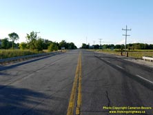
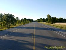
Left - Facing south towards Brechin along Hwy 169 approaching Udney. See an
Enlarged Photo Here. (Photograph taken on August 6, 2016 - © Cameron Bevers) Right - Approaching Ramara Concession B & C on Hwy 169, facing north towards Washago. The northern sections of Hwy 169 between Simcoe Road 45 (Monck Road) and Washago are quite sparsely populated. Accordingly, there are not many intersections located along the highway. See an Enlarged Photo Here. (Photograph taken on August 6, 2016 - © Cameron Bevers) 
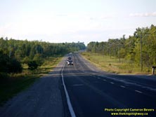
Left - Facing south along Hwy 169 near Ramara Concession B & C. This revised route of Hwy 69 (later known as Hwy 169) was established in 1952. The new
highway bypassed the original 1936 route of Hwy 69 via Rama Road (now Simcoe Road 44). Initially, Hwy 69 ran along the shores of Lake Couchiching between Atherley and
Washago. See an Enlarged Photo Here. (Photograph taken on August 6, 2016 - © Cameron Bevers) Right - View of Hwy 169 about 2 km south of the Black River Bridge, facing north towards Washago. This highway forms a convenient cut-off route for motorists heading to and from Cottage Country via Hwy 12. By taking the Hwy 169 cut-off between Brechin and Washago, motorists will reduce the driving distance on a trip between Whitby and Gravenhurst by about 13 km, versus taking the longer route of Hwy 12 and Hwy 11 via Atherley and Orillia. See an Enlarged Photo Here. (Photograph taken on August 6, 2016 - © Cameron Bevers) 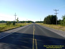

Left - Facing north along Hwy 169 near the Black River Bridge. This highway has many long tangent sections, which greatly facilitates passing opportunities.
See an Enlarged Photo Here. (Photograph taken on August 6, 2016 - © Cameron Bevers) Right - View across the Black River Bridge on Hwy 169, facing north towards Washago. See an Enlarged Photo Here. (Photograph taken on August 6, 2016 - © Cameron Bevers) 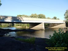
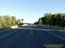
Left - Western side of the Black River Bridge on Hwy 169, located about 6 km south of Washago. See an
Enlarged Photo Here. (Photograph taken on August 6, 2016 - © Cameron Bevers) Right - Facing south along Hwy 169 towards Brechin at the Black River Bridge. See an Enlarged Photo Here. (Photograph taken on August 6, 2016 - © Cameron Bevers) 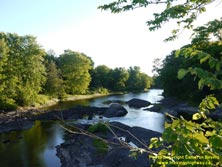

Left - A scenic evening view of the Black River as seen from Hwy 169. See an
Enlarged Photo Here. (Photograph taken on August 6, 2016 - © Cameron Bevers) Right - Eastern side of the Black River Bridge on Hwy 169 south of Washago. This two-span continuous steel girder structure was completed in 1957. See an Enlarged Photo Here. (Photograph taken on August 6, 2016 - © Cameron Bevers) 

Left - Facing south along Hwy 169 towards Brechin from the small rural community of Fawkham. See an
Enlarged Photo Here. (Photograph taken on August 6, 2016 - © Cameron Bevers) Right - Facing north along Hwy 169 towards Washago at Brooks Sideroad. A fairly significant highway diversion was constructed here for Hwy 69 (later known as Hwy 169) in 1953. Originally, Hwy 69 continued straight ahead alongside the hydro pole line onto Brooks Sideroad. Jurisdiction over Old Hwy 69 was reverted to the former County of Ontario in May 1954. See an Enlarged Photo Here. (Photograph taken on August 6, 2016 - © Cameron Bevers) 

Left - Facing south along Hwy 169 towards Fawkham from Brooks Sideroad (Old Hwy 69). This curve marks the end of the Rama Township Diversion south of Washago. See an
Enlarged Photo Here. (Photograph taken on August 6, 2016 - © Cameron Bevers) Right - Facing north along Old Hwy 69 (Brooks Sideroad) approaching Fairgrounds Road. Prior to the completion of the Rama Township Diversion in 1953, Hwy 69 turned left at the T-junction just ahead on its route north towards Washago. See an Enlarged Photo Here. (Photograph taken on August 6, 2016 - © Cameron Bevers) 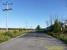

Left - Old Hwy 69 (Brooks Sideroad), facing south towards Fawkham from Fairgrounds Road. See an
Enlarged Photo Here. (Photograph taken on August 6, 2016 - © Cameron Bevers) Right - Facing east along Fairgrounds Road (Old Hwy 69) approaching Brooks Sideroad. Until 1953, Hwy 69 turned right onto Brooks Sideroad a short distance ahead as the highway resumed its route south towards Brechin. Since this part of the old highway was bypassed by the Rama Township Diversion fairly early on, this section of Old Hwy 69 provides highway enthusiasts with some historical insight as to what the route would have looked like back in the early 1950s. See an Enlarged Photo Here. (Photograph taken on August 6, 2016 - © Cameron Bevers) 

Left - Old Hwy 69 (Fairgrounds Road), facing east from the current route of Hwy 169 south of Washago. The old highway route diverges from Hwy 169 just south of
the Gregg Bridge over the Black River, which is located about 1 km south of Washago. The Rama Township Diversion bypassed about 2 km of Old Hwy 69 in 1953. See an
Enlarged Photo Here. (Photograph taken on August 6, 2016 - © Cameron Bevers) Right - Facing south along Hwy 169 at the Gregg Bridge over the Black River, located about 1 km south of Washago. See an Enlarged Photo Here. (Photograph taken on August 6, 2016 - © Cameron Bevers) 
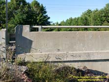
Left - Western side of the Gregg Bridge on Hwy 169 south of Washago. This single-span concrete girder structure was completed over the Black River in 1992. It
replaced a steel pony truss bridge built by the former County of Ontario in 1948, several years before the Washago-Brechin Road was assumed by the DHO in 1952 as a
new route for Hwy 69. See an Enlarged Photo Here. (Photograph taken on August 6, 2016 - © Cameron Bevers) Right - Structure identification number and date stamp (1992) on the Gregg Bridge south of Washago. See an Enlarged Photo Here. (Photograph taken on August 6, 2016 - © Cameron Bevers) 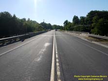

Left - Facing north along Hwy 169 towards Washago at the Gregg Bridge over the Black River. See an
Enlarged Photo Here. (Photograph taken on August 6, 2016 - © Cameron Bevers) Right - Facing north along Hwy 169 at the two bridges over the East Branch of the Severn River in Washago. Upon crossing these two bridges, Hwy 169 passes over a series of islands, separated from the mainland by the Trent-Severn Waterway and the natural branches of the Severn River. The first of these islands is known as Rama Island. See an Enlarged Photo Here. (Photograph taken on June 17, 2006 - © Cameron Bevers) 

Left - Western side of the Severn River East Branch Bridge #1 at Washago. This single-span concrete rigid frame structure was completed in 1956. See an
Enlarged Photo Here. (Photograph taken on June 17, 2006 - © Cameron Bevers) Right - Eastern side of the Severn River East Branch Bridge #1 on Hwy 169 in Washago. See an Enlarged Photo Here. (Photograph taken on June 17, 2006 - © Cameron Bevers) 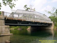

Left - Eastern side of the Severn River East Branch Bridge #2 on Hwy 169 at Washago. This single-span steel pony truss structure was completed in 1957.
Recently, a metal caging was installed on this bridge in an effort to discourage people from diving off of the bridge into the deceptively shallow waters of the
Severn River. See an Enlarged Photo Here. (Photograph taken on June 17, 2006 - © Cameron Bevers) Right - Facing north along Hwy 169 across the Severn River East Branch Bridge #2. This was one of two new highway bridges built across the Severn River in 1956-1957 on the South Washago Diversion. The diversion was constructed to bypass a single-lane bridge on the old highway alignment which had become a traffic bottleneck by the mid-1950s. See an Enlarged Photo Here. (Photograph taken on June 17, 2006 - © Cameron Bevers) 

Left - Western side of the Severn River East Branch Bridge #2 on Hwy 169 at Washago, as seen from the Old Hwy 69 Bridge at the end of Little Falls Road. This
structure is a Warren-type truss, with diagonal truss members affixed to common intersecting points but angled in continuously alternating up-and-down directions. See
an Enlarged Photo Here. (Photograph taken on June 17, 2006 - © Cameron Bevers) Right - Little Falls Road (Old Hwy 69), approaching the Severn River East Branch Bridge in Washago. Up until the completion of the South Washago Diversion in 1957, all highway traffic had to squeeze across this narrow turn-of-the-century bridge. The old bridge continued to serve local traffic for several years after it was bypassed, before it was eventually closed to vehicular traffic altogether. This former highway bridge now only sees the occasional pedestrian. See an Enlarged Photo Here. (Photograph taken on June 17, 2006 - © Cameron Bevers) 

Left - Western side of the Old Severn River East Branch Bridge at the end of Little Falls Road (Old Hwy 69) in Washago. This single-span reinforced concrete
arch bridge dates from approximately 1910. Like its much larger neighbour, the old highway bridge on Little Falls Road has also been retrofitted with a metal caging
to discourage divers. The "bowstring" arch of the metal caging was designed with aesthetics in mind. See an
Enlarged Photo Here. (Photograph taken on June 17, 2006 - © Cameron Bevers) Right - Looking across the Severn River East Branch Bridge at the end of Little Falls Road (Old Hwy 69). This bridge was so narrow that traffic on Hwy 69 had to cross one vehicle at a time. This narrow bridge was bypassed when a new route for Hwy 69 (the South Washago Diversion) opened to traffic in 1957. This new diversion removed a serious traffic bottleneck at the south entrance to Washago, by providing a highway bridge which could carry two lanes of traffic simultaneously. See an Enlarged Photo Here. (Photograph taken on June 17, 2006 - © Cameron Bevers) 

Left - Eastern side of the Severn River East Branch Bridge on Old Hwy 69, as seen from the South Washago Diversion (Hwy 169). See an
Enlarged Photo Here. (Photograph taken on June 17, 2006 - © Cameron Bevers) Right - The construction of the South Washago Diversion also removed this hazardous reverse curve in the old route of Hwy 69. Little Falls Road has been closed to through traffic for many years. Although the old pavement is still in place today, the last time long-distance traffic on Hwy 69 crossed this bridge was at the dawn of the Space Age! See an Enlarged Photo Here. (Photograph taken on June 17, 2006 - © Cameron Bevers) 

Left - Approaching the Severn River East Branch Bridges #1 and #2 on Hwy 169 in Washago, facing south towards Brechin. The completion of the South Washago
Diversion in 1957 greatly improved the highway's alignment approaching Washago and bypassed a narrow one-lane bridge. See an
Enlarged Photo Here. (Photograph taken on June 17, 2006 - © Cameron Bevers) Right - Facing south along Hwy 169 from Rama Road (Old Hwy 69) in Washago. See an Enlarged Photo Here. (Photograph taken on August 6, 2016 - © Cameron Bevers) 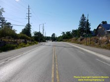

Left - Approaching Rama Road (Old Hwy 69) on Hwy 169, facing north towards Washago. Today, Old Hwy 69 via Longford is known as Simcoe Road 44. See an
Enlarged Photo Here. (Photograph taken on August 6, 2016 - © Cameron Bevers) Right - Hwy 169 at Rama Road in Washago, facing north. In August 1936, the first leg of Hwy 69 was established along the eastern side of Lake Couchiching between Atherley and Washago along what is now Rama Road. This original route of Hwy 69 remained in the King's Highway System until 1952, when it was supplanted by a new route of Hwy 69 between Brechin and Washago. Jurisdiction over the old 1936 route of Hwy 69 was transferred from the province to the former County of Ontario in May 1952. See an Enlarged Photo Here. (Photograph taken on August 6, 2016 - © Cameron Bevers) 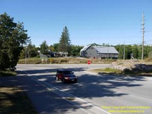
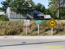
Left - End of Rama Road (Simcoe Road 44) at Hwy 169 in Washago. When Hwy 69 was first established in 1936, the highway turned left here and continued north for
two blocks to join with Hwy 11 at Muskoka Street in Downtown Washago. Initially, the highway ended in Washago, but Hwy 69 was later extended north towards Parry Sound
via Gravenhurst, Bala and MacTier in 1937. See an Enlarged Photo Here. (Photograph taken on August 6, 2016 - © Cameron Bevers) Right - Junction sign assembly and fingerboard guide signs at the end of Rama Road at the Hwy 169 Junction in Washago. See an Enlarged Photo Here. (Photograph taken on August 6, 2016 - © Cameron Bevers) 
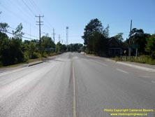
Left - Facing south along Hwy 169 towards Rama Road (Old Hwy 69) in Washago. As originally established in 1936, Hwy 69 turned right onto Rama Road just ahead
and continued south via Longford to connect with Hwy 12 at Atherley near Orillia. During the 1950s, Hwy 69 was relocated onto a new route straight ahead which
connected to Hwy 12 just north of Brechin. See an Enlarged Photo Here. (Photograph taken on August 6, 2016 - © Cameron Bevers) Right - Facing north along Hwy 169 at the Peace Bridge in Washago, located between Rama Road and Grist Mill Road. See an Enlarged Photo Here. (Photograph taken on August 6, 2016 - © Cameron Bevers) 
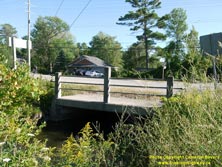
Left - Southern side of the Peace Bridge on Hwy 169 in Washago. This small culvert was built by the former County of Ontario in 1927 and was widened to its
current configuration by the DHO in 1956. Although small, this short culvert over the Washago Mill Race has a very interesting history to tell. Reportedly, two
neighbours named A.W. Grigg and John Agnew who lived beside one another adjacent to the Washago Mill Race had a bitter dispute over a trivial matter back in 1905.
They refused to speak to one another for 22 years. The two men eventually agreed to bury the proverbial hatchet and rekindle their friendship spoiled by the dispute,
by mutually agreeing to open the County of Ontario's new bridge together at the official opening ceremony in 1927. Reportedly, the name "Peace Bridge" was inspired by
the truce between the two men and was borrowed from the well-known International Peace Bridge between Fort Erie and Buffalo, which was being constructed that same
year. The name Peace Bridge seemed very fitting, as the notorious quarrel between A.W. Grigg and John Agnew was widely known in the Washago area. The two men remained
friends for the rest of their days. See an Enlarged Photo Here. (Photograph taken on August 6, 2016 - © Cameron Bevers) Right - Northern side of the Peace Bridge on Hwy 169 in Washago at Grist Mill Road. See an Enlarged Photo Here. (Photograph taken on August 6, 2016 - © Cameron Bevers) 

Left - General view of the location of the Peace Bridge on Hwy 169 at Grist Mill Road. This tiny structure is easy to miss! See an
Enlarged Photo Here. (Photograph taken on August 6, 2016 - © Cameron Bevers) Right - It is believed that the Peace Bridge on Hwy 169 was originally built in the 1920s with steel tube handrails, which were reinstalled on the structure when the culvert was extended by the DHO in 1956. A heritage plaque commemorating the bridge's 1927 opening was set into one of the north concrete balusters. See an Enlarged Photo Here. (Photograph taken on August 6, 2016 - © Cameron Bevers) 

Left - Commemorative plaque marking the completion of the Peace Bridge on Hwy 169 in 1927. This plaque is actually a fairly recent installation. Although the
text on the replacement commemorative plaque is copied verbatim from the original, the newer version has a slightly different text layout from the original 1927
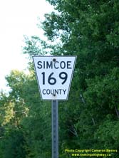
plaque. See an Enlarged Photo Here. (Photograph taken on August 6, 2016 - © Cameron Bevers) Centre - A newer Simcoe County Road 169 flowerpot route marker near Washago. Simcoe County recently replaced its old black-and-white county road route markers. See an Enlarged Photo Here. (Photograph taken on August 6, 2016 - © Cameron Bevers) Right - An older black-and-white Simcoe County Road 169 flowerpot route marker near Washago. Hwy 169 was a provincially-owned King's Highway prior to 1998. See an Enlarged Photo Here. (Photograph taken on August 6, 2016 - © Cameron Bevers) 

Left - View of the Severn River West Branch from Hwy 169 in Washago. Due to it striking colour, this watercourse is sometimes referred to locally as the
"Green River". This branch of the Severn River separates Rama Island from Orillia Island. See an
Enlarged Photo Here. (Photograph taken on August 6, 2016 - © Cameron Bevers) Right - Western side of the Severn River West Branch (Green River) Bridge on Hwy 169 in Washago. This two-span concrete rigid frame structure was completed in 1957. See an Enlarged Photo Here. (Photograph taken on August 6, 2016 - © Cameron Bevers) 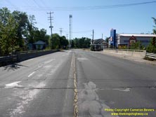
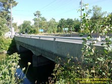
Left - Facing north along Hwy 169 at the Severn River West Branch (Green River) Bridge. Washago's town centre is actually situated on an island between the
various branches of the Severn River, known as Orillia Island. See an Enlarged Photo Here. (Photograph taken on August 6, 2016 - © Cameron Bevers) Right - Eastern side of the Severn River West Branch (Green River) Bridge on Hwy 169 in Washago. See an Enlarged Photo Here. (Photograph taken on August 6, 2016 - © Cameron Bevers) 

Left - Facing south along Hwy 169 from Muskoka Street in Washago towards the Severn River West Branch (Green River) Bridge. See an
Enlarged Photo Here. (Photograph taken on August 6, 2016 - © Cameron Bevers) Right - Facing north along Hwy 169 at Muskoka Street in Washago. Historically, Muskoka Street was part of Hwy 11 & Hwy 69. Up until 1955, Hwy 69 turned right onto Muskoka Street and followed a concurrent route with Hwy 11 to Gravenhurst. Once the Washago Bypass opened to traffic in 1955, Hwy 69 continued straight ahead to join with the relocated route of Hwy 11 a short distance west of town. See an Enlarged Photo Here. (Photograph taken on August 6, 2016 - © Cameron Bevers) 

Left - The angled orientation of this vintage diner sign relative to Washago's Muskoka Street reflects an obvious desire by a previous proprietor to capture
the attention of motorists cruising through Washago along Hwy 11 on their way between Orillia and Gravenhurst. At one time, the Hwy 11 connection passed through the
grassed area in the foreground. Subsequent street improvements realigned Muskoka Street to meet Hwy 169 closer to a right-angle, as seen today. See an
Enlarged Photo Here. (Photograph taken on August 6, 2016 - © Cameron Bevers) Right - Approaching the Hwy 169 Junction on Muskoka Street (Old Hwy 11 & Hwy 69), facing south. Prior to the completion of the Washago Bypass in 1955, Hwy 69 and Hwy 11 parted ways at this intersection. The route of Hwy 11 turned to the right just beyond the diner sign and continued south towards Orillia, while Hwy 69 curved to the left and headed south towards Brechin. See an Enlarged Photo Here. (Photograph taken on August 6, 2016 - © Cameron Bevers) 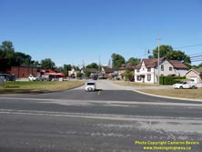
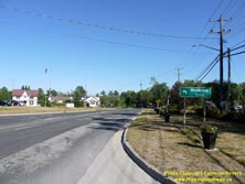
Left - Facing north along Muskoka Street from Hwy 169 in Washago. The large grassed areas to the left and right of the present-day intersection are where the
original routes of Hwy 11 & Hwy 69 would have been located. This intersection was rebuilt after the Washago Bypass opened to traffic in the mid-1950s, in
reflection of the fact that through traffic no longer needed to follow Washago's Muskoka Street. See an
Enlarged Photo Here. (Photograph taken on August 6, 2016 - © Cameron Bevers) Right - Sign for the appropriately-named Muskoka Street on southbound Hwy 169 in Washago. Prior to 1955, all traffic bound for Muskoka from Southern Ontario had to pass along Washago's main street, as there was no direct highway linking Port Severn and Parry Sound at that time. The Trans-Canada Highway north of Port Severn didn't open to traffic until 1958. See an Enlarged Photo Here. (Photograph taken on August 6, 2016 - © Cameron Bevers) 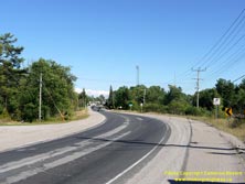
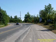
Left - Facing south along Hwy 169 at the former site of the Canadian National Railway (CNR) crossing on Hwy 11. At one time, the highway curved in the opposite
direction, as Hwy 11 headed south out of Washago towards Orillia. The old route of Hwy 11 curved in from the right, where the yellow-and-black curve chevron sign
appears today. After the Washago Bypass was opened to traffic in 1955, the CNR crossing on Old Hwy 11 was closed off to traffic. The route of Hwy 69 was then
realigned and extended out to the new Hwy 11 Bypass, including the construction of the new highway curve seen here. See an
Enlarged Photo Here. (Photograph taken on August 6, 2016 - © Cameron Bevers) Right - Approaching Washago on Hwy 169 near the Hwy 11 Interchange, facing south. This short connection between Old Hwy 11 and the Washago Bypass (Hwy 11 New) was built in the mid-1950s. The Washago Connector was numbered as Hwy 69 up until 1976, when it was renumbered as Hwy 169. See an Enlarged Photo Here. (Photograph taken on August 6, 2016 - © Cameron Bevers)
Continue on to King's Highway 169 Present Day Photos: Washago to Gravenhurst
|
|---|
Links to Adjacent King's Highway Photograph Pages:
Back to Hwy 169 - Historical Photos (1936-1999)
Hwy 169 Photo Index
On to Hwy 169 - Washago to Gravenhurst
Back to King's Highway 148 Photos /
King's Highway 169 History /
On to King's Highway 400 Photos
Ontario Highway History - Main Menu / Back to List of Highways Website contents, photos & text © 2002-2026, Cameron
Bevers (Webmaster) - All Rights Reserved / Contact Me
|
|---|